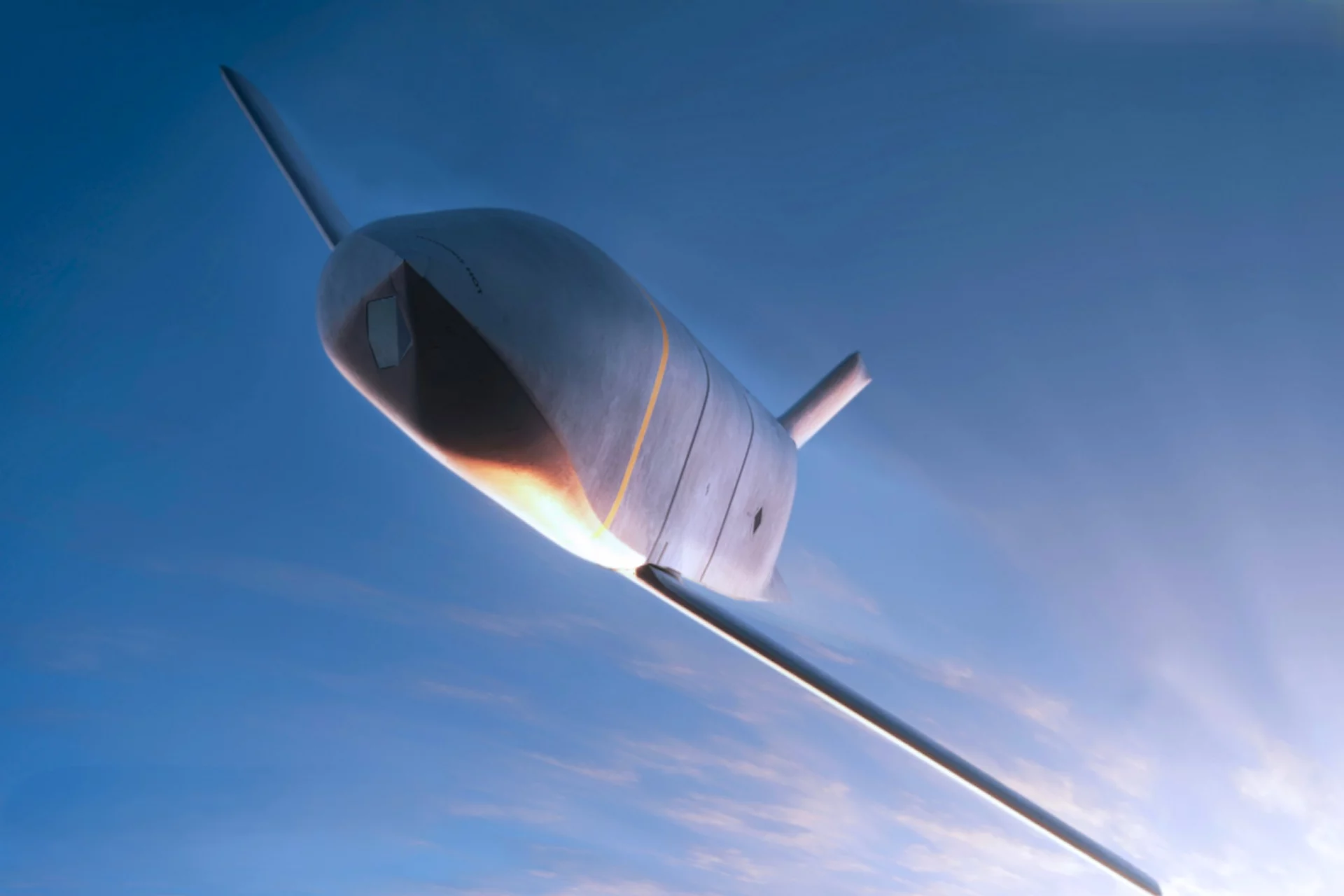
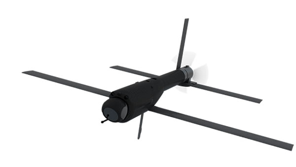
The U.S. Air Force has opened market research for a GPS Increment 2 GNSS M-code receiver for the Joint Air-to-Surface Standoff Missile (JASSM) program.
The Air Force’s Materiel Command Lifecycle Management Center at Eglin Air Force Base published a Request for Information on March 17 to identify qualified vendors capable of developing and producing the receiver.
Key requirements include:
demonstrating a point-of-departure design at or above Technology Readiness Level/Manufacturing Readiness Level 5 applicable to U.S. Department of Defense tactical missiles
identifying existing programs leveraged
providing current TRL and MRL status
presenting a funded development plan to achieve required maturity.
Respondents must also
describe their technical approach for the GPS receiver
identify the status of Increment 2 M-code Application Specific Integrated Circuit certification with the GPS Directorate Security Team
demonstrate an active production line delivering DoD M-code receivers where possible
provide a notional low-risk development and integration schedule from contract award.
The government is using the market research phase to assess vendor capability before proceeding to formal solicitation. The opportunity is open to qualified commercial vendors without foreign participation. The government is seeking established manufacturers with demonstrated capability in DoD M-code receiver production.
Respondents must submit white paper responses of 10 pages or less by May 29. Administrative information including company credentials, facility security clearance, and executed Non-Disclosure Agreements must be submitted separately and do not count toward the 10-page limit.
The U.S. Air Force is increasingly referring to its next generation of unmanned aircraft as “fighter drones,” as the service prepares to integrate these vehicles alongside traditional fighter jets in combat missions. The Air Force’s Collaborative Combat Aircraft (CCA) program includes two separate vehicles under development by General Atomics Aeronautical Systems (GA-ASI) and Anduril, both designed to operate as combat-ready UAVs. These UAVs are being built to complement existing fighter fleets, providing additional capabilities and support during operations. According to Air Force officials, the new aircraft are expected to play a key role in future air combat by flying alongside piloted fighters and taking on a variety of tactical missions.
One is an all-stealth design for undetected penetration of enemy defenses; the other is a sleek fighting companion.
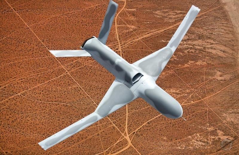
It appears the General Atomics YFQ-42A/CCA drew inspiration from the earlier stealth capabilities of the Avenger UAV, which has been in flight for more than a decade. This aircraft has a maximum ceiling of over 50,000 ft, flies at 400 mph, has around 15 hours of endurance and is powered by a built-in turbofan engine.
Avenger UAV (Credit: GA-ASI/Tyson Rininger)
One notable feature of the CCA version is its split, sloping “tailfin” and rounded design, along with a top fuselage air intake that shields the power plant from potential radar signals – all stealthy characteristics similar to those of its Avenger counterpart. Looking closely at the prototype, the doors on its belly appear to be for an internal weapons bay.
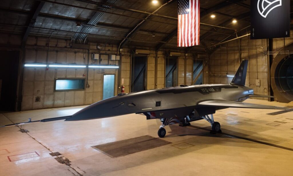
Another USAF CCA prototype, built by Anduril, has been named the FYQ-44. It features a sleek and fast design, similar to earlier pre-stealth fighters, but also includes an internal weapons bay, rounded contours, and an air intake below the fuselage for a turbofan engine.
The USAF’s release of these two CCA prototype contenders seems to suggest that they could be the fighter aircraft of the future. The CCA program, however, does talk about control of these armed UAVs by accompanying mainline manned fighter aircraft, but with autonomous capability to find and destroy once dispatched to attack a target.
The intent is that these unmanned fighters will be significantly less costly to acquire than their expensive manned brothers so that high-risk targets may still be attacked and destroyed without potential loss of the flying pilot or their expensive aircraft. The unmanned fighters would be programmed by the manned aircraft and missiles in their internal weapons bay, would then go on to be controlled by onboard CCA weapons systems, which would relay data back continuously to the pilot who would have final go/no-go authority.
Both prototypes are slated to fly later this year following extensive ground testing campaigns.
After securing an initial $60 million contract from the USAF in 2021, Hermeus went on to raise $100 million in funding in 2022. This was followed by an investment from Raytheon Technologies’ RTX Ventures later that year. Additionally, the company landed a contract for Hypersonic risk reduction from the Defense Innovation Unit (DIU), allowing Hermeus to maintain its funding and momentum. This enabled the company to build and recently fly its first unmanned aircraft, which is designed to travel at extremely high speeds, according to the company.
Initially, with an integrated GE J85 engine, Hermeus is now launching the incorporation of the Pratt & Whitney F-100 into its own “Chimera II turbine-based combined cycle (TBCC) propulsion system,” all aimed at taking subsequent iterations of their prototype to hypersonic speeds.
Quaterhorse has been developed to demonstrate high-speed take-off and landing of a large unmanned aircraft, and is the first in a series of prototypes. And a couple of months ago, on May 27 at Edwards Air Force Base (AFB) in California, Quaterhorse did in fact take off, performed a short overhead circuit and landed! So, more flight tests are now expected to explore the drone’s flight characteristics.
The TBCC two-phase engine with the Pratt F-100 front-end is slated to take Darkhorse, the next planned drone derivative, to Mach 2.8 on the F-100 and then up to over Mach 5 with the hypersonic back-end section of the engine. It could be said that the whole vehicle is being built around this monster engine!
It will be interesting to see how flight testing of Quaterhorse progresses, but even more exciting to hopefully see if and when Hermeus gets the next hypersonic version flying. Additionally, we can anticipate the first flights of the USAF CCA prototypes.
It is amazing how, from the humble beginnings of hobbyist radio-controlled recreational model aircraft, drones have evolved with sophisticated autopilots and are now becoming autonomous vehicles that are taking on front-line air force attack-support. Technological progress is now headed towards hypersonic capability.
The Air Force Life Cycle Management Center’s Positioning, Navigation and Timing (PNT) Program Office, Integrated Solutions for Systems (IS4S) and AEVEX Aerospace have completed flight tests for the Resilient-Embedded GPS/INS (R-EGI) Modular Open Systems Architecture (MOSA). The tests demonstrated R-EGI’s ability to integrate third-party alternative PNT solutions to ensure reliable navigation in GPS-denied environments.
This achievement marks a step forward in developing R-EGI, demonstrating its ability to integrate a “plug & play” third-party alternative PNT capability that ensures reliable navigation in GPS-denied environments.
“This flight test represents a pivotal moment in the evolution of resilient PNT systems,” said Jeff Hebert, senior scientist for PNT at the Air Force. “The rapid and cost-effective integration of third-party PNT solutions into Department of Defense weapons systems is precisely why R-EGI and its open architecture were envisioned.”
The R-EGI system’s open MOSA design enables seamless integration of government and third-party applications to address emerging navigation threats. Its Mission Capability Navigation (MCNAV) component allows for seamless integration of external alternative PNT solutions under challenging conditions.
During six test flights on a Special Operations Command C-146A Cougar aircraft, R-EGI operated successfully in GPS-denied environments, validating the system’s resilience and capacity for real-time adaptability. Using AEVEX Aerospace’s LynxVBN vision-based navigation system, it maintained approximately 10 m of positioning accuracy for up to 2.5 hours. Notably, LynxVBN was integrated into R-EGI’s MCNAV software in just one hour, underscoring the system’s adaptability. As the algorithms continue to improve and evolve, R-EGI’s alternative PNT accuracy will only become more refined, enhancing its capability to perform in increasingly complex and challenging environments, according to the company.
“After demonstrating that the R-EGI architecture could integrate multiple GPS receiver vendors, and then three months later, witnessing its performance, from the Cougar-provided live-stream data feed, in real-time GPS-denied flight scenarios was the most impressive showcase we’ve seen in the program’s history,” said Major Bernard Mutz, project manager for R-EGI
The successful integration of alternative PNT technologies into R-EGI seeks to enhance the system’s GPS resilience. Also, it sets a new benchmark for reliable, flexible navigation in GPS-degraded environments, said Mikel Miller, senior vice president for PNT at IS4S.
Unidentified UAVs over military installations have sparked security concerns across the United States. Numerous sightings of suspected drones have been reported over residential areas, restricted sites and critical infrastructure, including reservoirs, electric transmission lines, rail stations, police departments and military bases. These incidents have prompted federal agencies to investigate and address increasing public concerns.
Government response
John Kirby, the White House national security spokesperson, provided an update regarding the recent drone sightings across the United States. According to Kirby, more than 5,000 drone sightings have been reported in recent weeks, but only about 100 of these required further investigation.
Kirby said the sightings have included a combination of lawful commercial drones, hobbyist drones and law enforcement drones, as well as some crewed aircraft and stars mistaken for drones.
However, the U.S. government is implementing precautionary measures. UAV detection and tracking systems are being installed at Picatinny Arsenal and Naval Weapons Station Earle in New Jersey. The FBI is spearheading investigations into the sightings, and local law enforcement agencies are conducting their own inquiries as well, CNN reported.
Several military installations have reported drone activity, including:
Picatinny Arsenal in New Jersey confirmed 11 unauthorized drone flights over its airspace.
Naval Weapons Station Earle in New Jersey has also reported drone sightings.
Ramstein Air Base in Germany experienced drone activity in early December 2024.
In an interview with ABC News, Alejandro Mayorkas, head of the Department of Homeland Security, said, “There’s no question that drones are being sighted.”
Impact on daily operations
The drone sightings have affected civilian infrastructure as well. Stewart International Airport in New York temporarily closed its runways for about an hour due to reported drone activity. Residents in several East Coast states have also reported seeing hovering and low-flying bright lights at night.
While the increase in sightings has raised concerns among residents and lawmakers alike, federal authorities maintain that most of these incidents do not pose a significant threat to public safety or national security.
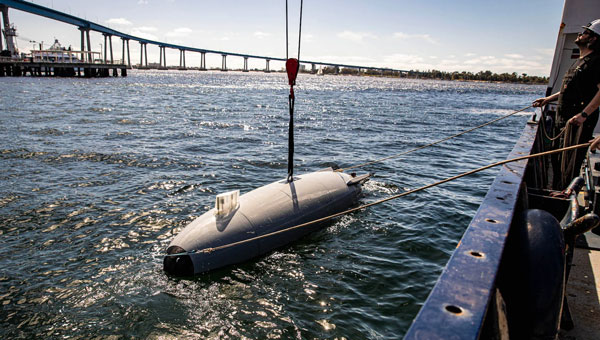
The U.S. Department of Defense (DOD) has spooled up to take the lead in drone warfare with its Replicator 1 program initiative. Securing $500 million in funding in 2023 for “attributable UAVs, DOD is planning another half of a million dollars for the Replicator 2 program. The Replicator initiatives are intended to bring on large volumes of potentially existing capability through increased manufacturing and technological capability. AeroVironment received Rep 1 funding for Switchblade-600 kamikaze drones, which had previously been used successfully in Ukraine, and various initiatives are also underway with many U.S. manufacturers of unmanned surface vessels (USVs), including Anduril’s Dive-LD autonomous underwater vehicles.
Anduril Dive-LD unmanned undersea vehicle. (U.S. Navy photo by Ian Delossantos)
Having launched contracts increasing the available volume of attack UAVs (loitering munitions), it has been decided that the Replicator 2 program will go after the protection of U.S. forces from enemy drone attacks. Both sides in Ukraine have built up their UAV attack capability, and as a consequence, both sides now need better defenses against offensive UAV threats. DoD has also learned from experience in the Middle East, where its naval assets have suffered from kamikaze UAV attacks in the Gulf.
Inexpensive, commercially available UAVs loaded with explosives and remote control and proximity detonators have proved effective weapons. The next phase of Replicator will seek funding in 2026 for counter small-unmanned aerial system (C-sUAS) initiatives, building up existing capability and technology and developing improved defense capabilities.
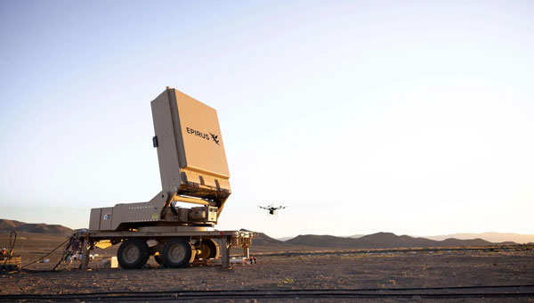
Several c-UAS systems have been developed and fielded in recent years, but DOD’s efforts on Directed Energy Weapons are being intensified. High power microwave (HPM) systems can be used to jam UAV communications and disrupt onboard drone electronics such as navigation, guidance, sensors and control systems. Its only drawback is that effectiveness diminishes rapidly with the range from the HPW transmitting antenna. This is due to the increased dissipation of microwave energy in the air with the square of the distance traveled – straight physics. Nevertheless, if you can pump enough power out of the transmitting antenna, say in a narrower beam, you may still be able to cover enough distance to disable an attacking swarm of adversary UAVs, even if it ends up being close in as the UAVs approach the target.
Based in Los Angeles, Epirus recently delivered its Leonidas Expeditionary HPM system under a U.S. Navy contract. The system is mounted on a towed trailer, with the HPM antenna mounted on a turntable to enable directional aiming for a more dynamic ground-based defense against drones. Previous testing has demonstrated the system’s capability to “fry” single and multiple UAVs.
A U.S. Army 2023 contract allowed Epirus to prototype four of the Leonidas systems, which have been delivered to the agency and are potentially slated to find active service in the Middle East. This real-world test aims to shake down the systems under high-stress defensive situations, providing feedback for future improvements if required. The situation on the ground clearly demands improved defensive capability.
Earlier tests of high-power laser defenses in the region allegedly encountered some difficulty with durability and heat dissipation for 50Kw vehicle-mounted systems, while 20Kw laser systems performed better.
It would seem that the high-intensity microwave beams used by the Leonidas systems might be more usable by ground forces. Epirus has reported that a unique approach to power management was one of the initial core elements developed for the Leonidas system, which may affect the ability to form high-power microwave beams.
Earlier defensive approaches have included rifle fire, shoulder-mounted missiles, expensive guided missile defenses, anti-drone drones that collide or throw nets, jamming of the control signals, and, of course, GNSS jamming and/or spoofing. HPM “frying” of multiple drones at a time may be another key defensive approach that may make drone attacks harder for adversaries to inflict on our forces on the battlefield.
So, the next phase of this game could be to develop counter-counter-drone technologies to defeat the defensive systems—this may be a never-ending process.
SandboxAQ has been awarded an SBIR Phase 2B Tactical Funding Increase (TACFI) by the United States Air Force (USAF) to further develop its dual-use AQNav magnetic navigation (MagNav) system. Under the contract, SandboxAQ and its partner AFWERX will explore new configurations of the AQNav technology, including a pod-based attachment, for use on a broader range of aircraft platforms, such as unmanned aerial systems.
AQNav navigation technology combines proprietary artificial intelligence (AI) Large Quantitative Models (LQMs), powerful quantum sensors and the Earth’s crustal magnetic field, resulting in a solution that operates effectively in all weather conditions, day or night and across any terrain. AQNav technology is completely passive and operates in real-time, offering an unjammable and un-spoofable alternative to traditional navigation methods. This system functions entirely independently of GNSS, offering a secure and dependable navigation option in environments where satellite signals may be compromised or unavailable. This is a key example of applying quantitative AI – AI models trained on quantitative data and not language. SandboxAQ is a leader in Large Quantitative Models (LQMs), in this case to pull the signal from the background magnetic noise for navigation.
This funding increase extends a prior Direct-to-Phase-II SBIR contract awarded to SandboxAQ in January 2023. To date, SandboxAQ’s AQNav technology has logged more than 200 flight hours and more than 40 sorties across multiple regions on four different aircraft types, ranging in size from single-engine planes to large military transport aircraft. In this process, AQNav was successfully tested in two USAF exercises – Exercise Golden Phoenix and Exercise Mobility Guardian – Air Mobility Command’s largest exercise at the time.
AQNav uses a powerful quantum magnetometer system to acquire data from Earth’s crustal magnetic field, which exhibits geographically unique patterns – similar to a human fingerprint. AQNav uses proprietary LQMs to compare this data against known magnetic maps, enabling the system to quickly and accurately find its position. Due to the high sensitivity of foundational quantum sensors, AI algorithms are applied to improve the signal-to-noise ratio, removing any mechanical, electrical, or other interference that would impact the system’s ability to acquire its location.
AQNav is available worldwide and can be used in air, land, and sea applications. The system does not rely on visual ground features or satellite transmissions to function and is not affected by weather conditions. Additionally, AQNav’s passive technology emits no electronic signals, which reduces the aircraft’s detectability. It operates at room temperature, requires no shielding, and has a small form factor that can be integrated into a wide variety of platforms, from multi-engine airliners to unmanned aerial vehicles.
SandboxAQ is developing AQNav as a dual-use solution to address the need for resilience to GPS vulnerabilities, which extends societally and economically. In addition to the USAF, SandboxAQ is engaged with several aerospace leaders to test and develop AQNav, including other allied governments, Boeing and Acubed — Airbus’s Silicon Valley research and innovation center.
TrustPoint, a commercial GPS and navigation technology company, has been awarded a Phase II Small Business Technology Transfer (STTR) contract by AFWERX, totaling $1.6 million. The contract focuses on the development of advanced, resilient navigation applications to meet the challenges faced by the Department of the Air Force.
In collaboration with the Naval Postgraduate School, TrustPoint aims to enhance its GNSS capabilities and pave the way for applications that will boost the national defense of the United States.
The Air Force Research Laboratory (AFRL) and AFWERX have partnered to optimize the Small Business Innovation Research (SBIR) and STTR processes. Their efforts aim to provide quicker proposal-to-award timelines, broadening the applicant pool to include more small businesses and reducing bureaucratic overhead through ongoing process improvements. Since the initiation of the Open Topic SBIR/STTR program in 2018, the DAF has expanded the scope of innovations it funds, with TrustPoint’s project commencing on April 2, 2024.
By Peter Steigenberger, André Hauschild, Steffen Thoelert and Richard B. Langley
Between Feb. 7, 05:02 UTC and Feb. 8, 12:30 UTC, 2017, all seven operational GPS Block IIR-M satellites were consecutively subject to short periods of unavailability. These official outage periods, when the satellite signals were set unhealthy and deemed unusable, were announced ahead of time through Notice Advisories to Navstar Users (NANUs). An overview of the outage periods and the corresponding NANUs for each satellite identified by their pseudorandom noise code (PRN) assignment and space vehicle number (SVN) is provided in TABLE 1.
Table 1. GPS Block IIR-M satellite outage periods and corresponding 2017 NANUs.
An analysis of the measured signal-to-noise-density ratio (C/N0) from several tracking stations of the International GNSS Service (IGS) indicates that the satellites’ transmit powers were increased during the outage periods. The effect is visible in the plots in FIGURES 1 and 2, which show C/N0 of the L1 C/A-code over time for satellite passes on the three consecutive days Feb. 6, 7 and 8, 2017.
Figure 1 shows the results for PRN 17 as tracked by a Septentrio PolaRx4TR receiver (USN8) located in Washington, DC. The pass on the outage day Feb. 7 is plotted in blue. Obviously, the receiver is configured to not track unhealthy satellites, since no observations are available during the outage period. However, a clear increase in the C/N0 is visible from about 50.5 dB-Hz before the outage to approximately 52 dB-Hz after the outage. The C/N0 level of the day before is similar to the level prior to the outage. The C/N0 level on the following day is very similar to the C/N0 after the outage, which indicates that the satellite continues to transmit with an increased power.
Figure 1. Plot of L1 C/A-code C/N0 over time for consecutive satellite passes of satellite PRN 17 (SVN 53) tracked by a Septentrio PolaRx4TR receiver located in Washington, DC, on Feb. 6–8, 2017. The satellite’s unhealthy period on Feb. 7 is indicated by the gray shaded area.
The plot in Figure 2 shows the same analysis, this time for PRN 05 and for a Leica GR10 receiver (KOUG) located in Kourou, French Guiana. This receiver continues to track the satellite during the unhealthy period. The distinct step in C/N0 is clearly visible shortly after the satellite is set unhealthy. Also, this satellite continues to transmit with increased power during the pass on the following day. The same observations as in Figure 1 and Figure 2 can also be made for all other Block IIR-M satellites and other receivers.
Figure 2. Plot of L1 C/A-code C/N0 over time for consecutive passes of satellite PRN 05 (SVN 50) tracked by a Leica GR10 receiver located in Kourou, French Guiana, on Feb. 6–8. The satellite’s unhealthy period on Feb. 7 is indicated by the gray shaded area.
The difference between the measured C/N0 before and after the unhealthy period is typically 1–2 dB-Hz depending on the receiver and the satellite (see TABLE 2). On average, a power increase of 1.5 dB with a scatter of ±0.25 dB among the various satellites is suggested by the measured data.
Furthermore, it may be noted that different receivers respond with a different change in C/N0 for a given change in transmit power. At the average 1.5 dB power increment, C/N0 changes between 1 dB and 2 dB are reported by the different types of receivers. This indicates manufacturer-specific algorithms for C/N0 estimation that impact the use of measured C/N0 as a reliable indicator of received signal power strength.
Table 2. Changes in C/N0 (dB-Hz) obtained from differences of days before and after the increase of the transmit power.
It is interesting to notice in this context that NANU 2017005 issued Jan. 19, 2017, states that “The 2d Space Operations Squadron (2 SOPS) periodically conducts configuration changes on GPS satellites to assess current capabilities, validate future capabilities and ensure continued interoperability.”
Furthermore, the Civil GPS Service Interface Committee Executive Secretariat released the following statement on Jan. 25, 2017: “Beginning 25 January 2017, Air Force Space Command (AFSPC) will conduct a limited duration test implementing an increase of the L1 C/A power level on the GPS Block IIR-M and IIF satellites (19 vehicles).”
However, no maintenance has been announced so far for any of the Block IIF satellites, and no obvious increase in the measured C/N0 could be found for these satellites. A repeated analysis for the Block IIR-M satellites on Feb. 22, 2017, confirmed that the L1 C/A-code power levels were still at their increased levels.
Measurements with the German Aerospace Center’s (DLR’s) 30-meter-diameter high-gain antenna at Weilheim, Germany, have been recorded to independently confirm the GPS Block IIR-M transmit power increase of the L1 C/A-code. FIGURE 3 shows the L1 spectral flux density for March 4, 2017 (blue line), and a previous measurement taken on Dec. 7, 2015 (red line). The sharp peak in the middle of the spectrum represents the C/A-code. A clear increase of the power in the measurement of March 2017 compared to Dec. 2015 is visible. Further analysis of the high-gain antenna data yields a power increase of about 2 dB.
Figure 3. L1 spectral flux density of PRN 29 (SVN 57) for Dec. 7, 2015 (red, normal C/A-code power level) and March 4, 2017 (blue, increased C/A-code power level).
However, the M-code flux density with main lobes near 1565 and 1585 MHz is reduced in March 2017 compared to Dec. 2015, whereas the P(Y)-code signal strength remains essentially unaltered. The total transmit power in the L1 frequency band is the same for both time periods. Therefore, the analysis reveals a redistribution of transmit power from M-code to C/A-code for the Block IIR-M satellite PRN 29 (SVN 57).
Authors Peter Steigenberger, André Hauschild and Steffen Thoelert are from the German Aerospace Center (DLR).
Richard B. Langley is from the University of New Brunswick and authors the monthly Innovation column for GPS World magazine.