News from the National Institutes of Health
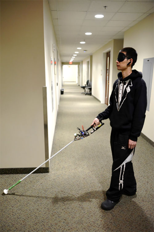
A new robotic cane can help the visually impaired navigate indoors. The cane is equipped with a color 3D camera, an inertial measurement sensor, and its own on-board computer.
When paired with a building’s architectural drawing, the device can accurately guide a user to a desired location with sensory and auditory cues, while simultaneously helping the user avoid obstacles like boxes, furniture and overhangs.
Development of the device was co-funded by the National Institutes of Health’s National Eye Institute (NEI) and the National Institute of Biomedical Imaging and Bioengineering (NIBIB). Details of the updated design were published in the journal IEEE/CAA Journal of Automatica Sinica.
“Many people in the visually impaired community consider the white cane to be their best and most functional navigational tool, despite it being century-old technology,” said Cang Ye, Ph.D., lead author of the study and professor of computer science at the College of Engineering at the Virginia Commonwealth University, Richmond. “For sighted people, technologies like GPS-based applications have revolutionized navigation. We’re interested in creating a device that closes many of the gaps in functionality for white cane users.”
While cellphone-based applications can provide navigation assistance — helping blind users stay within crosswalks, for example — large spaces inside buildings are a major challenge, especially when those spaces are unfamiliar.
Earlier versions of Ye’s robotic cane began tackling this problem by incorporating building floorplans; the user could tell the cane where he or she wished to go, and the cane — by a combination of auditory cues and a robotic rolling tip — could guide the user to the destination. But when used over long distances, the inaccuracies in the user’s location could build up, eventually leaving the user at an incorrect location.
To help correct this issue, Ye and colleagues have added a color-depth camera to the system. Using infrared light, much like a mobile phone’s front-facing camera, the system can determine the distance between the cane and other physical objects, including the floor, doorways and walls, as well as furniture and other obstacles. Using this information, along with data from an inertial sensor, the cane’s onboard computer can map the user’s precise location to the existing architectural drawing or floorplan, while also alerting the user to obstacles in their path.
“While some cell phone apps can give people auditory navigation instructions, when going around a corner for example, how do you know you’ve turned just the right amount?” said Ye. “The rolling tip on our robotic cane can guide you to turn at just the right point and exactly the right number of degrees, whether it’s 15 or 90. This version can also alert you to overhanging obstacles, which a standard white cane cannot.”
There are still a few kinks to be worked out before the system will be market-ready — it’s still too heavy for regular use, for example, and Ye’s team is looking for a way to slim down the device.
Nevertheless, with the ability to easily switch between its automated mode and a simpler, non-robotic “white cane mode,” Ye believes the device could provide a key independence tool for the blind and visually impaired, without losing the characteristics of the white cane that have stood the test of time.
The study was funded by NEI and NIBIB through grant EB018117.
Reference: Zhang H, Jin LQ, Ye C. “An RGB-D camera based visual positioning system for assistive navigation by a robotic navigation aid,” IEEE/CAA J. Autom. Sinica. 2021. 8(8):1389-1400. doi:10.1109/JAS.2021.1004084


