Tag: WINS

  • A WINS for Warfighters

    A WINS for Warfighters

    The current WINS form factor (left) sits beside a prototype for the future incarnation.
    The current WINS form factor (left) sits beside a prototype for the future incarnation.

    The Evolution of the Warfighter Integrated Navigation System

    A new device is being developed to enable foot soldiers to find their exact location in GPS-denied situations. If satellite signals are blocked by heavy jungle canopy, or because of enemy interference, soldiers — and Headquarters — will still know where they are with the Warfighter Integrated Navigation System (WINS).

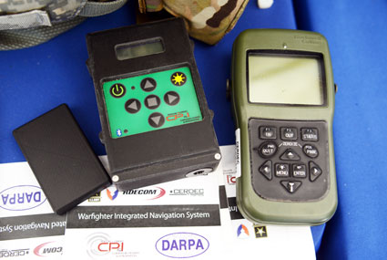
    WINS will be a compact, wearable navigation device capable of operating either as a standalone system or networked to distribute position location information to other soldier platforms. WINS will extend positioning capability for soldiers in environments where GPS is not available, reducing the effect of GPS interference and enabling integrity monitoring for trusted position reporting.

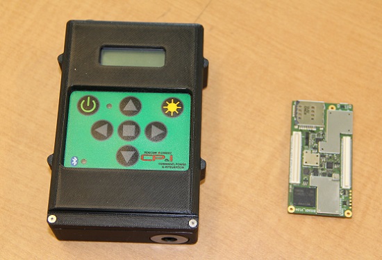
    The technology behind WINS is being developed at the U.S. Army’s Communications Electronics Research Development and Engineering Center (CERDEC) labs. “WINS will be not just one technology; it’s a soldier-worn multi-sensor source incorporating information from GPS, inertials, vision-aided navigation, RF ranging, etc.,” explained John DelColliano, chief for CERDEC’s PNT Branch, which falls under CERDEC’s Command, Power and Integration Directorate (CP&I).

    “All these will tie in to making a more robust navigation system, so if you’re in a situation where GPS fails, you can have other things to back you up.” For instance, inertial sensors will calculate an offset from the last-known GPS location using footsteps taken, speed, acceleration and time.

    “The bottom line is that the soldier, without having to do any extra work on his own, will have a navigation system on his person that will provide him with a solution that he can count on when he needs it,” DelColliano said.

    WINS is expected to help eliminate dependence on vulnerable commercial receivers. It will improve positioning in GPS-degraded environments, enduring some jamming and providing positioning indoors and in urban areas. It will enable soldier-based cooperative engagements and provide trusted dismounted soldier position through integration with Selective Availability Anti-Spoofing Module (SAASM) GPS receivers and redundant navigation sensors.

    “CP&I’s PNT branch has worked on these individual technologies for many years, but we’ve always had the vision of an integrated solution,” DelColliano said. “That’s where we are today. It makes the most sense for what the soldier is going to need in the battlefield.” With a WINS-equipped solder, DelColliano said, “We’ll be able to know where he is and at what time, and we’ll be able to track if something happened to him. This capability will also enable our forces to be more mobile and maneuverable. It allows the commander and HQ to see where each squad is.”

    As part of a technology demonstration program at Fort Dix, N.J., WINS is being developed under an incremental build process as researchers consider what functionality should be incorporated. The engineering specifications for WINS are expected to be transferred to Program Executive Office, Intelligence and Electronic Warfare & Sensors by 2017, and from there eventually be made available to soldiers.

    Future WINS capabilities

    The final version of the WINS will have the following capabilities:

    • Military GPS for a protected signal and anti-jam capability on the soldier.
    • Inertial measurement unit for soldiers to track their location.
    • RF ranging using a radio or radio-like device to communicate between soldier-worn nodes and determine the range between soldiers, computing positions through triangulation relative to GPS.
    • Vision-aided navigation using the same kind of camera as in a cell phone, which is ideal for SWaP-C (size, weight and power compliance), to help navigate by tracking the soldier’s motion through an environment.
    • Network-assisted navigation and GPS.
    • Chip-scale atomic clock.
  • Device Tracks Soldiers’ Movements without GPS

    Device Tracks Soldiers’ Movements without GPS

    The Warfighter Integrated Navigation System, center, uses inertial systems to determine a Soldier's location in the absence of a GPS signal. On the left, a smaller version of WINS. On the right, the Defense Advanced GPS Receiver, which soldiers use now for position, navigation, and timing. All three devices were on display at the DOD Lab Day, May 14, at the Pentagon. (Photo: U.S. Army/C. Todd Lopez)
    The Warfighter Integrated Navigation System, center, uses inertial systems to determine a Soldier’s location in the absence of a GPS signal. On the left, a smaller version of WINS. On the right, the Defense Advanced GPS Receiver, which soldiers use now for position, navigation, and timing. All three devices were on display at the DOD Lab Day, May 14, at the Pentagon. (Photo: U.S. Army/C. Todd Lopez)

    When GPS satellites can’t be seen due to dense jungle canopy, or they are blocked due to enemy interference, soldiers will still be able to track their location digitally using the Warfighter Integrated Navigation System (WINS), a device now under development at the Communications Electronics Research Development and Engineering Center (CERDEC).

    During the U.S. Department of Defense Lab Day held May 14 at the Pentagon, CERDEC researcher Osie A. David explained how the technology behind WINS will one day be transitioned to an Army program manager to bring assured navigational capability to soldiers.

    The WINS is a device small enough to carry in a soldier’s cargo pocket, about half the size of a pack of cigarettes.

    “It’s got a number of inertial sensors, such as a pedometer and an accelerometer, things you will find on your cell phone but of a higher quality,” he said. “Even if the enemy is denying you GPS or the terrain is, you can still get known location on here so it will show up on your Nett Warrior device or your command and control system.” The Nett Warrior is an integrated dismounted situational awareness and mission command system for use by leaders during combat operations, using advanced navigation and information sharing capabilities to allow for faster and more accurate decisions during the tactical fight.

    The Nett Warrior
    The Nett Warrior

    Those inertial sensors will calculate an offset from the last-known location using footsteps taken, speed, acceleration and time, for instance. The device even has way to measure altitude. “It’s got a pressure reader so it knows if you are on the third floor or first floor of a building,” David said.

    The WINS isn’t perfect. As time goes by without a new GPS signal, its estimate of current location will degrade. But the device provides for the user an estimate of its own miscalculation. “After a time, it’ll show you a circle radius for the error range,” he said. “It’s still better than having no GPS at all.”

    David said knowing location is everything in combat, and the WINS, or a follow-on system that uses technology from WINS, will make sure that soldiers have that no matter what happens to GPS.

    “Say we go to Southeast Asia and I’m in the middle of the jungle. There are not a lot of good landmarks. I’m navigating around and I lose the GPS because with the triple-canopy jungle, the GPS can’t penetrate that. I don’t know where I am on the map, so I’m in a bad situation. If I want to know exactly where I am so I can call for reinforcements or resupply, WINS is going to give me my location on a map, no matter where I am.”

    David said CERDEC is still working on issues like where soldiers should wear the device. He also said that he expects the engineering specifications for WINS to be transferred to Program Executive Office, Intelligence and Electronic Warfare & Sensors by 2017. It will be inside an Army program manager’s office, not an Army lab, that WINS or the technology it contains will be made available to soldiers.

    The Soldier Power Manager sits on top of a conformal battery. Allowing multiple devices to be connected to a battery, it reports battery usage, power remaining,  and power usage by connected devices. (Photo: U.S. Army/C. Todd Lopez)
    The Soldier Power Manager sits on top of a conformal battery. Allowing multiple devices to be connected to a battery, it reports battery usage, power remaining, and power usage by connected devices. (Photo: U.S. Army/C. Todd Lopez)

    David also had with him a device he called the Soldier Power Manager. The power manager was connected to a “conformal battery,” which was also developed at CERDEC in conjunction with industry. The conformal battery is flexible and slips easily into a soldier’s tactical vest without being uncomfortable due to stiffness. It wraps around a soldier’s torso.

    The power manager allows multiple devices to connect to a battery, and provides a display saying how much power is left in the battery, what devices are connected to the battery, and how much power each device is using.

    “It lets you know how much energy is left and what is plugged in,” David said. He said one advancement the lab has made on the system is to transfer the user interface to a Nett Warrior device, so soldiers can see it on that screen.

    “It lets you see the total power left on the device and how much energy each device is pulling, so you can make a decision about what device to pull — when energy gets low — to make sure you have enough power to meet mission needs. We have sort of integrated the energy component with the information to make better choices in the battlefield in terms of operational energy.”