MediaTek, China Telecom and Xiaomi have announced an upgrade to its real-time kinematic (RTK) high-precision positioning technology. The joint development integrates 5G connectivity, advanced chip design and Xiaomi’s smart technology.
RTK technology is usually found in professional surveying tools, but will now be available for location and positioning in smartphones, cars and city networks, according to the companies.
The newly upgraded RTK system enables outdoor positioning with sub-meter accuracy and fast response times. Leveraging 5G network infrastructure, smart data transmission, and close chipset-mobile software coordination, the system could be widely implemented on smart city infrastructure, autonomous driving, and smart transportation.
This partnership is part of Xiaomi’s growth beyond smartphones into urban development and smart mobility technologies under the Xiaomi HyperConnect banner.
The improved collaboration between MediaTek’s cutting-edge chipsets, China Telecom’s network, and Xiaomi’s hardware-software ecosystem enables an optimized RTK performance model that can potentially redefine how smart devices interact in real-world environments.
Qualcomm Technologies and Xiaomi have verified meter-level positioning in the Xiaomi 12T Pro powered by the Snapdragon 8+ Gen 1 mobile platform, in Germany.
Accuracy verification tests, including driving tests, were conducted by Qualcomm Technologies, Xiaomi, and Trimble in various scenarios such as open-sky rural roads and urban highways. The companies’ solutions demonstrated meter-level positioning variance at a 95% confidence level.
This level of accuracy in a commercial smartphone is enabled through Qualcomm meter-level positioning for mobile in combination with Trimble RTX correction services. When integrated with Snapdragon mobile platforms, Trimble RTX enhances the phone’s positioning capabilities.
Meter-level positioning accuracy can improve smartphone user experience in several scenarios, including mapping, driving, and other mobile applications. It enables greater accuracy when using ridesharing applications to identify pick-up locations for both driver and rider, fitness applications to track users’ movements, and in-vehicle real-time navigation applications for increased lane-level accuracy with greater map details and more accurate directions.
The Indian government is pushing smartphone makers to sell devices that receive NavIC signals along with GPS.
India originally stated NavIC would be required in smartphones sold starting in January 2023, according to Reuters, but strong reaction from smartphone manufacturers Apple, Xiaomi and Samsung apparently caused the government to push back or remove the deadline.
A deadline of January 2023 would not allow enough time for smartphone makers to integrate NavIC-enabled receivers to their devices. Steps include redesign, securing parts, testing and assembly. Many smartphones sold in India by the companies are economy-level devices priced under US$200.
The three tech giants met with government officials, seeking an extended target date of 2025, Reuters reported.
However, India’s Ministry of Electronics & IT issued a statement via Twitter :
A media report has claimed citing a meeting that mobile cos were asked to make smartphones compatible with NavIC within months. This is to clarify: (1) No timeline has been fixed. (2) The cited meeting was consultative; and (3) the issue is under discussion with all stakeholders.
NavIC (Navigation with Indian Constellation) is the operational name for the Indian Regional Navigation Satellite System (IRNSS) developed by India’s space agency for military and commercial purposes. NavIC consists of eight satellites that cover the Indian mainland and the region extending up to 1,500 km from its boundaries.
“NavIC can help in navigation on land, air, sea and also in disaster management,” Science & Technology Minister Jitendra Singh said in a press release. “NavIC satellites are placed at a higher orbit than the GPS of United States. NavIC satellites are placed in geostationary orbit (GEO) and geosynchronous orbit (GSO) with an altitude of about 36,000 km; GPS satellites are placed in medium earth orbit (MEO) with an altitude of about 20,000 km.”
“NavIC uses dual-frequency bands, which improves accuracy of dual-frequency receivers by enabling them to correct atmospheric errors through simultaneous use of two frequencies,” Singh said. “It also helps in better reliability and availability because the signal from either frequency can serve the positioning requirement equally well.”
Calendar pages allows seem to fly by quickly, and 2018 was no different. While many of the items discussed in last year’s review continued to be topics of advancement, there are several new sources of technology, data collection and potential issues for surveyors going into the new year.
Let’s look back at the stories that affected the surveyor and their use of GNSS technology in 2018.
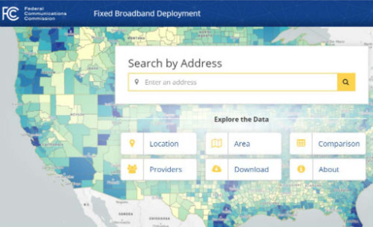
FCC broadband accuracy
The race across America to provide better broadband coverage hit a snag late in 2018 when critics of the Federal Communications Commission (FCC) voiced their displeasure with the accuracy of maps produced to depict the coverage of broadband access.
These critics are pressuring the FCC to verify internet coverage and speed of data availability in rural areas as reported by the broadband companies.
The FCC unveiled a new broadband map in February 2018. (Image: FCC)
These broadband companies are only required to report on the advertised availability and data speeds and not the actual coverage/speed of the installed networks. Critics of the FCC have found that information used from the broadband providers overstates the available speeds and number of internet service providers, thus allowing the FCC to produce mapping of broadband that is not correct.
Because of this incorrect reporting, it is estimated that almost 40 percent of rural America doesn’t have access to broadband data with no formal plan of rectifying this situation. The FCC has stated that they will investigate these coverage maps in order to determine if monies distributed to broadband providers were not used in accordance with the promised delivery of coverage and data speed.
Why does this matter to surveyors? As previously discussed in past columns, the reliance on the real-time network capability of GNSS is one of the biggest time and production savers for the surveyor and for those working in rural America is no exception.
Not just in small towns but out in the open where large parcels are being surveyed for many different reasons, including pipelines, wind and solar installations and title conveyances. By having broadband available use by surveyors, these tasks can be accomplished with shorter timeframes and less steps to keep critical data in compliance with established coordinate systems.
While this bill received lots of attention because of the FAA implications, the portion of the bill concentrating on geospatial oversight will have a lasting effect on the governance and development of the national mapping industry.
For many years, the ever-developing amount and sources of geospatial data has been growing within several different agencies of the United States government. This bill was established to help streamline the efforts and availability of geospatial data by assigning specific agencies to oversee the development and introduction of new technologies.
The biggest takeaway from this bill will be the reduction of agencies working on concurrent data sets for public and private use and therefore streamlining the opportunities to introduce newly acquired information into critical programs, (such as FEMA floodplain mapping, GAO asset management, etc.).
Part of the reason I wish to highlight this bill was the efforts of the National Society of Professional Surveyors (NSPS) to keep the state professional licensing laws intact, the use of private sector businesses for providing surveying services, and to keep quality-based selection (QBS) as the primary tool for awarding contracts for procurement services.
Because of the actions and reasoning by NSPS, the authors of the bill withdrew the language that would allow “low bid” opportunities within these contract awards. This influence by NSPS is a prime example of how a profession can influence legislation through our democratic process.
Galileo implementation, Beidou installation, GPS Block III launches
SpaceX’s Falcon 9 rocket orbited the first GPS III satellite on Dec. 23, 2018. (Photo: SpaceX)
In November 2018, the FCC opened a new chapter in GNSS observation by approving a waiver to allow GNSS receivers to utilize Galileo transmissions for location determination without a specific FCC license. Traditionally, the FCC would require licensing of public, receive-only GNSS equipment used with any foreign-based systems but worked with several US agencies to create a waiver to allow faster implementation to use the Galileo signals.
It should also be noted that the Chinese government has been rapidly building the latest stage of their own GNSS constellation, the BeiDou system. The United States and China have been promoting cooperation to allow each side to better understand the current workings of GPS and BeiDou, (GPS-BeiDou Statement). China is currently completing its third phase of the navigation system that potentially will surpass the United States GPS constellation in data availability and accuracy, (See GPS World“Directions 2019: BeiDou accelerates global deployment,” December 2018).
Not to be outdone, the U.S. has begun its implementation of their next wave of satellites, the GPS III containing the latest technology, the L1C civil signal, with improved accuracy and anti-jamming programming. On Dec. 23, the SpaceX Falcon 9 rocket delivered the GPS III SV01 into its intended orbit (SpaceX Launch) with more launches scheduled for additional satellite vehicles in 2019.
These efforts to increase satellite coverage and accuracy will only improve the use of GNSS receivers by surveyors. While I look forward to software and receiver upgrades to take advantage of the newer birds, we still need a backup plan in case of international conflicts and a reduction/discontinuation of GNSS service.
GPS and terrestrial backup
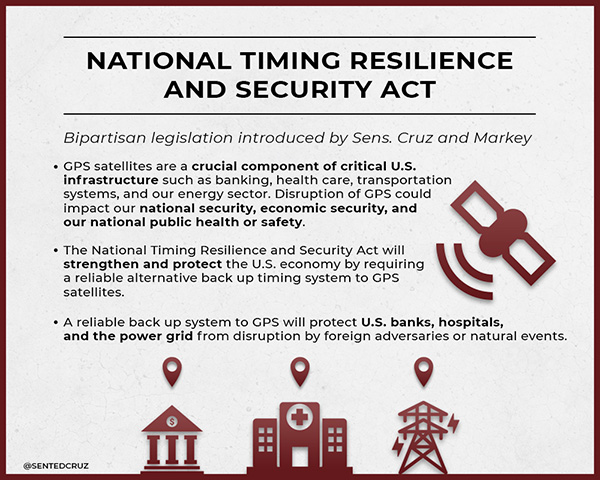
The Frank LoBiondo U.S. Coast Guard Authorization Act of 2018, which also included the National Timing Security and Resilience Act, was signed into law on Dec. 4 and directs the Secretary of Transportation to establish a terrestrial back system for the U.S. satellite navigation system within a two-year period (see “GPS to get terrestrial backup system”).
The bill lays out specific conditions for the backup plan:
terrestrial
wireless
synchronized to UTC
difficult to disrupt
able to penetrate underground and inside buildings
capable of deployment to remote locations
expandable to provide position, navigation and timing (PNT), and
able to work in concert with similar systems such as eLoran.
However, this bill did not provide any funding for the creation of this system but now allows the introduction of appropriations in future bills and acts. As I have written in past columns (see “The day GPS went away,” September 2017), it won’t be a matter of if but when something happens to our current GNSS capabilities and we need to develop this backup plan yesterday.
Dual-band GNSS cellphones as the new norm
My last submission featured the latest in chipset for cellphones and utilizing dual-frequency GNSS signal reception. Xiaomi, based in Beijing, China, introduced the Mi 8 phone with a dual-frequency GNSS chip in the Spring of 2018 to rave reviews.
This chip frequency reception (E1/L1+E5/L5) is targeted to embrace the Galileo and GPS constellations for increased accuracies (within a decimeter) well beyond the current norm for smartphones (typically 1-3 meters +/-).
Since then, Xiaomi has released the Mi Mix 3 and Huawei has released the Mate 20, Mate 20 Pro and Mate 20 X, all with dual-frequency chipsets. However, all of these phones are not available in the U.S., and the security issues with Huawei has been well documented (CNBC Report, February 2018).
The reason I still bring these up for the surveyor is because soon we will have dual-frequency capability on the phone in our pockets here in the U.S. Such phones can greatly increase efficiencies, especially when used during reconnaissance efforts. I believe many more phone manufacturers will begin to incorporate dual-frequency chips in their future models to increase location accuracies for the users and take advantage of upcoming network enhancements (see GPS World“Dual-frequency GNSS smartphone hits the market,” June 2018.)
Surveyors vs. technology disruptors
The Mi 8 smartphone offers dual-frequency capability. (Image: Xiaomi)
One of the biggest stories in the surveying world made national headlines after a start-up “GEO-spatial” consultant created by retired bankers was sued by the Mississippi Board of Licensure for Professional Engineer and Surveyors for having “engaged, and continues to engage in the practice of surveying while not licensed by the Board.” (Madison County, Mississippi, Chancery Court.) While the initial suit remained under the national radar, the countersuit by the consultant and subsequent articles in national websites brought the situation to the front page.
The issue at hand is the creation of “plats” combining a legal description for a parcel with a high-resolution photo (captured by various means, including UAV) and depicting said legal description on the photo for use by banks and other financial institutions for risk evaluation. Their argument is that they have “First Amendment rights” to provide public information (the legal description) on a recent aerial photograph in order to provide an exhibit for lenders to review and make loan decisions. Banks are now paying much less in fees to this company for an exhibit instead of a Plat of Survey provided by a licensed surveyor, yet the exhibit provides no assurance (or certification) to its validity and/or any metadata for the represented information.
The subsequent articles by both Bloomberg and Ars Technica writers liken the situation to Airbnb versus hotels and Uber/Lyft versus taxi drivers as a new “disruption in technology” brings forth change to previously licensed professions. In fact, the author of the Bloomberg article stated, “the clients are sophisticated, and they’re not complaining.”
Using this mentality, we could apply it to any licensed profession and allow services normally regulated by laws to be administered by non-professionals, as long as the client “is sophisticated and not complaining.” This means anyone can provide accounting, medical, dental or even law services if the client is satisfied. As previously published here, (see GPS World“Accuracy, precision and boundary retracement in surveying” July 2017), a boundary survey is not simply a mathematical figure from a legal description. It takes a trained person to know how to properly relate a legal description to a physical parcel and professional licensing provides that assurance (and protection) to the public.
This situation falls squarely in the GNSS wheelhouse for surveyors, especially as technology advances and accuracies become smaller with progress, (i.e. GPS Block III, BeiDuo, Galileo, etc.) and the ability to measure with higher positional accuracy, (i.e. Xiaomi Mi 8 and other to follow).
The surveying profession has joked for years that when these technologies do come forward, many unlicensed “professionals” will come forward with their measuring devices (phones) and locate property lines as part of their service.
But for now, it isn’t just the physical location by GNSS measurement we should worry about; it is the high-resolution photo software, GIS data sources and those folks enterprising enough to put all this information together. The surveying profession will need to ramp up its message to public to help better define what the licensed surveyor provides versus the “we can do it much cheaper and faster” stories. More often than not, you get what you pay for.
Data collection advancements
Emlid Reach RS with iPad. (Photo: Tim Burch)
While 2018 didn’t see any revolutionary changes to GNSS data collection, several small advances are noteworthy. Besides the previously mentioned dual-frequency cellphones, we are also seeing more integration with the cellphones themselves as data collectors in conjunction with stand-alone GNSS receivers (see GPS World“University research uses smartphones for precision GNSS,” September 2018).
Several of the major survey equipment manufacturers are joining a group of small GNSS start-ups by introducing single- and dual-frequency receivers to work with both Android- and iOS-based phones and tablets for more cost-effective positional solutions.
Another trend that is becoming very popular is the use of post-processing kinematic (PPK) solutions with many of the newest models of multi-rotor and fixed wing UAVs. The early (and expensive) trend of aerial vehicles produced by the major surveying equipment manufacturers insisted on installation of a dual-frequency RTK receiver in order to provide a more robust control system for the orthometric photo process. Because there is still a need to combine the still photos from the UAV flight via various “stitching” software, the need (and expense) of RTK within the receiver, while a nice feature, has become overkill for most aerial needs. However, there are times and applications when a fixed-RTK location could be useful, especially during emergency situations when needing to utilize the UAV for live streaming purposes.
The last big trend to gain popularity comes from Propeller, a young tech company from Australia that provides both a control point product and data reduction/reporting service. Their revolutionary ground control point (GCP) target, the Aeropoint, is becoming a very popular item for UAV pilots worldwide. These 24-inch (61-CM) square foam targets contain a single-frequency GNSS receiver that collects RINEX data while performing your UAV flight. Spread these targets around your site, setup and perform your survey, then download the target data to the Propeller app on your phone/tablet. The app automatically uploads the data to the company’s site and processes the geographical location for each target into your chosen coordinate system. It truly is that simple and the Propeller folks have made it easy to use. Their online software, Propeller Platform, is also available for photo/data processing and site analysis/visualization/volume computations. They, too, are now teaming with DJI to offer PPK solutions combining Aeropoint data along with Phantom 4 RTK photo data in a convenient, streamlined process.
For 2018, our firm (SPACECO Inc) expanded our UAV program in several ways to take advantage of these trends. First, we been using the Emlid Reach RS single-frequency GNSS receiver utilizing a Bluetooth connection to an iOS-based tablet to GCP’s for our UAV program. The receiver’s low cost and ease of use with an RTN network has been a pleasant change from typical surveying equipment. We also use Propeller’s Aeropoints in locations where the RTN coverage is not readily available. For sites that are substantial (typically 300 acres+), we often send our data to the Propeller Platform for photo stitching and data reduction to take advantage of their computing power.
WingtraOne. (Photo: Brian Kravets, SPACECO Inc.)
Lastly, we wanted to expand our fleet of quad-rotor UAV’s to include a fixed wing model for larger sites. A visit with the Wingtra crew at InterGeo 2017 in Berlin convinced me that a vertical take-off and land (VTOL) model would be a great addition, so we took delivery of our WingtraOne this past summer. The ease of use and amount of project space the Wingtra can cover was already great but we’ve added the PPK module to reduce the amount of GCP’s necessary, especially in inaccessible areas. All these additions to our survey department (carefully vetted and purchased; no freebies from any of the manufacturers!) have provided new ways to expand our services to our clients and allows us the opportunity to enjoy what we do along the way. It is my pleasure to report from personal experience that these trends are solid and will continue to increase our abilities and productivity for days to come.
What’s next for 2019?
Some of the items I see gaining traction in 2019 will include additional sensors for UAV’s (LiDAR, hyperspectral, infrared), continued improvement in cost effectiveness of laser scanners and LiDAR, increased interest in SLAM (simultaneous localization and mapping) technology and, of course, more geolocation services tied into autonomous vehicles/delivery. Will 2019 be the year Amazon drops my packages by UAV at my front door? As fast as these technologies are developing, I wouldn’t bet against it.
The worldwide wearable device market recorded its eighth consecutive quarter of steady growth in the first quarter of 2015. According to the International Data Corporation (IDC) Worldwide Quarterly Wearable Device Tracker, vendors shipped a total of 11.4 million wearables in the first quarter, a 200 percent increase from the 3.8 million wearables shipped in the first quarter of 2014.
“Bucking the post-holiday decline normally associated with the first quarter is a strong sign for the wearables market,” said Ramon Llamas, research manager, Wearables. “It demonstrates growing end-user interest and the vendors’ ability to deliver a diversity of devices and experiences. In addition, demand from emerging markets is on the rise and vendors are eager to meet these new opportunities.
“What remains to be seen is how Apple’s arrival will change the landscape,” added Llamas. “The Apple Watch will likely become the device that other wearables will be measured against, fairly or not. This will force the competition to up their game in order to stay on the leading edge of the market.” The Apple Watch began shipping April 24.
“As with any young market, price erosion has been quite drastic,” said Jitesh Ubrani, senior research analyst, Worldwide Mobile Device Trackers. “We now see over 40% of the devices priced under $100, and that’s one reason why the top 5 vendors have been able to grow their dominance from two thirds of the market in the first quarter of last year to three quarters this quarter. Despite this price erosion, Apple’s entrance with a product priced at the high end of the spectrum will test consumers’ willingness to pay a premium for a brand or product that is the center of attention.”
Wearable Vendor Highlights
Fitbit started 2015 the same way it ended 2014: as the clear market leader in the worldwide wearable device market. Fitbit’s first quarter shipments were driven by the release of three new devices (the Charge, Charge HR, and the Surge) along with continued demand for its older Flex wristband and One and Zip clip-on models. Separately, these address multiple segments of the market, from casual exerciser to committed athlete, and collectively leverage Fitbit’s behavior change engine to encourage activity.
Xiaomi started off the year by blasting through the one million unit mark with its Mi Band for the first time, a significant feat made all the more impressive considering the device just started shipping during the second half of 2014. Similar to its smartphones, Xiaomi’s Mi Band was delivered primarily within its home country of China, but recent announcements point to more global aspirations for the company.
Garmin’s wearable device portfolio spans multiple areas of health and fitness, including activity tracking, running, hiking, golfing, triathlons, and multi-sport. The majority of Garmin’s devices are GPS-enabled to track location and distance, and some leverage the company’s ConnectIQ third-party applications to record activity, show notifications, and news.
Samsung’s fourth place finish came from worldwide demand for its Gear smartwatches. Since its debut in 2013, the Gear portfolio has diversified to include the Tizen-powered Gear, Gear 2, Gear Fit, Gear 2 Neo, Gear S, and the Android-Wear powered Gear Live. What has limited Samsung, however, is the ability for Gear devices to connect only with select high-end Samsung smartphones.
Jawbone beat Pebble and Sony for fifth place, a result driven by the release of its UP MOVE and continued demand for its nearly year-old UP24. The company will release two new devices in the second quarter of 2015, with the similarly-functioning UP2 and the mobile payments-enabled UP3. The company maintained its design strategy of no displays, but again touted its predictive data engine to encourage healthier lifestyles.
Top Five Wearables Vendors, Shipments, Market Share and Year-Over-Year Growth, Q1 2015 Data (Units in Millions)
Vendor
1Q15 Shipment Volumes
1Q15 Market Share
1Q14 Shipment Volumes
1Q14 Market Share
Year-over-year Change
1. Fitbit
3.9
34.2%
1.7
44.7%
129.4%
2. Xiaomi
2.8
24.6%
0
0.0%
N/A
3. Garmin
0.7
6.1%
0.3
7.9%
133.3%
4. Samsung
0.6
5.3%
0.3
7.9%
100.0%
5. Jawbone
0.5
4.4%
0.2
5.3%
150.0%
Others
2.9
25.4%
1.3
34.2%
123.1%
Total
11.4
100.0%
3.8
100.0%
200.0%
Source: IDC Worldwide Quarterly Wearable Tracker, June 2, 2015
Table Notes:
Data is subject to change.
Vendor shipments are branded device shipments and exclude OEM sales for all vendors.
The “Vendor” represents the current parent company (or holding company) for all brands owned and operated as subsidiary.