Author: GPS World Staff

  • GSA: 40 percent of GNSS receivers are Galileo-ready

    GSA: 40 percent of GNSS receivers are Galileo-ready

    60 percent support two or more constellations

    Chipset and receiver manufacturers are already equipping their devices with multi-constellation capabilities, including Galileo, and taking advantage of available services, according to a new analysis by the European GNSS Agency (GSA).

    The study examines the global top 31 companies and reviews publicly available technical documentation on their product portfolios, for more than 300 receivers, chipsets and modules available on the market. The parameters researched included such technical specifications as GNSS core constellation capabilities, space-based augmentation system (SBAS) capabilities and the market segments to which the manufacturers sell their products.

    Each device is given equal weight in the results displayed here, regardless of whether it is a chipset or a receiver and no matter what its sales volume. The results should therefore be interpreted not as the distribution of constellations utilized by end-users, but rather the distribution of constellations available in a manufacturer’s offerings. Because some receiver models are used in more than one market segment, it is impossible to have a direct match between general analysis charts and segment charts.

    Figure 1 shows the percentage of available receivers capable of tracking the various constellations. GPS is naturally present in all devices, followed by GLONASS. Galileo and BeiDou are progressively adopted by leading manufacturers.

    Figure 1. Capability of GNSS receivers, all Segments.
    Figure 1. Capability of GNSS receivers, all Segments.

    Figure 2 shows the percentage of available receivers capable of tracking signals from one GNSS (that is, GPS only), two GNSS (in various combinations), three GNSS, or tracking signals from all constellations at the same time. The percentages add up to 100.

    Figure 2. Supported constellation by receivers, all segments.
    Figure 2. Supported constellation by receivers, all segments.

    From this information, the GSA concludes that almost 60 percent of all available receivers, chipset and modules support a minimum of two constellations. Of these, nearly 40 percent are Galileo compatible. Furthermore, knowing that the top three providers of smartphone chips are on track to be Galileo compatible by the time Initial Services are declared later this year, the actual market share — this time taking into account the number of devices — is likely to be much higher than the 40 percent of Galileo-compatible models. The GSA states that this shows a multi-constellation capability including Galileo is becoming a standard feature across all market segments.

    Market segments

    Breaking down this level of Galileo compatibility further, the GSA found variations across different market sectors. In the high-precision market, used primarily for surveying and agriculture applications, all the leading brands have integrated Galileo into their products.

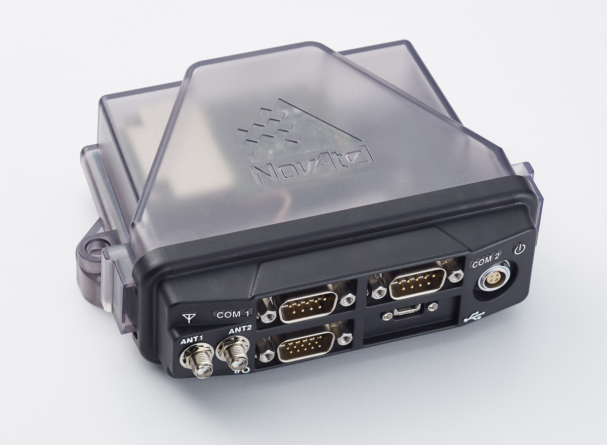
    For example, in 2008 Septentrio launched a fully integrated industrial Galileo-capable GNSS receiver, followed 1.5 years later by a multi-frequency multi-constellation OEM platform for machine control and survey applications built on a new, Galileo-capable application-specific integrated circuit (ASIC) tracking all Galileo signals and frequencies, called AsteRx3. Likewise, Javad GNSS‘ Triumph receivers track all satellite systems, including Galileo. Other companies in the high-precision market who have integrated Galileo into their products include NovAtel, Furuno, Leica Geosystems, ComNav, Trimble and Topcon.

    Looking toward automotive and mass-market products in general, the integration of Galileo within the hardware is complete, although activation tends to remain pending, depending on the request of customer. Most companies serving this sector — including u-blox, STMicroelectronics, Broadcom, Qualcomm, Intel and Mediatek — have announced products that are Galileo-capable.

    In regulated transport systems where safety and liability critical applications are key (for example, aviation, maritime and rail), the integration of Galileo signals tends to be slower. This is the result of integration being dependent on the updating of necessary standards and regulations, on top of the very long lifespan of these devices.

    Supporting integration

    To further increase the level of Galileo integration in all three of these market sectors, the GSA continues to work directly with chipset and receiver manufacturers, through technology workshops, sharing Galileo updates, co-marketing efforts, and dedicated funding for receiver development projects and studies.

    The GSA also coordinated a comprehensive testing program in cooperation with the European Commission’s Joint Research Centre and the European Space Agency (ESA). Over the past year, hundreds of tests and live in-field testing hours were conducted, verifying how different models integrate Galileo signals. This information allows manufacturers to update their technology and get the most out of the system’s increased accuracy and reliability within a multi-constellation environment.

    The GSA also launched its Fundamental Elements program, a research and development funding mechanism supporting the development of chipsets and receivers. The program will run through 2020 and has a projected budget of 111.5 million euros. Its main objective is to facilitate the development of applications across different sectors of the economy and promote the development of such fundamental elements as Galileo-enabled chipsets and receivers.

    The European Union’s Horizon 2020 research program, which aims to foster adoption of Galileo via content and application development, focuses on the integration of services provided by Galileo into devices and their commercialization. The Horizon 2020 third call for applications in satellite navigation-Galileo will open in November 2016, with a March 2017 deadline.

    With a budget of approximately 100 million euros for the 2014–2020 period dedicated to Europoean GNSS applications, the program provides excellent opportunities for their development. The third call addresses concrete solutions and applications in the GNSS market and aims to support innovative applications, products, feasibility studies and market tests that have a substantial impact on European innovation, know-how and economy.

    New ICD. The European Commission has published a new release of the Galileo Open Service Signal in Space Interface Control Document (OS SIS ICD v1.2). This document provides the information needed by receiver and chipset manufacturers, application developers and service providers to process and make use of the open signals generated by the Galileo satellites. In particular, the document specifies:

    • Galileo signal characteristics
    • characteristics of Galileo spreading codes
    • Galileo message structure
    • message data contents.

    This latest version of the ICD is based on direct feedback from receiver manufacturers and other stakeholders.

    The GSA is well advanced in developing the European GNSS Service Centre (GSC), which provides the single interface for information and help to users of the Galileo OS. Once fully developed, the GSC will operate on a 24/7 basis and offer a range of services, including hosting the Galileo User Helpdesk, providing the interfaces between the Galileo System and OS users, and hosting a center of expertise for OS service aspects.

    “The analysis, testing, funding and knowledge sharing are all geared towards promoting the development of receiver technology — the key enabler for translating Galileo signals into useful services,” said Carlo des Dorides, GSA executive director. “As a result of this work, the GSA has paved the way for Galileo to be fully integrated into a new generation of receivers, and ensured its signals provide a wide array of innovative applications and services that directly benefit the end-user.”

    Galileo Services, an industry consortium, offered this further perspective on the study. “We see that there is a strong interest from European industry to provide solutions for European GNSS applications globally,” said Gard Ueland, chairman. “An increased focus from European institutions leaves us optimistic for an increased presence of European players in the future. Notably, we see members of Galileo Services and OREGIN that already have or are developing receivers for a broad range of applications, in particular building on Galileo differentiators.”

  • Trimble offers GNSS module for system integrators

    Trimble offers GNSS module for system integrators

    MB-Two module by Trimble.
    MB-Two module by Trimble.

    Trimble has introduced the MB-Two GNSS module, which delivers highly accurate GNSS-based heading plus pitch or roll in an advanced industry standard form-factor for system integrators.

    The module’s embedded Z-Blade GNSS technology uses all available dual-frequency GNSS signals equally, without any constellation preference, to deliver fast and stable centimeter-accurate position and heading information, the company said.

    The MB-Two is designed for a wide variety of applications such as unmanned, agriculture, automotive, marine and military systems.

    The announcement was made at AUVSI’s Xponential 2016, the largest trade show for the unmanned systems and robotics industry.

    “System integrators demand high performance, reliability and support for their positioning solutions,” said Elmar Lenz, general manager of Trimble’s Integrated Technologies Division. “The MB-Two is designed for easy integration and rugged dependability. The size, weight and power specifications of the unit make it the ideal choice for smaller unmanned platforms.”

    The MB-Two features an enhanced dual-core GNSS engine with 240 channels capable of tracking L1/L2 frequencies from the GPS, GLONASS, Galileo and BeiDou constellations. The GNSS engine supports Trimble RTX correction services, including CenterPoint RTX and RangePoint RTX, delivered worldwide via L-Band satellite. The MB-Two combined with CenterPoint RTX delivers centimeter-level positioning without requiring a local base station or VRS network.

    The Trimble MB-Two module is available now through the Trimble GNSS OEM international network of representatives and authorized dealers.

  • Launchpad: Galileo-ready receivers

    OEM: Galileo-ready receivers

    Triple-frequency receiver

    Ready for Galileo

    NovAtel's FlexPak6D enclosed GNSS receiver.
    NovAtel’s FlexPak6 enclosed GNSS receiver.

    The compact FlexPak6 receiver houses NovAtel’s OEM628 triple-frequency plus L-band GNSS receiver board. It tracks all current and future GNSS constellations, with a highly configurable interface designed to meet current and future positioning and integration needs. The FlexPak6 is a GPS and GLONASS receiver that is also Galileo and Compass ready. Upgradable receiver firmware ensures easy updating to future signals. While multi-constellation tracking provides higher solution availability and reliability, its flexible communication interface broadens deployment options. It provides 100-Hz measurements for high dynamic applications. Signals tracked include L1, L2 and L2C and L5. It also has RT-2, ALIGN, GLIDE, RAIM firmware options.

    NovAtel, www.novatel.com


    Interference mitigation

    Single- or dual-antenna receiver with latest algorithms

    AsteRx-U dual-antenna receiver.
    AsteRx-U dual-antenna receiver.

    The AsteRx-U receiver incorporates the latest GNSS tracking and positioning algorithms, such as LOCK+ technology to maintain tracking during heavy vibration machine use and IONO+ technology to assure accuracy in regions of elevated ionospheric activity. Interference mitigation counteracts ambient and deliberate RF interference. The AsteRX-U is built around Septentrio’s latest application-specific integrated circuit (ASIC), the GReCo4, and incorporates built-in jamming detection and countermeasures, multipath rejection and fast acquisition. More than 500 hardware channels track all available constellations (GPS, GLONASS, Galileo, Beidou, IRNSS and QZSS).

    Septentrio, www.septentrio.com


    GNSS/MEMS package

    For applications requiring 
both RTK and orientation

    Trimble-BD935-INS-Module-WThe Trimble BD935-INS delivers GNSS and inertial technology in an easy-to-integrate form factor for demanding conditions and applications such as lightweight robotic or unmanned vehicles. It features precision GNSS with an integrated 3D micro-electro-mechanical systems (MEMS) inertial sensor package, triple frequency for both GPS and GLONASS constellation, and dual frequency for BeiDou and Galileo. The compact module augments real-time precise positioning with 3D orientation. Connectivity and configuration allow system integrators and OEMs to add GNSS and attitude to specialized or custom hardware solutions. By integrating inertial sensors onto the GNSS module, users receive more robust performance in challenging environments. The module delivers fast and reliable real-time kinematic (RTK) initialization for 1–2 centimeter positioning. The integrated GNSS-inertial engine delivers high-accuracy GNSS and DGNSS positions in challenging environments such as urban canyons, tunnels and heavy canopy.

    Trimble, www.trimble.com


    555-channel receiver

    Leica_GS16_front_right_on_pole_with_CS20_300DPI-WCapacity for galileo and other future signals

    With its robust 555-channel engine, the new Leica Viva GS16 receiver is empowered by RTKplus to access all known and current signals while intelligently distinguishing which ones are the optimal combination to lock onto for accurate positioning adapting to any environmental conditions. There is also capacity for future signals, such as the full deployment of BeiDou and the expected progress of Galileo and QZSS. Thanks to SmartLink, the precise point-positioning technology, uninterrupted positioning continues even when local corrections services are unavailable due to obstructions or lack of cellular coverage. When no reference data is available, SmartLink continues to enable fully remote work. On a field tablet or controller, users can interact with immersive 3D models directly in the field, ensuring all data is collected and linked to the office.

    Leica Geosystems, leica-geosystems.com


    SURVEY & MAPPING

    Mobile mapping system

    SurfSLAM-WLaser scanner rolls on a trolley

    SurphSLAM combines the new Surphaser 10 laser scanner and GeoSLAM’s new RealTime SLAM registration software. SurphSLAM can be used for extremely accurate high-resolution 3D mobile mapping without the need for GPS. The integration of technologies allows for the resulting point cloud to be registered and displayed in real time, facilitating the performance and speed of the survey. Surphaser scanners produce high-accuracy data sets with ultra-low noise levels. The combination of speed, low range noise, sub-millimeter accuracy and reduced size of the scanner make it suitable for a versatile mobile mapping system such as SurphSLAM. The custom-designed trolley is lightweight and collapsible.

    Basis Software, www.surphaser.com; GeoSLAM, geoslam.com


    GeoPackage support

    Edge3.9.3-GeoPDF-Notebook-Device-WOGC GeoPackage enables platform-independent data exchange

    TerraGo Edge 3.9.3 features full support for OGC GeoPackage, a universal format for sharing maps and geographic data across mobile devices and platforms. TerraGo Edge enables users to import and export OGC GeoPackage as a SQLite database optimized for performance on iOS and Android devices. Release 3.9.3 closes the loop for a complete GeoPackage collaboration workflow by allowing Edge app users to import GeoPackage data from a mobile device, collect location-tagged field data, and roundtrip the information back to the GIS or other enterprise systems of record.

    TerraGo, www.terragotech.com


    NTRIP software

    Open-source client extended with full galileo support

    BNC on a Mac system for static real-time precise point positioning with Google Maps, such as for early warning of natural hazards.
    BNC on a Mac system for static real-time precise point positioning with Google Maps, such as for early warning of natural hazards.

    Version 2.12 of the BKG NTRIP Client (BNC) real-time software for Windows, Linux and Mac now comes with complete command line interface and considerable post-processing functionality. RINEX Version 3 file editing and quality check with full support of Galileo, BeiDou and SBAS — besides GPS and GLONASS — are also among the new features. BNC version 2.12 allows simultaneous multi-station precise point positioning (PPP) for real-time displacement monitoring of entire reference station networks. Comparison of satellite orbit/clock files in SP3 format is another new feature, along with a large set of examples for various applications. BNC software was originally developed bythe Federal Agency for Cartography and Geodesy (BKG) and Czech Technical University.

    BKG GNSS Data Center, https://igs.bkg.bund.de/ntrip/download


    Smart antenna

    For deformation monitoring

    Leica_GX910_antennaThe Leica GMX910 smart antenna is desgined for static, long-term projects requiring a high number of sensors. It can enable dynamic monitoring with up to 10-Hz data streaming and advanced multi-frequency, multi-constellation tracking. Starting with the basic GPS single-frequency receiver and adding multiple upgradable options, the antenna adapts to a wide range of GNSS monitoring applications, from complex manmade to natural structures. The smallest movements of bridges, dams or high-rise buildings are detected in real-time. The antenna supports multiple GNSS satellite systems and signals, tracking up to 555 channels. An IP67 rating against dust and water, extended temperature ranges and low power consumption enables installation of the device in remote areas and severe conditions.

    Leica Geosystems, leica-geosystems.com


    UAV

    GNSS helix antenna

    For disaster monitoring, traffic patrol, security monitoring

    Harxon-HX-CH6601AThe 25-gram HX-CH6601A GNSS helix antenna for UAV and geospatial applications receives GPS L1/L2, GLONASS L1/L2 and BeiDou B1/B2. It offers exceptional pattern control, polarization purity and high efficiency in a compact form factor. The antenna is equipped with a high-quality, durable IP65 sealed radome housing and terminated with a subminiature version A (SMA) connector, which has high gain and wide beam width to ensure the signal-receiving performance of satellites at a low-elevation angle.

    Harxon, www.harxon.com


    Collision avoidance

    uAvionix-collision-avoidance-W1.5 gram micro ADS-B receiver

    The pingRX ADS-B (automatic dependent surveillance – broadcast) receiver requires 1/100th the power of conventional ADS-B receivers. It implements sense-and-avoid capabilities for small drones operating in the National Airspace. pingRX measures 32 x 15 x 3 millimeters, which is a fraction of the size of earlier units. It receives ADS-B information broadcast by other aircraft on two frequencies approved by the U.S. Federal Aviation Administration (978 MHz and 1090 MHz.) This allows the unit to detect commercial aircraft threats within a 100-statute-mile radius in real time.

    uAvioniX, www.uavionix.com


    Multirotor System

    Shotover-U1-UAV-camera-WAvailable as turn-key sUAS or as standalone gimbal

    The U1 is a professional-grade unmanned aerial vehicle for the industrial survey and surveillance markets, as well as for cinematographers. Features include redundant flight control and battery systems, customized downlink with two high-definition (HD) video feeds, stability even at full zoom with a gyro-stabilized gimbal system, and remote camera control.

    Shotover, www.shotover.com


    TRANSPORTATION

    Dash camera

    CDC-601-Angle-caranddriver-dashcam-WCar & Driver branded dash cam includes built-in GPS

    The dash camera CDC-601 is equipped with built-in GPS and motion detection. Media shortcut keys allow the driver to manage settings and view their recordings. The camera automatically records when the driver starts the engine and shuts down when the ignition turns off. The 1080p high-definition camera has a 120-degree wide-angle lens, loop recording, time stamp and accident detection. An 8-GB card is included, but it can support up to a 32-GB card.

    Summit CE Group, summitcegroup.com


    Navigation for underwater vehicles

    Tiny inertial navigation system helps propel ROVs

    A science ROV being retrieved by an oceanographic research vessel.
    A science ROV being retrieved by an oceanographic research vessel.

    The Rovins Nano is a new inertial navigation system for the offshore industry. Based on iXBlue’s fiber-optic gyroscope technology, the Rovins Nano is designed for for remotely operated underwater vehicle (ROV) pilots performing maintenance and construction operations. It offers the stability and accuracy of the inertial position, outputting true north, roll, pitch and rotation rates. It can directly transmit the ROV’s position with extreme accuracy because of its integrated INS algorithm capable of collecting acoustic data, regardless of the depth. Rovins Nano adapts itself to the user with easy configuration, installation and use. The goal is for the pilot to forget the existence of the product when maneuvering. Because of its compactness, lightness and open architecture with all third-party sensors, Rovins Nano is easy to integrate into existing ROVs.

    iXBlue, www.ixblue.com


    CORS for DOTS

    New platform optimzed for transportation departments modernizing aging CORS installations

    The Septentrio PolaRx5 GNSS receiver.
    The Septentrio PolaRx5 GNSS receiver.

    A new PolaRx5 Continuously Operating Reference Station (CORS) platform has been optimized for state departments of transportation (DOTs) and other real-time-kinematic (RTK) network operators. The PolaRx5 is powered by Septentrio’s AsteRx4 next-generation multi-frequency engine. It offers 544 hardware channels and supports all major satellite signals including GPS, GLONASS, Galileo and BeiDou, as well as regional satellite systems such as QZSS and IRNSS. Septentrio’s Advanced Interference Mitigation (AIM+) technology enables the PolaRx5 to filter out both intentional and unintentional sources of radio interference, from narrowband signals over high-powered pulsed signals to chirp jammers and Iridium transmitters. In addition, Septentrio’s patented APME+ multipath mitigation technology guarantees superior measurement quality by eliminating short-delay multipath errors without introduction of bias. The PolaRx5 leverages Septentrio’s web interface and built-in Wi-Fi and Bluetooth interfaces to give users complete control and visibility of the receiver. The user interface integrates into existing network management systems. The web browser provides secure access to all receiver settings and status, data storage and firmware upgrades as well as a built-in spectrum analyzer for system monitoring.

    Septentrio Americas, septentrio.com


    Analog GPS speedometer

    OMATA_Limited_White_SMALL-WClassic form for high-tech tracking

    The Omata One speedometer displays essential information to cyclists in a classic form. The GPS computer inside the speedometer records with high precision so that cyclists can download their activity data to their preferred training applications or websites. On the outside, Omata One has a legible and mechanical analog movement that shows riders the speed, distance, ascent and time. The product displays only these four core pieces of information so the cyclist can focus on the ride. Omata plans to offer additional GPS speedometers for other sports.

    Omata, omata.com


    Connected car dongle

    Adds LTE, Wi-Fi and cloud-based diagnostics to older cars

    ConnectedCar_Samsung-WSamsung Connect Auto plugs directly into a car’s OBD II port underneath the steering wheel. It uses real-time alerts to help users improve their driving behavior, including increased fuel efficiency, while offering a Wi-Fi connection for passengers. The connection is kept secure using Samsung KNOX , the company’s mobile security platform. The backbone of Samsung Connect Auto is KNOX security and Tizen OS for interoperability. Developers can leverage Tizen and Samsung’s software development kit (SDK) to further evolve additional services. Samsung also encourages safe driving behavior by using geofencing and driver rating algorithms. In the event of an accident, emergency alerts notify the driver’s contacts, and accident concierge services are provided. A “Find My Car” app also helps in locating a car in real time using LTE and GPS. Samsung Connect Auto will initially be available in the second quarter in the U.S., with AT&T the first wireless provider.

    Samsung, www.samsung.com

  • Laser ranging plus GNSS

    Laser ranging plus GNSS

    Context-dependent scan matching for aided navigation

    By Jyh-Ching Juang, Shang-Lin Yu and Shun-Hung Chen

    juang_opener-W

    Context-dependent scan matching for aided navigation — finding the rotation and translation that best align two consecutive scans — provides laser-ranging data that can be blended into a GNSS navigation system. A quality index based on analysis of intra-frame point clouds assesses the scan context, accounting for variations in feature richness, to yield a robust aided navigation solution.

    For robust and autonomous navigation, many different sensors have been incorporated and, indeed, fused to form a navigation suite that typically includes a GNSS receiver, inertial measurement unit, vision sensor, laser rangefinder, odometer and others. Recently, driven by the goal to achieve autonomous driving, laser range data and image data have been widely adopted in the establishment of vehicle safety and autonomy functions. Laser range data can facilitate navigation and guidance. Through the use of scan matching, vehicle motion can be detected and used in dead reckoning. The surroundings of a vehicle can also be built based on point clouds, so that a feasible path can be generated for obstacle avoidance and vehicle guidance. To some extent, the image data can also be exploited in a similar manner. The use of a visual odometry technique attempts to estimate the relative motion between two consecutive images for dead-reckoning navigation.

    This article addresses a limitation in scan matching for vehicular navigation and proposes a context-dependent scheme to account for the variation of the richness of features in scan-matching-based navigation. Environmental context in terms of the richness of features is known to affect the quality of the resulting navigation performance. Thus, in scan matching, we seek to establish a quality index to quantify the quality of the resulting estimates on rotation and translation. In this manner, after fusion with other sensors, a robust positioning solution can be obtained.

    Here, we briefly review the scan-matching technique and discuss the aforementioned limitation using a real-world example. We then investigate a context-dependent weighting concept, and the entropy of a scan is used to quantify the richness of its features. We find that a scan with low entropy may be prone to improper registration and an erroneous navigation result. Thus, a weighting is assigned to the scan-matching result for integrated navigation processing. To verify and demonstrate the proposed context-dependent weighting approach, the method is implemented and tested in a vehicle. The result verifies that the proposed scheme can indeed avoid improper registration and lead to robust navigation performance.

    Scan Matching

    Scan matching is an enabling technique in vehicle navigation, map building and obstacle avoidance, produced by laser ranging devices. Scan matching finds the rotation and translation that best align two consecutive scans. Given two point sets {pn, n = 1,2,K,N} and {qm, m = 1,2,K,M} at two consecutive instants, the scan-matching problem is to determine a correspondence n → m(n) for the registration of two scans and a rotation matrix R and translation (shift) vector s such that the objective function is minimized:

    E1(1)

    Once the mapping m(n) is determined, the optimization of (1) can be solved analytically. The determination of the mapping from n to m(n) is typically accomplished by using an iterative method. This class of methods is termed as iterative closest point (ICP), in which the mapping m(n) is determined by searching for the closest point in the target point cloud. There have been many different variations to the ICP by using a different objective function for minimization, a point-to-plane matching, the removal of boundary and/or low-quality correspondences, and so forth. By repeating the scan-matching process, the rotation matrices and translation vectors can be determined and used in the dead-reckoning navigation process to estimate the position and attitude of the vehicle. In robotics and autonomous vehicles, the scan matching is typically integrated with the map-building process for simultaneous localization and mapping (SLAM).

    Figure 1 depicts a representative result when the scan-matching technique is used in the SLAM. In the figure, the vehicle moves from the bottom to the top. As the vehicle moves, the laser rangefinder collects measurements for the determination of the vehicle and the mapping of the environment. The location of the vehicle can be estimated (in green) and the environment can be mapped (in blue) by using the scan-matching and filtering techniques. However, as also depicted in the figure, as the vehicle moves to the end of the corridor the point clouds that are obtained from the laser rangefinder (in red) are constrained, and the change of the pose of the vehicle cannot be accurately determined.

    Figure 1. Representative SLAM result.
    Figure 1. Representative SLAM result.

    Figure 2 shows the original scans at two consecutive instants (in blue and gray, respectively) and the matched scan after the scan-matching process (in red) when the vehicle moves along the corridor.

    Figure 2. Scan-matching result 1.
    Figure 2. Scan-matching result 1.

    At this point, the laser rangefinder obtains measurements that are rich in context. The rotation and translation of the vehicle can be estimated with an acceptable level of accuracy, and the vehicle can be located. In this example, the translation vector is found to be s = [11.07 0.50 –0.58]mm and the minimal error of the objective function is 3.47. When the vehicle moves to the end of the corridor, the scans at two consecutive instants, together with the matched scan, are depicted in Figure 3.

    Figure 3. Scan-matching result 2.
    Figure 3. Scan-matching result 2.

    In this case, only the end wall is observed by the laser scanner, and the determination of the rotation and translation based on scan matching is subject to errors due to the lack of features. Indeed, by applying the scan-matching technique, the translation vector is found to be s = [9.18 –2.84 13.22]T , which is obviously incorrect in the z axis component. Also, the minimal error of the objective function is 3.20, which is smaller than the error in Figure 2. Thus, the error may not provide a fair assessment of the scan matching due primarily to the fact that the error in registration is not taken into account in the objective function (1). In short, lack of features in the environment may induce improper registration and lead to navigation error.

    To account for the aforementioned limitation, several methods can be adopted. One can resort to some variations of the scan-matching techniques by, for example, using feature extraction and matching. Blending with other sensors can be employed. In this case, the vehicle can be equipped with gyros to give information on the change of attitude so that the change of translation can be better estimated. This research project addressed this issue by using a context-dependent weighting to quantify the scan-matching results.

    Context-Dependent Weighting

    Scan matching attempts to investigate the relationship between two consecutive scans to explore the inter-frame characteristics. However, as discussed, the quality of the scan-matching result depends on the richness of features in the scan, which is revealed by examining the intra-frame characteristic. Given a scan in 2D or 3D, some quality indices can be established to assess its characteristic. For example, principal component analysis (PCA) is a widely applied technique to quantify a scan and to obtain normal vector in a polygon environment. For vehicle navigation in an outdoor environment, the PCA approach may be limited. Here, we propose the use of entropy to assess the complexity of the environment of a scan (or image).

    Given a set of K random variables, the entropy is defined as

    E2,(2)

    where pstands for the probability of the k-th random variable. The entropy is a measure that can be used to probe the randomness of a set of random variables. As each probability is bounded by 1, the entropy in (2) ranges between 0 and logK.

    To assess the entropy of a scan, which is characterized in terms of a combination of angle and range, the scan is converted through a kernel function to become a density-based map. Several different kernel functions can be used. With the density-based scan, the histogram can be formed to obtain an estimate of the probabilities and, consequently, (2) is used to evaluate the entropy.

    Figure 4 and Figure 5 represent the original scan and the density-based scan, respectively. The entropy of the sacn in Figure 4 is evaluated to be 1.17. In contrast, the scan in Figure 6 is found to have an entropy of 0.86. Note that Figure 6 is limited in terms of its features, leading to a smaller entropy.

    Figure 4. A representative laser range measurement.
    Figure 4. A representative laser range measurement.
    Figure 5. A density-based scan.
    Figure 5. A density-based scan.
    Figure 6. Another scan.
    Figure 6. Another scan.

    By evaluating the entropy of the scan, the scan-matching result can be quantified. A weighting can indeed be assigned as a function of the entropy for integration with other sensors in the integrated navigation system. A limitation of using laser scan data for the assessment of entropy is the need of the conversion to its corresponding density-based map. In vehicular navigation, a camera is often mounted together with a laser rangefinder. As a result, it is possible to use the image data from the camera for the assessment of entropy.

    Figure 7 depicts the navigation system design when the context-dependent weighting is used. The navigation suite uses laser rangefinder, camera and other navigation sensors to estimate the position, velocity and attitude of the vehicle. In this approach, the reference scan is matched with the current reading scan based on the scan-matching technique to produce estimates on the rotation and translation. In the meantime, the current scan is overlaid on the image that is obtained from the camera. The region of interest, which is the image that covers the scan points, is extracted. With respect to the region of interest of the image, the entropy is evaluated. The entropy then serves as an indicator in adjusting the weighting of the rotation and translation. The use of image data is the saving in computational complexity. A potential limitation is that the entropy may be sensitive to the variation of gray scale, or RGB values may affect the result.

    Figure 7. Integrated navigation with context-dependent weighting.
    Figure 7. Integrated navigation with context-dependent weighting.

    Experiments

    To verify the applicability of the context-dependent weighting, an experiment is conducted. The vehicle is equipped with the following navigation sensors for the determination of position, velocity and attitude.

    • laser rangefinder
    • camera
    • IMU
    • GPS receiver
    • odometer

    In addition, a GPS real-time kinematic (RTK) receiver provides ground truth. The RTK solution is only used in the evaluation process. Figure 8 depicts the location of the sensors after installation in the test vehicle Luxgen U7.

    Figure 8. Test vehicle and the locations of sensors.
    Figure 8. Test vehicle and the locations of sensors.

    The experiment was conducted at a test track of the Automotive Research and Test Center (ARTC), Taiwan, and Figure 9 depicts the track as well as the RTK result. The starting point is at the right upper corner of the track, and the vehicle moves in a counter-clockwise direction.

    Figure 9. Test track at ARTC, Taiwan.
    Figure 9. Test track at ARTC, Taiwan.

    The proposed context-dependent weighting approach is evaluated. To assess the significance of the context-dependent weighting, the navigation system processes the laser rangefinder, IMU and encoder data only as these data are obtained from dead-reckoning sensors. More exactly, the GPS receiver data is not used in the processing to better quantify the contrition of the proposed approach. In practice, the GPS receiver data can be used to account for dead-reckoning sensor errors.

    Figure 10 depicts the comparison of the estimated trajectory. In the figure, the RTK result is used as a reference, and the dead-reckoning results with and without the context-dependent weighting are shown. Note that when the context-dependent weighting is not used, the estimated trajectory (in red) is subject to two erroneous turns at the lower left corner and upper right corner, respectively.

    Figure 10. Estimated trajectories.
    Figure 10. Estimated trajectories.

    The entropy as a function of time is evaluated and shown in Figure 11. Note that the entropies are relatively low at 240 seconds and 1960 seconds, respectively. These two instants correspond to the moments when the vehicle is at the aforementioned corners. Through the use of entropy-based context-dependent weighting in the dead-reckoning process, the navigation error is significantly reduced, as shown in the estimated trajectory (in blue). Thus, the effectiveness of the proposed scheme is verified.

    Figure 11. Entropy as a function of time.
    Figure 11. Entropy as a function of time.

    Conclusion

    For autonomous vehicle applications, knowledge of the current state (such as position, velocity and attitude) of the host vehicle are needed. For robust and autonomous navigation, many different sensors have been incorporated and fused to form a navigation suite. In fusing different sensor data for better accuracy and integrity, the quality of sensors must be considered. We investigated the use of a scan-matching technique for aided navigation. The context of the environment in terms of the richness of features may affect the quality of the resulting navigation system.

    To address the context-dependent issue, we used a context-dependent entropy measure to assess the quality in scan matching. In addition to the increments in translation and rotation, the corresponding quality indices are obtained to better blend the scan-matching result into the navigation system. As a result, anomalous navigation results due to lack of features and improper registration can be better dealt with. The proposed scheme is experimentally verified.

    Acknowledgments

    The work is supported by the joint NCKU-ARTC research project, Taiwan.


    JYH-CHING JUANG received a Ph.D. in electrical engineering from the University of Southern California, Los Angeles. He was with Lockheed Aeronautical System Company, Burbank, before joining the faculty of the Department of Electrical Engineering, National Cheng Kung University, Tainan, Taiwan. His research interests include sensor networks, GNSS signal processing and software-based receivers.

    SHANG-LIN YU is an M.S. student in the Department of Electrical Engineering, National Cheng Kung University.

    SHUN-HUNG CHEN received a Ph.D. from the Department of Electrical Engineering, National Cheng Kung University. He is with the Electronic Control Technology Group, Research & Development Division, Automotive Research & Testing Center in Taiwan. His research interests include vehicle navigation and autonomous driving.

  • First EGNOS LPV-200 approach implemented at Charles de Gaulle Airport

    First EGNOS LPV-200 approach implemented at Charles de Gaulle Airport

    On May 3, the first LPV-200 approaches were implemented at Paris Charles de Gaulle Airport (LFPG) — the first such approaches to be implemented in Europe. The milestone follows publication of the EGNOS-based procedures on April 28, according to the European GNSS Agency (GSA), which manages EGNOS on behalf of the European Commission.

    LPV-200 enables aircraft approach procedures that are operationally equivalent to a CAT I instrument landing system (ILS) procedures. This allows for lateral and angular vertical guidance during the Final Approach Segment (FAS) without requiring visual contact with the ground until a Decision Height (DH) down to only 200 feet above the runway (LPV minima as low as 200 feet).

    The first LPV-200 approach in Europe took place May 3 at Charles de Gaulle Airport.
    The first LPV-200 approach in Europe took place May 3 at Charles de Gaulle Airport.

    These EGNOS — European Geostationary Navigation Overlay Service — based approaches are considered ILS look-alike, as the LPV-200 service level is compliant with International Civil Aviation Organization (ICAO) Annex 10 Category I precision approach performance requirements, but without the need for the expensive ground infrastructure required for ILS.

    “EGNOS LPV-200 is now the most cost effective and safest solution for airports requiring CAT I approach procedures,” says GSA Executive Director Carlo des Dorides. “The involvement of major aircraft manufacturers confirms that this service is a real added-value for civil aviation setting the basis for a better rationalization of nav-aids in European airports.”

    The publication of LPV-200 procedures provides numerous benefits, including:

    • Reduced delays, diversions and cancellations thanks, to the lower minima, potentially reducing the operational costs for flying to this destination.
    • Increased continuity of airport operations in case of ILS outage or maintenance.
    • Enhanced safety levels, as the LPV-200 procedures can serve effectively as a CAT I approach procedures and can also be used as a back-up to ILS based procedures.
    • Improved efficiency of operations, lowering fuel consumption, CO2 emissions and decreasing aviation’s environmental impact.

    The LPV-200 Service provides European Airports with the means to implement the most demanding PBN operations as defined by ICAO,” explained ESSP CEO Thierry Racaud. “We congratulate the efforts of those involved in achieving this important milestone for the European aviation community.”

    DSNA, the French Air Navigation Service Provider, pioneered these procedures as an outcome of the work co-financed by the European Union and carried out since the GSA declared the EGNOS LPV-200 service operational on 29 September 2015.

    Maurice Georges, DSNA CEO, added, “The new LPV-200 approach procedures now implemented at Paris-CDG aim to demonstrate that the SBAS technology, EGNOS in Europe, is a Category I performance approach solution that is reliable. We are convinced that SBAS is a fundamental technology to modernize our navigation infrastructure. Following this first implementation, LPV-200 approach procedures will be progressively deployed over our IFR runway-ends network.”

    The approach was been flown by ATR 42-600, Dassault Falcon 2000 aircraft and Airbus A350, with positive pilot feedback. “The LPV system is much more stable and more reliable in terms of safety, but also more efficient than the ILS approach. It really makes a difference,” remarked Eric Delesalle, ATR Chief Pilot, after the first LPV 200 landing on runway 26L at CDG airport.

    “The accuracy and stability of the LPV guidance is really amazing, much better than with ILS. Lowering the LPV minima down to 200ft in Europe is a great improvement enabled by EGNOS, and is very valuable for business aviation operations,” confirmed Jean-Louis Dumas, Dassault Flight Test Pilot.

    Future implementation. The GSA expects that by launching the first LPV-200 procedure at such an international hub as Charles de Gaulle, it will pave the way for the publication of additional LPV-200 service level procedures at other European airports. In fact, it is already confirmed that Vienna International (LOWW) is set to be the next airport to publish LPV 200 procedures.

  • Harris offers comprehensive solution for drone safety

    Harris offers comprehensive solution for drone safety

    Harris Corporation has introduced a comprehensive solution to increase the safety of drones and other commercial unmanned aircraft systems (UAS) flying at low altitudes in the U.S. The announcement was made during Xponential 2016 being held May 2-5 at the Ernest N. Morial Convention Center in New Orleans.

    Harris’ ADS-B Xtend service provides critical surveillance information to help UAS operators and airspace managers to increase safety of their operations by providing them with a real-time view of other aircraft flying at low altitudes under 500 feet.

    The ADS-B tower with the Xtend antenna. (Photo: Harris Corp.)
    The ADS-B tower with the Xtend antenna. (Photo: Harris Corp.)

    The system supplements the FAA’s existing ADS-B network, which provides precise and reliable satellite-based surveillance for the nation’s air traffic control system. The solution features a networked, dual-band receiver and relay system that can be attached to existing structures or to mobile vehicles for roaming coverage.

    ADS-B Xtend expands the benefits of the company’s existing UAS situational awareness tool, Symphony RangeVue, which provides data for higher altitude flight traffic. Symphony RangeVue puts real-time FAA aircraft tracking data, flexible background maps and weather information in the hands of UAS operators through a web-hosted platform so they can make better informed decisions.

    Data from networks of ADS-B Xtend relays is fused with all FAA system derived real-time aircraft surveillance data from more than 650 ADS-B ground stations with more than 425 FAA radar systems. This unique combination of local infrastructure and NAS surveillance data makes ADS-B Xtend a comprehensive situational awareness solution for the UAS market.

    “Strategically deploying ADS-B Xtend receivers will close gaps in ADS-B coverage, significantly increasing the quality and quantity of data available UAS operators,” said Ed Sayadian, president, Harris Mission Networks. “This will increase surveillance data available to UAS operators and enhance safety and efficiency. ADS-B Xtend is yet another step in our commitment to develop the most comprehensive surveillance airspace data set available.”

  • Insitu and PrecisionHawk form commercial drone alliance

    Insitu and PrecisionHawk form commercial drone alliance

    Insitu and BNSF officials launch ScanEagle in support of the FAA's Pathfinder initiative. (Photo: Insitu)
    Insitu and BNSF officials launch ScanEagle in support of the FAA’s pathfinder initiative (Photo: Insitu)

    Insitu and PrecisionHawk have formed a strategic alliance to provide UAS solutions that help commercial enterprises achieve safe unmanned flight for extended and beyond-visual-line-of-sight operations. Insitu is a provider of information and unmanned aircraft systems (UAS) for commercial, civil and military operations, and PrecisionHawk is an aerial data provider.

    Both companies are exhibiting at this week’s AUVSI Xponential 2016 show in New Orleans.

    The alliance also leverages the extensive research and testing capabilities of two of the participants of the Federal Aviation Administration (FAA) Pathfinder Program, which is dedicated to expanding the use of UAS within the nation’s airspace.

    “While our businesses are diverse, the areas where we intersect have tremendous potential for creating new opportunities in the commercial industries we both serve,” said Ryan M. Hartman, Insitu President and CEO. “This alliance ensures that more businesses will explore what unmanned technology can offer.”

    Thanks to the integration of each company’s proprietary platforms, hardware and software, Insitu and PrecisionHawk plan to deliver even more data insights.

    “Our customers are always pushing us to bring more advanced and comprehensive solutions, and we go above and beyond to make sure we are developing tools that serve their specific needs,” said PrecisionHawk president Christopher Dean. “We believe this alliance with Insitu will help us deliver on our promise even more.”
    The emphasis of the U.S.-based alliance is on providing business intelligence support for commercial operations, including asset protection, property preservation, safety enhancement and environmental monitoring.

  • Papers sought for IGNSS conference in Sydney

    The call for papers is now open for IGNSS 2016, set for Dec. 6-8 in Sydney, Australia. Closing date for abstract submission is July 4; and the final date for the submission of papers requiring peer review is Sept. 26.

    The International GNSS Society (IGNSS) runs the Southeast Asian region’s premier conference on GNSS and related position, navigation and timing (PNT) technologies. It will bring together leaders in GNSS and PNT to examine the latest technology, present cutting-edge research and discuss in open forums the implications for policy, market development and positioning infrastructure deployment.

    IGNSS 2016 will showcase a number of contemporary topics including, the role of PNT in automated land and aerial vehicles, the growing range of commercial precise positioning services, hard infrastructure issues such as space based augmentation systems, and soft infrastructure issues such as datum modernization and mitigation of system vulnerabilities. These hot topics will be discussed in the context of the latest system developments fueling the multi-GNSS era.

    Topics will include the following:

    • Emerging Application Areas for GNSS
    • Key Industries and their Reliance on GNSS
    • Aviation and Avionics
    • Cooperative Intelligent Transport Systems
    • Maritime Applications
    • Unmanned Aerial Systems
    • Alternatives to GNSS
    • National Positioning Infrastructure
    • Policies and Standards
    • GNSS Augmentation including SBAS
    • Datums and Geodesy
    • National and International GNSS Developments
    • Embracing the Multi-GNSS Era
    • GNSS Receiver Development
    • GNSS Vulnerability
    • Machine Guidance in Agriculture, Construction and Mining

    Learn more at the conference website.

  • FAA establishing advisory committee on UAV integration

    Speaking today at Xponential, the AUVSI annual conference in New Orleans, FAA Administrator Michael Huerta announced the agency is establishing a broad-based advisory committee that will provide advice on key unmanned aircraft integration issues. He also announced plans to make it easier for students to fly unmanned aircraft as part of their coursework.

    Huerta said the drone advisory committee is an outgrowth of the successful stakeholder-based UAS registration task force and the MicroUAS aviation rule-making committee.

    Those panels were set up for a single purpose and for limited duration. In contrast, the drone advisory committee is intended to be a long-lasting group. It will help identify and prioritize integration challenges and improvements, and create broad support for an overall integration strategy.

    “Input from stakeholders is critical to our ability to achieve that perfect balance between integration and safety,” Huerta said. “We know that our policies and overall regulation of this segment of aviation will be more successful if we have the backing of a strong, diverse coalition.”

    Huerta said he has asked Intel CEO Brian Krzanich to chair the group.

    Student UAS operation

    Huerta also announced the FAA will start allowing students to operate UAS for educational and research purposes today.

    As a result, schools and students will no longer need a Section 333 exemption or any other authorization to fly provided they follow the rules for model aircraft. Faculty will be able to use drones in connection with helping their students with their courses.

    “Schools and universities are incubators for tomorrow’s great ideas, and we think this is going to be a significant shot in the arm for innovation,” Huerta said.

  • DJI, PrecisionHawk partner on UAV remote sensing for agriculture

    PrecisionHawk and DJI announced during the Association for Unmanned Vehicle Systems International’s Xponential show an exclusive partnership for the agriculture market with a complete agricultural analytics solution. The solution links DJI’s drone hardware to PrecisionHawk’s drone software platform, DataMapper.

    “Farmers need real-time information about their crops, their fields and their harvests, and DJI and PrecisionHawk are working together to give them what they need,” said Michael Perry, DJI’s Director of Strategic Partnerships. “We are excited to make collecting and analyzing aerial data easier and more cost-effective than ever, because putting this technology within reach of working farmers will help them as well as everyone who relies on the crops they produce.”

    DJI’s UAV platforms, such as the Matrice M100 and M600 series, allow for extensive customization, providing the flexibility to monitor crops, carry advanced sensors or accomplish other tasks specific to each mission.

    The combined package will also include the new DataMapper Inflight app for data collection and a one-year subscription to DataMapper for data management and analysis.

    The pairing of industry-leading UAV hardware with the best-in-class analytics platform enables agriculture professionals to concentrate on identifying crop stress and maximizing yields.

    “This partnership is bringing the best of both worlds to the agriculture industry,” said Pat Lohman, VP Partnerships at PrecisionHawk. “By combining our strengths — DJI’s world-renowned hardware and PrecisionHawk’s seamless software tools that bridge the gap from flight to geospatial data analysis — we are effectively eliminating any major barriers to entry and allowing the industry to begin adopting this technology in their everyday workflows on a broader scale.”

    With the DataMapper Inflight app, a user can easily create a flight plan and autonomously collect geospatial data. The images are viewable within DataMapper where they are processed into 2D and 3D maps and ready for further analysis. Users also have access to DataMapper’s library of analysis algorithms that provide detailed information around the major decisions a farmer makes throughout the season: optimizing inputs, reacting to threats, improving variable rate, increasing efficiency of crop scouting and estimating yield.

    “We believe that in order to promote widespread adoption of this technology we need to build products and partnerships that empower the user,” Lohman continued. “In an effort to do so, the DataMapper Inflight app is now compatible with the entire line of DJI hardware to make it easier and more accessible than ever to collect actionable, aerial data.”

    The new DataMapper Inflight app is now available for download on Android and coming soon on iOS.

  • Leica releases ‘self-learning’ GNSS receiver for survey

    Leica releases ‘self-learning’ GNSS receiver for survey

    Leica_GS16_front_right_on_pole_with_CS20_300DPI-WLeica Geosystems has announced the Leica Viva GS16 survey receiver, along with updated Leica Captivate and SmartWorx Viva software.

    The GS16 is a “self-learning GNSS receiver,” the company said, able to automatically select the optimal combination of GNSS signals and stay connected with or without reference links.

    The new release enhances the Leica Captivate Experience released in 2015. The addition of self-learning GNSS is accompanied by increased lock-on capability in the multi-station and various upgrades to the immersive Captivate software.

    With a robust 555-channel engine, the new receiver is empowered by RTKplus to access all known and current signals, while intelligently distinguishing which ones are the optimal combination to lock onto for accurate positioning adapting to any environmental conditions.

    The GS16 also has capacity for future signals, such as the full deployment of BeiDou and the expected progress of Galileo and QZSS. With SmartLink, a precise point-positioning technology, uninterrupted positioning continues even when local correction services are unavailable because of obstructions or lack of cellular coverage. Even when no reference data is available, SmartLink continues to enable fully remote work.

    Embedded with the touch technology of the Leica Captivate measurement software, users can now bring the 3D experience from their total stations and multi-stations directly into their GNSS workflows. Cumbersome and time-consuming calculations and conversions are no longer needed with a direct link between self-learning total stations and multi-stations and the new self-learning GNSS receiver.

    Leica-GS16-OOn a field tablet or controller, users can interact with immersive 3D models directly in the field, ensuring all data is collected and linked to the office, eliminating the need for return trips to the field.

    “When we developed the Viva GS16 receiver, we drew on 30 years of experience in GNSS to make the best receiver we have made to date,” said Bernhard Richter, Leica Geosystems GNSS business director. “With its flexible design, this receiver is a safe investment for the future while also bringing immediate benefits using the new GNSS signals and SmartLink.”


    Upgraded software

    In addition, Leica Captivate v2.00 and SmartWorx Viva v6.00 have also been released. This upgrade brings Dynamic Lock, the increased lock-on capability of ATRplus in the MultiStation. Now significantly enlarging the search area for locking onto a moving target, the MultiStation can be used in standard surveying or high-dynamic machine control applications for better performance.

    This upgrade also brings a long-range Bluetooth capability for the Leica CS35 tablet, enabling long-range control for robotic total stations and more flexibility on any site. Users can now also position and orient a total station to any object, allowing use on a moving platform for increased mobility.

  • South Korea to build eLoran system after jamming incident

    South Korea will award a contract this month to secure technology required to build an eLoran system as an alternative to GPS, reports the Australian Broadcasting Company (ABC).

    The announcement follows South Korea pointing the finger at North Korea for jamming its GPS signal reception in late March.

    The South Korean eLoran plan envisions setting up coastal transmitters by the end of 2019, said Seo Ji-won, a government advisory panel member and professor at Yonsei University.

    “The need for us is especially high, because of the deliberate signal interference by North Korea,” a South Korean government official told Reuters, as reported by ABC.

    The latest jamming campaign from the North began on March 31. According to ABC, the jamming lasted nearly a week and affected signal reception of more than 1,000 aircraft and 700 ships, with the jamming originating from five locations along the border, South Korean officials said.

    GPS vulnerability poses security and commercial risks, especially for ships whose crews are not familiar with traditional navigation techniques or using paper charts. Vessels such as fishing boats lack backup electronic navigation systems.

    Air traffic was not usually affected because the GPS system is normally used as a backup in South Korea, not a primary navigation tool.

    GPS in the United States and Europe could also experience malicious jamming attacks, reinforcing the need for a backup alternative such as eLoran.