Don Jewell, our intrepid Defense editor, finally stopped traveling long enough to catch up with Robert “Bob” Canty, the Raytheon vice president and program manager for the GPS OCX program. They managed to find time for a very interesting and uplifting conversation concerning the history, current status, and way ahead for the next-generation GPS operational ground control segment. Uplifting because, incredibly, this critical space program is actually on schedule and on budget. Alert the media and roll the presses!
DJ (Don Jewell): Bob I really appreciate you taking the time to sit down with GPS World and talk about OCX which is the future GPS Operational Ground Control Segment located at Schriever AFB in Colorado.
BC (Bob Canty): Don, I am always happy to talk about OCX. The program is doing extremely well and it is a good space story to tell.
DJ: Great, Bob. Now, historically, exactly how long has the Raytheon OCX team effort been in place? By that I am referring to the fact that Raytheon was required to prepare some amount of operational software for the last demo phase during the OCX competition, before contract award, that would supposedly be used at a later date. Are you making use of that software, and if you count that time during the competition phase, exactly how long have you or your team been working the OCX program?
BC: Don, what’s interesting is that we (Raytheon) were involved all the way back in the SARD (System Architecture and Requirements Definition) days, the early 2000s. I have personally been involved since the SARD days as well when we were supporting the Spectrum Astro and the Boeing teams. Then, after the SARD phase, the Spectrum Astro team joined the Lockheed Martin team, so then we were supporting Lockheed Martin (LMCO) and Boeing in that phase. When the space and control segment competitions were separated we had a PRDA (Program Research and Development Announcement) team, and consequently our team has been together since 2005. So our team has been around GPS a long time…when we came into the last phase, which was Phase A, of the program our team had a very mature design and a very mature approach. The Raytheon team was integrated and had many of the process steps behind us when we came into Phase A.
Essentially, we designed in Phase A the ability to be able to reuse that software in Phase B, so 97 percent of the software we developed in Phase A is being reused now in Phase B. Now, because of our reuse heritage, we have reuse from many different programs. We were able to incorporate that experience into Phase A and deliver a significant amount of code. Just from a DSLOC (Delivered Source Lines of Code) standpoint, on the order of 40 percent of the Block 1 code is completed and integrated together. When you look at equivalent source lines of code, or how much effort it took us to put that DSLOC together, it was about 75,000 lines of code. So when I take a look at all the code that AEP/LADO (Architecture Evolution Plan [current GPS ground control system]) has as delivered source lines of code, our final program will have less than half the lines of code than are currently in operations with the AEP/LADO program.
Now to get back to your original question about Raytheon’s longevity with the OCX program. In November 2007, Raytheon won a $160 million Phase A System Design and Risk Reduction contract. In February 2010, just 12 months ago, Raytheon was awarded a 73-month, $886 million contract for Blocks 1 and 2 of the GPS Advanced Control Segment (OCX). Raytheon has been working the next-generation GPS control system for more than 10 years. Now the Raytheon team, as such, has been in place since the PDRA phase so we have worked together for over five years. By establishing our technical approach and processes prior to Phase A, we were able to move very quickly into maturing our system design. This allowed us to develop software that is reusable in Phase B.
DJ: That’s great Bob, but why the smaller overall amount of code? Are you just utilizing a more modern and efficient software development language?
BC: Right, Don, it has to do with the overall efficiency of the code and the way it is architected and designed. There are many things we are doing with this particular code. Specifically we build functionality once and use it in many places in the architecture. By understanding the complete construct of what we have to deliver, we can get a tremendous amount of efficiency by the way we architect the overall SW and reuse pieces. We build once and deploy in several different places.
DJ: That sounds like very efficient code, Bob. What exactly is the primary software development language the Raytheon team is using?
BC: It is primarily C++ and Java.
DJ: So that must make it easier to follow sequences and find errors and problems in the code.
BC: It does, and from an integration standpoint, the overall modularity approach of a Service Oriented Architecture (SOA), facilitates integration. An SOA done right, and they aren’t all designed correctly, partitions code into much smaller modules with standard interfaces that makes it easier to integrate and test. Plus, in older architectures, you had to integrate all the code together before you could find problems among modules. In today’s OCX architecture you can really isolate problems down to different layers in the architecture, which also makes it much simpler to integrate and test.
DJ: It certainly sounds like OCX software will be easier to maintain. And I think you mentioned to me before that there will be no reuse of the AEP software in the OCX code.
BC: Right. We have no AEP code in our architecture at all. We are, however, reusing some parts of the LADO (Launch and Early Orbit, Anomaly Resolution, and Disposal Operations) software. Some of the software code that Braxton has, especially for modeling and simulation — and I will talk more about that in a minute — is being validated in our modeling and simulation framework. We are bringing all that reuse of Braxton software into our overall offering.
Essentially, Don, the entire OCX architecture was designed to easily evolve to accommodate new functionally, automation and changes in the mission CONOPS (Concept of Operations). It is also a very efficient design. Our design will use less than half the lines of code as AEP/LADO with twice the capability. As I said, we purposely did not reuse any AEP software. We have taken advantage of Braxton’s validated LADO IIR, IIR-M, and IIF models. Raytheon is also taking advantage of our Eclipse Command and Control and Equinox Mission Management product suites. ITT reuses designs from its GPS IIR, GPS IIR-M, and GPS IIIA , and Raytheon’s NCS (Network Centric Systems) brings reuse from the FAA’s (Federal Aviation Administration) Wide-Area Augmentation System better known as WAAS.
DJ: I guess that makes sense, and it’s obviously more economical for cost and schedule to automate and reuse software where you can. And since you mentioned LADO, many of the 2SOPS (2nd Space Operations Squadron) operators tell me that they prefer to use the Braxton LADO system and software because so much of it is automated. It does away with human interpretation and is less prone to fat fingering errors, especially during times of high-operations tempo on the operations floor at Schriever AFB.
BC: Absolutely. In our system going forward, we are bringing more automation into play. As you start bringing in NAVWAR (Navigation Warfare) in Block II, the overall goal is to have the same or a fewer number of operators than are on the GPS operatio
ns floor today. We are essentially doubling the operational capacity with the same or a fewer number of people. We are introducing much more automation into OCX program, more even than the Braxton LADO program has today.
DJ: We’ve talked a lot about software and procedures, but is the OCX program also about hardware?
BC: You’re right, Don. Although the GPS OCX contract is primarily a software development effort, there is a significant amount of hardware. Approximately 20 percent of the effort is hardware. In addition to the computer equipment that will support operations at the primary and alternate Master Control Stations (AMCS), we will be installing new GPS receivers in 17 globally distributed monitoring stations to monitor all GPS signals, and upgrading the ground antennas at all four legacy ground antenna (GA) locations. Most of it is COTS (commercial off the shelf) hardware, the only exception being the receivers that we put in the monitoring stations. They are custom built receivers in order to get the performance we are looking for. Since we are incorporating the M-Code (military-only code) capability into the receivers, we are required to go through an intensive information assurance (IA) accreditation process. So that is really the only custom piece of hardware out there as far as OCX is concerned.
DJ: Does that mean that you are going to have to certify all new hardware to prove that it will operate with OCX?
BC: Actually, no, there are only two segments of the hardware program that are going to have to be certified, and that is the GPS monitors/receivers and the key management system.
DJ: Key management… Does that mean that you are currently working the SAASM (Selective Availability Anti-Spoofing Module) OTAR (over the air re-keying) and OTAD (over-the-air delivery) piece of the GPS control system as well within the OCX program?
BC: Correct.
DJ: And now the question that everyone wants answered; is the OCX program still on schedule? Will it be delivered on time?
BC: We are on schedule and on cost. Since contract award in February 2010, we have successfully completed our Technical Baseline Review, Integrated Baseline Review, Software Specification Review, and Hardware Preliminary Design Review. We are on track for a successful system PDR in the second quarter of calendar year 2011 (2Q11). We just completed software iteration version 1.2 integration and test. We have started software iteration version 1.3 design activities so we are right on schedule. As I mentioned before, since we had a lot of code reuse coming out of Phase A, we were able to incorporate 97% of it into our iteration version 1.2 of the software baseline. We will progress all the way to version 1.7 in our software iterations for Block 1, so essentially we are currently a little less than a third of the way through our software development activity. We completed iteration 1.2 right on the day it was scheduled in our original operational baseline schedule. Starting this week we are beginning our iterative software design for iteration version 1.3 and that is scheduled to complete in the fall of 2011. So, yes, right now on the software development side we are right on schedule.
DJ: Bob, anyone familiar with the OCX and GPS IIIA programs has heard about a supposed gap or lack of synchronization between the two programs. Is there still a gap between the OCX FOC (full operational capability) date and the proposed launch date for the first GPS IIIA satellite? If so, how large is that gap and is it getting bigger or smaller?
BC: Don, the first GPS IIIA satellite is currently scheduled to launch in May 2014, and the OCX Block 1.0 Ready To Operate (RTO) date is August 2015. Over the past six months, we have worked closely with the GPS Directorate and GPS IIIA contractor Lockheed Martin (LMCO) to align our schedules and ensure OCX is ready to support the first IIIA launch. This has required the introduction of a streamlined Launch and Checkout System (LCS) designed to:
Reduce schedule risk for OCX Block 1.0 RTO through early completion of GPS IIIA integration, test, exercises, and rehearsals.
Provide earliest GPS IIIA-1 operational availability.
Provide opportunity for discovery of potential IIIA-1 design issues.
LCS will provide Block 1.0 Initial Checkout Capability in April 2013, On-Orbit Checkout Capability (spacecraft only) in March 2014, and Full Checkout Capability (spacecraft and navigation payload) in March 2015 (in time for the scheduled IIIA-2 launch). With LCS we have essentially closed the gap between GPS IIIA launch and OCX Block 1.0 delivery.
DJ: Great. You have theoretically closed the gap as long as LCS comes to fruition. Barring that, if required, could LADO launch the first GPS IIIA satellite?
BC: The LADO system does not currently support the IIIA vehicle and, ultimately, it is not about launching GPS IIIA as much as it is about bringing it into operations. OCX is the only system that can bring GPS IIIA into operations. Raytheon feels the current LCS approach significantly reduces the operational risk to GPS IIIA.
DJ: Now, Bob, as we mentioned earlier Raytheon has put together a team. You are not doing this alone, so please remind us of who your initial teammates were and are they all still on board? Have any new teammates been added and what does each teammate specialize in as far as OCX support is concerned?
BC: Actually, we maintain the same team today with which we started the OCX contract. Raytheon‘s teammates include Boeing, ITT Corporation, Braxton Technologies, Infinity Systems Engineering, and the Jet Propulsion Laboratory. Details on each partner and its role in the GPS OCX program are as follows:
DJ: Is the Raytheon team going to design a new Kalman filter for OCX? [Editor: for those who aren’t aware, a Kalman filter is not a hardware device but rather a set of sophisticated processing algorithms.] And if so, how do you envision the transition process progressing? Is this an area of special concern? And would Raytheon build the Kalman filter or would it be one of your teammates? If so, which one and why?
BC:I think you just asked me six rapid-fire questions about the Kalman filter.Yes, we are designing new Kalman filter algorithms for OCX. Our Jet Propulsion Laboratory (JPL) teammate, with extensive experience in this area, is responsible for developing the Kalman filter algorithms and ITT Space Systems is integrating the algorithms into the OCX navigation solution. Based on past experience, we are developing a very robust and flexible transition plan in which the Kalman filter can be operated in parallel and switched in and out even after long periods of operations. We believe this will facilitate a smooth transition from the current GPS AEP OCS to OCX.
DJ: Bob, if you don’t mind, I would like to go back to the gap issue for just a moment, just to make sure there are no misunderstandings. According to LMCO, the GPS IIIA program is continuing to move to the left, so much so that the first IIIA launch might take place before the last IIF launch. Will this cause OCX any special problems?
BC: Don, as stated before, the first GPS IIIA launch is scheduled for May 2
014 and we do not anticipate any schedule problems.
DJ: That’s great. Not to beat a dead horse, but that is a question we get a lot at GPS World, and I just wanted to make sure we had it covered. Now to move on, have there been any major surprises in the program so far, good or bad?
BC: I have been very pleased with the collaboration efforts among the GP (GPS Directorate), SE&I (Systems Engineering and Integration), GPS IIIA, and OCX contractors. The cooperation, data sharing, and teaming are outstanding. Bringing in a diversity of views and solutions is really enhancing the program.
DJ: Bob, is there a particular aspect of the OCX program of which you as the PM (program manager) are particularly proud?
BC: There is. As identified earlier, we are proud to be on schedule and on cost. We have an outstanding team that is executing to meet the customer’s needs. The strong relationship we have built with our teammates, with Lockheed Martin, the GPS IIIA contractor, and our SMC customer has been vital to the success of the program to date. In addition, we believe the ability to design a solution that leverages significant software reuse has proven invaluable to reducing cost, schedule, and technical risk on the program.
DJ: Sounds like the A-Team motto, “I love it when a plan comes together.” But what about the future, the way ahead for OCX? Is the government continuing to add requirements as you go along?
As you know many PMs have seen their well-planned programs fail because of continuous government change requests.
BC: Actually, Don, the requirements have been very stable on Block 1 and 2 for OCX. As for the future of OCX, the net-centric features that will be enabled by OCX will revolutionize future GPS services. We anticipate new capabilities such as:
Net-centric GPS user equipment will enable delivery of future GPS OCX net-centric services (e.g., situational awareness, augmentation, differential GPS) directly to end-users.
Net-centric user equipment and the future ISR (intelligence, surveillance, reconnaissance) sensor “cloud” will close the loop for GPS forward monitoring for assured delivery of PNT services and for identifying, locating and reporting sources of interference.
Collaborative, effects-based decision support tools and ad hoc planning coupled with an integrated space/ground network will tighten the NAVWAR and integrity timeline.
Combined planning of space, air, and ground-based L-band augmentation assets for assured PNT (position, navigation and timing).
Secure, cross-domain collaboration and GPS mission situational awareness will provide efficient user help-desk services and automation for constellation management.
Standards-based developer’s toolkits will speed delivery of new capabilities to users and ensure future interoperability.
DJ: OK, Bob, OCX may be flashy, new, on schedule and on budget as well as being projected to be more efficient. But as the PM what do you consider to be the most impressive or critical new capabilities that OCX brings to the GPS control system and to the warfighters?
BC: GPS OCX consolidates all ground system operations into a single, flexible, service-oriented architecture (SOA) solution that meets the needs of both legacy and future satellites. GPS OCX offers the capability to optimize across all elements of the space segment and provides net-centric interfaces and services to improve civil and commercial capabilities and enhance warfighter effectiveness well into the future.
GPS OCX will act as a service bridge between space and user segments, enabling a more innovative, user-centric system including:
Improved availability of signals from space
Increased accuracy of data
Flexible modern software that is easier to maintain and modernize
Timely clock and calendar updates
Enhanced anti-jam and interference performance
Increased capacity for satellite support
Increased Situational Awareness for GPS operators
Syncs with current satellites and future satellites
Performance continuity with existing GPS devices.
GPS OCX will revolutionize command and control (C2) and mission capabilities for U.S. armed forces and our allies, transforming the focus of GPS operations from satellite C2, to user-oriented, effects-based operations. The program will increase operational efficiency by supporting network-centric capabilities, navigation warfare, and effects-based operations (EBO), while providing the war fighter secure, actionable and predictive information to enhance situational awareness, real-time decision-making, and responsiveness.
DJ: Bob, what can you tell us about the new Raytheon GPS collaboration facility that is scheduled to open sometime this month in El Segundo, California? What part will that facility and its capabilities play, if any, in the OCX process going forward?
BC: Don, bringing new GPS capability on-line is directly related to when the control segment (OCX) can transition the capability to everyday operations. We recognize that close collaboration is necessary for enterprise success. The GPS Collaboration Center will be used for OCX development and deployment in addition to demonstrating future GPS capabilities from across the Raytheon Corporation and the OCX team.
DJ: Well Bob I’m certainly impressed and I want to thank you once again for your time today. This is an impressive story. There aren’t many space programs today that are on their cost and schedule budget or anywhere near it for that matter. That in itself is an amazing achievement. Any closing comments or important questions we forgot?
BC: Don, I appreciate the opportunity to talk about the OCX program and in closing I want to say that GPS OCX, the next-generation operational gateway service, is designed to provide secure, accurate, and reliable navigation and timing information to effectively support military, commercial, and civil users. GPS OCX will act as the service integrator for ground, space, and user segments to enhance mission command and control, and situational awareness capabilities, while seamlessly supporting millions of users around the world.
Raytheon IIS brings more than four decades of high-availability, precision-based, and command and control systems experience to GPS OCX. In addition, Raytheon IIS understands the need to move from a platform-centric to a user-centric system, and is able to deliver capability upgrades in an asynchronous environment and support the government’s desire to operate as a systems integrator. As the prime contractor for the GPS OCX program, Raytheon will continue to ensure that the solution is delivered on time, and on budget.
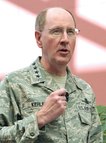
Colonel Bernard Gruber, director of the GPS Directorate.
Don Jewell (DJ), our Defense Editor, caught up with Colonel Bernard Gruber (BG), the newest director of the newly renamed Global Positioning Systems Directorate at SMC in Los Angeles, California. They discussed the current status of the GPS program and the way ahead. Don caught Colonel Gruber just before he departed for the East Coast for an Executive-Level Acquisition Course at the Defense Acquisition University at Fort Belvoir, Virginia.
DJ: Colonel Gruber, thanks so much for taking the time to talk with us today. I know you are a busy man. I know our readers would benefit from a GPS program status update, and I hoped we might also discuss the future of GPS if you are comfortable with that?
BG: It would be my pleasure, and Happy New Year to you, Don.
DJ: Thank you, sir. One of the questions I have been asked many times is how will the re-designation as a Joint Program Office or GPS Systems Directorate versus a GPS Wing affect operations and day-to-day activities, and will it have any impact on your effectiveness as an organization or on the user community? And what exactly is your title now, anyway? I have heard so many versions. Set us straight please.
BG: Great first question, Don. It’s been almost five years since we’ve been assigned as a Joint Program Office. And while I answer to a lot of things, my title is now officially the director of the Global Positioning Systems Directorate. The re-designation to the GPS Directorate is basically transparent when considering day-to-day activities and our effectiveness. We are still the same strong organization with the same mission and goals. We still develop, acquire and sustain GPS space, ground, and user equipment and want to keep GPS as the world’s gold standard for positioning, navigation, and timing, and the “joint” aspects of our program are as strong as ever.
DJ: That’s great to hear sir, so business as usual, just a unit re-designation to work through. Now let’s get to a space segment question. The first GPS IIF (IIF SV-1) is on orbit and reportedly performing better than expected. Could you provide us with a status update as well as a forecast for when IIF-2 will be ready for launch, and do you expect the same performance as IIF-1?
BG: The first-ever GPS IIF (SVN-62) is performing its navigation mission well and with the best atomic clock performance ever seen on-orbit. GPS IIF SV-2 is in final integrated system test and on track for a summer 2011 launch. We are heavily focused on getting these first couple of vehicles absolutely right to ensure that our production run of the remaining 10 IIF vehicles stays on track to support the GPS constellation. We expect to see solid performance meeting all requirements from SV-2 and all GPS IIF satellites.
DJ: Well, we certainly hope that prediction comes true. The last time we checked the GPS IIIA program was on track as well, and perhaps even a bit ahead of schedule. Has anything changed, and how do you foresee the future of the IIIA program?
BG: Don, we are still on track; the program has switched its focus from design to manufacturing with half of our 59 manufacturing readiness reviews completed to date. On December 17, the GPS IIIA space vehicle program received Milestone C approval, as well as authorization to initiate “long lead” parts procurement for the first two production satellites. This was a huge accomplishment for the whole GPS team. A total of eight GPS IIIA satellites will be built, with first delivery scheduled for spring 2014.
Additionally, the Bus Real Time Simulator (BRTS), which is the first deliverable on the contract, was received by the government in September 2010. The Assembly, Integration, and Test facility construction in Denver, Colorado, is on schedule with the outside of the building fully enclosed. So, yes, we’ve been making huge progress since we successfully completed, two months early, our GPS IIIA critical design review last August.
DJ: We hear the term all the time, but just what is Milestone C for the GPS IIIA program? And can you tell us a little more about the BRTS?
BG: Sure. We use these terms all the time and forget that there is another audience out there that does not use them on a daily basis. Milestone C is formal approval of the work completed in engineering and manufacturing development and approval to enter production and deployment, specifically low-rate initial production (LRIP) for most programs. For satellite programs, such as GPS IIIA, this is approval to begin production. As mentioned, we were approved for long-lead parts buys for our first two IIIA production vehicles, SVs 3 and 4. It might be interesting to note here that SVs 1 and 2 were bought with research and development (R&D) dollars, just a different color of money appropriated by Congress.
As mentioned, the BRTS was one of our very first deliverables on the IIIA contract. What we do with the BRTS is we take the simulated GPS signals that come from the A2100 bus that’s part of the Lockheed Martin GPS III system. This allows us to work through all the interface, data, and timing issues we have. Physically, it sits across the street from Los Angeles AFB in the laboratory in the Aerospace engineering facility.
DJ: Now the OCX program (Global Positioning System (GPS) Advanced Control Segment) is also reportedly on track, but historically ground support programs for space programs have always been a problem and a long pole in the tent for GPS. Can you give us an update on OCX and what we can expect in the next couple of years?
BG: Yes, I can. Since contract award last February, several reviews have been successfully completed: namely the Technical Baseline Review (TBR); Integrated Baseline Review (IBR); Software Specification Review (SSR); and a Hardware Preliminary Design Review (HPDR). We are planning for a system Preliminary Design Review in the spring of 2011. I know that’s a lot of reviews, but all of these will lead us to a Milestone B decision by the DOD, and is anticipated by the third quarter of fiscal year 2011, and reduce our risk posture along the way.
Now before you ask [laughs], a Milestone B decision is formal approval of work completed in the Technology
Development phase and approval to enter into the Engineering and Manufacturing Development phase. As you know, with OCX, we completed a source selection in February, which was a down-select from the two phase A contracts to a single developer — Raytheon Space Systems in Aurora, Colorado.
Over the next couple of years, you can expect us to set up facilities, buy hardware, and continue software development until delivery of the first block in 2015.
DJ: Thanks for clearing that up. Now for one of my favorite topics; what about the MUE and MGUE programs?
BG: The Modernized User Equipment (MUE) program was established to leverage technology demonstrations to significantly reduce risk and ensure a high probability of success for the Military GPS User Equipment (MGUE) program. We have received working hardware from each of the three MUE vendors and government testing is under way. The MGUE program has progressed nicely through the latest series of program reviews and we anticipate a Milestone A decision in early 2011.
Now, to be consistent, I guess
I should define Milestone A, which is formal approval of a program’s Materiel Solution Analysis to go into Technology Development. For MGUE, we have written a Technology Development Strategy document, using lessons learned from the MUE program, which highlights the acquisition strategy of the new program. This document has been approved by senior Air Force acquisition officials, and we are working to achieve OSD (Office of the Secretary of Defense, Robert Gates) approval in February.
MGUE will provide the warfighter with next-generation capabilities including a more secure GPS receiver and use of a more robust GPS military signal.
DJ: That’s great. Plus we managed to hit all three milestones and you defined them for us. Now what about flex power? We heard there might have been more problems than first announced when all the data from the flex power demonstration was analyzed. Any comments?
BG: After all was said and done, we considered the exercise of flex power in 2010 a great success. As you noted, there were a couple of older GPS receiver designs that exhibited unexpected behavior. To date, we have identified the issues and we now understand the behavior of these receivers during flex power conditions. Along with our sister wing, the 50th at Schriever AFB, the GPS Directorate is working with each of the affected organizations to determine the extent of operational impact, if any, and to identify acceptable techniques, tactics, or procedures that would allow these organizations to operate nominally in a flex power environment.
DJ: Colonel Gruber, let’s stay with the user equipment topic for a moment more. What are you able to tell us about OTAD (over-the-air-distribution) and OTAR (over-the air-re-keying)?
BG: Thanks for asking Don. A [cryptographic] key is required to unlock access to the GPS military signal. These keys are typically distributed to each military user and periodically loaded directly into each GPS receiver. As the number of military users has grown, the logistics for distributing these [physical] keys has become logistically more difficult. An over-the-air distribution capability has recently been added that facilitates the distribution of keys directly to military GPS receivers via the GPS signal, instead of physical contact or connection. We are confident this capability will help to alleviate some of the burden associated with physical key distribution. An on-orbit OTAD exercise was recently held to validate the capability and to help train users. The test, designated Transition Exercise #7, was successful and the GPS Directorate is excited to see this capability come on line in the near future.
DJ: Certainly we know having to key military GPS receivers sometimes presents a problem and many military users (warfighters) say it can be cumbersome and time-consuming. What do you say to the warfighters that repeatedly say these are many of the reasons they have gone to commercial and civil equipment in theater, not only as a backup but sometimes as their primary PNT equipment?
BG: The first thing that must be kept in mind is this: commercial and civil equipment is susceptible to being jammed or providing misleading information as a result of electronic attack. Warfighters depending on the integrity of their GPS data on the battlefield are assuming a significant operational risk when using commercial receivers, comparable to conducting military missions using non-secured communications. We understand that military receivers cannot always compete with commercial products in terms of the ability to rapidly incorporate the latest technology, so it is important that we receive user inputs so we can incorporate changes, if possible, in current receivers or into the design of new receivers.
DJ: Speaking of the integrity of GPS receivers, should we be on the watch for another major ground control segment (AEP) update any time soon?
BG: Again, with the 50th Space Wing, we actually just released and fielded AEP (Architecture Evolution Plan) Version 5.6 of our ground software. Part of our efforts to ensure seamless transition of these updates has been to develop a release process that includes a pre-engagement strategy and a test suite with many variations of current GPS user equipment. The next major update will be AEP Version 5.8. It is planned to complete depot-level software testing in the fall of 2011 and is scheduled for fielding in early 2012.
DJ: So, no new AEP updates to concern users for a while. However, there is currently a Sources Sought for GPS IIIA launch capability that was just released. Is there a problem projected with launching IIIA satellites that we don’t know about?
BG: There is no problem projected with launching the IIIA satellites. The GPS program has implemented a new concept of operations (CONOPS), where on-orbit testing is conducted by the program office before turning the satellite over to operations. The first GPS IIIA satellite will launch prior to the new control segment (OCX) being operational; therefore, we have taken measures to ensure a system is available to fully checkout the first IIIA spacecraft. This system, called LCS (Launch and Checkout System), ensures the maximum value of on-orbit testing to GPS III production, which in turn provides an on-orbit asset for test and checkout of the new OCX control segment as it becomes available for operations. We expect OCX and the first GPS IIIA satellite to be operationally available simultaneously.
DJ: So, what exactly makes the launch process so different between the IIAs, IIRs, IIFs, and IIIAs?
BG: Fundamentally there are no differences with the exception of the new CONOPS, which has gone into effect with the launch of the first GPS IIF. As I mentioned earlier, the GPS Directorate is now responsible for conducting on-orbit testing prior to turning the satellite over to the operational community.
DJ: Now talk about a CONOPS change; this certainly sounds like a major change in policy.
BG: Actually, Don, it is not so much a change as a move to comply with current policy. An AFSPCI (HQ Air Force Space Command Instruction) currently specifies that the program office must certify the satellite performance to the 14AF (14th Air Force) and the command (AFSPC) on-orbit. While this is commonly practiced by other space programs, GPS has been an exception. It aligns the authority to conduct the test with the program director’s accountability for its outcome. The change aligns GPS with the AFSPCI, and was first implemented on IIF-1.
DJ: So this is a major CONOPS change that means now you are responsible, that is the GPS Directorate, for the satellite from procurement until it is declared operationally ready and turned over to the 2 SOPS (2nd Space Operations Squadron) at Schriever AFB in Colorado. And you went through that process for the first time on IIF-1. Interesting.
That brings us to the next family of GPS satellites to be launched after IIF and that is IIIA. When exactly can we expect the first IIIA launch to occur?
BG: We are still on track to deliver the first GPS IIIA to
support a forecast late spring 2014 launch.
DJ: Colonel Gruber, uncharacteristically the GPS IIIA launch date has actually moved to the left or earlier on the calendar. If the IIIA launch date keeps moving to the left, could you find yourself in the position of launching a GPS IIIA before the last IIF is launched?
BG: As currently foreca
st, the first IIIA certainly could launch prior to the last IIF. While we will continue to work this with the 50th and through the 14AF, this may be a plan that helps the GPS program maintain itself as the gold standard for positioning, navigation, and timing. To that end, it will give us the ability to test and characterize the first on-orbit IIIA while still keeping IIFs in reserve.
DJ: Other than the major CONOPS change we just mentioned, what other significant changes have you made since you have been the new GPS Wing commander and now the director of the GPS Directorate?
BG: To be honest, Don, not many. Basically, we are continuing to build on the tremendous work of Colonel (USAF, Ret.) Dave Madden. With that in mind, I spent the first 30 days just listening and learning. That gave me an opportunity then at the 90-day point to release my Director’s Intent for 2011. And shortly thereafter, I signed out the Directorate’s Strategic Plan that put our organizational goals and objectives into three bins:
Mission Effectiveness, which equals mission assurance
Mission Efficiency, which equals return-on-investment, and
Taking care of our people — always.
Although I didn’t change a lot, I did energize (or maybe re-energize) a few key areas. First, I wanted to close the gap between OCX and GPS IIIA, which we have now effectively done; second, I am taking another look at dual launch for future GPS space vehicles, including the use of new lithium ion (LiON) batteries and a lighter weight interface between the space vehicle and the launch vehicle; and third, I want to put a clear focus on standards so that vendors can exploit new technology and solutions for future user equipment.
DJ: What significant challenges then do you see in your future tenure?
BG: I think our biggest challenge is potential budget constraints in this fiscally constrained environment. Program stability is absolutely paramount for program success, and program stability requires three legs:
Requirements stability
Funding stability; and
Personnel stability.
We’ll keep our eye sharply on all three.
Another major challenge facing the GPS Directorate is the proliferation of GPS user equipment, both from the perspective of the hostile intentions of our enemies, as well as interoperability or compatibility with the sheer number of GPS receivers out there. To that end, we have embarked upon an “Underwriter’s Laboratory” construct for security and performance validation.
DJ: Colonel Gruber, I want to thank you again for your time today and ask as a final question if there are any closing comments you would like to make or any additional topics you would like to discuss?
BG: Don, the great thing about the GPS program is that everyone truly wants to make this system work, and I’ve found that people understand GPS is a worldwide utility. As I hope I’ve articulated, we have an exciting future in this program, and you can clearly see how much is going on. And Don, let me say that I appreciate folks like you and GPS World magazine who continue to educate people around the world about our system. To that end, I would like to close with a special thanks to the men and women of the GPS Directorate for their tenacity, unparalleled work ethic, and incredible dedication to mission success.
DJ: It is our pleasure, sir, and again, thanks for your time and for the update. Good luck at Ft. Belvoir.
Global Positioning System experts from Air Force Space Command and the Space and Missile Systems Center will hold a media roundtable teleconference tomorrow, September 24, at 2:30 p.m. Mountain Time (4:30 p.m. Eastern Time) to discuss the recent GAO report titled “Global Positioning System: Challenges in Sustaining and Upgrading Capabilities Persist.” Colonel David Buckman, AFSPC command lead for positioning, navigation and timing, and Colonel Bernard Gruber, commander of the Global Positioning System Wing at Los Angeles Air Force Base, will participate in the teleconference.
Air Force Space Command, which has responsibility for sustaining and maintaining the Global Positioning System, feels that the GAO report is overly pessimistic and doesn’t adequately acknowledge what AFSPC has done to address constellation sustainment, according to a press release issued from the Air Force, Peterson Air Force Base, Colorado. “The Air Force has created the largest, most accurate constellation, with the greatest capability, in the history of GPS, with 31 operational satellites currently on orbit,” stated the press release. “This is well above the 24 minimum satellites needed for a full constellation and to meet constellation performance standards. Since 1995, GPS has never failed to exceed performance standards.”
The release continued, “AFSPC is working to mitigate the challenges identified by the GAO through a number of activities, including: applying a ‘back-to-basics’ approach to acquisition, continuing to identify additional ways to maximize the life of our operational satellites, implementing robust mission assurance processes, and transforming our launch enterprise.”
The first GPS IIF satellite completed on-orbit testing and checkout and was set operational on August 26 as planned, the Air Force said, The GPS IIF program is ready for full rate production and continues to build confidence in its production line. Through the institution of robust mission assurance processes, AFSPC is confident in the future of the GPS IIF program.
The follow-on program, GPS IIIA, recently completed critical design review, two months ahead of schedule, the Air Force said. “AFSPC is optimistic that its ‘back-to-basics’ approach, including stable requirements, mature technologies, and more government oversight, will ensure a successful program, providing the GPS IIIA and its ground segment, OCX, within a timeframe that maintains a robust GPS constellation and supports GPS users.”
The first time I ever heard of the Magnavox Research Laboratory in Torrance, California, was in 1966, as a young engineer working at Hughes Aircraft. We were building large (46-foot diameter) ground stations for the Defense Satellite Communications System (DSCS). Magnavox was supplying the secret anti-jam modems used in the terminals.
Because of this, I also learned a little about spread-spectrum pseudo-noise (PN), something quite esoteric at the time and not taught in engineering school. I noticed a widespread respect for Magnavox from my colleagues who referred to the company and its equipment as “Magicbox.”
Within a year I had transferred to the Hughes division responsible for developing satellites. We were working on a study known as 621B, for using satellites for positioning. Our teammate for the study was Magnavox. That team was responsible for the payload signal design, for which the team chose PN as the modulation to provide for multiple access, ranging, data transmission, and anti-jam.
Before long, my boss decided to leave Hughes and go work for Magnavox. He took two of his systems engineers with him. I was one of them.
In1968, the U.S. Air Force could not yet sell the 621B concept as an Advanced Development Program, so instead opted to experiment and prove that PN modulation could be used to accurately measure a half-mile of cable. Hughes bowed out since there wasn’t any satellite procurement in the offing. Magnavox and the other 621B contractor, TRW, each took on the challenge of measuring the cable.
Where Hughes had been 10-deep in Ph.D.s in every discipline, Magnavox was 10-deep in PN experts, which I believe at that time was the world’s majority. Thus it was natural for the Air Force to ask them to continue, and develop a receiver to be used in the next phase of 621B. An inverted range was set up with four PN transmitters, and an aircraft with the receiver and a bottom antenna flew over them. The aircraft’s position was determined using the PN range measurements and the known locations of the transmitters. The data from that receiver, called the MX450, was used to help justify the Department of Defense (DoD) decision to proceed into the Advanced Development Phase of GPS. Some of the people who contributed to this were named in Dr. Brad Parkinson’s recent articles on the origins of GPS. During that time I was working on the next generation of spread-spectrum modems for the DSCS.
Magnavox went on to develop these PN satcom modems for all three services, and thus was a natural choice to develop the first military GPS receivers (known as X and Y sets and the first Manpack), as well as the first C/A receiver, the Z set, and the very first spaceborne receiver called GPSPAC.
As soon as we completed the first Manpack, I approached Col. Paul Weber, the Joint Program Office Army Deputy Program Manger, and asked if he would pose with the Manpack on his back for a brochure we wanted to produce to show to potential Army and Marine Corps users. He agreed, dressed in his combat uniform, and went with our photographer into the wild woods of San Pedro (near the Port of Los Angeles) for the picture shown in the brochure.
Magnavox also developed the military GPS Engineering Models in competition with Rockwell Collins. Magnavox lost the production contract to Rockwell Collins a year after I left to join IEC, now known as L-3 Communications.
Magnavox also pioneered commercial GPS sets for use in the marine and survey markets. Today, you will still find many of the original GPS user equipment developers still at it as consultants and engineers at Raytheon, Navcom, Trimble, IEC, and others. Perhaps our most famous alumni is Dr. Min Kao, the “min” of Garmin.
Len Jaconbson
LEN JACOBSON is a consultant to the GPS industry and has served as an expert witness in many legal proceedings involving GPS. He is the author of the book GNSS Markets and Applications, published in 2007, and is a longstanding member of this magazine’s Editorial Advisory Board.
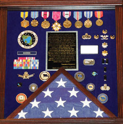
I had the honor of attending Colonel David Maddens’ retirement luncheon at the Space and Missile Systems Center (SMC) on Los Angeles Air Force Base (LAAFB) on June 16, and it was quite an event. Just prior to it, I asked Dave if he would like to conduct an exit interview after he took a short vacation with his family. He agreed it would be a good idea and a way to say some things he has wanted to say for awhile.
During the retirement luncheon, various people and organizations presented Dave with mementos of his time at the GPS Wing; I stopped counting at approximately 50 different presentations. This is an indication of the high regard in which Dave is held by those with whom he works on a daily basis. The military shadowbox he was presented (see photo), which is a typical military farewell presentation, had the following inscription, which is certainly not typical, and sums up the way those who work with Dave feel about him as a commander and as a person.
SHADOWBOX presented to Col. Madden on his retirement. The quote reads, in part,“The credit belongs to the man who is actually in the arena, whose face is marred by dust and sweat and blood, who strives valiantly, who errs and comes up short again and again, because there is no effort without error or shortcoming, but who knows the great enthusiasms, the great devotions, who spends himself for a worthy cause; who, at the best, knows, in the end, the triumph of high achievement, and who, at the worst, if he fails, at least he fails while daring greatly, so that his place shall never be with those cold and timid souls who knew neither victory nor defeat.” Theodore Roosevelt, 1910
“It is not the critic who counts: not the man who points out how the strong man stumbles or where the doer of deeds could have done better. The credit belongs to the man who is actually in the arena, whose face is marred by dust and sweat and blood, who strives valiantly, who errs and comes up short again and again, because there is no effort without error or shortcoming, but who knows the great enthusiasms, the great devotions, who spends himself for a worthy cause; who, at the best, knows, in the end, the triumph of high achievement, and who, at the worst, if he fails, at least he fails while daring greatly, so that his place shall never be with those cold and timid souls who knew neither victory nor defeat.”
Theodore Roosevelt
“Citizenship in a Republic,”
Speech at the Sorbonne, Paris, April 23, 1910
Dave was officially retired the next day by Colonel (USAF, retired) Bradford Parkinson. Dr. Parkinson was the first GPS Joint Program Office Director, in the early 1970s. He recently reviewed those early days and those responsible for the success of GPS with a two part series in the pages of GPS World.
Interview
Don Jewell (DJ): Dave, after almost four years first as the Vice Commander and then for the last three years the commander of the GPS Wing, of what are you most proud?
Colonel David Madden (DM): Overall, the GPS Wing has made significant progress over the years moving critical space system developments and acquisitions forward. The GPS Wing continues to lead with a “back-to-basics” foundation of rigorous system engineering, incorporated strategies like parallel risk reduction and capability insertion efforts, incremental delivery of timely and valuable capabilities to warfighters and civil users, and best business practices with solid cost estimates and contract incentives. Our new GPS III space vehicle, Next Generation Control Segment, and our GPS Modernized User Equipment programs incorporate our latest thinking of these innovations, and pave the path as a model for future acquisitions: low risk and high confidene associated with program execution (cost, schedule and technical performance).
The GPSW Team has had many specific accomplishments over the last four years. I would like to highlight just a few.
Space Segment. In the space segment, we accomplished a major milestone in GPS history with the launch of the final GPS IIR-M satellite in Aug 2009. GPS IIR-21 (M) marked a critical milestone in the GPS modernization program that was initiated in early 2000. The GPS IIR/IIR-M satellites are the cornerstone of the GPS constellation, and I expect them to perform well into the future. We’ve completed the development, testing and launch operations of the first GPS IIF Space Vehicle. The GPS IIF is the “Dawn of a New Era” of GPS services, providing new and improved capabilities that will continue to support not only the warfighter but commercial and civil users around the globe. IIF vehicles two and three will be delivered by early 2011, and two of the remaining nine fixed-priced vehicles are already proceeding down the Boeing Pulse Line.
Another noteworthy accomplishment was the award of the GPS III spacecraft contract. The GPS III will be developed in three increments with each increment to include more capabilities based on technical maturity. We successfully completed the GPS IIIA satellite Preliminary Design Review (PDR) in May 2009 and the GPS IIIA Critical Design Review (CDR) is scheduled for August 2010, two months ahead of schedule, which completes the detailed design and lays the foundation for fabrication. GPS IIIA is a back-to-basics spacecraft program with a strong focus on systems engineering, mission success, and acquisition excellence.
Ground Segment. In the GPS ground control segment, great lengths were taken to ensure the successful replacement of the decades-old command and control (C2) system with the new Architecture Evolution Plan (AEP) software, to improve GPS operator interfaces while providing a test capability for the new signals on the modernized satellites and to improve launch, anomaly, and disposal (LADO) operations. This new software will also provide robust security improvements to include “over-the-air” distribution (OTAD) of encryption keys to properly equipped military users.
I would also like to mention the successful award of the Next Generation Control Segment (OCX) back-to basics contract. The current acquisition strategy for fielding the OCX consists of four increments (commonly referred to as Blocks). The recently awarded OCX contract consists of Blocks one and two [while] Blocks three and four will be follow-on contracts that align with the future GPS IIIB and GPS IIIC spacecraft capabilities.
Colonel (USAF, retired) Bradford Parkinson congratulates Colonel Dave Madden on his fruitful career and retirement.
User Segment. In the GPS user equipment segment, we are actively working the development of a new generation of military user equipment to take advantage of the modernized M-Code [military only] signals. Currently we are conducting technical demonstrations and risk reduction for our next generation Military GPS User Equipment (MGUE) and defining a creative acquisition strategy.
USD-AT&L (the undersecretary of Defense for Acquisition, Technology and Logistics) signed an acquisition decision memorandum (ADM) on May 24, 2010, approving a material development decision for MGUE: the formal entry point for MGUE into the acquisition process. Currently, our three Military User Equipment (MUE) contractors are testing and delivering prototype cards this summer; government testing follows.
The foundation of our MGUE acquisition strategy is an incremental approach that leverages technology developed under the MUE program to move into engineering and manufacturing development of the first MGUE receivers as soon as possible. The strategy will be submitted to the Pentagon this summer after SMC coordination and PEO Space approval.
Our business strategy over the long term is to develop common GPS modules (CGMs) as the core engine for all DoD user equipment. We will develop CGMs incrementally as well, to support the form factors for the air, maritime, and ground domains. By early fall, we will have a final technical requirements document (TRD) for the MGUE form factors and CGM. We expect an RFP release in Feb 2011, and a Milestone A in May 2011. By early FY12, we should be on contract for Increment One of MGUE.
System Sustainment. From a systems sustainment standpoint, our GPS Wing detachment located at Peterson AFB has exceeded all expectation associated with ground (softwa
re and remote sites), user, and satellite systems sustainment. Even with all the system upgrades over the past year our sustainment team has kept the operational system performance well above the requirement: Read, no capability impact to civil or military users.
In fact, performance (availability, accuracy, and integrity) has been significantly improved over the last four years. Finally, they are normalizing sustainment of the current user equipment (DAGR-Defense Advanced GPS Receiver, MAGR-2K-Miniaturized Airborne GPS Receiver Version 2, and ADAP-Advanced Digital Antenna Production program) by transitioning sustainment responsibility to Air Force Material Command, specifically the Warner Robins Air Logistics Center depot at Robins AFB, Georgia.
Partnerships. The GPS Wing has established a close working relationship with Air Force Space Command Headquarters at Peterson AFB, Colorado for overall system operations, sustainment, and development responsibility; the 45th Space Wing (launch operations teams at Cape Canaveral Air Force Station in Florida), the 50th Space Wing (Overall System Operators at Schreiver AFB in Colorado), the Launch and Range Systems Wing (Los Angeles, California acquisition organization with responsibility for getting our GPS satellites successfully to orbit), the United Launch Alliance, the many government agencies (FAA, DOT, DOE, NSA, NGA, NASA, and so on), OSD organizations (PA&E, NII, AT&L, DOT&E), and our dedicated and professional prime contractors and major subcontractors to successfully sustain and enhance GPS mission capabilities — providing the highest overall daily system availability and the most robust GPS on-orbit constellation ever for war fighters and civil users worldwide. The constellation is healthier than it has ever been, and with the launch of the first IIF satellite and the on-track development of GPS IIIA, we are poised to maintain GPS as the gold standard for positioning, navigation, and timing well into the future.
The People. Finally and most importantly, I am proud of the men and women that make up the GPS Wing. They have molded many players (Aerospace, MITRE, service reps, international officers, government and civil agencies, SE&I and SETA (support) contractors, and U.S. Air Force military and civilians) into a finely tuned machine that is always focused on the number one priority: mission success. At the same time they have made the Wing a fun place to work. The GPS Wing members have made significant contributions to the quality of life in the GPSW, on LAAFB (Los Angeles Air Force Base), and the local community. Whether it was the great Company Grade Officer Association activities, tasty Tuesdays, the BBQs by the base gym, the holiday parties, the POW/MIA (Prisoner of War/Missing in Action) Run, the yearly toy contributions to the Marine Corp Toys for Tots program, regular food drives to support the Redondo Beach community, the yearly car show, the GPS Partnership Council, GPS University, or the many visits to local schools (just to name a few activities), they are truly a class act of which I was honored to be a small part.
DJ: Dave, how would you most like to be remembered?
DM: As the “AGER” guy. The one who put the enterprise back together, which will lead to better synchronization among the segments and ultimately deliver future warfighting capability to the U.S. and Allied forces. Senior AF, DoD, and Congressional leadership now look at GPSW execution as a enterprise rather than a collection of individual ACAT 1D (Acquisition Category 1D) programs. This has allowed the modernization program to move forward, significantly reducing the numbers of reviews, documents, and decision complexity.
DJ: Dave can you explain just where we are today in the ongoing GPS-IIF saga? Are we on track and on schedule to have IIF-1 activated sometime in late August? Will there be a second IIF launch this calendar year? Does Boeing finally have it all together?
DM: Don, I’m actually glad you asked the question that way, because it gives me an opportunity to address it squarely. It is completely fair to call the GPS IIF program a saga because of how long it took us to get to our first launch. But it is also important to ensure the credit and blame gets spread properly. The program did suffer from the sins of acquisition reform in the 1990s — on the government side and the industry side —- as well as major requirements changes years after program initiation. In hindsight, I’d have to say that we collectively failed again in the mid 2000s when we were overly optimistic about the time and funding needed for the challenges we would face in recovering from TSPR (Total System Performance Responsibility). On the flip side, during my tenure here I’ve had great support from my senior leadership — and from their Boeing counterparts — for taking the time necessary to ensure we have a quality program. We kept our eye on mission assurance and fixed quite a few end-of-life risks. We might not have had that luxury if the constellation weren’t so robust over the past few years.
In the end, the proof is in the on-orbit performance. So far, I’m proud to say that the checkout of SVN-62 has been proceeding very smoothly. My guys and Boeing have a great working relationship with the crews up at the 50th Space Wing, so the bird is in good hands. I expect we’ll find a few things we want to tweak before making the satellite available to users. Most space programs do that with the first satellite of a kind. In the end, the users will have a satellite that adds real benefit to the constellation performance.
Right now the teams are still pushing hard to get SV-2 ready to launch. There are still a few hurdles to clear, and the leadership needs to evaluate whether or not the constellation really needs another GPS IIF just yet or can it wait until next summer. I would love to watch another one go up this year, but it just won’t be the same watching from the sidelines!
DJ: I know it won’t be the same, Dave, but it should still be exciting. Now how about an update on the OCX program and how it is progressing?
DM: The OCX program is off to a great start. We awarded the contract to Raytheon in February 2010 and kicked off the integrated baseline review (IBR) in March. We are currently working side-by-side with Raytheon to solidify the program management baseline so we can jointly manage the program in a back-to-basics manner. Phase B software development for controlling modernized features is underway and builds on Phase A products, which we demonstrated with a prototype in December 2008. I have tremendous confidence that the OCX program will deliver promised capabilities on time to support modernized GPS.
DJ: Can you give us an update on where we are with the GPS IIIA program? Have you been successful in maintaining the no-changes mandate?
DM: GPS IIIA has maintained a stringent, back-to-basics approach since program inception. This has included significant investment in early systems engineering, and strict requirements discipline. To date, no new requirements have been levied on the GPS IIIA. Any new requirements for consideration are being addressed in future blocks as planned. The program is currently on track, and is forecasting the completion of Critical Design Review 60 days ahead of the baseline schedule.
DJ: We have satellites on orbit today that will reach their mean mission duration without broadcasting all resident signals or using all capabilities? Is there a plan to address this issue?
DM: Although there is some concern that the IIR-M satellites may reach their end of life before the L2C capability has been deployed, or that the IIF satellites may reach their end of life before L5 has gone operational, the concern is not justified by our reliability predictions and our current program plans. Current plans are for OCX Block 1 to provide L2C support, which is projected in the August 2015 timeframe, whereas the IIR-M satellites are expected to live well into the 2020 timeframe. Likewise, OCX Block 2 will provide L5 support in the 2016 timeframe, and our IIF satellites are expected to live into the 2025 timeframe. Therefore the likelihood that IIR-M or IIF satellites will be decommissioned before L2C or L5 have become operational, respectively, is very low.
Over the last couple of years, lots of discussion has gone into the integration issue, but I am not really sure what providing fully integrated GPS capability really means. What I do know is the user needs all three segments (satellite, ground command and control, and user equipment) to fully utilize new system capability. I also know that system integration comes in two forms. First and foremost from a technical design standpoint. This allows individual segments to be delivered independently but with high confidence the system will operate when all three elements arrive. This gives flexibility to the dynamics associated with budgets, policy decisions, requirements changes, unexpected technical hurdles, launch availability, and weapon platform availability for integration and testing (just to name a few variables). Rest assured the GPS enterprise is integrated at the technical level. However, it’s the second form of integration that gets all the attention: having all segments delivered in a reasonable proximity to each other. Not to make excuses, but as it relates to GPS, this is just hard to accomplish because it involves a span of control and accountability that is almost infinite. Many in the community recognize this reality, which has allowed the Air Force to set appropriate and realistic expectations so real capability can be delivered.
That being said, there are prudent things that can and are being done to speed the deployment of capability and set appropriate expectations. The most significant has been to broadcast the M-Code, L2C, and soon L5 signals from space to allow civil and military user equipment manufacturers to begin development and testing of their next generation of receivers. This gives industry a jump while the U.S. Air Force continues to develop the C2 capability and the next-generation signal monitoring capability (required to ensure signal in space performance integrity). Also, building the modernization programs with a strong mission assurance foundation is a major step forward. We understand the lessons learned that established the baseline for the current Block II systems delivery; the Block III systems are built on a solid acquisition strategy of reduced risk and increase execution confidence.
DJ: What do you see as one of the biggest GPS enterprise challenges, and what are some of your thoughts on the way ahead?
DM: That’s easy, Don: ensuring global PNT services are not interrupted as the United States continues to modernize GPS. If we don’t continue to develop a more robust means of ensuring user equipment compatibility, even a small number of non-system-compatible receivers (military or civilian) can significantly delay the delivery of critical modernized capability for everyone. Let me explain and provide some thoughts.
Since its initial design in the early 1970s, GPS has evolved in both capability and complexity. In the early days, systems engineering across the space, control, and user segments was relatively straightforward. The GPS Joint Program Office developed all military user equipment, and was able to rigorously ensure all specifications were verified prior to fielding. Over the past 20 years, however, GPS has become ubiquitous throughout the Department of Defense, with tailored satellite navigation solutions developed and acquired by dozens of program offices to support hundreds of unique requirements. Meanwhile, commercial GPS is one of the foundations of the Information Age, with GPS receivers produced in quantities approaching half a billion devices per year. The model of simply providing policies, standards, and interface control documents without providing a means to certify receiver compliance is becoming more challenging due to the continued growth in both military and civil applications for PNT, the competitive nature associated with user system applications and performance, and the increased complexity of GPS. Furthermore, it is especially difficult fielding upgrades to an established system like GPS while maintaining backwards compatibility with previously fielded equipment. These challenges are further exacerbated by difficulties associated with synchronizing the lengthy timelines associated with fielding ground-segment, satellite, and user equipment upgrades.
Recent highly isolated incidents, involving civilian and military receiver and other manufacturers, have highlighted the significant impact a very small number of receivers experiencing compatibility issues can have on the entire enterprise of worldwide users. In addition, a number of cases associated with improper receiver integration into major weapon systems have delayed system fielding as well not allowed the weapon system to best optimize GPS to the overall weapon systems performance.
Therefore, it is my opinion, to ensure worldwide PNT services are not interrupted as we continue to modernize the GPS, a more robust means of ensuring compatibility needs to be explored. (I would like to stop and make a note here: by “we” I mean all the DoD and civil agency stakeholders.) This means we need to not only continue to release “building codes” but we need to develop a capability to be more involved in the development, integration, and testing of new military and possibly civil user equipment.
We have recently taken a number of big steps in this direction.
First, we are currently significantly increasing the number of civil and military GPS receivers in our government testing labs. This will enable us to run tests against a wider variety of receivers, to gain higher confidence before we deploy system upgrades.
Second, we recognize that we need to ensure that our signal specifications, for both military and civil users, are as clear as we can make them. User-community representatives are already encouraged to be full participants in appropriate interface-control working groups. We further recognize that there is no substitute for thorough testing, and hence fully appreciate the importance of deploying signal-in-space capabilities as early as possible, on predictable schedules, so user equipment can be field-tested prior to market release or operational deployment.
Third, we are developing new upgrade fielding methodology whereby when we deploy system upgrades, we will take a more methodical approach and, whenever possible, field upgrades to smaller segments of receivers to prove compatibility without exposing all operational assets simultaneously. We will also apply a new software sustainment model to future military GPS user equipment, to ensure that inevitable system changes are systematically and rigorously executed with minimal impact on DOD programs.
Finally, we are investigating the establishment of something similar to an underwriters laboratory service to help support military programs with integrating GPS into their weapon systems during development. The teams associated with such lab services would support program design reviews as well as help develop the validation criteria for overall system acceptance. In addition, we are also starting discussions with key GPS civil receiver developers on how we might be able to provide a similar service to commercial receiver developers (potential fee-for-service type model).
Don, I highly recommend we continue to develop the four efforts I just mentioned but also dedicate significant time to critical thinking events to ensure we have minimized the risk of a widespread receiver issue, delays in delivering modernized capabilities, or sub-optimized weapon system performance. Manufacturers of equipment adversely affected by recent GPS upgrades have significantly stepped up their interactions with the GPS program office to resolve the compatibility issue and are playing a major role in providing an upgrade to their affected receivers to correct the issue. To date, no operational weapon systems have had to be grounded or civil capability degraded. I encourage the GPS community to treat recent events as a call to arms. GPS has become a critical national and international utility but it is much more complex than the electric or telephone services. How military or civil GPS receivers are designed, developed, and integrated into systems has a significant impact on the overall performance or lack of performance of the system. Don’t let recent events be a lesson not learned; let’s lead and solve the risk before it becomes an issue.
DJ: These are all excellent ideas, Dave, and many of them we have discussed in the past as concepts. It sounds like many of them are now a work in progress, but since you won’t be around to shepherd them into fruition, just what sort of prudent advice would you give Colonel Bernie Gruber as he assumes command of the GPS Wing?
DM: First and foremost, listen to your people — we have a great team! They are skilled professionals who really care about GPS. Second, keep the MGUE program focused and moving forward.
DJ: I certainly hope at a minimum that Bernie listens to your advice on MGUE. Now, Dave, when will the GPS Wing transition back to a Joint Program office, and what affect will this have on the military personnel working GPS? Will this re-designation be detrimental to their careers and future plans for the JPO? Will it lessen the GPS Wing’s/JPO’s influence in the GPS community and with other services?
DM: Don, we are scheduled to complete the transition and stand-up as the GPS Directorate on October 1, 2010. The Center is having one inactivation ceremony for all the Wings in SMC on September 8. The transition will be seamless and have a minimal effect on our military personnel. Our senior leadership is working on ensuring our materiel leader positions have group or squadron commander equivalency and will also be command-screened and boarded. There will not be very much difference within the Wing on a day-to-day basis. For the most part, the work, responsibility, and accountability will remain intact. The re-designation will have very little detriment upon the careers of the officers within the Wing. The officers’ records will show a transition and re-designation to explain the change, and that it is no cause of their own. As far as future plans for the organization, the strength of the leadership here in the Wing will still be in place and will be just as effective as it is now to lead each individual in our organization and to move forward and progress in GPS capabilities into the next era. Other services will still look to us to continue to forge advancements in GPS satellites so that our influence in the world’s GPS community will remain the standard: stronger than ever. Our organization will continue to acquire and sustain global navigation, positioning and timing services for our war fighters and civil users. We’ll still be the Green Monsters everyone knows and loves!
DJ: What message would you like to leave with our readers as you move on from GPS to the milsatcom community?
DM: GPS is in great hands. I look forward to the challenges ahead.
DJ: Any final comments, Dave?
DM: It has truly been a pleasure leading the GPS Team — my best job in 30 years of service. And you, Don, have also been a welcome friend.
GPS improves the quality of life for everyone on the planet. It saves lives both on the battlefield and in our cities and towns across the globe. The U.S Air Force and Air Force Space Command have been the diligent stewards of GPS since program inception in the 1970s and continue its commitment to this critical component of our national infrastructure. The current GPS constellation has the most satellites and the greatest capability ever. We are committed to maintaining our current level of service, as well as striving to improve service and capability through ongoing modernization efforts. The Air Force will continue to pursue an achievable path maintaining GPS as the premier provider of positioning, navigation and timing for military and civilian users around the world.
DJ: Dave, everyone at GPS World wishes you the best of luck in your future endeavors, and thank you for your honesty and candid responses to our inquiries through the years. You were the leader the GPS Wing needed for the last three plus years and you have left a legacy of which you can be justly proud. And in my opinion if the GPS Wing, Directorate or JPO thinks they have seen the last of Dave Madden, they should think again. Best of luck in milsatcom.
The U.S. Army’s Autonomous Platform Demonstrator, or APD, is a 9.6-ton, six-wheeled, hybrid-electric robotic vehicle currently undergoing developmental and mobility testing at Aberdeen Proving Ground, Maryland. According to an Army statement, the demonstrator vehicle represents the state of the art in unmanned ground vehicle mobility technology.
With its advanced hybrid-electric drive train, the 15-foot-long vehicle, being developed by the U.S. Army Tank Automotive Research, Development and Engineering Center (TARDEC), can achieve speeds of more than 50 mph.
When equipped with its autonomous navigation system, the APD is configured with GPS waypoint technology, an inertial measurement unit and computer algorithms which enable it to move autonomously at speeds up to 50 mph while avoiding obstacles in its path.
“The vehicle has obstacle detection and avoidance technology,” said Jim Overholt, senior research scientist in robotics at TARDEC.
The mobility testing is aimed at advancing and developing the robot’s ability to maneuver at higher speeds while maintaining extreme terrain-ability at lower speeds.
“We’ve run it through courses, slope testing and brake testing,” said Chris Ostrowski, associate director for Vehicle Electronics and Architectures at TARDEC.
The APD is currently testing high-speed maneuverability, such as lane changing. “This is a challenging controls problem with a skid steer vehicle. We want the robot to be stable when performing maneuvers like this, but we also want it to retain the other mobility characteristics that it possesses at lower speeds,” said Ostrowski.
Other mobility characteristics include the ability to climb a one-meter step, navigate a 60-percent slope, and pivot turn in place.
Being a series hybrid-electric vehicle, the APD is propelled by six in-hub electric motors and has a diesel generator which charges its lithium ion batteries.
“The state-of-the-art hybrid-electric drive train is just one of the mobility technologies we are demonstrating with this platform,” said Andrew Kerbrat, APD project manager, TARDEC.
Other technologies being demonstrated include advanced suspension systems, thermal and power management systems, robotic safety systems, and lightweight hull technologies.
“We’ve made a lot of progress with this platform in a short time period. From concept to wheels on the ground was just a shade over two years, and in the eight months since then, we’ve driven almost 3,000 kilometers and have demonstrated 95 percent of the metrics that we were trying to show with this platform,” said Kerbrat.
APD is the mobility platform being used by the Robotic Vehicle Control Architecture, or RVCA Army Technology Objective, also out of TARDEC. Working with PEO-Integration, RVCA has integrated a suite of system control, display and sensing hardware and software onto APD that allow it to be controled real-time by a Soldier, or operate in an autonomous mode.
“It uses a variety of sensors and a Ladar — a laser/radar scanning radar that can detect moving objects at distances,” said Overholt. Additionally, RVCA provides Reconnaissance Surveillance and Target Acquisition capabilities.
“It has a four-meter mast with a sensor ball on top so it goes up pretty high and can see out quite a ways,” said Chris Ostrowski.
“When you combine the autonomy and control capabilities provided by RVCA with the extreme mobility characteristics of APD, it allows the Soldier operator to quickly deploy a mission payload precisely where he wants it, and over some very tough terrain,” said Kerbrat.
“The bottom line is that we are providing the soldier with a significant capability that will assist him in the performance of his mission, while keeping him safer in the process.”
General C. Robert Kehler, Commander of the U.S. Air Force Space Command
Editor Don Jewell Talks with the Air Force General Heading Space Command: His Views, Use, and Plans for GPS
Defense editor Don Jewell is a retired Air Force officer who served for 30 years; many of his former peers and contemporaries are currently senior officers in today’s U.S. Air Force. Don sat down recently with General C. Robert Kehler, Commander of the U.S. Air Force Space Command, whom he has known and worked with for more than 20 years, to discuss GPS from the four-star point of view.
Don Jewell (DJ): General Kehler, thanks for taking the time to have this discussion today. I would like to keep this very informal, more of a conversation, like the days when you and I and Willie Shelton [now Lt. Gen. Shelton, USAF] sat around on your lanai, sharing a brew, telling war stories, and solving the world’s problems.
General Kehler (GK): Believe me, Don, there are days when I wish we were still doing that. I appreciate the opportunity to have a conversation with you.
DJ:Great. Sir, to get to the crux of the matter, as the senior warfighter for space, how do you see GPS in the future, and how does it contribute to the joint fight?
GK: Don, you know this, as may many of your readers at GPS World, but I don’t believe we can say it often enough: GPS is the primary source of position, navigation, and timing (PNT) information for the Department of Defense, and it will remain that way at least until the year 2030. This has been a remarkably successful program, supporting the joint warfighter in nearly every aspect of joint operations. How GPS supports joint operations, whether it’s the individual soldier, sailor, airman, Marine, or Coast Guardsman, who is on the ground or inflight or who happens to be in the dark in a mountainous region somewhere or in the flat expanse of the desert — it doesn’t much matter. GPS has been their constant companion now for many years. They have come to rely on GPS in ways that help them do their job better, and it allows them to perform missions that in the past they would not have been able to perform in this kind of a manner, with this kind of perfectness.
GPS is going to remain the foundation of the PNT strategy. And with the modernization effort that we have underway in GPS, we are going to make sure that it remains the world’s premier source of position, navigation, and timing information, and in particular that it remains woven through the fabric of the joint warfighting network.
DJ:This portends an excellent future for GPS, despite comments by the Air Force Chief of Staff and Gen. “Hoss” Cartwright, vice chairman of the Joint Chiefs of Staff, that we should move away from GPS. Do the Chief’s comments cause you any concern?
GK:They do not cause me any concern. We are committed to keeping GPS the gold standard. We have a commitment in that regard. I understand exactly what the Chief of Staff said and why. I will be happy to discuss that more.
DJ: We’ll table that for now, and get to it later if we have the time. I have often heard you say in your GPS update and status briefings that GPS is one of your good systems. Indeed, you have described it as one of the systems you don’t have to worry about too much, because it works. It would be interesting to ascertain how you know when you are doing a good job with GPS. How do you know it works? For example, do you receive comments, e-mails, or letters from warfighters?
GK: I think there are really two big ways that we know we are doing a good job with GPS. First of all, we measure our performance against the standard. What the users see, of course, is accuracy and satellite availability. Those have become our two primary standards. We make sure we are performing up to those standards. And in fact, as you know, we continually outperform those documented standards and the requirements that we have.
We also look, not only at the satellites, but at the ground command and control (C2) system and the ground support network. We make sure those elements are always up and running as well. From a numbers standpoint, from a “how well are we meeting the standards we have set for ourselves” standpoint, we exceed those standards. We exceed in terms of accuracy and availability, both the satellite system and the ground-supporting infrastructure as well.
But these days, I will tell you, I think the numbers are interesting, but what I think we look at just as hard is how the public talks about GPS.
And if you look today, GPS, at least in my opinion, is everywhere in the public conscience. I was saying earlier today, you really don’t have to go much farther than your television set. Almost any evening you turn the TV on you’ll hear something about GPS. You’ll either hear people who are equating their product to GPS, or you’ll hear in a television show someone mention GPS or their GPS device. And that is without it being a program about the satellites themselves, or the U.S. Air Force, or the things we do at Schriever Air Force Base to make it all work.
My view is that the fact that we get this informal public feedback constantly, and that it’s positive, says a lot about how good a job we are doing as well. When your program becomes a new word in the English language, I think that says something about success. Any more, if you say GPS to people they might not point to a satellite, they might point to the little device they are holding in their hand, but they understand somebody is providing that for them and that it is working well.
The final piece to that is also our civil partners. You know we have a GPS Executive Committee (PNT ExCom) inside the government that meets periodically to have conversations about the way ahead on GPS for the entire government, and by extension for the United States. The feedback that we get at those meetings, and unfortunately I can’t get to every one of them, but in those that I have attended, the feedback has been universally positive.
We just had a Civil Focus Day recently, and the feedback we got was universally positive. Are there things we can do better? Yes, of course there are, there are always things you can do better, but I can tell that we are doing a good job with GPS, not only because of the numbers that we look at but because of the feedback that we get, and the way GPS has been accepted and adopted, if you will, as part of the lexicon.
DJ: You’re absolutely right about the positive feedback. I attended Civil Focus Day, wearing a different hat, as you know, and I agree, everybody was onboard and positive about GPS.
The next topic revolves around how your scorecard is graded by the joint community, and do you have a way of actually getting feedback from the warfighter?
GK: Yes, as I said, we are graded or we grade ourselves primarily on accuracy and availability as they are documented for us in the performance standards. In watching those numbers, we know that we are exceeding the performance standards that we set for ourselves. But we also receive feedback directly from the warfighters. We receive feedback from the military users through the GPS Operations Center (GPSOC). You know, and I think most of your readers know, that there is a way that you can directly contact what we call the GPSOC 24 hours a day, seven days a week, and we find that both our military and civilian users do that.
Another way that we receive feedback is through the Coa
st Guard Navigation Center (NAVCEN), where they are specifically watching and helping us watch the performance of GPS. We get feedback directly from them as well. But much like the prior topic, there are also other ways that we get feedback.
For example, in each of our theaters of operations, for each of our combatant commanders, the joint or combined force air component commander is also designated as the space coordinating authority. And working for that space coordinating authority in the AOC (Air Operations Center) is someone called the director of space forces, an Air Force officer who is responsible for making sure that the space support is there when it needs to be and in the fashion that it needs to be. Those directors of space forces also have a small staff working with the combined force air component commanders.
They are getting direct feedback from the warfighters as well. They are either getting it as a normal course of business, on a day-in day-out basis, or they are asking for it specifically as well. We are also getting direct feedback from the units themselves. We have made contact through a number of our forward space people. We work with Army Space and Missile Defense Command and as a matter of fact we have talked with the Marines and others directly. We don’t wait for their feedback, we go out and solicit it also, and we actually help them solve some very difficult problems that we had early on in the conflict with some of our weapons systems that we have now fixed.
We are mindful, we know when certain operations are underway, we deconflict that with activities in the [GPS] constellation, making sure that we are providing the very best service all the time. We are embedded through the planning process in the theaters with military operations and with space professionals who are in the planning cells and Air Operations Centers. We are very comfortable. We are getting constant feedback from the warfighters in addition to the scoring we do ourselves and against the performance standards.
DJ: As you know, in many of my articles I frequently comment that where GPS is concerned, geometry and numbers matter. In that regard you recently approved a 24+3 GPS constellation change. Now we get a good many letters from warfighters at GPS World, and some letters are all about GPS accuracy as you spoke of earlier, but actually more letters mention GPS availability as being critical. Where do you stand on the debate of what is more critical, accuracy or availability, as far as the warfighters are concerned?
GK: We don’t separate the two children here, availability and accuracy. Obviously, it doesn’t mean a lot to us if you have high availability and not high accuracy, or if you have high accuracy and not high availability. They go together, and we work both of those issues. We try to make sure that we have the highest availability and accuracy. The accuracy numbers have been very good, as you know. We have been trying to improve availability, particularly for users in impeded environments. We are doing that by taking advantage of the largest constellation of operational GPS satellites we have ever had on orbit. We have begun to adjust the way we have configured the on-orbit constellation.
You called it 24+3, and we were all calling it 24+3 for a while. Now we are calling it Expandable 24, because those are the words that are actually in the Standard Positioning Service Performance Standard. We are expanding the available operational useful slots from 24 in the constellation to 27, and that movement is underway. This should result in improved availability for users in challenged areas like mountainous terrain, deep canyons, and in some cases urban terrain. It improves those kinds of availability numbers worldwide for everyone, for all users. This is not just for warfighters, it’s for all users.
We have begun the movement of the satellites (SVs), and because we are trying to balance on-orbit longevity with movement, it will take us a period of months to move the satellites to the new locations. That movement is underway, and the availability numbers should begin to improve as the movement begins; you don’t have to wait until they are all in their final locations.
By the way, as an aside, just last night, I was driving in Washington [D.C.] and I was using the navigation feature in my cell phone. One of the things it tells you is how many satellites are in view as you are driving along. Now, just to be clear, I was not driving, I was a passenger in the car, so I was not distracted by trying to drive. But I sat there with the thing in my lap, watching it while we were driving through the streets of Washington, D.C., and there were never less than nine satellites in view. At best I noticed that there were 12.
So I thought about that for a minute. Half of the constellation was occasionally in view as we were driving around the streets of Washington. This is pretty powerful, and we are talking about availability. I sat there thinking to myself, yo, if we can help somebody out there — turn that availability when they need it into the right number of satellites — this is a pretty powerful movement that we’ve got going.
DJ: It is, and what you just said about being in the back of the car reminds me about what General Chuck Horner (USAF, ret.) said after he retired as commander in chief, Space Command. He said you know you are truly retired as a four-star general when you go out and get in the back of the car in the morning, and nothing happens.
GK: You’re exactly right. I have a new officer aide who had never been stationed in Washington, and can’t survive in Washington without some kind of a GPS navigation device. He had one going in the front seat, and I had mine going in the backseat, and we were comparing notes as we drove along. It really is pretty remarkable.
DJ: Our readers will he happy to hear that you also have dueling GPSs. I have readers write and say they have up to three or four going at one time on long trips, comparing different GPS device accuracies and interfaces.
GPS has truly been a life-changing event for many of our users, especially the warfighters. I receive hundreds of letters and e-mails from warfighters and this move to Expandable 24 is meeting with unanimous approval.
GK: That’s good to know, and I must say that originated here. Actually, that originated with the IRT [GPS Independent Review Team], as you well know. We then took that to Strategic Command, and Strategic Command embraced it. General Chilton embraced it immediately, and I think that we have done the right thing here. The downside risk here did not outweigh the positive impact that we think we can have on people who need expanded availability.
DJ: Sir, as I said before, wearing a different hat, I attended your Civil Focus Day and I thought it was outstanding. Do you have any comments you would like to make concerning that event, and do you think you achieved your goals?
GK: We did achieve our goals, because our primary goal is improving communication and cooperation, as well as making sure we’ve got a stronger working relationship between the civil and military GPS communities. In that regard I think our goal was achieved. We addressed a lot of crucial concerns that impact both communities. We emphasized that the ongoing GPS modernization and enhancement efforts are going to be transparent to the civil users, and in fact will result in pretty dramatic improvements for civil users:more signals and other enhancements that I think are going to be useful as time goes by. In that regard I was very pleased.
We had a number of very senior people throughout the government who expressed their interest in GPS with their attendance. We had seen, as you know, additional commitment from some of the other [U.S.] government agencies to be supportive in helping to invest in GPS, which I think is very positive. I just think that in general terms we want to make ourselves more transparent in terms of how we are dealing with the constellation and the future of the constellation.
We recognize in Air Force Space Command the unique role that we have for this global utility that the United States of America provides free of charge for everyone else on planet Earth. We recognize that with the use of this and the increasing impact it has on all our lives, comes a unique responsibility for stewardship. We have embraced that responsibility, and that means we have to be transparent and we have to have a collaborative team that we work with, and that was a large part of the Civil Focus Day.
DJ: Many of the proposed systems that may or will one day compete with or complement the GPS are on hold, delayed, or still not at full operational capability. What is your viewpoint on where we stand in relationship to these systems, such as GLONASS, Galileo, and Beidou, for example?
GK: Our objective from an Air Force standpoint has been to support the U.S. government’s goal of wanting to engage in cooperative activities related to space-based PNT, and I think the focus of that cooperation has been to try and ensure that we have compatibility between GPS and other space-based PNT systems. There is a goal on our part to make sure we can be compatible and interoperable. There is a goal on our part to make sure we are protecting our national security interests and that we are maintaining a level playing field in the global market for space-based PNT goods and services.
Those are our objectives, those are the national objectives of the U.S., and the Air Force is supporting those objectives through our management and operation of the GPS constellation. That will continue to be our posture: to make sure, as best we can, to have fostered successful relationships on space-based PNT.
DJ: You certainly can’t ask for more than that. The objectives are laudable, but on the surface they don’t necessarily fit well with the recent comments by the chief of staff of the USAF, and I guess that brings us to the topic we briefly discussed earlier. Do you fully understand where the chief was going with his comments concerning GPS at Tufts University last month, and do you have any comments that might help our readers put the chief’s remarks in the proper perspective?
GK: I do. I was present when General Schwartz made his comments, and honestly I understood what he was saying and why. I think that he was misunderstood in implication. I think what he said was misapplied by some. In my view, General Schwartz fully supports GPS. What he was doing, though, is he was talking about GPS and its value for military operations.
What we know is that, like any other military capability that we rely on for important pieces of our warfighting force, GPS will be challenged by a determined enemy that is interested in trying to defeat U.S. forces on the field of battle somewhere. He was reminding us that we need to be mindful of that:adversaries could potentially exploit GPS as a vulnerability because of the way we have come to rely on our GPS for our own American way of warfare. And because it is such a critical system to the warfighter, it will be an attractive target to any would-be enemy.
Having said that, his point was, with which I fully agree, we have to be diligent in finding ways to operate with the same accuracy and precision in the event that GPS is degraded. That’s exactly what the GPS Modernization Program is designed to do. But this goes beyond GPS as well, it goes into other things, for example, missiles are guided to targets or munitions are guided to targets in some cases by GPS, in some cases by inertial systems, and in some cases by a combination of both. It would be foolish for us to not have provided for the eventuality where GPS will be jammed. But again he was talking about a military environment here; he was not talking about the global environment, he was talking about the military environment.
I recommend to people sometimes that they should go look at, well, pick your search engine of choice on your home computer, and type in “GPS jammers” and see what you get. There is a proliferation of GPS jammers around the world, everything from the sizes that will plug into the cigarette lighter in your car to large devices that are sold internationally for military purposes. We know that GPS will be contested when or if we are involved in any military conflict. The chief was warning us that we need to take that into account, and I believe he was exactly right to do it.
DJ: Thank you, sir, that helps clarify the Chief’s remarks considerably. I just wish he had said what you said versus what he said. Sometimes senior leaders are just too close to the problem and they erroneously assume their audience has information, knowledge, or insights that they in fact just do not possess, and it skews their perception of the senior leader’s remarks.
The last topic I would like to discuss concerns the infamous AEP 5.5C update that did not go quite as well as planned. Again in this instance, the public perception may be skewed by a lack of information and a lack of communication. I know you are fully up to speed on this issue; what are your thoughts?
GK: I would make a couple of points about upgrading the ground software. First, with this latest version of the ground software, AEP 5.5 and all of its iterations, we learned a lot about the complexity of the GPS system, how complex it has become. We learned a lot about standards, and what happens if you make receivers and you don’t follow the standards, because there was nothing wrong with the [AEP] 5.5 software in this case. The issue was in the receivers — a very small percentage of our military receivers — where the manufacturers did not comply with the standards. We hold ourselves to a set of standards, we publish those standards, as you well know, and it is important for people who are making GPS devices to follow those standards.
Now here’s what we learned, though. We learned that not only is it important to follow the standards, but we learned that we can do better in how extensively we test prior to installing software. By that I mean — not that we didn’t test extensively before — increase the population of receivers that we test against and the rigor with which we test them, would be a better way to say this.
The other thing we learned is that collaboration and cooperation needs to be more robust, such that we are doing these upgrades on an active basis, not a passive basis. What we had been doing before is we would publish a NANU and say that we were about to do an upgrade to the ground software. We would then do the upgrade. We would wait to find out what was happening. What we learned this time was, that is probably too passive as we go to the future. Not only will we test more extensively across a broader range of GPS devices, but we will also put [receivers] in place, in a series of predetermined locations, if you will, where we will contact them actively to find out as we are progressing whether they are encountering any difficulties. We did learn a lot here.
We also learned that these upgrades need to be done in a fashion that is repeatable, so that every time we do this we will have a process in place that allows us to treat them roughly the same, depending on the magnitude and risk associated with the change, if you will, in terms of how we intend to go forward. I think we learned a lot about vetting and we learned a lot about execution. We
reminded ourselves again why standards are so important, and we reminded ourselves why partnerships are so important and why rapid feedback is important: so that we can deal with problems as they emerge.
We also learned something for the longer term, Don. We learned that we probably need better simulation tools as we look to the future, because you know there is only one active system, and it is the active system. It has become so complicated that there are hundreds of millions of receivers out there, as you well know, and the likelihood that we can characterize all of them in advance of a software drop is pretty low. We are going to have to get better at following a simulation as we go forward.
The most significant piece of data, though, from all this was there was nothing wrong with AEP 5.5. It performed exactly the way it was designed. The issues that were encountered were anomalies in user equipment, and that user equipment was identified because it did not follow the standards.
DJ: General Kehler, do you have any closing remarks for our readers, a message you want to make sure gets heard?
GK: Don, we understand the unique position that we are in as stewards of GPS. This is unusual, I believe, throughout the U.S. military, that a military service would have this type of responsibility for a system that has this kind of global impact. And it has that global impact 24 hours a day, seven days a week, 365 days a year. We recognize that unique responsibility that we have.
We know that means we have to be transparent about the way we conduct our business. We think that we are doing much better at that, and we will get better at that even more as we look to the future.
Our bottom line is that we believe that GPS is the gold standard today for the world. We intend to keep it that way as we look to the future, and we will allow the performance of the GPS system to speak for itself. We are very, very proud of the job that we do regarding GPS.
The young — many very young — men and women who operate and fly that constellation everyday, the outstanding technical people we have who design and build the satellites, the phenomenal launch team that we have that gets them to the Cape and gets them successfully on orbit — all of these pieces that are taken together along with, by the way, a civil group of participants from across the government who work very hard at all of this, along with independent folks who are on our review teams and elsewhere as well as the industry, the broader industry —this is a remarkable success story that has now influenced virtually everything we do, everywhere on the face of the planet. I think we ought to be very proud of that, and I can tell you that this Command is extraordinarily proud of it and recognizes that this puts a unique burden on us to deliver. We are going to continue to do just that.
DJ: That’s a great message and a very important one. In closing, might I ask you about your future? Rumor has it that there are plans afoot for you to move onward and upward.
GK: Don, my wife keeps saying that we go to Myrna — she is the dry cleaner and tailor down the street here — to find out where we are going.
I don’t know. I have been here two and a half years, Don, and typically this assignment will last about three years. That will take us into late summer, early fall, and I honestly, honestly do not know what happens with us next. We are going to have to wait and see what the pleasure is of my superiors and how all the pieces sort of fit together.
I think you know, when you get to be a four-star, there are a lot of factors that come to bear. At this point we will just have to wait and see. The only thing that I am worried about right now is the job that I’ve got, and I will be very, very pleased to stay here. We could stay here for 10 more years, and I would be delighted to stay here because this is a magnificent command.
We are doing phenomenally important work, and I am very proud of the people in Air Force Space Command. This is a wonderful, wonderful group of people.
DJ: You should be proud of them, sir. We get a lot of mail about what a great job the Air Force is doing as the steward of GPS. Our mail is always very positive concerning Air Force Space Command. I want you to know, sir, in closing, that working with Colonel Ford and Colonel Buckman has been a real pleasure. Your folks have been just super.
GK: I think so, too, and I don’t tell them that enough, really. We’ve got a great team here at headquarters, and we’ve got a great team across this command. We are delighted to have cyber responsibilities now, and there is clearly a relationship between space and cyberspace, and we see it. Every time I get a chance to commend the people in the Command, I like to take the opportunity to do so.
DJ: Thank you for your time today, sir. I know how busy you are, and I think we should find the time soon to sit down and have another discussion, possibly on cyberspace.
The next-generation GPS ground-control system, known as OCX.
Officials from the Space and Missile Systems Center’s Global Positioning Systems Wing announced today the award of the Next-Generation GPS Control Segment (OCX) contract to Raytheon Company, Intelligence and Information Systems, Aurora, Colorado.
The OCX development contract will be 73 months in duration and with option years for sustainment worth $1,535,147,916. The contract will include development and installation of hardware and software at GPS control stations at Schriever Air Force Base in Colorado and Vandenberg AFB in California, deployment of advanced monitor stations at remote sites, and initial contractor support with sustainment options for five years.
OCX will replace the current GPS Operational Control System, maintaining backwards compatibility with the Block IIR and IIR-M constellation, providing command and control of the new GPS IIF and GPS III families of satellites, and enabling new modernized signal capabilities.
“OCX is urgently needed not only to enable new warfighter capabilities but also to put the new GPS III space vehicles into mission operations,” said Col. Dave Madden, commander, GPSW. “OCX will have a flexible architecture that can rapidly adapt to the changing needs of today’s warfighter and will connect to the Global Information Grid so that warfighters around the globe have immediate access to GPS data and constellation status.”
“OCX will allow AFSPC to effectively and efficiently plan and control full-spectrum precision position, navigation and timing information for all GPS user communities,” Madden said. “OCX will achieve this vision by implementing an incremental development approach that supports the evolving military operational environment, while enabling civil and international users who are employing GPS in innovative applications like transportation.”
The Air Force Space Command’s Space and Missile Systems Center, located at Los Angeles Air Force Base, California, is the U.S. Air Force’s center of acquisition excellence for acquiring and developing military space systems including six wings and three groups responsible for GPS, military satellite communications, defense meteorological satellites, space launch and range systems, satellite control network, space-based infrared systems, intercontinental ballistic missile systems, and space situational awareness capabilities.
Call it Madden withdrawal. It’s bad enough that I just endured Super Bowl XLIV without the smooth and engaging color commentary of the iconic John Madden, the legendary Hall of Fame, Super Bowl XI winning coach and virtual football entrepreneur. This year I patently missed John’s pithy commentary and the distinctive timbre of his voice. Coach Madden’s broadcast career has continued for more than thirty years and his instantly recognizable voice always invokes the desire to watch a football game. I would watch any game he color-commentated even if I did not particularly care about the competitors. It just wasn’t the same Super Bowl this year without John Madden, but somehow I soldiered on.
Col. David Madden.
The other Madden I’m going to miss and so will many of you, even if you don’t know it yet, is Colonel David Madden (USAF). Dave serves as the GPS Wing Commander at SMC (Space & Missile Systems Center) in Los Angeles, California, and will be stepping down as early as May, and hanging up his U.S. Air Force uniform at the same time. Dave has been the voice of GPS for many of us since he became the GPS Vice Wing Commander in July 2006. He became the commander in June of 2007, but he made his presence known the minute he landed at SMC. Dave has been a hard charger for the last 30 years and has numerous accomplishments of which he can be justly proud, but Dave hit his stride when he arrived at the GPS Wing. He was the right leader in the right place at the right time. Dave was immediately credible in the GPS world because of his previous forays in the classified and unclassified space arena.
Colonel Madden, the consummate military professional, who once described himself as a dangerous entity because he thought outside the box known as the military establishment, displays the immediately recognizable confidence of a leader who knows his job and emphatically embraces his mission; yet he is not overly arrogant and is always willing to listen. Sometimes he even deigns to speak honestly and openly to journalists. Dave has been the undisputed leader of the GPS Wing at a time when leadership was sorely needed. He used his engineering, systems management, and leadership expertise to create a cohesive team at the GPS Wing that simply and consistently gets the job done. His GPS accomplishments are many, but his greatest may be that he put the GPS back on the path as the PNT (Position, Navigation and Timing) and GNSS (Global Navigation Satellite System) gold standard for the world. He knows how to listen and take advice, and he knows when to stop debating, discussing, and dare I say arguing, and make the hard decisions. He and his finely honed force at SMC work tirelessly and intelligently to grow the GPS constellation in size and accuracy, but most importantly he is relentless in his support of the warfighter during a time of war.
Colonel Madden is a true patriot and fortunately he is not going far; rumor has it he will soon be an SES (Senior Executive Service) government civilian in yet another important space sector at SMC. Dave will be sorely missed by those of us that have had the honor to work closely with him in the GPS global arena for the past four years. Best of luck, Dave.
Col. Bernard J. Gruber.
Of course we also give a hearty welcome to Colonel Bernard J. (Bernie) Gruber, the new GPS Wing Commander or SPO (Special Program Office) director, as there is apparently a name and responsibility change or regression under way at SMC for various Wing-level organizations. Colonel Gruber served previously at SMC in the former GPS SPO in the user equipment office, the foreign military sales office, and as the program manager for Advanced Military Devices. So while he is not new to the space business or to GPS, he does have some large shoes to fill and we wish him well. If Bernie is half as smart as we know he is, he will be having some long and candid conversations with Mr. Madden, and I don’t mean the football legend.
Updates
There is so much happening in the PNT world that I could write a book. I promise not to do that, but an in-depth column is appropriate and you will see that in the near future. For now, allow me to quickly update the status of several ongoing programs and recent events.
24+3
We scooped the world at GPS World on 24+3 and fortunately everything is on schedule and working as planned. Two of the satellites are currently in their long transfer orbits and SVN 26 should start to move this week. Both SVN 24 and SVN 26 are Block-IIA satellites and are consequently a bit long in the tooth; 11 of the original 19 IIAs launched between 1990-1997 remain on orbit. These geriatric satellites are presently operating on different types of atomic clocks but their overall timing accuracy is not diminished, still averaging 1x10E-14. SVN 24 is currently utilizing a Caesium (also written Cesium) atomic clock and SVN 26 is utilizing a Rubidium atomic clock. This is a good mix for the plus three satellites as Caesium is nominally better over the long term for time stability and Rubidium is stable over a shorter period of time without periodic updates.
See Eric Gakstatter’s recent articles in GPS World for more technical information on the new locations for the three GPS satellites that are, or about to be, on the move.
GPS IIF. Photo: IIF
IIF
I received a plethora of mail recently either asking or raging about the status of the Boeing IIF, next generation of GPS satellites. I won’t even attempt to recount all the schedules and budgets this critical program has busted. The important point is, according to the latest schedule, sometime this month, hopefully in the next 10 days, IIF-SV1 will arrive at Cape Canaveral in Florida where it will subsequently be integrated with the Delta IV EELV or Evolved Expendable Launch Vehicle. This will be the first EELV to launch a GPS satellite; therefore, the integration and testing times, both on the ground and on orbit, are expected to be considerably more extensive than normal. Plus there are some unique features of the Delta IV that bear watching. The first stage of a Delta IV consists of one or, in the heavy variety, three Common Booster Core(s) (CBC) powered by a Rocketdyne RS-68 engine. Unlike most first-stage legacy rocket engines, which use solid fuel or kerosene, the RS-68 engines burn liquid hydrogen and liquid oxygen. The RS-68 is the first large, liquid-fueled rocket engine designed in the U.S. since the Space Shuttle Main Engine (SSME) in the 1970s, and at more than 63 meters or 206.7 feet in length, the Delta IV (at right) is the tallest rocket in active use.
When you see images of the first GPS IIF launch, the perspective will be a bit different from the venerable Delta II GPS launches of the past.
AEP 5.5C Update
The GPS Wing and 2SOPS (2nd Space Operations Squadron) initiated a software update (see my column in last month’s GPS World) of the ground command and control (C2) system for GPS on January 11, 2010, over a month ago as you read this. To put it mildly, the update did not go as smoothly as planned. There were immediate problems with certain military, commercial, and civilian receivers, plus some other system glitches appeared that are reportedly unrelated. To ensure there aren’t any more unknown receiver problems lurking in the shadows, the GPS Wing issued a unique NANU (Notice Advisory to NAVSTAR Users) through the NAVCEN (U.S. Coast Guard Navigation Center) for civilian and commercial GPS users, and through the GPSOC (GPS Operations Center) for military users, asking for user comments. The GPS is so ubiquitous, and there are so many global receiver manufacturers with so many different GPS receivers on the market today that, not surprisingly, the GPS Wing has been unable to keep track. It is a Herculean task and therefore instead of checking and certifying every GPS receiver manufactured, the GPS Wing issued an updateable ICD or Interface Control Document that all receiver manufacturers use as a voluntary guide to determine compliance. However, even the ICD leaves room for interpretation and is more ambiguous than the GPS Wing intended, so it should come as no surprise that there were and are still receiver issues following the latest AEP update. The GPS Wing is currently receiving more help than they think they need, but this too shall pass; it will just take time. The GPS Wing did not revert to AEP 5.4 (the previous version) because of the upcoming IIF-SV1 launch. The scheduled sequential AEP 5.5C and AEP 5.5D updates are required before the ground control segment can adequately control the more advanced capabilities of the IIF satellites.
The actionable aspect of this update and NANU is that if you are experiencing any problems or glitches with your GPS receiver that occurred after the January 11 update, then you should notify the 2SOPS if it is a military receiver and the NAVCEN if it is a civilian or commercial receiver. The original deadline was January 29, 2010, but I have it on good authority that reports are still being received. So, if you have a GPS receiver issue, please report it.
For civil and commercial users, the U.S. Coast Guard Navigation Center’s address is:
NAVCEN MS7310
7323 Telegraph Road
Alexandria, VA 20598-7310
You can contact NAVCEN by telephone at (703) 313-5900 or go to its comprehensive website.
GPS Civil Focus Day
On February 3 the Commander of HQ Air Force Space Command, General C. Robert Kehler, hosted the 2nd GPS Civil Focus Day. This event was long overdue; the last one occurred more than five years ago. It was one of the best updates I have attended that was specifically crafted for the civilian community. My hat is off to Colonel Dave Buckman and crew for all their hard work that made this event such a success. There were numerous government VIPs present, and it would take several columns to review their input, but suffice it to say the briefings and discussions were candid, informative, and unfortunately not for attribution. Therefore, before I can reveal more I need to be granted permission and that is in the works. Meanwhile we will post the cleared GPS Civil Focus Day briefings on the GPS World website, so watch the GPS World daily news for the location. The important point is that this high-level meeting of the minds underscored that GPS, the global PNT gold standard, is and always has been a dual-use system, and the USAF on behalf of the U.S. government is working hard to meet everyone’s global PNT needs.
Mobile Epiphany and Touch Inspect
To wrap up the column this month, I want to say thanks to everyone who has written me concerning the Touch Inspect software application from Mobile Epiphany I mentioned in my December 2009 GPS World column. The response from the military, civil, and commercial communities has been simply overwhelming, and therefore I am planning an in-depth review of this versatile application in a future issue. I have not historically, as a rule, reviewed software to the same degree that I have hardware, but in this case I am impressed with the application, especially the superb integration of GPS capabilities and the user interface. So a review is in order. Watch this space.
Until next time happy navigating and keep those cards, letters, and e-mails coming.
A portable spoofer implemented on a digital signal processor mounts a spoofing attack, characterizes spoofing effects, and suggests possible defense tactics. GNSS users and receiver manufacturers should explore and implement authentication methods against sophisticated spoofing attacks.
By Todd E. Humphreys, University of Texas, Brent A. Ledvina, Virginia Tech, Mark L. Psiaki, Brady W. O’Hanlon, and Paul M. Kitner, Jr., Cornell University
Seven years after the Volpe Report warned that “[a]s GPS further penetrates into the civil infrastructure, it becomes a tempting target that could be exploited by individuals, groups, or countries hostile to the U.S.,” civil GPS receivers remain as vulnerable as ever to this threat. Among other types of interference, the Volpe report considers civil GPS spoofing, a pernicious type of intentional interference whereby a GPS receiver is fooled into tracking counterfeit GPS signals. More sinister than intentional jamming, spoofing deceives the targeted receiver, which cannot detect a spoofing attack and so cannot warn users that its navigation solution is untrustworthy. The Volpe report noted the absence of any off-the-shelf defense against civilian spoofing and lamented that “[t]here also is no open information on . . . the expected capabilities of spoofing systems made from commercial components.” It recommended studies to characterize the spoofing threat: “Information on the capabilities, limitations, and operational procedures [of spoofers] would help identify vulnerable areas and detection strategies.”
We recently canvassed four manufacturers of high-quality GPS receivers. They revealed that they were aware of the spoofing vulnerability but had not taken steps to equip their receivers with even rudimentary spoofing countermeasures. The manufacturers expressed skepticism about the seriousness of the threat and noted that countermeasures, if required, had better not be too expensive. Such attitudes propel further examination of the threat and practical countermeasures.
Important research into spoofing countermeasures during the last decade begins with an internal memorandum from the MITRE Corporation recommending these techniques to counter spoofing:
Amplitude discrimination
Time-of-arrival discrimination
Consistency of navigation inertial measurement unit (IMU) cross-check
Polarization discrimination
Angle-of-arrival discrimination
Cryptographic authentication
The first two techniques could be implemented in software on GPS receivers, but would be effective against only the most simplistic attacks. The next three tactics would be effective against some — but not all — more sophisticated attacks. In particular, angle-of-arrival discrimination, which exploits differential carrier-phase measurements taken between multiple antennas, could only be spoofed by a sophisticated coordinated spoofing attack (discussed later). However, they require additional hardware: multiple antennas or a high-grade IMU, whose cost militates against widespread adoption.
Cryptographic authentication, the last technique on the list, has received detailed study since 2001. Logan Scott offered several levels of authentication in a 2003 ION GPS/GNSS paper and urged their prompt adoption in a GPS World op-ed column in July 2007. His methods are backward-compatible with non-compliant GPS receivers. Spreading-code authentication, the basis for his Level 2 and 3 authentication, entails embedding messages in the GPS ranging codes and periodically authenticating these messages. Because this method effectively binds a digital signature to the ranging codes, it would render a compliant receiver practically impervious to a spoofing attack except during the short interval between reception and authentication of the embedded messages.
These cryptographic techniques all require modification of the civil GPS signal structure. Such changes appear extremely unlikely in the short term because, as one experienced observer noted, “signal definition inertia is enormous.” A less effective but more practical approach over the United States would be to authenticate only the WAAS signal managed by the U.S. Department of Transportation and the Federal Aviation Administration. Since the WAAS signal is constructed on the ground and transmitted via bent-pipe communication spacecraft, it is more amenable to immediate modification. Even so, efforts to persuade WAAS officials to adopt spreading code authentication have so far proven fruitless.
The Homeland Security Institute, a research arm of the U.S. Department of Homeland Security, has also considered the threat of civil GPS spoofing. On its website it has posted a report listing seven spoofing countermeasures. The proposed countermeasures include the first three techniques from the list here. Some of the remaining four countermeasures would be trivial to spoof. None of the seven would adequately defend against a sophisticated attack. Nonetheless, the posting claims that its proposed techniques “should allow suspicious GPS signal activity to be detected.” We worry that such optimistic language in such a prominent posting will mislead many readers into believing that the spoofing threat has been adequately addressed.
Our goals here are to assess the spoofing threat and develop and test practical and effective countermeasures. To advance these goals we found it necessary to go through the exercise of building a civil GPS spoofer. The process of developing a complete portable spoofer allows one to explore the range of practical spoofing techniques. Thus one discovers which aspects of spoofing are hard and which are easy to implement in practice. With this information, we can more accurately assess the difficulty of mounting an attack, and receiver developers can prioritize their defenses by choosing countermeasures that are effective against easily implementable spoofing techniques.
Software-defined GPS receivers furnish a natural platform for the study of civil spoofing and its effects. In a software receiver, real-time correlators, tracking loops, and navigation solver are all implemented in software on a programmable processor.
Initial Threat Assesment
Consider the spoofing threat continuum in FIGURE 1, roughly divided into simplistic, intermediate, and sophisticated spoofing attacks for threat analysis.
FIGURE 1. The spoofing threat continuum: simplistic, intermediate, and sophisticated spoofing attacks.
Simplistic Attack via Simulator. As far as we know, all stand-alone commercial civilian GPS receivers available today are trivial to spoof. One simply attaches a power amplifier and an antenna to a GPS signal simulator and radiates the RF signal toward the target receiver. A successful attack along these lines was demonstrated by researchers at Argonne National Laboratories in 2002.
Despite the ease of such an attack, it has some drawbacks. One is cost: the price of modern simulators can reach $400,000. Simulators can be rented for less than $1,000 per week, making them accessible for short-term mischief, but long-term use remains costly. Size is another drawback. Most GPS signal simulators are heavy and cumbersome. If used in the simplest attack mode, situated close to a target receiver’s antenna, a signal simulator would be challenging to plant and visually conspicuous. Of course, if the custodian of the target receiver is complicit in the spoofing attack — as is the case, for example, with the fishing vessel skipper who spoofs the onboard monitoring unit to fish undetected in forbidden waters — the conspicuousness of the signal spoofer is irrelevant.
The menace posed by such an attack is diminished by the fact that it is likely easy to detect, because of the difficulty of synchronizing a simulator’s output with the GPS signals in its vicinity. An unsynchronized attack effectively acts like signal jamming, and may cause the victim receiver to lose lock and have to undergo a partial or complete reacquisition. Such a forced re-acquisition would raise suspicion of a spoofing attack. If the unsynchronized attack somehow avoids causing loss-of-lock, it will nonetheless cause an abrupt change in the victim receiver’s GPS time estimate. The victim receiver could flag jumps of more than 100 nanoseconds as evidence of possible spoofing. The spoofer can attempt to counter this defense by intentionally jamming first and then spoofing, but an extended jamming is itself telltale evidence of interference.
Of course, the fact that a simulator-type attack is easy to defend does not increase security. A gaping vulnerability will remain until civil GPS receivers at least are equipped with the rudimentary spoofing countermeasures required to detect a simulator-type attack.
Intermediate Attack. One of the challenges that must be overcome to carry out a successful spoofing attack is to gain accurate knowledge of the target receiver antenna’s position and velocity. This knowledge is required to precisely position the counterfeit signals relative to the genuine signals at the target antenna. Without such precise positioning, a spoofing attack is easily detected.
An attack via portable receiver-spoofer, portrayed in FIGURE 2, overcomes this difficulty by construction. The receiver-spoofer can be made small enough for inconspicuous placement near the target receiver’s antenna. The receiver component draws in genuine GPS signals to estimate its own position, velocity, and time. Due to proximity, these apply approximately to the target antenna. Based on these estimates, the receiver-spoofer then generates counterfeit signals and generally orchestrates the spoofing attack. The portable receiver-spoofer could even be placed somewhat distant from the target receiver if the target were static and its position relative to the receiver-spoofer had been pre-surveyed.
FIGURE 2. Illustration of a spoofing attack via portable receiver-spoofer.
Each channel of the target receiver is brought under control of the receiver-spoofer as illustrated in the inset at the upper right of Figure 2. The counterfeit correlation peak is aligned with the peak corresponding to the genuine signal. The power of the counterfeit signal is then gradually increased. Eventually, the counterfeit signal gains control of the delay-lock loop tracking points that flank the correlation peak.
As one might imagine, there are no commercially available portable receiver-spoofer devices. This of course decreases the present likelihood of the receiver-spoofer attack mode. Nonetheless, the emergence of software-defined GPS receivers significantly erodes this barrier. As we demonstrate here, the hardware for a receiver-spoofer can be assembled from inexpensive off-the-shelf components. The software remains fairly sophisticated, but it would be unwise to assume it was beyond the capabilities of clever malefactors. The civil GPS signal structure is, after all, completely detailed in a publicly available interface control document, and entire books have been written on software-defined GPS receivers. In perhaps the most worrisome scenario, anticipated in Scott’s 2003 paper, the software definition of a receiver-spoofer may someday be available for download from the Internet. The expertise required to download and exercise the code would surely be within the reach of many potential malefactors.
An attack via portable receiver-spoofer could be difficult to detect. The receiver-spoofer can synchronize its signals to GPS time and, by virtue of its proximity to the target antenna, align the counterfeit and genuine signals. A receiver equipped with a stable reference oscillator and a low-drift inertial measurement unit (IMU, for receivers on dynamic platforms) could withstand an attack via receiver-spoofer for several hours. Eventually, however, a patient receiver-spoofer would gain undetected control by keeping its perturbations to time and position within the envelope allowed by the drift rates of the target receiver’s oscillator and IMU.
The only known user-equipment-based countermeasure that would be completely effective against an attack launched from a portable receiver-spoofer with a single transmitting antenna is angle-of-arrival discrimination. With a single transmitting antenna, it would be impossible to continuously replicate the relative carrier phase between two or more antennas of an appropriately equipped target receiver.
While an intermediate attack is not presently likely because the requisite device is not readily available, the emergence of software-defined GPS receivers increases its future likelihood. Furthermore, this mode of attack could defeat most known user-equipment-based spoofing countermeasures.
Sophisticated Attack. The angle-of-arrival defense against a portable receiver-spoofer can be thwarted by a coordinated attack with as many receiver-spoofers as antennas on the target receiver. Imagine a receiver-spoofer the size of a pack of cards, small enough to mount directly atop a target antenna. The receiver-spoofer’s receiving and transmitting antennas are situated respectively on the upper and lower faces of the device and are shielded to avoid self-spoofing. Now imagine several such devices sharing a common reference oscillator and communication link, with each device mounted to one of the target receiver’s antennas. The angle-of-arrival defense fails under this attack scenario.
Naturally, this attack inherits all of the challenges of mounting a single receiver-spoofer attack, with the additional expense of multiple receiver-spoofers and the additional complexity that the perturbations to the incoming signals must be phase-coordinated.
The only known defense against such an attack is cryptographic authentication.
Thus, an attack via multiple phase-locked portable receiver-spoofers is somewhat less likely than an attack via single portable receiver-spoofer, but may be impossible to detect with user-equipment-based spoofing defenses.
Target Spoofer Type. The foregoing discussion of the spoofing threat continuum suggests that a spoofing attack via GPS signal simulator poses the greatest near-term threat. However, there are known effective defenses against such an attack, and these can be implemented in software on commercial GPS receivers. In contrast, an attack launched from one or more portable receiver-spoofer(s) poses the greatest long-term threat. Known user-equipment-based defenses against such attacks are few and of limited effectiveness. Accordingly, we focus here on the portable receiver-spoofer attack mode. To better understand this mode, we built a software-defined portable receiver-spoofer as a research platform.
Architecture
We developed a software-defined receiver-spoofer as an extension of the Cornell GRID receiver, adding a spoofer software module and transmission hardware; see FIGURE 3.
FIGURE 3. Block diagram of the reciever-spoofer architecture.
Receiver Module. The hardware consists of an RF front end, a complex programable logic device (CPLD) for signal multiplexing (not shown), and a digital signal processor (DSP). The receiver software includes a full navigation solution engine. Software is entirely written in natural-language C++ to facilitate code development and maintenance.
The software correlation engine, based on a bit-wise parallel correlation technique, is crucial to meeting real-time deadlines in the receiver-spoofer under the simultaneous burdens of receiver processing and spoofing. Here is an overview.
FIGURE 4 depicts the standard correlation operation that occurs within any GPS receiver. The incoming signal x(t) is mixed by complex multiplication with a complex local signal replica, xl(t). The product is integrated over a short interval (typically 1–20 milliseconds) and sampled to produce the quadrature baseband components Ik and Qk , also known as baseband accumulations.
FIGURE 4. Standard correlation operation. The local signal replica xl(t) is complex and ⊗* denotes complex multiplication.
FIGURE 5 depicts a byte-wise software implementation of the standard correlation operation. In this implementation, the individual signal samples are stored in 8-bit bytes.
FIGURE 5. Byte-wise implementation of the correlation operation. Boxes in the signal trains represent bytes, each of which stores an 8-bit signed representation of the signal x or of the complex local replica xl. Grayed boxes represent the operands of one complex multiplication operation.
Because many DSPs and general-purpose CPUs are capable of performing several multiply-and-accumulate operations in parallel (for example, eight in high-performance fixed-point DSPs), the byte-wise implementation can be quite computationally efficient. However, storing the local carrier and code replica samples as bytes makes the tables in which they are packed for efficient table look-up prohibitively large for storage in on-chip (fast) memory. Furthermore, despite its computational efficiency, the byte-wise implementation is still only one-quarter to one-half as fast as the bit-wise parallel implementation when implemented on a high-performance fixed-point DSP.
FIGURE 6 depicts the bit-wise parallel correlation implementation. The operation assumes the incoming signal and the local signal replicas are quantized to two bits — one sign and one magnitude bit. The sign and magnitude bits are packed into 32-bit words. Explicit complex multiplication is replaced by a combination of the bit-wise logical operations AND, NOR, and XOR. In effect, the bitwise parallel method performs 32 multiply-and-accumulate operations in parallel. Importantly, storage of the local carrier replicas as bit-packed sign and magnitude words is also memory-efficient, which makes on-chip storage of the local signal replica look-up tables possible.
FIGURE 6. Bit-wise parallel implementation of the correlation operation. Boxes in the signal trains represent 8-bit bytes. Grayed boxes represent operands of one complex multiplication operation, implemented by bit-wise AND, NOR, and XOR operations. (Click to enlarge).
Spoofer Module. Beyond the hardware required for the GPS receiver, the receiver-spoofer requires only signal transmission hardware: a digital/analog converter, a frequency synthesizer and mixer for mixing to near the GPS L1 frequency, in-line attenuators, and a transmission antenna. For this article, we conducted no over-the-air tests to avoid possible FCC violations; hence, we do not further discuss the transmission hardware.
The heart of the spoofer is the spoofer software module, shown in FIGURE 7.
FIGURE 7. Block diagram of the spoofer module.
Control Module: The spoofer’s control module coordinates a spoofing attack by directing the frequency, code-phase offset, and signal amplitude applied in each of n spoofing channels. Some components of the control module described here remain under development.
The control module accepts the following inputs from the receiver module:
estimates {t (circumflex) k } 1 n of the start times of the kth C/A code period on receiver channels 1–n;
the estimates {θ (circumflex) k } 1 n of the beat carrier phase on receiver channels 1–n at times {t (circumflex) k } 1 n ;
the estimates {f (circumflex) D,k } 1 n of the Doppler frequency shift on receiver channels 1–n at times {t (circumflex) k } 1 n ;
the estimates {A (circumflex) k } 1 n of the signal amplitudes on receiver channels 1–n at times {t (circumflex) k } 1 n ;
the receiver-spoofer’s current 3-dimensional position P and velocity V.
The control module orchestrates a spoofing attack in the following way. It begins by commanding n spoofer channels to generate signals with Doppler frequency offsets equal to {f (circumflex)D,k } 1n and code phases whose relative alignment is equivalent to that dictated by {t (circumflex)k } 1n. It then applies a common-mode code phase advance to compensate for buffering delays within the receiver-spoofer. If this advance is chosen correctly, then each spoofing signal will be code-phase-aligned with its genuine-signal counterpart at the target receiver’s antenna. The control module then commands an increase in the signal amplitude of one or more spoofer channels to effect lift-off of the target receiver’s tracking points. This continues until all target receiver channels are presumed to be under control of the spoofer.
At this point the control module gradually leads the target receiver off its true position and time to an alternate position or time. Let ΔxD (tk ) = [Δvx (tk ), Δvy (tk ), Δvz (tk ), Δb•(tk )]T be the perturbation that the control module applies to the target receiver’s observed velocity and clock rate bias at receiver-spoofer time tk . The time rate of change of the perturbation Δb•(tk ) must be less than the expected drift rate of the target receiver’s reference oscillator. Likewise, the time rate of change of the velocity perturbations Δvx (tk ), Δvy (tk ), and Δvz (tk ) must be less than the accelerations that the target receiver expects, or, if the target receiver is equipped with an IMU, less than the expected uncertainty in the accelerometer bias.
To enforce ΔxD (tk ), the control module linearizes the standard Doppler frequency measurement model about the current receiver time, position, and velocity estimates and computes offsets to the quantities {f (circumflex)D,k } 1n that are commensurate with the perturbation ΔxD (tk ).
Similarly, let Δx(tk ) = [Δx(tk ), Δy(tk ), Δz(tk ), Δt(tk )]T be the perturbation that the control module applies to the target receiver’s observed position and time at receiverspoofer time tk . Δx(tk ) is calculated by integrating the time history of ΔxD (tk ) values from some initial condition, typically ΔxD (tk ) = 0 so that the target receiver’s observed velocity and clock rate bias is initially approximately equal to its true velocity and clock rate bias. To enforce Δx(tk ), the control module linearizes the standard pseudorange measurement model about the current receiver time and position estimates and computes offsets to the quantities {t (circumflex)k } 1n that are commensurate with the perturbation Δx(tk ).
Following this strategy, the control module can, as gradually as necessary, misdirect the target receiver’s observed position and time.
The spoofer control module currently makes no attempt to align the beat carrier phases of its output signals with those of the received GPS signals, and so the phase values {θ (circumflex)k } 1n are currently discarded. More sophisticated future versions of the receiver-spoofer will likely make use of these phase values.
Spoofer Channels: Each of the n spoofer channels is configured to correspond to one of the n authentic GPS signals that the receiver module tracks. The signal generated by the nth spoofer channel can be modeled as
(1)
(2)
where xn(τi) is the ith sample of the signal, τi is the time of the ith sample, An (τi ) is the control-module-commanded amplitude at τi , dn (τi ) is the data bit value that applies at τi , Cn (τi –tn,k ) is the C/A code chip value that applies at τi , tn,k is the control-module-commanded start time of the kth C/A code period, Q{•} is a 2-bit quantization function, fIF is the intermediate frequency, θn (τi ) is the beat carrier phase at τi , and fD,n,k is the control-module-commanded Doppler frequency shift at time tn,k . The C/A code function Cn(τ) can be further represented as
(3)
and the data bit function dn(τ) as
(4)
where {cn,1 , cn,2 , …, cn,1023 } and {dn,j , dn,j+1 , …} are the unique C/A code chip sequence and navigation data bit sequence corresponding to the GPS satellite whose signal is being emulated on the nth spoofer channel, Tc and Td are the duration of one C/A code chip and one navigation data bit, and ∏T(τ) is the usual rectangular support function equal to unity over 0 ≤ τ< T and zero otherwise.
To generate the C/A code samples {Cn (τi )}, i = 1,2, …, the spoofer channels make use of the same bit-packed C/A code replicas that are employed for signal correlation in the receiver module, which are stored in large look-up tables. However, to generate the samples of the quantized carrier replica
(5)
the spoofer channels cannot exploit the same bit-packed carrier replicas that are used for signal correlation in the receiver. This is because, to minimize on-chip memory requirements, the receiver’s carrier replicas all begin at the same phase value and have only a coarse 175-Hz frequency resolution. The receiver compensates for these factors by performing a rotational “fix-up” on the in-phase and quadrature accumulation values. Unfortunately, such a scheme is unworkable for generating the sampled carrier replicas in the spoofer channels because anything less than precise phase and frequency control over the carrier replicas would potentially alert a target receiver to a spoofing attack. Consequently, it was necessary to develop a carrier-replica generator more capable than that used in the receiver module.
Carrier-Replica Generator: Two requirements drove the carrier-replica generator design: precision and efficiency. Regarding precision, to evade detection the generator must be able to set the initial phase of a carrier replica segment to within approximately one degree and the Doppler frequency offset over the segment to within approximately 1 Hz. Regarding efficiency, to meet real-time deadlines the generator would have to be capable of generating a replica segment T S seconds long in less than T S /30 seconds. We developed a generator meeting these requirements.
A quantized sampled carrier replica can be represented in bit-wise parallel format as a block of 32-bit words. In the simplest case, the carrier replicas are one-bit quantized with 0 and 1 respectively representing the values –1 and 1. The carrier replica generator can be configured to generate 1- to 4-bit-quantized samples. Two-bit quantization was chosen for implementation within the spoofer, with one bit representing the sign and the other representing the magnitude of the signal. The choice of 2-bit quantization balanced a tradeoff between efficiency and the amount of quantization noise introduced into the final linear combination of the spoofer channel outputs.
The carrier replicas are sampled at a rate fS > 2fIF Hz as shown for the minimum and maximum Doppler frequency shifts in FIGURE 8. The key observation that makes real-time generation of the carrier replicas possible is the following: There is little diversity in the 32-bit words that result from packing 32 samples of quantized carrier replicas over a ±10-kHz range of Doppler frequency offsets and 2π radians of carrier phase. This is another way of saying that the information content of the quantized sampled carrier replicas is low, which is to be expected.
FIGURE 8. Two-bit quantization of the local carrier replica at the maximum and minimum Doppler frequency shifts.
Figure 8 illustrates this concept by showing a case with a sampling frequency fS = 5.714 MHz, an intermediate frequency fIF = 1.405 MHz, and a Doppler frequency range of ±10kHz. This Doppler frequency range covers the expected range of Doppler shifts seen by a terrestrial GPS receiver, with ~ 5 kHz of margin for receiver clock rate error. The sampling and intermediate frequencies are typical for civil GPS applications. Over the interval shown in Figure 8, the total number of cycles for the two signals, whose initial phases are aligned, differs by less than 1/8 of a cycle. When sampled and 2-bit quantized into the sign (s) and magnitude (m) bits that run along the bottom of each frame, the resultant carrier replicas have the same sign-bit history and only 10 different magnitude bits. This indicates that the sampled carrier replicas covering a reasonable Doppler shift frequency range are primarily a function of the initial phase offset for each 32-bit word. This observation remains true whenever fIF < fS and fD,mabs << fIF , where fD,mabs is the maximum absolute value of the Doppler frequency shift.
The low information content of the sampled carrier replicas makes them amenable to tabular storage and efficient retrieval. Two tables are required, one each for the sign and magnitude bits. Let if ∈ {0,1, …, Nf – 1} and iθ ∈ {0,1, …, Nθ – 1} represent the respective indices into the frequency and phase dimensions of the tables. For each carrier replica segment (typically 1-ms long), a single frequency index is calculated as
(6)
where fD is the exact desired frequency and fD,min and fD,max are the minimum and maximum Doppler frequency shifts. The phase index iθ is different for each of the 32-bit words that are strung together to compose the carrier replica segment. Let τk be the time offset of the midpoint of the kth word in the segment relative to the time of the first sample in the segment. The phase at the midpoint of the kth word is calculated as
(7)
where θ0 is the phase of the first sample in the segment, and the modulo operation is modulo 2π. Finally, the phase index of the kth word is calculated as
(8)
To meet precision requirements, the number of indices into the frequency and phase dimensions of the tables were set respectively to Nf = 32 and Nθ = 256. With this table size, the table-generated carrier replicas are not significantly different from carrier replicas generated by applying the exact phase and frequency values using double-precision computations. The sign and magnitude tables occupy a total of 64 kB in on-chip memory.
Data Bit Predictor: The GPS L1 navigation data bit sequence {d n,j , d n,j+1 , …} required by the nth spoofer channel is most easily generated in one of two ways. The simplest approach is to pass data bits to the spoofer channels as soon as they can be reliably read off the incoming GPS signals. Naturally, this approach produces a delay in the arrival time of the spoofing data bit as compared to that of the true data bit at the target receiver’s antenna. The delay is most conveniently made an integer number of 1-ms C/A code intervals. Clearly, such a delay is undesirable in a spoofer because a target receiver could be designed to watch for such a delay and thereby detect a spoofing attack.
The second approach is to predict the data bits based on knowledge of the bit structure and a recent bit observation interval. This is the function of the receiver-spoofer’s data bit predictor. This method relies on the fact that the GPS navigation message has a 12.5-minute period and remains nearly perfectly predictable for a period of two hours. In fact, the almanac component of the 12.5-minute data block is refreshed by the GPS Control Segment only once per day, and the remaining data — the individual satellite ephemeris data — can be observed in less than one minute. There are data bit segments within the TLM word of the navigation message that are unpredictable on a regular basis. However, these segments are also unpredictable for the target receiver (in the absence of external data bit aiding). Therefore, the spoofer can simply fill the unpredictable data bit segments with arbitrary data bits and adapt the parity bits and HOW word polarity accordingly.
Discrepancies have been observed between the almanac data of Block IIA and later satellites. For example, the least significant bits of particular ephemeris parameters can differ. This is believed to be a rounding error in early satellites. These discrepancies cause problems with data-bit prediction for Block IIA satellites. The GPS control segment has been alerted to this and is taking corrective measures. Meanwhile, the spoofer module’s data-bit predictor keeps two copies of almanac data: one for Block IIA and one for later satellites.
During a spoofing attack, rising GPS satellites pose a challenge for the data-bit predictor; indeed, for the entire receiver-spoofer. The receiver-spoofer must prevent the target receiver from acquiring bit lock on the new signal until the data-bit predictor has a chance to observe the new satellite’s ephemeris data. This could be done by transmitting a spoofing signal with arbitrary data bits whose boundaries change sporadically by an integer number of C/A code periods.
Sample-Wise Combiner: Summation of the bit-packed signals generated in each of the spoofer channels is performed sample by sample. The ith sample from the nth spoofer channel is weighted by A n (τ i ) and summed with the corresponding samples from the other spoofer channels, each weighted appropriately. While computationally expensive, sample-wise operations are necessary to generate a combined signal that represents a quantized superposition of the individual spoofing signals with correct relative amplitudes. The composite signal is then re-quantized to 1 or 2 bits before being loaded into the output circular buffer. Re-quantization of the composite signal introduces additional signal distortion, which decreases the carrier-to-noise ratio of each component signal. For 1-bit re-quantization, which is the current configuration, the signal distortion is tolerable until more than eight spoofing signals are combined. More precisely, 1-bit requantization can sustain no more than eight equal-amplitude component signals at a carrier-to-noise ratio of C/N 0 = 48 or higher.
Implementation
The software-defined receiver-spoofer has been implemented on the Cornell GRID receiver platform (FIGURE 9). Receiver and spoofer software modules run on the same processor.
FIGURE 9. The Cornell GRID receiver, hardware platform for the receiver-spoofer.
When tuned for efficiency, the receiver-spoofer meets real-time deadlines with computational resources to spare. At full capability, the receiver-spoofer tracks 12 GPS L1 C/A signals and simultaneously generates 12 spoofing signals, in addition to performing a 1-Hz navigation solution and continuous background acquisition. The 1-bit re-quantization of the composite spoofing signal limits the spoofer module practically to eight component signals. Future versions of the receiver-spoofer may trade computational resources for 2-bit re-quantization, permitting more than eight component spoofing signals.
The marginal computational demands of each tracking and spoofing channel are respectively 1.2 percent and 4 percent of the DSP, the latter value reflecting the high computational cost of carrier replica generation and sample-wise signal combination within the spoofer module.
The core Cornell GRID receiver software is the product of hundreds of developer-hours of work. Developing the spoofer module and extending the core GRID receiver software to include it required a team of three experienced developers working approximately 40 hours apiece, or approximately three developer-weeks. The hardware components of the receiver-spoofer platform shown in Figure 9 are all off-the-shelf components whose total cost is approximately $1,500.
Demonstration Attack
We devised a method for demonstrating a spoofing attack without actually transmitting RF signals at the GPS L1 frequency over the air, which would have violated FCC restrictions on transmitting in a protected band. An interval of digitized authentic GPS L1 C/A code data sampled at 5.7 MHz was stored to disk. The data were input to the receiver-spoofer, which tracked the six GPS signals present, generated corresponding spoofing signals, and combined these into a 1-bit quantized output bitstream. The output bitstream was then combined with the original data by interleaving, and the resulting bitstream was input to a Cornell GRID receiver acting as target receiver, as shown in FIGURE 10.
FIGURE 10. The “bit combination” framework for demonstrating a spoofing attack.
The receiver-spoofer accurately reproduced the code phase, frequency, data-bit values, and relative amplitude of all six GPS L1 signals present. The spoofing signals’ carrier phases, while not designed to match those of the genuine signals, were continuous across accumulation intervals as intended.
To enable observation of the spoofing attack, the target receiver was augmented with correlator taps at 81 different 0.2-chip offsets about the prompt tap, which is nominally aligned with the incoming signal. The amplitude time history from each correlator tap can be combined to produce “footage” of the spoofing attack from the perspective of the individual channels.
FIGURE 11 shows a sequence of frames depicting the attack on one of the channels. The attack lasts approximately 30 seconds. Each successive panel represents a snapshot of the 81 taps’ amplitudes at roughly 6-second intervals. The three red dots represent the delay-lock loop’s tracking points, which continuously attempt to align themselves so that the center point is maximized and the flanking points are equalized. The top frame shows the tracking points nicely aligned on the genuine signal’s correlation peak, while the counterfeit signal’s peak approaches furtively from the right. Of course, in a typical spoofing attack, the counterfeit peak would simply be initially aligned with the genuine peak and initially smaller than the counterfeit peak in the top panel; its approach from the right and large size in the present case is merely for clarity of presentation.
FIGURE 11. A sequence of frames (from top to bottom) showing a successful single-channel spoofing attack.
After the spoofed peak aligns with the genuine one, its signal power is gradually increased until it begins to control the tracking points. Eventually, the counterfeit peak drags the tracking points off to the left of the true peak. In the lower two panels of Figure 11, the true peak appears to drift off towards the right because the counterfeit peak has hijacked the 81 taps of the figure’s image zone, which are tied to the victim receiver’s tracking points, and it drags them all leftward relative to the true peak. A sophisticated spoofing attack will attempt right-to-left, or late-to-early, tracking lift-off wherever possible so as to disguise the attack as multipath.
FIGURE 12 illustrates the attack from the perspective of the baseband phasors in the complex plane. In the present version of the receiver-spoofer, no attempt is made to phase-align the authentic and spoofing signals. Consequently, a sign change in the data bit stream is possible as the spoofing phasor’s amplitude gradually increases and the target receiver’s phase-lock loop eventually transitions from tracking the authentic phasor to tracking the spoofing phasor. However, the rotational rates of the two phasors, ωa and ωs in Figure 12, should be nearly equivalent. From Figure 12 it should be apparent that if a receiver-spoofer were capable of phase-aligning with a genuine signal, it could, by transmitting the exact difference between a desired spoofing signal and the true signal at the target antenna, simultaneously produce a spoofing phasor and suppress the authentic phasor. When combined with data-bit prediction, such an attack could be impossible to detect relying solely on user-equipment-based defenses.
FIGURE 12. The authentic and spoofing baseband phasors with respective rotational rates of a and s on the complex I-Q plane.
Countermeasures
Three spoofing countermeasures have been suggested by work to date. Two of these, both software-defined user-equipment-based defenses, are presented here. These can be thought of as additions to the five user-equipment-based countermeasures presented earlier. The third method, a promising low-impact cryptographic technique, will be disclosed in a separate publication. Neither of the user-equipment-based defenses discussed below is spoofproof; however, each is straightforward to implement and increases the difficulty of mounting a successful spoofing attack.
Data-Bit Latency Defense. The data bit-latency defense is premised on the difficulty of re-transmitting the GPS data bits in real time. The alternative, data-bit prediction, is itself somewhat challenging and is vulnerable to detection at the 2-hour ephemeris update boundaries and when a GPS satellite rises above the horizon.
FIGURE 13 illustrates the latency between the spoofing and authentic data bit streams that would arise in the absence of data-bit prediction. To detect this condition, the target receiver has only to continuously monitor bit lock. In other words, the receiver looks for a data-bit sign change between consecutive accumulations at the C/A code-length interval. If a sign change is detected at other than an expected data-bit boundary, then the target receiver raises a flag. Except in unusual circumstances, such as low signal power or ionospheric scintillation, a raised flag betrays a spoofing attack. We have implemented and validated the data-bit latency defense on a modified Cornell GRID receiver.
FIGURE 13. Illustration of the likely latency of the spoofing data bit stream compared to the authentic data bit stream.
Besides by data-bit prediction, a spoofer can attempt to counter the data-bit latency defense by jamming until the target receiver loses bit lock and then spoofing during reacquisition. However, as with the time-discrepancy defense, an extended jamming period may be required to sufficiently widen the target receiver’s window of acceptance, and extended jamming is itself telltale evidence of interference.
Vestigial Signal Defense. This defense is premised on the difficulty of suppressing the authentic signal after successful lift-off of the delay-lock loop tracking points. To suppress the authentic signal, a spoofer must transmit the difference between a desired spoofing signal and the true signal at the target antenna. Construction of an effective suppressor signal requires knowledge to within roughly 1/8 of a cycle of each authentic signal’s carrier phase at the phase center of the target antenna. Such precise knowledge of carrier phase implies centimeter-level knowledge of the 3-dimensional vector between the target antenna and the transmitter phase centers. This would be challenging except in circumstances where the receiver-spoofer could be placed in the immediate proximity of the target antenna phase center.
Absent an effective suppressor signal, a vestige of the authentic GPS signal will remain in the input to the target receiver. Soon after lift-off of the delay-lock loop tracking points, the vestige may be well disguised as multipath, but its persistence and distance from the spoofed correlator peak will eventually distinguish the two effects.
To detect the vestigial authentic signal, the target receiver employs the following software-defined technique. First, the receiver copies the incoming digitized front-end data into a buffer used only for vestigial detection. Next, the receiver selects one of the GPS signals being tracked and removes this signal from the data in the buffer. This is the same technique used to remove strong signals in combating the near/far problem in spread-spectrum multiple-access systems, including GPS. Once the tracked signal has been removed, the receiver performs acquisition for the same signal (same PRN identifier) on the buffered data.
These steps are repeated for the same GPS signal and the results are summed non-coherently until a probability of detection threshold is met for some assumed C/N0 value and some desired probability of false alarm. If a significant vestigial signal is present in the data, this technique will reveal it.
Conclusions
The deepening dependence of the civil infrastructure on GPS and the potential for financial gain or high-profile mischief makes civil GPS spoofing a gathering threat. The software-defined receiver-spoofer described here demonstrates that it is straightforward to mount a spoofing attack that would defeat most known user-equipment-based spoofing countermeasures. Moreover, it appears that nothing short of cryptographic authentication can guard against a sophisticated spoofing attack.
With the addition of each modernized GNSS signal, the cost of mounting a spoofing attack rises markedly, and would quickly exceed the capabilities of the GPS L1 civil spoofer demonstrated here. Nonetheless, faster DSPs or FPGAs would make multi-signal attacks possible. Moreover, there will remain many single-frequency L1 C/A code receivers in critical applications for years to come.
It is imperative that more research and funds be devoted to developing and testing practical and effective user-equipment-based civil GPS spoofing countermeasures such as the data-bit latency defense and the vestigial signal defense introduced here. Further research into cryptographic authentication methods should also be pursued. Officials in the U.S. Department of Transportation, the Federal Aviation Administration, and the Department of Homeland Security should consider the perils of civil GPS spoofing and oversee development and adoption of effective countermeasures. Commercial manufacturers of GPS user equipment should adopt at least rudimentary spoofing countermeasures.
In conclusion, consider two security maxims advanced by the Vulnerability Assessment Team at Argonne National Laboratory. The first certainly applies to civil GPS spoofing. One can only hope that the second does not.
Yippee Maxim: There are effective, simple, and low-cost countermeasures (at least partial countermeasures) to many vulnerabilities.
Show Me Maxim: No serious security vulnerability, including blatantly obvious ones, will be dealt with until there is overwhelming evidence and widespread recognition that adversaries have already catastrophically exploited it. In other words, “significant psychological (or literal) damage is required before any significant security changes will be made.”
Acknowledgments
The Cornell GRID receiver development has been funded under ONR grant N00014-04-1-0105. A Reference/Further Reading section will be appended to the version of this article appearing online at env-gpsworld-integration.kinsta.cloud. An earlier version of this article was published in the Proceedings of the September 2008 Institute of Navigation GNSS Conference in Savanna, Georgia.
Manufacturers
The receiver-spoofer consists of a Zarlink/Plessey GP2015 RF front end, a CPLD for signal multiplexing, and a Texas Instruments TMS320C6455 DSP.
TODD E. HUMPHREYS is a research assistant professor in the department of Aerospace Engineering and Engineering Mechanics at the University of Texas at Austin. He received a Ph.D. in aerospace engineering from Cornell University; [email protected].
BRENT M. LEDVINA is an assistant professor in the Electrical and Computer Engineering Department at Virginia Tech. He received a Ph.D. in electrical and computer engineering from Cornell University.
MARK L. PSIAKI is a professor in the Sibley School of Mechanical and Aerospace Engineering at Cornell. He received a Ph.D. degree in mechanical and aerospace engineering from Princeton University.
BRADY W. O’HANLON received a B.S. in electrical and computer engineering from Cornell University,where he pursues a M.S./Ph.D degree.
PAUL M. KINTNER, JR. is a professor of electrical and computer engineering at Cornell. He received a Ph.D. in physics from the University of Minnesota.
References
“Vulnerability assessment of the transportation infrastructure relying on the Global Positioning System,” Tech. rep., John A. Volpe National Transportation Systems Center, 2001.
Key, E. L., Techniques to Counter GPS Spoofing,” Internal memorandum, MITRE Corporation, Feb. 1995.
Scott, L., “Anti-spoofing and authenticated signal architectures for civil navigation systems,” Proc. ION GPS/GNSS 2003,Institute of Navigation, Portland, Oregon, 2003, pp. 1542-1552.
Hein, G., Kneissi, F., Avila-Rodriguez, J.-A., and Wallner, S., “Authenticating GNSS: Proofs against spoofs, Part 1,” Inside GNSS, July/August 2007, pp. 58-63.
Hein, G., Kneissi, F., Avila-Rodriguez, J.-A., and Wallner, S., “Authenticating GNSS: Proofs against spoofs, Part 2,”Inside GNSS, September/October 2007, pp. 71-78.
Ledvina, B. M., Cerruti, A. P., Psiaki, M. L., Powell, S. P., and Kintner, Jr., P. M., “Performance Tests of a 12-Channel Real-Time GPS L1 Software Receiver,” Proceedings of ION GPS 2003, Institute of Navigation, Portland, OR, 2003.
Ledvina, B. M., Psiaki, M. L., Powell, S. P., and Kintner, Jr., P. M., “Real-Time Software Receiver Tracking of GPS L2 Civilian Signals using a Hardware Simulator,”Proceedings of ION GNSS 2005, Institute of Navigation, Long Beach, CA, Sept. 2005.
Ledvina, B. M., Psiaki, M. L., Powell, S. P., and Kintner, Jr., P. M., “Bit-Wise Parallel Algorithms for E±cient Software Correlation Applied to a GPS Software Receiver,”IEEE Transactions on Wireless Communications, Vol. 3, No. 5, Sept. 2004.
Humphreys, T. E., Ledvina, B. M., Psiaki, M. L., and Kintner, Jr., P. M., “GNSS Receiver Implementation on a DSP: Status, Challenges, and Prospects,”Proceedings of ION GNSS 2006, Institute of Navigation, Fort Worth, TX, 2006.
Warner, J. S. and Johnston, R. G., “A simple demonstration that the Global Positioning System (GPS) Is Vulnerable to Spoofing,”Journal of Security Administration, 2003.
Borre, K., Akos, D., Bertelsen, N., Rinder, P., and Jensen, S.,A Software-defined GPS and Galileo Receiver: A Single-frequency Approach, Birkhauser, 2007.
Ledvina, B. M.,”Real-Time Generation of Bit-Packed OverSampled Carrier Replicas,” 2008, in preparation.
Johannesson, R. J.,Cross-correlation mitigation in GPS signal acquisition for a real-time software receiver, Master’s thesis, Cornell University, 2007.
LizardTech is partnering with Smartronix to enable the U.S. Air Force to access to imagery in support of U.S. troops in Iraq and Afghanistan, reducing turnaround time from months to weeks.
Smartronix, a consultant to the U.S. Air Force Special Operations Command (AFSOC), was tasked to provide the Air Force a faster means to serve out imagery to support war efforts in the Iraqi and Afghan theaters. Previously, AFSOC employed a process for storing and serving imagery, however the delay time was typically in excess of three months from image acquisition to deployment, according to the companies. After implementing LizardTech’s Express Suite, AFSOC was able to compress their imagery to Multiresolution Seamless Image Database (MrSID), a wavelet-based image encoder, viewer, and file format, reproject it, load it into Oracle, and have it ready to serve to the field in less than three weeks, reportedly four and a half times faster than before.
“Using the LizardTech Express Suite family of products we were able to save the Air Force time and money,” said David Streed, spokesman for Smartronix, Inc. “Our requirements for storage dropped from terabytes to gigabytes, which kept equipment costs down, allowed a significantly smaller footprint, and saved our client in excess of 1,700 man hours – all while providing the imagery they needed in a timely manner.”
The Boeing Company has been awarded a $153.5 million U.S. Naval Research Laboratory contract to demonstrate High Integrity Global Positioning System (GPS) technology concepts. The contract is expected to run through 2010.
The High Integrity GPS effort combines satellite signals from the Iridium Low Earth Orbit telecommunications system and GPS Mid Earth Orbit navigational satellites to enhance navigation availability, integrity, accuracy, and jam-resistant capabilities for warfighters.
“High Integrity GPS is an effective near-term tool that will augment GPS satellites to provide critical new capabilities, including aggressive levels of additional anti-jam protection,” said David Whelan, Boeing Integrated Defense Systems chief scientist and vice president/deputy general manager, Advanced Systems. “Our research concluded that significant low-cost improvements to GPS can be achieved by using existing signal platforms and systems such as the Iridium constellation.”
The need to provide a more capable GPS for warfighters stems from the increasing sophistication of hostile jamming capabilities, according to Boeing. GPS supports numerous military and civil applications, so the ability to jam the system presents a grave threat, the company said.
“Boeing has been working over the years to find new ways to maximize the effectiveness of the GPS constellation,” said Alex Lopez, vice president, Advanced Network and Space Systems. “With this integrated approach, we can increase the value of the current system by improving its operational mission-assurance capabilities.”
Based on its years of experience supporting the operation of the Iridium system, Boeing is able to integrate the system with GPS in a manner to create the first such combined navigation and communication “system-of-systems,” the company claimed.
The High Integrity GPS team includes Boeing Advanced Systems and Phantom Works, Iridium LLC, Rockwell Collins, Coherent Navigation, and experts from academia.
Iridium Satellite LLC, headquartered in Bethesda, Md., operates the Iridium constellation to provide worldwide voice and data satellite communications services for the private sector and the U.S. government. Boeing has provided Iridium with systems engineering and constellation management functions since the system became operational in 2000.
Phantom Works is the advanced research and development unit of Boeing. Its charter is to provide innovative technology solutions that reduce cycle time and cost of aerospace products and services while improving their quality and performance.