Category: Defense

  • The System: Commercial GPS in Combat

    Partnership Council Affords Insight, Drama

    By Alan Cameron

    This year’s GPS Partnership Council provided among other highlights a discussion of the tensions between commercial off-the-shelf (COTS) receiver systems used in tactical combat operations versus official military GPS user equipment (MGUE), and an enthralling warfighters’ panel that revealed much of those COTS/MGUE dilemmas. The event, held May 1–2 in El Segundo, California, drew an enthusiastic and involved audience, including many GPS veterans. I was struck by the graying of the clan as well as the practiced and confident presentations of current civilian and military program staffs.

    Keynote speaker Brig. Gen. Martin Whelan, Director of Requirements, Headquarters Air Force Space Command, emphasized that ideas for improvement of the system would be hard sells under current budget realities, but good ideas for lower cost would be welcome. Referring to the three segments — space, ground, and user — he recommended that the segments should talk with each other and challenge requirements. In effect, he implied that the separate segments could reduce overall costs, rationalize requirements, and cooperate better in optimizing the resilience and flexibility of the system, including — this is my interpretation — taking advantage of the “competitive” GNSSs to effect user satisfaction.

    According to Whelan, resiliency of the space segment is a top priority; smaller satellites, hosted payloads, and net-centric designs were highlighted. He commented that multiple GNSSs should be employed in such a way that the user does not know the difference.

    Regarding the upcoming budget, he told us that Department of Defense will be cut by 22 percent, the Air Force will drop 9 percent — but the AF space budget only 1.5 percent. A notable exception to the generally favorable overview was his comment that the MGUE segment, from a distance, looked uncoordinated. Much more along this line came up later during both days of the Council.

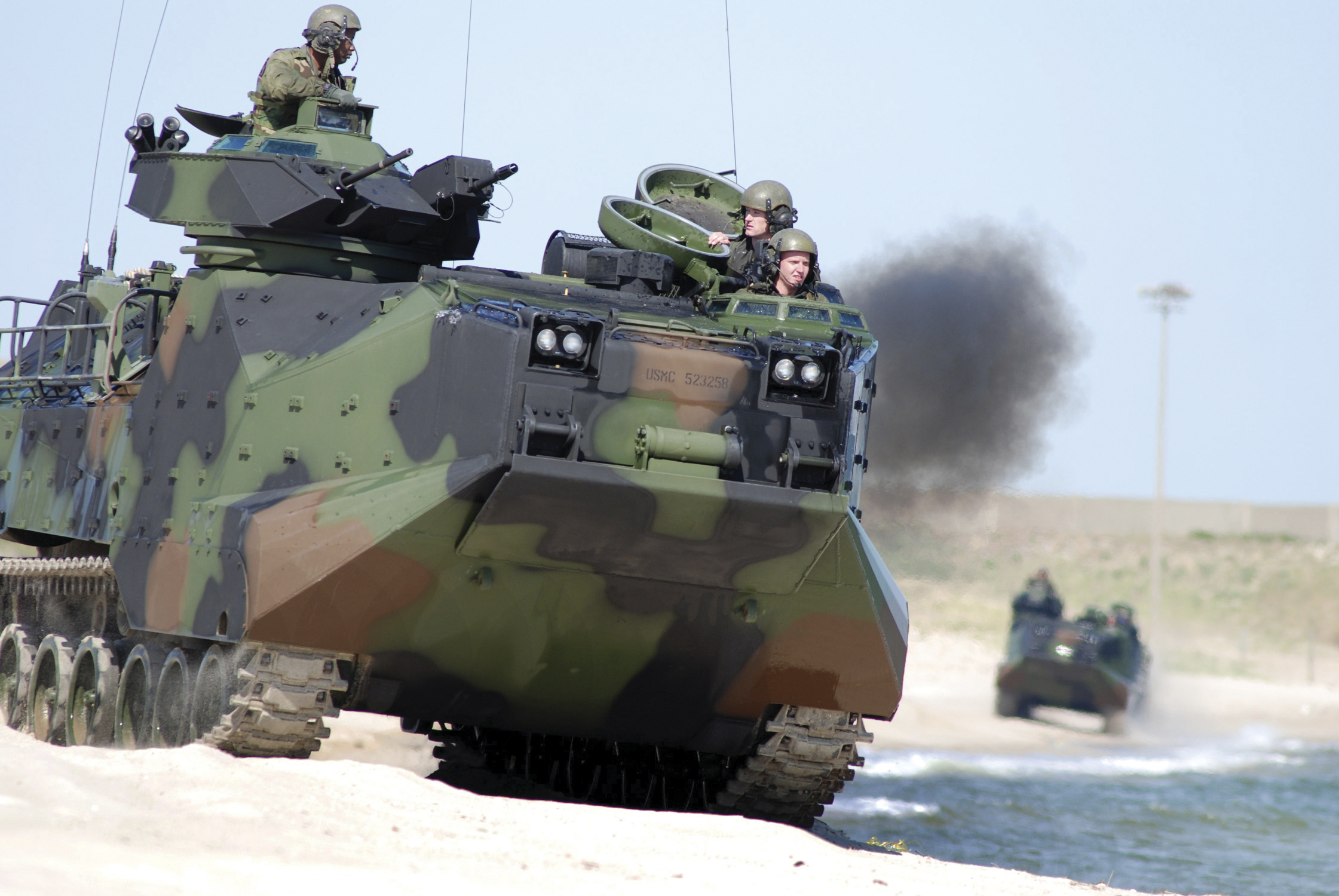
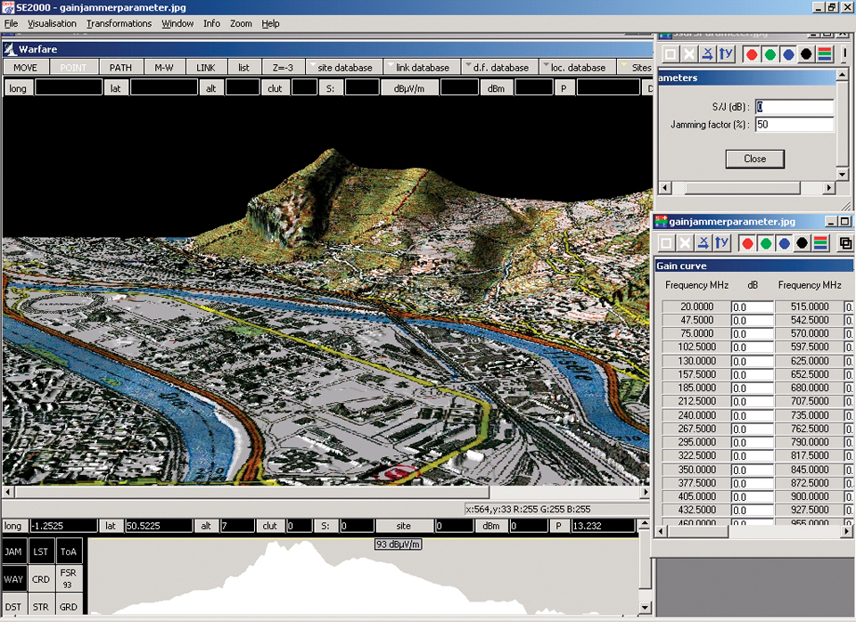
    Widespread COTS. There was an air of defensiveness about the user segment, and many comments on both the success and the risks associated with the widespread use of COTS user equipment. We heard further commentary on the very infrequent use of SAASM keys, due to the difficulty of procedures to obtain and employ them, and due to the perception of very low risk of jamming and spoofing threats in current combat deployments.

    A session on “The Future Military Receiver” enlisted two panels of government experts and contractors from Deere-NavCom, Garmin, IEC, Johns Hopkins Applied Physics Labs, Raytheon, and Rockwell-Collins. Although the unclassified nature of the presentations limited the level of detail, it clearly emerged that many tactical, in-combat deployments of COTS GPS receiver systems had occurred and continue to occur.

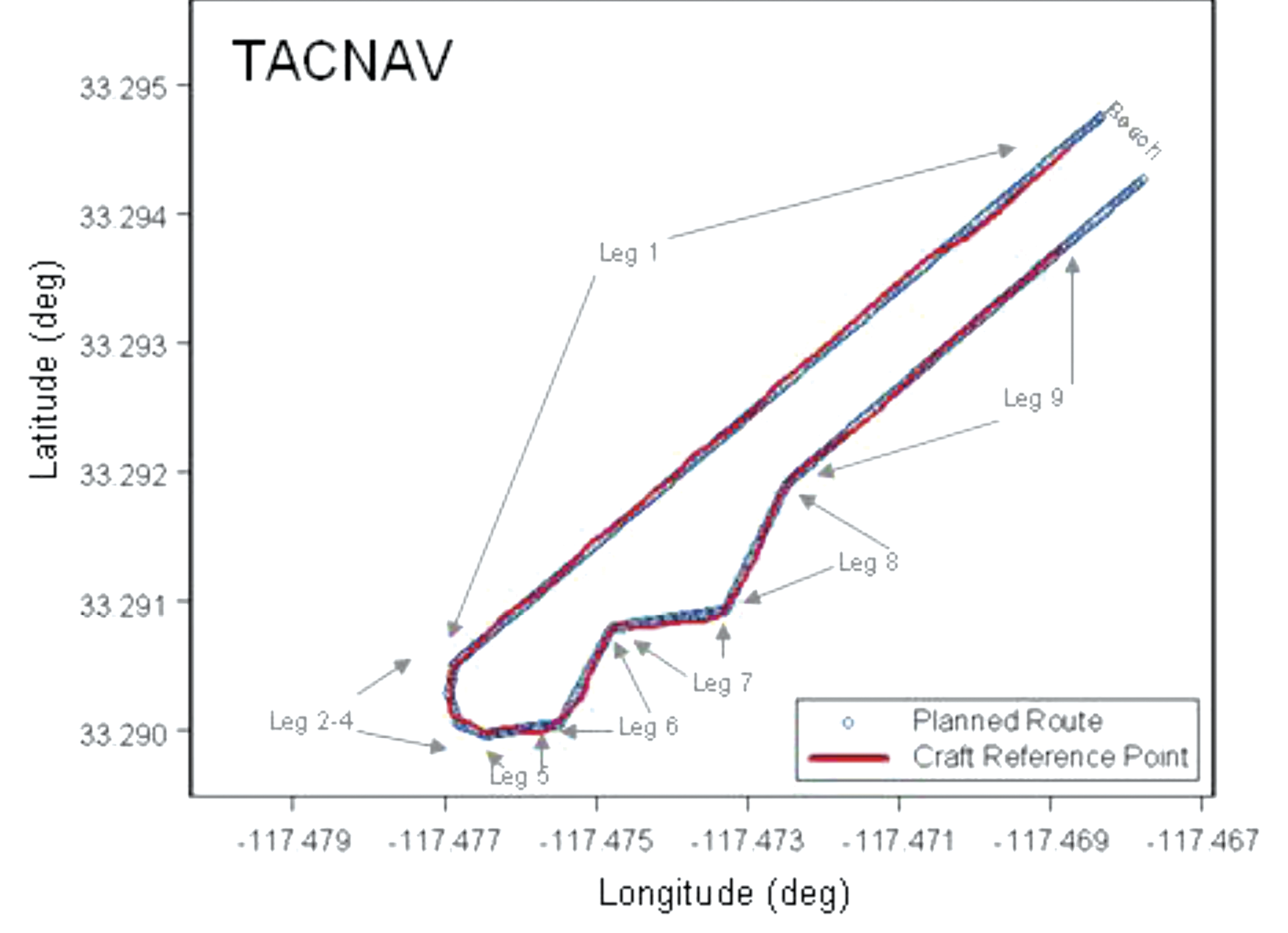
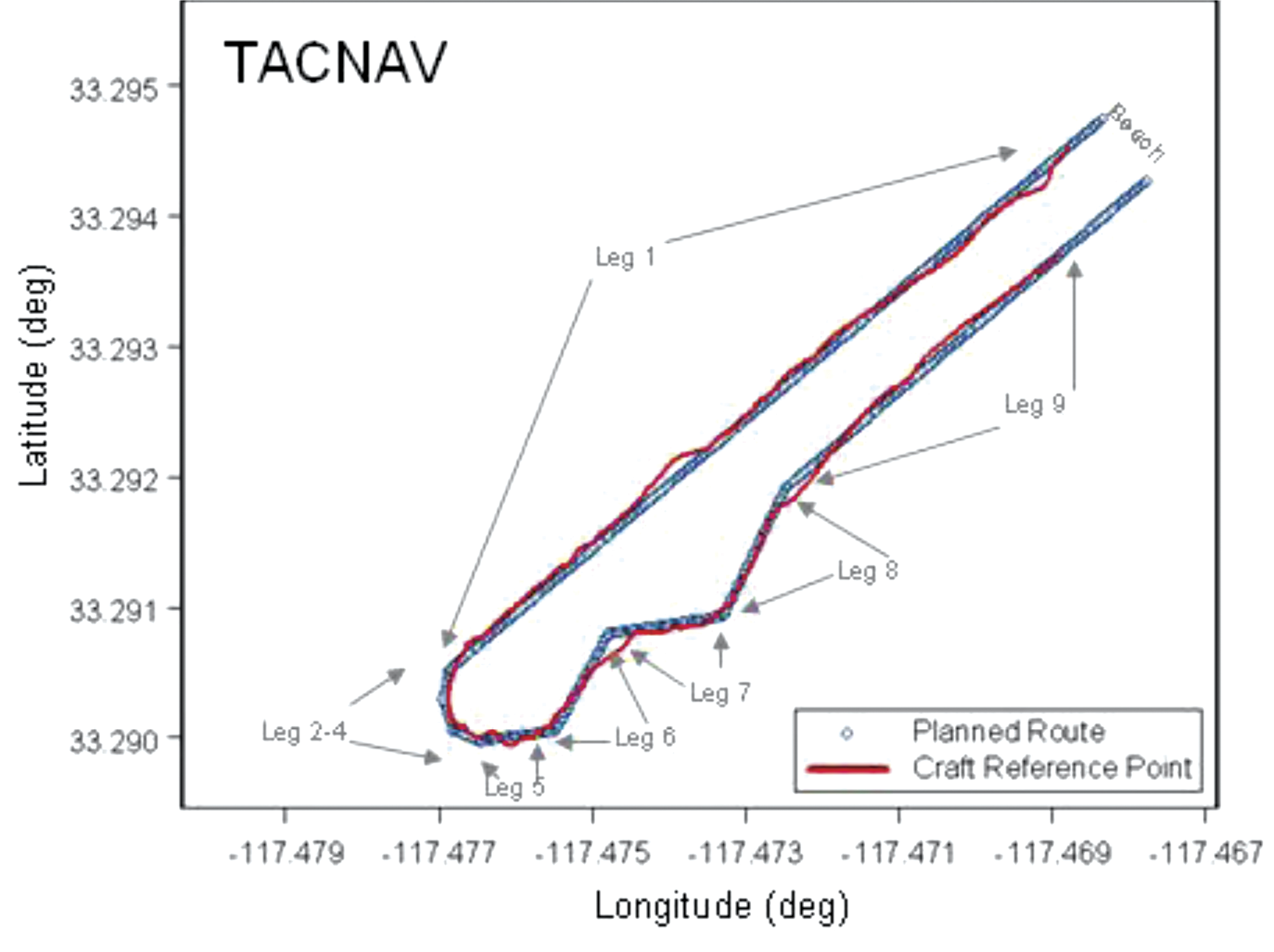
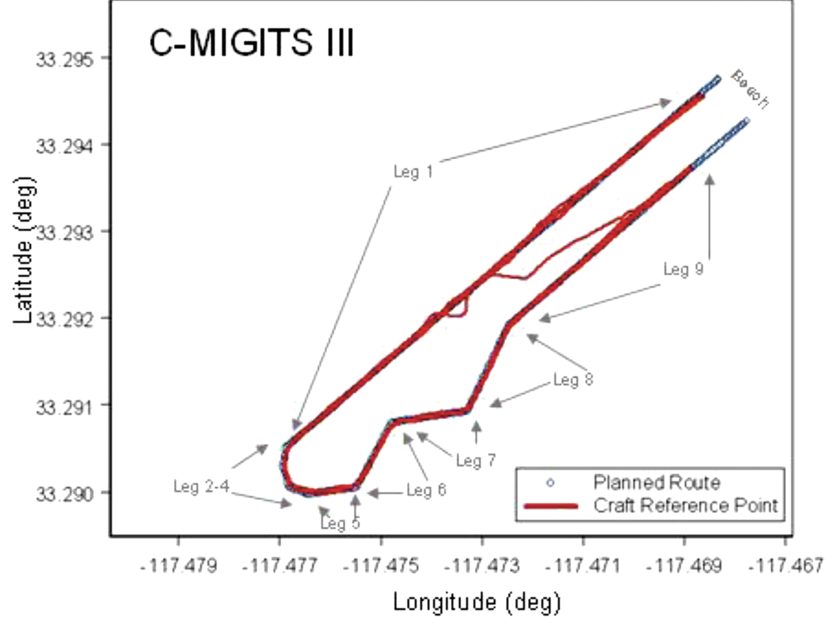
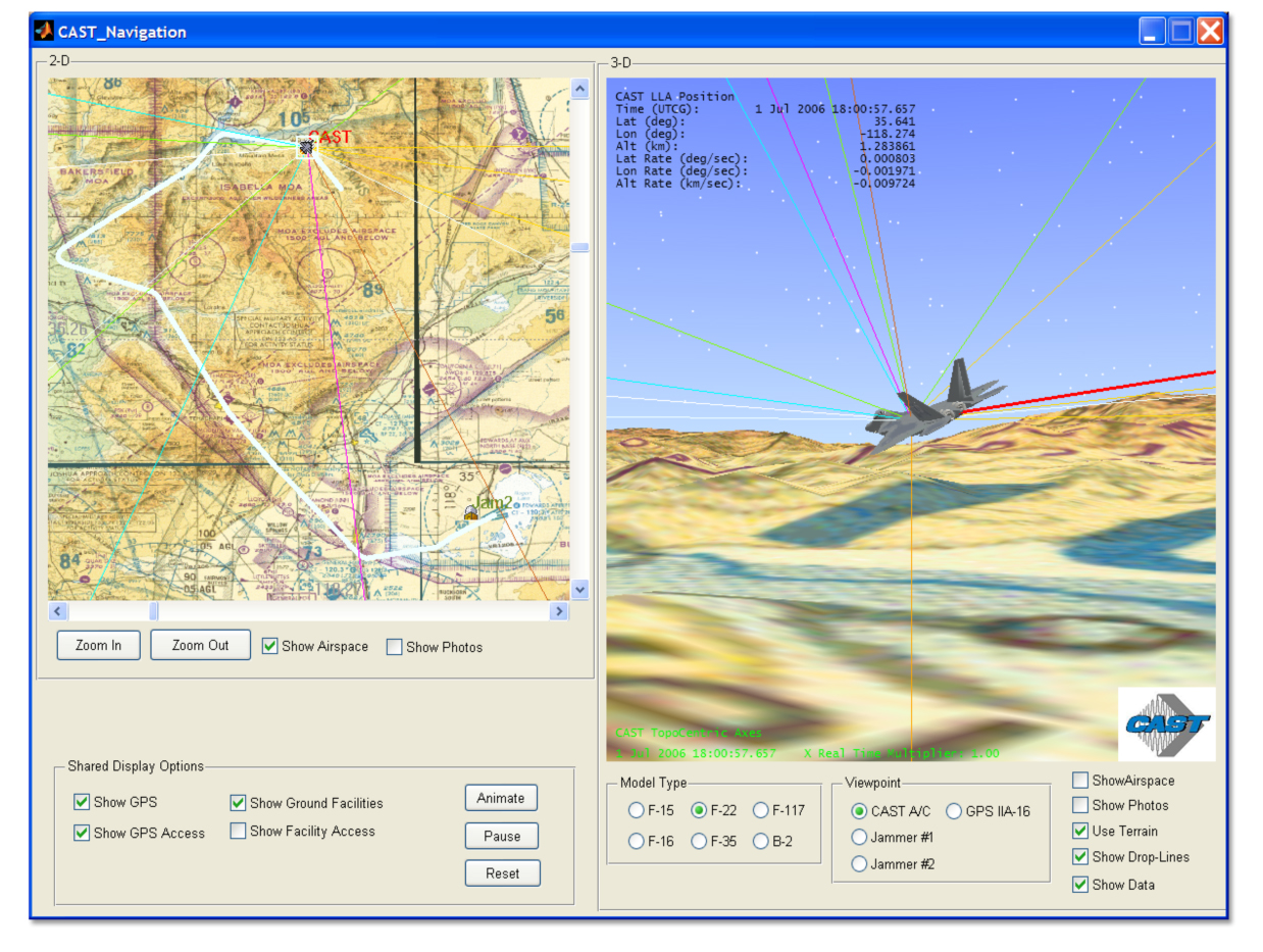
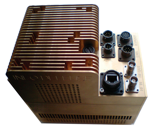
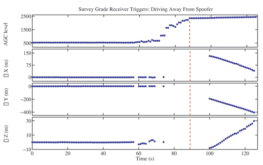
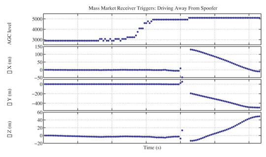
    A video compared the jamming resistance of a Garmin receiver with that of approved GPS User equipment receivers. It showed a screen of the Garmin receiver losing satellites at greater distances from the jammer and losing lock at closer distances. Directorate employees and officers made several references to the risks from dependence upon COTS receivers, and related with considerable candor the difficulties with large, expensive, power-hungry MGUE, both mobile and platform-mounted, models of which were held up during the presentations — often to laughter from some in the audience.

    More on this followed in Day Two’s dramatic warfighters’ panel, which many people felt was by itself worth the price of admission. These experienced users of GPS under fire — from Coast Guard search and rescue to Air Force forward controllers calling in air strikes within range of small-arms fire — related direct personal experience in a broad array of critical applications. They clearly knew how to use COTS equipment to good advantage and described the operational protocols developed from hard and sometimes painful experience.

    Manipulation of multiple screens in a heavy device, which requires initialization or synchronization before dismounting, was often simply not an option. Translation of such experience into qualified requirements is a major challenge for the Air Force and Army. Overdependence on the anecdotal but very valid combat experiences would weaken a design against an enemy with even rudimentary jamming and spoofing capability.

    An astute questioner asked “Have you seen any evidence that the enemy (in Afghanistan) has changed tactics because of our technology?”

    The answer came “Not yet,” with a comment that the enemy’s early warning systems are very sophisticated and the target of a mission to capture a high-value individual (HVI) frequently knows that such a mission is underway; his support network spirits him away and attacks the mission with the advantage of surprise denied to our forces, abetted by the advantage of favorable terrain and numbers accruing to the enemy.

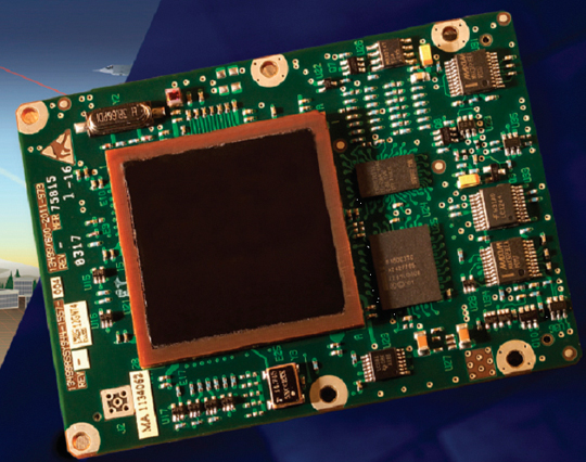
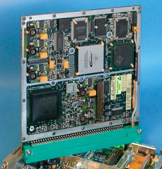
    The Puck. The Army-led MGUE program status was described as being at technology readiness level (TRL) 6.0; the request for proposals was released on April 16. The key to the success across platforms of this “system of systems” was said to be the Common GPS Module (CGM), also referred to as the Puck. This module is M, P, and C/A code-capable and SAASM-capable but has flexible interfaces and “emulates commercial.” The module itself is a system-on-chip (SoC) that can be integrated across many platforms. Depending upon the level of integration employed, it can be as small as chips found in smartphones or somewhat larger.

    The program schedule was defended as having only been funded two years ago and having very complex security and platform interfaces. This program presentation drew a large number of questions and commentary from the audience, much of it politely skeptical and showing impatience with the bureaucratic aspects of the program. Well-informed former military field-grade officers in the audience questioned its real availability. The answer that it would be available in quantity sometime in 2017 did not please the questioners.

    In short, procurement regulations appeared to be the highest barrier to a rapid, flexible program for a net-centric, open-architecture system development.

    Currently, the circuit boards for the MGUE are classified secret, but it is hoped to have these at a confidential or unclassified level for deployment by handling the encryption exclusively in software. The leader of this presentation indicated that software receivers were the ideal but were not available, so reduction in size, power consumption, and complexity in hardware was the goal.

    Trumping Military. One almost nostalgic comment hearkened back to the time when military systems were regarded as the height of technological excellence, whereas it is now generally perceived that commercial systems trump the military in sophistication. Garmin claimed to have developed SAASM receivers in the lab but found little interest from business leaders at that time.

    The CEO of Mayflower Communications, which makes and sells miniaturized SAASM receivers, pointed out that anybody could make a SAASM receiver employing a Sandia crypto-chip approved by the U.S. National Security Agency (NSA) but pointed out, as did several others, that the availability of certifications and authorizations was very limited, and that volume drove cost. Implicitly, NSA’s requirements and protocols got blamed for the limited distribution and use of SAASM receivers.

    Day Two

    The second day of the GPS Partnership Council comprised The Nation and The Warfighter. In the latter group came an outline of the Army’s COTS vision and — the hit of the entire conference — the Warfighter panel with a keynote introduction by a USAF colonel warrior now at the GPS Directorate.

    The Nation. Tony Russo, director of the National Coordination Office for Space-Based Positioning, Navigation, and Timing, disabused those who thought that the apparent demise of the LightSquared threat had eliminated that subject from his agendas; he still deals with it often. He provided entertaining and informative examples of non-obvious and valuable applications of GPS, from assessing rugby players’ game performance through detection of clandestine underground nuclear tests to a social application of matching available part-time and temporary workers with jobs when labor demand surges and a roster shows where the closest qualified candidates are.

    John Merrill of the Department of Homeland Security (DHS) identified 18 critical infrastructures that depend upon GPS integrity and showed the cascading effect of taking out sites like SCADA (Supervisory Control and Data Acquisition) systems. He related a threat-illustrative story of a DHS agent who required constant contact via his agency smart phone but who could not get reception while attending mass in church. The pastor later and very proudly showed him the mobile phone jammer in the sacristy; he had given up on asking parishioners to turn off their cell phones off during services.

    James Miller of the National Aeronautics and Space administration noted that only 5 percent of space missions lie outside the GPS coverage envelope (3,000 kilometers to geostationary altitude of 35,800 kilometers is the space service volume). Reducing the burden on spacecraft tracking networks is a highly profitable application for GPS.

    Warfighters Panel. These real-life experiences from combat and other vital operations could easily justify an entire article of their own. The following examples will illustrate the life-saving force multiplication of GPS, particularly the ubiquitous civil GPS technology in the current combat environment.

    •  An Air Force Special Operations Major described a mission to snatch an HVI, giving great detail on battlefield terrain, combat conditions, and how he worked between a COTS GPS receiver and a COTS handheld computer with Google Earth-like facilities to bring JDAMs (GPS-equipped smart munitions) onto an ambush mounted by defenders of the HVI, who were alerted to the raid by their extensive and sophisticated early-warning network consisting of sympathizers with cell phones. His description of the heroics of individual forward controllers, their injuries and fatalities, and the symbiosis of man and machine in a relatively benign electromagnetic interference but relatively malign electromagnetic propagation environment, and overtly and covertly hostile indigenous population, was dramatic and compelling.

    Clearly, unsophisticated  and easily-available  high-power jammers rapidly alter such situations to reduce our technological advantages. Also clear was the need to design user equipment, not just to reject interference but to minimize time and the inevitable ambiguities in actual combat situations.

    •  A Coast Guard lieutenant described the search-and-rescue missions he flies out of local airports to Pacific Ocean sites. Again, COTS equipment, aided by the near-ubiquity of commercial GPS equipment, along with VHF marine radio on boats and ships, enhances these mission results over those flown with standard USCG-issued navigation equipment.

    •  An Air Force tanker pilot major now attached to the GPS Directorate described three personal experiences. He once had to ask his boom operator to retrieve the Garmin receiver issued in the survival kit in order to navigate the tanker for rendezvous with tactical aircraft needing fuel when the tanker’s standard equipment failed.

    When tasked to fly into an airport in Afghanistan with unreliable navaids, under suddenly occurring zero-zero conditions, the onboard GPS enabled him to land safely.

    In a third instance in Iraq, he observed a downed airman being approached by gunmen. The gunmen with AK-47s were being targeted by drone operators. The major was able to discern that these gunmen were friendly forces moving to rescue the downed airman and avert a friendly-fire disaster. The downed airman’s ability to send his exact coordinates were key to the ability of the observer to get close enough to direct rescue efforts and to avoid a fatal error.

    • A Navy surface warfare lieutenant commander and a CWO Riverine or small boat skipper cited instances in which GPS was essential to missions and ways in which user equipment design could improve their operations — for example, by making it float.

    All the veterans repeated, during or after their accounts of ways in which GPS saved lives or enabled missions, “thank you for what you do,” addressed to the audience, the presenters, and their leaders. Going into denied territory places a high premium on user friendliness, battery life, robustness, size, and weight. In the future, inevitably, jam and spoof resistance will be an object of gratitude, as well.

    Final Review. We all know these things, intuitively and by doctrine, but hearing reports from people in harm’s way or retrieving comrades from harm’s way was a great addition to the usual program and technology descriptions by the development teams.

    I was particularly impressed with the very articulate, sophisticated, and focused presentations of these combat veterans. It is highly incumbent on the industry and the government GNSS leaders to translate these experiences into design requirements quickly, so that future systems are less dependent on individual ingenuity and on commercial gap-fillers.

    Much of this progress depends on truly incorporating the applications focus of commercial product development and on use of other GNSS systems for robustness, flexibility, and affordability — often quoted as mission goals by the leaders of this enterprise.


    MBOC Signal Furor

    A subsidiary of the UK Ministry of Defence has taken a UK patent on the new Galileo/GPS III MBOC signal design, the product of lengthy and cooperative negotiations between U.S. and European scientists. The patent, in the names of two UK engineers who participated in the project, is being used by a legal firm to demand royalty fees from receiver manufacturers, causing considerable controversy.

    LightSquared Bankrupt

    LightSquared, the company that mounted a powerful threat to GPS signals from November 2010 through February 2012, filed for bankruptcy protection on May 14 after losing a protracted battle in the court of the Federal Communications Commission. The war is not over, however. Exploding sprectrum demand for mobile data use makes it likely that future challenges to GPS and GNSS spectrum will emerge.

    Compass Muscling Up

    Two mid-Earth orbit (MEO) Beidou/Compass satellites were launched April 29. Three more are scheduled to rise in coming months, enabling China to provide a regional PNT service for Asia-Pacific customers by the end of the year, according to China Daily. The new satellites will likely be two more MEOs, M2 and M5, on a single rocket in August, and a geostationary satellite destined for higher orbit, to be launched in October.

  • Augmented Reality for Precision Navigation: Enhancing Performance in High-Stress Operations

    Augmented reality delivers two important military capabilities to the warfighter: situational awareness and precision piloting capabilities, both key to survival on the battlefield. Look-ahead drive-to-position, based on accurate GPS positions, extends the importance of GPS to high-speed operation or very close maneuvering situations where humans cannot cycle through a chart or map display, then place themselves in the real world to make maneuvering decisions.

    By Thomas Zysk, Jeffory Luce, and James Cunningham

    Augmented reality (AR) is a concept in daily use in the modern technology vernacular. In one popular form, AR enhances football broadcasts with overlaid information such as the first down line. A much more robust capability for application in high-performance navigation systems uses accurate GPS and heading sensors to geographically register a virtual world accurately over a real-world, real-time view. In a military context, AR can provide critical context to situational awareness.

    AR for military use was originally developed as a maritime equivalent to the aviator’s heads-up display. Evaluations using a task-load index function showed a 342 percent improvement in side-task operator performance when using AR. Operators do not have to make the mental conversion from 2D (map or chart view) to 3D real-world view. This translation is where errors can be made in high-stress scenarios and forms the root cause of many accidents. AR provides a game-changing capability to enhance warfighter performance when it matters and is invaluable during high-stress, dynamic operations.

    Photo approved for release by MC1(AW/SW) Michael W. Pendergrass, Fleet Public Affairs Center Atlantic, (757) 444-4199 ext 322
    Amphibious assault vehicle (AAV), U.S. Marine Corps.

    In this navigation context, AR was developed for use in low-visibility situations, such as navigating in dense fog or at night during lights-out missions. The technology can provide a visual depiction of critical points of interest, regardless of real-world visibilities. AR provides the means to integrate sensors and supporting geographic information system and related systems into a cohesive visual display that overcomes environment limitations or such things as closed-hatch operations on military vehicles.

    AR delivers two important military capabilities to the warfighter: situational awareness and precision piloting capabilities, both key to survival on the battlefield.

    Situational Awareness. Any information with a geographical registration component can be overlaid on the real-world view in a single composite display format. This can track data, threat locations, friendly-force locations, obstacles, and safe havens; the list grows each day. This information adds immensely to the operator’s understanding of the environment. This fused information, over a real-world, real-time view, is functionally an enhanced Common Operational Picture (COP). Operators can be more cognizant of the tactical situation day, night, or in any visibility condition.

    Precision Piloting. The faster one drives in an automobile, the further down the road one must focus to stay on the highway. AR provides this look-ahead drive-to-position based on accurate GPS positions. This extends the importance of GPS to high-speed operation or very close maneuvering situations where humans cannot cycle through a chart or map display, then place themselves in the real world to make maneuvering decisions.

    AR enables a rich suite of functions supporting the access and maintenance of a COP, and demonstrated maneuver accuracy. For the Augmented Reality Visualization for the Common Operational Picture (ARVCOP) system, any situational awareness information available can be overlaid on the real-world view in a clear and organized way. Operators do not have to go through the process of translating what they see on a map to what they see in front of them, a translation process that often incurs error. AR then delivers this to warfighters through a human-cognition friendly, integrated display of sensor data and geographically registered overlays, as Figure 1 illustrates. The AR view is shown along with a two-dimensional view on the right side of the display.

    Photo: Thomas Zysk, Jeffory Luce, and James Cunningham
    Figure 1. ARVCOP display example.

    Developed by the Office of Naval Research with industry partner Technology Systems Inc., ARVCOP provides a human-machine interface that can magnify the effectiveness of precision positioning. In this article, we discuss how AR is utilized in this context and the results of testing AR precision-navigation systems aboard Marine Corps amphibious assault vehicles (AAVs, see photo) on the beaches of Marine Corps Base Camp Pendleton, California.

    Precision piloting, or driving accuracy, is achieved by providing the operator a point toward which to drive that is in relation to the current position. Testing showed that looking ahead or driving to a point forced the operator to self-correct for the effects of wind, waves, and current.

    AR is exemplified by a software application that combines real-time video imagery with virtual images to provide a new dimension in navigation piloting accuracy. Figure 2 is an AR display on a ferry boat showing the navigational route marked by rails.

    Photo: Thomas Zysk, Jeffory Luce, and James Cunningham
    Figure 2. Real world with augmented reality.

    AR can overlay critical chart information such as buoys and channel markers, as well as radar or automated information system (AIS) contacts. In fact, any information that has a geo-registration component (geographic location attached) can be precisely overlaid on a real-time or infrared camera view. Operators have reported they are able to maneuver in unfamiliar waters at high speed with confidence, especially at night or in inclement weather (Figure 3).

    Photo: Thomas Zysk, Jeffory Luce, and James Cunningham
    Figure 3. Obscure visibility with augmented reality.

    An operator using AR does not have to look down at a chart, radar, or AIS display, and then up at the real world to put the information into context. Charts, radar, and AIS output 2D information that must be made relevant to a 3D world. Analysis shows that converting 2D to 3D is a strenuous and error-prone task for the brain. Accidents can be caused by an initial mistake, which is then compounded by other decisions made with incorrect information. Figure 4 shows how AR automates the conversion process, allowing the human to focus on other relevant tasks.

    Photo: Thomas Zysk, Jeffory Luce, and James Cunningham
    Figure 4. Augmented Reality Visualization of the Common Operational Picture (ARVCOP) block diagram.

    R & D Hardware

    AR applications on AAVs have demonstrated the technology’s utility on land, in water, and through the hazardous surf zone, delivering precise routing through cleared transit lanes. The system is intuitive to operate. Operators with little or no training in AR systems executed precise maneuvers through lanes planned with bends and turns. The AR system used a military GPS and heading device. Electronic chart and tactical data brought positional context to the display. A virtual world was created and software algorithms draped the virtual world over a real-world camera view creating an AR display (Figure 5) for the AAV test.

    Photo: Thomas Zysk, Jeffory Luce, and James Cunningham
    Figure 5. AAV with research and development commercially available ARVCOP hardware.

    Camp Pendleton Tests. In 2009, rigorous testing was completed for the ARVCOP system using AAVs in the surf at Marine Corps Base Camp Pendleton. Safe maneuver lanes were marked with mine-like objects and other hazards. Complex routes that included turns and zigzag patterns were planned toward the beach. Routes were delivered to vehicles using a radio circuit, and adjustments to the planned route were made on the fly to adapt to changing tactical situations.

    The AAV is a 26-ton vehicle that is a challenge to operate when placed in a surface environment with wind, waves, and currents. Hardware employed ranged from legacy devices, including a magnetic heading device, to modern devices. With Research and Development (R&D) hardware, the results were dramatic compared to the traditional means of navigating assault lanes. The technology enabled new mission concepts, such as irregular routes ashore and avoidance of hazards sighted by other forces as the mission was in progress. The evaluation criteria for these tests were cross-track errors (CTEs), measured relative to a planned route. Separate, high-accuracy GPS was used for truth data to measure the accuracy of the route driven. Figure 6 shows the video camera and GPS antenna locations on the AAVs.

    Photo: Thomas Zysk, Jeffory Luce, and James Cunningham
    Figure 6. Video camera is located directly beneath the GPS antenna.

    Figure 7 gives an example of the resultant AR video imagery for the R&D commercially available hardware on the AAVs. Figure 8 shows the planned routes for the R&D test evaluations. The distance offshore was 946 meters, and the planned total route length was 1,990 meters.

    Photo: Thomas Zysk, Jeffory Luce, and James Cunningham
    Figure 7. ARVCOP video using R&D hardware.
    Photo: Thomas Zysk, Jeffory Luce, and James Cunningham
    Figure 8. Planned route for the R&D testing.

    Video Augmentation Accuracy

    To determine position accuracy of the augmented figures drawn on the video images, time encoded images were captured. The augmented images were captured by ARVCOP using both the Civilian-Miniature Integrated GPS/INS Tactical System (C-MIGITS III) and the Tactical Navigation Digital Compass System (TACNAV) as input devices. Typically, multiple images are used to determine reference frame biases between the camera and the inertial measurement unit but, in this case, multiple image solutions lacked convergence. For this analysis, single-image solutions were generated. Figure 9, which shows locations of virtual and real objects, is an example of an image used in this analysis. The reference location of the virtual object is the bottom of the green post. The real-object coordinates input to ARVCOP were generated using a GPS survey and have centimeter-level accuracy. Figure 9 illustrates the inaccuracies in the system. During this calibration test, the augmentation showed errors of about 100 mrad (6 degrees) in the display of the virtual objects. (Authors’ note: This paragraph accurately reflects system performance on that day three years ago. Shortly after the test, system modifications were made that eliminated much of that error.)

    Photo: Thomas Zysk, Jeffory Luce, and James Cunningham
    Figure 9. ARVCOP image captured showing virtual and real objects.

    Test Results

    Evaluation of the AAV operation using ARVCOP as a driver’s aid was done by comparing the planned route with the actual route driven. The comparisons were made by finding the distance normal to the route, input to ARVCOP, and the vehicle’s estimated positions, generated using a GPS-relative positioning technique; no vehicle heading information was used and only horizontal components were compared. These differences between planned and executed routes are the CTEs. As mentioned earlier, both the C-MIGITS III and the TACNAV were used as input to ARVCOP for these tests. Figure 10 shows an example of the raw data, with the ARVCOP planned route (blue) overlaid with the GPS estimated positions (red). In this example, ARVCOP used C-MIGITS III heading input updated at a 10-Hz rate.

    Figure 10 illustrates how the AAV stayed on the planned course, showing only small deviations. The blue line represents the planned route and the red points are the GPS-estimated positions.

    Photo: Thomas Zysk, Jeffory Luce, and James Cunningham
    Figure 10. AAV planned and actual route, Run 2.

    When TACNAV was employed to supply heading information, similar results were seen. Figure 11 shows the first run made with TACNAV heading estimates. The AAV stayed on planned route except for some minor deviations.

    Photo: Thomas Zysk, Jeffory Luce, and James Cunningham
    Figure 11. AAV planned and actual route, Run 5.

    Figure 12 is of the second run using TACNAV heading information. In this instance, larger and more frequent excursions from the planned route are shown. The differences between Figures 11 and 12 are the result of the driver’s interpretation of the ARVCOP display. When the TACNAV was used as input to ARVCOP, the driver’s display showed greater instability than when the C-MIGITS III was used. The instability was a 1-Hz, few-degree shift in augmentation on the video corresponding to the TACNAV input rate. Figure 12 shows the result of the driver trying to follow all the augmentation shifts. When the driver ignored the sudden shifts in augmentation and drove a perceived average route, the resulting track was smoother, as Figure 11 shows. The 1-Hz input rate and the inherent TACNAV variations both contributed to the augmentation’s jumpy appearance.

    Photo: Thomas Zysk, Jeffory Luce, and James Cunningham
    Figure 12. AAV planned and actual route, Run 6.

    Figure 13 shows the tracks of all the runs from the February 2009 tests that used the C-MIGITS III, except for runs 7 and 8. Run 7 was excluded because high surf caused its early termination when the vehicle was ordered to shore by the safety officer. The driver’s display was lost during Run 8 because of a loose cable and the test was aborted.

    Photo: Thomas Zysk, Jeffory Luce, and James Cunningham
    Figure 13. AAV planned and actual route, C-MIGITS-III heading data.
    Photo: Thomas Zysk, Jeffory Luce, and James Cunningham
    Table 1 (left) shows the CTE statistics for the C-MIGITS–III runs. Table 2 (right) shows the CTE statistics for the TACNAV runs.

    Table 1 shows the CTE statistics for the C-MIGITS–III runs. Table 2 shows the CTE statistics for the TACNAV runs. Average speed over the course varied from 4 to 5 knots. It took about 15 minutes to drive the entire route.

    Discussion

    Comparison of the heading estimates between the C-MIGITS III and the TACNAV estimates showed variations of about 3 to 5 degrees, after removal of a bias. Investigation of the relationship of the heading angle error with the heading angle showed that after TACNAV calibration, significant heading error correlations remained in its estimates. Using the TACNAV as a source of heading information showed that the slower 1-Hz update rate and inherent variations of the sensor degraded the augmentation software’s performance. For example, when using the TACNAV, the augmented lane boundaries occasionally jumped a few degrees corresponding to the receipt of heading estimate updates. This was particularly evident after vehicle turns. The C-MIGITS III 10-Hz update rate and higher accuracy estimates enabled ARVCOP augmentation without distracting artifacts and provided the driver with more accurate navigation information. The ARVCOP-augmented objects were drawn on the video with a heading accuracy of about 6 degrees.

    During February 2009 R&D tests, the AAV made eight surf runs using ARVCOP with C-MIGITS III input and two runs using TACNAV input. CTE statistics for the ARVCOP C-MIGITS-III testing showed rms differences of about 2.9 meters. The ARVCOP TACNAV testing showed larger rms differences of about 4.9 meters. These statistics represent the rms error between the AAV’s planned and executed route.

    Summary

    AR technology provides a human-machine interface for a navigation system enabling precise maneuvering. ARVCOP presents navigation data so intuitively that operators are able to multitask as required in mission performance while still being able to precisely maneuver. ARVCOP proved the concept of AR-based precise navigation in rigorous operational scenarios with the U.S. Marine Corps (USMC).

    Test results for the R&D commercially available civilian GPS/INS hardware provided CTE of mean 2.1 meters and standard deviation of 2.0 meters. Operational hardware was evaluated in July 2009 over four days of testing, including 47 runs, in conditions with sea states ranging between 1 and 2.5, and many drivers. In 2010, at NSWCDD and Naval Surface Warfare Center, Panama City Division (NSWCPC), land demonstrations were performed with similar hardware navigating cleared paths through simulated mine fields at night. Vehicles were able to transit cleared routes with no external markings. The Naval Sea Systems Command Program Manager, (PMS 495), Mine Warfare Office, is now installing ARVCOP on USMC AAVs.

    Acknowledgments

    This work was sponsored by Brian Almquist, program officer, Ocean Battlespace Sensing Science and Technology Department, Office of Naval Research. LtCol Brian Seiffert, USMC, acting director of the Amphibious Vehicle Test Branch (AVTB), Camp Pendleton, supported the demonstration. GySgt Chapa and SSgt Schaefer, USMC, coordinated the AVTB effort. Kennard Watson, NSWCPC, coordinated the Camp Pendleton test plan. William Chambers, Maritime Technology Consulting LLC, Udayan Bhapkar, Andrew Sutter, and Alan Evans, NSWCDD, supported the tests and evaluations. Ronald Paradis, KVH Industries, Inc., supported heading sensor calibration.

    Manufacturers

    The C-MIGITS III is made by Systron Donner Inertial Division (www.systron.com) and TACNAV by KVH Industries (www.kvh.com).


    Tom Zysk (captain, U.S. Navy, retired) has more than 35 years of experience in the Department of Defense and industry. He held positions with Raytheon and General Dynamics before joining Technology Systems Inc.

    Jeffory Luce is a senior program manager at Technology Systems, Inc. (TSI). As lead for the ARVCOP program, he successfully transitioned TSI’s first project to a Program of Record.

    James Cunningham has worked in GPS research and development at the Naval Surface Warfare Center, Dahlgren Division, for more than 25 years

  • NovAtel, L-3 Interstate Electronics Partner on Civil RTK and SAASM Receiver Card

    NovAtel Inc. today announced the development of its OEM625S Selective Availability Anti-Spoofing Module (SAASM) GNSS receiver, a collaborative effort between NovAtel and L-3 Interstate Electronics Corporation (IEC).

    System integrators have come to rely on the centimeter-level positioning accuracy made possible with real-time kinematic (RTK) commercial GPS receivers. Many authorized defense customers rely on access to the Precise Positioning Service (PPS) for single-point positioning. The OEM625S will combine a commercial dual-frequency NovAtel GNSS receiver with an L-3 IEC XFACTOR SAASM in a single card solution, reducing overall size and power requirements for end customer applications.

    The OEM625S will maintain NovAtel’s OEMV-2 form factor, ensuring a successful drop-in replacement and backward compatibility for existing customers. Integrators can continue to use their existing user interface, which will be enhanced with OEM625S logs and commands for SAASM functionality.

    NovAtel’s well-established, comprehensive set of software commands facilitates system integration, NovAtel said. The SAASM position is provided via a dedicated communication port, as well as through NovAtel’s software command protocol, allowing for maximum flexibility.

    “For the past 17 years NovAtel’s customers have enjoyed great success in integrating our OEM family of high-precision receivers into a wide array of defense applications,” stated Graham Purves, executive vice president of NovAtel. “Adding the L-3 XFACTOR SAASM to our receiver card will allow defense customers to continue to use our products in the most demanding military environments.”

    Ric Pozo, general manager of L-3 IEC’s Navigation Systems business unit, commented, “We are pleased to collaborate with NovAtel and provide the warfighter this highly flexible and capable GPS SAASM product. Our combined teams are looking forward to bringing this one-of-a-kind solution to market.”

    NovAtel will accept orders for the OEM625S from authorized customers starting in the third quarter of 2012.

  • Polaris Wireless Announces Contract in Europe-Middle East-Africa (EMEA) Region

    Polaris Wireless, maker of high-accuracy, software-based wireless location solutions, today announced a significant customer contract for a multi-million dollar deployment of the Polaris Wireless Altus and OmniLocate location surveillance product suite in the Europe-Middle East-Africa (EMEA) region. Polaris Wireless said it could not disclose the customer’s name at this time.

    The deal represents a major increase in Polaris Wireless business, and is the 14th deployment of the Polaris Wireless high-accuracy wireless location surveillance solution outside the U.S. and 38th globally. Polaris Wireless high-accuracy location solutions are a tool used to combat crime and terrorism, and have been extensively deployed since 2003 for public safety applications in the U.S. market.

    “We are very pleased to have achieved such a significant company milestone for high-accuracy wireless location surveillance solutions,” said Manlio Allegra, Polaris Wireless CEO and co-founder. “Our momentum is directly attributed to our unmatched ability to consistently deliver a 2G/3G-compatible (and very soon 4G) high-accuracy, highly-scalable, software-based location solution for public safety and surveillance.”

    The Polaris Wireless Altus application suite is a software-based surveillance solution that enables accurate mass location — providing users the ability to simultaneously locate all subscribers in a wireless network in real time and on a historical basis. This unique capability enables functions, such as target identification, tracking via geo-fence, and post-event analytics, which are vital to the anti-crime and anti-terrorism surveillance efforts of Polaris Wireless customers around the world, the company said.

    “This deal has contributed to the highest revenue-earning year in Polaris Wireless history,” continued Allegra. “We are exploring several additional opportunities in the international marketplace, and plan to increase our workforce in order to meet the growing demand.”

    To maximize its accuracy location performance, the Altus application suite is being deployed with the OmniLocate platform powered by Polaris Wireless Location Signatures (WLS), a software-based location method for dense urban and indoor environments. Polaris WLS is capable of locating a wireless device to within 40 meters for the majority of the calls and helps customers avoid the costly and time-consuming deployment and maintenance associated with hardware-based location solutions, the company said.

  • CAST Navigation: Signal Diversity and the PHGPST

    As loyal readers are aware, I have long been an advocate of signal diversity as a solution to many of the ills that plague the GPS user, especially outdated user equipment. Signal diversity potentially provides users with more signals and signal origins. More signals improve availability, the number-one user criteria by a huge margin, and serve as a defense against jamming and spoofing. Signal diversity also provides security and integrity, resulting in accurate and reliable GPS-derived data.

    For users to take full advantage of signal diversity, they must have the best software-defined user equipment available. And the best equipment, if it were available today, would be the PHGPST or Perfect Handheld GPS Transceiver, which has so often been a popular topic of discussion over the last several years. I cannot count the thousands of letters and emails from warfighters, first responders, and civil users who immediately see the value of software-defined receivers and want to know where to purchase the PHGPST. For now, some early GPS software-defined user equipment does exist, but to reach the goal of the PHGPST, receiver manufacturers must first be able to accurately and reliably simulate/generate all the diverse PNT (position, navigation and timing) signals available, which include some signals not ordinarily categorized as PNT signals today. Certainly not an easy task; however, there is hope. Recently, I heard about a small GNSS/INS simulation company that may be paving the way to the PHGPST — CAST Navigation in Tewksbury, Massachusetts.

    CAST Navigation

    CAST Navigation, which qualifies under current federal acquisition guidelines as a small company, bills itself as, and my military contacts confirm that they are indeed, a leading provider of GPS signal simulators, as well as a company that supports navigation system research, development, integration and testing at commercial and military laboratories worldwide. CAST develops cutting-edge GNSS/INS simulation systems with an expert staff that provides their customers with the latest technology and knowledgeable, experience-driven support.

    Tough Industry

    Those of you who are real GPS techies should not have to think very hard to call up the names of at least three GPS–PNT signal simulation companies that have gone belly-up in the past five to ten years, and some of those memories are just plain painful for the U.S. military and industry alike. This can really be a tough business.

    According to Susan Gove, vice president of CAST Navigation, “…the signal simulation field is certainly not an easy business and it is extremely competitive, but we have been around for a long time and are doing well,” which is exactly why a company like CAST Navigation — which has survived and grown for the last 25+ years with an outstanding track record — is of such interest when it comes to PNT signal diversity and the PHGPST.

    Add the fact that recent Information Assurance (IA) and cyber security requirements have just made the GNSS business tougher for all concerned and a reliable, professional, flexible GNSS/INS signal simulation company becomes critically important to the industry as a whole. According to John Clark, VP for Engineering at CAST Navigation, “…our scenario-based software simulations, which include jamming, interference, multipath signals and spoofing allow for simultaneous and multiple scenarios — indeed, almost any battlefield signal perturbation the user needs to simulate is doable with our hardware and software. In fact, we routinely help our customers tailor scenarios for specific needs, and our customer feedback mechanism tells us our customers are extremely happy and productive with CAST Navigation’s scenario-driven software capabilities.”

    cast_1000-W . Credit: Cast
    The CAST-1000 GPS Simulation System.

    Signal Diversity

    A major requirement for signal diverse solutions to GNSS issues — to include jamming, unintentional interference and high masking angles — is the right antenna. Conventional wisdom says the right antenna is a Controlled Radiation Pattern Antenna or CRPA. Ideally, the right CRPA will eventually be capable of receiving all space-based PNT and SBAS signals (GPS, GLONASS, Galileo, Beidou, WAAS, EGNOS etc.) as well as ground-based cellular and LF (low frequency) and/or eLORAN signals. The CAST-5000 Wavefront simulator allows companies and the military to perform a full end-to-end test of a platform’s CRPA, the antenna electronics, and the GPS receiver before that receiver is ever deployed to the field. So it is a must-have capability for the truly signal diverse GPS receiver manufacturer. But to be honest, GPS signals are still key; they are still the gold standard for PNT. I am not aware of any GLONASS-only receivers on the market today, nor am I aware of any Galileo-only receivers being planned. GPS is the key component for available, reliable, and accurate PNT data.

    Recently at the Munich Satellite Summit, all the European receiver manufacturers were touting GPS receivers with the Galileo/GLONASS option. Even if the marketing brochures list Galileo or GLONASS first in the name, a little probing makes it obvious that the primary baseline PNT system is GPS with augmentations. So although signal diversity is the goal and more and more systems are, to some extent, signal diverse or signal-diverse capable today, the reality is that GPS is still the Gold Standard. If we are ever to truly enjoy signal diversity and all the associated benefits, PNT signal generators and simulators will be a key developmental tool. To that end and with affordability in mind, CAST Navigation has the capability or is in the process of developing simulations for many of the diverse signals mentioned to include SAASM signals for the U.S. military and our allies.

    Simulations and Predictions

    For the past several years the DoD and several government agencies have made good use of a very functional PDOP (positional dilution of precision) prediction algorithm and tool named GIANT. General Dynamics originally developed the GIANT program under contract to the U.S. government. Currently, GIANT is being enhanced primarily by LINDQUIST, with the help of select government agencies; with the recent integration of Google Maps, GIANT is proving to be a very useful tool for the warfighter and first responder. Amazingly CAST Navigation has a very similar product that is available for all users to include the U.S. military. The CAST product is called TOP or Terrain Obscuration Program. Like GIANT it provides a real-time determination of satellite visibility based upon the terrain (presented in a 3-D visualization) surrounding the actual position or predicted position of specific GPS receivers, fixed or mobile.

    TOP170map . Credit: Cast
    (Click to enlarge.)

    While this concept sounds a bit academic at first, when you see it in action and talk to warfighters and planners who have benefited from GIANT first hand, it is clearly a mission-success parameter as well as a life-saving capability. For years GIANT was purely a flat Earth planning tool, and while it was useful, the addition of real-time processing, Google Maps, and DTED data have made both GIANT and TOP incredibly useful programs. Both programs help ensure GPS user equipment, applications, and weapon systems are more accurate, since signal availability is now predictable. The first time I saw the new GIANT tool in action, it literally took my breath away, and now that capability is available for everyone with the TOP product from CAST Navigation. Knowing first-hand what both GIANT and TOP are capable of for warfighters and first responders, I cannot now imagine a government, commercial, or civil planner, who must utilize or install GPS equipment or systems that depend on GPS capabilities, that would not benefit from these groundbreaking programs. In a natural or urban canyon situation, with high masking angles, installing GPS receivers or antennas with the greatest visibility would be pure guesswork without a program like TOP that guides planners and installation engineers with real-time data extrapolating optimal PNT reception locations, both fixed and mobile, over time.

    sgx_high-W . Credit: Cast

    SGX

    Combine the capability of GIANT or TOP with a portable or handheld GPS signal generator/simulator, such as the new handheld CAST SGX, and users are able to accurately characterize and predict the effects of area terrain and masking angles on any GPS receiver prior to actually venturing into the field. Users are able to determine which receivers will function optimally and produce the most reliable results in any physically constrained or sky-challenged environment. For both government and civil users, the fidelity of TOP and GIANT are a direct function of and only constrained by the Digital Terrain Element Data (DTED) access authorized for specific users.

    The CAST SGX (signal simulator/generator) is a GPS signal device housed in a portable lightweight handheld enclosure. In other words, it is a portable handheld GPS signal device at home in the laboratory, running on house current, or in the field running on long-life batteries. Regardless of the power source, the CAST SGX is capable of generating GPS L1 signals (with P-Code options) of up to 16 GPS satellites, which are more than most users would normally have in view at any one time.

    The CAST SGX is an important new development in GPS signal simulation and generation. Historically GPS signal simulators/generators have been huge, heavy and complicated pieces of laboratory equipment requiring a Ph.D. to run properly, and users were tied down to evaluating GPS receivers only where the unwieldy GPS signal simulator/generator was located. Now with the portable CAST SGX, the signal generator can go where the receivers are located and real-world data can be collected in real time. The scenarios the SBAS (satellite based augmentation system) capable SGX have made available are extraordinary, and I have purposefully not speculated on the military possibilities as those speculations become classified in a hurry. But just allow your imagination to wander a bit and you will see what I mean.

    SGX Software

    The optional CAST-XGen Plus software, which I have not had a chance to personally test but hope to in the near future, has the capability to integrate with Google Maps and reportedly gives the user the ability to generate advanced customized scenarios for use with the SGX device. The software allows for complete control over atmospheric effects, the GPS almanac, ephemeris and all satellite error sources to include masking angles and multipath. So you don’t actually have to take the SGX device out into the field, but the great part is now you can. Ruminate on that for awhile and the possibilities appear endless.

    According to Susan Gove, the handheld SGX is proving to be a huge success, and the SGX along with CAST Navigation software products will be available at the ION 2012 Joint Navigation Conference
 (ION JNC) June 12-15, at the Crowne Plaza Hotel in Colorado Springs, Colorado. Be sure to stop by and take a look at this amazing new product.

    Bottom Line

    I am impressed by what I have learned about CAST Navigation. They are a small, agile, innovative GNSS/INS simulation company that has brought much needed portability and availability of GPS signals and simulation to operators, planners, and system designers worldwide. CAST Navigation hopefully has a bright future and may well play a key role in the future of the availability and integrity of GPS signals for users globally. They may also help blaze the path to the PHGPST. Check them out at ION JNC.

    Until next time, happy navigating.


  • Simulating Inertial/GNSS Hybrid: SINERGHYS Test Bench for Military and Avionics Receivers

    By Stéphane Gallot, Pascal Dutot, and Christophe Sajous

    A new hardware assessment tool automates testing and mission replay, managing military GPS receiver input and output data, with an operational implementation and with a better control of initialization conditions, especially direct P(Y) acquisition. The test bench drives a GPS/Galileo simulator, a digital jammer, and software programs for visibility computation based on terrain modeling, and for multipath generation on 3D renderings.

    Comprehensive assessment of military GPS receivers becomes more complex as they are integrated into advanced systems. To limit testing on systems under live conditions, laboratory evaluations with real elements are essential.

    A new hybrid test bench called Statistical INERtial Gnss HYbrid in Simulation (SINERGHYS) is designed for governmental use to validate the integration of GPS/Galileo receivers within the navigation system for different platforms. As system-level requirements become more stringent, this bench has been designed to assess the behavior of the complete system in an operational context.

    This new assessment hardware-in-the-loop tool is designed to automate testing and to replay missions with an operational implementation and with a better control of initialization conditions, especially direct P(Y) acquisition. This test bench drives many simulation tools: a GPS/Galileo simulator, a digital miniaturized jammer, and different softwares such as one enabling the computation of visibility depending on the terrain modeling, or one dedicated to the generation of multipaths on surfaces of realistic 3D scenes.

    Credit: Stéphane Gallot, Pascal Dutot, and Christophe Sajous
    Figure 1. Depiction of SINERGHYS.
    Credit: Stéphane Gallot, Pascal Dutot, and Christophe Sajous
    Figure 2. Focus on the bench.

    A Common Bench. Since 2000, with the arrival of the new cryptographic generation (the selective availability anti-spoofing module, or SAASM), the French government defence procurement agency (DGA) GPS laboratory decided to buy off-the-shelf GPS SAASM receivers that cover different form factors and applications. To test performance, it was necessary to acquire a test bench suitable for each GPS receiver. Testing procedures became more and more complex, and most of the manufacturer-provided benches could not perform every test required, such as direct P(Y) acquisition. To improve French expertise concerning GPS receivers, the DGA GPS laboratory decided to develop a common, generic test bench taking into account the integration constraints of each receiver. The perimeter of the hybrid test bench consists of a PC and a generic GPS test bench.

    Figures 3 and 4 show examples of military GPS receivers integrated into the bench.

    Credit: Stéphane Gallot, Pascal Dutot, and Christophe Sajous
    Figure 3. MPE-S (Ground-based application, Rockwell Collins).
    Credit: Stéphane Gallot, Pascal Dutot, and Christophe Sajous
    Figure 4. 1000S (Avionics,Thales).
    Credit: Stéphane Gallot, Pascal Dutot, and Christophe Sajous
    Figure 5. Embedded jammer.
    Credit: Stéphane Gallot, Pascal Dutot, and Christophe Sajous
    Figure 6. Jamming environment for a fighter aircraft. (Click to enlarge.)

    Bench management is centralized, so test conditions are generic, and all simulation parameters are fully controlled. This enables users to display a unique view of the complete information and to be able to replay specific scenarios.

    The bench manages military GPS receivers’ input and output data as described in the respective receivers’ interface control document (ICD) or interface specification: this enables, for example, the initialization of GPS receivers by sending precise time to facilitate direct P(Y) acquisition. This new bench is compatible with many GPS receivers with different form factors and applications.

    Several receivers can be tested at the same time with the same software, so that the behavior of the GPS receivers can be compared in real time. Data from the different receivers can be observed on the same window of the graphic user interface (GUI). Specific data from ICDs can be displayed on the GUI. The user can visualize three different windows: the first is related to integrity, the second to alarms, and the third to cryptography. All the data output by the receivers can be recorded and replayed.

    To facilitate and enhance trials on GPS receivers, the bench can use a Monte Carlo method, enabling sequentially and automatically chained scenarios, up to 10,000 test sequences, primarily for characterization of time-to-first-fix (TTFF).

    Inertial navigation system (INS)/GPS hybridization in real time can be simulated via processing based on a Kalman filter of the information delivered by simulated INS and GPS. Loose and tight coupling can be selected through the GUI as well as filter parameters. The Kalman filter design is independent from the receiver and from the type of trajectory simulated. The user can decide whether the GPS receiver does receive aiding either from the simulated INS, or from the optimal navigation (output of Kalman filter).

    Interfaces

    The bench can interface with various external means and drive some tools and materials involved in the functioning of the bench.

    With GPS Simulator. In the interface with the simulator, an intuitive GUI facilitates scenario preparation. When ready, SINERGHYS begins to drive the GPS simulator in remote-control mode. Any type of trajectory can be simulated with its operational environment modeled. The simulator outputs an RF signal to the receiver, and representative aiding, if required, by ethernet protocol to SINERGHYS.

    With Jammer. Two types of interference signal generators can be used with the bench. Any available waveform can be generated. The bandwidth can go up to 20 Mhz for one generator and up to 80 Mhz for the other.

    SINERGHYS is also compatible with a specific jammer called Embedded Jammer, designed to test vulnerability of GNSS systems (Figure 5).

    The GPS receiver under test tracks the real GPS satellites combined with the simulated jamming signal. Thanks to the position and attitudes provided by the aircraft and to a modelized antenna diagram, the jammer computes in real time representative jamming that would be generated by real jammers.

    This jammer works in two modes: localized mode (coordinates, jammer power, and waveform) and power profile mode. It was initially designed to be used inside an aircraft but can be used for laboratory testing as well.

    The simulated environment is defined in the configuration software: waveform, emitter, scenario definitions (bands, number of emitters), and antenna diagram.

    Four GNSS bands can be selected: GPS L1 and L2 (40 MHz) and Galileo E6 (40 MHz) and E5 (90 MHz). The embedded jammer can generate up to 14 simultaneous jammers per band, each with different waveforms. Therefore, up to 56 simultaneous jammers can be simulated.

    The center frequency of the jamming signals can be chosen anywhere in the bandwidth. Modulation examples: continuous wave, broadband noise, binary phase shift keying), binary offset carrier (x,y), and so on.

    Credit: Stéphane Gallot, Pascal Dutot, and Christophe Sajous
    Figure 7. Modulation examples.

    External software interfaces fall under three categories.

    Warfare. Electronic warfare software, which provides jamming coverage, performs a precise assessment of propagation (reflection and diffraction) of the interfering signals (depending on terrain modeling). Interference levels are transmitted to SINERGHYS during pre-processing.

    Credit: Stéphane Gallot, Pascal Dutot, and Christophe Sajous
    Figure 8. Warfare GUI.

    Satellite Tool Kit (STK). This software is designed to provide sophisticated modeling and visualization capabilities and  performs functions critical to all mission types, including propagation of vehicles, and determination of visibility areas and times. STK generates paths for space and ground-based objects, such as satellites, ships, aircraft, and land vehicles. STK also provides animation capabilities and a two-dimensional map background for visualizing the path of these vehicles. Within SINERGHYS, STK is used for real-time visualization.

    Credit: Stéphane Gallot, Pascal Dutot, and Christophe Sajous
    Figure 9. STK GUI.

    Ergospace. This software is designed to generate multipaths, enabling the modeling of reflected paths of different satellite signals on surfaces of realistic 3D scenes. Pre-processed multipaths are sent to SINERGHYS and generated by the GPS simulator. The software is also used for real-time visualization.

    Credit: Stéphane Gallot, Pascal Dutot, and Christophe Sajous
    Figure 10. Ergospace GUI.
    Credit: Stéphane Gallot, Pascal Dutot, and Christophe Sajous
    Figure 11. Example of the window showing the general state of the GPS receiver (c/n, svid, gram receiver and channel states, code and frequency tracked).

    Operational Mission Characterization

    The bench can evaluate and characterize receiver performance in most possible representative conditions.

    Management of GPS Inputs/Outputs. Both black and red keys can be loaded inside the GPS receivers in both DS101 and DS102 protocols. This loading can be performed manually through key loaders such as KYK13 or DTD/ANCYZ10, but also through the host application with hexadecimal keys.

    The bench can send commands to GPS receivers such as non-volatile memory erasure command, INS, precise time source, precise time and time interval (PTTI) activation commands, or choices between “mixed mode” and “all Y,” between “L1 primary” and “L2 primary,” and so on. Depending on user requirements, the bench can provide time, position, speed, almanac, ephemeris, or specific navigation sub-frames.

    To test the jamming resistance of GPS receivers, it is essential to be able to provide INS aiding. SINERGHYS uses perfect or degraded aiding and adapts the format or the frequency for the considered GPS receiver.

    Direct P(Y) acquisition functionality is an important case that needs to be evaluated. The GPS receiver needs a precise time to perform direct P(Y) acquisition. The time accuracy, from a few nanoseconds to several milliseconds, has a strong impact on the GPS behavior. A special delay box applied to the pulse-per-second signal of the GPS simulator in accordance with PTTI message (that is, time figure of merit), enables such a simulated accuracy.

    A standard IS 153-like interface was developed to display GPS data on a convenient GUI in order to have a common software to visualize output data from the GPS receivers. The user can also visualize some specific data from GPS ICDs concerning integrity, alarms, and cryptography.

    All receiver output data are recorded for later analysis.

    Credit: Stéphane Gallot, Pascal Dutot, and Christophe Sajous
    Table 1. Example of Direct P(Y) acquisitions in accordance with time uncertainty (with times to get “GRAM state 5” and “protected status”).

    Monte Carlo Trials

    The bench enables sequentially and automatically chaining scenarios (up to 10 000 test sequences) to perform statistics on acquisition times. Indeed, it is primarily used for the characterization of TTFF. GPS signal acquisition is dependent on many different parameters, as described in Figure 12. To properly characterize receiver acquisition times requires a large number of tests. The comparison with GPS Receiver Applications Module requirements can be easily performed.

    Credit: Stéphane Gallot, Pascal Dutot, and Christophe Sajous
    Figure 12. Setup parameters to study GPS signal acquisition.
    Credit: Stéphane Gallot, Pascal Dutot, and Christophe Sajous
    Figure 13. Example of a random selection for the position error.

    One Monte Carlo trial consists of a repetition of unitary test: powering the receiver, then sending to the GPS receiver random errors of position, speed, time, levels of jamming, and finally stopping the test sequence on trigger. At the end of Monte Carlo trials, statistical computing enables accurate analysis and expertises.

    The random selections are optimized to reduce the number of cases. The bench can replay a particular case: as the seeds are deterministic, a special case of Monte Carlo method can be selected and replayed.

    Real-Time INS/GPS Data Fusion

    The information delivered by INS and GPS are processed by a Kalman filter. The INS trajectory is provided by the simulator or by an external file.

    Two types of coupling are considered: loose coupling with position and velocity information, and tight coupling with pseudoranges and delta ranges to estimate errors. In both cases, the GPS receiver receives aiding from either the simulated INS or the optimal navigation (Kalman filter output).

    Credit: Stéphane Gallot, Pascal Dutot, and Christophe Sajous
    Figure 14. Example of an optimal navigation along a specified trajectory in a jamming environment.
    Credit: Stéphane Gallot, Pascal Dutot, and Christophe Sajous
    Figure 15. Position and velocity errors and navigation corridor.

    The purpose of the Kalman filter is to estimate the navigation errors (position, velocity, and attitudes) and sensor errors (INS, GPS).

    The filter design is original because it is independent from the receiver under test and from the type of application (hardiness privileged with reference to jamming). It is also able to estimate the time offset between position and velocity measurement on any GPS receiver under test.

    Conclusion

    SINERGHYS combines several resources into a single test bench. A complex mode can simulate an operational implementation with different interfaces and by chaining test sequences: receiver initialization, management of the switching of antenna patterns during a simulation, masking of GPS signals, management of jamming, INS/GPS data fusion, and so on. In this mode, missions can be replayed in a realistic environment. This bench is a complementary resource for flight trials and digital models because it can characterize the initialization phases with a good control of initial conditions. SINERGHYS enables users to know, as precisely as possible, the capabilities and limitations of a specific global navigation chain.

    Manufacturers

    SINERGHYS was developed by Bertin Technologies and specified by the French Ministry of Defense (MoD)DGA Information Superiority. It drives a Spirent GPS/Galileo simulator, Agilent 4431B and MXG generators, and software programs such as Analytical Graphics, Inc. (AGI) Satellite Tool Kit and Ergospace 3D scenes. The embedded jammer was developed by Ineo Defense in 2010 to MoD-DGA specifications.


    Stéphane Gallot works at the French MoD (DGA Information Superiority) as a radionavigation expert. His particular interest is the integration of military GPS receivers including SAASM modules within French platforms.

    Pascal Dutot is an architect engineer at the French MoD (DGA Information Superiority). His main activity is to optimize and control GPS integration in the global navigation chain.

    Christophe Sajous works at the French MoD (DGA Information Superiority) as a radionavigation expert. He is also responsible for the “navigation per satellites” laboratory within the radionavigation department.

  • U.S. Army Geospatial Center Introduced the HyDRA Android App

    The U.S. Army Geospatial Center (AGC) and Engineer Research and Development Center introduced the Hydrologic Data Resources Application (HyDRA) – a Web-based data survey and analysis tool created to provide the Dept. of Defense (DoD) logistics and geospatial intelligence-related water communities with information on water resources data collection, visualization and dissemination in a mobile, enterprise-enabled environment.


    According to the announcement, HyDRA allows users to view, collect and edit unclassified water resources features via Android 2.2+ OS smart devices using Google Maps and Google Earth applications. Wells, water tanks, water storage points, dams, treatment plants and other features may be added, queried and edited in “connected” and “disconnected” modes; collected features may also be edited through a Web page using the same functionality. The Web page and app were created to assist U.S. Army engineers and the water community working in infrastructure and reconstruction operations with feature collection and identification. A compass feature is also included to assist the user in finding the nearest water feature and its bearings.

    The mobile application may be downloaded from the AGC’s Web site. An offline version of the mobile application is under development and will allow the user to store collected data locally and sync to the server after an internet connection becomes available.

  • Grand Setting for a Grand Summit

    Most of Munich is an ultra-modern German city, albeit one of the most expensive cities in Europe, where you can travel anywhere by tram, automobile, S-Bahn, rail or taxi. But why bother when you have the opportunity and thrill of walking through the old city center and have Bavarians greet you with “May God greet you” or “God bless­”? — what a way to say hello. That experience, which brings back fond memories — more on that in my main column — combined with the wonderful aromas from bakeries and early morning baristas hard at work, which are hard to pass by, made the short walk to the Residenz München seem all too short; and then you are there — greeted with the magnificence of the Munich Satellite Summit venue.

    The Residenz München served as the seat of government and residence of Bavarian dukes, electors and kings from 1508 to 1918. The Residenz began life in 1385 as a castle on the outskirts of München and subsequently transformed over the centuries into a magnificent palace or Schloss, its buildings and gardens extending further into the center of town or Stadtmitte. And this is the incredible venue for the Munich Satellite Summit. It is breathtakingly magnificent and yet for all its age and history the Residenz serves its varied and ever-changing purposes well, and certainly is the perfect venue for the summit. This is the 10th anniversary of the summit in this location, and hopefully it will never change. Anything else now, with so much grandeur and history, would be a huge disappointment.

    As you ascend steps that have been trod and worn down daily by kings, dukes, barons, and commoners alike for more than 625 years, it comes home that you are in a very special place. If that is not enough, the König’s guarded banquet room, which is still set with silver place settings, silverware, and crystal goblets to feed more than 100 at one grand table, soon gives you a clue that you are someplace special. Whilst there are several large banquet rooms and court areas easily capable of holding the 400+ attendees, the organizers have wisely chosen to keep you moving from place to place to pique your interest in the old castle and to keep the blood flowing after sitting through a series of high-tech presentations.

    In the alte Schloss, the summit presentations are in one area, the company and sponsor booths are in another, and the German coffee and refreshments in yet another. This keeps you moving and also keeps the noise and modern-day distractions to a manageable level — plus, of course, it is perfect for networking. There are a myriad of interesting nooks and crannies for meet-ups and impromptu discussions. Fortunately the conveniently provided summit Wi-Fi signals penetrate the thick stone walls and are available in all meeting and presentation areas.

    The real danger of meeting in this iconic Bavarian palace is that you are constantly distracted by the beauty and history surrounding you. I constantly reminded myself I was attending a 21st-century satellite summit and not a whirlwind tour of gorgeous historical Bavarian architecture. Although I must admit I managed to do a little of the latter in between presentations and meetings. Just don’t tell my editor.

    Fortunately, lunch is served in-suite, so you do not have to leave the fabulous Schloss for sustenance — and what a gourmet lunch. You guessed it: the meals were fit for a King or König, certainly more than sufficient for a mere journalist. Although I must admit to being a bit worried since as a vegetarian, Germany does not exactly have the reputation of providing veggie substitutes for wurst und sauerbraten. However, to say I was happily surprised is putting it mildly.

    Frauleins Heike Haas and Bärbel Deisting, whom I cannot praise highly enough, the intrepid and unflappable organizers of this wonderful international event, had obviously warned their chef and he provided sumptuous vegetarian or “vegetarisch auf Deutsch,” options for every meal. My most common refrain at mealtimes, as I returned for seconds and thirds, was…are you sure this does not have any meat in it? The meals, snacks, and of course the coffee are not to be missed. You might miss five minutes of a presentation but don’t dare miss a meal.

    This was my first year to attend the Munich Summit as Alan Cameron, our intrepid editor-in-chief and now publisher, has always attended in the past. So most of the greetings went like this: “Hi Don, glad you are here. Where’s Alan?” My invariable response was, “Busy being the publisher.”

    The opening plenary, as it is so aptly named, took place in the Allerheiligen-Hofkirche, or Court Church of All Saints, and it was a fitting venue. The master of ceremonies opined that the Court Church of All Saints only took 11 years to complete in the 1800s, in direct contrast to the Galileo constellation, which has already been in existence for more than 11 years with…well, you get the point.

    Now for an historical note: King Ludwig 1 who commissioned the Court Church of All Saints married Therese of Saxe-Hildburghausen in October 1810 and the resulting wedding celebration was the occasion for the first ever Oktoberfest. Beer drinkers for the last 200 years are still celebrating that wedding. I know I did when I attended University in München more than 45 years ago, but that is a story for another time. And no, this is not the Neuschwanstein, Wagner loving, mad King Ludwig, who unfortunately after a lifetime of swimming forgot how at the crucial moment…that was his grandson.


  • Grüss Gott – Munich Satellite Summit

    There is a reason the Munich Satellite Summit is billed as a summit and not a symposium or conference. It’s a different atmosphere that invites group chats, informal get-togethers, and networking. One item of note that I came away with is that the Chinese are looking for help and partners for their PNT constellations, of which there appear to be three in the making. But asked point blank when they would finally release the full ICD specifications for receivers (a partial ICD has been released) the answer was the same as last year. They did not know when that might happen. It is hard to build receivers and support a specific program, much less three PNT constellations, when you don’t have the specifications.

    Grüss Gott! rang out across the ancient cobblestoned Marienplatz, home of the beautiful and timeless Glockenspiel or mechanized clock tower as I strolled along. The Glockenspeil is located in the heart of the old city of München, Germany and I passed it every morning as I strolled toward the Residenz München, which centuries ago was home and castle to the Kings of Bavaria. This particular beautiful spring morning the ancient castle was my destination and the incredible venue for the Munich Satellite Summit. Talk about location, location, location! (Read more about this incredible setting.)

    Plenary Session

    There were no less than 10 plenary speakers on opening night. In retrospect there should have only been five, but that is a lesson learned, as is the fact that the Chinese presenter was totally indecipherable. Even reading his slides I still could not understand a word he said. As an organizer of such events, and yes I know from experience, you quickly learn that poor and even unintelligible speakers are just a curse that comes with the territory. However, the musical interludes presented by an a cappella musical group were outstanding. This was the highlight of the evening, which tells you something about the plenary — it was not bad actually as plenaries go, everything worked like clockwork. It was just a tad bit too long. No one ever hopes…well maybe that is backwards…actually everyone hopes to attend a plenary that is actually informative but it rarely occurs. The summit plenary wasn’t bad; the food, drink and networking opportunities were great, but next year I vote for more songs, fewer indecipherable speeches and, until they get their act together, the only Chinese item on the plenary or any summit agenda should be egg rolls.

    This is not an expression of Xenophobia or bigotry, not at all — I just hate to waste my time. I spent several hours listening to the Chinese presentations during the summit and literally understanding about 10% or less, and unless I, and everyone else missed it, there was absolutely nothing new announced. It was a total rehash of the National Space Symposiums uninformative Chinese forum from last April.

    The one item of note that I did comprehend is that the Chinese are looking for help and partners for their PNT constellations, of which there appear to be three in the making. But asked point blank when they would finally release the full ICD specifications for receivers (a partial ICD has been released), the answer was the same as last year. They did not know when that might happen. It is hard to build receivers and support a specific program, much less three PNT constellations, when you don’t have the specifications.

    I met Joel Szabat, the senior government representative at the plenary who is currently serving as a senior official in the U.S. Department of Transportation. Joel and I have corresponded but never met, so this was a great opportunity to get acquainted. And I must add that Joel’s comments during the plenary session were right on the mark. They were short, concise, and to the point. Very well done. If only others had emulated him.

    Other notable U.S. attendees were Colonel Bernie Gruber, director of the GPS Directorate, who gave a well received but brief GPS status briefing, and some of his staff along with Hank Skalski, the Civil GPS liaison at HQ AFSPC; Ron Hatch from John Deere (Starfire); as well as an old friend, Dr. Per Enge, director of the GPS laboratory and senior professor in the Department of Aeronautics & Astronautics at Stanford University. Representatives from Lockheed-Martin Space Systems and other U.S. companies were present as well, so the U.S. space program was well represented.

    One of the Royal Lions Guarding the entrance
    to the Munich Satellite Summit.

    Summit

    There is a reason the Munich Satellite Summit is billed as a summit and not a symposium or conference. There is a different atmosphere that invites group chats, informal get-togethers and networking. It may sound strange; however, in an ancient German palace the atmosphere is a bit less formal than at the National Space Symposium in Colorado Springs, Colorado, which is the largest Space Symposium in the world. The Munich Satellite Summit will garner ~400 international attendees while at the Broadmoor Resort there will be closer to 5,000 attending. So the summit is definitely a bit more intimate and less rushed. More conducive to networking, which in my estimation is the real value of the summit. At the summit you can easily visit all the booths in 30 minutes or less and in Colorado Springs you will be lucky to get through all the booths in less than three days of dedicated booth-hopping. In Germany everyone is a bit more relaxed, and at the National Space Symposium everyone is trying to see and attend everything; it is definitely a bit more frenetic and yet both venues are amazing in their own way and each event has its place in the scheme of things.

    Both the Munich Space Summit and the National Space Symposium, which includes Cyber 1.2 (15-19 April 2012), are about more than GPS and PNT, yet these are the predominant themes at both events…and this is only as it should be… Who me? Biased!

    eLORAN

    Seriously, the Munich Space Summit is naturally more European Space Agency (ESA) and Galileo-oriented than the National Space Symposium, and yet this year one of the main themes and topics of conversation was eLORAN and the USCG-supported UrsaNav foray into that endeavor.

    My GPS World column on that timely topic came out on March 14, the first full day of the summit, so it was a constant topic of conversation for me and I was happy to hear that sections from the article were quoted numerous times during the summit. Many were happily surprised by the UrsaNav efforts and even more surprised by the USCG support.

    A dedicated eLORAN session included Professor David Last from the UK and a speaker from the subcontinent, who told some pretty hair-raising pirate stories to illustrate his points of why a strong, impervious to jamming, low-frequency timing and PNT system is needed in his part of the world and is generally a good idea on a global basis. I would agree — when being attacked by pirates, knowing immediately exactly where and when you are can be of critical importance when seeking help. It was an entertaining, informative session that was standing-room only.

    During the entire summit, I only heard the word LightSquared used as an expletive. Most everyone said…thank goodness that “§”&%” is over… or words to that effect. Most everyone marveled that it took a year to get through the whole fiasco and wondered what will happen next…it is like waiting for the other shoe to drop…but there was an obvious huge sigh of relief and then inevitably comments like …see, that’s why the United States needs an eLORAN system. ” Point taken I hope.

    And the U.S. does desperately need a proven high-power LF Stratum-1 timing signal that covers the U.S., approaches to the U.S. as well as portions of Canada and Latin America. Faithful readers know that I often quote the statistic that 90% of GPS users globally use GPS for time. Time and frequency standards are critical to our national infrastructure, even more so since GPS freely provides time to a very high degree of accuracy for all and using the GPS timing source has become ubiquitous among most U.S. government agencies.

    Time is critically important to all we do — more so than most of us ever take the time to consider. However the subject of time fascinates many. I remember a conference on timing a few months ago in Boulder, Colorado, at NIST with numerous timing briefings given by an old friend, Judah Levine. The topics included, “What is Time?”, “What is a Second?”, “What is a Leap Second?” and “The Importance of Frequency” — I don’t remember anyone leaving the room while Judah was speaking.

    Some of the more critical factors concerning time as associated with GPS and eLORAN are that unlike mechanical devices — such as an INS (inertial navigation system) that display your position — GPS and eLORAN signals contain data that informs you when you are as well as where you are. GPS and eLORAN can give you the day, date and time as well as a geographical or spatial position, which is crucial data for automated scheduling of activities that is so prevalent in many of our critical infrastructures today.

    I and several subject matter experts will discuss aspects of eLORAN and more during a GPS World-sponsored webinar in June 2012. Stay tuned for more information concerning that event.

    Other Forays

    Munich is a big modern city with all that brings with it and it has changed a great deal in the last 45 years, since I attended University there. I helped edit the university newspaper, worked as a disc jockey at Radio Free Europe to pay my way though university, and worked as a roving correspondent. See, I really have been in this business for a long time in one way or another. So, being the intrepid journalist I have always been, only much older and wiser and with much less hair to lose, I scheduled side trips to Astrium, Audi, BMW, Mercedes, VW-Porsche, and NATO AWACS. Do you see a trend developing?

    The Astrium personnel and the factory tour were very special, and you will be hearing more about both at another time. Astrium is building several of the key components of the Galileo satellites as a subcontractor to OHB Technology AG in Bremen, Germany.

    Bottom Line

    There is so much to say about the Munich Satellite Summit and of course the extra curricular excursions; it is impossible to do so in just one or two columns, so I will be covering different aspects over the next several months. Bottom Line: the Munich Satellite Summit is a seminal event and a treat not to be missed. I want to thank our Editor-in-Chief and Publisher Alan Cameron for allowing me to attend this year, and I hope that Alan remains so busy that I will have the opportunity to personally greet you with Grüss Gott in München in February 2013. Tschüss!

    Until then, happy navigating.


  • Thales to Provide GPS SAASM Receivers for French Navy Lynx Helicopters

    Thales has been awarded a contract by the Service Industriel de l’Aéronautique (SIAé), France’s military aircraft maintenance, repair and overhaul service, to supply stand-alone GPS receivers for the French Navy’s Lynx helicopters, which are currently being upgraded by the French defence procurement agency (DGA).

    Thales’s GNSS 1000-S receiver relies on SAASM (Selective Availability Anti-Spoofing Module) technology to access military GPS encrypted signals. This technology also uses state-of-the-art signal processing offering extended satellite tracking capabilities in terms of precision, integrity, availability and jamming resistance in severe operational conditions.

    This contract consolidates Thales’s European leadership in the field of military GPS receivers, which already equip FREMM multi-mission frigates, cruise missiles, Tiger helicopters, C-135 refuelling aircraft, Atlantique-2 marine patrol aircraft and Mirage 2000D fighters in service with the French armed forces, and the tanker aircraft being delivered for the UK’s FSTA (Future Strategic Tanker Aircraft) programme.

    The GNSS 1000-S is part of Thales’s suite of GNSS products which will be presented at the European Navigation Conference in Gdansk, Poland, April 25-27 on the Galileo Services booth.

  • Detecting False Signals with Automatic Gain Control

    By Holly Borowski, Oscar Isoz, Fredrik Marsten Eklöf, Sherman Lo, and Dennis Akos

    A component of most GPS receiver front-ends, the automatic gain control (AGC) can flag potential jamming and spoofing attacks. The detection method is simple to implement and accessible to most GPS receivers. It may be used alone or as a complement other anti-spoofing architectures. This article presents results from a baseline AGC characterization, develos a simple spoofing detection method, and demonstrate the results of that method on receiver data gathered in the presence of a live spoofing attack.

    Growing reliance on GNSS also creates the need to defend against those with the ability to exploit its weaknesses. Specifically, GNSS signal spoofing is recently a growing concern, as an effective spoofing attack can fool a GNSS receiver into producing erroneous navigation and timing information. Although applicable to many GNSS, GPS will be used as the example.

    One example of spoofing seen recently in the popular press was the Iranian claims of bringing down a U.S. unmanned aircraft via a GPS spoofing attack. Although this may be unfounded given the complexity required, spoofing attacks to autonomous vehicles are emerging threats. A second hypothetical example is a fisherman whose location is monitored using GNSS may be motivated to use spoofing, such that illegally fishing in protected waters is not detetcted, increasing profits.

    GPS signals received by a traditional hemispherical antenna are below the thermal noise floor, a physical constant dependent only on temperature. Although multiple signals are transmitted at low power in the same frequency band, they can be acquired and tracked using code-division multiple-access (CDMA). However, low signal power also makes GPS systems vulnerable to intentional radio-frequency interference (RFI) and the more sophisticated spoofing.

    Spoofers range from simple to sophisticated. For example, a simple spoofer may be built from a GPS repeater (known as meaconing) by simply using it to rebroadcast signals at a higher power than the authentic GNSS signals. Receivers close enough to these spoofers then acquire and track the stronger spoofed signal, producing an erroneous position/timing solution. In this case, a position jump is likely to occur in the victim receiver’s reported solution as it transitions from the true signals to the spoofed signal, alerting the user of a potential spoofing attack. Somewhat more complex than a simple repeater would be to broadcast signals from a GPS simulator, which would enable a threat with more control over the signal-to-noise ratios as well as the resulting position. Finally, a very sophisticated spoofing attack first introduced by Humphreys , et al. in 2008 may be implemented by placing a spoofer near the receiver, so that it can correctly align its transmitted false signals to the authentic ones seen by the victim receiver. The spoofer then gradually increases the power of its transmitted signals, eventually capturing the receiver. After the receiver begins tracking the false signals, the spoofer can gradually deviate its transmitted signals from the authentic ones, causing the victim receiver to produce false navigation and timing information. 

    Effective methods have been developed for distinguishing spoofed from authentic GPS signals with a summary most recently presented in a January 2012 GPS World article by Wesson, Shepard, and Humphreys. In short, these methods can be divided into cryptographic and non-cryptographic spoofing detection schemes.Unfortunately the presented methods are not readily available to the majority of current standalone GPS receivers and can be quite computationally expensive. 

    We suggest a method using the Automatic Gain Control (AGC), a component of most GPS receiver front ends, to flag potential jamming and spoofing attacks. The proposed spoofing detection method is simple to implement and accessible to most GPS receivers as a measure of confidence in the authenticity of received and tracked signals. It may be used by itself on receivers without other spoofing detection capabilities or to complement other anti-spoofing architectures.

    AGC Background

    GPS receivers consist of an analog portion and a digital portion: the analog signal, comprised nominally of GNSS signals and white Gaussian thermal noise, is received, amplified, down-converted, and filtered, then converted to a digital signal for processing within receiver acquisition and tracking loops. During signal sampling and quantization by the Analog to Digital Converter (ADC), some quantization losses will occur. These losses depend on the ratio between the ADC’s maximum quantization threshold, L, the number of bits utilized, and the incoming signal standard deviation, σ.

    This is where the AGC comes in. In a typical GPS receiver, it sits between the analog portion of the front end and the ADC, as shown in Figure 1. The AGC acts as a variable gain amplifier, adjusting the power of the incoming signal to optimize the L/σ ratio, minimizing quantization losses. This assumes the receiver is a multibit design which is the norm for GPS receivers today.

    Credit:  Holly Borowski, Oscar Isoz, Fredrik Marsten Eklöf, Sherman Lo, and Dennis Akos
    FIGURE 1. Typical GPS receiver architecture.

    When the GPS band is interference free, which should be the norm due to restrictions on emissions in and near the band, the AGC gain depends almost exclusively on thermal noise, since the received GPS signal power level is below that of the thermal noise floor. Since this thermal noise is a physical constant with minimal fluctuation resulting from the span of temperature variations on earth, the primary role of the AGC is to adjust to different active antenna gain values. However, in the unlikely presence of interference the AGC gain drops in response to increased power in the GPS band. Thus, AGC levels may be used to indicate potential interference. Moreover, AGC levels are expected to respond to the interference before receiver performance is compromised, so useful flags may be established, which could provide a warning before a problem exists.

    Baseline AGC Data Gathering

    Prior to the spoofer experiment, baseline AGC data were collected for 72 hours using both a survey grade and a mass market receiver. The GPS antenna was located on the roof of the Engineering Center at Colorado University (CU) in Boulder (Figure 2). 

    Credit:  Holly Borowski, Oscar Isoz, Fredrik Marsten Eklöf, Sherman Lo, and Dennis Akos
    FIGURE 2. Antenna location for baseline AGC data collection.

    Currently there is no standardization among GPS receivers for AGC reporting units or the measurement itself. Most receivers offer such a metric but it is likely that each needs to be interpreted individually. However, in general this metric provides an indication of the relative gain of the amplifier within the receiver. Should the active antenna be disconnected (loss of gain), the AGC metric will increase showing the increase in internal gain needed to compensate for the loss of the active antenna amplification of the thermal noise floor. Should additional energy be detected in band, the internal gain will decrease accordingly.

    Baseline AGC levels from the survey grade and mass market receiver are shown in Figures 3a and 3b, respectively. The survey grade receiver AGC measurement was more sensitive to changes in the nominal environment; these results will be discussed later in more detail. The mass market receiver provided a much more consistent measure for the entire test period. Interestingly, there was one brief yet noticeable drop in AGC metric from the survey grade and mass market receivers at approximately hour 59 into the collection. Its magnitude was not overly significant, as it did not have an impact on the availability or accuracy of the position solution measurements from either receiver. It is assumed that this is a brief RFI event that occurred during the collection, perhaps from an illegal personal privacy device (PPD) in a vehicle on the nearby road.

    Credit:  Holly Borowski, Oscar Isoz, Fredrik Marsten Eklöf, Sherman Lo, and Dennis Akos
    FIGURE 3A. Nominal AGC values for survey-grade receiver
    Credit:  Holly Borowski, Oscar Isoz, Fredrik Marsten Eklöf, Sherman Lo, and Dennis Akos
    FIGURE 3B. Nominal AGC values for mass-market receiver.

    This RFI event outlier was excluded from the computed mean and standard deviation from the receivers’ AGC data. As shown in Figure 4a, the mean reported AGC gain was approximately 2510, and its standard deviation was approximately 99. For the mass market receiver, the data shows clear evidence of quantiztion in Figure 4b. Here the mean AGC level in this test was approximately 5432, standard deviation was approximately 64. Again, the absolute measures mean little and cannot be compared from various vendors of receivers. It is, of course, possible to calibrate individual receivers and obtain an absolute measure should this be required for a specific application. During the baseline data collection receiver reported position solutions were nominal, with deviations on the order of 2-3 meters in east and north directions, and 5-6 meters in the vertical direction for both receivers. A Gaussian curve was fit to the AGC data and although the data may not be well modeled by a Gaussian, a 2x standard deviation will be used to establish a quick initial flag to indicate potential spoofing/interference. 

    Credit:  Holly Borowski, Oscar Isoz, Fredrik Marsten Eklöf, Sherman Lo, and Dennis Akos
    FIGURE 4A. Histogram of survey-grade AGC data.
    Credit:  Holly Borowski, Oscar Isoz, Fredrik Marsten Eklöf, Sherman Lo, and Dennis Akos
    FIGURE 4B. Histogram of mass-market AGC data.

    AGC Reactions to Live Spoofing

    Live RFI or spoofing experiments are quite difficult to conduct due to the global and national legislation protecting the GPS frequency band. Any such experiments tend to be conducted with significant advanced planning and in locations where the testing will have no impact on any system or application which uses GPS outside the test range. Thus, we are grateful to have been able to test the AGC detection of live transmissions in the GPS band. This was done at the Robotförsökplats Norrland test range in Northern Sweden (Figures 5A, 5B, 5C) with the support of the Swedish Defense Research Agency.

    Credit:  Holly Borowski, Oscar Isoz, Fredrik Marsten Eklöf, Sherman Lo, and Dennis Akos
    FIGURE 5A Robotförsökplats Norrland test range in Northern Sweden (green outline is the test range and red outline is the flight restriction area, approximate 130 x 70 kilometers).
    Credit:  Holly Borowski, Oscar Isoz, Fredrik Marsten Eklöf, Sherman Lo, and Dennis Akos
    FIGURE 5B Repeater spoofer transmission antenna.

    Credit:  Holly Borowski, Oscar Isoz, Fredrik Marsten Eklöf, Sherman Lo, and Dennis Akos
    FIGURE 5C. Test vehicle

    Dynamic GPS receiver measurements (position and AGC) from both the survey grade and mass market receivers were logged in the presence of repeater spoofing. Tests performed involved installing GPS antennas on the rooftop of a vehicle and driving along a 4km stretch of road toward (and away) from a hill top repeater spoofer transmission antenna while logging AGC levels and receiver positions from various GPS receivers. The data from both the survey grade and mass market receivers, used in the baseline collections, will be used here. The repeater spoofer source and transmissions antennas and the road (color shaded by elevation) used to go to/from the spoofer transmission antenna are shown in Figure 6

    Credit:  Holly Borowski, Oscar Isoz, Fredrik Marsten Eklöf, Sherman Lo, and Dennis Akos
    FIGURE 6. Google Earth view of testing environment.

    The baseline receiver data was used to establish the change in AGC levels necessary to flag potential jamming, spoofing, or unintentional RFI. In order to implement the AGC flag proposed in this paper, a known fixed RF chain (antenna, cable, and front end) would be calibrated in a known non RFI environment and the mean AGC would be established. Given the baseline data collection, a mean value has been established and a 2σ threshold is set as the RFI/Spoofing flag for each receiver. When the AGC drops below this flag, the resulting position/time solution should not be trusted.

    In Figure 7 the measurements (AGC metric and survey receiver reported position) are shown as a function of time as the receiver is driven toward the spoofer transmission antenna. Under nominal conditions (no RFI or spoofing) one would expect a constant “safe” AGC value as well as a smooth gradual change in the reported XYZ coordinates (as the drive maintained a constant speed on the road for the duration of the test). However, as expected, due to the additional power in the GPS band, the AGC gain drops as the receiver gets closer to the repeater spoofer. At approximately 138 seconds the receiver fails to report a position and this continues for the next 30 seconds as the vehicle progresses toward the spoofer transmission antenna. At approximately 168 seconds, the survey receiver is captured and reports the fixed position of the spoofer source antenna despite continually moving toward the transmission source. Although the loss of lock and position jump could be utilized as a flag for spoofer detection, the AGC metric here clearly shows the additional power in the band prior to any corruption of the reported GPS receiver position. If the previously computed threshold is used here, the 2σ trigger occurs as the AGC level begins to drop, significantly before any loss of lock or any change in the position solution resulting from the repeater spoofer. 

    Credit:  Holly Borowski, Oscar Isoz, Fredrik Marsten Eklöf, Sherman Lo, and Dennis Akos
    FIGURE 7. Survey-grade RX AGC/position during drive toward spoofer.

    Figure 8 shows this same data for the mass market receiver with similar observations. First, and most importantly, the AGC metric can be used here as a flag well before any corruption of the resulting position solution. The resulting position solution as the receiver becomes “captured” by the spoofer is odd, not going directly to the repeater source antenna location but also not maintaining the true position either. Likely a result of the navigation filtering coupled with individual range measurements transitioning from the true satellite measurements to that from the repeater spoofer. Nevertheless, it is clear from the AGC metric that the receiver output should not be trusted , well before any misleading information is provided.

     FIGURE 8. Mass-market RX AGC/position during drive to spoofer.
    FIGURE 8. Mass-market RX AGC/position during drive to spoofer.

    Figure 9 shows AGC levels and reported positions for the survey grade receiver as it is driven away from the repeater spoofer. At the beginning, the receiver is already captured by the spoofer and reports a false fixed position solution even while the vehicle is moving. While in close proximity to the spoofer, the AGC levels are low, attempting to compensate for the additional power in the GPS band. This would be an obvious flag that the resulting position cannot be trusted (all measurements to the left of the threshold are considered untrustworthy). As the receiver is driven away and exits the spoofer’s region of influence, power levels in the GPS band return to normal, the AGC reacts accordingly by increasing its gain, and the receiver begins to report accurate position solutions. 

    Credit:  Holly Borowski, Oscar Isoz, Fredrik Marsten Eklöf, Sherman Lo, and Dennis Akos
    FIGURE 9. Survey-grade RX AGC/position during drive from spoofer.

    Figure 10 shows this same data for the mass market receiver with similar observations. The AGC metric can be used as a flag indicating the position solution cannot be trusted until the receiver is well outside the range of the repeater spoofer. In this test, the AGC level does not return to a level within the established threshold, indicating that GPS solutions should not yet be trusted. This is likely a result of an overly conservative threshold (perhaps from the poor fit of data which is not well represented by a Gaussian) or perhaps hysteresis or smoothing in the AGC metric for this receiver.

    Credit:  Holly Borowski, Oscar Isoz, Fredrik Marsten Eklöf, Sherman Lo, and Dennis Akos
    FIGURE 10. Mass-market RX AGC/position during drive from spoofer.

    These cases are representative of similar repeater spoofing tests we performed: in all cases this trigger identified potential interference well before the receiver reported false positions with the simple triggers established. 

    Improvements and Optimizations

    These results do demonstrate the power of AGC to detect deception in GPS transmission, rendering these spoofers no more of a threat than the much less sophisticated jammers. However, the spoofer used in this testing was of a simple nature — a repeater spoofer.

    The challenge would be to utilize such an approach to detect the most sophisticated spoofing attacks. This should be possible as the underlying thermal noise floor is a physical constant and in order for a receiver to be spoofed additional energy must enter the RF chain which, again, should be detectable. The optimization will come in via establishing thresholds – similar to GPS signal acquisition/detection. One will not want to set such a loose threshold such that frequent false alarms provide little confidence in the resulting position/time solution. Likewise one would not want to establish threshold so loose that the more sophisticated spoofing attacks would be successful. The key is the calibration and assessment of the underlying AGC measurement.

    Recall the variation observed in the survey grade receiver data. Was this truly random noise that one must overbound as was done to establish the threshold for the experiments in this paper? And why were the noise levels so different for the baseline AGC collections in the survey grade and mass market receiver? We try to address both of these questions to provide a bit of insight into the advantages and shortcomings of the AGC metric.

    First, the AGC measurement across receivers is not equal. In comparing these two receivers, the survey grade receiver has a much higher resolution measurement than that of the mass market receiver. This is obvious from the baseline data which showed little deviation from specific quantized levels in the mass market AGC metric. So although the great majority of GPS receiver already have/report their AGC measurement it may not be of sufficient fidelity for the most sophisticated spoofer detection.

    Second, high resolution provides little benefit in a noisy measurement. So there is a pending question if there is a source for the variation in the AGC measurement for the survey grade receiver during the 72 hour baseline data collection – or was it simply a noisy measurement. Past work in this area led to the association of ambient temperature and the AGC measure, but perhaps not in the way one would initially think. Yes, the thermal noise level is dependent on temperature (from kTB), as well as bandwidth and Boltzmann’s constant, but this is really antenna temperature and in this case the correlation is with ambient temperature.

    The baseline AGC levels were compared to changes in ambient temperatures in Boulder during testing to determine if observed fluctuations were related to temperature. The weather data were gathered in Broomfield, approximately 10 miles from CU; thus plotted temperatures do not exactly reflect the air temperature at the antenna. However, the data do reflect a correlation between approximate ambient temperature and AGC gain, shown in Figure 11a, b, and c.

    Credit:  Holly Borowski, Oscar Isoz, Fredrik Marsten Eklöf, Sherman Lo, and Dennis Akos
    FIGURE 11A. AGC measure (survey-grade RX) and ambient temperature, Day 1.
    Credit:  Holly Borowski, Oscar Isoz, Fredrik Marsten Eklöf, Sherman Lo, and Dennis Akos
    FIGURE 11B. AGC measure (survey-grade RX) and ambient temperature, Day 2.
    Credit:  Holly Borowski, Oscar Isoz, Fredrik Marsten Eklöf, Sherman Lo, and Dennis Akos
    FIGURE 11C. AGC measure (survey-grade RX) and ambient temperature, Day 3.

    Why does this correlation exist? Why, when the temperature increases, must the gain of the receiver also increase? That may initially appear to be counter intuitive in that one may think higher temperature would result in higher thermal noise. Again, it is important not to confuse antenna temperature and ambient temperature which is the basis for the thermal noise floor. Why then must the receiver provide more gain with higher ambient temperatures? The validated hypothesis is that the antenna is an active design with an internal low noise amplifier. The gain, or really efficiency, of this amplifier is dependent on its temperature (and it is quite small, on the order of a dB). So as the ambient temperature increases the efficiency of the amplifier in the antenna decrease so the receiver is required to put more gain into the RF chain to accommodate. 

    This temperature correlation is an attempt to illustrate the power of the AGC metric and its potential sensitivity for detection. Other triggering methods, such as comparing current AGC levels with a moving average of previous values, could be implemented depending on desired performance. If such changes can be incorporated and/or calibrated out, we expect the most sophisticated spoofers could be detected coupled with a low false alarm rate.

    Conclusion

    A trigger based on the AGC, a measure available in a majority of GPS receivers, has been proposed that indicates the presence of potential signal spoofing prior to a compromise in receiver positioning. This proposed trigger is an effective tool for current GPS receivers to establish a low computational complexity measure of confidence of the reported position solution, and may complement other spoofing detection methods. The triggering mechanism may be adapted according to desired sensitivity in AGC changes, thereby either reducing the false alarm rate, or providing a conservative flag of potential RFI. Upon receiving such a flag, other navigation sources may be consulted to determine position, or the trust in the GPS solution may simply be lowered. Thus spoofing would be no more of a threat to satellite navigation/timing receivers than the much less sophisticated jamming.

    Acknowledgments

    Our thanks to the Robotförsökplats Norrland test range in Northern Sweden and the Swedish Defense Research Agency, particularly Peter Johanson and Mickael Alexandersson (who provided many of the photographs) for supporting the experiment.


    Holly Borowski is a Ph.D. student working in the Research and Engineering Center for Unmanned Vehicles at the University of Colorado-Boulder. Her research involves unmanned vehicle path planning for information gathering in uncertain environments.

    Oscar Isoz is a Ph.D. student at Luleå University of Technology. He has studied GPS interference detection and localization and is now focusing on radio occultation.

    Fredrik Marsten Eklöf is the project manager for NAVWAR research at the Swedish Defense Research Agency.

    Sherman Lo is a senior research engineer at the Stanford GPS Laboratory. He is the associate investigator for the Stanford University efforts on the FAA evaluation of alternative position navigation and timing (APNT) systems for aviation.

    Dennis Akos is an associate professor with the Aerospace Engineering Sciences Department at the University of Colorado as well as a consulting associate professor with Stanford University and a visiting professor with Luleå University of Technology.

  • Expert Advice: Soldiers and Civilian GPS: Dangerous (and Deadly?) Expediency


    Headshot: Jules McNeff
    Headshot: Jules McNeff

    By Jules McNeff

    An old adage says, “Be careful what you wish for, you might get it.” That is particularly relevant in today’s world of GPS and the positioning, navigation, and timing (PNT) dependencies it has created. In business, it’s all about location, and in military circles, something called real-time situational awareness, driven by the ready availability of PNT from GPS. However, it has been reported (and validated by experience) that U.S. soldiers believe that the GPS equipment they are issued through official channels is too big, too heavy, uses too many batteries, and is old-looking and not sexy like the multi-color, multi-app personal electronics and smart phones they are accustomed to at home.

    Furthermore, they reportedly feel encumbered by Department of Defense (DoD) policies that require the use of encrypted military GPS signals when executing combat mission command-and-control or performing combat-related actions such as synchronizing tactical networks, designating targets, and calling for fire support when in contact with an adversary force. They wish they could just use their iPhone, or iPad, or similar smart device with its integral location-based apps and ready communication capabilities, and not have to deal with what many see as obsolescent gear and antiquated policies. Unfortunately, were that wish to really come true across the joint force and mission domain, it could have disastrous and deadly consequences.

    This is not intended to be a defense of the DoD requirements and acquisition processes, for there is much that could be improved within both. Adherence to those processes in the procurement of PNT equipment means that it will take longer to develop and produce the equipment than comparable commercial units, and that the equipment will probably be heavier and less user-friendly than commercial products.

    However, those processes exist and are rigorously followed, first because they are required by statute, but also for practical reasons of justifying investments of taxpayer resources and ensuring as much as possible that whatever is procured will withstand the rigors of service in its intended military application. For GPS equipment, this includes not only the rigors of the physical environment but also those of the electronic environment, including threats of both unintentional and hostile interference and signal imitation. It is precisely that threat environment that presents the greatest danger to reliance on commercial GPS products in military applications.

    The U.S. military and coalition forces have been fortunate from a PNT perspective over the last couple of decades in facing relatively unsophisticated adversaries with either limited access to or limited desire to routinely employ PNT countermeasure technology. Consequently, we have seemingly become complacent to the risks posed by overreliance on commercial-derivative PNT products. This complacency is apparent in the recent reporting from the Army’s forward-leaning Network Integration Evaluation (NIE) program, in which the Army assesses leading-edge commercial technologies and identifies those with great promise in order to fast-track them into operation, bypassing as much as possible the aforementioned DoD requirements and acquisition processes. 

    At the same time, the Army gives a wink and a nod to the GPS security policies requiring use of encrypted military GPS signals for combat operations. It is a virtual certainty that if GPS drives the location-based applications in the commercial-derivative technologies evaluated by NIE, those applications are all powered by civilian GPS and not the encrypted military GPS. As noted, civilian GPS is frequently seen by those not thoroughly familiar with PNT technology as the cheap, expedient choice because more secure or integrated PNT sources are too expensive, too heavy, too much bother, and so on. 

    It is also apparent, though not confirmed, that during NIE field testing, the opposing force toolkit does not include navigation warfare (NAVWAR) techniques for GPS jamming and spoofing. If it did, and if the test scenarios included active GPS jamming and spoofing, then the commercial location-based apps with civilian GPS as their input would not work or would derive erroneous solutions. In that case, the Army might have to reconsider its rapid deployment decisions for these vitally important devices. Clearly, it is not doing that.

    The highly touted Rifleman Radio, advertised by the Army as a success, uses civilian GPS as its source of PNT information. The Army is planning to deploy tens of thousands of these radios for operational use over the next several years. While soldiers may be told or even admonished not to use the position and timing solutions derived from these radios for other than situational awareness — in other words, not to use them for direct combat or combat-support tasks — the likelihood of that policy being followed in the real world is nil. Either of necessity or for convenience, soldiers will use what is made available to them for whatever purposes they deem appropriate. That will be true whether the commercial-derivative PNT solution is in a smartphone or a Rifleman Radio. 

    For the near term, that may not be a problem. However, at some point, in a contested environment against a knowledgeable adversary, mission effectiveness will be compromised and soldiers’ lives will be endangered by such devices. Further, proliferation of these devices will constrain our own commanders in their ability to employ offensive NAVWAR techniques that might be necessary to disrupt adversary use of open civilian GPS signals against our forces in the combat theater.

    These statements are not mere speculation. The vulnerability of civilian GPS signals to unintentional interference and intentional jamming is well known. Reports of personal privacy devices interfering with reception of civilian GPS signals at Newark Airport provide a recent example (see “Personal Privacy Jammers,” page 28 in this issue). What is less well understood, but even more sinister in a combat environment, is civil GPS susceptibility to spoofing: the intentional creation of false, but believable, signals. 

    In a recent interview with Fox News, Todd Humphreys, a well-regarded GPS researcher from the University of Texas, stated, “The civil GPS signal is completely open and vulnerable to a spoofing attack, because they have no authentication and no encryption. It’s almost trivial to mimic those signals to imitate them and fool a GPS receiver into tracking your signals instead of the authentic ones.” In a combat environment, such deception could result in mission failure or loss of life through loss of command-and-control communications in high tempo lethal actions, erroneous target designations, or misdirected fires.

    All those who recommend providing soldiers in combat situations with PNT capabilities derived from civilian GPS, whether via smart phone, iPad, or Rifleman Radio, in lieu of or even in addition to their less convenient but more reliable military GPS devices, should reconsider that recommendation in light of the above. 

    There is no argument to the statement that the DoD owes the warfighter more modern, integrated, compact, battery-efficient PNT devices incorporating military GPS. Those will come through the acquisition process, though not as fast as we all would like. In reality, a proliferation of civil PNT devices in military operations will likely delay further the availability of more suitable integrated military equipment. 

    In the meantime, we should not be misled because of our experience in today’s war. Instead, we must plan for future actions in anti-access/area denial situations against knowledgeable adversaries. We cannot afford to undermine the warfighters’ cause in advance by advocating reliance on vulnerable and exploitable commercial GPS equipment that can get them killed.


    Jules McNeff is vice president for strategy and programs for Overlook Systems Technologies. He served 20 years in the U.S. Air Force, and then was responsible for Defense Department management and oversight of the GPS program. He is a charter member of GPS World’s Editorial Advisory Board.