A new European project is researching automated collection of geodata and production of high-definition maps.
The GAMMS project is funded by the European Union Agency for the Space Programme (EUSPA), and will take place until the end of 2023. Galileo will be the main enabler of GAMMS, given its precise, multipath-resistant measurements and its upcoming high-accuracy service (HAS).
A European consortium, led by the French map service provider GEOSAT, will investigate how the combination of self-driving mapping cars (autonomous mobile-mapping systems) and artificial intelligence-based mapping software can automate the production of high-definition maps.
These maps are used by driverless vehicles and need to be provably accurate, complete and up to date. Fast, sustainable production of trustworthy maps is the goal.
Consortium members include:
GEOSAT — map-making and machine learning
GeoNumerics — multi-sensor fusion and accurate navigation
“It is as challenging as interesting to bring together the geodetic estimation methods with the navigation ones in multi-sensor systems powered by EGNSS and its differentiators, VDMs (vehicle data management systems) and visual features,” said Marta Blázquez, responsible for GAMMS at GeoNumerics. “GAMMS will boost the development of NEXA, our trajectory determination platform, and GENA, our adjustment platform for dynamic networks, in the direction of trustworthy navigation.”
GeoNumerics is responsible for computing the mapping vehicle trajectory (a time series of position, velocity and attitude coordinates) by integrating the manifold of sensors available in a mapping vehicle.
Measurements of inertial units and atomic clocks will be fused with measurements of all available navigation satellites (GPS, GLONASS, Galileo and BeiDou), odometers, cameras and laser scanners. For this purpose, GeoNumerics’ GENA and NEXA systems will be further developed to include new sensor mathematical models and to improve its robust estimation methods.
For a major project, surveying with traditional GPS equipment would normally take many days, Learn how Trimble and Propeller helped speed progress.
Wills Bros, a family-run contractor based in the UK and Ireland, has begun work on the £29 million (USD $40 million) Maybole Bypass project in Scotland. The 6-km (~ 3.75-mi) project involves 900,000 cubic meters of earth removal and a further 15,000 cubes of rock that needs to be excavated and removed. In addition, Wills Bros is responsible for the construction of 10 culverts to deal with water flow in the area.
For a project this size, surveying the entire site with traditional, ground-based GPS equipment would normally take six days, estimates Jonathan Wills, who was instrumental in the company’s recent investment in Trimble and Propeller equipment. But considering the increased accuracy tolerance required for some of the structural elements involving the culverts, getting useful survey data from the ground would actually take weeks for this project.
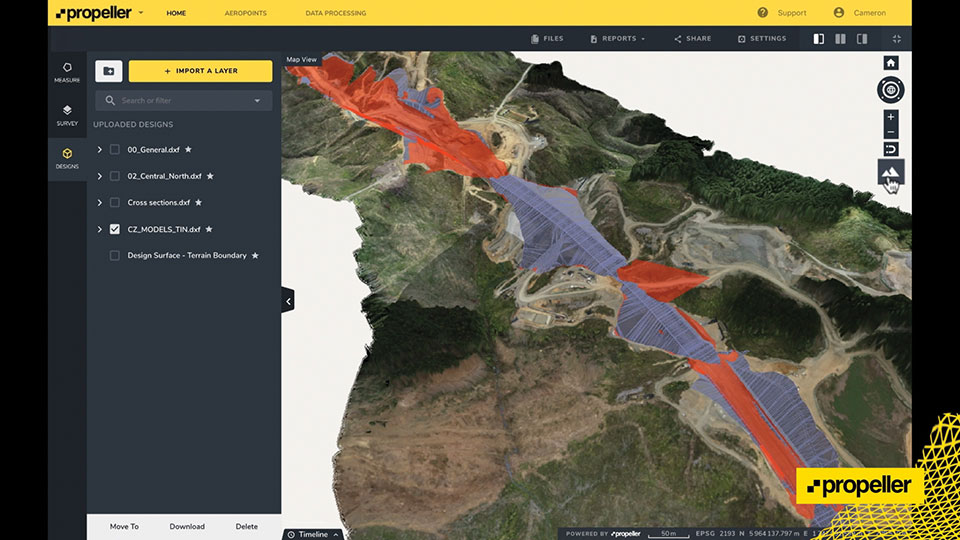
As an alternative, Wills Bros is using Propeller PPK, a drone surveying workflow that combines DJI’s Phantom 4 RTK drone; AeroPoints’ “smart” ground-control points; offloaded data processing; and the Propeller Platform software that allows measuring of the site using 3D models generated from drone images. Wills Bros also is using Trimble Stratus for cloud-based drone survey processing, visualization and analytics with Propeller Platform.
Wills Bros was able to collect an initial earthwork takeoff of the Maybole project area in a fraction of the time.
“Savings on labor costs alone have been considerable given the fact that on so many occasions we can now obtain detailed project data within a second rather than sending a man on site to survey for information,” Wills said. “The drone comes in a backpack and is up in the air doing its thing within minutes. From the outset, the time savings are immense.”
Once the drone and ground-control data are uploaded, Propeller transforms them into a 3D terrain model that can be measured in the cloud-based Propeller Platform.
The Maptitude 2021 ZIP Code Business Count data are available now. The update includes the total number of businesses by type (by six-digit North American Industry Classification System or NAIC” codes, formerly known as SIC codes).
For each business type (for instance, full-service restaurants), users can map the number that fall into each employment size category (for instance, full-service restaurants with 1-4 employees, full-service restaurants with 1000+ employees, etc.).
These data are useful for businesses and market research analysts because they allow analysis of market potential, measuring the effectiveness of sales and advertising programs, setting sales quotas, and developing budgets. Government agencies use the data for administration and planning.
The ZIP Code Business Count data are free for Maptitude 2021 users, and is also available as shapefile, KML, KMZ or GeoJSON for a fee.
A new map detailing the location, height and canopy for trees more than 3 meters in height is helping Sevenoaks District Council manage its iconic ancient trees and natural woodland.
Derived from Bluesky’s National Tree Map, which provides geospatial intelligence for more than 300 million trees across the United Kingdom, the data has already been used to create a district-wide map of tree cover, to create 3D visualizations to inform development decisions, and to support planning enforcement investigations.
Sevenoaks District Council originally purchased National Tree Map data from Bluesky in November 2019, and the data is widely used across the council with specific applications in planning.
Updated this year, the original and new tree-map layers are stored in the council’s GIS alongside multiple years of aerial photography, Ordnance Survey maps, data such as Ancient Woodland and Biodiversity Opportunities, and council data including Tree Preservation Orders and Planning Applications. The tree data is accessible to all staff via the council’s intranet mapping system GISMO (GIS Online).
The name Sevenoaks (the name given to the town and more recently to the district) dates to circa 800 A.D. and is thought to be derived from “Seouenaca,” the name given to a small chapel near seven oak trees. Records of these trees through the ages are sparse; it is not until the 19th century when a group of seven trees appears on an Ordnance Survey map.
The eponymous oak trees have been replaced many times over the years, including the planting of seven oaks to commemorate the coronation of Edward VII in 1902 and tree planting by personnel from the Canadian Air Force in 1947 in gratitude for being billeted in the town.
Bluesky’s National Tree Map is created using innovative algorithms and image processing techniques in combination with the most up-to-date and detailed aerial photography, terrain and surface height data, and color infrared imagery.
In addition to the three vector map layers — Crown Polygons, Idealised Crowns and Height Points — the Bluesky National Tree Map also includes an attribute table with unique identification for each crown feature, height attributes and area calculations.
A new blog offered by Inertial Labs discusses the scope of work to turn lidar point-cloud data collection into actionable deliverables. The blog, “Providing Actionable LiDAR Point Cloud Deliverables and the Inertial Labs RESEPI” by Luke Wilson, is also available as a downloadable PDF.
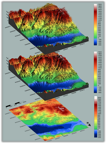
A digital terrain model, a digital surface model, and a digital elevation model (from top). (Image: Inertial Labs)
The blog introduces lidar and creation of point clouds, then discusses the use of GPS-aided inertial navigation systems (INS). “A lidar point cloud is the product of sensor fusion across a GPS-aided INS and a lidar scanner. Each sensor plays a critical role in how a lidar payload functions and the applicability of its point cloud output,” explains Wilson.
Wilson describes complications with converting datum reference frames, both traditional and reference ellipsoid such as WGS84. He also discusses projected coordinate systems. He concludes with analysis of the data using point classification — the foundation to create models including digital terrain, surface and elevation models (DTM, DSM and DEM respectively).
Finally, Wilson explains how Inertial Labs’ RESEPI is a quick and efficient way to generate models of an environment, including in fields such as construction and utility management.
RESEPI stands for REmote SEnsing Payload Instrument, Inertial Labs’ complete multiplatform, multisensor lidar and RGB payload solution for such remote sensing applications.
In 2019, the City of Hobart Sanitary and Stormwater District (HSD) in Hobart, Indiana, recognized the benefits of geospatial technology and location intelligence to transform the city. HSD reached out to Geographic Technologies Group (GTG) to write and implement a geographic information system (GIS) strategic plan.
GTG is one of the world’s leading local government GIS companies, working to advance the science of location intelligence and geospatial technology. GTG built a GIS strategic plan for HSD using high-resolution aerial imagery from Nearmap to help build on the city’s need to deliver geospatial data to customers.
“Our content integrates easily with GTG’s applications and acts as a valuable component to their strategic planning services,” said Karl Terrey, director, Global Alliances at Nearmap. “Our imagery is refreshed multiple times per year and when combined with GTG’s technology allows governments to make decisions based on conditions in their communities in near-real-time.”
Image: Geographical Technologies Group
Before GTG, HSD was maintaining a GIS viewer web app that was not user friendly, and thus underutilized.
HSD leaders recognized the need for an interface that would serve the district as well as other city departments while being easy to navigate. Nearmap’s technology corrected this, by equipping users with controls that were customized to address all the needs of its users.
Image: Geographical Technologies Group
“Our goal has always been to solve problems, and introduce a new kind of decision support for our clients,” said James Kelt, VP of Corporate Software at GTG. “Our clients love the imagery and the more we worked with Nearmap, the more we’ve been able to provide this added value to our customers.”
With the help of the user-friendly ArcGIS Hub, where citizens could access GIS tools, and GTG’s new program, the city of Hobart gained greater citizen engagement that allowed them to find information for themselves.
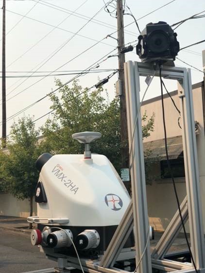
NV5 Geospatial has acquired the new Riegl VMX-2HA dual-scanner mobile mapping system. The system will initially deploy in utility and transportation projects and enable NV5 Geospatial to collect highly accurate, feature-rich data at highway speeds.
The flexibility, ease of setup, and smaller footprint will also allow the use of the VMX-2HA on various platforms, including boats, all-terrain vehicles and trains.
The VMX-2HA delivers mobile point clouds at a resolution of 1,000 to 4,000 points per square meter (pops) and 0.08-foot vertical accuracy in terms of 95% confidence intervals. It also features a high-speed 10 GigE link, which supports reliable data acquisition of up to 2 million measurements per second and image data from all integrated cameras.
NV5 Geospatial will launch the VMX-2HA as part of a mapping project for a large U.S. utility company and implement it for work being done for the U.S. Department of Transportation.
A roundup of recent products in the GNSS and inertial positioning industry from the July 2021 issue of GPS World magazine.
OEM
GNSS/INS Sensors
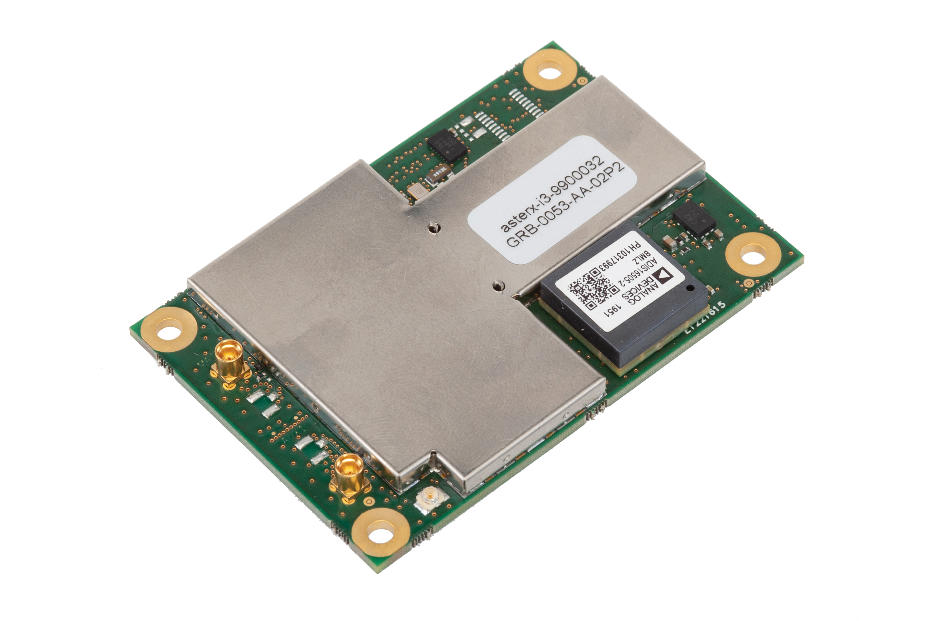
Photo: Septentrio
Five receivers in new product line
The AsteRx-i3 product family provides an array of next-generation receivers, from plug-and-play navigation solutions to feature-rich receivers with raw measurement access. Included are OEM boards and ruggedized receivers enclosed in a waterproof IP68 housing. The Pro receivers offer high accuracy positioning with 3D orientation and dead-reckoning for plug-and-play integrations. Pro+ receivers provide integrated positioning and orientation along with raw measurements, in single- or dual-antenna configurations, suitable for applications with sensor fusion. One of the receivers offers an off-board inertial measurement unit (IMU), which can be mounted exactly at the alignment point of interest.
The RES 720 GNSS dual-frequency embedded timing module provides next-generation networks with 5-nanosecond accuracy. It uses L1 and L5 GNSS signals to provide superior protection to jamming and spoofing, mitigates multipath in harsh environments, and adds security features to make it suitable for resilient networks. At 19 x 19 millimeters, the RES 720 is suitable for 5G Open Radio Access Networks (RAN)/XHaul, smart grids, data centers, industrial automation and satellite communication networks, as well as calibration services and perimeter monitoring applications.
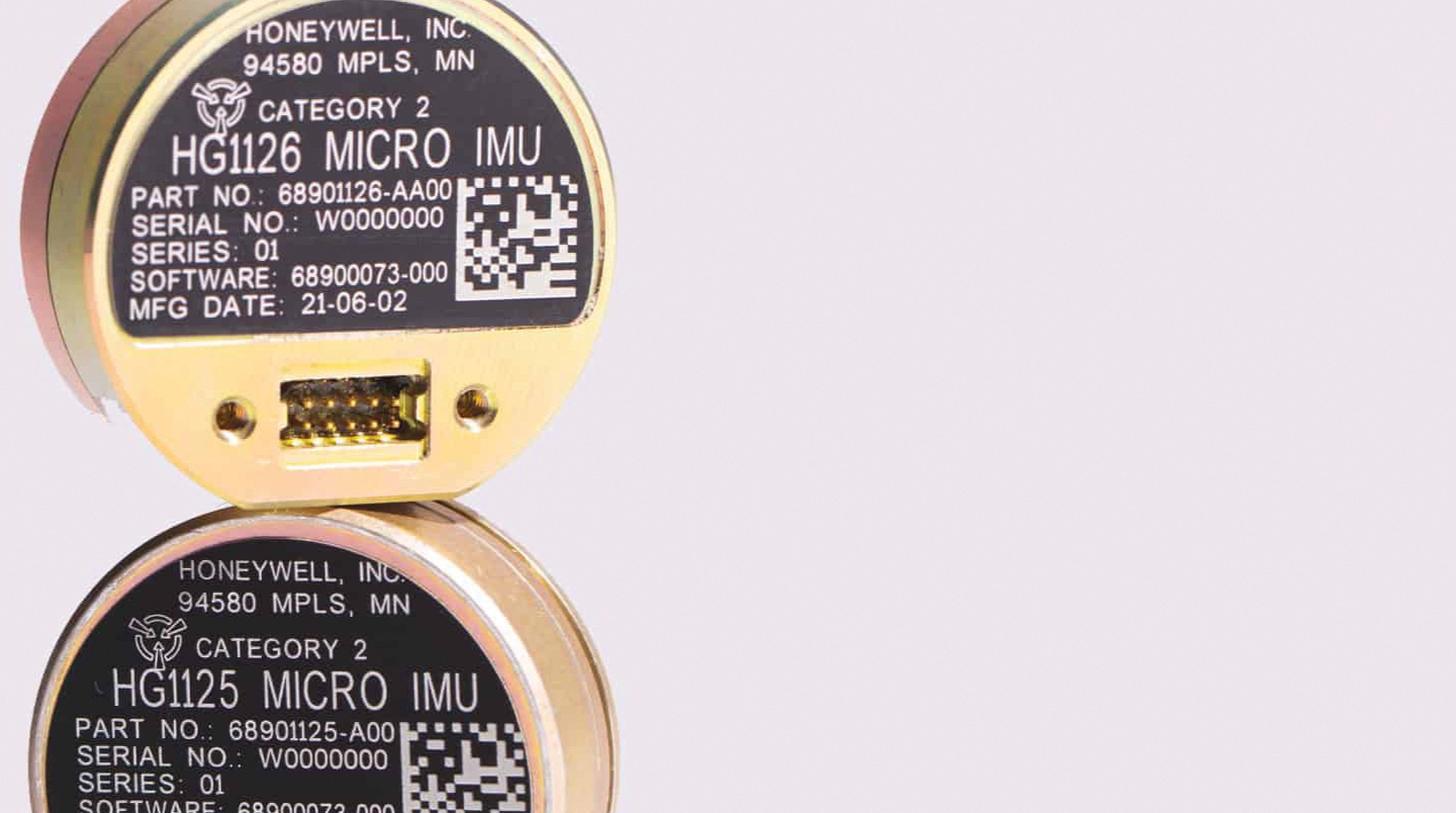
The new HG1125 and HG1126 IMUs are low-cost inertial measurement units that serve both commercial and military applications. They use sensors based on micro-electromechanical systems (MEMS) technology to precisely measure motion. They can survive shocks up to 40,000 G-force. The HG1125 and HG1126 can be used for a variety of defense and commercial applications, such as tactical military needs, drilling, unmanned aerial vehicles or navigation systems for general aviation aircraft.
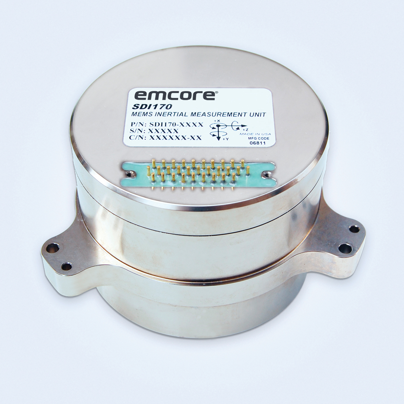
The SDI170 quartz MEMS tactical-grade IMU is designed as a form-, fit- and function-compatible replacement for the HG1700-AG58 ring-laser gyroscope (RLG) IMU, but with superior overall performance, versatility and a significantly higher mean time between failures (MTBF) rating over ruggedized environments. The SDI170 IMU delivers highly linear accelerometer performance and longer life compared to the HG1700 IMU.
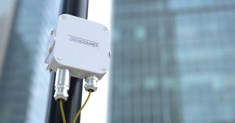
The OSA 5405-MB is a compact outdoor precision time protocol (PTP) grandmaster clock with a multi-band GNSS receiver and an integrated antenna. It ensures timing accuracy by eliminating the impact of ionospheric delay variation, enabling communication service providers and enterprises to deliver the nanosecond precision needed for 5G fronthaul and other time-sensitive applications. A multi-constellation GNSS receiver and antenna enable the OSA 5405-MB to meet PRTC-B accuracy requirements (+/–40 nanoseconds) even in challenging conditions. It receives GNSS signals in two frequency bands, using the differences between them to calculate and compensate for ionospheric delay variation. The OSA 5405-MB is resilient against jamming and spoofing, considered critical for 5G synchronization. It can work with up to four GNSS constellations concurrently (GPS, Galileo, GLONASS and BeiDou).
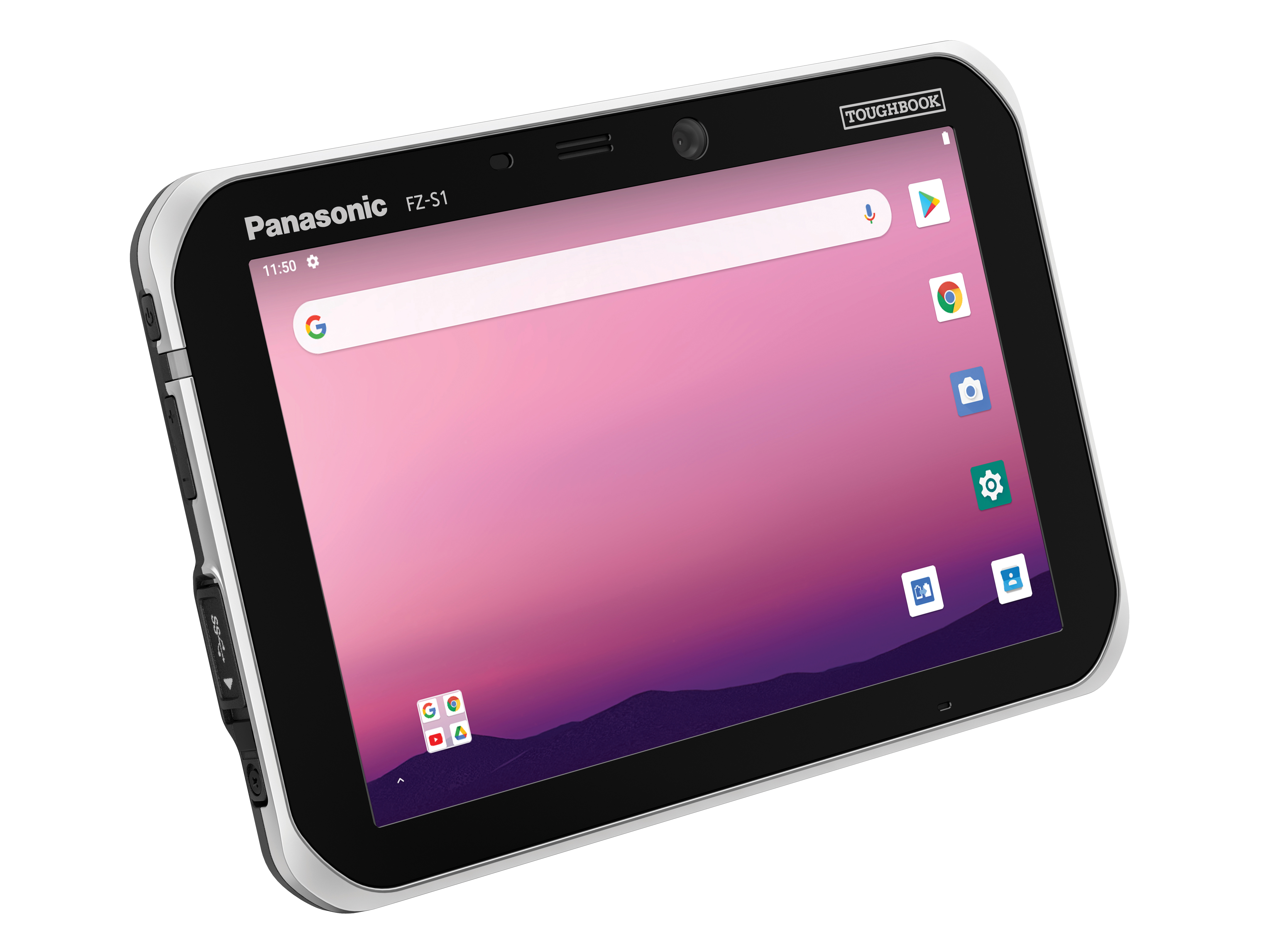
The Toughbook S1 is a fully rugged 7-inch Android tablet for capturing and accessing critical information in the field. GPS and LTE come optionally. The tablet is supported by Productivity+, a comprehensive Android ecosystem that enables customers to develop, deploy and sustain the Android OS environment in the enterprise. The Toughbook S1 tablet’s compact, rugged and lightweight body is made for portability and reliability for field workers. It has a 14-hour battery life and warm swap battery. Features include a sleek outdoor-readable anti-reflection screen, patented rain mode and multi-touch performance whether using a stylus, finger or glove.
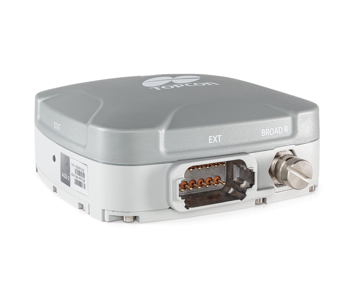
The AGS-2 and AGM-1 are manual guidance and autosteering receivers. Location data enable crop optimization, including soil preparation, seeding, crop care and harvesting. Designed to suit virtually any agricultural machine type, make and model, the AGS-2 receiver and steering controller combines steering with network reception and tracking. It comes standard with DGNSS correction services and is upgradeable using NTRIP and an optional RTK radio in the Topcon CL-55 cloud connectivity device. The AGM-1 is offered as an economical entry-level manual-guidance receiver.
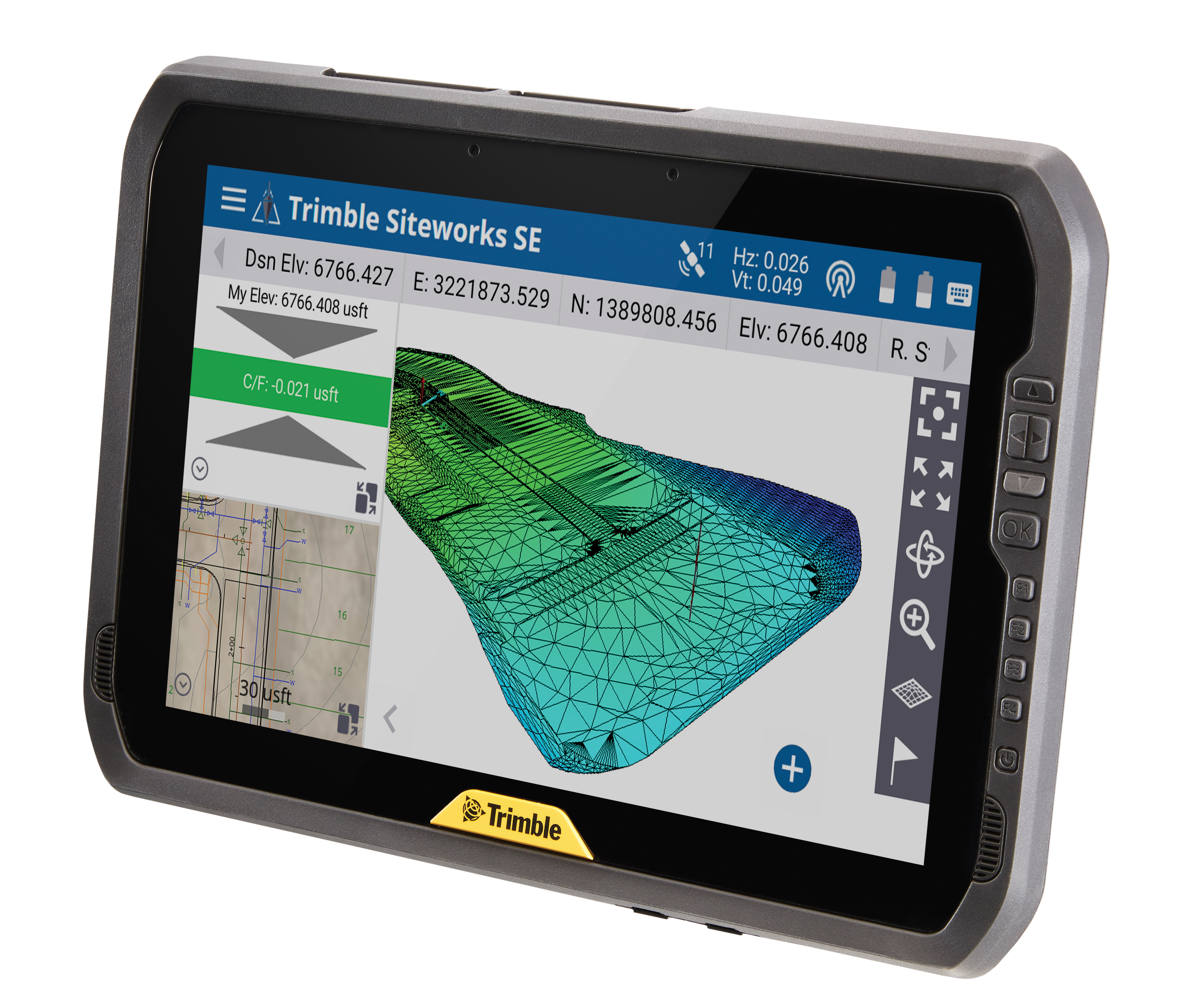
Provides fast data processing for construction and surveying
The Trimble T100 high-performance tablet is suitable for both experienced and novice users. It is optimized for Trimble Siteworks Software and supporting office applications such as Trimble Business Center. Its accessories are designed to complement user workflows, enabling users to complete quality assurance and quality control before leaving the field. The tablet is designed to be flexible and usable in a variety of configurations and job sites. It is engineered to be ergonomic and portable on and off the pole. Features include a 10-inch (25.4 cm) sunlight-readable touchscreen display, a directional keypad with programmable function keys and a 92-Wh internal battery.
Surfer has new gridding, contouring and surface mapping software to make it easier for users to visualize, display and analyze complex 3D data. Surfer enables users to model data sets, apply an array of advanced analytics tools, and graphically communicate the results. The scientific modeling package is used in oil and gas exploration, environmental consulting, mining, engineering and geospatial projects. Enhancements have been made to 3D Base Maps, Contour Volume/Area Calculation, 3D PDF Exporting Options and automated features for creation of scripts and workflows.
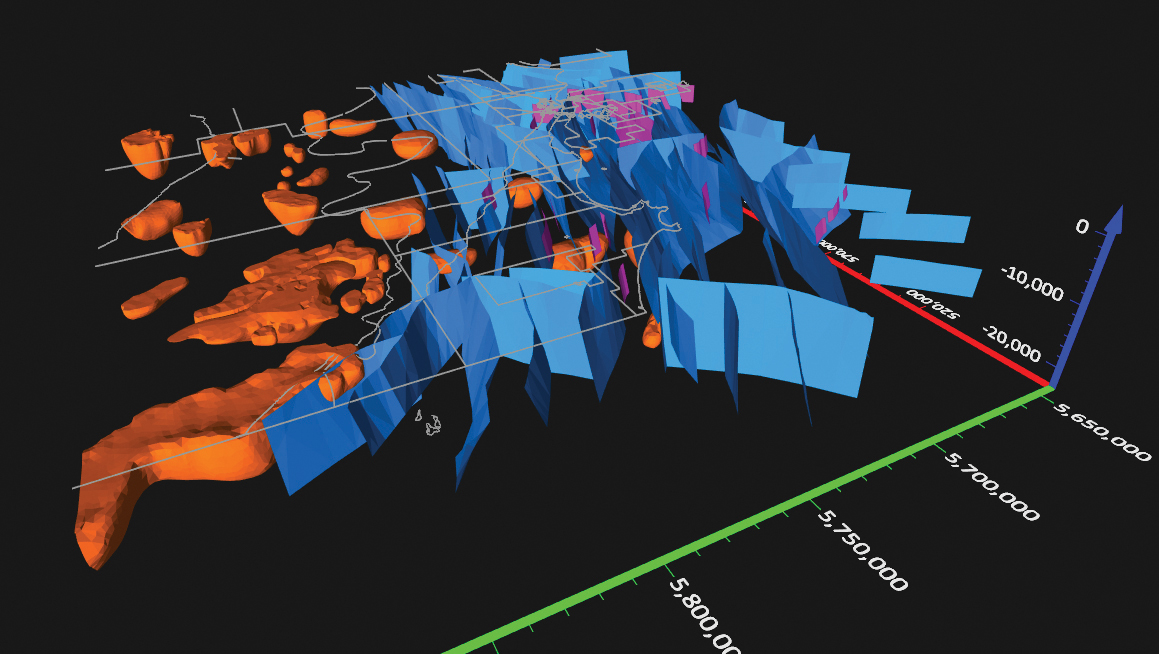
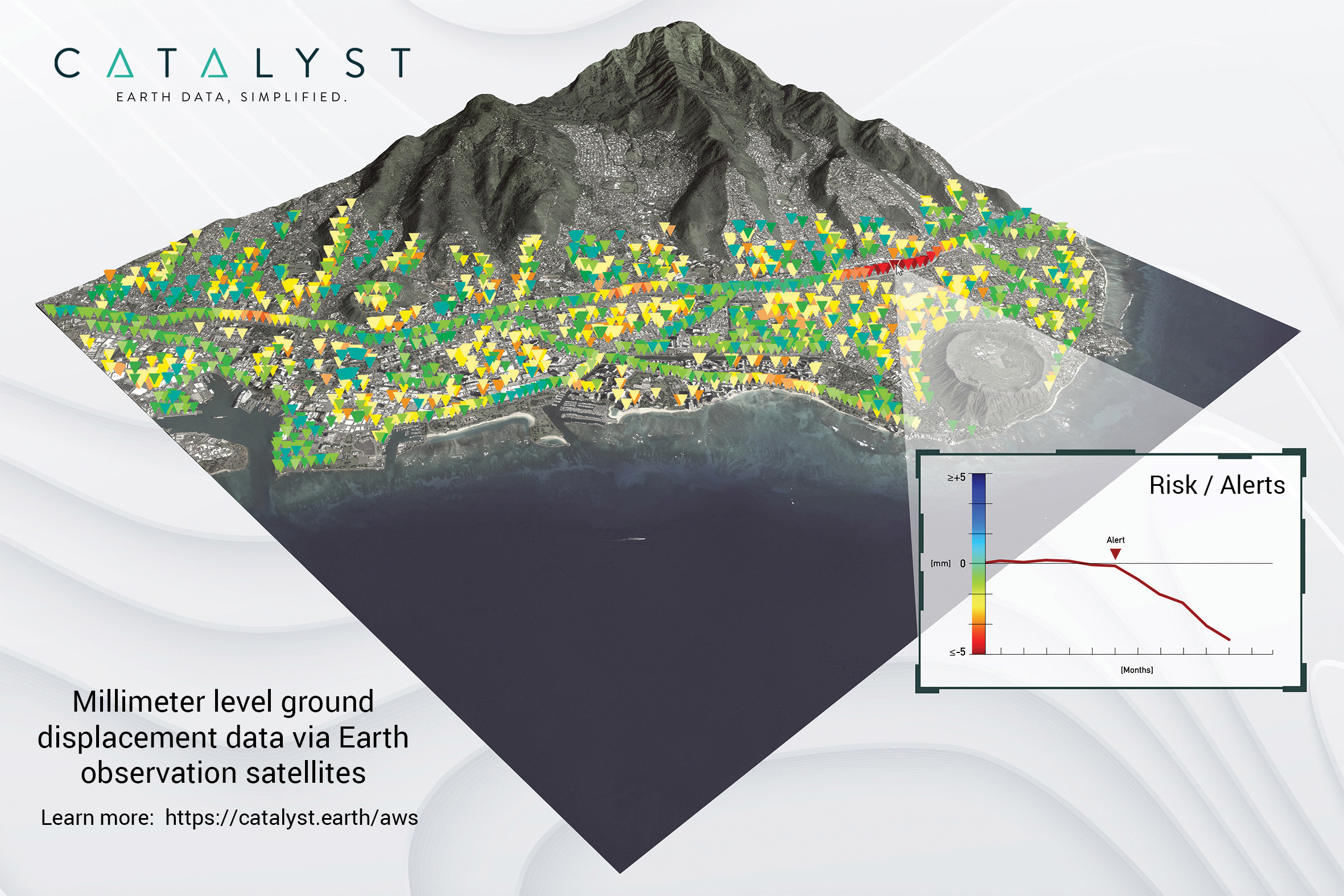
A Catalyst-AWS collaboration delivers actionable geoscience analytics to users, providing satellite-based Earth observation intelligence. The data and analytics are delivered via Amazon Web Services (AWS) Cloud. Catalyst is a PCI Geomatics brand. The initial solution, available through AWS Data Exchange, is an infrastructure risk-assessment service that uses satellite data to continuously monitor millimeter-level ground displacement over a subscriber’s area of interest anywhere on Earth. Catalyst is exploring additional risk mitigation solutions and monitoring services using AWS. Having image processing science and imagery on the cloud reduces latency and costly data transfers.
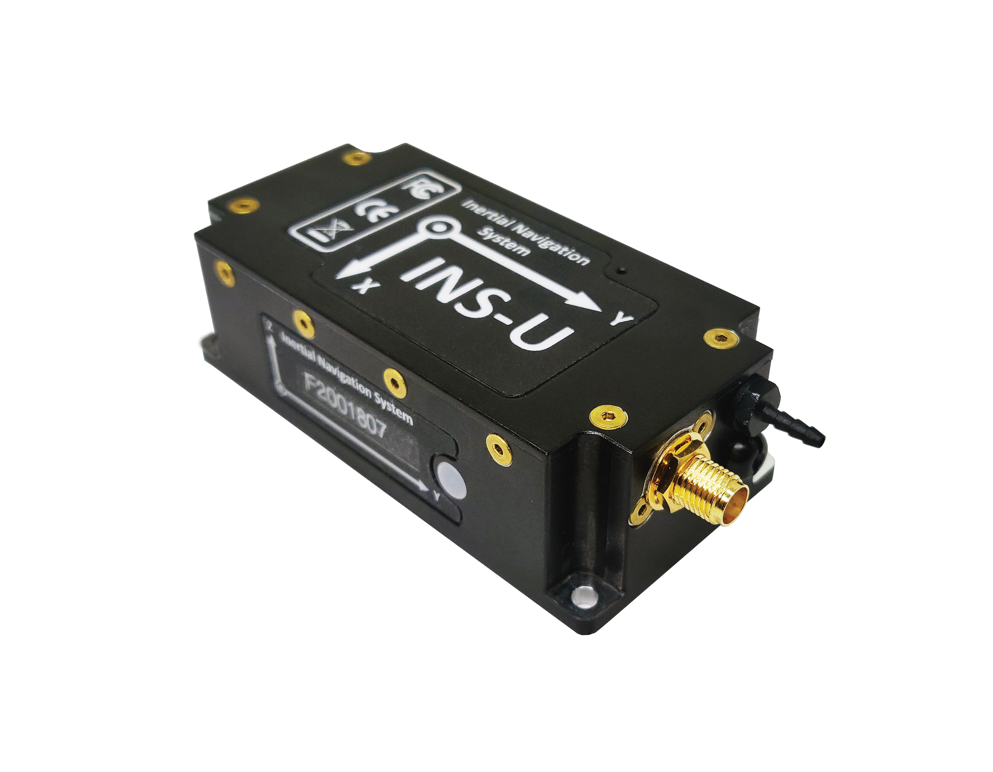
The GPS-aided INS-U is a fully integrated attitude and heading reference system (AHRS), IMU and air-data computer high-performance strapdown system that determines position, navigation and timing information for any device on which it is mounted. The INS-U uses a single antenna, multi-constellation u-blox GNSS receiver. With access to GPS, GLONASS, Galileo, QZSS and BeiDou, the INS-U can be used in a variety of GPS-enabled environments and is protected against spoofing and jamming. The INS-U has two barometers, a miniature gyro-compensated fluxgate compass, and tri-axis temperature-calibrated advanced MEMS accelerometers and gyroscopes. These high-performance sensors, along with Inertial Labs’ new on-board sensor-fusion filter, and state-of-the-art guidance and navigation algorithms, provide accurate position, velocity and orientation of the device under measurement.
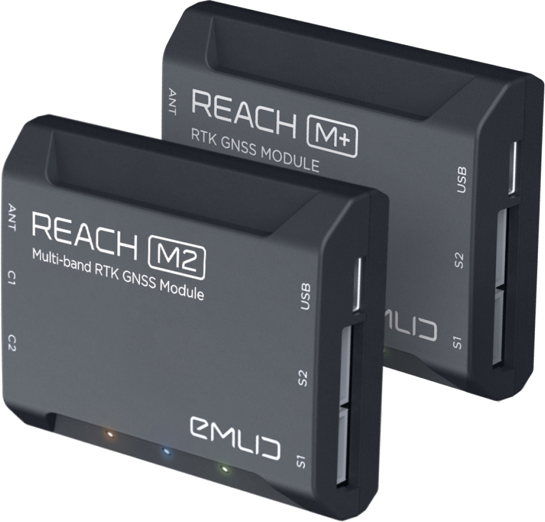
The Reach M+ and Reach M2 positioning modules for UAV mapping provide centimeter-level accuracy in real-time kinematic (RTK) and post-processed kinematic (PPK) modes, enabling precise UAV mapping with fewer ground control points. The Reach M+ single-band receiver has a baseline up to 20 kilometers in PPK. The Reach M2 is a multi-band receiver with a baseline up to 100 kilometers in PPK. Reach connects directly to a camera’s hot-shoe port and is synced with the shutter. Time and coordinates of each photo are logged with a resolution of less than a microsecond. Reach captures flash sync pulses with sub-microsecond resolution and stores them in a raw data RINEX log in the internal memory. This method allows ground control points to be used only to check accuracy.
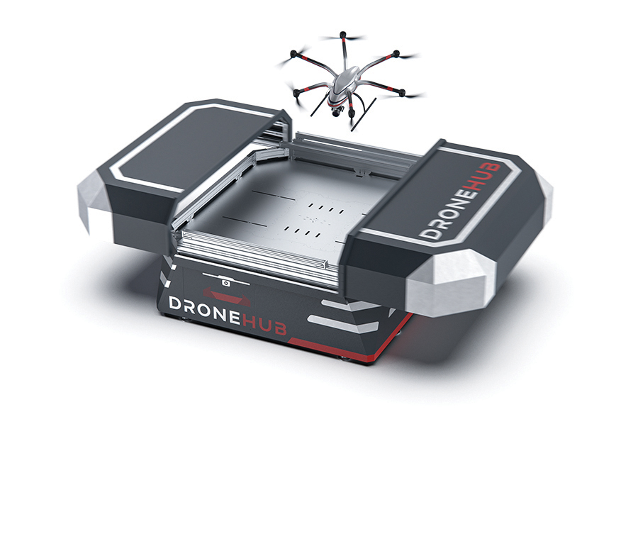
System simplifies drone inspection missions, deliveries
The Dronehub is an automated solution that can provide undisturbed drone service 24/7 in nearly any weather condition. With the integration of IBM artificial intelligence technology, Dronehub solutions can operate and automatically provide information with little human interaction. The system includes the drone and a docking station with automatic battery replacement. It can fly for 45 minutes in +/–45° C weather, up to 35 km in winds up to 15 m/s. It can carry a payload up to 5 kg as far as 15 km. It can be used for monitoring, inspection and measurement; cargo transport and parcel deliveries; and mobile ground infrastructure; and security.
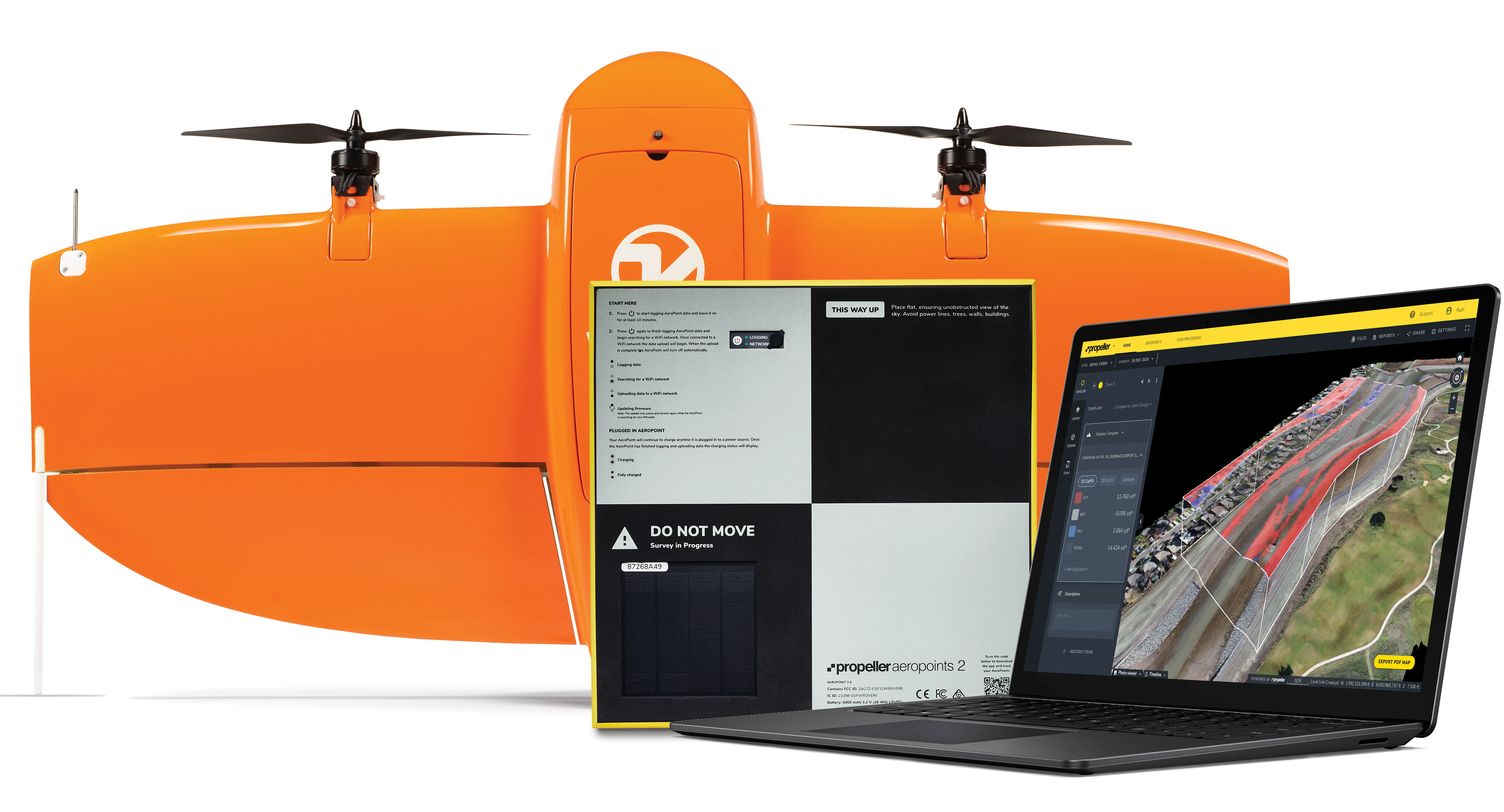
The Propeller Platform and WingtraOne drone package enable construction professionals to collect survey-grade data across the worksite consistently and accurately. To operate, surveyors place Propeller AeroPoints (smart ground-control points) on their worksite, and then fly the WingtraOne drone to collect worksite survey data. Survey images are uploaded to Propeller’s cloud-based platform, where the fully automated geotagging and photogrammetry processing is completed within 24 hours of submission on the platform. Uses include mines, road and railway projects, highways and industrial complexes. Data collection with AeroPoints and Propeller PPK can serve as a reliable, single source for survey data and progress. Teams across the entire worksite can view geographically accurate and realistic 3D site models and track, inspect and report on job progress and productivity safely and accurately.
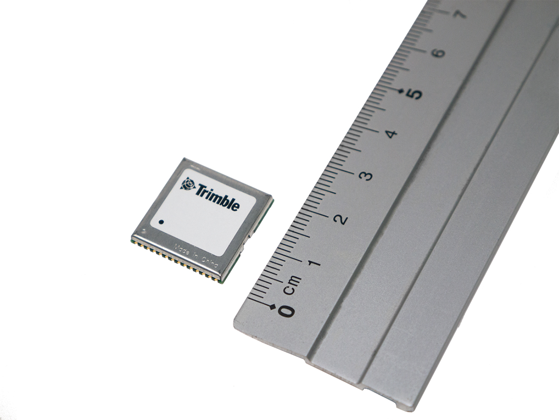
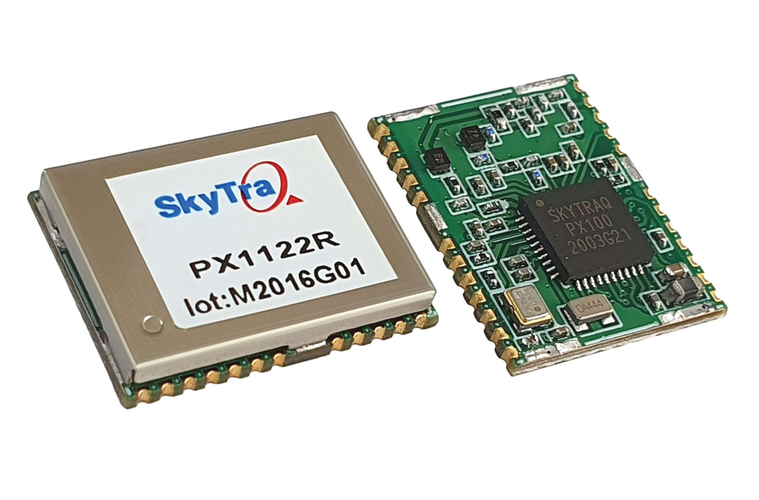
Stamp-sized module provides RTK positioning and heading
The PX1122R is a high-performance multi-band quad-GNSS real-time kinematic (RTK) receiver featuring 1 cm + 1 ppm position accuracy and under 10-second RTK convergence. It has a 12 x 16 millimeter form factor, about the size of a postage stamp. It can be configured for a base or a rover, and supports a moving base RTK for precision heading applications. The PX1122R has a maximum quad-GNSS RTK update rate of 10 Hz, providing a quick response time and more stable performance for fast-moving precision guidance applications.
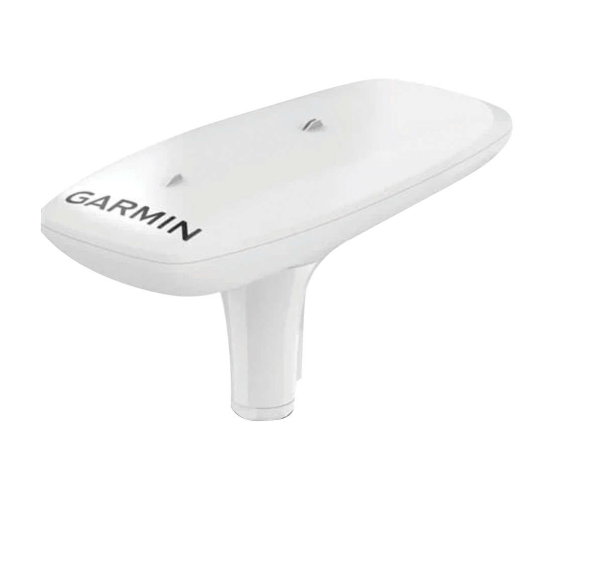
Utilizing both L1 and L5 GPS frequencies, along with multi-constellation support (GPS, Galileo, GLONASS and BeiDou), the MSC 10 marine satellite compass provides precise positioning and heading accuracy within 2 degrees. Its 10-Hz position update rate delivers detailed tracking information. It eliminates magnetic interference, which can degrade heading accuracy. The MSC 10 is easy to install and can be used as the primary position and heading sensor across multiple systems, including autopilots. If the satellite signal is lost, it will transition from GPS-based to a backup magnetometer-based heading.
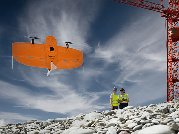
A new vertical-takeoff-and-landing (VTOL) drone — the WingtraOne GEN II — is now available. The GEN II offers industrial reliability and mapping versatility with an oblique camera configuration for high-quality 3D drone-mapping data capture.
Drone maker Wingtra spent six years developing the GEN II, and tested it over 100,000 flights. Its WingtraOne is being used by professionals worldwide across many industries.
According to Wingtra, the GEN II represents a solid step forward in industrialization and reliability along with new perks that push the previous limits of commercial mapping drones.
The WingtraOne GEN II. (Photo: Wingtra)
Oblique 3D Mapping Payload
“We wanted to make the WingtraOne drone even more versatile for our customers. So next to our flagship 42MP Sony RX1, we’re including new, high-end mapping payloads,” said Maximilian Boosfeld, co-founder and CEO of Wingtra. “I’m especially excited to announce our oblique solution, which offers outstanding 3D mapping results. It’s the perfect choice for capturing infrastructure — from a single industrial plant to entire cities.”
WingtraOne’s GEN II oblique mapping solution is backed by signed partnership agreements with Bentley Systems and Esri. To demonstrate the power of GEN II carrying its Oblique Sony A6100 payload, the Wingtra team mapped the city of Zurich, Switzerland, in six flight hours, producing a 3D model processed with both Bentley ContextCapture and Esri’s Site Scan for ArcGIS. Bentley and Esri’s software are both recommended for processing Wingtra oblique datasets.
“Bentley Systems is delighted to partner with Wingtra to transform high-resolution oblique imagery from WingtraOne drones into 3D reality meshes — an ideal starting point for infrastructure digital twins,” said Phil Christensen, VP, Industry Solutions, iTwin Context, Bentley Systems. “This enables our common users to perform analytics on the resulting models as well as leverage Bentley’s iTwin platform to share performant, city-scale digital twins.”
“Our partnership with Wingtra unlocks new capabilities for Site Scan for ArcGIS users by allowing them to create wide-scale and accurate 3D meshes leveraging the oblique payload on the WingtraOne Gen II,” said Richard Cooke, director of Global Business Development at Esri. “These high-resolution images processed through Site Scan produce an enriched 3D GIS for our users who require modelling of open-pit mines, accurate construction updates, creation of digital twins for cities, and more.”
The WingtraOne GEN II drone was used to map Zurich and create a digital twin of the city. (Image: Wingtra)
Integrated PPK and Self-Diagnosis
WingtraOne GEN II features post-processed kinematic (PPK) ability integrated on every drone, including multispectral Altum and RedEdge payloads, as well as advanced fail-safe and self-diagnosis algorithms and services for dependable operations.
“We have studied over 100,000 flights and all incoming customer reports to understand what the limits might be so we can push them further,” said Julian Surber, Wingtra product manager. “As a result, we’ve designed many reliability tools for GEN II to guarantee uninterrupted operations.”
Wingtra’s engineering team has redesigned the electronics of the GEN II from its predecessor WingtraOne for increased reliability, including a more powerful onboard computer, optimized PCB designs, and a new navigation and heading unit developed inhouse.
The GEN II runs through health-monitoring algorithms for motors, servos, batteries, camera, PPK and onboard sensors, health self checks that minimize the potential of flight with unsafe equipment.
Precision Agriculture Boost
Wingtra’s top-of-the-line multispectral payloads Micasense Altum and RedEdge will now be paired with high-accuracy PPK, which improves the quality of multispectral insights for uses such as irrigation management and prescription maps for pesticides.
Seoul Robotics has launched Voyage, a plug-and-play lidar perception system. The all-in-one deployment kit is equipped with the company’s proprietary software SENSR2, lidar sensors and a computer.
Seoul Robotics is a 3D computer vision company using artificial intelligence (AI) and machine learning for intelligent robotic perception systems. The company’s sensor-agnostic perception software is deployed by BMW, Mercedes-Benz, the Chattanooga Department of Transportation and Emart, among others.
Seoul Robotics provides companies, institutions and governments with the software behind the sensor that enables its use in markets such as retail, smart cities and security. Voyage is designed to help organizations and communities increase efficiencies and improve safety through a cost-effective, customizable system.
The lidar market, which is on track to reach more than $3 billion by 2025, has become crowded over the past several years as the technology became synonymous with autonomous vehicles. The marketplace is flooded with companies producing sensors to fuel the demand of this industry, but most sensors on the market are sold without any intelligence, leaving companies to develop software in-house, which significantly increases the time and cost of deployment.
With Voyage, organizations are not obligated to purchase a particular sensor if it is not a fit for the solution they are deploying. Customers don’t have to worry about changing software when they change or upgrade their sensors — Voyage is a non-proprietary solution that breaks down the barriers to entry and allows for quick access to 3D vision, according to Seoul Robotics.
“First and foremost, lidar sensors do not work without sophisticated perception software. The lidar industry is investing billions of dollars on sensors without even considering the software needed to interpret the data into actionable solutions,” said HanBin Lee, CEO of Seoul Robotics. “Voyage combines analytics and sensors to bring tangible solutions to market much faster.”
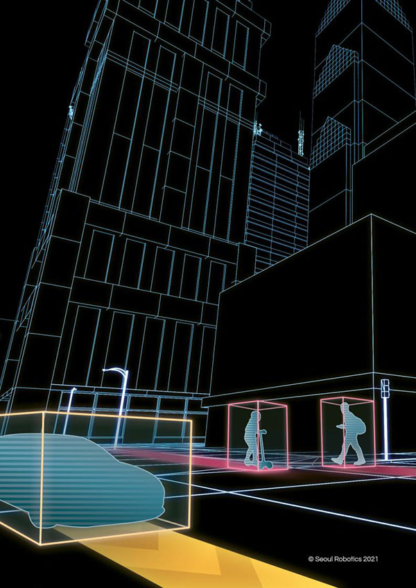
Voyage provides highly accurate object detection, tracking and classification capabilities to enable a wide range of applications for smart cities, intelligent transportation systems, retail analytics, crowd monitoring and security. It fuses three cutting-edge technologies:
3D lidar sensing powered by Seoul Robotics’ proprietary software SENSR2
Edge computing for minimum data burden and ease of integration
Built-in sophisticated perception software for instantaneous analytics
Voyage provides centimeter-accurate 3D object detection, tracking, and classification in addition to volumetric profiling and motion prediction capabilities, regardless of lighting conditions, and can collect and process data from up to four sensors for seamless insights across the sensor coverage zones. As Voyage does not capture, show or store any biometric and otherwise identifying data, it aims to maximize the protection of people’s privacy when installed as part of various smart cities and security systems.
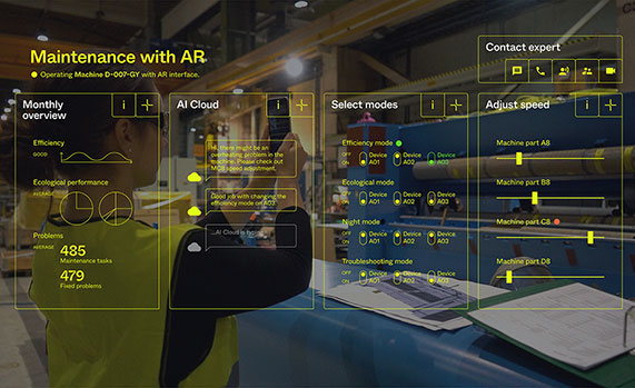
Hexagon AB has acquired Immersal Oy, an innovator of spatial mapping and visual positioning solutions for producing augmented reality (AR) applications.
AR applications enhance real-world experiences by augmenting a user’s visual perception with the display of digital content in the physical world.
AR’s ability to weave context-specific, 3D information into physical spaces provides endless opportunities to save time, improve performance and reduce costs across a wide range of industries and applications — from surveying, construction, public safety and manufacturing to maintenance, training and navigation applications.
An immersive experience can help boost task efficiency, improve safety protocols, optimize workflows and increase collaboration.
The Immersal SDK (software development kit) allows developers to merge and “anchor” digital content to real-world objects – with precise accuracy to their actual location in the physical space — by enabling a user’s mobile device to locate and orient itself in the surrounding physical world using machine-readable maps.
The maps, which are used for visual positioning, are constructed from image data supported by various mapping devices (including mobile phones) and hosted in the Immersal Cloud Service.
“Hexagon has long been a leader in delivering smart digital realities that combine inputs from reality capture sensors with advanced visualisation software and tools to enable remote, location-based intelligence. This acquisition puts the power of these insights into the hands of those on-site, enhancing their field of view with superimposed digital information, meaning they can literally do more with what they see,” said Hexagon President and CEO Ola Rollén. “For example, direct access to information about an asset — while working with that asset — including step-by-step instructions on how to repair it, can streamline maintenance tasks while reducing material waste and re-work.”
Immersal has years of experience developing AI and machine learning-based spatial anchor technology, which “anchors” virtual objects or models for viewing on different devices in the same position and orientation. This unlocks a wide variety of location-based solutions and services — from consumer-oriented augmented reality applications in gaming and media and entertainment to digital twin solutions on an enterprise scale.
Immersal’s technology can map large spaces — both indoors and outdoors — and works both offline on-device and online using the Cloud Service.
Founded in 2015 and headquartered in Helsinki, Finland, Immersal will operate as part of Hexagon’s Geosystems division. The acquisition has no significant impact on Hexagon’s earnings.
Deal makes data from 40 Chinese satellites available through UP42 now, another 40 by late 2021
UP42 has signed an agreement with HEAD Aerospace of Beijing to make image data from more than 40 Chinese Earth Observation satellites available on the UP42 marketplace.
The broad selection of imaging capabilities from the constellations dramatically expands the range of applications in multiple sectors, with the most significant benefits expected in infrastructure, transportation, utilities, agriculture and government.
The UP42 marketplace contains more than 50 geospatial data sets, including satellite imagery from six international organizations. The newly added satellites’ diverse and often unique imaging capabilities include wide-swath imaging at very high resolution, nighttime acquisitions, frequent intraday revisits, tri-stereo collection and hyperspectral imaging.
“This partnership is an important milestone for us as a company but, more importantly, for our customers. By diversifying our data sets, we are unlocking a broader spectrum of use cases for our users in multiple sectors. This is the true meaning of ‘democratizing access to Earth insights’,” said UP42 CEO Sean Wiid.
HEAD Aerospace is an international distributor of satellite imagery collected by commercial Earth Observation missions. The UP42-HEAD agreement includes imagery from multiple constellations, including SuperView, Earthscanner, Gaofen-7, DailyVision, NightVision, Hyperscan, and Tri-Stereo ZY3. These seven constellations will total more than 80 satellites by the end of 2021.
“Sharing a similar approach facilitating users’ easy access to an agnostic data source by a centralized portal with a wide choice of satellite attributes, we are glad to have partnered with UP42. This partnership represents another new milestone for us in expanding our global network.” said Kammy Brun, managing director of HEAD Aerospace.
While each satellite constellation was designed with one or more imaging specialties, a remarkable variety of operational capabilities are shared across the constellations to support numerous applications and industries. Examples include:
Large-Area Very High-Resolution Mapping – Planning and monitoring critical infrastructure, including utility transmission grids and transportation networks, can be performed for entire states, countries and regions. Up to 40,000 square kilometers can be covered with wide-swath (136 km) imagery captured at a half-meter spatial resolution on a single pass.
Intraday and Early Morning Monitoring – The EarlyEye tasking product leverages multiple HEAD Aerospace constellations to deliver early-morning frequent images, an hour earlier than usual commercial offer at 10:30 a.m. Designed for frequent monitoring of critical assets and rapidly changing situations related to energy security, defense/intelligence and infrastructure management, a high-resolution revisit schedule of four times per day is possible, with 15-minute revisit between 09:00 and 13:30 anywhere on Earth to be possible by the end of 2021.
High Vertical Accuracy Mapping – Multiple satellites perform stereo imaging at high resolution for high-quality land use and cadastral mapping. One constellation captures single-pass tri-stereo imagery validated with onboard laser altimetry data, generating digital elevation models (DEMs), digital terrain models (DTMs), and other large-scale 3D mapping products with vertical accuracy of 5 meters. Additionally, the SuperView constellation captures daily stereo imagery with vertical accuracy of better than 2 m.
Hyperspectral Imaging – Imaging in 25 spectral bands spanning the visible, near-infrared, and mid-infrared portions of the spectrum is designed for regional natural resource management: detecting crop stress and planning pesticide/fertilizer applications, species mapping of forests and vegetative land cover, and protecting environmentally sensitive areas. These data sets can also be used in agriculture monitoring, mineral exploration and water-quality monitoring.
Nighttime Imaging – Monitoring and surveillance activities by government entities, energy utilities and security organizations can be carried out around the clock with true-color, high-resolution at 1 m optical and video imaging during daylight and dark of night. Nighttime collection is suitable for surveillance such as illegal camping, border surveillance, change detection (especially in rapidly evolving events), powerline incidents and designing streetlight placement in urban settings. Day and night video can detect vehicle and ship movement.
UP42 users have a growing selection of satellite imagery to choose from on the geospatial marketplace. UP42 technical experts are available to assist customers in selecting the best data set to meet the needs of specific end-use applications in all industries and sectors. These experts can also help in tasking a satellite for new image acquisition or querying the archive to obtain existing imagery.