M3 Systems and TilT Consulting on June 1 were declared winners of the MyEUspace Competition 2021 for their passive radar for detection and localization of obstacles based solely on GNSS signals.
The SANGENE project (Sens And Navigation on GNSS ENvironment Estimation) aims to demonstrate the concept of an integrated GNSS-based passive radar for the detection and first localization of obstacles.
The SANGENE solution is a passive radar technology based solely on GNSS signals integrated into a localization and navigation device currently available onboard an aircraft or a drone. Today’s operational navigation equipment often use a combination of equipment to identify and locate other carriers or obstacles, but these means do not permit detection and visualization of non-equipped or uncooperative carriers, and can be a source of danger.
As “signals of opportunity,” GNSS signals can be used for detecting obstacles. With reflected signals, GNSS satellites behave as multiple radar signal sources that are widely available while remaining discrete.
This principle of passive detector also makes it possible to increase the localization capacity of the GNSS devices already present, without having any major architectural changes to their design.
Within a few months, this solution has passed from a first level of concept and definition to an implementation model. With the impetus provided by the competition, the validation phase will soon begin.
The MyEUspace Competition was organized by the European Union Agency for the Space Program (EUPSA) to support development of innovative commercial solutions — such as mobile apps or hardware-based solutions — that leverage Galileo or Copernicus EU space data.
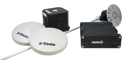
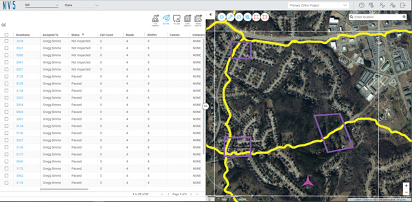
Customizable system provides robust positioning without added site infrastructure for IHI Corp.
Photo: Trimble
Trimble has announced the first deployment of its map-based localization system for land-based autonomous vehicle applications.
IHI Corp., a heavy industry manufacturer based in Japan, will retrofit its existing container and haulage trucks with a customized Applanix POS LV system as part of its broader autonomy capabilities for the transport of goods around industrial facilities.
Map-based localization provides precise positioning and orientation estimation, augmenting GNSS/inertial data, which is critical for safe and efficient autonomous vehicle operations. The ability to provide IHI Corp. a full workflow and real-time data ensures seamless integration into IHI’s truck design.
The custom-built, locally supported system leverages Trimble’s engineering capabilities and technology to provide reliable performance across a variety of challenging environments, the company said. Using this system, IHI Corp. can provide robust positioning for its autonomous fleet without additional site infrastructure, lowering capital expenditure costs and improving scalability.
Tailoring POS LV to work within IHI’s unique specifications and existing autonomous platform, the map-based localization system couples an inertial navigation system (INS) with simultaneous localization and mapping-based (SLAM) capabilities, and works with several types of sensors, including lidar. POS LV provides an accurate base map using post-processed data and localizes vehicle positioning in real time, enabling the reliable and safe autonomous operation of industrial vehicles.
IHI continually enhances its work environments, while also compensating for varying labor scenarios and personnel shortages. This makes the need to automate transportation critical to operations. The complexities of the evolving industrial manufacturing environment require solutions that can be tailored to a customer’s specific application requirements.
By partnering with Trimble, IHI can develop a retrofit system that addresses two major challenges — affordability and reliability — within the autonomous operation of large-scale industrial equipment.
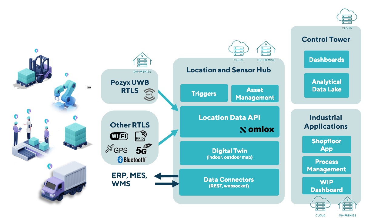
The Pozyx Platform is an asset tracking and identification solution for seamless indoor and outdoor tracking, based on the omlox hub and supporting multiple location technologies.
The omlox hub is an open standard for real-time location systems (RTLS) that combines location data from GPS, ultra-wideband, 5G, radio-frequency identification, Wi-Fi and Bluetooth.
The Pozyx Platform offers a seamless indoor/outdoor transition with zoom-in from a worldwide map to a detailed indoor map, showing highly accurate locations up to 10 cm. It is designed for smart manufacturing, providing a supply-chain solution that supports Industry 4.0.
It tracks and identifies any asset, providing real-time data to facilitate warehouse and inventory control, keep track of critical tools, and slash lost asset costs.
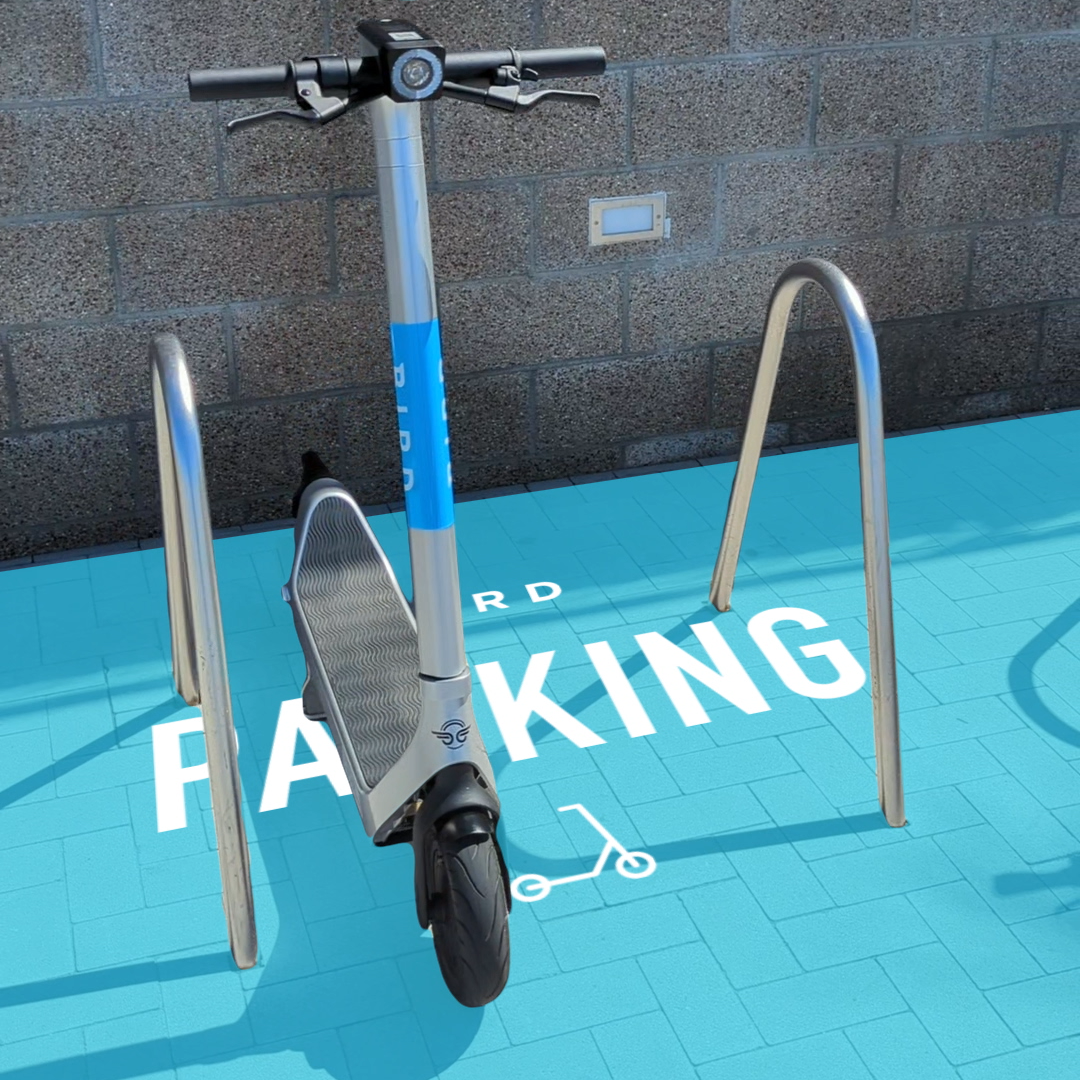
Bird uses the ARCore Geospatial API to enable a scooter parking app. (Image: Bird)
Google has launched the ARCore Geospatial API in ARCore software development kits (SDKs) for Android and iOS across all compatible ARCore-enabled devices.
The application programming interface (API) is available at no cost to download and opens up nearly 15 years of Google Maps data to help developers build more useful and immersive augmented reality (AR) experiences.
“The Geospatial API provides access to global localization — the same technology that has been powering Live View in Google Maps since 2019, providing people with helpful AR-powered arrows and turn-by-turn directions,” explains a Google blog.
“Based on the Visual Positioning Service (VPS) with tens of billions of images in Street View, developers can now anchor content by latitude, longitude and altitude in more than 87 countries, without being there or having to scan the physical space, saving significant time and resources.
“For end users, discovering and interacting with AR is faster and more accurate as images from the scanned environment are instantaneously matched against our model of the world,” the blog states. “This model is built using advanced machine-learning techniques, which extract trillions of 3D points from Street View images that are then used to compute a device’s position and orientation in less than a second.
“In other words, users can be anywhere Street View is available, and just by pointing their camera, their device understands exactly where it is, which way it is pointed and where the AR content should appear, almost immediately.”
Early-access partners include the NBA, Snap and Lyft, who are exploring and building applications in areas such as education, entertainment and utilities. For example, micromobility companies Bird, Lime and WeMo are using the API to remove friction from parking e-scooters and e-bikes, adding pinpoint accuracy so that riders know exactly when their vehicle is in a valid parking spot. Lime has been piloting its app in London, Paris, Tel Aviv, Bordeaux, Madrid and San Diego.
The partnership will help to grow global adoption of the u-blox PointPerfect high-precision positioning service, in particular for automotive applications.
U-blox and Geespace have signed a memorandum of understanding (MOU) on the expansion of their respective augmentation services for high-precision applications.
Geespace is a provider of aerospace information and communications infrastructure and application solutions. Both partners will be able to extend their service offering to the U.S., European and Chinese markets, primarily in the automotive sector.
The rise of reliable and cost-effective high-precision positioning has improved the accuracy of GNSS solutions to the order of tens of centimeters, enabling a plethora of new applications in automotive, as well as industrial and robotics segments. Global adoption has, however, been hampered by a fragmentation of the augmentation services landscape, thee companies said.
For global adoption to become a reality, worldwide coverage is required, as is unified pricing and business models designed to serve mass-market high-precision solutions for automotive and industrial customers operating on a global scale. The resulting differences in technical specifications have also made development of such solutions requiring different services complex.
The MoU between u-blox and Geespace seeks to create a combined offering that will enable both companies to offer full-stack high-precision positioning software and hardware solutions to customers across the U.S., European and Chinese markets.
Also, it will enable Geespace, which provides automotive GNSS augmentation services to its parent company Geely Group, to use the u-blox PointPerfect GNSS augmentation service to grow its coverage to serve Geely’s automotive brands. Headquartered in Hangzhou, China, Geely Group brands include Geely Auto, Lynk & Co, Zeekr, Volvo Cars, Polestar, Lotus, London Electric Vehicle Company, Farizon Auto and CAOCAO Mobility.
The MOU also will enable u-blox to expand coverage of PointPerfect to offer customers a comprehensive high-precision solution for products sold in China, and benefit from simplified development and logistics efforts.
A roundup of recent products in the GNSS and inertial positioning industry from the May 2022 issue of GPS World magazine.
SURVEYING
Measurement Workflows
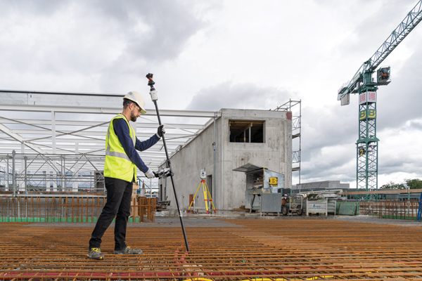
Field-to-office inspection with survey-grade accuracy
Photo: Trimble
Trimble Access field software now connects with Infotech’s Appia service to streamline the workflow from survey to construction. Aimed at the inspection process for civil infrastructure projects, the software provides high-accuracy measurement workflows for daily work reports and inspection reporting for engineering, construction and public agencies. By streamlining the connection between data collected by Trimble GNSS rovers and simultaneously syncing Trimble Access, Infotech Mobile Inspector and Infotech Appia, inspectors can now complete their daily work reports more efficiently in the field and reduce errors. With manual processes removed, inspectors can more accurately represent infrastructure assets.
For surveying, mapping and construction professionals
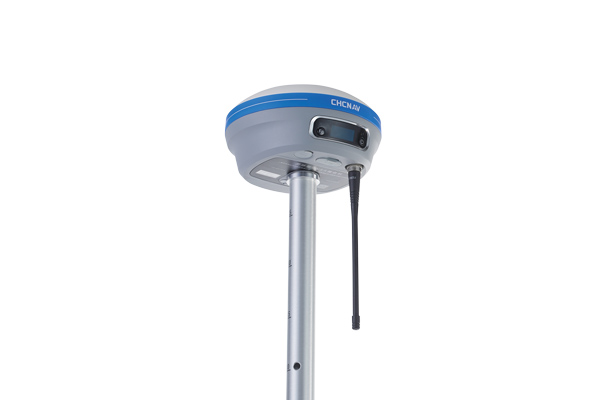
Photo: CHCNav
The i83 GNSS receiver is powered by a multi-band GNSS receiver, iStar technology, and a calibration-free, high-end inertial measurement unit (IMU) for faster and reliable field GNSS surveying. The third-generation high-gain antenna with advanced CHCNAV iStar algorithm improves GNSS satellite signal tracking efficiency by more than 30%. The i83 GNSS receiver features 1,408 GNSS channels for high performance across GPS, GLONASS, BeiDou, Galileo and QZSS constellations. Its onboard GNSS technology delivers centimeter-level positioning, maintains reliable fixed real-time kinematic (RTK) accuracy, and collects points faster than previous models, even in demanding conditions. The i83 receiver’s built-in IMU automatically compensates for pole tilt. In less than 5 seconds, the 200-Hz inertial module is initialized to ensure survey-grade accuracy over a pole-tilt range of up to 30 degrees. Productivity is dramatically increased, RTK usability greatly improved, and potential human error reduced, whether you are an engineer, site foreman or surveyor.
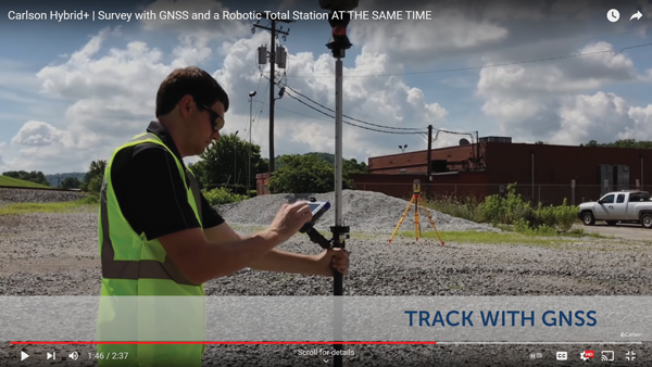
Simplifies surveying with both GPS and total station
Photo: Carlson Software
SurvPC Hybrid+ is a module for SurvCE version 6 software that enables surveying with mixed brands of GNSS receivers and total stations. SurvCE is a data-collection software package from Carlson Software. SurvPC Hybrid+ provides driver support for numerous devices, allowing the surveyor to interface with both types. Features include Follow Me, Smart Lock, Smart Staking, Cross Check, Backup Tracking, Hybrid-Resection, Auto-Localize, and Easy Setup Wizard.
SurPad 4.2 is designed to help surveyors work efficiently at all types of land surveying and road engineering projects in the field. It runs on eSurvey handhelds, Android smartphones and tablets, and third-party Android devices. It integrates with professional receiver control, point collection, stakeout, geographic information system (GIS) data collection, road measurement, road design, cross-section measurement and railway stakeout. SurPad 4.2 provides multiple operation and communication systems, has mapping and CAD functions, and has a coordinate system. It also includes a survey mode encompassing topo, control, quick point and COGO civil engineering programs.
The Leica AP20 AutoPole provides tilt compensation, automatic pole-height readings and unique target identification for automated total stations. It combines an intelligent sensor module with the AP Reflector Pole and operates with existing Leica Geosystems’ automated total stations to create a solution for autonomous workflows. Tilt compensation decreases measurement time and increases flexibility and safety on site by enabling measurement of points in inaccessible or risky locations. By updating the pole height automatically in the field software, the system ensures that the height on record is always correct.
INSITE Data Reviewer moves geospatial data validation to the cloud, giving key stakeholders the ability to collaborate in real time. The third module in the INSITE Lifecycle suite of products, INSITE Data Reviewer provides reviewers real-time access to aerial imagery, lidar data and geographic information system (GIS) layers via the cloud to standardize quality control. This increases data validation speed and reduces costs of geospatial projects. The INSITE Lifecycle suite combines Project Tracker, Data Delivery and Data Reviewer modules through which users can see their projects executed on a map, from data acquisition through processing.
Eos Laser Mapping for ArcGIS is now available on Android devices. It allows mobile crews to capture high-accuracy laser offsets directly into ArcGIS Field Maps with Arrow Series GNSS receivers. The solution combines technology from geographic information system (GIS) provider Esri, laser rangefinders from Laser Tech, and Eos’ own Arrow Series GNSS receivers. The release supports three workflows: standard laser offset (range-azimuth), range-range (range-intersect) and range-backsight (a total station-like method).
The MV60 micro-electromechanical system (MEMS) accelerometer delivers high performance and reliability in a small, rugged and low-cost package. The MV60 measures the acceleration experienced by an object during movement and is designed for use in inertial measurement units and navigation systems deployed on land, air and sea vehicles to measure velocity. It has a compact footprint of 1.2 square inches and shock survivability of up to 5,000 g. It also offers bandwidth of greater than 300 Hz — important for environmentally demanding missions.
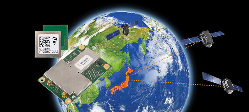
Receivers support Japan’s cm-level augmentation service
Photo: Septentrio
Three multi-frequency GNSS receivers now support the Centimeter-Level Augmentation Service (CLAS), receiving the L6 signal that transmits high-accuracy corrections from Japan’s QZSS constellation. The mosaic-CLAS receiver is in a small form-factor suitable for high-volume industrial applications. The AsteRx-m3 CLAS OEM board combines PPP-RTK CLAS with dual-antenna heading functionality. The AsteRx SB3 CLAS features a ruggedized IP68 enclosure to protect it in harsh environments.
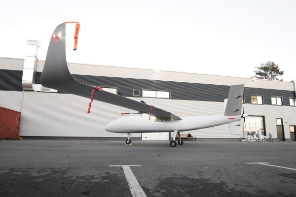
The S1-V300 medium-altitude long-endurance (MALE) unmanned aerial system (UAS) prototype is based on the Saker MALE UAS design that achieved operational capability in 2020. The prototype features a new design and a more powerful heavy fuel engine with 260 HP, offering greater speed, payload and endurance of 28 hours with a range of 4,020 km. The aircraft features unique UAVOS avionics solutions and a redundant flight control system that will enable complex missions, including overland and maritime intelligence, surveillance and reconnaissance (ISR) missions. The improved S1-V300 prototype is equipped with both line-of-sight and beyond-visual-line-of-sight (BVLOS) datalink systems for over-the-horizon operations. It can be integrated with multiple ISR sensors, including electro-optical infrared cameras and a synthetic aperture radar that offers all-weather, day/night performance for a wide-area search capability.
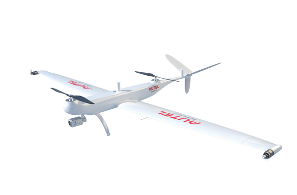
Dragonfish Lite and Pro now available in United States
Photo: Autel Robotics
The rugged Dragonfish UAVs are capable of vertical takeoff and landing (VTOL) with both multi-rotor and winged flight, with an endurance of up to 180 minutes. They are suitable for professional applications such as energy, mining, defense and surveillance. Maximum winged flight speed is 30 m/s (108 km/h, 67 mph), and maximum video transmission range is 30 km (18.6 miles) with a base station. The aircraft can make a smart decision to either land or return to base in case of issues such as loss of GPS signal, loss of operator communications, or low battery power. The tilt-rotor system will automatically transition to multi-rotor mode if adverse conditions cause fixed-winged flight to stall or become unsustainable. The Dragonfish battery, barometer, positioning system, compass and inertial measurement unit all have backup modules to ensure flight safety.
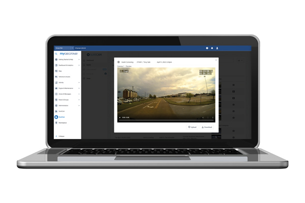
The SureCam connected dash camera system now features a method for capturing video footage from SureCam cameras using Geotab’s telematics device and rule-based system. This results in a seamless display of video within the MyGeotab platform. The enhanced SureCam fleet video solution leverages Geotab’s numerous data-based rules, such as improper seat belt usage and speeding. It also uses G-force triggered alerts that detect unsafe driving behaviors and automatically captures video footage that can be reviewed later. A new Video Request feature in GeoTab enables fleet managers to preview and download additional SureCam video, enabling them to investigate call-ins and other minor incidents that may not have been triggered by an event-based rule.
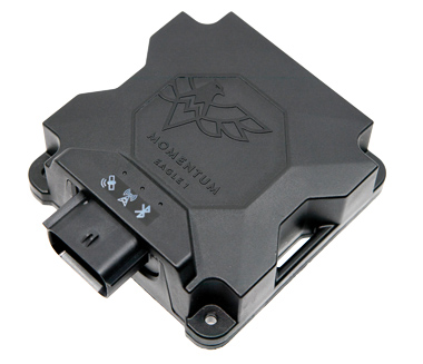
Momentum IoT’s long-life Eagle 1 tracker works without external power for more than six months after a single charge. The device switches on-the-fly between narrowband internet of things (NB-IoT) and LTE Cat-M. The Eagle 1 leverages Telit’s dual-mode ME310G1 module, which delivers low power consumption in a small footprint. The Eagle 1 detects movement with a built-in accelerometer. Using movement and signals from its GPS receiver to determine vehicle trip starts and stops, the device can go into hibernation mode during periods when the vehicle is not in use, further reducing power consumption. Applications include garbage and storage bins, portable toilets, roll-off containers, message-boards, coolers, and other equipment typically stationed in non-powered, remote places for extended periods.
Vai Photonics was founded in Canberra in 2021 by physicists Lyle Roberts (left) and James Spollard to commercialize their research at Australian National University. ANU Vice Chancellor Brian Schmidt is at right. (Photo: Vai Photonics)
Advanced Navigation has acquired Vai Photonics, a spin-out from Australian National University (ANU) developing patented photonic sensors for precision navigation.
Vai Photonics’ vision, to provide technology to drive the autonomy revolution, is similar to Advanced Navigation’s. It will join Advanced Navigation in commercializing its research into autonomous and robotic applications across land, air, sea and space.
“The technology Vai Photonics is developing will be of huge importance to the emerging autonomy revolution,” said Xavier Orr, CEO and co-founder of Advanced Navigation. “The synergies, shared vision and collaborative potential we see between Vai Photonics and Advanced Navigation will enable us to be at the absolute forefront of robotic- and autonomy-driven technologies. Photonic technology will be critical to the overall success, safety and reliability of these new systems.”
James Spollard, CTO and co-founder of Vai Photonics, explained the technology. “Precision navigation when GPS is unavailable or unreliable is a major challenge in the development of autonomous systems. Our emerging photonic-sensing technology will enable positioning and navigation that is orders of magnitude more stable and precise than existing solutions in these environments. By combining laser interferometry and electro-optics with advanced signal-processing algorithms and real-time software, we can measure how fast a vehicle is moving in three dimensions. As a result, we can accurately measure how the vehicle is moving through the environment, and from this infer where the vehicle is located with great precision.”
The technology, in development for more than 15 years at ANU, will solve complex autonomy challenges across aerospace, automotive, weather and space exploration, as well as railways and logistics.
Aircraft with an electric vertical-takeoff-and-landing system such as flying taxis will greatly benefit from this technology, according to Advanced Navigation. Landing and takeoff are often considered the most dangerous and expensive part of a flight route. Vai Photonics sensors will provide safe and reliable autonomous takeoff and landings under all conditions.
Space travel and exploration is fraught with risks, vast complexity and enormous cost. This technology will bring massive benefits to space missions, helping to cement Advanced Navigation as the gold-standard for space-qualified navigation systems for space exploration.
“The work that underpins Vai Photonics’ advanced autonomous navigation systems stems from the search for elusive gravitational waves — ripples in space and time caused by massive cosmic events like black holes colliding,” said Brian Schmidt, vice-chancellor of ANU. “The team have built on a decade of research and development across advanced and ultra-precise laser measurements, digital signals and quantum optics to build their innovative navigation technology.”
U-blox and Geespace have signed a memorandum of understanding to expand their respective augmentation services for high-precision applications. Both partners will be able to extend their service offering to the U.S., European and Chinese markets, primarily in the automotive sector.
Geespace is provider of aerospace information and communications (AICT) infrastructure and application solutions.
The agreement between u-blox and Geespace seeks to create a combined offering that will enable both companies to offer full-stack high-precision positioning software and hardware solutions to customers across the United States, Europe and China. It will enable Geespace, which provides automotive GNSS augmentation services to its parent company Geely Group, to use the u-blox PointPerfect GNSS augmentation service to grow its coverage to serve Geely’s automotive brands.
Meanwhile, it will enable u-blox to expand the coverage of the PointPerfect service to offer customers a comprehensive high-precision solution for products sold in China, and benefit from simplified development and logistics efforts.
The rise of reliable and cost-effective high-precision positioning has improved the accuracy of GNSS solutions to the order of tens of centimeters, enabling new applications in the automotive, industrial and robotics industries. Global adoption has, however, been hampered by a fragmentation of the augmentation services landscape, the companies stated in a press release.
For global adoption to become a reality, worldwide coverage is required, as is unified pricing and business models designed to serve mass-market high-precision solutions for automotive and industrial customers operating on a global scale, the companies said.
The housed AsteRx-U3 Marine and the OEM board AsteRx-m3 Fg are the two new GNSS receivers for dredging, marine construction and offshore applications
Photo: CharlieChesvick/E+/Getty Images
Septentrio, a leader in high-precision GNSS positioning solutions, has launched two new GNSS products for marine applications: AsteRx-U3 Marine and AsteRx-m3 Fg.
Both products offer accurate positioning near shore and offshore via centimeter-level real-time kinematic (RTK) or the built-in Fugro precise point positioning (PPP) sub-decimeter subscription service, delivered either over NTRIP internet or over L-band satellite.
Corrections delivered over L-band allow dredging, bathymetry or marine construction projects even in areas where there is no internet service. The AsteRx-U3 Marine receiver, enclosed in an IP68-rated housing, offers a unique feature of a dedicated L-band demodulator with a separate L-band RF input, which allows for the use of dedicated antennas for excellent reception of L-band signals even at high latitudes.
“The new products are designed around our most powerful GNSS core, bringing the latest evolution in GNSS technology to the demanding marine construction and dredging markets,” said Silviu Taujan, product manager at Septentrio. “They build on the success of the field-proven AsteRx-U Marine Fg and AsteRx4-Fg, with more processing power to allow tracking of all visible satellite signals while enabling higher update rates. AsteRx-U3 Marine and AsteRx-m3 Fg are both feature-rich receivers, combining the best-in-class RTK base and rover functionality with an option of sub-decimeter PPP positioning.”
Orders for both products can be placed immediately. Deliveries for AsteRx-m3 Fg will follow the company’s standard lead times, while deliveries for AsteRx-U3 Marine will start from July.
Septentrio GNSS technology is resilient to RF interference, which on vessels can come from satellite uplinks such as Iridium modems or from other radio antennas. Having robust GNSS technology means accurate and uninterrupted positioning on any vessel, even in challenging marine environments. Both AsteRx-U3 Marine and AsteRx-m3 Fg receivers offer accurate heading and pitch or heading and roll orientation information with the dual GNSS antenna configuration.
The Open PNT Industry Alliance (OPIA) issued a statement regarding the recently approved U.S. Fiscal Year 2022 Appropriations Act. The alliance advocates for support of alternative positioning, navigation and timing (PNT) services.
In its statement, the 21 corporate members express support for the funding provided to the Department of Transportation to pursue alternative forms of PNT.
The OPIA also highlights a change to the National Timing Resilience and Security Act that eliminates the “land-based” technology requirement. The consensus among members is that the adjustment was needed so that the law would allow for multiple forms of PNT, a concept that aligns with the diverse technology principles of the coalition.
The Consolidated Appropriations Act for Fiscal Year 2022 (H.R. 2471) promotes robust positioning, navigation, and timing (PNT) technologies and preserves competition that drives innovation in the market.
Important Funding for PNT Services
The FY 2022 Appropriations Act, passed by the U.S. Congress and signed into law by President Biden on March 15, 2022, provides $15 million for the U.S. Department of Transportation (U.S. DOT) to establish a program that will support the U.S. government’s pursuit of many types of alternative PNT. The legislation aligns with U.S. DOT’s January 2021 “Complementary PNT and GPS Backup Technologies Demonstration Report” and summarizes how the funding will be applied.
OPIA encourages U.S. DOT to apply this funding to procure alternative PNT services and supplementary solutions that will protect critical infrastructure. Our members are prepared to engage civil government officials and critical infrastructure owners and operators to match needs with solutions.
Critical Change to Existing PNT Law
The National Timing Resilience and Security Act of 2018 (NTRSA) focused attention on the need to reinforce GPS. Congress subsequently recognized that NTRSA would be harmful to the commercial PNT market. The FY 2022 Appropriations Act revises the NTRSA to align with the U.S. DOT’s 2021 report that “the best strategy for achieving resilient PNT service is to pursue multiple technologies to promote diversity in the PNT functions that support transportation and other critical infrastructure sectors.”
This straightforward change to the NTRSA is as follows:
“Section 312(a) of title 49 United States Code, shall be amended by striking ‘land-based,’ after ‘operation of a’.” When the revised objective of the NTRSA is read in context, it is evident that the law is now fully inclusive of multiple forms of alternative PNT:
Subject to the availability of appropriations, the Secretary of Transportation shall provide for the establishment, sustainment, and operation of a land-based, resilient, and reliable alternative timing system (1) to reduce critical dependencies and provide a complement to and backup for the timing component of the Global Positioning System (referred to in this section as “GPS”); and (2) to ensure the availability of uncorrupted and non-degraded timing signals for military and civilian users in the event that GPS timing signals are corrupted, degraded, unreliable, or otherwise unavailable.
This move by Congress comports with the findings of the U.S. DOT’s report on PNT which state that “suitable and mature technologies are available in the private sector and offer owners and operators of critical infrastructure a diverse array of complementary PNT services to meet their GPS backup needs. Because such needs are application-specific, GPS resilience across all critical infrastructure sectors will require a plurality of diverse PNT technologies to meet multiple use cases.”
The commonsense modification to the NTRSA allows multiple alternatives to GPS and other global navigation satellite systems (GNSS) to deliver against a complex and ever-expanding set of institutional and end-user requirements.
The alignment with OPIA’s bedrock principles is clear:
A diverse technological landscape offers varied operational characteristics to support all critical infrastructure sectors.
True resilience requires diversity that a sole-source technology cannot meet in terms of reliability, performance, and the flexibility to address evolving attack prevention and threat response needs.
The ingenuity of the private sector marketplace will drive the emergence of multiple cost-effective GPS/GNSS alternatives that evolve according to technological innovations and market dynamics.
Open PNT Industry Alliance members provide what critical infrastructure needs for resilience: alternative forms of PNT that complement GPS/GNSS as well as augmentation services, security solutions, and hardware/software for time synchronization, navigation and location applications.
New offerings will deliver accurate navigation to industrial applications even in areas where GPS is unavailable
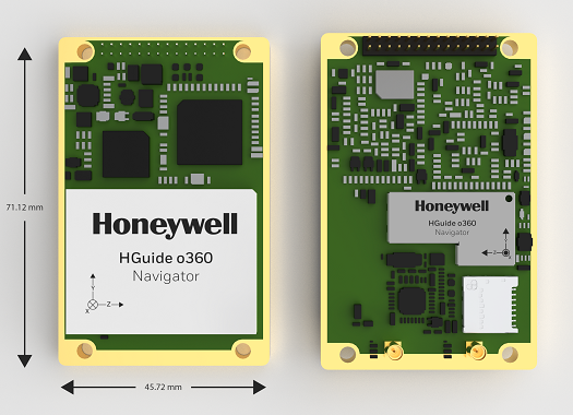
The HGuide o360 Navigator. (Photo: Honeywell)
Honeywell has expanded its HGuide industrial navigation portfolio with three new technologically advanced navigation systems — the HGuide o360 INS/GNSS navigator, HGuide n500 inertial navigator and the HGuide g080 GNSS receiver.
The new HGuide products are designed for a wide array of industrial and autonomous applications across air, land and sea vehicles and related equipment.
The HGuide o360 navigationsystem is a compact single-card, all-attitude inertial navigation system (INS) GNSS navigator that can deliver an accurate and robust position and attitude navigation service, even through GNSS-challenged or denied environments, to industrial and autonomous applications. It provides the features and compatibility needed for a simple integration.
“The HGuide o360 is an engineering marvel and a technological breakthrough. There are no similar competing products in the industry today that can achieve such a high-performance level at this price point and size,” said Matt Picchetti, vice president and general manager, Navigation & Sensors, Honeywell Aerospace. “The entire HGuide product line is suitable for a wide range of industries, including autonomous vehicles, marine and a host of industrial applications where accurate positioning and attitude information is required in real time.”
The HGuide o360 INS/GNSS navigator contains a powerful dual antenna, multi-frequency, multi-constellation, real-time kinematic (RTK) GNSS receiver, Honeywell’s i300 inertial measurement unit (IMU) technology, and a high-grade calibrated magnetometer.
The HGuide o360 is designed for platforms that require high-performance navigation data in an ultra-low size, weight and power (SWAP) package.
The HGuide n500 inertial navigator is a navigation-grade bring-your-own-GNSS all-attitude navigator that supports continuous position and attitude navigation even during prolonged GNSS outages. The HGuide n500 is built on Honeywell’s HG4930 IMU plus the Honeywell HGuide Sensor Fusion software.
The HGuide g080 GNSS receiver is a dual-antenna, triple-radio frequency, all-constellation GNSS receiver that delivers heading and positioning down to sub-centimeter levels even in GNSS-challenged environments. It includes an onboard IMU to allow tracking during short GNSS outages and enable smooth and fast reacquisition. The product is available with or without RTK functionality.
Inertial navigation systems are highly critical in navigation and comprise an IMU, a GNSS receiver and sensor fusion software. These components work together to calculate position, orientation and velocity to deliver critical navigation information in GNSS-denied areas such as urban canyons, bridges, tunnels, mountains, parking garages and dense forests.
A roundup of recent products in the GNSS and inertial positioning industry from the April 2022 issue of GPS World magazine.
OEM
GNSS+5G Antenna
9-in-one combination antenna with dual-band GNSS
Photo: Taoglas
The Taoglas MA990 Guardian antenna is a 9-in-1 combination antenna with dual-band GNSS (L1/L2) and globally supported cellular (5G/4G). It has been designed to support emerging market demand for modules that cover specific 5G/4G bands. Two of its eight cellular MIMO antennas cover from 600 Mhz to 6,000 MHz, while another two are optimized for 3,000 MHz to 6,000 MHz to cover high-band 5G and C-band/CBRS applications. The customizable antenna is designed to operate on all global carrier networks and is future-proofed to work with the latest 5G routers on the market. Housed in a low-profile, robust, IP67-rated waterproof, adhesive-mount external enclosure, the MA990 is designed for space-constrained, mission-critical applications, including asset and vehicle tracking, first-responder vehicles and high-definition video sources such as surveillance cameras.
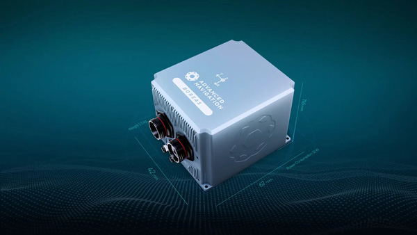
The Boreas fiber-optic-gyroscope inertial navigation system (INS) is an ultra-high accuracy, strategic-grade INS offering a reduction in size, weight, power and cost. It is based on Advanced Navigation’s new digital fiber-optic gyroscope (DFOG) technology. The Boreas is targeted at applications requiring always-available, ultra-high accuracy orientation and navigation including marine, surveying, subsea, aerospace, robotics and space. It delivers strategic-grade bias stability of 0.001 deg/hr. This allows it to achieve ultra-high roll/pitch accuracy of 0.005 degrees and heading accuracy of 0.006 degrees. The Boreas allows for full independence from GPS with dead-reckoning accuracy of 0.01% of the distance traveled with an odometer or Doppler velocity log. In addition, the Boreas features ultra-fast gyro compassing, taking only two minutes to acquire heading in both stationary environments or on the move. Gyro compassing allows the system to determine a highly accurate heading of 0.01 degrees secant latitude without relying on magnetic heading or GPS.
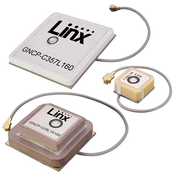
Seven new GNSS active ceramic-patch antennas support global GNSS applications including GPS, Galileo, GLONASS, BeiDou, NavIC and QZSS systems in the L1/E1/B1, L2/E5/B2B, and L5/E5/B2A bands. Each antenna integrates a high-gain low-noise amplifier (LNA) and right-hand circular polarization (RHCP) to provide a high-performance solution for GNSS signal reception. Each active GNSS antenna has either a 60-mm or 100-mm coaxial cable terminated in a MHF1/U.FL-type plug (female socket) connector. They also meet the need for multi-band L1/L2, L1/L5, and L1/L2/L5 GNSS offerings.
The Pulse-40 inertial measurement unit (IMU) is a tactical-grade IMU designed for high performance in harsh conditions but miniaturized for applications where precision and robustness matter in all conditions. Use cases include warfare systems, satellite communications, robotics, lidar devices, gimbals, cameras and inertial navigation systems (INS). The Pulse-40 IMU provides six degrees of freedom. It integrates micro-electromechanical (MEMS) three-axes accelerometers and gyroscopes in a unique redundant design that allows the device size to shrink while pushing performance to its maximum. Among the performance specifications, the Pulse-40 features excellent gyro and accelerometer bias instability of 0.8°/h and 6 µg respectively, enabling long dead-reckoning and maintaining excellent heading performance. With sensors featuring extremely low vibration rectification error (VRE), the Pulse-40 can sustain high vibration environments, up to 10 g root-mean-squared. An embedded continuous built-in-test ensures data reliability during operation, a key parameter for critical applications. Features include 12 grams, 0.3W power consumption; ultra-low noise gyro (0.08°/√h) and excellent gyro bias instability (0.8°/h); high-precision accelerometers (6 µg); MIL-STD 810-qualified for shocks and vibrations; high bandwidth (480 Hz) and high data rate (2 KHz); highly tested and calibrated from –40° C to 85° C; and no export restrictions.
Adds online services for field surveying and mapping
Photo: CHC Navigation
LandStar version 7.3.7 adds cloud-based services and remote support features to simplify surveyors’ daily tasks. Online data storage and file sharing greatly facilitates interactions within a company and between field operators. LandStar 7’s remote assistance feature allows support personnel to take control of the field crew’s devices. Users simply provide a remote code to grant control of their data controller and be guided efficiently to the solution. The new version of LandStar 7 further improves support for CAD files and operates faster when importing 20MB DWG or 200MB DXF basemap files. Users can directly click on points, lines and blocks to stake out. In addition, object symbols and colors are displayed in the same way as in the original CAD design, making it easier for users to identify them.
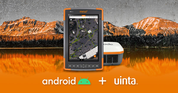
Uinta is now available for devices running on Android. This is particularly valuable for workers who prefer to use an Android tablet or smartphone as a data collector. Uinta’s intuitive and customizable user workflow makes land measurement and asset mapping easier for data collection in the field. Uinta can now be used on a range of smartphones and tablets, including Juniper Systems’ Cedar CT8X2 and Mesa 3 rugged tablets running on Android. When using Juniper’s Geode GNSS receiver and running Uinta on an Android phone or tablet, users create a total mapping solution. They can collect high-accuracy GNSS data on the Geode, record the data in Uinta software, and see the data on a mobile or tablet. The intuitive software includes project templates that can be modified to meet individual project needs. Uinta is commonly used in utility mapping; commercial and agricultural irrigation; industrial asset inspections and rounds; and numerous environmental sciences in forestry, wetlands, wildlife and vegetation mapping.
Visualize the present and simulate the future of Scottish cities
Photo: Bluesky
Scottish cities Edinburgh and Glasgow have been added to the growing coverage of MetroVista 3D city models. The data is available as ultra-high resolution 5-centimeter aerial photography with 16 points per meter (ppm) lidar. The data also is being processed to create a fully rendered mesh model suitable for use in a range of GIS, CAD and modeling software packages Acquired using the Leica CityMapper aerial sensor that simultaneously captures vertical and oblique imagery together with high-point density lidar, MetroVista data is becoming increasingly popular for smart city applications. Providing a geographically accurate and detailed 3D representation of the urban environment, MetroVista data provides insight for applications such as urban design, defense and security modeling, insurance assessments and utility and telecom planning.
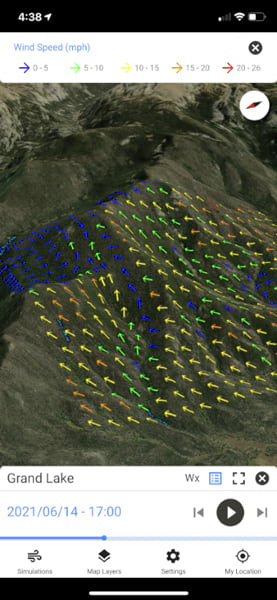
WindNinja is a high-resolution wind modeling app created for firefighters who need to quickly compute and visualize wind direction and speed simulations. The simulations provide them with situational awareness, help keep them safe, and help them conduct work such as burnout operations. The mobile app, developed using ArcGIS AppStudio from Esri, provides high-resolution, near-surface wind forecasts that include wind speeds and directions displayed on a map. The user selects an area of interest of 50 square kilometers or less, names the simulation, chooses a forecast duration of up to 15 hours, selects whether to receive an email or SMS notification when the simulation is ready to view, and then submits the request. The user also can select from a variety of basemaps and turn on data layers — vegetation, atmospheric, oceanic, land-surface imagery — collected by NOAA satellites.
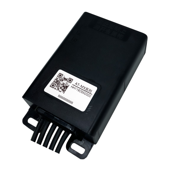
Intelligent control system meets urban transport requirements
Photo: Xiaoan Technology
The AT-MX intelligent control system for shared electric bicycles uses the latest ultra-low-power u-blox M10 GNSS technology to enhance the positioning performance of their fleet for improved compliance with increasingly stringent Chinese policy requirements. The growing popularity of shared micromobility solutions for short-distance urban travel has led municipal authorities around the world to introduce new legislation to mitigate their perceived negative impacts, for instance, with restrictions on where users can drive and park their vehicles. Meanwhile, vehicle operators and maintenance personnel need to efficiently locate vehicles requiring maintenance and gather reliable vehicle usage data to balance bicycle placement and operational safety. Enforcing regulatory compliance and optimizing operations both require the safe, accurate and efficient bicycle positioning solutions.
Ensures safe operations through reliable, robust and continuous positioning
Image: Hexagon
SPAN technology delivers a deeply coupled GNSS and inertial navigation system (INS) that provides robust, reliable and continuous centimeter-level positioning for operators to maintain safety and maximize uptime. Now available for the dynamic positioning of vessels, the GNSS+INS solutions can bridge outages in GNSS tracking and through short periods of radio-frequency interference, jamming or spoofing. It provides vessels with an added layer of resiliency and achieve continuous centimeter-level accuracy across all conditions. SPAN GNSS+INS technology is compatible with commercial inertial measurement units (IMUs) and scalable with the LD900 GNSS receiver, Quantum visualization software and APEX correction services. Features include continuous centimeter-level positioning made more robust and reliable through enhanced GNSS tracking and deep coupling of inertial measurements; rapid reacquisition of GNSS signals after outages or interruptions through a deep coupling process; constant monitoring of GNSS absolute positioning combined with heading, velocity and attitude measurements; and added positioning redundancy with system robustness against potential signal outages, interference or disruptions.
Ibtechar, one of Qatar’s top providers of practical innovation and turnkey solutions, has developed a drone tracker and a GPS-based system that ensure the safety and security of critical infrastructure, VIP residents, national borders, and military facilities. The customized solution is made by a Qatar-based team of researchers and technologists with extensive knowledge and expertise in applied research and counter-drone systems. It aims to secure airports, power lines, and other vital assets that can be targets for drone attacks. Prototypes have gone through 487 flight tests in 19 locations, as well as 676 drive and walk tests. Features include compatibility with GPS, GLONASS and BDS; real-time tracking, popup notifications and SMS alerts; smart geo-fencing; drone whitelists/blacklists; base-station triangulation (cell ID); IMU, tilt, vibration sensor, and NFC; and offline mode. The new tracking system can identify the operating drones by displaying the drone itself, its serial number, the commercial frequency used, and motion details (speed, altitude, azimuth, path, etc.).
DroneDeploy lets users capture, process and analyze data in one platform. Users can create high-resolution 2D and 3D interior and exterior maps and models accurate to between 1 cm and 5 cm. It is designed for individuals, teams or enterprises and is suitable for all use cases and industries. However, primary markets include agriculture, construction, mining, energy, roofing and inspection. Features include Mobile Flight App to capture images directly from
an iOS or Android device; Live Map to create real-time, sharable
2D maps; Autonomous Flight to preprogram routes; as well as
360 Walkthrough for a 360-degree, virtual tour through a 3D model of a site. Industry-specific features are available, such as Plant Health to help farmers measure crop health and viability.