Category: Transportation

  • Genesys launches high-definition ADAS maps for India

    Genesys launches high-definition ADAS maps for India

    Genesys has developed India’s first large-scale high-definition maps engineered specifically for vehicles enabled with advanced driver assistance systems (ADAS).

    Covering more than 1 lakh km of India’s national highways, expressways and strategic corridors, this initiative marks one of India’s most ambitious road intelligence programs and establishes a new benchmark for automotive-grade precision.

    India’s highways account for a disproportionately high share of road fatalities, driven by fast-moving traffic, inconsistent lane discipline, and limited real-time awareness for drivers and vehicles. HD maps narrow this gap by adding the centimeter-level context that traditional maps cannot provide — lane geometry, curves, slopes, signage, barriers and localization cues that help ADAS systems anticipate danger instead of merely reacting to it. This is a big leap forward from current sensor-based ADAS systems, Genesys said.

    The HD maps include ADAS-critical features such as lane geometry, road markings, barriers, signage, medians, elevation and curvature profiles, and localization objects like poles and gantries — all processed to achieve centimeter-grade precision.

    CORS network plays a key role

    To achieve the centimeter-level accuracy required for ADAS Level 2 functionality, Genesys relies on the Survey of India’s Continuously Operating Reference Stations (CORS) network. Real-time GNSS correction signals along major corridors dramatically strengthen field operations, allowing survey teams to capture lane-level and asset-level detail that meets global automotive standards.

    This work builds on the existing memorandum of understanding between Genesys and Survey of India, enabling collaboration on digital twin projects, national mapping programs, and high-accuracy geospatial missions.

    These datasets are owned by Genesys and can be licensed across industries, creating opportunities in commercial fleet navigation, logistics optimization, mobility platforms, safety analytics and automotive R&D.

  • IATA sounds alarm over rising GNSS interference

    IATA sounds alarm over rising GNSS interference

    Collated from various news reports

    The International Air Transport Association (IATA) has called for vigilance following the increasing number of GNSS spoofing and jamming incidents worldwide. The growing interference poses a significant risk to flight navigation and pilot safety.

    Of note is a spike in incidents at major Indian airports. Almost 2,000 GNSS interference incidents have been logged at airports in India since 2023, including the airports in Delhi, Mumbai, Kolkata, Amritsar, Hyderabad, Bengaluru and Chennai.

    IATA represents more than 360 airlines, accounting for 80% of global air traffic. Indian carriers Air India, IndiGo, Air India Express and SpiceJet are members.

    “GPS spoofing and jamming incidents are increasing rapidly across the world,” said IATA Director General Willie Walsh, speaking at an industry event in Geneva. “This is not merely a technical concern — it’s an operational vigilance issue for pilots.”

    Walsh noted a higher frequency of interference events, expanding well beyond conflict zones and affecting global civil aviation routes.

    India’s Civil Aviation Ministry informed Parliament that between November 2023 and November 2025, a total of 1,951 GNSS interference cases were reported. The data collection began after the Directorate General of Civil Aviation (DGCA) issued an advisory circular in November 2023, mandating airlines to report all GNSS-related disruptions.

  • Voyant Photonics expands FMWC lidar platform

    Voyant Photonics expands FMWC lidar platform

    Voyant Photonics has released new versions of its Carbon lidar platform, adding 32-line and 64-line variants designed for compact, cost-sensitive and compute-limited systems.

    The new models, which will be displayed at CES 2026 (booth 4875, Las Vegas Convention Center West Hall), complement existing 128-line configurations and are optimized for industrial autonomy, robotics, drones and smart infrastructure applications.

    Building on the same semiconductor foundation as Voyant’s flagship Carbon platform, the new versions offer lower data rates and simplified integration while maintaining core FMCW advantages including velocity measurement, interference immunity and high dynamic range.

    “With these additions, we’re extending our FMCW lidar to applications where cost and compute budgets are essential and where historically the only available options were over-engineered sensors built for automotive and not designed with industrial needs in mind,” said Clément Kong, vice president of sales at Voyant Photonics. “Carbon 32 and Carbon 64 make it possible for developers to embed true 4D perception in the smallest and most constrained devices, accelerating the shift from autonomous vehicles to autonomous everything.”

    Platform capabilities

    The Carbon family uses Voyant’s proprietary silicon-photonics architecture that integrates beam steering and coherent detection on a single photonic chip, enabling mass-production economics, reduced calibration drift and unit-to-unit consistency.

    The new variants include high-precision depth sensing and real-time velocity measurement, exceptional ambient light immunity and compact design for industrial and mobile environments.

    With line resolutions spanning 32, 64 and 128, original equipment manufacturers and system integrators can tailor performance, bandwidth and compute load to specific use cases, from robotics and automated guided vehicles to drones and embedded edge platforms.

    According to the company, Voyant’s commercialization strategy focuses on transforming lidar from a niche automotive sensor into a core component of machine perception across industries. Its chip-scale FMCW technology delivers both motion and depth per pixel, enabling spatial reasoning capabilities for industrial automation, robotics, smart infrastructure, logistics and defense.

    By partnering with semiconductor foundries and leveraging the global photonics supply chain, Voyant aims to achieve scalability and cost efficiency, opening markets previously closed to traditional time-of-flight lidar solutions.

    “We’re entering a new era of physical AI, where devices and machines interpret and interact with the world around them,” said Clément Nouvel, CEO of Voyant Photonics. “Voyant’s vision is to make high-performance 4D sensing as ubiquitous and affordable as any other embedded component, bringing real-world autonomy to every sector.”

  • India’s DGCA clarifies 10-minute GNSS interference reporting requirement

    India’s DGCA clarifies 10-minute GNSS interference reporting requirement

    India’s Directorate General of Civil Aviation (DGCA) has issued an adendum on reporting procedures for suspected GNSS spoofing, reports news service AIN. On Nov. 10, the DGCA began requiring that all spoofing and jamming incidents be reported within 10 minutes, following an intense period of disruptions around Indira Gandhi International Airport in Delhi.

     The addendum is meant to clarify exactly what pilots and operators are required to do both before and after a GNSS interference incident is suspected.

    The disruptions produced false EGPWS alerts, position errors, and incorrect altitude indications, according to OpsGroup. The interference briefly drove ADS-B integrity in the Delhi terminal area to zero, affecting hundreds of aircraft and leaving controllers unable to rely on GPS-based surveillance.

    GPSwise (powered by SkAI Data Services) provides a real time GPS Spoofing and Jamming map spanning the globe.

  • UK Working Group discusses next steps to protect PNT

    UK Working Group discusses next steps to protect PNT

    The UK Hydrographic Office (UKHO) hosted the UK’s first cross-government geodesy, positioning, navigation and timing working group in October. Representatives from 19 government bodies shared insight on the risks, opportunities and interdependencies linked to PNT systems, including GNSS.

    On Nov. 19, the UK announced a £155M investment in PNT. The working group will continue to support collaboration and exchange knowledge as further resilience actions progress, according to the UKHO.

    GNSS supports critical activities across the UK economy. It provides accurate location and timing for communications, maritime and aviation safety, and the smooth running of power and financial networks. As threats to space-based systems grow, improving national resilience is increasingly important.

    “The UKHO’s expertise in geodesy plays a key role in helping the UK understand and protect PNT services. Our specialists provide trusted positioning and timing advice across defense and civil programs, including supporting the safety of navigation in UK waters,” the agency said.

    “It is fantastic to hear that the work with eLoran, GNSS Interference Monitoring Programme, Space Based Time Transfer and the National Timing Centre have received ongoing funding,” said Joe Pearce, senior geodesy and PNT specialist, UKHO. “This funding will assist both our data collection and the mariner. It will protect and assist future geodesy and PNT, improving resilience as these systems come increasingly under threat.”

    The UKHO also provides information on how to protect against GNSS and AIS jamming and spoofing for vessel operators.

  • FAA warns pilots of risks in flying over Venezuela

    FAA warns pilots of risks in flying over Venezuela

    The U.S. Federal Aviation Administration (FAA) has warned all pilots to “exercise caution” when flying in the airspace over Venezuela “due to the worsening security situation and heightened military activity,” reports ABC News. Possible risks include GNSS jamming and spoofing.

    The FAA message said the unspecified threats “could pose a potential risk to aircraft at all altitudes” as well planes taking off and landing in the country and even aircraft on the ground.

    The warning comes as the Trump administration has ramped up pressure on Venezuelan President Nicolás Maduro. The Trump administration also has carried out a series of strikes on small boats in the Caribbean Sea and eastern Pacific Ocean that it accuses of ferrying drugs to the U.S., killing more than 80 people since the campaign began in early September.

    The U.S. military has conducted bomber flights up to the coast of Venezuela, sometimes as part of a training exercise to simulate an attack, and sent the aircraft carrier USS Gerald R. Ford into the region.

    The Ford aircraft carrier and several destroyers were just the latest addition to the largest U.S. force assembled in the Caribbean Sea near Venezuela in generations. The Trump administration does not see Maduro, who faces charges of narcoterrorism in the U.S., as the legitimate leader of the South American country.

  • Norbit to provide GNSS on-board units for European tolling

    Norbit to provide GNSS on-board units for European tolling

    Norbit’s Connectivity segment has received a new order for deliveries of GNSS on-board units to the European Electronic Toll Service (EETS) provider Toll4Europe. Norbit, based in Trondheim, Norway, is a global provider of tailored technology to selected applications. Its Connectivity segment provides tailored wireless solutions for identification, monitoring and tracking.

    Deliveries of the GNSS units are scheduled for first half of 2026. The total order is estimated at 160 million kroner.

    “We are proud to be given the trust from Europe’s leading tolling service provider,” said Per Jørgen Weisethaunet, CEO of Norbit. “This repeat order demonstrates the strength of our ability to deliver tailored technology and our strategy to act as a technology partner for our client.”

  • Qatar hosts regional workshop on GNSS interference

    Qatar hosts regional workshop on GNSS interference

    The Qatar Civil Aviation Authority (QCAA) this week is hosting the Joint ICAO Europe and North Atlantic (EUR/NAT) and Middle East (MID) Workshop on GNSS Radio Frequency Interference, reports the Qatar News Agency.

    The workshop is organized jointly by the ICAO EUR/NAT and MID Regional Offices and is being held in Doha, Qatar, Nov.18-20.

    In the opening session, Mohamed bin Faleh Al Hajri, QCAA manager, reaffirmed Qatar’s commitment to enhancing aviation safety and efficiency through close collaboration with ICAO and regional partners.

    The workshop brings together countries and stakeholders from the EUR/NAT and MID regions to address the increasing threat that GNSS radio frequency interference poses to aviation safety and efficiency. Al Hajri emphasized the importance of active participation to exchange experiences, strengthen cooperation, and build sustainable partnerships that support GNSS resilience.

    He highlighted that hosting the workshop reflects joint efforts aimed at strengthening the robustness and reliability of GNSS — a core pillar in ensuring the safety and efficiency of international air navigation.

    Regional dialogue

    The workshop aims to:

    • facilitate regional dialogue on the operational impact of GNSS radio frequency interference
    • share experiences among participating States and stakeholders
    • explore measures to improve reporting mechanisms, enhance mitigation strategies, and strengthen the overall resilience of satellite-based navigation systems.

    It also seeks to reinforce cooperation between the EUR/NAT and MID Regions to safeguard the infrastructure and integrity of GNSS-based navigation systems.

  • Sinclair Technologies Unveils 5G GNSS antennas

    Sinclair Technologies Unveils 5G GNSS antennas

    Sinclair Technologies has launched its SM 5G Family Tier, featuring the SM714 and SM2601 series antennas. The next-generation, multi-band, multi-port transport antennas are engineered to deliver superior connectivity, reliability and versatility for GNSS, 5G, LTE, Wi-Fi and other mission-critical wireless applications.

    The SM714 antenna. (Photo: Sinclair Technologies)
    The SM714 antenna. (Photo: Sinclair Technologies)

    The SM714 is a 4-in-1 low-profile customizable transit antenna that combines 5G/LTE, Wi-Fi and tri-band GNSS coverage in a single compact form. Supporting 617–5925 MHz, it enables seamless operation across all major 5G and LTE bands. The integrated high-gain tri-band GNSS module provides fast, accurate positioning, while the IP67-rated rugged housing ensures long-term durability. With its 2.6-inch ultra-low profile and single-hole mount, the SM714 is suitable for vehicles, fleet systems and connected mobility applications requiring a discreet, high-performance solution.

    The SM2601D is a 5-in-1 low-profile customizable antenna purpose-built for transportation, fleet and rail systems. It features five independent ports: one for PTC (219–223 MHz), one for Wi-Fi (2400–6000 MHz), one for GNSS, and two full-band cellular ports (694–2700 MHz) that support diversity and MIMO operation for multi-radio systems. This dual-cell configuration offers greater throughput, flexibility, and redundancy in complex communication environments. Housed in a fire-rated, weather-resistant black radome, the SM2601 ensures exceptional reliability in harsh operating conditions.

    Together, the SM 5G family ter delivers high performance and design flexibility for connected mobility, fleet tracking and smart infrastructure — extending Sinclair’s 75-year legacy of engineering excellence and innovation in RF antenna technology.

    “The launch of our SM 5G Family marks a bold step in redefining the boundaries of connectivity,” said Martine Cardozo, sales director, Sinclair Technologies. “By blending creativity with cutting-edge innovation, we aim to deliver highly reliable, all-in-one solutions that meet the evolving demands of a market in constant motion.”

    Key Benefits

    SM714 – Compact 5G / GNSS Transit Antenna

    • Wideband coverage: 617–5925 MHz across all major 5G/LTE bands
    • Tri-band GNSS (GPS, Galileo, GLONASS, BeiDou) for fast, precise positioning
    • Rugged IP67 housing ensures long-term reliability in harsh environments
    • Ultra-low 2.6 in. profile minimizes installation footprint and risk of damage
    • Ideal for vehicle rooftops, fleet applications, and mobile IoT systems

    SM2601 – Multi-Port Transport Antenna (Spec Sheet)

    • Five integrated ports: PTC, GNSS, Wi-Fi, and dual broadband 694–2700 MHz channels
    • Supports MIMO and multi-radio configurations for maximum system flexibility
    • Fire-rated, weather-resistant radome built for extreme operating conditions
    • High-gain GNSS with low-noise amplifier enhances accuracy and signal integrity
    • Optimized for rail, transit, and mission-critical fleet communications
  • Kolkata is latest Indian city to be affected by GNSS interference

    Kolkata is latest Indian city to be affected by GNSS interference

    India has issued a Notice to Air Missions (NOTAM) warning of possible GPS interference or signal loss along air traffic routes near Kolkata, reports Business Today.

    The NOTAM, valid Nov. 13-17, alerts airlines and pilots to remain vigilant to GNSS disruptions. It follows previous communications sharing issues with GNSS interference in New Delhi and Mumbai. Pilots and air traffic controllers also were asked to report any interference incidents within 10 minutes to the Directorate General of Civil Aviation (DGCA).

  • Pilots, ATC asked to report GPS interference in India within 10 minutes

    Pilots, ATC asked to report GPS interference in India within 10 minutes

    India’s Directorate General of Civil Aviation (DGCA) has made it mandatory for pilots and air traffic controllers to report GPS interference within 10 minutes of it occurring, reports Hindustan Times. The new protocol follows incidents at the New Delhi airport reported on Nov. 5.

    Incidents that should be reported include position anomalies, navigation errors, loss of GPS integrity, and spoofed location data, states a three-page circular issued on Nov. 10.

    The real-time reporting should include data such as aircraft type and registration, airline or operator name, date and time of spoofing occurrence, flight sector and route, coordinates or area of occurrence, type of interference and aircraft equipment affected.

  • Advancing vehicle autonomy with reliable GNSS

    Advancing vehicle autonomy with reliable GNSS

    GNSS technology has had a reputation for unreliability in safety-critical applications, such as advanced driver assistance systems (ADAS). This perception has shaped automotive design and manufacturing: some ADAS developers have avoided GNSS altogether, instead relying on cameras, lidar and other sensors. Here, Manuel Del Castillo, VP of business development at Focal Point Positioning, explains how, with the right reliability, GNSS can offer a powerful layer of redundancy and support these other sensor types.


    The hesitation to include GNSS in ADAS stacks is historical. Traditionally, this technology was unreliable, especially in dense, urban environments where satellite signals were obstructed. Consequently, many automakers turned to alternative sensors. For example, cameras can identify lane markings, traffic signs and objects, while lidar can build highly detailed 3D maps of the vehicle’s surroundings.

    Each of these sensors provides important navigational data. However, they all describe a car’s location relative to its immediate environment. With no reliable source of absolute positioning, these relative measurements can’t confirm the vehicle’s exact place in the world — information that is critical for safe navigation.    

    Why ADAS Needs GNSS

    Cameras, lidar and other sensors provide rich environmental data. However, they are limited by what they can directly observe. A camera can identify lane markings but can’t confirm which road the vehicle is on when multiple lanes or junctions overlap. Similarly, lidar can map obstacles in 3D, but without a wider frame of reference, it will struggle to anchor that map to the road network. HD maps provide another valuable layer, but without an accurate global position, they too can be misaligned with the real world, limiting their value.

    GNSS can help plug this gap. By supplying absolute latitude and longitude, it ensures that the relative information from the other sensors is grounded in the correct location. GNSS helps calibrate and initialise other sensors, while also providing a cross-check against their measurements to detect potential errors or drift in sensor performance over time. Therefore, reliable GNSS is not an alternative to cameras, lidar or radar. It complements these sensors and boosts accuracy and the reliability of the overall system.

    The Importance of Redundancy

    Increasingly, the importance of GNSS in ADAS stacks is being recognised. As automotive production moves toward L3 automation and beyond, the demand for absolute positioning increases, along with the need for safe, layered sensing. GNSS, alongside cameras, lidar and radar, can help automakers improve navigational resilience without reinventing vehicular architectures.

    Reliable GNSS isn’t about replacing other technologies. It is about reinforcing them. Having a global frame of reference helps ensure that the relative data from other sensors is grounded in the correct place. For automakers, the next step is recognising that GNSS can improve safety and trust in ADAS stacks, supporting the transition toward autonomous driving.

    Advancing GNSS Reliability

    Even with GNSS integrated into the vehicle’s sensors, challenges remain. Urban canyons and dense foliage can  attenuate or even block satellite signals and create reflections, reducing accuracy. Since ADAS systems need reliably accurate absolute positioning, these challenges need to be addressed if we want  GNSS to play a role in ADAS.

    Newer, more sophisticated GNSS solutions are needed. The progression to Level 3 does not require an entirely new technology stack but rather extracting the very best from each of the existing components. For GNSS, this evolution involves implementing software-based solutions to achieve the necessary reliability improvements without overhauling hardware components. Pursuing cost-effective upgrades enhances performance without necessitating complete system redesigns, thereby keeping costs under control.

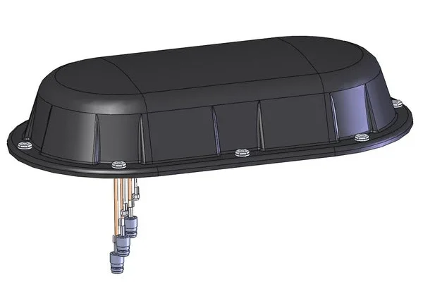
    FocalPoint’s S-GNSS Auto software enhances GNSS accuracy in autonomous vehicles, providing reliable, absolute location to improve overall ADAS safety and efficiency. By boosting line-of-sight signals and rejecting non-line-of-sight signals, this simple firmware upgrade can help vehicles maintain accuracy in challenging environments.

    By reducing positional uncertainty, these enhanced GNSS solutions strengthen the overall sensor stack. Together, these layers improve resilience, safety, and confidence in higher levels of vehicle automation.

    As the automotive industry moves further towards L3 automation and beyond, reliable data on absolute position will be essential and will only reinforce the insights captured by cameras, lidar and other sensors.

    To find out how S-GNSS Auto can help automotive OEMs transition to L3 autonomy, download FocalPoint’s white paper here.