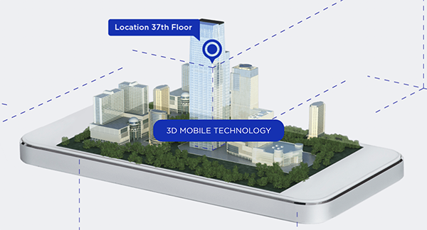
Phone users can now be located by emergency responders within one floor level inside multi-story buildings
Polaris Wireless, an innovator of high-accuracy software-based wireless location solutions, announces the company’s Z-axis location solution is commercially available nationwide.
The technology — demonstrated to meet the 3-meter vertical location accuracy requirement of the Federal Communications Commission (FCC) — is integrated into Schok Gear’s newly released flip phones.
Schok’s flip phones are typically used by consumers looking for a simple, yet powerful flip phone, that can now be accurately located in emergencies. Adding indoor and vertical location to these devices enables first responders to locate all wireless 911 callers with floor-level accuracy in multi-story buildings.
“This is a major milestone for the 911 industry to deliver FCC-compliant Z-axis emergency location technology for users of feature phones” said Manlio Allegra, CEO and Founder of Polaris Wireless. “Working with Schok and their partners has been straightforward and it’s exciting to see for the first time the complete Z-axis solution commercially available in a flip phone.”
“The Polaris Wireless location software was seamlessly integrated with our existing location and chipset vendors” said Samuel Gutiérrez, chairman and CEO, Schok, LLC. “Our Schok flip feature phone passed Tier I carrier acceptance testing, which for the first time included Z-axis location. Now our customers can be assured their accurate vertical location will enable first responders to find them faster in an emergency.”
The vertical component of wireless location is critical in today’s environment when most 911 calls are placed by mobile phones and increasingly indoors, where location determination is particularly challenging. Accurate indoor wireless location is a game-changer for first responders to quickly get to where they are needed, regardless of the phone being used by callers. The Polaris Wireless Z-axis service is available seamlessly nationwide for public safety and commercial deployments.
Prince’s death on April 21 highlights a fatal flaw in the United States’ antiquated 911 emergency system. When you call from cell phone, 911 doesn’t automatically know where you are. 911 often can’t determine the location of an emergency, even when the call for help comes from a GPS-equipped smartphone. Often the 911 operator can only zero in the nearest cell tower, which can be several miles away or in the next county.
In the transcript of the 911 call from Prince’s house comes this exchange:
911 operator: OK, what’s the address?
Caller: We’re at Prince’s house.
911 operator: OK, does anybody know the address? OK, your cell phone’s not going to tell me where you’re at, so I need you to find me an address … OK, have you found an address yet?
Caller: Yeah, um, I’m so sorry, I’m so sorry. (The caller is heard asking others if they know the address.)
911 operator: Is there any mail around that you could look at?
While a quicker response may not have saved Prince’s life, some experts estimate that cutting 911 response by one minute could save one person every hour every day nationwide.
The FCC and the four largest cellphone carriers say they’re doing their best to address the problem. One possible solution is LaaSer, a technology suite that runs in the cloud. LaaSer updates your precise location at the exact same time that the call to 911 is being made, so that the answering operator is immediately presented with your information.
With Laaser, any mobile device delivers accurate location information about the caller to 911 operators immediately. It does this using existing infrastructure, so carriers, handset manufacturers and 911 call centers wouldn’t have to change their systems to receive the benefits.
Unlike current 911 mobile phone technology, LaaSer takes advantage of all of the location information already available in smartphones, including GPS, Wi-Fi, Bluetooth, near-field communications (NFC)/RFID, compass, accelerometer, barometer and more.
TCS’ Matt Vincent poses with public safety gear that includes Taoglas Storm Antenna at APCO.
It is refreshing to see nascent technology such as indoor location being used to enable accurate emergency services response. That’s what’s going on right now as beacons, Wi-Fi and other technology that works inside, where GPS doesn’t work, is being tested nationwide by companies hoping for government adoption. With new FCC regulations that are finally trying to keep up with commercial location products, it may be a reality soon. What really drove location into wireless handsets was the 1990s FCC regulations — will they now drive indoor positioning?
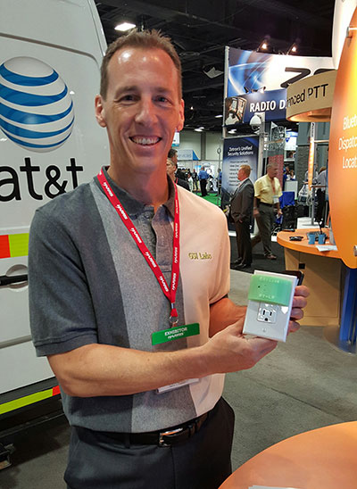
GSI Labs’ John Martin holds indoor beacon at APCO.
WASHINGTON — The same technology that allows consumers to find products indoors will allow emergency personnel to locate people in trouble in the coming years, said officials at the Association of Public-Safety Communications Officials (APCO) annual meeting here, held Aug. 16-19.
Companies are using existing commercial technologies, also used by retailers to determine customer preferences, to provide indoor location in combination with the National Emergency Address Database. This provides public-safety answering points, or PSAPs, accurate addresses and positions to dispatch emergency services to allow first responders to find people on specific floors and in rooms, not huge areas.
Beacons and Wi-Fi seem to be the lead technologies in use for emergency indoor location. Longmont, Colo.-based Intrado installed 65 Apple iBeacons at the Washington Convention Center to showcase its developing indoor positioning technology.
“Old 9-1-1 technology was just a dot on the map. Now people are saying, ‘how can Starbucks can find me, but 9-1-1 can’t?’” said John Snapp, Intrado senior technical officer.
Another company, TeleCommunication Systems, is getting into the indoor public safety market with its LocatE9-1-1 product that leverages the company’s indoor location engine, or ILE. The ILE connects to multiple databases that can be used during a 9-1-1 call to determine what location information is available for the wireless device.
“Deep inside buildings, location technology often fails us. Sometimes emergency workers have to rely on verbal information [from people at the scene],” said Tim Lorello, TCS senior vice president and chief marketing officer. “We are a location aggregator. However, we do know location won’t be deployed everywhere, but there are multiple technologies tied to Wi-Fi hotspots, barometric pressure and Bluetooth.”
In addition to government agencies, wireless carriers are taking notice of the indoor positioning capabilities for public safety. At APCO, GSI Labs, a 20-year-old business, was in the AT&T booth displaying its codeBlue-911 beacon system. “We think that for bigger venues such as warehouses and stores, this is a great public safety tool. The [Bluetooth Low Energy] beacons have about 20-to-50-foot accuracy, depending on the battery,” said GSI Labs’ John Martin. “A security company is looking at using the beacons to monitor employees during the night.”
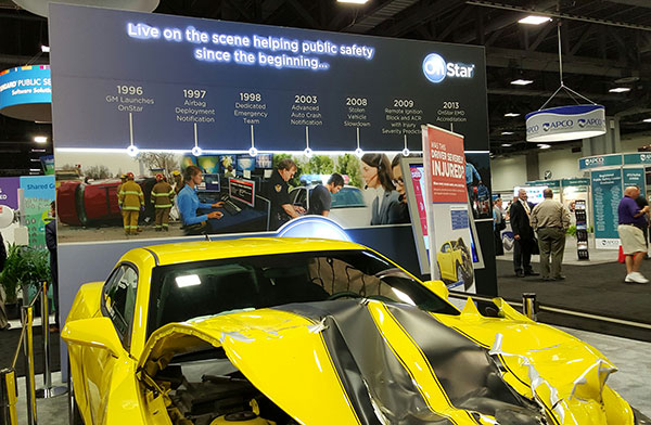
OnStar booth features wrecked car to portray emergency messaging capabilities at APCO.
FCC Still at Forefront of Location Accuracy Requirements
In an address at the conference, FCC Chairman Tom Wheeler said that the agency has taken steps to increase the reliability of the nation’s 9-1-1 system. “Uber can pinpoint [a potential customer]. We won’t tolerate 9-1-1 failures,” said Wheeler, who also called for a national maps database.
Some people newer to the location industry don’t remember it was the enhanced 9-1-1 FCC rules that drove the installation of GPS into cell phones in the mid-1990s. In several presentations at APCO, it was noted that more than 80 percent of all emergency calls are made with a wireless device, not landline.
The FCC announced new rules this year that require wireless operators to provide dispatchable location within 50 meters with these new deadlines and conditions: 40 percent of all wireless 9-1-1 calls within 2 years; 50 percent within 3 years; 70 percent within 5 years; and 80 percent within 6 years.
If anyone doesn’t think the FCC is the 800-pound regulatory gorilla for location, then they have missed the LightSquared GPS signal interference saga. According to published reports, LightSquared has hired Reed Hundt, former FCC chairman, as an attorney representing the company.
LightSquared, which is trying to emerge from bankruptcy, has been seeking FCC approval to transfer its spectrum licenses to its new entity. The company is trying to see if the GPS interference issues can be resolved.
In other APCO news, Time Machines rolled out its TM 2000A timing device that costs $499.95. The big deal about the timing device is the price — which has many of the same features that competitors offer for more than $5,000, said Doug Ehlers, Mindshare by CSS president, a sister company of Time Machines, who also said the company is expanding its distribution in Europe.
Gimbal Partners with Do It Outdoors Media
While emergency networks are getting big, the commercial networks are continuing to make inroads with advertising agencies and partners. Location and proximity-based marketing company Gimbal recently partnered with Do It Outdoors Media in a deal that will use Gimbal’s beacon technology.
Gimbal said that Do It Outdoors Media, which is the largest national mobile billboard and field marketing company, will create a smartphone campaign that provides proximity-based consumer offers to opt-in users.
Beacons will be placed in Do It Outdoors Media’s mobile billboard units, which are owned and operated by the company. In addition, there will be product placement on Segways, jet packs, brand ambassador teams and other marketing sites.
Gimbal says that when a consumer enters into a beacon zone, which is effective from 50 meters away, content will be delivered through a push notification within an advertiser’s or a third-party mobile app.
In other location news:
While a small trade show for a focused group of government communication professionals, APCO drew 5,700 attendees, with 282 exhibitors. Conference organizers said it was the highest attended show in seven years.
An updated version of the former GPS-Wireless conference will take place Dec. 2-3 at the Crowne Plaza San Francisco Airport Hotel. The conference, Location IoT, will focus on new markets for M2M and the Internet of Things. Topics will include indoor location markets, connected vehicles and many others. Two hosted networking receptions are included. Contact me, Kevin Dennehy, at kdennehy @g psworld.com for more information.
Many of the nation’s leading public safety and public health organizations submitted comments this week in support of a proposed Federal Communications Commission (FCC) rule to help emergency responders more quickly and accurately find 911 callers using wireless phones from indoor locations. More than 300 individuals and organizations filed during the initial comment period with the overwhelming majority supporting the FCC proposal.
Among those supporting the rule were many of the largest and most respected organizations representing 911 professionals, police officers, fire fighters, EMS workers, public safety professionals, older Americans, heart attack and Alzheimer’s patients, and the deaf and hard of hearing. They were joined by hundreds of individual 911 dispatchers and first responders who submitted personal comments through the FCC’s web site or in survey responses that were filed with the FCC.
“The support for this rule across the public safety and public communities is truly breathtaking,” said Jamie Barnett, director of the Find Me 911 Coalition and former chief of the FCC’s Public Safety and Homeland Security Bureau. “These organizations are on the front lines of emergency response, and they know that lives are being lost every day because 911 professionals cannot quickly find indoor callers using wireless phones. The urgency of this rulemaking is unquestionable, and we commend Chairman Wheeler and the other commissioners for their leadership by taking fast action on it.”
According to the FCC’s estimates, at least 10,000 lives a year could be saved by improvements in response time through the FCC’s proposed rule. All of the comments submitted are online.
Find Me 911 is an effort supported by more than 200,000 individuals, as well as national and local organizations. The individuals and organizations represent a broad range of 911 operators and first responders — emergency medical services personnel, fire fighters and police. Find Me 911 seeks to ensure that the FCC moves forward quickly to establish a reasonable, measurable level of location accuracy for emergency calls made indoors, enabling first responders to locate emergency calls from wireless phones from all locations rapidly and efficiently.
Among the organizations filing joint or individual comments in support of the FCC’s proposed rule were:
Law Enforcement
International Association of Chiefs of Police
National Sheriffs’ Association
Fire Fighters
International Association of Fire Fighters
International Association of Fire Chiefs
Emergency Medical Professionals
National Association of State Emergency Medical Services (EMS) Officials
National Association of EMS Physicians
National Association of EMTs
National EMS Management Association
American College of Emergency Physicians
9-1-1 Professionals
National Association of State 911 Administrators
National Emergency Number Association
Association of Public Safety Communications Officials
CALNENA
Texas 9-1-1 Alliance
Texas Commission on State Emergency Communications
[Texas] Municipal Emergency Communication Districts Association
San Francisco Department of Emergency Management
Nebraska Public Safety Commission
Older Americans
AARP
Alliance for Retired Americans
Public Health
Alzheimer’s Association
American Heart Association
Public Safety
National Association of Regulatory Utility Commissioners
National Public Safety Telecommunications Council
Deaf and Hard of Hearing
Telecommunications for the Deaf and Hard of Hearing
National Association of the Deaf
Association of Late-Deafened Adults
Cerebral Palsy and Deaf Organization
California Coalition of Agencies Serving the Deaf and Hard of Hearing
Deaf and Hard of Hearing Consumer Advocacy Network
On June 6, the FCC, following a unanimous vote of the commission, issued an order enabling NextNav, LLC to begin commercial operation of its advanced positioning network, which is designed to support 911 emergency first responders. NextNav is deploying its nationwide network using Part 90 Multilateration Location and Monitoring Service licenses that are held by its affiliate, Progeny LMS, LLC. NextNav has been operating a fully-deployed location network for trial, testing and other non-commercial purposes in the San Francisco Bay Area for more than three years.
“We are pleased that the Commission has unanimously approved our ability to enter into commercial service,” said Gary Parsons, CEO of NextNav. “The commission conducted an extremely thoughtful review of the technical characteristics of our innovative system, and this order will allow us to offer location services that have the potential to significantly enhance 911 and public safety applications.”
NextNav’s high-performance terrestrial positioning network is designed to complement GPS in urban areas and inside structures, places where GPS is significantly degraded or denied due to blockage of the fainter, satellite-based GPS signal. The FCC-chartered Communications Security, Reliability and Interoperability Council Working Group III found that NextNav’s system delivered 90 percent smaller search rings then existing technologies in challenging indoor urban environments, and was the only technology tested capable of providing floor-level height accuracy.
The operation of this system is significantly enhanced by its use of Part 90 M-LMS spectrum licenses, which are designated for the location of mobile devices. The spectrum licenses used by NextNav cover nearly all major U.S. urban centers and over 93 percent of the U.S. population.
TeleCommunication Systems (TCS), a provider of mobile communication technology, announced that its TCS VoLTE9-1-1 service is first into production with Tier-1 wireless carriers, including two of the largest North American operators. The fully customizable solution enables 4G/LTE carriers to provide both 911 call routing and originating coarse/precise location information, including the 10-digit callback number, to public safety access points (PSAPs).
Initially, wireless carriers deployed 4G/LTE solely for data use. Without VoLTE9-1-1 capabilities, carriers must process emergency calls over 3G networks (circuit-switched fallback), even in areas where LTE is deployed. However, with TCS’ VoLTE9-1-1 service, they can now process 911 calls in an all-LTE environment, enabling them to reclaim or reuse 3G spectrum.
“As carriers increasingly move toward LTE networks, the ability to handle 911 emergency communications is critical,” said Thomas Ginter of TCS. “By leveraging VoLTE9-1-1, network operators are helping to ensure subscribers receive the responsiveness they need in an emergency situation, while expanding coverage to areas where 3G coverage is lacking.”
TCS VoLTE9-1-1 features:
Call routing to the PSAP: The TCS VoLTE9-1-1 service routes a 4G/LTE-originated 911 call using coarse location via the route determination function component.
PSAP telecommunicators can call back if disconnected: The TCS VoLTE9-1-1 service remains fully backwards compatible, supporting necessary functions such as providing PSAPs with full 10-digit subscriber callback numbers.
Re-bid by a PSAP for precise location after call routing: The location retrieval function allows a wireless carrier complete flexibility in choosing its underlying high-accuracy location technology and supports updated/precise position requests.
Emergency voice call continuity for location service: Location continuity and location delivery to the PSAPs are supported in usage scenarios where the 911 call switches from 4G/LTE to 3G/2G networks.
Expansion beyond voice: As wireless networks advance, multimedia objects such as text, audio and video can be transferred to a compatible termination point with LTE IP networks, for example, an NG ESINet and i3 PSAP. Leveraging an all-IP network makes it easier and more cost effective to interconnect services.
Small cell support: The TCS VoLTE9-1-1 solution supports small cells, including femtocells, microcells, and picocells, which are now commonly used in dense urban, indoor areas and enterprise networks.
TCS supports half of all U.S. wireless E911 calls, serving more than 140 million wireless and IP-enabled devices. The company holds more than 280 patents, 43 of which relate to public safety, and more than 360 pending worldwide.
New technology and wireless carrier openness now make real-time access to telephone location information available to the enterprise with no application required on the mobile device.
Yes, that’s right: no application required! Cloud-based location, offered via direct connections to wireless operators, changes the playing field for enterprises to introduce instant operational efficiencies. Marrying location insight, privacy controls, and multi-modal communications through network application programming interfaces (APIs) provides enterprises with flexibility, cost savings, and time-to-market advantages. Whether delivering geo-targeted promotions, dispatching services, verifying worker activities, or performing other location-relevant actions, businesses now have cross-carrier access to location information for more than 85 percent of U.S. wireless subscribers — instantly!
This enables businesses to go app-less with no costly, time-consuming deployment and maintenance of handset applications. Additionally, no specialized hardware is required. Location through carrier networks also assures secure and tamper-proof delivery of the location information since no potentially hackable client software is involved in the generation or delivery of that information. It comes straight from the carrier network over secure connections.
Cloud-based deployment, such as that available through TechnoCom’s Location Platform, opens up location intelligence to all device types, including both smartphones and feature phones. This removes a huge barrier that exists with the existing smartphone-only applications and enables businesses to immediately tailor their workflows and business processes to utilize the knowledge of real-time location from a secure and dependable source. Development cycles and costs are a fraction of those required for smartphone applications, such as Droid or iPhone apps, and the adoption hurdle of user download initiation is eliminated.
Simplification of access and deployment paves the way for adoption and finally opens the floodgate for location-based services to be implemented on a large scale across all wireless networks. This is analogous to the inflection point that cross-carrier text messaging access and interoperability had on cellular text messaging adoption rates in the ’90s.
By leveraging technology similar to that in the carrier networks and proven for use in 911 emergencies, businesses instantaneously benefit when new data is exposed by wireless operators, such as device capabilities, presence, rate plan status, roaming status, and so on. Enterprises may immediately harness this insight with upgrades to their server applications and no new technology deployments required in the field. That offers businesses a huge return on investment as they integrate once and consume enhancements dynamically. Location from the cloud opens up a new, instant intelligence frontier that was not possible for businesses to leverage just last year.
This unprecedented access to location information comes with a responsibility to comply with industry-accepted privacy controls. To make this easy on enterprises that are not expert in such policies, TechnoCom Location Platform provides carrier-approved privacy management functionality, and we work hand-in-hand with our customers to ensure their implementations are in line with best practices established by CTIA.
Tapping into location from other mediums such as VoIP, Wi-Max, NFC, Wi-Fi will increase the ubiquity of cloud-based location access even further. As devices get smarter and more powerful, better communications, device intelligence, and positional awareness will catapult businesses to yet another level of efficiencies in interacting with their mobile users, workers, and assets.
Mario Proietti is co-founder and chief executive officer of TechnoCom Corporation, and a member of the Editorial Advisory Board of GPS World magazine. He has a master’s degree in electrical engineering from the University of Southern California. TechnoCom delivers cross-carrier location services to enterprises through its location platform’s web services APIs. The company also integrates location technologies into wireless networks, products, and software, and works with wireless carriers to enable E911 and location-based services.
Rosum Corporation commented on the Senate Committee on Commerce, Science and Transportation’s April 10 hearing on “VoIP and the Future of 9-1-1 Services.” Rosum also responded to recent remarks by Federal Communications Commission Chairman Kevin Martin on the need for more accurate location determination of E9-1-1 calls from mobile devices.
“There are multiple trends in consumer telephony today that highlight the need for reliable ‘in-building 9-1-1’ location capability”, said Skip Speaks, CEO of Rosum Corporation. Speaks noted four specific trends: the growth in wireless-only subscribers who use their wireless handset as a primary line, the growth in users of nomadic VoIP services and users of VoIP lines as a primary line, data showing the bulk of wireless 9-1-1 calls are made indoors, and the emergence of home base stations that need to be located indoors for activation and 9-1-1 purposes.
Speaks continued, “As these new capabilities enter the home, they expand the definition of the home telephone. One can expect that a 9-1-1 call made over the traditional home phone connected by copper wire will result in first responders going to the right address. While substantial resources have been invested by providers of wireless and Internet telephony service to implement E9-1-1 service, it is clear that there is still work to be done to ensure that accurate, actionable location information is consistently delivered to our first responders. We encourage the Senate Commerce Committee and the Federal Communications Commission to conduct a thoughtful review of the future of 9-1-1 services, with a focus on in-building 9-1-1 performance. There is every reason for consumers to expect rapid and accurate response to 9-1-1 calls regardless of the technology they have chosen.”
Rosum also presented on the subject of “Reliable Location for In-Building 9-1-1 and First Response” at the Geospatial Integration for Public Safety Conference, co-organized by the National Emergency Number Association (NENA) and the Urban and Regional Information Systems Association (URISA), on April 16 in New Orleans.
People like to say that about uses of GPS, or what some-one would do if they won the lottery, or a child’s options when released from school into an endless summer.
But sometimes it’s good for our imagination to have limits. Some things our hearts and minds are better off not being able to visualize.
Consider our recent horrors. Nazi death camps. Hiroshima. Cambodia’s killing fields. Genocidal Tutsis and Hutus. And now the twin towers of the World Trade Center. The Pentagon in flames, for crying out loud!
One moment, an idea was unimaginable; the next, it’s historical fact — indelible, inescapable, unforgettable. The world has changed, and we along with it. The new millennium has cut its teeth on the edge of a sword.
Probably John of Patmos would have preferred not to have had his imagination stoked by revelation 2,000 years ago. Yet there it was: the fourth seal, a pale horse and rider, his companions loose in the world, wielding death by sword, famine, pestilence, and wild beasts. Four horsemen, but riding under a single banner of terror.
Many must feel the apocalypse is bearing down on us now, like the planes bearing down on those three buildings in New York and Washington. Even the date has an ominous numerological coincidence: September 11, 9-11, the same numbers that were punched frantically into cell phones as events rushed toward their horrible destiny.
So, we find ourselves as though on the edge of a precipice, crevasses opening ahead of and behind us: irrevocably separated from what now seems a sweetly peaceful past, the way forward blocked by an abyss of certain dangers and uncertain risks.
The already stuttering economy has mimicked those tumbling structures in New York and Washington, although the collapse has been nowhere near as devastating or profound. We have gone down into a valley – emotionally, economically – and it may be a long way till we climb back out.
In this long journey back to the light, however, I expect that we will find GPS has become more a part of the recovery than a victim of the decline. Why? Because it is such a fine tool.
In the present circumstances, of course, the first uses of GPS that come to mind are the military ones. The guided missiles, the handheld and vehicle-mounted navigators, GPS/wireless locators for downed pilots, precision munitions like those discussed in an article elsewhere in this issue. Yet even as an aroused world tries to extricate the sources and agents of terror from a global body politic, we will find broader uses for GPS.
The Volpe Transportation Systems Center report on the vulnerability of transportation infrastructures relying on GPS, released the day before the terrorist attacks, will evoke even stronger resonance now. Security has become the watchword not merely for a day, but for the foreseeable future.
Consequently, we’ll see a lot more GPS surveying, mapping, and machine control systems at work in securing physical assets. We’ll see increased efforts to ensure the use of GPS timing that underlies the world’s synchronized telecommunications infrastructure, the Internet, power systems, local and wide area computing networks. We may even see some innovations in emergency automatic landing of aircraft seized by hijackers, as discussed in an essay in this issue.
But I suspect that the biggest incentive that these tragic events will provoke in GPS applications will be in its use in tracking people and assets. Figuratively reaching out and touching someone, as the well-known wireless marketing slogan puts it, is no longer enough. To more completely assuage the anxious undercurrents that these events have set in motion, we’ll need to be able to reach out and locate someone, or let someone know our own location. So, too, our public modes of transportation, our material goods in transit, will demand even greater real-time knowledge of their location and status.
Yes, a chasm has opened before us. And yet, to come safely across to the other side, it doesn’t matter how deep the abyss is, but rather how wide. Our actions in the months and years ahead can widen or narrow the gap separating the world from a better future. In that regard, we should consider the words of German philosopher Friedrich Nietzsche, “He who fights with monsters might take care so that he doesn’t thereby become a monster. If you gaze long into an abyss, the abyss gazes also into you.”
The United States has been grievously injured, innocent people wrongfully killed. Yet every nation has some cause to cry out for justice; every human being has a right to be delivered. To navigate this perilous terrain, will require better guidance than even that available from GPS.
 Prince’s death on April 21 highlights a fatal flaw in the United States’ antiquated 911 emergency system. When you call from cell phone, 911 doesn’t automatically know where you are. 911 often can’t determine the location of an emergency, even when the call for help comes from a GPS-equipped smartphone. Often the 911 operator can only zero in the nearest cell tower, which can be several miles away or in the next county.