The United States Air Force plans to order two more GPS III satellites from contractor Lockheed Martin, according to SpaceNews. Lockheed Martin is under contract to build eight GPS III satellites, with the first planned to be launched in 2016. The contract includes options for up to four more satellites.
However, the Air Force plans to open up construction of subsequent GPS satellites for competitive bidding with GPS III space vehicle 11, reports Aviation Week.
The satellites are part of the Air Force’s $167.3 billion budget request for fiscal 2016, up from $152.8 billion provided by Congress for fiscal 2015.
The Air Force also intends to buy only one GPS satellite — from Lockheed Martin or a different contractor — in 2017 rather than the three included in the current budget blueprint, according to the SpaceNews.
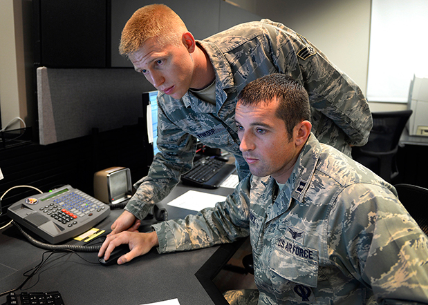
Capt. Jared Delaney, 19th Space Operations Squadron satellite vehicle operator, right, and Senior Airman Bryan Wynkoop, 19 SOPS satellite system operator, monitor telemetry during the GPS SVN-69 launch Oct. 29, 2014 at Schriever Air Force Base, Colo. (U.S. Air Force photo/Dennis Rogers).
The following story by Scott Prater appeared in the Schriever Sentinel, a weekly newspaper published by the Colorado Springs Military Newspaper Group. See http://www.schriever.af.mil/units/publicaffairs/ for further information.
By Scott Prater Schriever Sentinel
11/19/2014 – SCHRIEVER AIR FORCE BASE, Colo. — It’s been a busy year for members of the 19th Space Operations Squadron. As operators of the GPS launch and early orbit, anomaly-resolution and disposal system, 19 SOPS members executed a historically high number of satellite launches (four), and disposed of a legacy GPS vehicle, all within the past 10 months.
“The last time we launched four vehicles in one year was 1993,” said Maj. Kimberly Adams, 19 SOPS LADO flight commander. “We’re looking forward to a more normal [operations] tempo, in the coming year.”
Tensions were high Oct. 29 during the lift-off and early-orbit of SVN-69, a GPS Block IIF vehicle, when a CBS news crew captured film footage of the event on the operations floor here.
“That was out of the ordinary for sure,” Adams said. “Compound that anxiety with the knowledge that we had just completed final configuration of a GPS vehicle disposal not 48 hours prior and you can understand the type of month October was for us and our 2nd Space Operations Squadron teammates.”
Senior Airman Bryan Wynkoop, 19 SOPS satellite system operator, wouldn’t change a thing about the past few months of 2014.
“It’s exciting,” he said. “This sure beats working a regular job. The drama and importance of what’s taking place here is exactly what I signed up for.”
Adams and Wynkoop are Air Force Reservists, as are all 19 SOPS members. The squadron falls under the Air Force’s 310th Space Wing, headquartered at Schriever AFB, and works in partnership with 2 SOPS, the 50th Space Wing unit responsible for commanding and controlling the GPS constellation.
Adams says 19 SOPS was stood up precisely to conduct GPS launches, manage anomalies and process disposals.
“We start preparing for launch about 90 days out,” Adams said. “With so many launches so close together, we often began preparations for one launch before the previous one was off the pad.”
Their partnership with 2 SOPS has proved beneficial for both squadrons.
“This most recent launch was my seventh and Airman Wynkoop’s sixth,” said Adams, who is in her fifth year at 19 SOPS. “Active-duty Airmen typically reside on station for roughly three years, so oftentimes our 2 SOPS teammates are looking to us to provide continuity and experience.”
That continuity became crucial during disposal operations for SVN-33. It had been more than two years since the two squadrons had disposed of a vehicle and Wynkoop was one of the few Airmen at Schriever who was familiar with the operation’s intricacies.
“These events don’t happen often, so to have played a role in two huge events was something special for all of us who were here,” he said.
Less than 48 hours after SVN-33 had been fully configured for disposal, SVN-69 was standing on the launch pad at Cape Canaveral, Florida.
Adams, Wynkoop and their fellow 19 SOPS operators’ day started eight hours prior to the launch.
“Wynkoop had to set up communications links with our antenna at the Cape so we could get telemetry data from the satellite,” Adams said. “Once the rocket lifted off, I was performing communications checks and verifying that we were meeting all of our requirements.”
Then they waited.
Three and half hours after launch, SVN-69 separated from its booster rocket.
“At that point we obtained an initial state of health from the satellite to ensure everything was OK and then we started commanding,” Adams said.
Wynkoop explained that though he and his teammates are actually studying telemetry data through their monitors on the operations floor, it’s easy to envision what’s happening in space.
“The vehicle is spinning once it separates from the booster,” he said. “We then issue commands to slow the spin and deploy the vehicle’s solar arrays, antennas and other critical components. Later, we get the vehicle in a condition known as sun safe. Shortly after, the vehicle acquires Earth and is in a stable orbit in the GPS slot where it’s supposed to be.”
Now, it’s up to 2 SOPS to command and control the satellite, one of 39 on orbit. The squadron expects to receive satellite control authority of the spacecraft later this month and the next GPS launch is scheduled for March 2015.
Several pleasant surprises popped up at this year’s Institute of Navigation’s Joint Navigation Conference (ION JNC) in Orlando, Florida, and the best by far centered on the presenters and the attendees. In a change from recent years due to budget restrictions, better known as sequescastration, this year two senior Air Force generals attended and actively participated in several events.
General (S) John Hyten – Vice Commander AFSPC – Courtesy of the USAF
General (S) John E. Hyten (USAF), currently the Vice and soon to be the Commander of USAF Space Command (AFSPC), participated in two days of ION JNC and was featured as the keynote speaker on the second day of the plenary session. As a senior steward of the Global Positioning System, indeed for all USAF Space Systems, General Hyten has a special place in his heart for GPS, having served as the Commander, 50th Space Wing, Schriever AFB in Colorado, the home of GPS.
The 2nd Space Operations Squadron is a component of the 50th Operations Group, 50th Space Wing, Schriever AFB, CO. The squadron was activated Jan. 30, 1992.
Conference attendees were pleasantly surprised with the access they had to General Hyten as he toured exhibits and joined fellow attendees for lunch, presentations, and discussions in the hallways. General Hyten made it clear that he was there to interact with ION JNC attendees and welcomed everyone to engage him in conversation. A rare invitation from a very busy general officer with huge responsibilities — and an invitation that many attendees clearly took to heart, as General Hyten was continually engaged in discussions during his two-day stay.
In his plenary presentation, General Hyten addressed GPS and the general lack of knowledge in the public today concerning the origins of the system. Hint — the answer is the United States Air Force. More on that later.
Major General (USAF) Robert Wheeler
Major General Robert Wheeler (call sign Wheels) also attended ION JNC this year to speak during the classified day on June 19 and to participate as an ad hoc member of the always-popular War Fighter Crosstalk Panel. General Wheeler currently serves on the staff of the Secretary of Defense (SECDEF) as Deputy Chief Information Officer for Command, Control, Communications and Computers (C4) and Information Infrastructure Capabilities (DCIO for C4IIC). General Wheeler is a command pilot with more than 5,000 hours in multiple aircraft, including the B-2 bomber in which he saw combat time over theater.
It was obvious from his initial comments in the classified sessions that General Wheeler is a warrior and staunch supporter of GPS and all things PNT-related. As much as I would like to relate some of his more pithy remarks, they were made in a classified environment, so sharing them is impossible in this venue. However, suffice it to say the General’s comments were well received by the war fighters who attended as well as the classified session attendees, which included many of our closest international allies.
The comment was made several times in my hearing that “We sure hope General Hyten and General Wheeler are invited back again next year.”
If all goes according to plan, General Hyten will be a four star and a MAJCOM Commander in just a few weeks. If he thought he was busy before . . .
Now let’s utilize that sage observation as a segue to General Hyten’s Plenary remarks at this years ION JNC. Having known John Hyten for over 20 years it has always been my experience that he does things just a bit differently – he hears a slightly different drumbeat and this year’s plenary speech was certainly no exception. Right from the start this speech was a bit different. General Hyten warned his audience he was going to praise them for their hard work and then gently admonish them but in a good way. With that opening statement he certainly had everyone’s attention. General Hyten asked for a show of hands from those attendees who knew that GPS originated with the USAF, the 50th Space Wing at Schriever AFB and particularly the 2SOPS (2nd Space Operations Squadron).
2SOPS operators on the GPS Operations Floor at Schriever AFB, CO
In the GPS/PNT-savvy audience Gen Hyten was addressing, literally every hand went up, and that was evidently what he hoped to see. The response was not a surprise to anyone, however the general went on to make the point that if he went out into the general population in the Renaissance Hotel at SeaWorld he would be lucky to find one in ten who even knew what GPS stood for, and that it came from space, and almost none would know that it was, is, and will for the foreseeable future always be provided free of charge to global users courtesy of the USAF.
GPS has been provided by the USAF free of charge for global users ever since President Ronald Reagan declared it so via a Presidential Decision Directive issued in 1988 shortly after the Soviet military shot down a Korean Air airliner (Flight 007) that had strayed off course and into Soviet Airspace due to a navigation error.
Ironically, General Hyten made the point that if the U.S. Government charged for use of the GPS signals, even at a nickel (5 cents) per user per device per year, it would pay for itself, and everyone would know that the USAF provided the service on behalf of the U.S. Government.
However, since it is free, ubiquitous, and considered almost a utility today, everyone around the world just assumes it will always be there and they don’t think about how or why the signals are provided. GPS is just always there.
GPS Orbitology 101- Courtesy of the USAF
General Hyten went on to make several cogent points concerning current and future use of GPS and other PNT assets. At the same time he warned us that there are those in the Pentagon [Obviously shortsighted, my comment, not the general’s.— DJ] who erroneously question why we still need GPS today. They myopically see it as an antiquated, compromised system. When in fact GPS and multi-GNSS PNT systems are on the cutting edge of technology.
The general made the comparison with WWII bombers that were being shot down at an alarming rate until the War Department (circa 1943) started the practice ofusing fighter escorts to help them fight through and return home safely. The analogy applies to GPS, which even today is being purposefully and at times maliciously attacked by spoofers and jammers.
Augmentations
Fortunately there are numerous actions that can and are being taken to secure GPS as a critical global service — fighter escorts if you will — that will not only help GPS maintain its preeminent Gold Standard position in the world of global PNT, but allow the system to grow and mature, even flourish, with additional high tech capabilities such as CNAV and MNAV (new civilian and military navigation messages).
Indeed the general stated that we have just begun to explore all the transformational capabilities being added to our GPS/PNT and multi-GNSS arsenal with the addition of L1-L2 M-Code (military code) and L2-L5 CNAV signals.
Of additional interest are space-based augmentations (SBAS) such as WAAS (Wide Area Augmentation System) and EGNOS (European Geostationary Navigation Overlay Service) as well as independent regional terrestrial augmentations and backups such as E- and D-LORAN (long range navigation), which today have demonstrated a time stability of 1×10(-12) and a position accuracy of 5-10 meters, an order of magnitude better than LORAN C’s 50-1,000 meters.
General Hyten went on to warn the commercial PNT vendors and government program managers in the 400+ audience that they must cease placing commercial GPS receivers in critical government systems that support the war fighters, government users, and our critical national infrastructure. Indeed he said this is why we have SAASM (Selective Availability Anti-Spoofing Module) and M-Code: to help secure these critical systems against interference, jamming and spoofing, intentional or otherwise. He also pleaded with industry manufacturers and vendors of PNT devices to please build their devices in strict adherence to the U.S. government;s ICD process. While the general declined to mention specific cases or companies, most in the room were aware of the ramifications of ICD non-compliance, from usefulness, mission and financial perspectives.
The general cited several known cases where, due to noncompliance, several systems just never did work well or consistently in a war zone. He said he knew of cases where “…the PNT systems worked fine in Yuma, Arizona but failed to work in Afghanistan. Please do not put commercial systems in critical military equipment.”
Pseudolites
Pseudolites are another area where the general has concerns. This is of course a hotly debated spectrum issue. Whereas we in the United States have been fighting highly-publicized spectrum battles, attempting to preserve the sanctity of the GPS spectrum globally, the Europeans are on the verge of approving pseudolite implementations all over the European continent that could seriously degrade GPS/PNT/Galileo signal reception and make PNT systems unusable or at least undependable in some critical areas, especially around the approaches to airports. Although on the surface pseudolites may seem like a good solution, I always remember what Dr. Bradford Parkinson is fond of saying: “An improperly implemented pseudolite is just another name for a potential GPS or PNT jammer.”
The Unofficial Test
After General Hyten’s comments, I decided to put his theory to the test. Just how many people know GPS is provided free to the world courtesy of the United States Air Force?
As someone who has been working GPS issues since 1975, I find it hard to believe that the American public is so uninformed about a system that is so critical to their everyday existence, because as most of you know, GPS is pervasive in almost all of our critical and not-so-critical national infrastructure. Indeed stealth GPS chips and receivers are embedded in so many devices today that it would be easier to name the devices that don’t use GPS. So I took the General at his word and set out to conduct my own mini-survey.
However, before I even had a chance to think much about what I would ask, I stepped into an elevator at the Sea World Renaissance Hotel where the ION JNC was taking place and found myself face to face with an elevator full of attendees from a major medical convention in the same hotel. They saw the ION JNC patch on my black golf shirt and asked me about it.
I told them and then asked what they knew about GPS. As in, did they know where the GPS signals came from and who provided them? Lots of answers were given and none of them remotely correct.
Frankly I was appalled, and before they exited the elevator I made sure they knew that GPS signals came from space and were provided totally free by the USAF. Mission accomplished. But not so fast; unfortunately the rest of my day and ad hoc surveys went about the same way. Some actually knew that GPS signals were free, some knew or thought they were provided by the government but had not a clue what agency or service.
Most thought they were radio signals from ground transmitters and were provided by the GPS equipment manufacturers. After asking more than 100 people where GPS signals originated and who provided them, I received exactly two correct answers, from wives whose husbands had recently served in the military in theater.
In my informal survey, 2% (two percent) of the respondents knew the right answers — and they had a military background. None of the true civilians had a clue. It was appalling and discouraging! Apparently General Hyten has done his homework and his point is well taken.
We need to get the word out that GPS is totally free, provided to the world by the United States Air Force. A simple but important message. Simple yes, and certainly discouraging at this specific venue, as this is a major part of the mission of ION and JNC — educating the world about the capabilities of GPS. Now I guess we need to emphasize the basics, just as GPS acquisition has reverted to a “back to a basics” approach. I agree with General Hyten that we (all those of us who care about GPS and all that it enables) need to do the same: get out the basic message every chance we get. Join me, won’t you, in getting that simple message across?
The next ION symposium, ION GNSS+ 2014 will take place September 8-12, 2014 at the Tampa Convention Center in Tampa, Florida. I hope to see you there.
Thanks
In closing I tip my hat to Lisa Beaty, the Executive Director of ION, and her entire team especially the new Military Division headed by my good friend and Institute for Defense Analyses (IDA) colleague Jim Doherty. Jim arranged the classified Cross Talk Military Panel this year, which was the hit of the show, as it has been under Jim’s leadership for the past several years. Jim stepped down this year as the Military Division Chair during the ION JNC symposium, and he will be sorely missed, although I suspect he will still be involved in some fashion.
The bottom line is that the ION symposia just keep getting better every year. The venues and the host hotels are first class, the food is excellent, and most of all the speakers and papers presented are scrubbed to the point that you really only get the cream of the crop. Unfortunately, you can’t say that about every GPS/PNT symposium today.
This year the exhibitors were in a large area that allowed everyone more room, and it made for a much more relaxed atmosphere in the exhibit area. I found that I spent a great deal more time with the exhibitors this year than in years past, and what I discovered there will be the subject of several future columns.
Until next time, happy navigating and remember, GPS comes to you courtesy of the United States Air Force.
Aim High!
What’s Don Reading?
Beyond Horizons – A Half Century of Air Force Space Leadership
David N. Spires, PhD – Professor Emeritus University of Colorado, Boulder, CO.
Reading good history volumes is one of my favorite pass times and when it comes to an early history of Air Force Space there is none better than Beyond Horizons.
Dr. Spires does an excellent job of setting the stage and explaining exactly how Air Force Space Command came into existence and why it was so sorely needed. The current volume covers the US Air Force and Air Force Space from its very beginnings at the end of WWII; think Dr. Theodore von Karman (Toward New Horizons) and General of the Army (Five-star) H.H. Arnold.
General Arnold actually flew a Wright Flyer back in 1911 and would have retired as a 5-star Army General but on May 7, 1949, Public Law 58-81 changed the designation of Arnold’s final rank and grade to that of General of the Air Force, and he remains the only person to have held the rank. He is also the only person to hold five-star rank in two U.S. military services. General Arnold was instrumental in funding and authorizing research conducted by von Karman, and von Karman was instrumental in research that eventually led to an Air Force and an Air Force Space Command. It is all here in this fascinating book which is edited by longtime friends and colleagues George W. Bradley III (PhD) and Rick W. Sturdevant (PhD), who serve today as the Chief and Deputy Historians respectively at Air Force Space Command.
The only pastime better than reading, this book is talking about it with the author personally, who was also a career Air Force Officer, which I have had the pleasure of doing briefly, on several occasions, and the conversations were fascinating. David is just full of interesting facts and stories concerning Air Force Space. I am convinced that if he were to commit them all to paper, there would be several volumes. I hope you enjoy this fascinating Air Force Space history.
Northrop Grumman and Boeing have responded to a U.S. Air Force call for contractors interested in building a follow-on set of GPS III satellites, according to a report in Space News.
Lockheed Martin is under contract to deliver the first eight GPS III satellites, but the award for up to 22 further IIIs remains open. Difficulties with the payload for the first batch of satellites mean that although the Lockheed has three space vehicles ready, it has no signal payload to put aboard them. Subcontractor Exelis is at work on that. Delivery delays have prompted the Air Force to look about for alternatives.
Lockheed Martin itself began investigating options for its supply line last year.
Air Force “Sources Sought” Call
The U.S. Air Force issued an official “Sources sought” notice in June on a production-ready GPS space vehicle, equipped with an alternate payload, for consideration alongside the Lockheed Martin-built GPS III vehicle. The first phase of the contract would include two firm-fixed price contracts worth $100–$200 million to demonstrate a competitor to GPS III.
Key requirements are that the satellite must offer a payload alternative to that built by Exelis; the satellite must be ready to launch by 2023; and the production line must turn out two to three new satellites per year.
The second phase features a competition between Lockheed Martin and one or more other companies for as many as 22 satellites. A final contract award would be made in 2017 or 2018.
Current GPS III contractor Lockheed Martin reportedly sent an engineering team to help Exelis expedite a resolution of payload holdups, while simultaneously investigating a switch to other suppliers, beginning with the ninth satellite in the GPS 3 series. Lockheed Martin says five companies responded to its solicitation last year.
Air Force Gives Free Hand. Gen. Ellen Pawlikowski, head of the Air Force Space and Missile Systems Center (SMC), told the national Space Symposium in Colorado in June, “Obviously we want a GPS III that does what its supposed to do, delivered on time, and it’s up to Lockheed to manage its subcontractors. My view is if Lockheed is not happy with their subcontractors nav payload, and they believe that they can get a lower risk approach to delivering a nav payload by seeking a secondary source for that, then that’s clearly a decision for them to make.
“They [Lockheed ] know we are disappointed at the delays that we have seen, the technical issues that their subcontractor has had, and probably they are considering whether an alternative source could provide them a better opportunity.“
Lockheed Martin spokesman Chip Eschenfelder issued a statement: “Exelis has made good progress on the first GPS III space vehicle, SV01 navigation payload. All GPS III SV01 navigation payload components have successfully completed unit acceptance and environmental testing, with the exception of one component, the mission data unit.
“To date, significant MDU hardware testing indicates signal cross talk issues are resolved. The SV01 navigation payload forecast delivery to Lockheed Martin is fall 2014.”
Boeing built the platform and major payload components for the GPS IIF satellites and is one of three companies that received contracts in January 2013 to study how to improve the accuracy, coverage, and efficiency of GPS using smaller satellites.
Northrop Grumman Aerospace of Redondo Beach, California, has already delivered deployable antenna sets to Lockheed Martin for the first six GPS III satellites. The division has delivered more than 1,000 antennas for previous generations of GPS spacecraft, Northrop Grumman said.
Calling it an “unprecedented and deeply worrying total disruption . . . [that] shook the industry,” Locata Corporation reiterated its call for redundant terrestrial systems to back up GNSS in the wake of the April 1 11-hour GLONASS system outage.
Nunzio Gambale, Locata CEO, said “We have been telling the industry for years that you cannot have a critically important capability like GPS without also having a backup! What is Plan B if the satellite systems fail? What replaces the space signal when there is a problem? If anyone needed a sign to understand why Locata has spent years inventing and developing the world’s first local terrestrial equivalent of the GPS system, then last week’s meltdown of a complete global satellite navigation system is it. This event should terrify every nation, government, and company that depends on navigation satellites for their business or, in some cases, their very lives.”
The navigation and timing functions of the global positioning systems underpin the world’s banking systems, stock exchanges, digital TV and Internet, cell phone networks, and, in some cases, the national electricity supply, Locata pointed out. GPS, in particular, plays a crucial role in transportation, shipping, and logistics, serving as the enabling technology for critical functions like air traffic control. Reliability is therefore not just important; it is essential across all applications. Locata, the Resilient Navigation and Timing Foundation (RNTF) in Washington, D.C., and others have persistently called attention to the need for redundant terrestrial systems that will back up expensive, vulnerable, and aging global satellite navigation constellations while simultaneously providing the local control and resiliency that satellite-based systems cannot deliver.
Professor Chris Rizos of the School of Civil and Environmental Engineering at the University of New South Wales stated that “This catastrophic failure of one of the world’s two global satellite navigation constellations is a wakeup call for all of us. We ignore the possibility of these ‘Black Swan’ events at our own peril.”
The GLONASS disruption was felt around the world, immediately upon its origination, especially in professional applications, such as tractor automation for farming, machine control and robotics in mining and heavy industry, and in the national infrastructure used by surveyors and industry across many countries.
“This shows just how interlinked the physical and cyber worlds have now become,” added Professor Brett Biddington, a space and cybersecurity expert from the School of Computer and Security Science at Edith Cowan University, Australia. “The prospect of a software glitch, whether unintentional or intentional, seems highly likely [as a cause for the failure]. If it was a deliberate attack, however, it points to a changing face of warfare where the real enemy may be impossible to detect and deter until very damaging strikes, such as an attack on the GPS system, have already taken place.
“The vital point here is that this is no longer just a question for scientists and technologists. A locally controlled backup system for this essential signal is a national policy question of the highest order.”
Locata Corporation and other industry authorities have long testified on global satellite navigation vulnerabilities and the need for diverse technology options to strengthen and back up GPS, GLONASS, and other systems. Locata developed a robust solution and has been awarded a sole-source contract by the U.S. Air Force (USAF) to provide its terrestrially based alternative positioning for military applications where GPS has been completely jammed. The first wide-area Locata system is being deployed now at the White Sands Missile Range in New Mexico. The USAF demonstrated that the White Sands Locata network delivers what has been extremely high accuracy over a 2,500-square mile area, positioning aircraft flying up to 35 miles away to an accuracy of better than six inches.
A pair of LocataLite transmit antennas overlook a section of the White Sands Missile Range blanketed by the Locata high-precision ground-based positioning system.
“There is no other technology that can do this, and it’s delivered in the complete absence of GPS,” continued Gambale. “What is being demonstrated at White Sands is that Locata supplies precisely the same function as GPS, even when there is no GPS available. That’s exactly what you need if the satellites fail.
“If this event had been a GPS failure instead of a GLONASS failure – and it could very easily have been – then the entire world would have plunged into a catastrophe. This event is the navigation equivalent of a ‘close call moment,’ and from here on out no one can even question that this is a really serious problem that must be addressed. Another industry expert recently told me, ‘If there was a sustained GPS outage, it would cause a global financial nuclear winter from which it would take us decades to recover.’”
Gambale concluded, “We need action to develop local backups like Locata around places like airports and other strategically important areas – now! We must not wait until we are faced with another seemingly impossible event like a complete satellite constellation failure. We may not dodge this bullet a second time.”
Locata terrestrial positioning technologies complement GPS by setting up ground-based transmitters, called LocataLites, to create a local constellation called a LocataNet. Once properly deployed, Locata’s unique nanosecond-accurate TimeLoc system synchronizes the network, which allows it to replicate the positioning capabilities of GPS, locally. LocataNets operate today in environments ranging from small warehouses to open-cut mines, wide-area aircraft approach-and-landing systems, and wider areas for aircraft and unmanned aerial vehicle (UAV) uses.
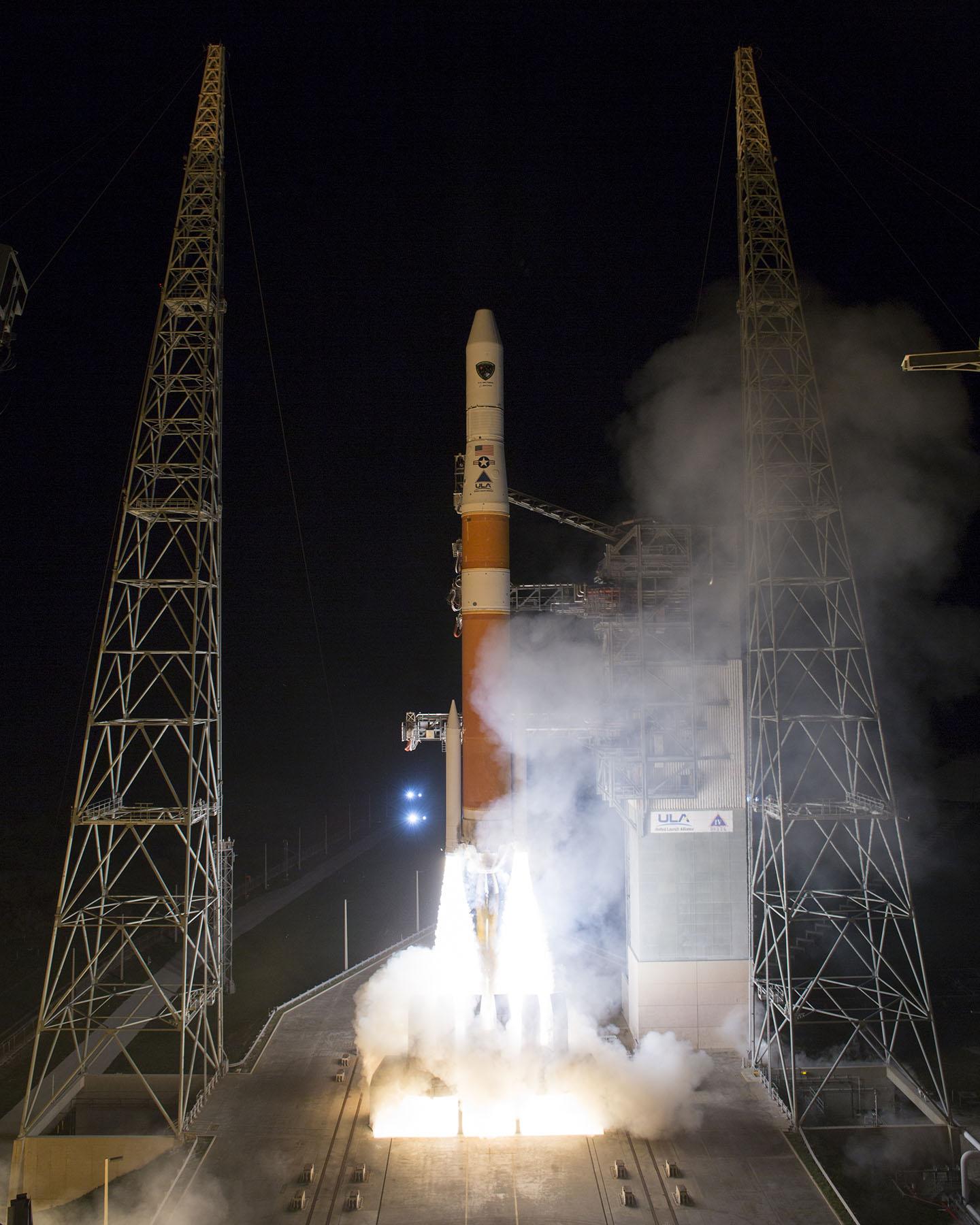
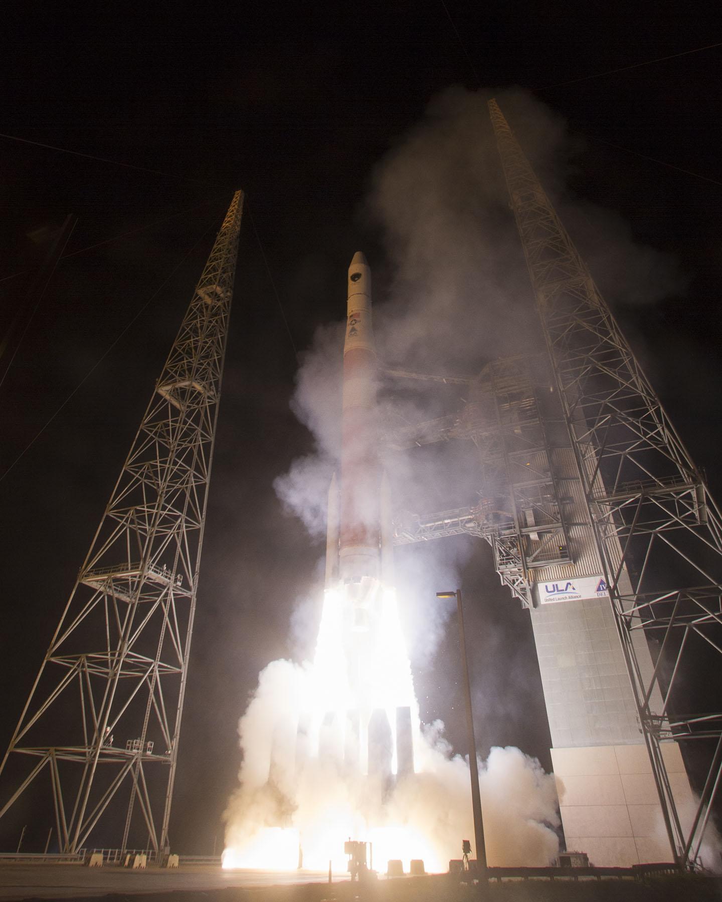
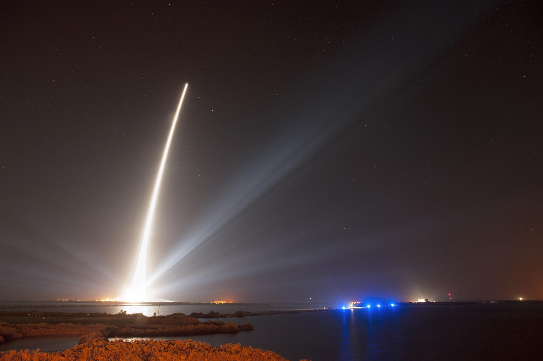
A United Launch Alliance Delta IV lifts off from Space Launch Complex-37 with the Air Force’s Global Positioning System (GPS) IIF-5 satellite. This launch marked the 25th Delta IV flight since the first flight in 2002. Credit: Ben Cooper/ULA
News compiled with the assistance of CANSPACE listserv.
After a brief delay due to concerns over solar radiation trends, the GPS IIF-5 satellite was successfully launched at the end of the designated launch window at 01:59 UTC on February 21. The satellite, attached to the launch rocket’s upper stage, was initially placed in a highly elliptical orbit. Following a third burn of the rocket, the satellite was released into its assigned orbit at about 05:37 UTC today.
Here is a video showing highlights of the launch:
GPS IIF-5 will replace the aging spacecraft known as GPS IIA-28 in Plane A, Slot 3 of the constellation.The GPS IIA-28 satellite was launched aboard Delta 249 on November 5, 1997, as the final member of the Block IIA series. It will go into a reserve role in the network for the remainder of its useful life.
This is the first of three GPS launches planned through July to replace aging craft in the constellation. GPS IIF-5 incrementally upgrades the constellation with improved accuracy, enhanced internal atomic clocks, better anti-jam resistance, a civil signal for commercial aviation, and a longer design life, all features of the Boeing-build Block IIF series. This will be the fifth of 12 Block IIF spacecraft being built to form the backbone of the GPS fleet for the next 15 years.
Launch logo. The nickname of the IIF-5 satellite is Canopus, the brightest star in the modern constellation Carina and the second brightest star in the night-time sky, after Sirius.
According to the Air Force, the new capabilities of the IIF satellites will provide greater navigational accuracy through improvements in atomic clock technology, a more robust signal for commercial aviation and safety-of-life applications, known as the new third civil signal (L5), a second civil signal (L2C) available for the dual-frequency GPS receivers and a 12-year design life providing long-term service. These upgrades improve anti-jam capabilities for the warfighter and improve security for military and civil users around the world.
“I am pleased with the outcome of today’s launch. The new capabilities provided by the IIF satellites will improve operations, sustainment and overall GPS service for the warfighter, international, commercial and civil communities,” said Col. Bill Cooley, director of the Space and Missile Systems Center’s Global Positioning Systems Directorate.
“The modernized capabilities that are coming on board with the successful launch of GPS IIF-5 will support the worldwide GPS community for years to come. I would like to recognize the outstanding commitment and the superb dedication to mission success from the 45th and 50th Space Wings, our industry partners: Boeing and United Launch Alliance, and the GPS IIF and Delta IV program teams at the Space and Missile Systems Center,” said he said.
The GPS Block IIF satellites are built by Boeing, and are operated by the United States Air Force following their launch by United Launch Alliance, using Evolved Expendable Launch Vehicles.
The first GPS IIF satellite was launched on May 27, 2010, and entered service on Aug. 26, 2010.
The second satellite, which launched on July 16, 2011, entered service on Aug. 22, 2011.
The third satellite launched on Oct. 4, 2012, and entered service 22 days later.
The fourth IIF was launched May 15, 2013, and entered service on June 21, 2013.
Every modern GPS satellite was launched from Cape Canaveral Air Force Station.
Each GPS IIF satellite delivers:
Greater navigational accuracy through improvements in atomic clock technology,
A new civilian L5 signal to aid commercial aviation and search and rescue operations,
Improved military signal and variable power for better resistance to jamming in hostile environments,
A 12-year design life providing long-term service and reduced operating costs,
An on-orbit, reprogrammable processor that can receive software uploads for improved system operation.
“Once again, a group of talented mission partners rose to the challenge of launching another successful mission from the Cape,” said Col. Douglas Schiess, commander, 45th Operations Group, who served as the Launch Decision Authority. “Those mission partners include the 45th Space Wing, the Space and Missile Systems Center, the 50th Space Wing, United Launch Alliance, Boeing, and our other industry partners with the Delta IV and GPS IIF launch teams.”
A United Launch Alliance Delta IV lifts off from Space Launch Complex-37 with the Air Force’s Global Positioning System (GPS) IIF-5 satellite. This launch marked the 25th Delta IV flight since the first flight in 2002.A United Launch Alliance Delta IV lifts off from Space Launch Complex-37 with the Air Force’s Global Positioning System (GPS) IIF-5 satellite. This launch marked the 25th Delta IV flight since the first flight in 2002.
Artist’s concept of a GPS III satellite in orbit, courtesy of Lockheed Martin.
Air Force Orders GPS III Satellites 05 and 06 from Lockheed Martin
A December 12 contract modification provided Air Force funding to Lockheed Martin to complete the fifth and sixth GPS III space vehicles (SV 05-06). Lockheeed originally received funding to procure long-lead parts for satellites five through eight (SV 05-08) in February 2013.
The $200,700,415 cost-plus-incentive-fee modification (P00276) on an existing contract (FA8807-08-C-0010) for GPS III space vehicles 05 and 06 means that work will be performed at Littleton. Colorado and Clifton, New Jersey, and is expected to be completed by Dec. 14, 2017 for space vehicle 05 and June 14, 2018 for space vehicle 06. The Air Force Space and Missile Systems Center Contracting Directorate, Los Angeles Air Force Base, California, is the contracting activity.
Galileo Achieves First Airborne Tracking
The European Space Agency’s Galileo satellites have achieved their first aerial fix of longitude, latitude, and altitude, enabling the inflight tracking of a test aircraft.
ESA’s four Galileo satellites in orbit have supported months of positioning tests on the ground across Europe since the first fix in March. Now the first aerial tracking using Galileo has taken place, determining the position of an aircraft using only its own independent navigation system.
The milestone took place on a Fairchild Metro-II above Gilze-Rijen Air Force Base in the Netherlands on November 12. It was part of an aerial campaign overseen jointly by ESA and the National Aerospace Laboratory of the Netherlands, NLR, with the support of Eurocontrol, the European Organisation for the Safety of Air Navigation, and LVNL, the Dutch Air Navigation Service Provider.
A pair of Galileo test receivers was used aboard the aircraft, the same kind employed for Galileo testing in the field and in labs across Europe. They were connected to an aeronautical-certified triple-frequency Galileo-ready antenna mounted on top of the aircraft.
Tests were scheduled during periods when all four Galileo satellites were visible in the sky. The receivers fixed the plane’s position, as well as determining key variables such as the position, velocity, and timing accuracy; time to first fix; signal-to-noise ratio; range error; and range–rate error.
Testing covered both Galileo’s publicly available Open Service and the more precise, encrypted Public Regulated Service, whose availability is limited to governmental entities.
Flights covered all major phases: take off, straight and level flight with constant speed, orbit, straight and level flight with alternating speeds, turns with a maximum bank angle of 60 degrees, pull-ups and push-overs, approaches and landings.
The flights also allowed positioning to be carried out during a wide variety of conditions, such as vibrations, speeds up to 456 km/h, accelerations up to 2 ghorizontal and 0.5–1.5 gvertical, and rapid jerks. The maximum altitude reached during the flights was 3,000 meters.
GPS III Prototype Proves Constellation Compatibility
The Lockheed Martin prototype of the next-generation GPS satellite, the GPS III, has proven that it is backwardly compatible with the existing GPS satellite constellation in orbit.
During tests concluded on October 17, Lockheed Martin’s GPS III testbed successfully communicated via cross-links to Air Force simulators of the current GPS constellation in orbit. The current GPS constellation includes GPS IIR, GPS IIR-M, and GPS IIF satellites.
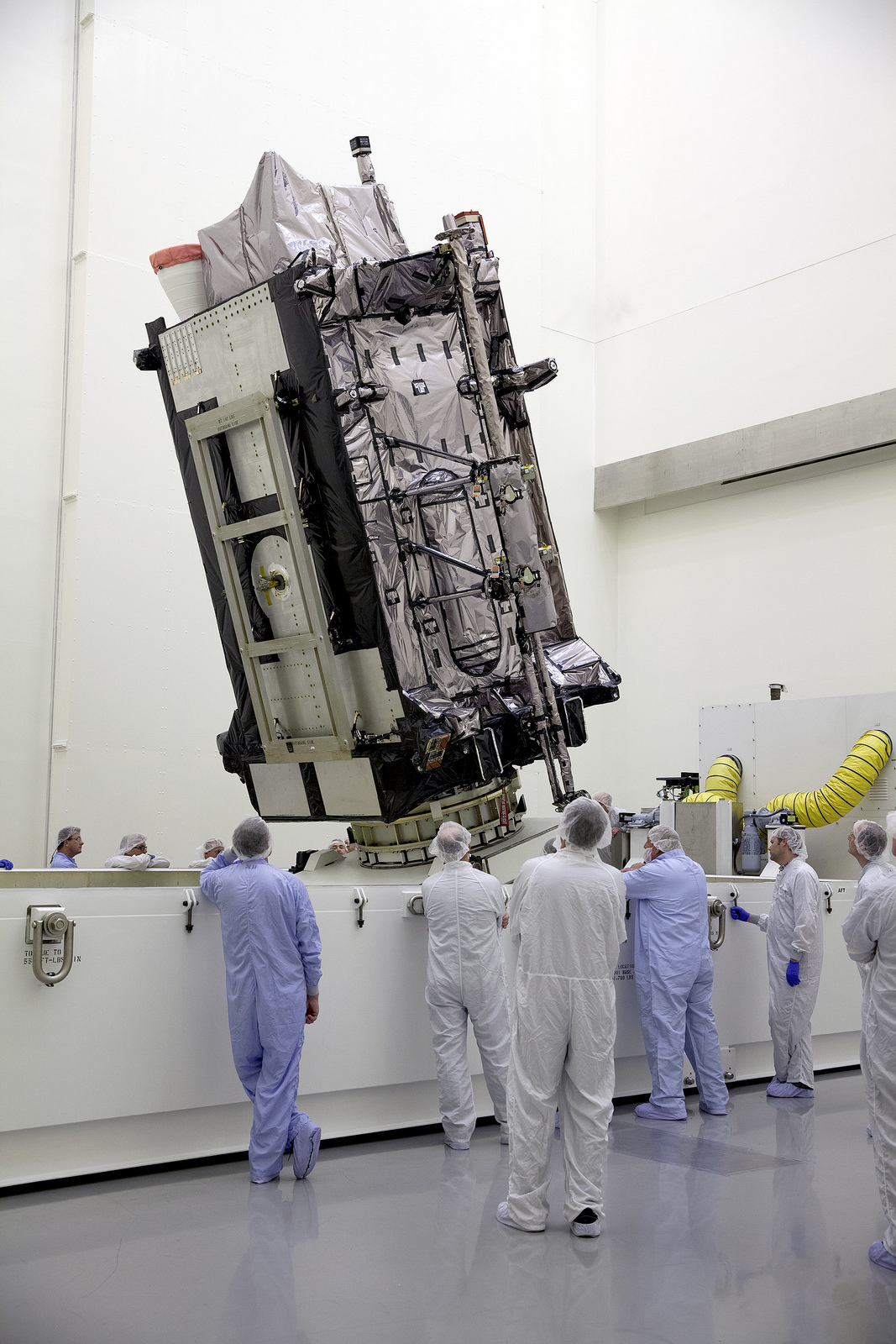
Testing also demonstrated the ability of an Air Force receiver to track navigation signals transmitted by the GPS III Nonflight Satellite Testbed (GNST). The GNST is a full-sized, functional satellite prototype at Cape Canaveral Air Force Station.
“These tests represent the first time when the GNST’s flight-like hardware has communicated with flight-like hardware from the rest of the GPS constellation and with a navigation receiver,” explained Paul Miller, Lockheed Martin’s director for GPS III Development. “This provides early confidence in the GPS III’s design to bring advanced capabilities to our nation, while also being backward-compatible.”
The first flight-ready GPS III satellite is expected to arrive at Cape Canaveral in 2014, for launch by the Air Force in 2015.
GPS III satellites will be the first GPS space vehicles with a new L1C civil signal designed to make it interoperable with other international global navigation satellite systems.
The GNST has helped to identify and resolve development issues prior to integration and test of the first GPS III flight space vehicle (SV 01). It has gone through the development, test, and production process for the GPS III program first, significantly reducing risk for the flight vehicles, improving production predictability, increasing mission assurance, and lowering overall program costs.
The GPS III team is led by the Global Positioning Systems Directorate at the U.S. Air Force Space and Missile Systems Center.
Lockheed Martin is the GPS III prime contractor, with teammates including ITT Exelis, General Dynamics, Infinity Systems Engineering, Honeywell, ATK, and other subcontractors.
Good News for Users and Manufacturers
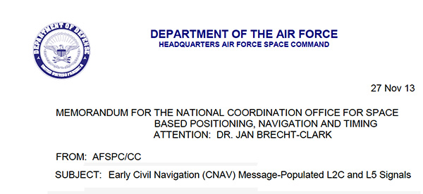
The U.S. Air Force is directing transmission of continuous CNAV message-populated L2C and L5 signals starting in April 2014. The move is designed to help development of user equipment compatible with the civil signals. Full text of the CNAV memo appears below.
Galileo FOC Satellites Endure Simulated Space Tests
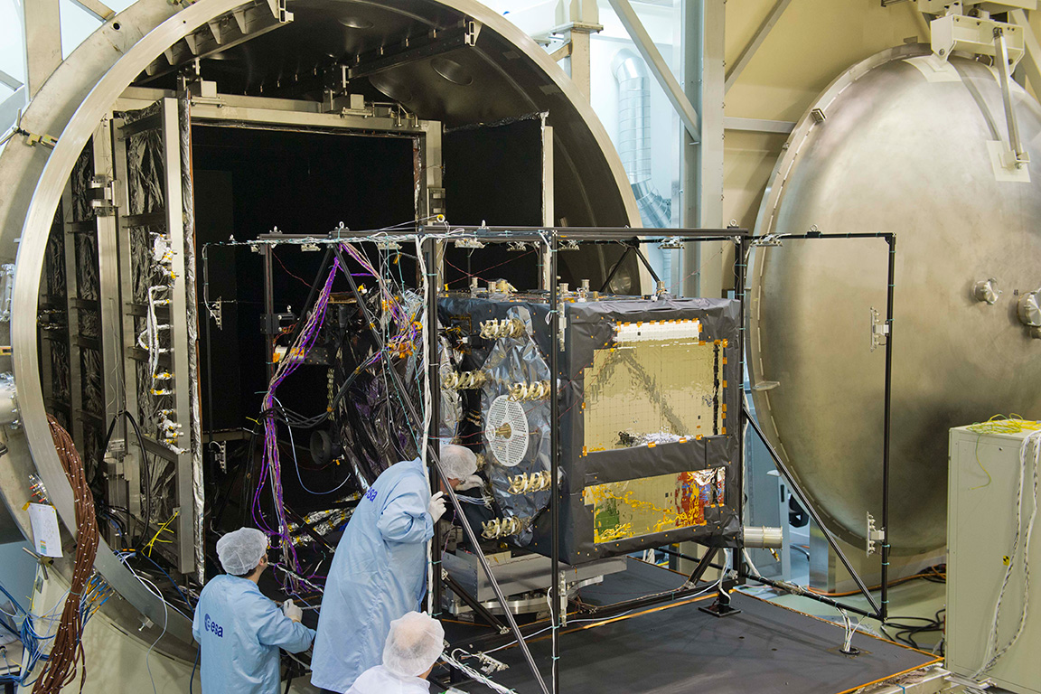
The European Space Agency’s newest Galileo satellite has emerged from five weeks of simulated space conditions. On November 29, a hatch slid open to end its thermal-vacuum test, a milestone on the way to orbit.
The satellite was placed in the 4.5-meter-diameter Phenix chamber in ESA’s ESTEC Test Centre in Noordwijk, the Netherlands, in late October. Once inside, the air was pumped out to create a space-quality vacuum. Temperature extremes were also reproduced, with the six copper walls of the thermal tent cooled by liquid nitrogen down to –180°C.
A second Galileo vehicle has been undergoing the same rigors at the site, along with a vibration and shock test to reproduce separation from the launcher. Thermal-vacuum testing on the second model will begin in early 2014. The two satellites will be launched on a Soyuz rocket from Europe’s Spaceport in French Guiana in mid-2014.
The next satellite is expected to arrive at ESTEC in March, with further satellites following every seven weeks or so. A total of 22 FOC satellites are being built by OHB in Germany, with navigation payloads being delivered from Surrey Satellite Technology Ltd. in the UK.
The first Galileo Full Operational Capability satellite emerges from the Phenix test chamber after five weeks of thermal–vacuum testing.
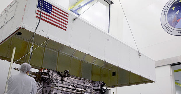
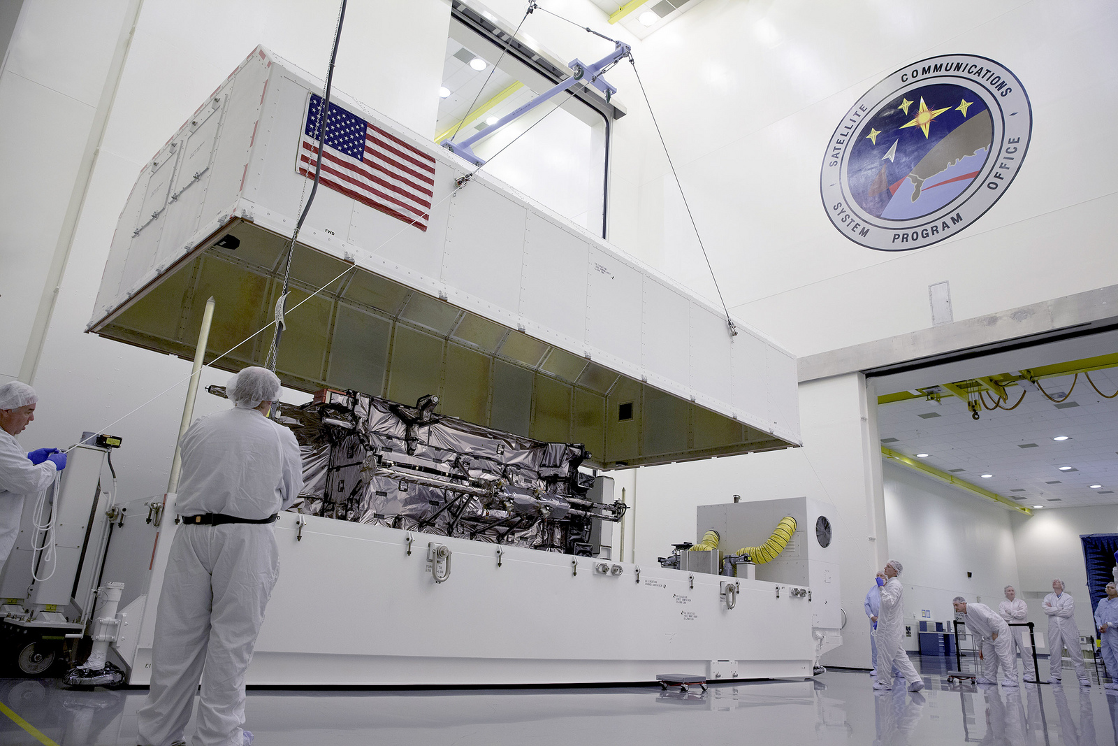
The GNST arrives at Cape Canaveral Air Force Station, Florida, in July.
The Lockheed Martin prototype of the next-generation GPS satellite, the GPS III, has proven that it is backwardly compatible with the existing GPS satellite constellation in orbit.
During tests that concluded on October 17, Lockheed Martin’s GPS III testbed successfully communicated via cross-links to Air Force simulators of the current GPS constellation in orbit. The current GPS constellation includes GPS IIR, GPS IIR-M, and GPS IIF satellites.
Testing also demonstrated the ability of an Air Force receiver to track navigation signals transmitted by the GPS III Nonflight Satellite Testbed (GNST). The GNST is a full-sized, functional satellite prototype at Cape Canaveral Air Force Station.
“These tests represent the first time when the GNST’s flight-like hardware has communicated with flight-like hardware from the rest of the GPS constellation and with a navigation receiver,” explained Paul Miller, Lockheed Martin’s director for GPS III Development. “This provides early confidence in the GPS III’s design to bring advanced capabilities to our nation, while also being backward-compatible.”
Lockheed Martin is under contract to produce the first four GPS III satellites (SV 01-04), and has received advanced procurement funding for long-lead components for the fifth, sixth, seventh, and eighth satellites (SV 05-08). The first flight-ready GPS III satellite is expected to arrive at Cape Canaveral in 2014, for launch by the Air Force in 2015.
Testing took place with the GNST — a test version of the GPS III — at Cape Canaveral.
GPS III, a critically important program for the Air Force, will replace aging GPS satellites in orbit while improving capability to meet the evolving demands of military, commercial and civilian users. GPS III satellites will deliver three times better accuracy; provide up to eight times more powerful anti-jamming capabilities; and include enhancements to extend spacecraft life 25 percent further than the prior GPS block. It will be the first GPS satellite with a new L1C civil signal designed to make it interoperable with other international global navigation satellite systems.
An innovative investment by the Air Force under the original GPS III development contract, the GNST has helped to identify and resolve development issues prior to integration and test of the first GPS III flight space vehicle (SV 01). Following the Air Force’s rigorous “back-to-basics” acquisition approach, the GNST has gone through the development, test, and production process for the GPS III program first, significantly reducing risk for the flight vehicles, improving production predictability, increasing mission assurance, and lowering overall program costs.
The GNST arrived at the Cape on July 19 to test facilities and pre-launch processes in advance of the arrival of the first flight satellite. On August 30, the GNST successfully established remote connectivity and communicated with the GPS Next Generation Operational Control System (OCX), being developed by Raytheon.
Before shipment to the Cape, the GNST completed a series of high-fidelity activities to pathfind the integration, test and environmental checkout that all production GPS III satellites undergo at Lockheed Martin’s GPS III Processing Facility (GPF) in Denver, Colo.
The GPS III team is led by the Global Positioning Systems Directorate at the U.S. Air Force Space and Missile Systems Center. Lockheed Martin is the GPS III prime contractor, with teammates including ITT Exelis, General Dynamics, Infinity Systems Engineering, Honeywell, ATK, and other subcontractors. Air Force Space Command’s 2nd Space Operations Squadron, based at Schriever Air Force Base, Colo., manages and operates the GPS constellation for both civil and military users.
The scheduled October 23 launch of GPS IIF-5, the fifth in the current “follow-on” generation of GPS satellites, has been postponed in order to complete a review of an adjustment made to the rocket’s upper stage engine. A fuel leak in that engine of the Delta 4 rocket during a GPS launch in October of last year created some worries for the Air Force and the United Launch Alliance (ULA), although the satellite successfully reached its intended orbit despite the upper stage producing less thrust than expected.
A subsequent investigation determined a fuel leak in the engine system was responsible. Two medium Delta IV rockets and one heavy version have launched since then, but ULA said continued investigation had produced new information about the engine’s first start.
While no new definitive launch date has been set, the ULA released a statement:
“The ongoing Phase II investigation has included extremely detailed characterization and reconstructions of the instrumentation signatures obtained from the October 2012 launch and these have recently resulted in some updated conclusions related to dynamic responses that occurred on the engine system during the first engine start event.
“The GPS IIF-5 Delta IV launch is being delayed to allow the technical team time to further assess these updated conclusions and assess the improvements already implemented and determine whether additional changes are required prior to the next Delta IV launch.
“The Delta IV booster for the GPS IIF-5 mission has completed the standard processing and checkout on the launch pad and will be maintained in a ready state for spacecraft mate and launch pending completion of this assessment. A new launch date will be established when the assessment of the updated dynamic response information is completed in the coming weeks.”
Raytheon Company reached several milestones recently in its development of the GPS Next -Generation Operational Control System (GPS OCX). Lockheed Martin’s GPS III Non-flight Satellite Testbed (GNST) — a full-sized, functional satellite prototype currently residing at Cape Canaveral Air Force Station — successfully established remote connectivity and communicated with OCX during pre-flight tests.
GNST proved that it could connect with and receive commands from Raytheon’s Launch and Check Out System (LCS), a part of OCX that supports the satellite and mitigates risks prior to launch. The GNST received commands from Lockheed Martin’s Launch and Checkout Capability (LCC) node in Newtown, Pennsylvania via the OCX servers at Raytheon’s facility in Aurora, Colorado; the system then returned satellite telemetry to the control station. The tests mirror launch and early orbit testing planned for all flight vehicles.
“While we have connected OCX with ground-based simulators before, these tests were the first time that OCX and a GPS III satellite have actually communicated,” said Keoki Jackson, vice president for Lockheed Martin’s Navigation Systems mission area.
Ahead of Schedule. Raytheon received Interim Authorization to Test (IATT) security certification from the U.S. Air Force for OCX LCS four months ahead of schedule. The company received a one-year certification with no liens, meaning the government does not require any changes.
“Typically, IATT certification is given for six-month increments,” said Matthew Gilligan, Raytheon’s GPS OCX program manager and a vice president in Raytheon’s Intelligence, Information, and Services business. “The LCS one-year accreditation speaks to the quality of the information assurance design and threat protection.” The IATT not only includes the LCS, but also Lockheed Martin’s GPS III satellite support systems, Exercise and Rehearsal Training Tool, and Upload Generation Tool.
OCX is being developed in two blocks. There are seven iterations in Block 1 and one in Block 2. LCS is the fifth Iteration of Block 1; it successfully completed Critical Design Review in June 2013.
Early Orbit Exercises. Lockheed Martin and Raytheon also completed the third of five planned launch and early orbit exercises to demonstrate launch readiness of GPS III and OCX.
Exercise 3 demonstrated space-ground communications; first acquisition and transfer orbit sequences; orbit-raising maneuver planning and execution; and basic anomaly detection and resolution capabilities. In addition, the industry and Air Force GPS Directorate teams jointly executed mission planning activities, such as orbit determination and the generation of upload command files.
Two additional readiness exercises and six 24/7 launch rehearsals are planned before launch of the first GPS III satellite. The first flight GPS III space vehicle (SV-01) is expected to be available for launch in 2014, and launched by the U.S. Air Force in 2015.
Exelis Encryptors. Exelis delivered the first three of a planned 14 ground-based encryptors to Raytheon Company for OCX. Designed to automatically code and decode GPS signals, encryptors facilitate the exchange of user information by securely transmitting navigation payload data between the OCX ground station and the orbiting constellation of satellites.
Delivery followed successful thermal, electromagnetic interference and security verification testing. Exelis provides critical elements of software in the navigation processing subsystem that will enable controllers to better understand the exact position of GPS satellites. This helps ensure accurate navigation information is securely broadcast to users. In addition to encryptors, Exelis is building high-precision receivers for use in GPS ground monitoring stations and satellite signal simulators for testing purposes.
Exelis is also on contract with Lockheed Martin to provide the payloads for the GPS III satellites.
Europe Tests Galileo Public Regulated Service
European Union member states began their independent testing of the Public Regulated Service (PRS) broadcast by the four Galileo navigation satellites in orbit. Transmitted on two frequency bands with enhanced protection, PRS offers a highly accurate positioning and timing service, with access strictly restricted to authorized users, such as government defense, security, and emergency services.
PRS access was initially considered for Galileo’s Full Operational Capability phase, but it has been enabled in 2013 in response to the strong interest of member states in this service. To allow early access to PRS during the current phase, the European Commission and ESA began the joint project PRS Participants To IOV (PPTI) in July 2012.
ESA ensured the availability of several tools developed under ESA contracts, including test receivers and other qualification equipment. ESA’s PRS Laboratory, based at the Agency’s ESTEC technical centre in Noordwijk, the Netherlands, provided training, demonstrations and sample data.
“Belgium, France, Italy, and the UK have now performed independent PRS acquisition and positioning tests. In parallel, ESA, through collaboration with Dutch and Italian authorities, is conducting PRS fixed and mobile validation in several locations in the Netherlands and Italy,” said Miguel Manteiga Bautista, head of ESA’s Galileo Security Office.
The PRS tests have demonstrated a current autonomous positioning accuracy of less than 10 meters when in the correct geometrical configuration. This is an impressive result considering the small number of Galileo satellites in orbit and the limited ground infrastructure so far deployed.
Italy has developed its own PRS receiver, and tests have confirmed the feasibility of independent PRS receiver development and verification based on specifications provided by ESA.
“The PPTI project is still ongoing to test more advanced functionalities this coming autumn and to run the first aeronautical PRS tests in collaboration with the Dutch authorities. Other member states have also expressed their willingness to join the IOV PRS experimentation campaigns soon,“ concluded Miguel Manteiga.
The project is a first step to ensure use of the PRS as soon as it becomes operational. It will be complemented by PRS pilot projects, focused on PRS applications, which are currently under definition in a common effort between European agencies.
The United States has submitted a request to be able to use Galileo’s PRS. Other non-EU countries have also expressed a desire to be associated with the program.
System Briefs
Way to Go GAO, Part II. The Air Force should come up with better cost estimates and options for new GPS satellites, according to a September 9 report from the U.S. Government Accountability Office (GAO). The GAO was responding to an Air Force study on lower-cost space solutions for GPS.
“More information on key cost drivers and cost estimates, and broader input from stakeholders would help guide future investment decisions,” the GAO concluded. Specifically, the key cost drivers include dual-launch capability, navigation satellites (smaller GPS-type satellites yet to be developed), and a nuclear detection capability.”
New Birds by Fall. Galileo satellite-builder OHB AG said it should know by late September whether tests of the first Full Operational Capability (FOC) Galileo satellites are proceeding well enough to permit their delivery later this year. The first FOC satellite began testing at ESA’s European Space Research and Technology Centre in May, and the second arrived August 9.
The OHB satellites either “bear a strong resemblance” or “are identical” to the four in-orbit validation spacecraft now in medium-Earth orbit, depending on the source. However, the on-board power of the OHB spacecraft exceeds that of the validation satellites built by a different manufacturer. According to one source, Galileo managers made the modification in part to enable Galileo’s encrypted Public Regulated Service signal to overcome a signal frequency overlap issue with China’s BeiDou constellation.
This year, ION GNSS+ was once again in Nashville, Tennessee — with around 1,050 attendees and 63 exhibitors, show attendance was down from last year, maybe because of a reduced military presence and more constrained government budgets. But the conference was a good one. The CGSIC (Civil GPS Service Interface Committee) ran just before the ION conference, and provided an opportunity for better visibility of the ins and outs of the GPS program and enabled a degree of U.S. military-commercial exchange.
On Tuesday, CGSIC gave us an overview of the Navigation & Timing exhibit at the National Aerospace Museum in Washington, D.C., an insight into news of the evolving U.S. government’s PNT policy, State Department international activities (including estimates of GPS contributing $68-122 billion and 3.3 million jobs to the U.S. economy), a Homeland Security update on interference detection and enforcement, and of course the regular GPS Directorate program updates from the Air Force. Then we had subcommittee reports from various sectors, including timing, survey, and from the Federal Aviation Administration (Distance Measuring Equipment, or DME, is apparently the FAA’s chosen back-up for GPS in the National Airspace System). Finally, the GPS Directorate chief engineer provided an overview of GPS R&D activities and an opportunity for civilian attendee feedback and input.
The lone commercial presenter — Eric Gakstatter, a fellow contributor to GPS World — proposed that the Air Force make “PRED” (predicted ephemeris, regularly produced by the Air Force GPS system, but not available to commercial users) be unclassified and released for civilian use.
Both Broadcom and Rx Networks commented that they provide predicted ephemeris to their users, and post conference I let Eric know that Baseband Technologies has a software product providing predicted ephemeris which is good for 28 days without any intermediate updates. The Air Force said it would think about releasing PRED, but there seemed to be significant issues to doing that.
The ION GNSS+ conference got going on the Wednesday morning, with a whole slew of technical papers, panel sessions, and the opening of the exhibition floor. The papers tend to be quite technical and sometimes quite academic — for example, “Approaches to Obtaining Beidou Hazardous Bias with Ordered Weighted Aggregation Operators” — but these quite detailed presentations is what a subset of ION GNSS+ attendees come for, and they want to hear the results of the very latest research. One “technical session” allowed manufacturers to provide announcements and summaries of their new products and systems — a welcome opportunity for commercial and technical attendees alike. ION has also instituted panel sessions, which deal with more global subjects — for example, Program Updates or High Integrity Systems (such as WAAS), which tend to draw equal attention from a good number of attendees.
The ION GNSS+ 2013 show floor.
The show floor always seems to be the highlight of the conference, however, and its often packed at times when papers or panels are not running. With around 63 exhibitors this year, it seemed a little smaller than last year, but there were also a number of new companies with booths.
Panel Sessions
Panel sessions I sat in on included Program Updates, some of New Products, and High Integrity Systems. Program updates were provided by GPS, GLONASS, Galileo, Beidou, and QZSS:
GPS URE (pseudorange inaccuracy due to ephemeris and clock errors) is running around 80 cm and was 47 cm at one time recently, versus a “promise” of 4 meters for civil users. The average age of the older IIA satellites (SVs) is currently running around 2-2.5 time design life, and as the newer generation of satellites (SVs) comes on line, URE is expected to continue to drop.
GLONASS is performing up to expectations and is relatively stable, despite the odd jump in URE which is apparently due mostly to ground control issues. The loss of three SVs in the July Proton launch failure was a setback, but with several SVs built and in storage, Russia anticipates resuming the replenishment schedule soon. They will get to orbit mostly using Soyuz launchers, and a few Protons. There is a commitment to launch new SVs with CDMA (time division format, as per all other GNSS) on L3, while maintaining existing FDMA (unique GLONASS frequency format) signals and, indeed, one GEO SV is apparently already on orbit transmitting an L3 CDMA test signal. GLONASS has the objective of achieving 60 cm URE by 2020.
Galileo is moving along with four SVs on orbit and initial fixes achieved with both commercial and government PRS signals; 22 FOC (production) SVs are now ordered, and 16 ground reference stations and five uplink stations stations are up and running. Significant effort is anticipated on the next phases of Galileo and EGNOS, and a €6 billion budget for this work has been approved.
Beidou apparently has 14 operational SVs right now, which is adequate for regional coverage of China, but work is intended to continue towards a global constellation of five GEOs and 30 non-GEO SVs. Work is also shortly intended on a Wide Area Differential Service, chipsets are already available for receivers, and site surveys are planned for offshore reference stations. A five-year plan has been approved, and the next launch is possibly in 2014 for testing of the global (MEO) constellation.
Michibiki cartoon.
QZSS has successfully proven the concepts of operation with the first Michibiki satellite, and Japan has ordered the remaining three SVs for the constellation. The ground network contact was also let in March 2012.The intention is to achieve sub-meter service on L1 C/A, and the CLAS augmentation system is targeted to provide a ~10 cm service.
The New Products panel had way too much academic and agency content for me and virtually no commercial new products content, so quite disappointing.
The High-Integrity (WAAS-systems) panel was much more interesting for a guy who used to live in this space:
WAAS has achieved LPV-200 (aircraft landing ~200ft decisions height) across the U.S., including Alaska in 2013, and RNP 0.3 (positioning within 0.3 nautical miles) across the whole of North America and a good portion of South America. Plans are moving forward with the introduction of L5 into WAAS. If Initial Operational Capability (IOC) for GPS L5 is 2021, then WAAS IOC for L1/L5 capability should be two years later — also replacement of obsolescent elements, and doubling the comms network bandwidth.
EGNOS has another Version 3 future evolutionary stage planned, with more RIMS (reference stations) planned, and possible expansion into Africa is on the table.
MSAS has not got to the operational accuracy it wanted yet, but with the current two MTSAT GEOS, RNP 0.3 is available over Japan and area. Ten more reference sites are needed to get to LPV-200, but there is no budget yet allocated.
Gagan now has two GEOs (GSAT-8 and 10) and achieves RNP 0.1 over India and anticipates operational certification by 2014.
SDCM (Russia) is anticipated to be in place by 2016 for L1, and by 2018 expects to add L5. Currently working some interference issues between the second SDCM GEO (Luch-5B) and an Inmarsat GEO at 15.5 ̊ West, the contact for the SDCM ground network is anticipated before the end of this year, and a heavier (five-ton) GEO (called Enisey) is planned for the 95 ̊ Eastslot in 2017/18. This will carry not only L1, but also L5 and L3, both CDMA signals. There was a lot of interest at ION in when the GLONASS CDMA L3 signal would be fielded in the GLONASS constellation — no real predictions for when, but the L3 ICD release should be “before the next GLONASS K launch.”
Exhibit Hall
The exhibition was indeed a little smaller than last year, but there was plenty of activity on the floor. Most people I talked with had new products at the show, or had new information they were eager to discuss:
STIM300 MEMS Sensor.
Sensonor (Norway)has joined up with NovAtel,who is now offering its STIM300 MEMS inertial sensor as part of the NovAtel SPAN family. Sensonor apparently has a number of installs on unmanned aerial vehicles (UAVs).
Sysnav (France) has a sensor that cleverly uses Magnetic Variation with MEMS to do fairly accurate positioning in the absence of GNSS signals. Sysnav was looking for partners in North America.
Javad had his usual extensive line of surveying instruments, but his latest OEM receiver showed up with 864 channels! With three processors, program memory, multi-constellation (everything!) and monster channel tracking (100 of which scan for GNSS interference), this by far had the greatest receiver capacity at the show.
Trimble announced its latest tiny BD930 RTK capable OEM receiver — supporting both triple-frequency GPS and GLONASS, plus dual-frequency Beidou and Galileo. And it’s completely enclosed in an RF screening “can.”
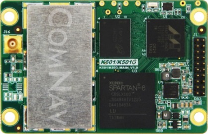
ComNav (China) showed up with a series of multi-frequency, GPS/Beidou/GLONASS RTK-capable OEM receivers, packaged receivers, and antennas. With 100 people based in Shanghai, ComNav claims to have captured 30% of the Chinese market, selling 15,000 receivers — derived from technology developed by Dr. Wong Yong Quan. Impressive capability on display — also seeking distribution in North America.
Surrey Satellite (UK) are apparently working on a number of R&D projects alongside building the nav payloads for the Galileo FOC SVs. TechDemoSat-1 is an innovative UK technology platform that includes a GPS reflectometry experiment to measure wave intensity for marine weather services. Apparently there is little weather information for large areas of the world’s oceans, and this may help to solve a major marine nav issue.
Nottingham University (UK) is working on predictive integrity for UAVs. GNSS signal outage/degradation in flight, caused by antenna obscuration, multipath, fading due to adverse geometry and Doppler shift, are critical for UAVs. Nottingham modeling is aimed at real-time avoidance of safety-critical flight conditions and fast recovery of navigation performance following GNSS data losses.
Trusted Positioning (Canada) is moving quickly down the indoor location path and has some neat software integration solutions for cell phones using signals of opportunity, pressure sensors and MEMS. The company sees the initial market being for things like mapping indoor locations, iteratively improving positioning, and location-based advertising.
Spirent GSS6425 record and playback system.
Spirent has released the GSS6425, which is a highly portable simulation system for recording live GPS L1/L2/L5, GLONASS L1/L2/L3, BeiDou-2 B1/B2, Galileo E1/E5, QZSS L1/L2/L5 and SBAS signals in the field — for repeated replay in the lab. BeiDou has been introduced across the Spirent simulation product line, and Spirent released information on sophisticated spoofing simulation.
IFEN (Germany) is also working on spoofing, has added BeiDou B1 and B2 signals, has added a four multi-RF output capability, and is working on automotive gyro and odometer testing capability.
R&S DDF007 Portable I/F Direction Finder.
Rohde & Schwarz had an extensive display of capability alongside its SMBV 100A GNSS simulator. An impressive array of spectrum analyzers and generators, with one set-up catching my eye — the DDF007 portable interference detection system used by government agencies for tracking down jammers.
I didn’t get to everyone’s booth, and I just didn’t have the space to cover everything, but I’d call this a reasonable cross section of the exhibitors; to some degree its a summary of the panels and includes some of the corridor discussions typical of ION.
So, I would call this another successful ION show, and I’m looking forward to next year’s ION GNSS+ conference in my neck of the woods in Tampa, Florida, in September. It would seem that the interest level remains high across academia, agencies and industry — but those of us who may still want to see new business as payback for the investment of attending and/or exhibiting, I think we would have preferred still more commercial content.
ION remains a place to meet and greet customers and people working across multiple market segments, where system providers can brief us and mix with users, and the intensity of technology development and research can be shared and sampled. It’s still an invaluable place to visit once a year if you are connected in any way to the GNSS industry and community.
Abstract submissions are now being accepted for the Institute of Navigation (ION) 2014 Joint Navigation Conference (JNC) to be held June 16-19, 2014.
For Official Use Only (FOUO) U.S.-only sessions will be held June 16-18 at the Renaissance Orlando at SeaWorld, Orlando, Florida; and the 4-EYES CLASSIFIED sessions will be held June 19 at Shades of Green Walt Disney World.
The conference, sponsored by the ION’s Military Division, is the largest U.S. military positioning, navigation and timing conference of the year with joint service and government participation. The event will focus on technical advances in guidance, navigation, and control (GN&C) with emphasis on joint development, test and support of affordable GN&C systems, logistics and integration.
The 2013 Joint Navigation Conference was canceled, so this will be the first time the conference has been held in two years.
From an operational perspective, the conference will also focus on advances in battlefield applications of GPS; critical strengths or weaknesses of fielded navigation devices; warfighter PNT requirements and solutions; and navigation warfare.
The ION JNC features more than 200 operational presentations on a diverse array of topics including:
Advanced Security Technologies/SAASM
Alternate Navigation Technologies: I, II & III
Atomic Clocks and Timing Applications
Autonomous Navigation
Aviation Applications
Battlefield Smart Phone Applications
Celestial Navigation and Star-Tracker Technology
Collaborative Navigation Techniques
GPS Constellation Performance
GPS in Military Applications/NAVWAR
GPS Modernization
Land Applications
Marine Applications
MEMS Inertial Measurement Unit
Micro Navigation Applications
Military GPS Receivers and Military GPS Receiver Technology
Military GPS Use and Experiences
Military GPS/Antenna Technologies and Interference Mitigation
Missile Applications
Modeling and Simulation
Multi-GNSS Receivers for Military Applications
Multi-Sensor Solutions for Guidance, Navigation, and Control
Navigating in Challenged Environments (e.g. Urban, Indoor and
Sub-Surface Navigation)
Precision Azimuth Sensing
Precision Navigation Capabilities for Test and Training
Technical Exhibit and Operational Product Demonstrations. JNC also features a technical exhibit and showcase of Guidance, Navigation and Control technology products and services and Operational Product Demonstrations. For more information on exhibiting and product demonstrations at the ION Joint Navigation Conference, call ION at 703-366-2723 or go to www.ion.org/jnc.
Attendance Restricted. FOUO U.S. ONLY. JNC conference attendance (June 16-19) will be controlled by the Joint Navigation Warfare Center and will be restricted to U.S. ONLY. The classified sessions will have 4-Eyes access (June 19) for citizens of U.S.A., Australia, Canada, and the United Kingdom. All participants must establish a need to know and be approved by the Joint Navigation Warfare Center security office.