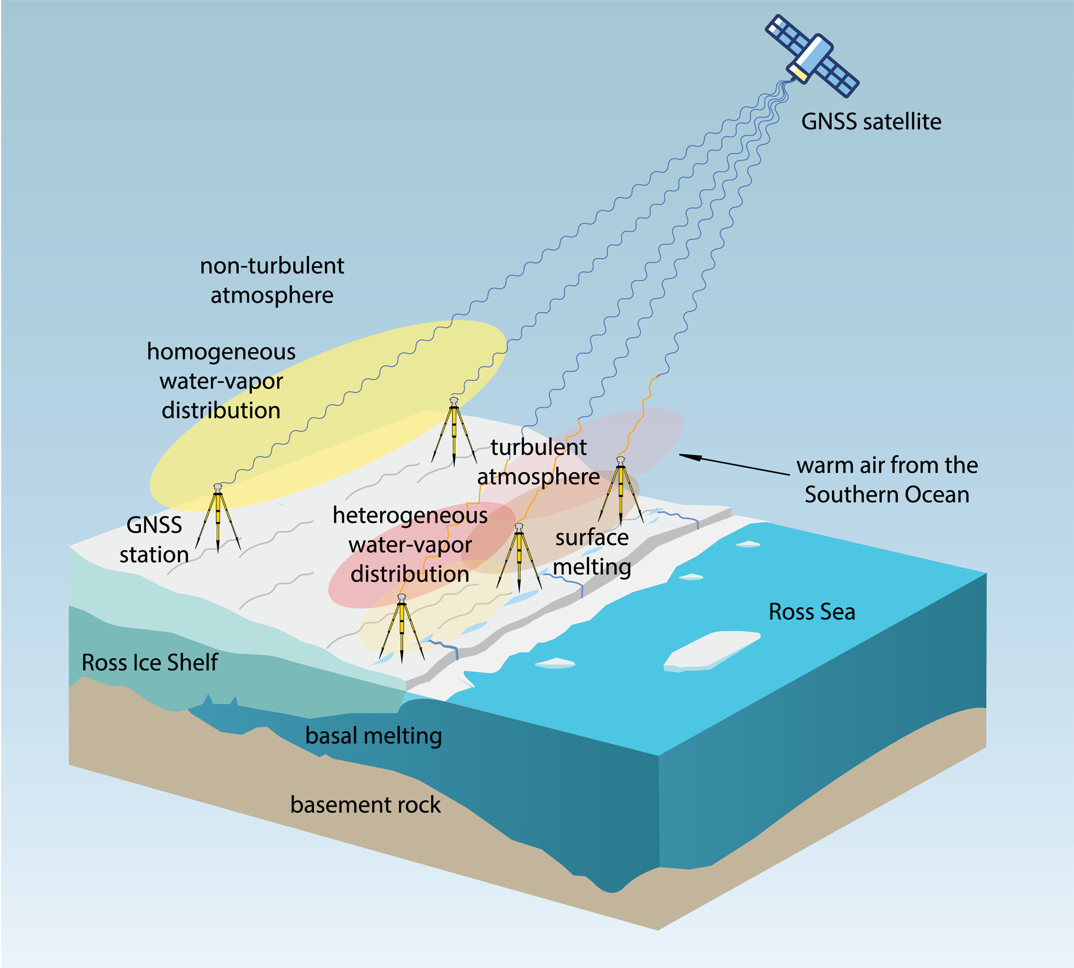
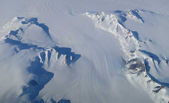
Observations suggest a major melting event at the Ross Ice Shelf was connected to atmospheric turbulence.
The Ross Ice Shelf in Antarctica typically melts on its underside as warmer ocean water flows beneath. But in January 2016, an unusual melting episode occurred on its topside.
A team from the Massachusetts Institute of Technology (MIT) Haystack Observatory used data from existing GNSS stations, in conjunction with 13 stations installed on shelf, to examine the turbulent state of the atmosphere. Key were delay differences at each station and between stations that showed the strength (or rockiness) of atmospheric turbulence over the ice shelf.
Wind, water vapor, and temperature variations drawn in by warm and humid air caused the surface to melt, with turbulence four times greater than usual during the 2016 surface melting event.
The study also demonstrated a novel application of the GNSS station data to remotely observe unusual atmospheric conditions.
The open-access study was published Feb. 27 in Geophysical Research Letters.
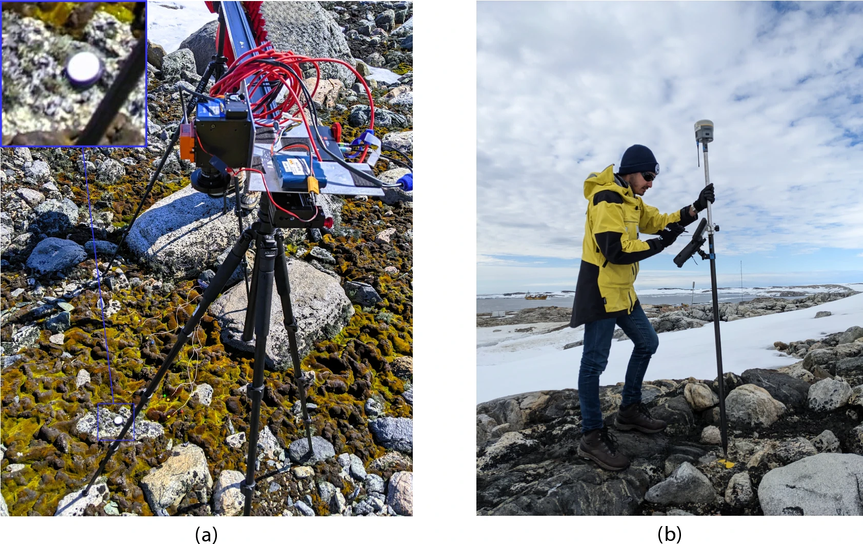
GNSS and unmanned aerial vehicles (UAVs) have revolutionized precise mapping in polar regions. For a team from Queensland University of Technology (QUT), UAVs enabled a flexible platform for deploying hyperspectral imaging (HSI) sensors and collecting high-resolution data, enhanced by GNSS with real-time kinematic (RTK) to ensure accurate geolocation for reliable vegetation analysis.
The team turned to UAVs to meet the unique challenges of monitoring Antarctic vegetation. Harsh conditions, remoteness, limited access and climate variability make traditional field surveys time-consuming and costly. Worse, they risk disturbing sensitive vegetation, explain the researchers.
What Grows There. Antarctica’s terrestrial ecosystems are home to freeze-tolerant vegetation like mosses and lichens, which play a crucial role in biogeochemical cycles, soil insulation and supporting biodiversity. These organisms underpin the continent’s fragile ecosystems, increasingly threatened by climate change, extreme events, and human activitiees.
While satellite imagery enables large-scale observations, its limited spectral and spatial resolution, alongside cloud interference, constrains fine-scale vegetation analysis. HSI captures a broad wavelength range, enabling discrimination of vegetation by their spectral signatures. Multispectral imaging (MSI) data, such as that from Sentinel-2, is also being explored.
UAVs offer flexible spatial coverage and high-resolution datasets.
However, unless these elements are integrated, mapping accuracy diminishes. Moreover, limited validation of spectral libraries and simulated imagery against field data restricts the reliability of remote sensing outcomes.
The team’s study addresses current gaps by building on the UAV-based HSI workflow that incorporates ground-based HSI data and MSI. “We expand this approach by integrating UAV-captured HSI data to enhance remote sensing capabilities in polar environments,” researchers explain. The updated methodology combines UAVs, high-resolution red, green, blue (RGB) imagery, and ground and aerial HSI data with machine-learning-based semantic segmentation.
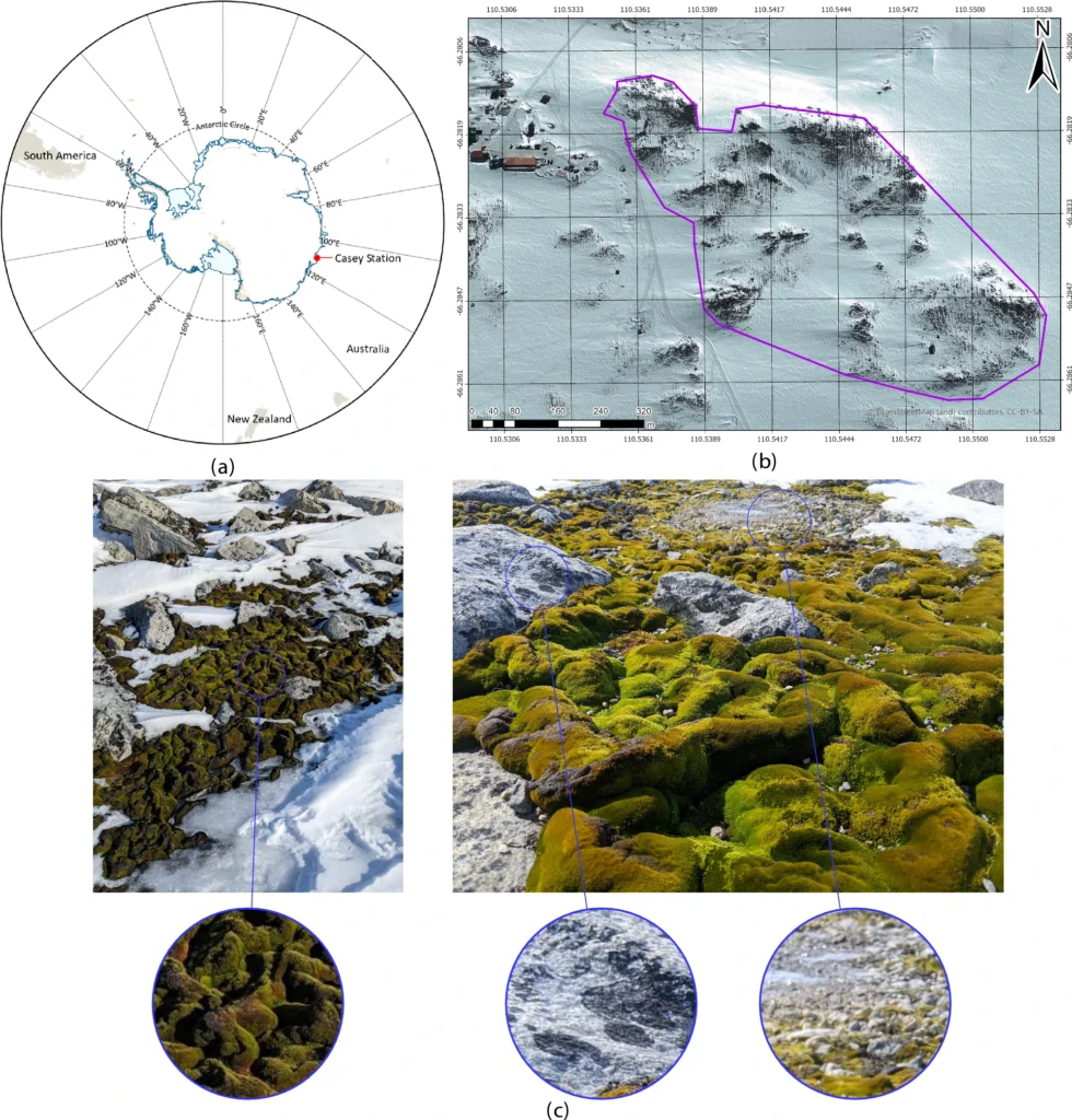
The new workflow was evaluated in Antarctic specially protected area (ASPA) 135, Windmill Islands, East Antarctica, focusing on lichen detection and moss health mapping (Fig. 1).
Location of ASPA 135 (6616’60” S, 11032’60” E) and studied vegetation. (a) Map of Antarctica showing Casey Station’s location using the Polar Stereographic Projection. (b) Map delineating ASPA 135 (purple) near Casey Station (top left). (c) Ground-level imagery of moss and lichen at ASPA 135, along with surrounding rock and ice formations. (Credit: QUT)
Read the full study, “Drone hyperspectral imaging and artificial intelligence for monitoring moss and lichen in Antarctica,” on the Scientific Reports website.
“Seen & Heard” is a monthly feature of GPS World magazine, traveling the world to capture interesting and unusual news stories involving the GNSS/PNT industry.
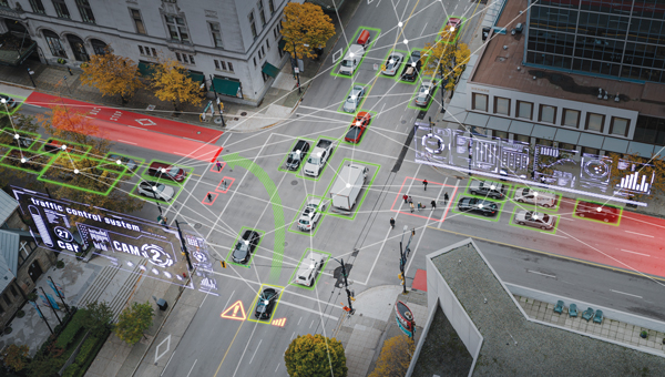
Researchers at Drexel University have developed a testing method to enhance the robustness of autonomous driving systems. Their approach uses dynamic visual patterns to evaluate object detection capabilities in self-driving cars, focusing on critical objects such as traffic signs. A “Screen Image Transformation Network” (SIT-Net) simulates real-world image capture scenarios affected by environmental factors. By identifying weaknesses in autonomous vehicle perception systems, the researchers aim to improve safety and reliability in future self-driving technologies.
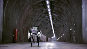
Robo-dog gets an upgrade
Photo: Boston Dynamics / Leica Geosystem
The Leica BLK ARC autonomous laser scanning module has become the first certified reality capture device capable of being fitted to Boston Dynamics’ robotic dog, Spot. The BLK ARC, when mounted on Spot, is designed for fully autonomous and repeatable scan missions. Users can plan scan paths remotely using existing drawings or BIM models, allowing the robot to navigate and capture data with minimal human intervention. Spot features a 360° vertical and 270° horizontal field of view, with a scan range of up to 25m.
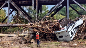
USGS aids recovery after Hurricane Helene
Photo: Logan Combs, USGS
The U.S. Geological Survey (USGS) is actively aiding recovery efforts following Hurricane Helene by collecting flood data, repairing damaged stream gages and analyzing new flood records. The agency has deployed its landslide event team to assess and document landslide impacts, conduct aerial surveys and map affected areas. By collaborating with local, state and federal agencies, the USGS is providing critical data and expertise to support disaster response and recovery efforts.
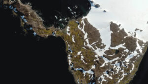
Antarctic Peninsula turns green
Photo: Tom Roland
Satellite imagery revealed that the Antarctic Peninsula is experiencing a dramatic increase in vegetation, with plant coverage expanding from less than 1 km² in 1986 to nearly 12 km² by 2021. This trend has accelerated significantly, coinciding with extreme heat events and record glacier melting linked to climate change. The study, conducted by researchers from the Universities of Exeter and Hertfordshire and the British Antarctic Survey, indicates that warmer temperatures and increased precipitation create favorable conditions for mosses, which dominate the newly vegetated areas.
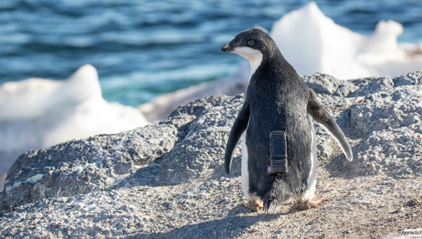
u-blox has partnered with Cellular Tracking Technologies (CTT), a specialist in wildlife telemetry and Internet of Things (IoT) solutions, in an initiative aimed at conserving Antarctic wildlife.
The collaboration has introduced a cloud-based positioning solution to monitor the activities of Adélie penguins in Ross Island, Antarctica. The venture began when Point Blue, an American wildlife conservation organization, reached out to CTT to create a tracking mechanism that could study the movements of young Adélie penguins. These birds are among the five penguin species inhabiting Antarctica and are considered crucial for environmental studies due to their sensitivity to ecological shifts caused by climate change and human activities, such as commercial fishing.
Due to the challenging conditions in Antarctica, tracking penguins required a device that was lightweight, non-intrusive, energy-efficient, and cost-effective in terms of data transmission. This was particularly important given the small size of the penguins, their rapid movement, and their extended underwater dives.
u-blox provided its CloudLocate positioning service to meet these stringent requirements, which led to the development of CTT’s Penguin Iridium GNSS tracker. The tracker is fixed to the penguins’ backs and uses one of u-blox’s compact GNSS modules. The CloudLocate service processes the positioning calculation in the cloud rather than on the device to save energy and enable prolonged monitoring periods without the need for frequent device replacements.
The tracker operates by sending a concise 50 B message, which captures essential location data during the brief moments when a penguin surfaces for air. This level of efficiency is critical in minimizing the costs associated with satellite connectivity, which is often prohibitively expensive in such remote regions.
This partnership marks an advancement in wildlife conservation technology by allowing for non-invasive, continuous monitoring of Adélie penguins and providing vital data for assessing the impacts of environmental changes. CTT aims to extend this tracking solution to a wider range of wildlife research and conservation projects to demonstrate the potential for technological innovation to contribute significantly to ecological preservation efforts.
“Seen & Heard” is a monthly feature of GPS World magazine, traveling the world to capture interesting and unusual news stories involving the GNSS/PNT industry.
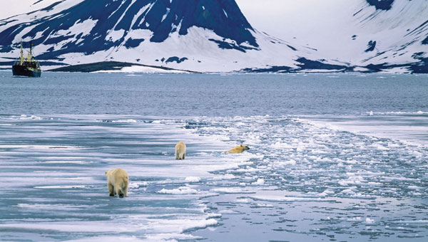
According to the 2023 Arctic Report Card by the National Oceanic and Atmospheric Administration (NOAA), new records have been documented showing that human-induced warming of the atmosphere, ocean and land is creating adverse impacts on people, ecosystems and communities across the Arctic region. The report states the Arctic is experiencing a faster rate of warming than any other part of the world. Overall, it was the Arctic’s sixth-warmest year on record. Sea ice extent continued to decline, with the past 17 Septembers now registering as the lowest on record.
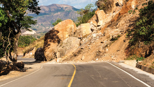
Researchers from Chang’an University in China have developed a new method of tracking landslides. The team combined GNSS precise point positioning (PPP) techniques with a cumulative sum control chart (CUSUM) method. Conducted at the Tengqing landslide in Liupanshui, Guizhou Province, Southwest China, the study aims to enhance the precision in tracking the movements of the landslides and improve the overall reliability of the monitoring results.
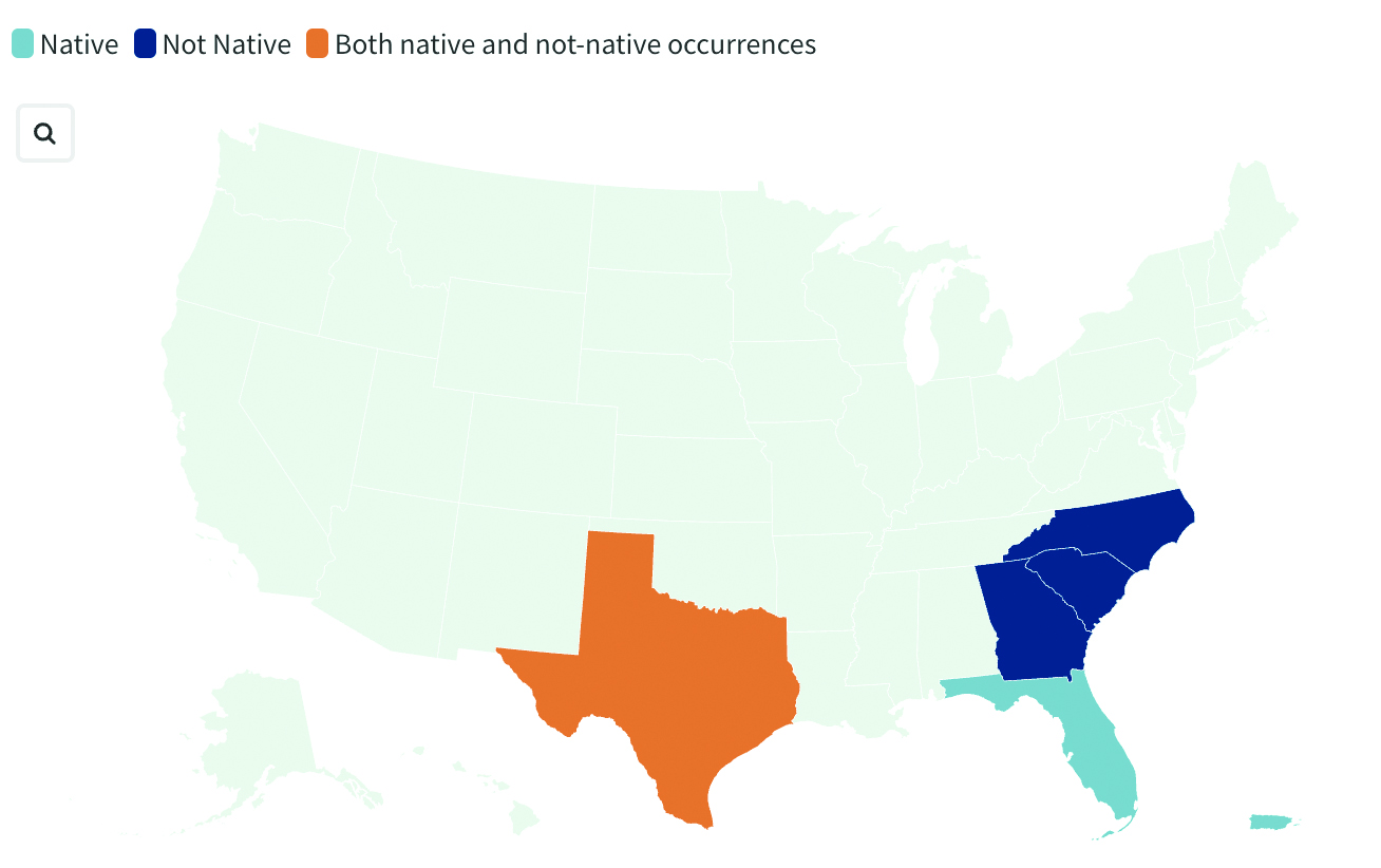
Crabs on the move
Image: United States Geological Survey (USGS)
Georgia officials are asking the public for help in spotting non-native blue land crabs as they appear to be moving north in recent years, according to data collected by the United States Geological Survey (USGS). According to USGS, it is unclear whether this movement is driven by humans or by the crabs themselves, or if the crabs are breeding in their non-native homes. Officials worry about the damage caused by the crabs’ burrowing behavior. While scientists learn about how the species interacts with its new environment, several states are asking residents to report sightings.
India’s war on drugs
Image: evandrorigon / E+ / Getty Images
India’s border security force (BSF) has said it is battling an unprecedented UAV “menace” infiltrating the border with Pakistan, fueling the drug crisis in the state of Punjab and raising serious security issues, reported The Guardian. UAVs have dropped weapons such as pistols and Chinese-made assault rifles, as well as consignments of opium and heroin believed to be from Afghanistan.
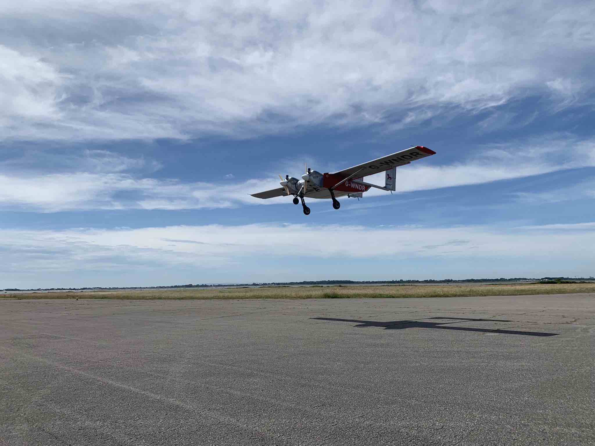
Helix Geospace will participate in the “Future flights challenge phase 3” project by Innovate UK involving drone swarms. The project aims to demonstrate how large unmanned systems can be used to solve environmental-protection concerns in GNSS-denied environments, functioning in swarms and utilizing a combination of digital twinning, computer vision and real-world flight testing.
The goal of the project is to prove that a single remote operator and local safety pilot can handle many unmanned devices and maintain continuous communication in GNSS-denied environments.
Commercially available antennas are susceptible to jamming and spoofing. DielectriX antennas from Helix Geospace are built into a sophisticated array system that can detect all jamming and spoofing events, pinpoint their precise source, and then eliminate their impact, maintaining the accuracy and resilience of GNSS positioning, navigation and timing in GNSS-denied environments.
Collaboration with NERC British Antarctic Survey and Lancashire fire and rescue will provide proof of exploitation and public engagement for the project. The Windracers aircraft will be equipped with British Antarctic Survey scientific research equipment and flown in the Antarctica region to gather novel research data, previously not achieved before at this scale.
The collaboration with Lancashire fire and rescue will help develop a solution for early fire detection and mitigation. The Windracers aircraft will be retrofitted with sensors and fire mitigation technology providing an airborne system that will patrol high-risk areas.
“Seen & Heard” is a monthly feature of GPS World magazine, traveling the world to capture interesting and unusual news stories involving the GNSS/PNT industry.
Photo: Anton Rodionov/iStock/Getty Images Plus
UNWANTED HITCHHIKERS
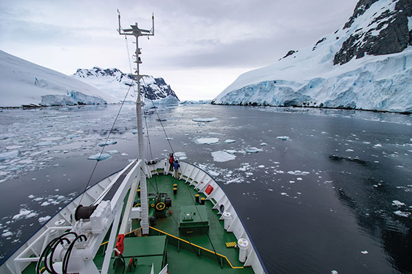
Antarctica’s pristine marine ecosystem, isolated for 15–30 million years, could be threatened by species such as mussels, barnacles, crabs and algae arriving on ships from 1,500 ports worldwide. A research team from the British Antarctic Survey and the University of Cambridge used automatic identification system (AIS) data, which relies on GNSS navigation data, and shipping databases to determine traffic to the Antarctic. The study is published in the Proceedings of the National Academy of Sciences, January 2022.
Photo: FrankRamspott/iStock/Getty Images Plus
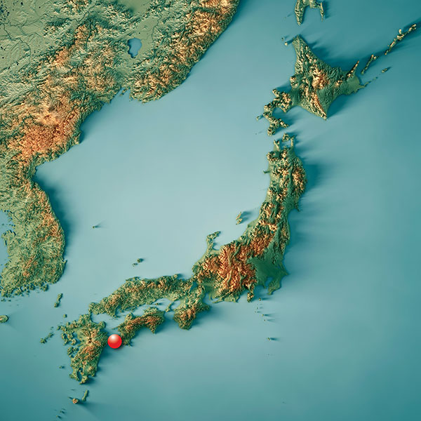
QUAKE PREDICTION
Within the next 30 years, a highly destructive Nankai Trough megathrust earthquake is predicted to hit southwest Japan. Understanding long-term slow slip events under the Bungo Channel is essential for pinpointing when such an earthquake will happen. Kobe University’s Yoshioka Shoichi and Seshimo Yukinari analyzed the 2018–2019 Bungo Channel slow-slip event using longitudinal GNSS data provided by the Geospatial Information Authority of Japan. The data revealed that even though the 2018–2019 event was shorter than others, it was bigger in terms of slippage and slip velocity, as well as magnitude. Results appear in Scientific Reports, Jan. 10, 2022.
Photo: Bluesky
SUPPORTING SOLAR
British aerial mapping company Bluesky is helping Derby Homes roll out integrated solar photovoltaic systems across its housing stock. A project to identify suitable roof coverings assessed more than 8,000 addresses for size, pitch, aspect, existing structures and infringing vegetation. Using its ultra-high-resolution imagery, Bluesky determined the solar suitability of each property, the number of panels needed, and their potential output. Derby Homes recently installed its first integrated solar array on an initial batch of trial properties identified by Bluesky.
Photo: JohnCarnemolla/iStock/Getty Images Plus
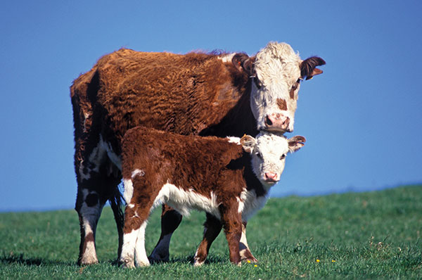
TAKING MOM TIME
CQUniversity’s precision livestock management research team is using GNSS to detect calving events in extensive grazing herds. The discovery could provide beef producers in Australia with a way to remotely monitor their cattle and improve calf survival rates, one of their biggest challenges. The research project used GNSS collars with motion-detecting accelerometers on 30 cows in a 28-hectare paddock over an eight-week period at Belmont Research Station. The collars captured the animals’ location information every 10 minutes. Because the distance between mother and herd increases during calving, the data helped predict calving events, which were then visually confirmed by the research team.
Turkey has opened GNSS base station in Antarctica, according to Sputnik News. The station can track changes in the location of icebergs and transmit photos of Antarctica’s surface, as well as process data from GPS, GLONASS and Galileo.
“A GNSS satellite navigation base station was set up within the framework of the fourth Turkish scientific expedition to Antarctica,” said Turkish Industry and Technology Minister Mustafa Varank, as quoted by the national Anadolu news agency. “A group of specialists from the Turkish General Directorate of Mapping has built Turkey’s first GNSS base station abroad.”
The 24-member Turkish research team joins 15 scientific projects in the Earth, life, and marine sciences. The expedition is being conducted under the auspices of the Turkish Presidential Administration and the Ministry of Industry and Technology and coordinated by the TUBITAK.
A kite-blown science expedition to the interior of Antarctica has made the most southerly positioning fixes yet made with Europe’s Galileo satellite navigation system.
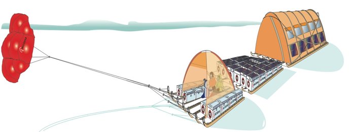
The Inuit WindSled is a multi-part sledge the size of a lorry, complete with mounted tents and solar power panels, pulled through the ice using a mammoth 150 sq. m. diameter kite. (Photo: Inuit WindSled via ESA)
Their measurements not only confirm Galileo performance at extremely high latitudes, but also offer knowledge of space weather events overhead. In particular they offer insights into the ionosphere — the electrically active upper layer of Earth’s atmosphere — above the southern continent, and the performance of Galileo software to correct ionospheric interference.
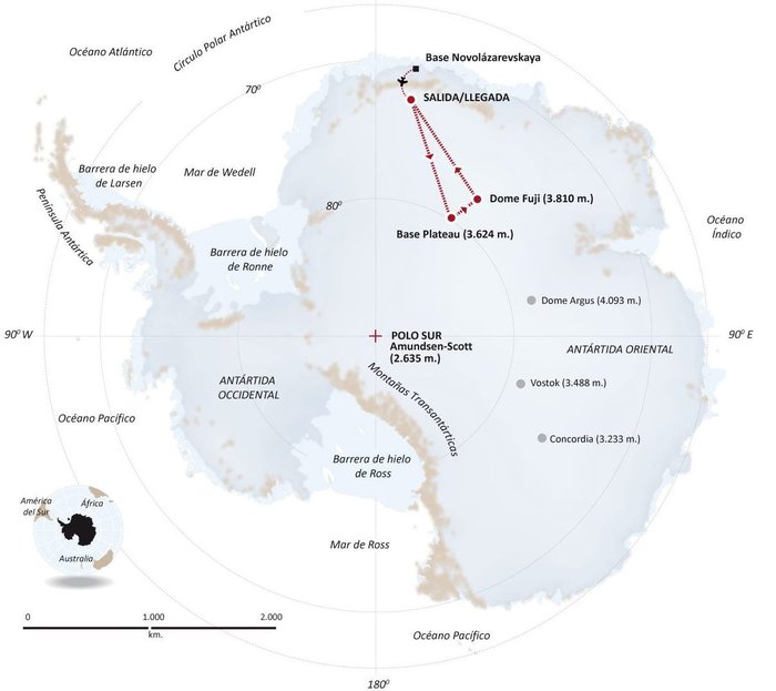
The four-person expedition left Russia’s Novolazarevskaya Base on 12 December last year. For more than 40 days they made their way to Dome Fuji, a 3810-meter-high ice dome in Eastern Antarctica — one of the coldest places on Earth. After reaching the high point on 21 January, they are now back at the Russian base.
The Inuit WindSled is a multi-part sledge the size of a lorry, complete with mounted tents and solar power panels, pulled through the ice using a mammoth 150 sq. m kite. (Graphic: ESA)
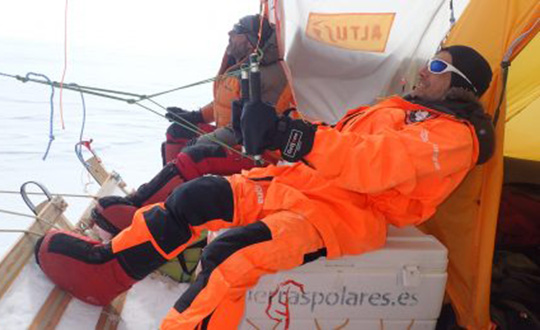
The “Antarctica Unexplored 2018-2019″ expedition, mounted by Spain’s Asociación Polar Trineo de Viento, is employing a unique zero-emission vehicle specially designed for polar exploration. The Inuit WindSled is a multi-part sledge the size of a lorry, complete with mounted tents and solar power panels, pulled through the ice using a mammoth 150 sq. m kite.
The Windsled’s inventor, Ramón Larramendi, is also the expedition leader. “This marks the first time we’ve climbed the Fuji Dome in a vehicle driven by the wind — everyone who reached there before relied on motorised vehicles. So this is also the first time we’ve traveled more than 2,400 km with more than 2,000 kg of cargo using a vehicle that does not pollute the Antarctic continent,” Larramendi said.
“We are also doing this in collaboration with ESA, among other scientific institutions, which is very important because it allows us to demonstrate this polar eco-vehicle has excellent possibilities for enabling science in the interior of the Antarctica continent,” Larramendi said.
The four-person “Antarctica Unexplored 2018-2019” expedition left Russia’s Novolazarevskaya Base on Dec. 12, 2018. For more than 40 days they made their way to Dome Fuji, a 3810-meter-high ice dome in Eastern Antarctica — one of the coldest places on Earth. (Graphic: ESA)
The expedition carries a total of 10 scientific experiments from different research institutions, covering fields such as climate change, meteorology and astrobiology. ESA’s involvement with the expedition is the Galileo Experimentation and Scientific Test in Antarctica (GESTA) project.
GESTA involves regular positioning fixes being made over the course of the expedition for all satellite navigation constellations in all kinds of weather and geomagnetic conditions encountered. ESA provided the satnav receiver, with GMV in Spain contributing an advanced signal recorder for data analysis.
One of the important aspects of the study is the monitoring of the ionosphere in such high latitudes during low solar activity. Ionospheric interference can degrade satellite navigation performance, and its incidence is linked to solar activity.
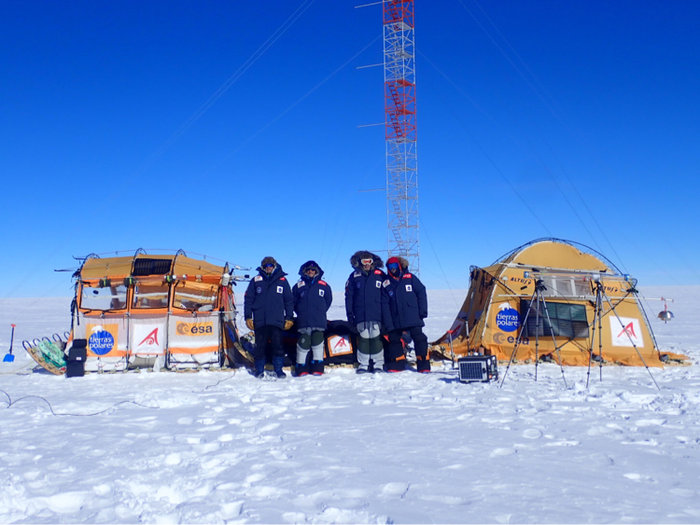
The expedition team with their Inuit WindSled at the high point of Dome Fuji. Note the ESA logo on the left tent of the WindSled. (Photo: Inuit WindSled via ESA)
GESTA is overseen by ESA’s Galileo Navigation Science Office, led by Javier Ventura-Traveset. “We are very pleased with this pilot scientific experience, having been able to collect Galileo measurements all over the expedition trip as planned,” said Ventura-Traveset. “The expedition reached latitudes near 80 degrees south, to our knowledge the most southerly latitude measurements ever-performed in-situ with Galileo in its current near-complete constellation status.
“We have also collected data from all other global satellite navigation systems and all available different frequencies, which will allow us also to assess multi-constellation solutions and compare their performance on these conditions. The expedition team kept in continuous contact via satellite with our office, allowing us to plan their activity, asking, for example, for dedicated data collections during space weather relevant events.”
“Once the expedition data are delivered, we will be able to assess Galileo positioning, navigation and timing capabilities at polar latitudes and how they are influenced by space weather events during low solar activity,” said Manuel Castillo, system engineer at the Galileo Navigation Science Office. “In particular, we will analyze if the occurrence of coronal holes is correlated with observed ionospheric interference. Coronal holes are open areas in the Sun’s outer layer, the corona, that allow the solar wind to leave the Sun and reach Earth, triggering moderate geomagnetic storms.
“At this moment in the 11-year solar cycle, with the Sun close to minimum activity, full-scale solar storms are not frequent, but the ongoing communication between the WindSled team and the Galileo Navigation Support Office allowed us to coordinate measurement times during the three minor geomagnetic storms the expedition experienced during the trip.”
A coronal hole in the Sun, observed by NASA’s Solar Dynamics Observatory on Jan. 5, 2019. (Photo: NASA)
The coronal holes triggering these geomagnetic storms were monitored, meanwhile, by Sun-watching missions such as NASA’s Solar Dynamic Observatory, the NASA-ESA SOHO and ESA’s Proba-2.
ESA’s Galileo Navigation Science Office is based in European Space Astronomy Centre, ESAC, near Madrid. It was set up in 2016 as a joint initiative between ESA’s Science and Navigation Directorates, coordinating scientific opportunities through interaction with the scientific community and the independent GNSS Science Advisory Committee.
The entirety of West Antarctica contains enough ice that, if it were to melt, would cause oceans to rise 10 feet. While the West Antarctic ice sheet is at risk of collapse, GPS data suggests this crisis could be averted because the bedrock supporting it is rising.
Using GPS, an international team of researchers found that the viscosity of the mantle under the West Antarctic Ice Sheet is much lower than expected, with the crust rebounding faster than expected, possibly stabilizing against catastrophic collapse. According to the study, in 100 years, the uplift rates at the GPS sites will be 2.5 to 3.5 times more rapid than currently observed.
Backer Islands GPS station: The small mushroom-shaped GPS antenna is supported by the nearby equipment with solar panels. (Photo: David Saddler via Colorado State University)
Participating researchers led by scientists at the Ohio State University installed a series of GPS stations on rock outcrops around the region to measure the Earth’s rise in response to thinning ice. Measurements showed that the bedrock uplift rates near the coast of West Antarctica were as high as 1.6 inches per year, one of the fastest rates ever recorded in glacial areas.
“This very rapid uplift may slow the runaway wasting and eventual collapse of the ice sheet,” said Rick Aster, a co-author of the study from Colorado State University. Nevertheless, Aster told the UK’s Independent, “To keep global sea levels from rising more than a few feet during this century and beyond, we must still limit greenhouse gas concentrations in the atmosphere, which can only occur through international cooperation and innovation.”
The team also included DTU Space. Study results were published in the journal Science.
At the end of 2016, the DemoGRAPE consortium observed, for the first time ever, ionospheric scintillations on Galileo signals in Antarctica, using Septentrio’s PolaRx5S GNSS reference receiver.
DemoGRAPE investigates improvement of high-precision satellite positioning with a view to developing scientific and technological applications in Antarctica. At higher latitudes, GNSS signal degradation due to ionospheric activity is more pronounced.
Septentrio’s PolaRx5S reference receiver.
The more precise phase-based positioning modes are particularly vulnerable to ionosphere disturbance such as scintillations. Elevated ionospheric activity can cause a loss of precise-positioning mode or, in more extreme cases, a total loss of signal lock.
Monitoring the movement and evolution of ice shelves and glaciers as well as geodetic prospecting require highly precise positioning. Besides this scientific interest, accurate positioning is important from a safety standpoint.
When visibility is limited and travel is restricted, designated routes between remote locations have to be strictly followed to avoid dangers such as falling into a crevasse during a snowstorm.
DEMOGrape is an international project lead by Istituto Nazionale di Geofisica e Vulcanologia (INGV), Rome, Italy in partnership with the Politecnico di Torino, the South African National Space Agency (SANSA) and the National Institute for Space Research, São Paulo, Brazil (INPE).
Septentrio’s PolaRx5S is the benchmark for GNSS space weather applications. It provides data for scintillation analysis (I&Q correlations, phase, code and carrier-to-noise) at up to 100 Hz for all GNSS L-band frequencies. SBF, RINEX and BINEX data logging is possible on both a built-in 16 GB memory and on an externally connected device. Up to 24 independent data archives can be defined. Logged data can be accessed via the web UI server or automatically pushed to a FTP server.
“We are really very happy of the fruitful collaboration with Septentrio colleagues that supported our measurements in the extreme environment of Antarctica,” the team said in an article published in Space Weather. “The first Galileo scintillations observed in the DemoGRAPE sites are attracting the attention of space weather communities, also beyond the European borders.” (Alfonsi, L., P. J. Cilliers, V. Romano, I. Hunstad, E. Correia, N. Linty, Fabio Dovis et al. “First Observations of GNSS Ionospheric Scintillations From DemoGRAPE Project.” Space Weather14, no. 10 (2016): 704-709).
“We are really proud to have enabled our colleagues and friends from INGV and the DEMOGrape consortium to make this first of a kind scintillation measurement on the Galileo signals,” said Bruno Bougard, director of R&D at Septentrio. “Galileo added value on high-precision application resides in its ability to increase the position availability and reliability compared to traditional GPS+GLONASS systems. Demonstrating its resilience to scintillation is key for operations at high latitudes.”
In February, mechatronics lead Kevin Bass of Intuitive Machines and contracted pilot Mike Laible successfully flew multiple runs with an unmanned aerial vehicle platform, Tiburon Jr., on the coast of Antarctica.
The long-range Tiburon Jr. takes Antarctic ice sheet studies to new heights.
From Wilkins Aerodrome in the southeast, the team launched Tiburon Jr. and collected valuable testing and environmental data. Battling harsh weather and constantly changing conditions, the team flew the UAV several times, allowing tests of all aspects of its platform.
“These flights provided us with valuable insights into cold-weather flight characteristics,” Bass said. “We successfully demonstrated that our onboard flight system is hardened the proper amount for the harsh environment.”
The onboard software also proved to be robust as it dealt with sensors whose response to the extreme conditions was not previously known.
With an 80-knot cruise speed and a 15-minute assembly, deploying a Tiburon Jr. UAV saved time and is significantly safer than manned flights in hazardous environments such as Antarctica, Bass explained.
Tiburon Jr. can be assembled in 15 minutes, an important feature in extreme environments.
The carbon-fiber Tiburon Jr. has a swappable nose cone, enabling a modular ISR sensor pod including visible, infrared and multispectral options. A remote ground station can accompany the ground transportation trailer for a portable stand-alone solution. Aircraft operations can be fully autonomous or man-in-the-loop.
The flight was conducted in cooperation with the University of Texas Institute for Geophysics and ICECAP (Investigating the Cryospheric Evolution of the Central Antarctic Plate).
For its climate change studies, ICECAP currently uses an upgraded World War II era DC-3 with a suite of geophysical instruments to map the thickness of the ice sheet and measure the texture, composition, density and topography of rocks below the ice.
Beginning in summer 2017–18, Tiburon Junior’s big brother, Tiburon, will join the survey team.