Tag: asset management

  • VertiGIS launches AI-powered cloud solution for spatial asset management

    VertiGIS launches AI-powered cloud solution for spatial asset management

    VertiGIS has introduced VertiGIS Neo, a secure, cloud-based platform designed to improve sector-specific workflows through artificial intelligence (AI).

    According to the company, VertiGIS Neo aims to accelerate business operations, streamline problem-solving and boost productivity by delivering modern web and mobile user experiences across its suite of solutions, including VertiGIS Studio, VertiGIS FM, VertiGIS Networks and VertiGIS ConnectMaster.

    The platform incorporates embedded AI to drive innovation for both end users and application development teams. VertiGIS Neo enhances workflow processes in three key areas:

    • End-user assistants: AI-powered assistants and a low-code/no-code interface help users complete tasks more efficiently in web and mobile applications.
    • Application builder productivity: AI co-pilots enable administrators to configure and customize solutions with less effort.
    • Process transformation: AI capabilities fundamentally change how work is performed, from field operations to back-office tasks.

    Flexible Cloud Deployments

    VertiGIS Neo is built on a cloud-first infrastructure that supports fully managed, private, or hybrid cloud environments, offering operational flexibility, scalability and enhanced security. The platform supports rapid deployment within CI/CD pipelines and provides predictable pricing models for customers.

    VertiGIS Neo offers three deployment options:

    • Cloud managed services: Complete cloud-based solution delivery, including data, infrastructure and applications.
    • Private cloud: Turnkey deployment into customer environments using prescribed hardware and containers.
    • Hybrid cloud: Multi-tenant and single-tenant SaaS applications accessing customer data within their environment.

    Industry Solutions

    VertiGIS Neo is designed to address business challenges across several sectors:

    • Utilities: Enables customers to model physical network infrastructure as digital twins and manage millions of service points, supporting the entire asset lifecycle from planning to decommissioning.
    • Telecommunications: Streamlines management of FTTx services and oversees both physical assets and logical circuits for communications providers.
    • Local Government: Helps build transparent, engaged and sustainable smart cities, improving engagement for both citizens and staff.
    • Enterprise: Integrates IoT and AI for real-time intelligence, remote sensing and asset tracking, fostering innovation in the private sector.

    VertiGIS Neo’s features include dynamic attribute analysis with natural language queries, voice-to-prompt interfaces for map queries and automatic asset inspection and damage assessment using image recognition. The platform also allows users to create intelligent workflows from text prompts and automates the digitization of paper forms into digital records.

  • An inside look at Trimble’s new product suite

    An inside look at Trimble’s new product suite

    Photo: Trimble
    Photo: Trimble

    From May 14 to 16, more than 1,400 attendees gathered at the Huntington Convention Center of Cleveland, Ohio for Trimble’s Innovate 2024 User Conference.

    At the conference, Trimble announced its upcoming asset lifecycle management suite, Trimble Unity. The software suite offers comprehensive capabilities that enable owners to efficiently plan, design, build, operate and maintain their assets.

    Trimble Unity provides an end-to-end solution that connects teams across all lifecycle phases, giving them access to critical data to make decisions. From designers, engineers and contractors to asset managers, inspection and maintenance crews, Trimble Unity offers all stakeholders visibility to reliable data across digital workflows that help foster collaboration, improve project outcomes and reduce the total costs of asset ownership.

    Trimble Unity capabilities includes:

    • Trimble Unity Construct: A cloud-based construction project and program management capability that provides insights to improve process control and reduce cycle times. It is powered by Trimble e-Builder.
    • Trimble Unity Maintain: An enterprise asset management capability that streamlines work activity, planning and analysis to optimize resource allocation and infrastructure reinvestment. It is powered by Trimble Cityworks AMS, Trimble AgileAssets and Trimble Unity Work Management.
    • Trimble Unity Permit: A permitting, land management and licensing capability for streamlining public and back-office operations required to manage permits, licenses, right-of-way and code enforcement. It is powered by Trimble Cityworks PLL.
    • Trimble Connect: A connected data environment that unifies asset data in files, native file formats and 3D modes to streamline accessibility and collaboration.

    In addition, Trimble Unity includes Trimble Unity Field, an all-in-one mobile application enabling field workers to design, build and maintain assets more efficiently, leading to improved productivity, reduced technology costs and improved community confidence.

    GPS World met with Senior Vice President for Trimble’s Owner and Public Sector, Cyndee Hoagland, for an exclusive interview about the new product suite, how GIS plays a pivotal role in the asset management lifecycle and more.

    Photo: Trimble
    Photo: Trimble

    What sectors can benefit from this new product suite?

    For the public sector side, federal, state and local governments. Think cities, municipalities, state departments of transportation (DOTs), airports and transit authorities. For the private sector, healthcare facilities and universities.

    Is Trimble adding any new capabilities to the applications within the suite?

    We added a GIS capability to e-Builder along with Trimble Unity Field, so the mobile application of e-Builder is new. We did not have a capability for location-based information within the application itself, but it is now included, which is the added GIS capability.

    How do data strategy and GIS play a role?

    Most of our users on the enterprise asset management side are GIS-centric, having GIS and GPS experience. They recognize and understand the value of location data combined with asset data. For example, it is so much better for an inspector to know the location of bolts that need to be repaired before the work begins.

    Additionally, from a GIS perspective, if you are thinking about the GPS elements, and location and spatial data relative to an asset from the planning stage, through design and construction all the way to operation and maintenance, that data can be used to more efficiently operate and maintain the asset over its lifecycle. This asset lifecycle management approach allows the owner to reduce their total cost of ownership for that asset by as much as 40%.

    Do you have an example?

    Let’s say a bridge costs $1 million to plan, design and construct. Historically, $3 million would then be spent on operations and maintenance across the bridge’s service life, bringing the total cost of ownership of the bridge to $4 million. However, using an asset lifecycle management approach, owners can reduce that $4 million cost by up to 40 percent, saving $1,600,000 on the total cost of ownership of that bridge.

    These enormous savings are possible because owners can track the location, condition and attributes of the bridge throughout the asset lifecycle and use that information to make better decisions for managing the asset. Owners can access information such as the location of the bridge, the type of asphalt used to build it, the geometry of all the components that create that bridge and more. All that asset-specific information is available in a GIS geolocated model, which is highly valuable not just for the owner, but for the design and contractor teams along the entire asset lifecycle.

    Are there benefits of using a mobile mapping platform to collect data as opposed to using a UAV?

    They serve different purposes. UAVs go up in the air at key points in a project to give owners an update on the project performance and how much is getting completed.

    Another way of capturing rich asset data quickly is mobile mapping and terrestrial laser scanning. What you will see, for example, is that a state DOT will have to provide information to the Federal Highway Administration (FHWA) relative to all their lane miles. In large scale projects, a vehicle-mounted mobile mapping system can be used to capture highly accurate and immersive asset data at highway speed. That data will then go into an asset management system, where it can help users prioritize where the road repairs need to take place.

    Will artificial intelligence (AI) be integrated into this suite in the future?

    AI is already being used today to transform large amounts of real-world data into information. If an owner has collected data to inspect a bridge, for example, the highly accurate and rich data from mobile mapping and UAV systems can show an owner where exactly repairs are needed. The datasets are, however, extremely large, and AI built into processing and analysis software can help reduce tedious tasks, such as extracting features. This streamlined analysis of the data helps to inform owners on how to best manage and maintain their assets.

    The key capabilities of the Trimble Unity Asset Lifecycle Management Suite will be available beginning in June 2024.

  • Hexagon helps Ghana utility modernize electricity distribution

    Hexagon helps Ghana utility modernize electricity distribution

    Hexagon’s Safety, Infrastructure & Geospatial division successfully deployed an advanced utility geographic enterprise asset management (EAM) system for the Electricity Company of Ghana (ECG). The smart EAM, featuring Hexagon’s G/Technology, will allow ECG to plan, manage and efficiently operate its distribution network to meet the growing needs of 4.5 million customers.

    The enterprise system from Hexagon unifies data from a variety of geographic information systems (GIS), enabling bi-directional data flow with other systems based on the Common Information Model (CIM) standard. The system enhances ECG’s ability to geographically reference and manage assets with integrated tools for data surveying, capture and maintenance and network planning and calculation.

    Mobile capabilities enable efficient inspections and maintenance, while a web portal assists employees with locating assets, reviewing the network and more. Migrating to Hexagon’s system will increase process efficiency and reduce asset-management costs by harmonizing systems, validating existing data and capturing missing data.

    “The utility GIS is the critical component that fuels innovation in the utility,” said Keli Gadzekpo, board chairman of ECG. “This project is the foundation and the first step to modernizing ECG operations. It is the platform for digitization of electrical network assets, a prerequisite for bringing efficiency in the wire business.”

    Photo: Hexagon
    Photo: Hexagon

    Part of ECG’s Modernizing Utility Operations Activity, the project was commissioned by Millennium Development Authority (MiDA), Ghana, on behalf of the Government of Ghana’s Millennium Challenge Account Entity Program and funded by the U.S. government.

    “We are exceedingly grateful to Hexagon for working tirelessly to deliver this innovative product,” said Julius K. Kpekpena, Ag CEO and COO, Millennium Development Authority. “The technology sets Ghana’s biggest electric distribution utility on the path to modernizing its operations. The GIS is the foundation for modern tools to help ECG plan its networks, reduce losses, collect revenues and serve customers more efficiently.”

    The project included procurement and installation of system software, server hardware, mobile field units and services for data migration by Hexagon, field validation of assets by PDSA Ghana (part of Hexagon), and production of aerial imagery by ILV Wagner using Hexagon’s Leica Geosystems surveying and airborne imaging technologies.

    “Reliable electricity requires accurate data and tools to plan, design and manage networks, which can also reduce overall maintenance costs,” said Maximillian Weber, senior vice president, Global Utilities & Communications, Hexagon’s Safety, Infrastructure & Geospatial division. “We are proud to support Electricity Company of Ghana in delivering quality service to its customers.”

  • GSA’s MyGalileoSolution competition deadline is Sept. 30

    GSA’s MyGalileoSolution competition deadline is Sept. 30

    MyGalileoSolution is the biggest competition ever organized by GSA with a prize pool of almost €1.5 million

    News from the European GNSS Agency

    The European GNSS Agency (GSA) has launched the MyGalileoSolution competition. The contest is targeting European innovators and entrepreneurs ready to develop location-based solutions, such as mobile applications, wearable-based solutions, asset management and tracking solutions, or robotics, leveraging Galileo as a source of positioning, navigation and/or timing. A wide participation from all Member States is expected.

    GSA has a successful track record in supporting and boosting GNSS-based innovative applications. For years, the agency has been leading several research and innovation initiatives such as the Galileo Masters, Horizon 2020 projects, and more recently European competitions like the 2019 MyGalileoApp and Hackathons across Europe and beyond.

    Two tracks for 56 prizes

    With a prize pool of almost € 1.5 million, MyGalileoSolution is the largest competition ever organized by the GSA. It consists of two independent and parallel tracks, each one with a list of goals and deliverables.

    Track 1 , From Idea to Prototype, aims to develop a beta version of an application or a prototype of a solution implementing an idea, reaching a minimum of 50% of its functionality.

    Track 2, From Prototype to Product, aims to develop a fully functional solution ready to be commercialised starting from a beta version of an application or a prototype.

    Participants are expected to leverage Galileo’s robust positioning and accurate timing and synchronization capabilities, showing how it can enable the development of the next generation of applications and services across a wide range of areas. In this competition the GSA is challenging innovators in four different areas: Crisis & Emergency Response, Smart Transport for Green Deal, Solution for Digital Age, and Cybersecurity.

    Galileo for location-based services

    With more than 1.5 billion Galileo-enabled smartphones and more than 51 million GNSS-enabled wearable devices in the market, location-based services (LBS) are booming. Accurate positioning and timing are at the heart of the growth and evolution of LBS, in addition the access to Android GNSS raw measurements has allowed for the creation of advanced GNSS positioning algorithms that enable the development of more ambitious smartphone-based applications.

    ‘’Galileo has set the trend for dual-frequency chipsets, which provide better accuracy and are more resistant to multipath in urban environments,” said Pascal Claudel, GSA acting executive director. “We are looking forward to seeing innovators launching their disruptive GNSS solutions and turning them into real businesses, hence leading to European growth, competitiveness and sustainability. There is ‘space’ for all types of innovation and we expect the participation of all Member States.”

    “Competitions like MyGalileoSolution are a great opportunity to quickly move from idea to market,” said Francesco Fiorito, leader of Argeo, the winning team of the 2019 MyGalileoApp competition. “It is a confidence boost for young entrepreneurs and their capacity to grow and generate new solutions and business,” Claudel concluded.

    Deadlines and more information

    The deadline for submission for both categories is Sept. 30. Projects will be evaluated in terms of their innovative nature, market potential, feasibility and Galileo relevance by a panel of GSA experts.

  • Estonian Railways selects Hexagon to automate and digitize operations

    Estonian Railways selects Hexagon to automate and digitize operations

    Railway solutions power asset management and infrastructure maintenance

    Estonian Railways Ltd., a state-owned company responsible for Estonia’s railway administration, has selected Hexagon’s Geospatial division to implement a transportation system that will automate and digitize the railway’s infrastructure maintenance, construction and traffic management processes.

    The combined asset management system and geographic information system (GIS) platform will help the company’s 700-plus employees efficiently manage assets and workflows.

    Powered by Hexagon’s GeoTrAMS, a web-based system for tram and light-rail infrastructure, and GeoMedia, a flexible GIS management platform, Estonia Railway will be able to visualize assets on a map while integrating with other companies and external systems.

    Hexagon’s state-of-the-art registry will serve multiple information systems and users at the same time, centralizing the use of asset and spatial data while avoiding data duplication and ensuring that users have access to the most up-to-date information.

    “As a company, we are in a unique situation of simultaneously implementing Hexagon-specific spatial data modules for rail infrastructure management and Microsoft’s ERP for asset management, gathering and digitizing different fragmented data, unifying different workflows and applying new data management principles,” said Maia Sokk, innovation manager at Estonian Railways. “Based on our strategic goals for the next four years, we are significantly modernizing our traffic management systems. Implementing Hexagon’s technologies is an important link in this ambitious plan.”

    Prior to selecting Hexagon, Estonian Railways used a fragmented system of disparate software applications to manage assets and infrastructure across its 750 miles of railroad, 129 platforms and 60 stations. With the new solution in place, Estonia Railway will be able to improve operational efficiency and transparency, better control expenses connected to the infrastructure and streamline administrative tasks.

    “Estonian Railways is forward-thinking in its use of location intelligence for managing infrastructure and operations,” said Mladen Stojic, president of Hexagon’s Geospatial division. “We are excited to deliver an integrated solution that will help the railway effectively monitor and maintain its assets while also ensuring successful management of rail traffic, construction projects and services.”

    Estonian Railways has been responsible for ensuring the smooth operation, management and maintenance of the country’s railway infrastructure since 1870.

    Learn more about how Hexagon helps organizations close the gap between the geospatial and operational worlds with its transportation solutions.

    Photo: joyt / iStock / Getty Images Plus / Getty Images
    Photo: joyt /iStock / Getty Images Plus/ Getty Images

  • Semtech releases LoRa Edge for IoT asset tracking

    Semtech releases LoRa Edge for IoT asset tracking

    Image: Semtech
    Image: Semtech

    Semtech Corporation, supplier of high-performance analog and mixed-signal semiconductors and advanced algorithms, has launched LoRa Edge, a versatile and low-power software defined LoRa-based platform.

    Semtech said LoRa Edge will enable a wide portfolio of applications for indoor and outdoor asset management, targeting industrial, building, home, agriculture, transportation and logistics markets.

    The first product from this portfolio is a geolocation solution for development of internet of things (IoT) devices for asset management applications. It features low-power Wi-Fi and GNSS sniffing capabilities combined with LoRa Cloud geolocation and device management services to significantly reduce the cost and complexity of locating and monitoring IoT assets.

    “Semtech continually delivers internet of things (IoT) solutions that simplify and accelerate the development of LPWAN applications,” said Pedro Pachuca, director of IoT Wireless in Semtech’s Wireless and Sensing Products Group. “LoRa Edge and LoRa Cloud geolocation services enable customers to develop ultra-low power applications for a variety of industries and will expand the mass adoption of LoRa in the IoT ecosystem.”

    Over the next decade, 500 billion devices are expected to connect to the internet (according to Cisco), as organizations continue to shift towards a more IoT-focused business strategy, and the majority of those IoT devices require some form of localization capability either at point of install or through the assets life.

    The LoRa Edge geolocation platform will enable solution providers to leverage the unique localization capabilities of LoRa as well as GNSS and Wi-Fi scanning capabilities from a single chip solution, allowing customers to choose the best localization tool for the application task they are addressing.

    By removing the need for incremental GNSS and Wi-Fi components, LoRa Edge reduces the bill of material (BOM) costs of devices and significantly reduces design and procurement complexity, Semtech said.

    The first LoRa Edge chipset targeted with geolocation (LR1110) is available today; more products from this portfolio will be released in the first half of this year.

    Product Features

    Multi-Purpose Radio Front-End

    • 150 – 2700 MHz continuous frequency synthesizer range
    • GPS/BeiDou scanning
    • Wi-Fi passive scanning

    Low-Power LoRa/(G)FSK RF Transceiver

    • Worldwide frequency bands support in the range 150 – 960 MHz
    • High power PA path +22 dBm
    • High efficiency PA path +15 dBm
    • Fully compatible with the LoRaWAN standard

    Cryptographic Engine

    • Hardware support for AES-128 encryption/decryption based algorithms
    • Handling device parameters such as DevEUI and JoinEUI
    • Protects confidential information such as encryption keys
    • Stores NwkKey, AppKey, as defined in the LoRaWAN standard
  • Mobile mapping market size worth over $40B by 2024

    The mobile mapping market size is expected to be worth more than $40 billion by 2024, according to a new research report by Global Market Insights.

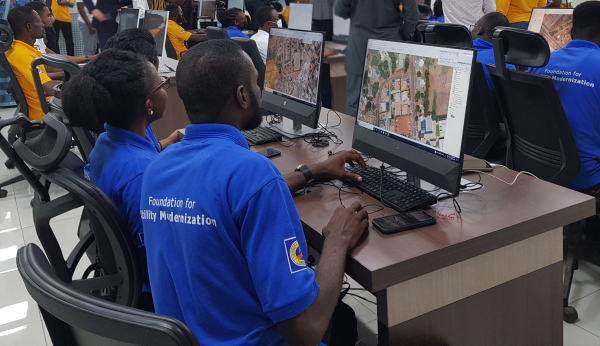
    The mobile mapping market is propelled by the increasing adoption of mobile devices such as smartphones and tablets across the globe. Smartphone users are extensively using mapping applications on their devices for navigation and driving assistance, the report said.

    Furthermore, they are also leveraging on the GIS and GPS applications to access geo-referenced data for searching nearby restaurants, cinema halls and other landmarks. This is encouraging the technology companies to commence mapping across the globe to acquire accurate GIS data and provide an enhanced customer experience.

    High initial investment is a major factor limiting the growth of the mobile mapping market. Currently, the market comprises a few major players with a long-standing expertise in location-based technologies. High initial investments in developing mobile mapping systems and assembling major components have restricted the entry of new players in the market.

    According to the report, the software market is anticipated to grow at a CAGR of 15 percent over the projected timespan. The growing demand for geo-referenced data acquisition and data analysis software among the organizations is driving the mobile mapping market growth. The software assists organizations in simplifying the data extraction process by combining the vital details. It retrieves geographic and spatial data captured by the positioning devices to develop maps and other graphic displays. This data is also used by enterprises to build effective decision support systems, which will drive the market demand.

    The report includes key industry insights in 250 pages with 341 market data tables and 38 figures and charts from the report, “Mobile Mapping Market Size, By Component (Hardware [Imaging Device, Laser Ranging Device & Scanning Device, Positioning Device], Software [Mapping Data Extraction, Data Processing], Service [Consulting, Integration & Maintenance, Managed Service]), By Application (Road & Railway Survey, GIS Data Collection, Vehicle Control & Guidance, Asset Management), By End-User (Agriculture, BFSI, Government & Public Sector, Real Estate, Retail, Mining, Telecommunication, Transport & Logistics), Industry Analysis Report, Regional Outlook (U.S., Canada, the United Kingdom, Germany, France, Italy, Spain, Australia & NZ, China, India, Japan, South Korea, Brazil, Mexico, Argentina, GCC, Israel, South Africa), Growth Potential, Competitive Market Share & Forecast, 2018 – 2024.”

    The mobile mapping technology is used for conducting road and rail surveys, collecting GIS data, and developing vehicle control and guidance systems and asset management systems. The road and rail survey market is expected to register a growth rate of over 17 percent during the forecast period. It is used to analyze the road and rail infrastructure and plan the engineering operations with minimum disruptions. The surveying authorities across the globe are using mobile mapping technology to create maps for the transportation department for road assessment purposes.

    The agriculture sector is estimated to grow at a CAGR of 22 percent during the forecast timeline. The integration of the GPS and GNSS devices into the farming process to acquire geospatial data is the primary factor driving the mobile mapping market share. Furthermore, the ability of the mobile mapping technology to monitor the crop yield and land variability also augments the demand for the technology among the farmers.

    The European region accounted for over 25 percent global mobile mapping market in 2017. The increasing investments by the government agencies have accelerated the adoption of mobile mapping technology in the region. For instance, in 2017, the U.K. government established the Geospatial Data Commission to frame a strategy for using the public sector location data to support the country’s growth.

    The Asia Pacific region will grow at a rapid pace over the forecast timespan. The rapid urbanization of the region and the growing number of infrastructural projects have fostered the growth of the mobile mapping market in the region. Moreover, the widespread adoption of smartphones has also driven the market size.

    Prominent players operating in the mobile mapping market are Phoenix LiDAR, Sharp Corporation, Teledyne Optech, TomTom International, Topcon Positioning Systems, MapJack, Mapquest, Navteq, NCTech, Microsoft, Mitsubishi, NovAtel, Phaseone industrial, Hexagon, EveryScape, Foursquare Labs and XIMEA.

    The major companies in the market are collaborating with other expert companies in the market to develop new product offerings and conduct strategic acquisitions to gain a competitive advantage over its competitors.

    For instance, in 2017, Garmin acquired Navionics, a provider of electronic navigational charts to the marine industry. This acquisition is aimed at combining the data from Navionics charts and Garmin’s blue charts to develop improved navigational services to its customers. Similarly, in 2017, Hexagon entered into an OEM partnership with Smart Guided Systems to develop new precision technologies for commercial applications.

    The global mobile mapping market research report includes an in-depth coverage of the industry with estimates and forecast revenue in USD respectively from 2013 to 2024, for the following segments.

    Mobile Mapping Market, By Component

    Hardware
    Imaging device
    Laser ranging and scanner device
    Positioning device
    Software
    Mapping data extraction
    Data processing
    Service
    Consulting
    Integration & maintenance
    Managed

    Mobile Mapping Market, By Application

    Road & railway survey
    GIS data collection
    Vehicle control & guidance
    Asset management

    Mobile Mapping Market, By End-User

    Agriculture
    BFSI
    Government & public sector
    Real estate & infrastructure
    Retail
    Mining
    Telecommunication

    Regions and Countries

    North America
    U.S.
    Canada
    Europe
    UK
    Germany
    France
    Spain
    Italy
    Asia Pacific
    ANZ
    China
    India
    Japan
    South Korea
    Latin America
    Brazil
    Mexico
    Argentina
    MEA
    GCC
    South Africa
    Israel

  • PCTEL showcases 4×4 LTE multi-GNSS antennas at InnoTrans

    PCTEL showcases 4×4 LTE multi-GNSS antennas at InnoTrans

    PCTEL Inc. will demonstrate its next generation of multi-band, multi-network 4G LTE antennas at InnoTrans 2018 for the transit and rail industries, which takes place Sept. 18-21 in Berlin.

    PCTEL’s new Trooper II and Coach II dual-carrier antenna platforms are designed to meet the requirements of increasingly complex RF communication systems in transportation applications.

    The Trooper II antenna. (Photo: PCTEL)
    The Trooper II antenna. (Photo: PCTEL)

    Both Trooper II and Coach II antennas feature four 4G LTE antenna elements, and four 802.11ac Wi-Fi MIMO elements compatible with the world’s leading multi-network cellular routers.

    The antennas support carrier aggregation for high-speed data transmissions in dense RF environments, such as transit depots and rail stations.

    They also incorporate PCTEL’s proprietary high-rejection multi-GNSS technology for high precision tracking and asset management. Both platforms are housed in attractive low-profile housings and can be easily installed on all types of mass transit vehicles, or even fixed surfaces, the company said.

    “PCTEL has a strong portfolio of products for rail and mass transit applications,” said Rishi Bharadwaj, PCTEL’s COO. “Our products have been qualified and deployed by major railroad equipment manufacturers and operators for over a decade. We are excited to showcase our industry-leading technology and capabilities at InnoTrans.

    “High-performance antennas play a crucial role in the implementation of wireless technologies to improve safety and operational efficiency,” Bharadwaj said. “PCTEL’s innovative MIMO antenna technology also enables transit operators to deliver a better passenger experience through more reliable high-speed internet access.”

  • Eos, Laser Technology and Esri Introduce Laser Mapping Workflow for Esri’s Collector for ArcGIS

    Eos, Laser Technology and Esri Introduce Laser Mapping Workflow for Esri’s Collector for ArcGIS

    From left: Esri Program Manager Doug Morgenthaler, Laser Technology Sr. Product Manger Derrick Reish and Eos CTO Jean-Yves Lauture.(Photo: Eos Positioning)
    From left: Esri Program Manager Doug Morgenthaler, Laser Technology Sr. Product Manger Derrick Reish and Eos CTO Jean-Yves Lauture. (Photo: Eos Positioning)

    The three-way partnership will enable field crews to collect centimeter-accurate 3D data in GNSS-impaired environments.

    GNSS receiver maker Eos Positioning Systems has released a laser offset solution within the Esri Collector for ArcGIS workflow.

    When combined with Laser Technology Inc.’s (LTI’s) laser rangefinders, the solution will allow field crews to capture centimeter-accurate 3D locations of hard-to-reach assets and in GNSS-impaired environments.

    “By combining the high-accuracy of the Eos Arrow Series GNSS receivers and the laser capabilities of LTI, we can empower field crews to capture highly accurate XYZ coordinates from a safe distance,” LTI Senior Product Manager Derrick Reish said. “This eliminates the need for physically occupying every point. It also provides more accurate location data, with a more affordable mobile asset-management workflows.”

    The Arrow Gold. (Photo: Eos Positioning)
    The Arrow Gold. (Photo: Eos Positioning)

    The solution has been in the works for months, as demand has grown for hard-to-reach, high-accuracy mapping within the Collector workflow.

    “Eos is extremely grateful to be a part of this initial release in high-accuracy asset location data with LTI’s laser rangefinders and Esri’s Collector mobile app,” Eos CTO Jean-Yves Lauture said. “Enabling this kind of accuracy means even the most budget-conscious field crews will be able to access the location of their hard-to-reach assets.”

    All three teams have been working closely to ensure a seamless integration with Collector and ArcGIS Online. When using an LTI laser rangefinder and an Eos Arrow Series receiver with Collector, a field worker can easily shoot, capture and share high-accuracy 3D location data that is streamed into ArcGIS Online in real-time.

    Image: Eos Positioning
    Image: Eos Positioning

    The solution is expected to be particularly useful in urban corridors, highway settings, forested (or wetlands) areas, and other areas where assets are hard or dangerous to occupy. This will both increase accuracy and efficiency, as well as decrease safety liabilities in dangerous situations, the companies said.

    “Esri is extremely pleased that Collector can now support the capture of high-accuracy asset locations from afar, leveraging our unique partnership with both Eos and LTI,” Esri Product Manager Jeff Shaner said. “This is a game changer for asset management.”

    Prior to this release, field crews challenged with capturing high-accuracy 3D locations for hard-to-reach assets would need to use a total station with a different software workflow and then mesh the data back in the office, a clumsy and inefficient workflow requiring lots of additional training and expertise. With the new workflow, field crews can operate in GNSS-impaired environments at a high-accuracy level without leaving the Collector/AGOL environment, creating a highly efficient workflow.

    The solution has been designed to provide several offset-mapping methods.

    “The implementation of several measurement methods gives users the freedom of choice, so they can pick the right laser option which meets their accuracy needs,” Reish said.

    Eos will unveil its offset measurement solution for Collector at the upcoming Esri User Conference in San Diego. For a field demonstration of how the solution works, attendees can visit Eos at booth #1019 during the conference, and attend the session “LaserGIS for Everyone: How to Combat Costly and Tedious Data Collection Workflows” at 10 a.m. on Wednesday.

  • Trimble MX9 mapping system designed for surveying, engineering, GIS

    Trimble has released its MX9 mobile mapping solution for large-scale scanning and mapping missions.

    The Trimble MX9 combines a vehicle-mounted mobile lidar system, multi-camera imaging and field software for efficient, precise and high-volume data capture for a broad range of mobile mapping applications such as road surveys, topographic mapping, 3D modeling and asset management.

    The Trimble MX9 captures dense point-cloud data along with 360-degree immersive georeferenced imagery using a spherical camera, GNSS/INS technology and dual-head laser scanning sensors.

    Trimbe-MX9-mobilemapper-O

    The system’s innovative and lightweight design facilitates easy installation and setup on a variety of vehicles. Spatial data can be captured at highway speeds from inside the vehicle for safe operation in transportation corridors.

    The intuitive, browser-based field software, accessible via most tablets or any notebook, enables operators to quickly establish and conduct data-acquisition missions, monitor the status of the system, and assess the quality of the acquired data in real time.

    “The Trimble MX9 is our next-generation mobile mapping system, focused on simple operation and integrated workflows for a new generation of users and applications,” said Ron Bisio, vice president of Trimble Geospatial. “We believe there’s a tremendous potential for a system that offers high-quality performance, simple installation and easy operation.

    “Being able to capture high-fidelity and survey-grade data for a whole project site, a complete city or even a statewide road-network allows our customers to use mobile mapping data for a variety of surveying, engineering and mapping applications.”

    The Trimble MX9 is designed for applications including transportation infrastructure planning, as-built surveying, GIS mapping and asset management. Survey and engineering professionals can analyze road cross-sections, perform clearance inspections, conduct topographic mapping, and also use the data for machine control.

    Mapping professionals can utilize the same data for city mapping and planning, inventory mapping and 3D modeling of buildings and linework.

    Complete integration with Trimble office software allows users to seamlessly process the acquired data and generate deliverables for a wide variety of applications. Tools are available for survey and engineering applications as well as deriving and publishing GIS and asset management deliverables.

    Users can also easily export their data for use with third-party software.

    The Trimble MX9 is available for virtual or live demonstrations, depending on customer location, beginning in April. The MX9 system includes a roof rack. Optional accessories such as a GNSS azimuth measurement system (GAMS) or a distance measurement instrument (DMI) are available.

  • Asteri Navigation launches X-series of wearable GNSS receivers

    Asteri Navigation launches X-series of wearable GNSS receivers

    Asteri Navigation will introduce a new line of rugged, compact and fully integrated GNSS receivers on Nov. 15 at the 2016 Autodesk University in Las Vegas, Nevada.

    Photo: Asteri NavigationSuitable for geospatial field data collection and inspection applications that require high accuracy positioning, the Asteri X-Series receivers are light enough to be mounted to external sensors or worn on the body or arm.

    Asteri Navigation will debut the affordable X-1 and X-2 receivers in booth No. 1783 at Autodesk University, which runs from Nov. 15-17 at The Venetian in Las Vegas. The X-3 is scheduled for release in December.

    The compact Asteri receivers were designed with safety and ease of use in mind. Each device weighs just 11.3 ounces with the 12-hour lithium battery. Their 2.8-inch by 5.4-inch size allows them to fit safely in shoulder or arm pouches.

    The internal single-frequency antenna enables users to capture accuracies of well under 10 centimeters with RTK/VRS corrections. This integrated design allows users to work in difficult terrain without worrying about equipment and antennas getting snagged or broken.

    Engineered to provide centimeter-level accuracy with Real-Time Kinematic (RTK) or Virtual Reference Station (CRS) correction when connected to an external antenna, the Asteri GNSS receivers support a generic NMEA 0183 GNSS data protocol. This makes them compatible with data collection and field mapping applications supporting the same protocol and ideal for users who want to develop their own software applications for inspection and GIS data capture activities.

    The new receivers can communicate via Bluetooth or cable with most popular devices used for field data collection, including utility line locators, ground penetrating radar, data loggers, laser rangefinders, smartphones, and tablets.

    Asteri expects the X-Series will be used extensively in mapping and survey applications related to asset management, pipeline operation, utility construction, forestry, electric staking, and underground utility location.

    For users needing higher accuracy, an external multi-frequency antenna can be added to the provided port on the receiver. In addition, the Asteri X-3 will be compatible with Atlas GNSS satellite-based real-time correction services worldwide.

    The three products in the X-Series provide varying levels of accuracy:

    • X-1 provides sub-meter accuracy out of the box.
    • X-2 offers accuracy of 1 meter down to 1 centimeter with RTK/VRS.
    • X-3 will achieve 1 centimeter with RTK/VRS, 30 centimeters with Atlas H30, 4-10 centimeters with Atlas H10.
  • Dude Solutions Purchases GIS Provider Mobile311

    Dude Solutions Inc., a software-as-a-service (SaaS) provider of operations management solutions, has acquired Mobile311, a GIS and mobile mapping solution provider. Terms of the transaction were not disclosed.

    The Mobile311 acquisition allows Dude Solutions to address the growing requirements of state and local governments, particularly those with public works needs, as well as universities and other entities that manage spatial and distributed assets, Dude Solutions said. Dude Solutions will now offer a comprehensive web-based and mobile operations solution that enables these organizations to more effectively manage both their facilities as well as assets at-large.

    “Mobile311 has built a powerful, patent-pending GIS and mobile application that aids in spatial and linear asset management — along with a growing client base,” said Kent Hudson, CEO of Dude Solutions, Inc. “Previously, spatial asset management software has been reserved for the largest cities and counties and, with this acquisition, Dude Solutions is democratizing GIS technology for any size local government client as it has with cloud-based facility management solutions.”

    Dude Solutions will offer Mobile311 GIS tools that extend the power of Dude Solutions’ offerings into clients’ spatial asset management programs. Mobile311 clients will have access to Dude Solutions’ innovations and product delivery and support. The platform allows mobile workers to access work orders and other critical geographic data in the field while giving supervisors additional reporting and analytical insights for increased efficiency.

    “There is a growing movement to utilize the power of mobile to better manage the complexities of operational asset management. With this acquisition, together we can provide the very best mobile GIS and mapping product in the market combined with Dude Solutions world-class delivery and support,” said Chuck Wright, president of Mobile311. “Building on our collective knowledge base of the operational must-haves for success, the combined organization will be a powerhouse in the marketplace.”

    Mobile311 is Dude Solutions’ second acquisition since it announced a growth investment of up to $100 million from Warburg Pincus, a global private equity firm focused on growth investing, in February 2014. The Mobile311 team has joined Dude Solutions and will now operate from Dude Solutions’ headquarters in Cary, N.C. In March, Dude Solutions acquired Windmill Software.