Tag: boating

  • Seaward Automation selects Savvy Navvy for chart integration on Command platform

    Seaward Automation selects Savvy Navvy for chart integration on Command platform

    Marine technology company Savvy Navvy has partnered with Seaward Automation to integrate its full navigation solution to their Command vessel management system, completing a fully integrated helm experience for boaters worldwide.

    Officially launching at the Palm Beach International Boat Show taking place March 25-29, the integration combines Seaward Automation’s innovative vessel system with Savvy Navvy’s intuitive, data-rich navigation charts.

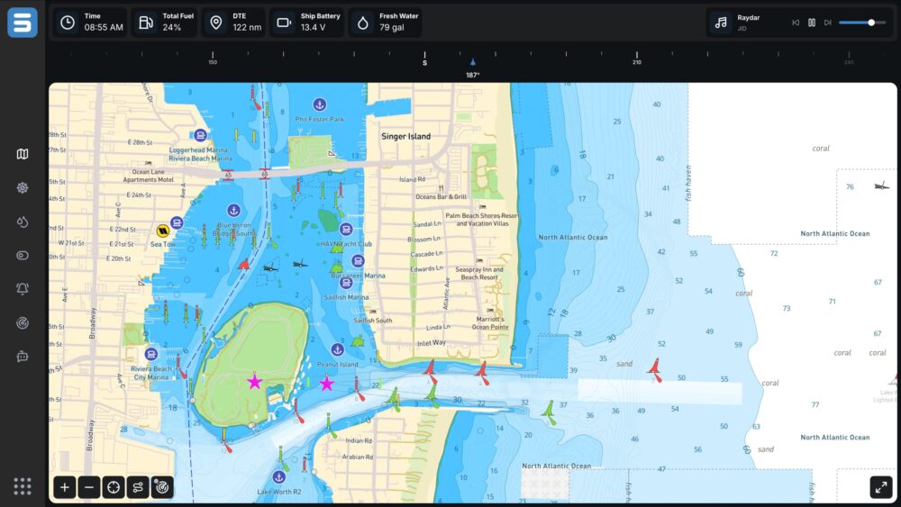
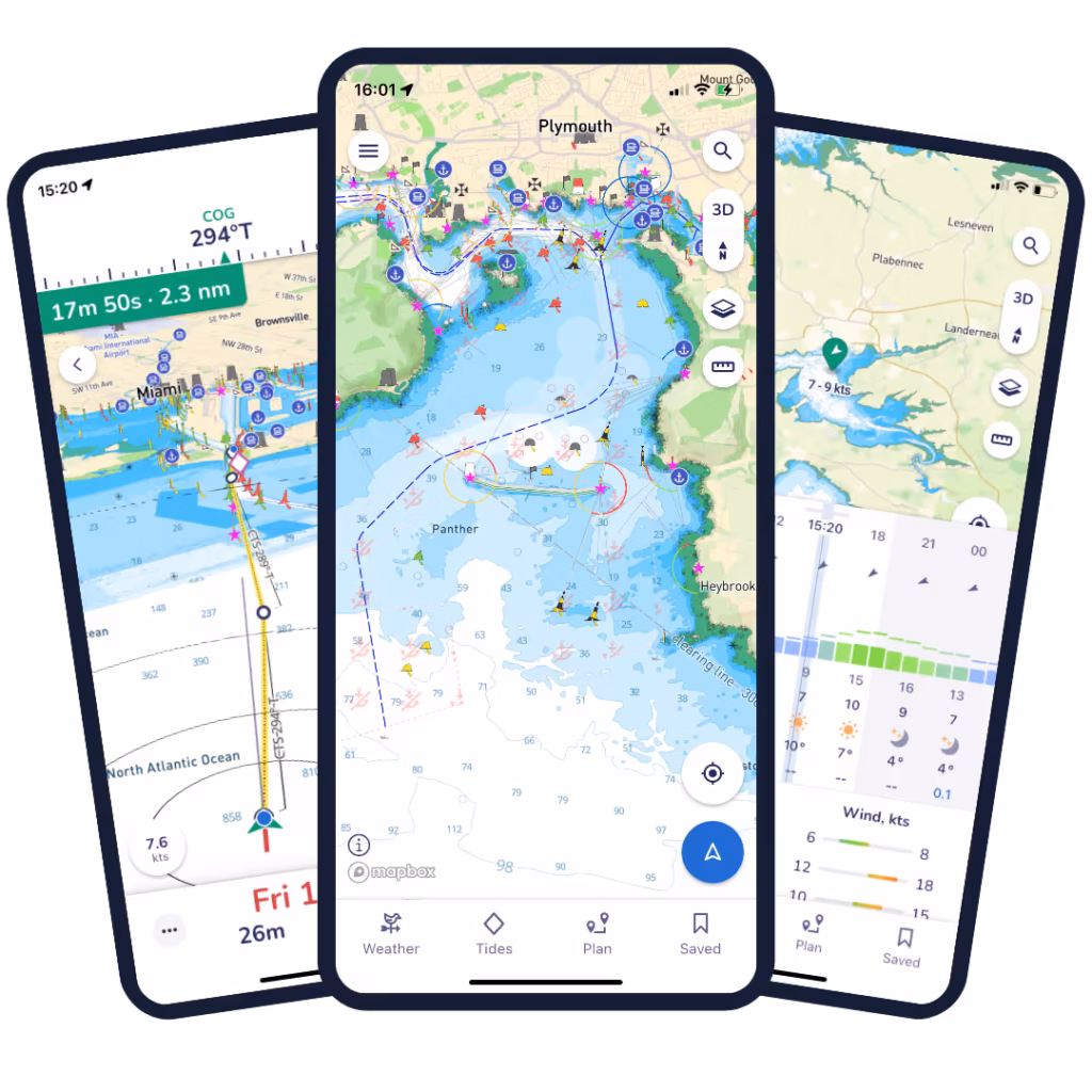
    The Command interface enables real-time control of critical vessel systems while consolidating multiple standalone displays into a single integrated helm experience. It is fully customizable for OEM integration or refit applications, ensuring a seamless fit for any vessel.

    Credit: Savvy Navvy
    Credit: Savvy Navvy

    In less than 18 months since launch, award-winning Savvy Integrated has quickly gained traction with marine manufacturers and boat builders looking for modern and flexible navigation solutions. 

    Seaward Automation specializes in advanced, logic-based automation solutions for sportfishing vessels and pleasure craft, as well as sailing yachts and commercial marine platforms. Its full vessel automation platform, Command, launched less than a year ago.

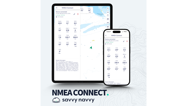
    Savvy Navvy provides smart routing, giving users the optimal route and dynamic ETAs based on real-time data: departure time, chart information, weather conditions, tide, boat specifications and local regulations.

    A live demo of Savvy Navvy on the Command platform will be available at the boatshow, Slip A215.

  • Savvy Navvy launches NMEA Connect for integrated onboard navigation

    Savvy Navvy launches NMEA Connect for integrated onboard navigation

    Marine navigation company Savvy Navvy introduces a new NMEA Connect feature that seamlessly integrates NMEA-enabled boat instruments with the app, providing real-time data and enhanced AIS visibility.

    Working with award-winning Actisense, recognized globally for their NMEA interconnectivity specialty, Savvy Navvy’s new NMEA Connect feature enables boaters to view real-time data including wind, depth, engine RPMs, speed through water, heading and more in the app.

    By combining onboard and over-the-horizon AIS, NMEA Connect delivers a complete view of nearby vessels for safer, smarter navigation. Through NMEA Connect, boaters can now access their boat’s instruments and Savvy Navvy’s smart routing technology from their pocket, eliminating the need to switch between multiple screens or devices.

    “Boaters increasingly seek apps that simplify navigation and enhance onboard intelligence. NMEA Connect combines the proven reliability of NMEA technology with Savvy Navvy’s smart routing capabilities, giving boaters everything they need in one place. For boats without NMEA-compatible chart plotters, Savvy Navvy now becomes your all-in-one display,” says Misha Vysokovskiy, chief product officer at Savvy Navvy.

    Actisense, global specialists in marine electronics, help leisure and commercial operators build safer, smarter and more dependable onboard networks.

    “Savvy Navvy already delivers a huge amount of value to boaters, pulling together geographic location and environmental data streams. The addition of NMEA data connection means that other integral navigation and systems data will give boaters better visibility of things like depth, speed over ground, wind speed, heading and engine RPM — all within the easy-to-use Savvy Navvy app. Actisense are proud to have partnered with Savvy Navvy, lending our NMEA specialism. We share company missions of making journeys safer and more efficient through better data,” says Justin Cohen, commercial director at Actisense.

    Savvy Navvy has had more than 3 million downloads globally. Unlike any other boating navigation solution, Savvy Navvy provides smart routing — giving users optimal routes and dynamic ETAs based on real-time data: departure time, chart information, weather conditions, tide, boat specifications and local regulations.

    The NMEA Connect feature comes just weeks after Savvy Navvy launched an industry-first new chart annotation tool and Three Point Fix, following requests from boating instructors to turn digital charts into interactive learning tools for the next generation of boaters.

  • Digital Yacht offers Onefix high-performance GNSS sensor for boaters

    Digital Yacht offers Onefix high-performance GNSS sensor for boaters

    Digital Yacht is offering OneFix , a high-performance GNSS sensor designed to offer positioning better than 1 m. The multi-constellation, dual-band sensor also has robust anti-spoofing algorithms to provide more reliable navigation.

    The sensor can fit most popular navigation systems, including legacy units, as well as connect to iPads and tablets and the latest multi-function NMEA 2000 compatible displays.

    OneFix incorporates a dual-band (L1 and L5) processor and works with GPS, Galileo, NavIC and Beidou to calculate a fix. GLONASS is available as an option with a second active antenna. Its advanced algorithm compares position fixes across all networks and frequencies to minimize spoofing and positional inaccuracies. The result is a highly reliable position fix which typically offers sub-1m accuracy.

    Photo:
    Photo: Digital Yacht

    It’s also been designed to connect to older systems via legacy NMEA 0183 as well as more modern systems with NMEA 2000. The wireless interface allows connectivity to iPads and tablets including popular apps such as Navionics and TimeZero. Most importantly, the wireless interface allows the user to view satellite status and potential errors or issues of position spoofing. Alerts for the navigation display are generated via NMEA 2000 if OneFix detects issues.

    It also incorporates data logging and an external event marker switch input so key points of a voyage (or even fishing hotspots) can be logged to memory. Tracks and data can be exported via a mobile device to Google Map overlays.