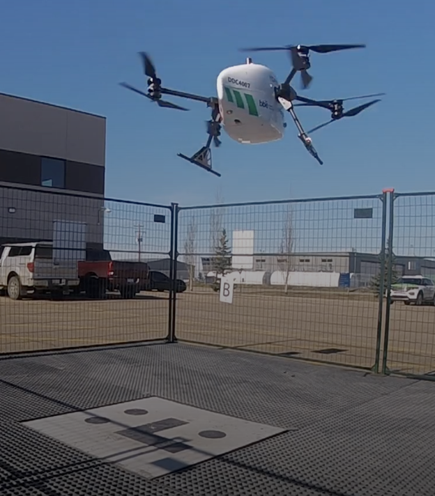
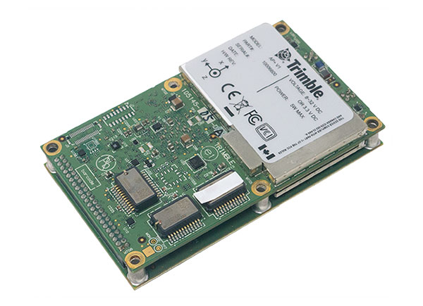
The Trimble module provides Volatus’ clients with a turnkey solution for highly-accurate aerial data acquisition and fully-remote drone operations in real-world missions, including beyond visual line of sight (BVLOS).
The Trimble PX-1 RTX uses Trimble’s CenterPoint RTX corrections along with compact, high-performance GNSS-inertial hardware to deliver real-time, centimeter-level positioning and highly precise inertial-derived true heading measurements. This technology reduces operational risks associated with poor sensor performance or magnetic interference by providing enhanced positioning redundancy.
Volatus must meet strict guidelines addressing airspace entry and exit, altitude and speed, and communication and remote identification when taking off from and landing at the Edmonton International Airport in Alberta, Canada. The flight corridor approved by Transport Canada and Nav Canada requires them to land and takeoff with precision, while staying at 50-feet altitude when crossing airplane arrival routes.
Trimble PX-1 RTX’s precise positioning capabilities address crucial accuracy challenges for takeoff and landing, while supporting an exact flight altitude and positioning within the flight corridor. This capability enaables Volatus to remain compliant with the controlled airspace authorization from Nav Canada, a non-profit that operates the country’s civil air navigation system.
The Trimble PX-1 RTX solution is available through Trimble sales channels.
Correction services enable farmers to pinpoint where to apply fertilizers so as not to waste any. (Image: artiemedvedev/iStock/Getty Images Plus/Getty Images)
Growing among the many options for GNSS corrections open to precision agriculture operators are tiered precise point positioning (PPP) services. Agriculture has had integrated GPS, and now GNSS, for decades. Ranging from individual RTK bases, networks of RTK bases and network RTK (RTN) to dedicated L-band satellite-delivered PPP, operators have been able to receive and apply the appropriate corrections for different crops and applications, from centimeters to meters.
Part of the appeal of such services, particularly for large agricultural concerns with mixed crops and operations, is having the full flexibility of tiered precisions. Additionally, near-global coverage has increased utilization.
“Specialty and high value crops require high accuracy,” said Michael Helling, senior director of strategy for Trimble’s autonomy group. “For instance, when drip tape is laid for fruits and vegetables, you would not want subsequent activities to be off more than an inch or so, to avoid cutting it. This is where RTK was essential, and a base was often set up, or an RTN accessed. But the RTX [Trimble’s PPP delivered by L-band satellites] high-precision option, CenterPoint RTX, easily meets those needs.”
Like some other PPP correction services, Trimble’s RTX also has lower precision subscription options: RangePoint for 15 cm and ViewPoint for 30 cm pass-to-pass accuracy. These services are also utilized outside of agriculture. For example, CenterPoint, delivering centimeter precision, is utilized for certain surveying and construction applications and FieldPoint for asset mapping. Trimble has also developed embedded solutions, based on the same core technology for, among other things, maritime, robotics, autonomous vehicle, and assisted driving applications.
Certainly many agriculture applications can suffice with lower precisions, such as broadacre crops, where there may be no need to maintain row-to-row and year-to-year repeatability. Where some amount of overlap between passes is acceptable, coarse navigation at sub-meter to meter precision may be all that is needed. However, as Helling notes, precision becomes addictive, and as the field equipment becomes more capable of positionally topical functions, many operators are stepping up in levels of precision.
“Farmers are more precisely testing fields with all kinds of sensors and seeing where the field actually differs in soil and nutrient content,” said Helling. “There are different approaches and value propositions. One is saying I need to fertilize this area better so that I can get a better yield. There are also situations where a specific area of the field might only produce to a certain level. Farmers can pinpoint where those areas are to apply fertilizers so as not to waste it and optimize their bottom line.”
For many agriculture applications, the reality is that you have a tractor pulling some other piece of equipment through a field.
“Think about sprayers, forever behind a tractor,” said Helling. “Our equipment can control a lot of things around the rate, precisely targeting specific pieces of a field or row. When you start thinking about sustainability, being able to turn the spray on and off where you’ve already sprayed, you can avoid overspray.”
Sensor integration helps automate the process.
“We just aquired a company in France called Bilberry; their technology is very effective at identifying weeds. You can identify what’s in the field and can decide how you’re going to treat it. The next immediate steps in automation for agriculture might not be full autonomy, but more automation in the equipment that’s being pulled, and sensors that inform what they do.”
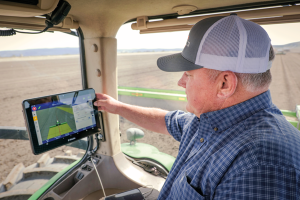
With the aid of Trimble’s correction services, the in-cab GFX-1260 display connects farmers to a wealth of knowledge about their fields and crops. (Photo: Trimble)
How do you define precision agriculture?
Precision agriculture is the use of technology in farming to increase yields through data and precision. Precision ag helps farmers improve yields by collecting data on all aspects of each plant to figure out exactly what it needs, when it needs it and how it will best survive. From planting, growing and cultivating to spreading, spraying and harvesting, precision agriculture allows farmers to monitor, measure and utilize data from beginning to end.
What have been the key turning points in the development of precision agriculture?
Accurate positioning is the enabler for all precision agriculture. RTK was one of the biggest initial developments within positioning as it allowed farmers a higher level of accuracy than had been seen previously. Precise Point Positioning (PPP) was the next big development. Our version of PPP, Trimble RTX, allows farmers the best of both worlds — RTK-level accuracy delivered via satellite, eliminating the need for base stations or sometimes unreliable radio, cell or internet signals. Though precision agriculture started with guidance, it has now made its way to implement-level, variable rate seeding and spraying and section control. ISOBUS has also been a big development in the past few years — allowing machines of all types to interact and communicate with each other, regardless of type, color and shape.
What are the specific requirements and challenges of precision agriculture for GNSS, and how do they differ from those of other kinds of mapping and machine control?
The challenge in GNSS is providing customers with the greatest availability in the field. While most fields are under open sky, obstacles such as trees and gullies make it more challenging. At Trimble, we provide market-leading pass-to-pass value with limited overlap for the customers at different price points. With our latest and most premium correction service, CenterPoint RTX, ease of use is also a key benefit.
When did Trimble begin to focus on precision agriculture?
Trimble unveiled its first agriculture receivers in 1999, signaling the start of the Trimble Agriculture division. In 2000, AgGPS Autopilot and automated steering systems were released for row crop application, further cementing Trimble’s presence in the precision agriculture community.
What are your relevant products/product lines?
Trimble offers technology integration that allows farmers to collect, share, and manage information across their farms, while providing improved operating efficiencies in the agricultural value chain. Trimble solutions include both hardware and software for guidance and steering, flow and application control, water management, harvest solutions, desktop and cloud-based data management, and correction services. Trimble’s CenterPoint RTX satellite-based correction service delivers GNSS positions repeatable to less than an inch. Combined with Trimble’s ProPoint GNSS technology, this service provides greater positioning availability, even in challenging environments such as tree lines, gullies and along contours where much of farming takes place.
For applications where centimeter-level accuracy is not as high of a priority, such as broad acre applications, Trimble RangePoint RTX and ViewPoint RTX give additional correction service options. They hold equipment to 6-inch and 12-inch pass-to-pass accuracy — or about the width of a tire between passing swaths. Trimble also offers Trimble VRS Now, giving farmers instant access to RTK positioning services using a network of permanent, continuously operating reference stations.
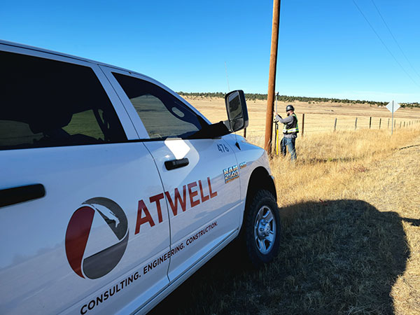
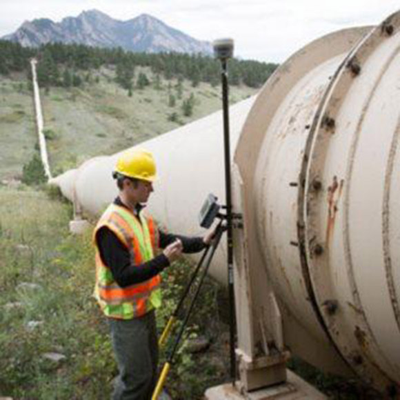
A positioning service energizes large pipeline surveying projects, saves time, and becomes a field crew favorite
For projects spanning large areas, a large engineering and construction firm discovered that a precise point positioning (PPP) service — Trimble’s CenterPoint RTX — could solve the challenge of receiving high-precision GNSS in remote areas.
Atwell Group LLC is a national consulting, engineering and construction services firm with 33 offices throughout the country and more than 1,000 team members. The company delivers a broad range of strategic and creative solutions to clients in three core markets: oil and gas, power and energy, and real estate and land development.
Atwell provides comprehensive turnkey services, including land and right-of-way support, engineering, land surveying, environmental compliance and permitting, and project and program management.
Photo: Trimble
Pipeline construction
Atwell’s introduction to PPP and Trimble’s CenterPoint RTX took place during two large-scale linear pipeline projects within remote areas. Atwell has substantial experience with projects of this scale, but the remoteness of some of the projects’ sections was proving to be a challenge. While they could expect to rely on base or network correction methods for most projects, Atwell needed to seek other correction alternatives — and up their efficiency for the long-corridor projects.
With the CenterPoint RTX service at hand, Atwell performed construction staking and as-built surveys for a 50-mile pipeline. The project spanned a five-month period, with an hour or more of time saved each day using the service.
Crews noticed an additional benefit: rapid response time. On any given day, there could be project managers, right-of-way agents, or inspectors on site, asking for additional survey data.
“Inspectors and others started to notice how fast our crews could jump from one place to another and get the shots they requested, without having to do any base setups,” said Jason Jung, project manager with Atwell.
“The speed at which our crews can get up and running with RTX is awesome.” — Jason Jung, 3D laser scanning projects manager, Atwell
Because of the range limits of base radios, the crews might have to do multiple setups of a conventional real-time kinematic (RTK) base each day. RTX removed this hindrance, saving the crews time by not having to use temporary RTK bases, which entails driving to base reference points, setup and teardown, and downtime from malfunctioning equipment and battery issues.
“RTX completely freed us from the time and hassle of base setups,” Jung said. “You turn it on, and it’s ready to go before you’ve had time to take a sip of coffee. And once our crews got used to it and gained confidence in the results, they have really loved this solution.”
Photo: Trimble
Scanning a pipeline
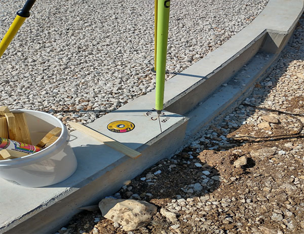
Atwell recently used CenterPoint RTX on a 135-mile large-diameter pipeline project that included 19 facilities along the route. Atwell provided as-built services related to the facilities using a Trimble X7 scanner.
The data captured was used to generate spatially correct site models that included the material traceability necessary to comply with Pipeline and Hazardous Materials Safety Administration (PHMSA) regulations. Crews used RTX to georeference point clouds from the scanner to provide the accuracy needed to comply with industry regulations. Each site was referenced with permanent monuments or scribes that tied into the master control system.
Crews also used the RTX service to establish hard checkpoints to meet Atwell’s strenuous quality-control requirements for ground targets, such as those used in UAS control work. To do the daily “in and out” check shots, they used the free BenchMap app to locate nearby survey control marks from the National Geodetic Survey database. Most checks were sub-0.08’.
The time saved in not having to change base positions, as well as setup and breakdown, were significant time savers along this lengthy project. The precisely registered scans helped speed up PHMSA required inspections and audits, and construction change management field operations.
A crew favorite
Atwell’s crews use Trimble R10 receivers and Trimble Access running on TSC7 controllers, but Jung noted that they have recently upgraded to some R12i GNSS receivers, “and they are already earning their keep.” He expects to realize even more benefits from RTX coupled with the advanced multi-constellation capabilities of the Trimble ProPoint RTK engine in the R12i.
RTX has not only become a crew favorite, it is fast becoming a go-to solution for many Atwell projects.
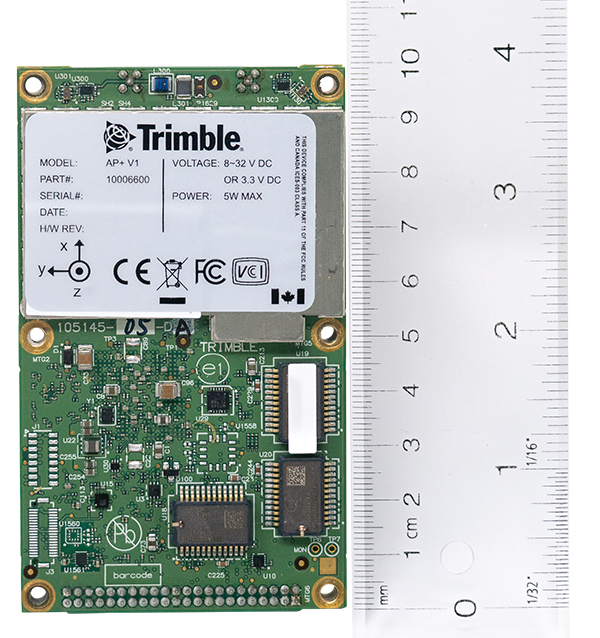
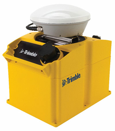
New hardware and software platform provides accuracy, position for land-vehicle system integrators
Photo: Applanix
Applanix, a Trimble Company, has announced the Trimble AP+ Land GNSS-inertial OEM platform for accurate and robust position and orientation for georeferencing sensors and positioning vehicles in land mobile-mapping applications.
The platform enables users to accurately and efficiently track and monitor fleets and produce high-definition (HD) maps and 3D models. It can also serve as a reference solution for advanced driver-assistance systems (ADAS) testing, even in challenging GNSS environments.
The comprehensive Trimble AP+ Land is small enough to integrate into compact mobile-mapping systems. It is compatible with virtually any type of mapping sensor, including single- or multi-lidar systems, video cameras, photogrammetric and panoramic cameras, and similar sensors.
Configurable to meet the mapping, positioning and direct georeferencing (DG) accuracy demands of mapping and positioning applications in challenging GNSS signal environments, the Trimble AP+ Land solution features:
Dual embedded survey-grade GNSS chipsets that can receive multi-frequency and multi-constellation signals
Dual custom-designed inertial measurement units (IMU)
Distance measurement indicator (DMI)
Compact size
Low power consumption
Optional RTK and Trimble CenterPoint RTX real-time correction service support
Full integration and post sales support through the Applanix Global support network
“We have taken the most advanced features of Applanix inertial and Trimble GNSS technology, and packaged them into a powerful compact and versatile solution optimized for mobile mapping and positioning applications,” said Joe Hutton, Applanix’s director of inertial technology, air and land products. “We remain committed to our customers’ success by developing flexible and scalable positioning solutions such as the AP+ Land and more.”
The Trimble AP+ Land OEM solution is supported by the Applanix POSPac MMS post-processing software, which features Trimble CenterPoint RTX post-processing for centimeter-level positioning globally without the need for base stations. These capabilities make it a suitable for integrators to produce a highly efficient land mobile-mapping system.
For lidar integrators, the Trimble AP+ Land OEM is compatible with the POSPac MMS LiDAR QC tools. SLAM technology computes the IMU to lidar boresight misalignment angles and also adjusts the trajectory to achieve the highest level of georeferencing accuracy in the generated point cloud.
GNSS signal convergence means significant time savings for surveyors
Photo: Trimble
Trimble has announced enhancements to its Trimble RTX correction services, tailored to meet the evolving needs of geospatial professionals and part of an ongoing strategy to deliver high-accuracy correction services to users worldwide.
Enhancements are designed to reduce convergence times, provide more reliable and robust signals, and make the workflow for surveyors easier. The enhancements further enable geospatial professionals to untether from the cost and complexities of GNSS base stations and complete fieldwork faster.
Surveyors in many regions worldwide can now spend less time in the field with CenterPoint RTX correction service, converging in typically three minutes compared with up to 15 minutes in the past. The breakthrough convergence-time reduction is available on Trimble GNSS receivers with ProPoint technology and will benefit land surveyors working around the globe by enabling them to start surveying faster.
In addition, CenterPoint RTX now supports the BeiDou III (BDS-III) constellation, which contributes to convergence time improvements. Support for BDS-III and convergence time improvements is available globally via IP/cellular and regionally via satellite delivery. Convergence times for the CenterPoint RTX Fast regions remain unchanged at less than one minute. CenterPoint RTX Fast coverage is available coast-to-coast in the U.S. and Western Europe.
Geospatial professionals will be able to work more reliably in challenging GNSS environments, such as urban multipath or under tree canopy, due to the addition of BDS III and GPS III satellite signals into the Trimble RTX solution. Even as GNSS satellites are retired and new ones become operational, Trimble RTX will consistently track and deliver robust and reliable corrections.
Using a Trimble receiver with ProPoint technology with Trimble Access field software and CenterPoint RTX correction service, surveyors will benefit from a streamlined workflow that simplifies how they work in their local coordinate systems. Surveyors can collect data using CenterPoint RTX correction service without the need for a site calibration or an offset.
“Our teams collaborate to continually improve the Trimble RTX-based real-time correction services integration with our geospatial solutions,” said Ron Bisio, senior vice president of Trimble Geospatial. “Surveyors worldwide rely on Trimble to develop products and services that help them get their work done quicker and easier, and this Trimble RTX update is another example of how we continue to deliver surveyors the tools they need to do their jobs even more efficiently.”
“We are celebrating 10 years of providing Trimble RTX-based correction services and each year our services outperform the year before,” said Lisa Wetherbee, general manager of Trimble Advanced Positioning. “We continue to enhance the performance and overall customer experience to help geospatial professionals increase their productivity and provide them peace of mind that our services and people will be there for them around the clock.”
Trimble RTX subscriptions for Trimble RTX-compatible GNSS receivers are available through Trimble’s Authorized Business Partners or Trimble’s online store.
Applanix, a Trimble company, has introduced the Trimble AP+ Air OEM solution for direct georeferencing of airborne sensor data.
The solution enables users to accurately and efficiently produce maps and 3D models without the use of ground control points.
The Trimble AP+ Air is a powerful solution for manned platforms, yet small enough for use on unmanned aerial vehicles (UAVs). It is also compatible with virtually any type of airborne remote sensor, including photogrammetric cameras, lidar, hyper and multispectral cameras, and synthetic aperture radar.
Comprised of next-generation compact, low-power hardware, the Trimble AP+ Air features dual embedded survey-grade GNSS chipsets, an onboard inertial measurement unit (IMU), an external IMU, and the all-new Applanix IN-Fusion+ GNSS-aided inertial firmware. It is configurable to support the direct georeferencing accuracy demands of low-flying UAVs to high-altitude manned platforms.
“We have taken the most advanced features of Applanix direct georeferencing and Trimble GNSS technology and packaged them into a powerful new, compact and versatile solution,” said Joe Hutton, Applanix’ director of inertial technology and airborne products. “It provides the flexibility required by systems integrators to embed a single hardware solution that can then be configured to meet the different direct georeferencing needs of a specific sensor type, whether flown on a UAV or manned aircraft. It truly is an ‘integrate once, use many times’ solution.”
The Trimble AP+ Air is fully supported by the Applanix POSPac MMS post-processing software, which features CenterPoint RTX post-processing for centimeter-level positioning anywhere in the world without the need for base stations. These capabilities make the solution ideal for integrators to produce a highly efficient airborne mapping system.
For lidar integrators, the Trimble AP+ Air is compatible with the POSPac MMS LiDAR QC Tools for computing boresight as well as adjusting the relative accuracy of the POSPac trajectory being used to generate the point cloud. For integration with cameras, the solution is supported by the POSPac MMS Photogrammetry Tools for computing boresight and performing camera IO quality control.
The Trimble AP+ Air OEM solution and POSPac MMS are available through Applanix sales channels.
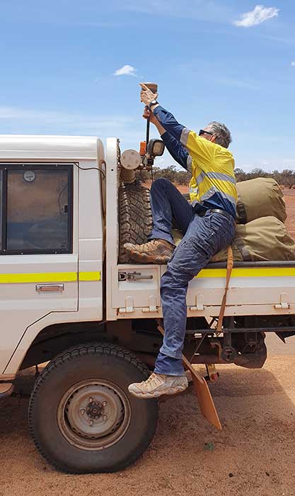
When someone imagines the Australian outback, they’re picturing Australia’s largest state, Western Australia (WA), which occupies an entire third of the continent.
Nearly all WA residents live in Perth, with the rest of WA reminiscent of the United States’ historic Wild West — sparsely populated towns with little infrastructure. That wild beauty and remoteness can also make surveying a less-than-beautiful experience.
“The outback of WA is a real test on my adaptability and logistics skills,” said Phil Richards, a professional surveyor and associate director with Perth-based RM Surveys. “It can take 1.5 days to get to your first site and once there, you’re totally isolated with no resources — and climate conditions that can range from 0 to 50 degrees Celsius. The sparse, rugged road systems make navigating anywhere a long journey. And if the weather turns bad on your job and you didn’t plan well, you could be completely stranded.”
Technological challenges that add to the complexity: limited mobile phone service, time-consuming RTK base station setups, inconsistent RTK cellular or radio communication, and geodetic control points that are difficult to access.
Advances in precise point positioning (PPP) technology, however, have been helping to resolve these obstacles and enable surveyors to optimize their real-time productivity without sacrificing accuracy. For Richards, who specializes in remote surveying work, this modern GNSS enhancement has helped bring a little tameness to the wilds of WA, enabling him to increase data collection efficiencies, reduce costs and boost the company’s bottom line.
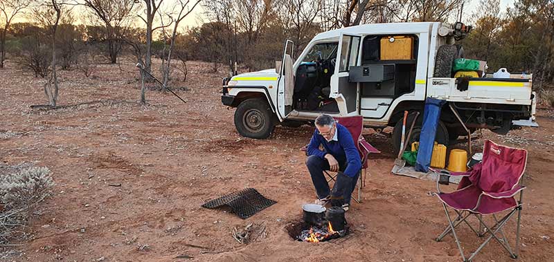
Camp breakfast: The R10 receiver rests on a spur while Phil Richards dines out. (Photo: Trimble)
The case for a new approach
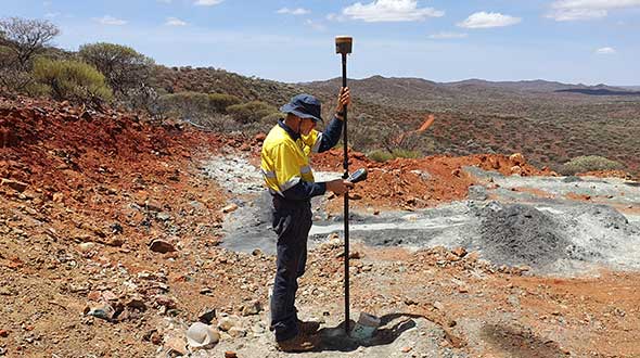
With his aptitude for remote surveying, much of Richards’ project work in WA has been in support of heavily active mining companies. For example, for the past 15 years, one iron ore producer has contracted him to travel more than 600 kilometers from Perth to measure exploratory drill hole collars. Drill collars, the remnants of drilling activity, are 3-millimeter-thick segments of PVC, about 150 mm in diameter, which protrude about 300 mm out of the ground, typically at a 60-degree angle. Measuring the center of that above-surface collar is a crucial stage in the exploration process to enable the client to develop a geological model of the mineral resource underground.
Managing 10 prospect sites across 300 km, the number of drill holes can vary from year to year, but there can be as many as 100 holes spread out over a few prospects at a time. Since 2007, Richards has been using Trimble R8 and, more recently, Trimble R10 GNSS receivers and RTK technology to acquire the drill-collar measurements.
On average, each prospect is 5 km by 2 km and has its own coordinate network. Depending on the number of collars and the distance to each, Richards would set up between two and nine RTK base stations on known control points to set project control. Using his Trimble GNSS receiver, he’d either drive or walk to each drill collar, set the foot of the range pole on the center of the collar at ground level, take a reading and record the measurement in Trimble Access field software on a Trimble TSC3 controller. Although the need for multiple base stations had added hours onto the projects, the RTK method consistently provided the needed accuracy.
X hits the spot
In 2015, the iron ore company restructured its mineral exploration program. Rather than drill numerous exploratory holes across a few prospects, the new focus was to drill fewer holes spread over the entire project area. That was going to be problematic for Richards’ traditional RTK routine.
“Previously, when it was predominantly surveying and less traveling, the RTK approach worked well for the project, even though setting up base stations is time consuming,” said Richards. “But when that switched to less surveying and more traveling, continuing with RTK was going to increase costs because each time I have to set up my base station, that’s an extra hour. If I have 10 drill-collar zones, that’s 10 hours. And if my base station is 10 minutes away, it adds more time and expense if I have a problem with it, or I can’t get a reliable signal, and I have to travel back to it to fix it or move it. The reduced number of collars and the increased distances between them required a more efficient method to make the project profitable.”
Taking the R10 off the vehicle mount. (Photo: Trimble)
Richards decided to test Trimble’s CenterPoint RTX correction service as an alternative. CenterPoint RTX is built on a network of GNSS tracking stations around the world that stream multi-frequency, multi-constellation data to the company’s network control centers. Advanced data processing algorithms analyze the three main error sources: satellite orbits, clock offsets and atmospheric effects, and develop models and correction data. This information is delivered to GNSS rovers via L-band satellite communications. The rover combines the correction data with its own satellite observations to produce accurate positions.
Richards ran five trials in conjunction with varied exploration surveys at test sites across 1,000 km of terrain. He took RTX measurements of survey control points with his R10 and compared them to the same positions acquired with RTK. Although the CenterPoint RTX can take up to 15 minutes to reach sub-2-centimeter horizontal accuracy in WA, Richards said the technology regularly delivered on performance. Most importantly, this technique enabled him to work without a base station and obtain real-time GNSS positions with centimeter accuracy even in isolated WA.
Integrating Trimble’s CenterPoint RTX into his workflows enabled Richard to use a single GNSS receiver system, much like working within the VRS networks available in the more populated areas of Australia.
Into the Outback
For the 2019 campaign, Richards and a colleague were contracted to acquire accurate 3D positions for 13 drill-collar holes stretched across two major prospects about 150 km apart. Their area of interest was 700 km northeast of Perth.
Within a 15-km-wide area, they had to acquire measurements for eight drill-collar holes. They calibrated the R10 receiver to the nearest control point to tie into the site’s coordinate system and moved through the area, methodically recording the positions of each collar hole. Despite the rough terrain, they finished both prospect sites in 1.5 days, compared to 2.5 days had they used RTK.
“Given the project format, with so much travel time and less surveying time, RTX is really the only way to do it,” Richards said. “It’s far quicker than setting up base stations — I saved 50% of the time using RTX on this campaign. I’m more efficient; I’m able to keep costs down; and I have the confidence in the system that I know I’ll deliver on accuracy. It’s hard to justify using any other method.”
“Seen & Heard” is a monthly feature of GPS World magazine, traveling the world to capture interesting and unusual news stories involving the GNSS/PNT industry.
Photo: Karma drone/GoPro
Bad karma
The GoPro Karma drone has been grounded since the new year began, reports The Verge. Multiple owners say their Karma controllers are flashing errors about not receiving a GPS signal, and that they can’t calibrate the compass. They’re not able to fly the drones even after disabling GPS. A GoPro spokesperson told The Verge that it is “actively troubleshooting” the issue.
Going wild at the casino
A Waze ad in January misdirected drivers headed to Atlantic City’s Borgata Hotel Casino & Spa into New Jersey’s Pine Barrens. Jackson Township police helped numerous motorists stuck on unpaved roads about 45 miles from the casino, which is just off the Atlantic City Expressway. The address on the ad was correct, but the location pinned with the ad is actually in the Colliers Mills wildlife area.
Photo: Rock penguins/Charles Bergman/Shutterstock.com
Feed the birds, not the mice
Irish structural engineer John Houston used a Trimble R10 GNSS receiver and Centerpoint RTX to help mitigate a serious threat to Gough Island’s birds. The Royal Society for the Protection of Birds seeks to eradicate invasive mice left from 19th-century ships. The survey will help locate temporary infrastructure for workers to distribute poisoned bait to kill the voracious rodents, which feed on two million defenseless eggs and chicks each year. Though 1,000 kilometers from the nearest reference station, Houston achieved centimeter accuracy on all survey points. See the monster mice here.
Photo: U.S. Marines at Al Asad Air Base in 2018. (Cpl. Jered T. Stone/Marine Corps)
Missiles guided by GLONASS
According to Israeli military intelligence website DEBKAfile, Russia gave Iran access to GLONASS to target the U.S. base in Iraq on Jan. 8. The strike injured 34 American soldiers. DEBKAfile reports that Russia-provided GLONASS access allowed Iranian missiles to hit with an accuracy of 10 meters at the Ain Assad base in western Iraq. “According to Russian sources, 19 missiles were fired from the territory of Iran, 17 of which hit the targets,” DEBKAfile said.
Trimble has expanded its CenterPoint RTX Fast GNSS correction service coverage area in North America.
Additional states and provinces now covered by Trimble RTX Fast include Alabama, California, Florida, Georgia, Michigan, Mississippi, New Mexico, North Carolina, Ohio, Oregon, South Carolina and Washington, and Alberta and Ontario Canada.
Trimble RTX Fast reduces convergence time, allowing customers to achieve horizontal positioning accuracy of better than one inch (2 centimeters), in as fast as one minute.
Now, with CenterPoint RTX more farmers, surveyors, GIS professionals and construction contractors can experience the RTK-level accuracy of traditional cellular-based Virtual Reference Station (VRS) networks, while benefiting from the versatility of a satellite-delivered correction service, Trimble said.
“Trimble RTX technology has continually evolved since its launch in 2011 with improving accuracy and reduced convergence times,” said Patricia Boothe, vice president of Trimble’s Advanced Positioning Division. “This network expansion demonstrates our commitment to bringing the market-leading performance of Trimble RTX Fast to more users, in more geographies around the world.”
Trimble’s RTX network is currently available throughout most of the world, with the RTX-Fast network coverage available in select geographies in the U.S., Canada and throughout most of Europe, when using Trimble RTX compatible GNSS receivers. Subscriptions are available through Trimble’s Authorized Business Partners or Trimble’s online store.
Trimble introduced several new products at its annual Trimble Dimensions user conference, taking place Nov. 5-7 in Las Vegas.
Photo: Trimble
GNSS Smart Antennas for Civil Construction. The new SPS785 GNSS smart antenna is a fully capable GNSS receiver that features high-quality GNSS accuracy at a lower price point. The SPS785 has full satellite coverage with the combination of GPS and all GNSS constellations. A seamless workflow with the Trimble Siteworks Positioning Systems means that everyone on the jobsite can use the same data and work on the same platform.
For added protection, the SPS785’s radio antenna fits inside the range pole. The lightweight and compact design enables contractors to work longer with less fatigue.
Also, a new dynamic tilt functionality was added to the Trimble SPS986 GNSS smart antenna. The SPS986 is specifically designed for rugged jobsite measurement applications, and is now available with a dynamic tilt upgrade. The dynamic tilt feature allows for faster data collection to enable construction surveyors to create larger digital terrain models faster and with improved accuracy. It is designed to capture higher accuracy measurements on steeper slopes from a moving vehicle and more accurate volume measurements to save time and money on material planning.
The dynamic tilt measurement mode also auto-measures antenna height. From inside the vehicle, contractors can set the height of the antenna and quickly interrogate surface models using the real-time 3D surface display in Trimble Siteworks field software.
The Kestrel seismogeodetic system. (Photo: Trimble)
Kestrel Seismogeodetic System. Trimble RTX technology is now delivered via satellite to the Kestrel seismogeodetic systemfor earthquake, volcano and infrastructure monitoring. Designed for scientists and structural engineers, Trimble’s Kestrel pairs uninterrupted, high-quality GNSS positioning corrections with seismic data — for Earthquake Early Warning (EEW), volcano and infrastructure monitoring of bridges, dams, towers and other civil structures.
In addition to internet-delivered Centerpoint RTX corrections, the Kestrel system also now supports L-band satellite delivered RTX corrections. This ensures corrections are not affected during communication delays or outages that occur during natural disasters. CenterPoint RTX enables centimeter-level absolute positioning, which is critical when analyzing and responding to the movement of a structure.
Field Staking and Design Solution for Electric Utilities. Trimble Field Designer is an innovative mobile staking and design solution that enables electric utilities to quickly design overhead and underground electric utility lines on mobile devices in the field.
Trimble Field Designer leverages mobile technology from Trimble business partner GeoSpatial Innovations, Inc. (GSI). It was developed to add new field staking and design capabilities to Trimble’s Network Information System (NIS), a network asset management solution. At the heart of Trimble NIS is a fully connected “live” network model built on a single database that provides for comprehensive documentation, topology and full life-cycle support of electric utility network assets.
Trimble Field Designer enables electric utilities to:
Capture pole locations efficiently and accurately
Measure distances, angles, elevations, offsets, and bisectors
Assign construction units to locations and spans for material and labor requirements
Capture comments and information about design
Reduce design time
Eliminate redundant data entry in the office.
Earthworks Grade Control Platform version 1.7. The latest version of Earthworks provides support for motor graders and automatic guidance for tiltrotator attachments. Trimble Earthworks for Motor Graders is a GNSS-based, 3D-grade control solution designed to make fine grading more accurate, faster and easier. In addition, Trimble Earthworks now gives excavator operators using tiltrotators the advantage of automatic machine control, which can result in increased productivity.
A video featuring a South African veteran surveyor, telling his story of achieving 2 cm horizontal accuracy with Trimble CenterPoint RTX. Satellite-delivered, survey grade accuracy and no base station required!