Qualcomm Technologies and Xiaomi have verified meter-level positioning in the Xiaomi 12T Pro powered by the Snapdragon 8+ Gen 1 mobile platform, in Germany.
Accuracy verification tests, including driving tests, were conducted by Qualcomm Technologies, Xiaomi, and Trimble in various scenarios such as open-sky rural roads and urban highways. The companies’ solutions demonstrated meter-level positioning variance at a 95% confidence level.
This level of accuracy in a commercial smartphone is enabled through Qualcomm meter-level positioning for mobile in combination with Trimble RTX correction services. When integrated with Snapdragon mobile platforms, Trimble RTX enhances the phone’s positioning capabilities.
Meter-level positioning accuracy can improve smartphone user experience in several scenarios, including mapping, driving, and other mobile applications. It enables greater accuracy when using ridesharing applications to identify pick-up locations for both driver and rider, fitness applications to track users’ movements, and in-vehicle real-time navigation applications for increased lane-level accuracy with greater map details and more accurate directions.
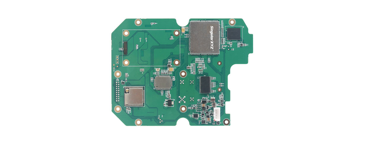
SingularXYZ, a manufacturer of GNSS technology, has launched its DK100 development kit. This multi-functional kit has selectable single-antenna and dual-antenna modules, full constellation tracking and centimeter-level positioning.
The DK100 development kit is a ready-to-use kit designed to simplify integration efforts and increase compatibility with a variety of applications. The kit reserves standard adapter board interfaces to connect different GNSS modules and radio modules for a variety of needs.
The development kit features a 4G module, Wi-Fi, Bluetooth, and Ethernet modules as well as status indicators on a single PCBA.
The DK100 development kit comes with its own web page for configuration. With Ethernet and Wi-Fi access, users can monitor device status and configure working mode and data transmission settings on the page.
The centimeter-level DK100 kit can be integrated in a range of horizontal and vertical applications, such as construction using CORS networks, precision agriculture, construction machinery, smart navigation, monitoring, robotics, unmanned systems and more.
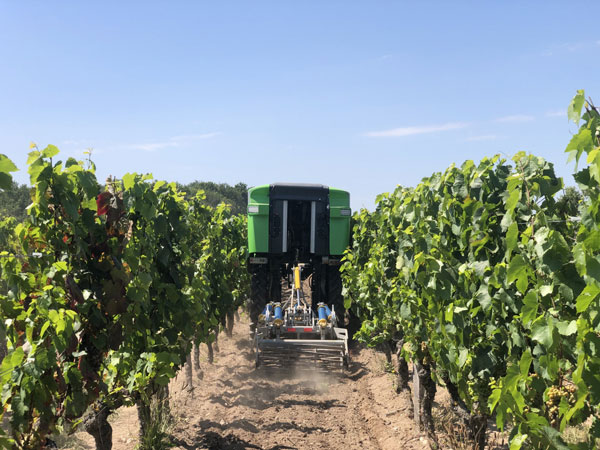
On a French vineyard in the Loire Valley, a tractor is driving between the grape vines with no one behind the wheel. Meet TREKTOR, the autonomous hybrid robot that works tirelessly to weed the organic vineyard producing some of the finest Gamay wine, called Anjou Gamay Village.
After TREKTOR worked the land for a month, its developer, a company called Sitia, reviewed the quality of their autonomous robot’s work. They counted grape vines damaged during operation — two in one month — and approached the farmer to reconcile the liability. To Sitia’s surprise, he responded, “When I use my manual tractor to get the same job done, I damage at least two vines a day! How did your tractor manage to be so careful?” Sitia’s developers thought for a while and then replied, “It’s thanks to the high quality and accuracy of the components that are inside.”
“Despite the strong magnetic field emitted by the generator on the TREKTOR, the AsteRx SB ProDirect receiver did not have any issues,” said Clément Aubry-Tardif, Sitia’s R&D manager. “The spectrum analyzer in its web interface showed other small radio interferences aboard the robot, but everything was still working fine.”
Integrated into the TREKTOR is an AsteRx SB ProDirect dual-antenna receiver, which provides the reliable high-accuracy positioning and heading needed for autonomous operation. Sitia chose the receiver for the following reasons.
It has centimeter-level accuracy with RTK, which reduces crop damage and increases yields.
Its heading helps point implements in the right direction. Unlike inertial systems, it’s reliable and accurate even in static or slow-moving applications.
Built-in advanced interference mitigation (AIM+) technology makes it resistant to radio interference, while its LOCK+ technology ensures robust satellite tracking even under intense vibrations or shocks.
It includes an intuitive web interface for fast prototyping and easy real-time testing.
Sitia is a French company specializing in autonomous robots. Its TREKTOR helps compensate for the current farmer shortage, which is especially felt on organic farms, where weeding is seven times more labor intensive due to the use of few (if any) herbicides. TREKTOR is a flexible solution that can adjust its height and width on the fly, adapting to various working environments. It can also change implements to perform various functions. Depending on TREKTOR’s dimensions and implements, the distance from the crop to the robot changes, making high-accuracy positioning crucial to minimize damage to any of the crops.
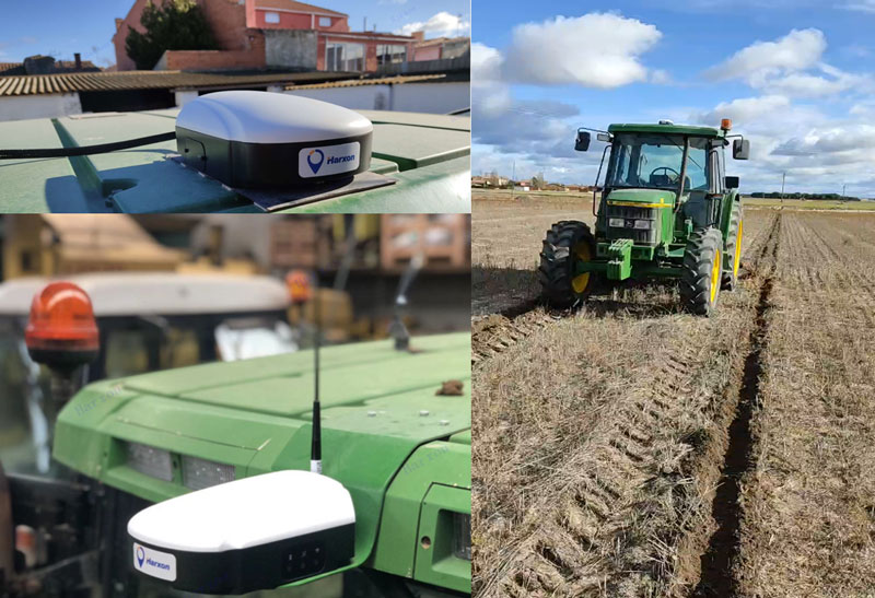
Today, many field operations — sowing, tilling, planting, cultivating, weeding and harvesting — rely on satellite-based autonomous guidance technology for agricultural machines. Yet farmers are still challenged by poor signal tracking, signal interference, communication instability and heading inaccuracy in tough environments, such as on uneven ground or slopes or under dense tree canopy. Because of insufficiently advanced navigation technology, ordinary machines fail to achieve the high efficiency expected and might even cause safety hazards. Therefore, the market has been awaiting a high-performance smart antenna with centimeter-level accuracy.
Harxon’s Smart Antenna TS112 PRO provides scalable and reliable positioning solutions for tough agricultural environments, such as uneven ground or fields with underground cables, as well as complicated weather conditions, including rain, fog and dust clouds.
The TS112 PRO integrates in one compact enclosure Harxon’s four-in-one GNSS/4G/Bluetooth/Wi-Fi antenna and a Hexagon | NovAtel OEM GNSS module. The multi-constellation GNSS antenna is designed with Harxon X-Survey technology and features multi-point feeding with high gain and wide beam width, which ensures high phase-center stability for ultimate RTK centimeter-level positioning accuracy. This is realized by subscribing to the Ntrip service via the LTE network to receive corrections or by setting up a local base station to broadcast corrections by radio.
The Hexagon | NovAtel OEM GNSS module is default-enabled for RTK, offering precise positioning and advanced interference mitigation for space-constrained applications and challenging environments. Additionally, users can achieve globally available centimeter-level positioning accuracy by using TerraStar satellite-delivered L-band correction services, with no need to set up an expensive network infrastructure.
TS112 PRO guarantees pass-to-pass accuracy down to 20 centimeters, where relative positioning is critical. It can also provide smoother steering and straighter rows by reducing positioning jumps that might occur during RTK signal outages or when a smart antenna changes positioning modes. Its terrain compensation algorithm is capable of correcting deviations caused by a vehicle’s roll and pitch while working on uneven ground or slopes.
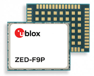
GNSS correction service receivers and the firmware-upgraded ZED-F9P upgraded to achieve reliable centimeter-level accuracies in seconds
Photo: U-blox
U‑blox is offering a suite of products and feature additions that simplify access to reliable centimeter-level positioning accuracies for the industrial, navigation and robotics markets.
The upgraded ZED-F9P high-precision GNSS receiver module and the corresponding NEO-D9S and NEO-D9C GNSS correction data receivers offer customers flexibility in assembling scalable solutions for their specific use cases, including robotic lawnmowers, unmanned autonomous vehicles (UAV) and semi-automated or fully automated machinery.
The software-upgraded u‑blox ZED-F9P-04B high-precision GNSS receiver is the first to support a secure SPARTN GNSS correction data format. It seamlessly connects to two new GNSS correction service receiver modules that stream correction data from communication satellites:
The u‑blox NEO-D9S will initially cover the European and U.S. markets before rolling out to the other areas of the globe.
The u‑blox NEO-D9C will cover Japan.
The NEO-D9S receives correction data using the SSR SPARTN data format over the satellite L-band channel. It uses cryptography to securely deliver PPP-RTK GNSS correction data, such as that offered by u‑blox’s PointPerfect service.
The NEO-D9C leverages the subscription-free Centimeter-Level Augmentation Service (CLAS) broadcast over mainland Japan provided by the Japanese Quasi-Zenith Satellite System (QZSS) constellation on the L6-band channel.
While u‑blox GNSS receivers are designed to work with most correction services on the market, pairing the ZED-F9P with the NEO-D9C or the NEO-D9S correction data receiver enables customers to save data transmission cost and operational efforts, the company said.
ZED-F9P-04B offers a new feature called protection level, which increases the trust applications can place in its position output. By continuously outputting the upper bound of the maximum likely positioning error, referred to as the protection level, the receiver lets autonomous applications, such as UAVs, make efficient real time path planning, increasing the quality of their operations.
In the case of robotic lawnmowers, the increased accuracy and reliability of the position will, for example, make it possible to do away with boundary wires, which today are buried under the turf to delimit the mowing area. Furthermore, it will allow lawnmowers to systematically cover a plot based on a digital map, as opposed to the random mowing approach commonly used today.
First samples of these products are available today, in professional and automotive grade. The correction data receivers will be available in automotive grade for the automotive markets.