Tag: conference

  • GEO Business expands for 2018, registration now open

    GEO Business expands for 2018, registration now open

    GEO Business, the United Kingdom’s largest geospatial exhibition and conference, has announced that registration is now open.

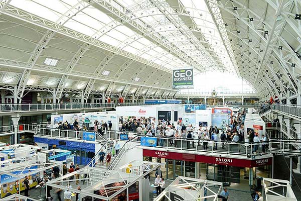
    The GEO Business show has grown every year since its inception, and the 2018 show looks set to be the most successful show to date with more exhibition space and a brand new seminar program. The event will return to the Business Design Centre, in London, UK, May 22-23.

    Since its record-breaking 2017 event last year, which welcomed 2,386 geomatics and geospatial professionals from around the world (a 48 percent increase since the launch in 2014), the exhibition has expanded onto the upper level. Exhibitors span the entire geospatial industry, showcasing cutting-edge technology and solutions that will mold the future of the industry.

    The 2018 GEO Business show will expand to the second level of the Business Design Center. (Photo: GEO Business)
    The 2018 GEO Business show will expand to the second level of the Business Design Center. (Photo: GEO Business)

    Confirmed exhibitors for 2018 include Survey Solutions Scotland, Land Registry, GAP Group, Phase One, Viametris, Surphaser/ MD3D, DHF Satellite and Ordnance Survey Ireland.

    New for 2018 is a free-to-attend seminar program designed to demonstrate the remarkable impact geospatial technologies and solutions on the global environment. The program will feature case studies from companies demonstrating how they are reducing costs and risk while increasing productivity.

    The 2017 GEO Business exhibit. (Photo: GEO Business)
    The 2017 GEO Business exhibit. (Photo: GEO Business)

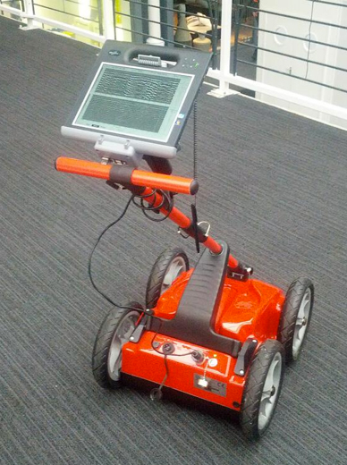
    The latest in augmented reality, building information management (BIM), geospatial information systems (GIS) and big data, laser scanning, mobile mapping, remote sensing and satellites, smart cities, surveying, UAVs, virtual reality and visualization will feature within the fields of architecture and construction, commercial property, environmental, equipment theft, floods, forestry, heritage, highways, hydrography, mining, rail and tunneling.

    With geospatial technology now impacting on more and more industries, GEO Business is attracting visitors from a wider range of industry sectors than ever before.

    “The geospatial industry is experiencing a huge transformation, everywhere you look at the moment you bare witness to the term ‘geospatial,’” Show Director Caroline Hobden said. “Innovative technology is steadily making its presence known in everyday life, whether it is through the revolutionary capabilities of augmented/virtual reality or the extraordinary data recorded by drones to name just a few, the world is sitting up and taking notice.

    “Even the U.K. government budget made mention of geospatial at the end of last year and as a result we excitedly await further announcements about the Geospatial Commission whose focus will be on location aware technologies revolutionising the digital economy.”

    The exhibition and seminar program will run alongside a strategic senior-level conference of invited speakers presenting and debating the role of geospatial in powering the Fourth Industrial Revolution, said GEO Business. The Fourth Industrial Revolution is changing how we live, work and communicate. It is reshaping government, education, healthcare and commerce — almost every aspect of life. The conference will celebrate, challenge and develop the role that geospatial has to play in maximizing the digital economy as part of this revolution.

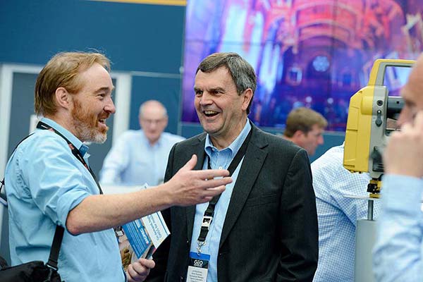
    Visitors will also have the unique opportunity to attend the well-established commercial workshop program hosted by exhibitors demonstrating their latest products and services and a full line-up of innovative social activities designed for informal networking with colleagues old and new.

    The exhibition, workshops and seminars are free to attend. There is a fee-to-attend the conference with an early-bird discounted rate for registrations before April 16. Public sector, association members and student discounts are also available. Visitors are encouraged to register online in advance to beat the queues onsite.

    For more information on stand sales or visitor registration, contact Caroline Hobden at [email protected] or call +44 (0)1453 836363.

  • IGNSS focuses on autonomy in February Sydney conference

    The upcoming annual conference sponsored by the IGNSS Society will take a close look at autonomy and provide GNSS constellation updates.

    IGNSS is the southeast Asian region’s premier conference on GNSS and related position, navigation and timing (PNT) technologies.

    This year’s conference theme is “Trusted Positioning: From Here to Autonomy.” The event, sponsored by Lockheed Martin, takes place Feb. 7-9 on the campus of the University of New South Wales in Sydney, Australia.

    At the conference, leaders in GNSS and PNT will gather to examine the latest technology, present cutting-edge research and discuss in open forums the implications for policy, market development and positioning infrastructure deployment.

    IGNSS 2018 will showcase a number of contemporary topics, including

    • the role of PNT in automated land, aerial and marine vehicles;
    • the growing range of commercial precise positioning services;
    • hard infrastructure issues such as space based augmentation systems; and
    • soft infrastructure issues such as datum modernization and mitigation of system vulnerabilities.

    These topics will be discussed in the context of the latest system developments fueling the multi-GNSS era.

    Running over two days immediately prior to IGNSS2018 is a meeting of the RTCM SC-104; all attendees are invited to attend.

    Also running one day before IGNSS2018 is the Japan-Australia Quasi-Zenith Satellite System Industry Utilisation Workshop. IGNSS delegates are also welcome to attend this free workshop.

    The IGNSS conference takes place on the UNSW campus in Sydney. (Photo: University of New South Wales)
    The IGNSS conference takes place on the UNSW campus in Sydney. (Photo: University of New South Wales)

    IGNSS2018 Highlight Sessions

    • Global GNSS service provider updates
    • SBAS Testbed overview and project updates
    • Panel: positioning autonomous systems

    Keynote Speakers

    • Air Vice-Marshall Kym Osley, Department of Defence
    • Kent Rosser, Discipline Leader Aerial Autonomous Systems, DST Group
    • Dorota Grejner-Brzezinska, The Ohio State University
    • Joe Burns, Sensurion
    • Rod Bryant, u-blox
    • Kendall Ferguson, RTCM Board of Directors & SC-104 Chair
    • Representative from the Expert Reference Group conducting the Review of Australia’s Space Industry Capability
    • Representative from the iMove CRC

    The IGNSS Association runs the SE Asian region’s premier conference on Global Navigation Satellite Systems and related Position, Navigation & Timing technologies. This year’s IGNSS is hosted in conjuction with the Australian Centre for Space Engineering Research at UNSW Sydney.

  • AUVSI conference targets unmanned defense market

    AUVSI conference targets unmanned defense market

    A conference aimed at military and government agency decision-makers is scheduled for Feb. 6–8.

    AUVSI Unmanned Systems – Defense. Protection. Security. (USDPS) will highlight what’s next for the defense, protection and security industries. The conference has been reimagined to include more opportunities to learn from industry and government thought-leaders and shop for the latest technology, said AUVSI.

    Expanded focus beyond the military includes government agencies such as Homeland Security, Interior, Justice, Energy, the FBI and  NOAA, as well as other public safety agencies.

    Thought leaders and subject matter experts from the military, government agencies and public safety outlets will provide details and insight on investments, innovation and sustainment, including what’s next with artificial intelligence and cybersecurity.

    More than 50 companies will be on site to provide military and government agencies with an inside view of new technologies and trends.

    In addition, a public safety educational lineup defines how to best use unmanned systems for explosive ordinance disposal and HAZMAT applications, addresses the counter-UAS threat at home and abroad, and provides insight on how disaster and emergency responders are using unmanned systems.

    The conference will take place at the  Gaylord National Resort & Convention Center in National Harbor, Maryland. Those registering before Nov. 19 can take advantage of advanced rates.

  • ION GNSS+ includes other sensors, offers new short courses

    ION GNSS+ includes other sensors, offers new short courses

    Companies and organizations like Spirent Federal Systems share their products and insights in the exhibit hall. (Photo: ION)

    The ION GNSS+ 2017 conference and industry exhibition covers all aspects of satellite navigation technology. It takes place Sept. 25–29 at the Oregon Convention Center in Portland.

    The theme this year is “GNSS + Other Sensors in Today’s Marketplace.”

    The conference will feature two tracks:

    • “Applications and Advances” focuses on safety of life, commercial and mass-market applications, and GNSS plans and policies.
    • The second track, “Research and Innovations,” will concentrate on autonomous systems, multi-sensor applications and advanced GNSS algorithms.

    Short Courses taught by Internationally Recognized Leaders

    This year, ION is introducing complimentary Short Courses to be taught by internationally recognized GNSS experts and educators throughout the day on Monday, Sept. 25.

    Short Courses are designed to enhance the ION GNSS+ attendee experience while giving everyone an opportunity to learn from the rock stars in the field, according to ION’s Executive Director, Lisa Beaty.

    Presented in a lecture-style learning environment, the Short Courses are designed for professionals at any level of their career, for engineers and academics as well as the non-engineer wanting to boost their knowledge base in a particular area (such as members of the sales team).

    The Short Courses will taught by internationally recognized GNSS experts and educators. These instructors are masters in their field, the people who developed the technology and “wrote the textbooks.”

    The Short Courses are complimentary to all registered ION GNSS+ 17 attendees.

    Courses include:

    • GNSS 101: An Introduction
    • Fundamentals of GNSS Receiver Design
    • Precise Time and Time Interval (PTTI) Services from GPS and GNSS Systems
    • Image-Aided Navigation
    • Assisted GNSS (A-GNSS)
    • Resilient Position Navigation and Time
    • A Practical Introduction to GNSS/INS Integration
    • Nonlinear Estimation Techniques for Navigation Systems

    Complete course descriptions can be found here.

    Conference Highlights

    Other highlights of ION GNSS+ will include:

    Pre-Conference Tutorials: Sept. 26

    • Kalman Filter Applications to Integrated Navigation 1 and 2, James L. Farrell / Frank van Graas
    • Introduction to Multi-Constellation GNSS Signals, John Betz
    • Raw GNSS Measurements from Android Phones: Theory and Application, Wyatt Riley / Steve Malkos / Mohammed Khider
    • GNSS Error Characterization, Analysis and Mitigation, Chris Bartone

    Plenary Session: Sept. 26, 6:30–8:30 p.m.

    • Featuring Stan Honey, yacht racing navigator, Emmy-winning developer of TV graphics, engineer in navigation and remote sensing.
    • Also featuring Carla Bailo, assistant vice president for Mobility Research and Business Development, The Ohio State University, speaking on smart mobility, smart cities and the importance of GIS in the Internet of Things.

    Exhibitor-Hosted Reception: Sept. 27, 6–8 p.m.

    Download the complete program.

  • Communication matters with spatial data

    International Cartographic Conference much more than just cartography

    I’ve always been a strong proponent of good cartography since my early days in geographic information systems (GIS) when I saw countless examples of very poor GIS map products. Regrettably, many early practitioners of GIS understood the software but lacked an appreciation and understanding of the good cartographic principals that are absolutely necessary to communicate spatial data well.

    Consequently, the International Cartography Conference (ICC 2017) was an event I didn’t want to miss, especially since this was the first time in 39 years that this prestigious conference has been held in the United States.

    The 28th annual International Cartographic Conference, ICC 2017, was held in Washington, D.C., July 2-7 with moe than 1,000 attendees from 80 countries representing government, academia and international companies.

    Two years ago at a an Esri Federal User Conference, I met Dr. Eric Anderson and Lynn Usery of the Cartography and Geographic Information Society of the US (CaGIS).  Both were promoting the ICC 2017 and heavily involved in its planning and organization.

    Dr. Anderson was a research scientist and executive with the U.S. Geological Survey (USGS) for 35 years and is now the executive director of CaGIS and a faculty member of the College of Charleston. Lynn Usery is a senior scientist of the U.S. Geological Survey (USGS) and director of the Center of Excellence for Geospatial Information Science. ICC events have been key activities of the International Cartographic Association (ICA).

    George Washington, First in the Arts of Mapmaking

    In a keynote address, Director Robert Cardillo from the National Geospatial-Intelligence Agency (NGA) explained the interesting history of NGA citing George Washington, surveyor and mapmaker, as NGA employee number one.

    Washington also appointed the nation’s first geographer and father of military mapping, Robert Erskine, whose work helped win the American Revolutionary War.

    He also spoke of the Civil War use of manned balloons with telegraph wires tethered to the ground, used to verbally aim indirect artillery defilade fire. He continued the history lesson up to modern times, leading to imagery and Big Data.

    Other keynote speakers included: Tom Patterson, senior cartographer, U.S. National Park Service; Lee Schwartz, geographer, U.S. Department of State; and Mikel Maron, Mapbox, OpenStreetMap Foundation.

    Among the many interesting presentations was one from Payam Tabrizian, Anna Petrasova and Vaclav Petras, all Ph.D. candidates at North Carolina State University and special guests of CaGIS. They  demonstrated their unique physical 3D sandbox system using low-cost gaming scanners and GRASS GIS.

    Imagine being able to hold a GIS in your hands: feel the shape of the earth, sculpt its topography, and direct the flow of water.

    This open-source interface physically, interactively manifests geospatial data, making GIS more intuitive and accessible for beginners, and creating new opportunities for developers. It consists of a near real-time feedback cycle of interaction, 3D scanning, point-cloud processing, geospatial computation and projection.

    Peer Review

    Although the word cartography was dominant, the conference covered a much broader range of topics, with a heavy emphasis on GIS and the science of mapping spatial data.

    Dr. Anderson reminded me that the conference is an outgrowth of the International Journal of Cartography, published on behalf of the ICA. The publication is a peer-reviewed journal, and much of the conference provides an opportunity for originators to present their work to a live audience.

    The conference ran from July 3-7 with more than 600 presentations and sessions. There were also several days of pre-conference meetings and field trips in the D.C. area. My colleague, William Tewelow, who has taken over my monthly Geointelligence Insider column, and I were both overwhelmed with the number of presentations.

    William was only able to attend part of the conference, but found a wealth of new material to digest and write about during the coming year.

    To give you an idea of the scope, below is a list of ICC Commissions (special interest groups), with each holding dozens of break-out sessions:

    • Art and Cartography
    • Atlases
    • Cartographic Heritage into the Digital
    • Cartography and Children
    • Cartography in Early Warning and Crisis Management
    • Cognitive Issues in Geographic Information Visualization
    • Education and Training
    • Generalization and Multiple Representation
    • Geospatial Analysis and Modeling
    • GI for Sustainability
    • History of Cartography
    • Location Based Services
    • Map Design
    • Map Production and Geoinformation Management
    • Map Projections
    • Maps and Graphics for Blind and Partially Sighted People
    • Maps and the Internet
    • Mountain Cartography
    • Open Source Geospatial Technologies
    • Planetary Cartography
    • SDI and Standards
    • Sensor-driven Mapping
    • Topographic Mapping
    • Toponymy
    • Ubiquitous Mapping
    • Use, User and Usability Issues
    • Visual Analytics

    You can read the session abstracts through the online schedule.  Additionally, ICC smartphone apps permit the download of text and some PowerPoint presentations. Go to your app store and search for and install “ICC2017.”

    Once you install the app, you can search for topics or presenters. You can view most presentation summaries, and even view or download some PowerPoint presentations and PDFs. (I’m not sure how long these will be available, so act soon).

    Expo and Posters

    The ICC featured several map/poster areas including a collection of maps created by children from around the world. Also included was an expo area with booths from organizations and businesses.

    Since this was a more academic conference that fell between GEOINT and the Esri User Conference, geospatial businesses were lightly represented. Below are video clips of some of the exhibitors.

    • Jill Saligoe-Simmel of MapDiva demonstrates Ortelius map design software for the Mac:

    • Markus Fuchs-Winkler with OCAD, a cartographic software program:

    • Liu Xiang Ming and Tao Wang of Top MAProducts at Qingdao Geotechnical Investigation & Surveying Research Institute. The comprehensive geoscience research institute focuses on geotechnical investigation, surveying, GIS and map culture. Ming and Wang were displaying some unique gift items with mapping themes. If you know someone with a gift shop or need some unique trade show or conference gifts, email Top MAProducts at [email protected].

    All in all, this was a very robust conference that I wish I could have seen more of. Lynn, Eric and the organizing committee did a superb job with such a complex effort.

    Photo and video by Art Kalinski

  • ION GNSS+ early bird registration closes Aug. 12

    To save on registration rates for ION GNSS+ 2016, the 29th annual meeting of the Institute of Navigation Satellite Division, complete your early bird registration by Friday, Aug. 12.

    If you book your hotel room for ION GNSS+ 2016 before you register, you will receive $200 off your conference registration. To qualify for the discount, enter your hotel confirmation number from the Hilton Portland & Executive Tower, The Quality Inn Downtown Convention Center or the Courtyard by Marriott Portland Downtown/Convention Center at the start of the registration process. You will need your valid hotel confirmation from one of these official ION GNSS+ hotels to claim the discount during registration.

    Keynote Address: The Positioning System of the Brain

    Join Professor John O’Keefe, winner of the Nobel Prize in Physiology and Medicine for the discovery of cells that constitute a positioning system in the brain, as he explains how animals and humans find their way and the “cognitive map” that forms the framework for identifying where you are, where other things are in your environment and how to get from one place to another.

    30th Anniversary Celebration

    Celebrate 30 years of ION GPS, ION GNSS and ION GNSS+ with a 1980’s style celebration, featuring the decade’s best food, games and music. 1980’s dress is encouraged; raffle tickets for prizes will be given to those who attend in costume. This event is included with all registrations.

    Read the full program here.


  • Papers sought for IGNSS conference in Sydney

    The call for papers is now open for IGNSS 2016, set for Dec. 6-8 in Sydney, Australia. Closing date for abstract submission is July 4; and the final date for the submission of papers requiring peer review is Sept. 26.

    The International GNSS Society (IGNSS) runs the Southeast Asian region’s premier conference on GNSS and related position, navigation and timing (PNT) technologies. It will bring together leaders in GNSS and PNT to examine the latest technology, present cutting-edge research and discuss in open forums the implications for policy, market development and positioning infrastructure deployment.

    IGNSS 2016 will showcase a number of contemporary topics including, the role of PNT in automated land and aerial vehicles, the growing range of commercial precise positioning services, hard infrastructure issues such as space based augmentation systems, and soft infrastructure issues such as datum modernization and mitigation of system vulnerabilities. These hot topics will be discussed in the context of the latest system developments fueling the multi-GNSS era.

    Topics will include the following:

    • Emerging Application Areas for GNSS
    • Key Industries and their Reliance on GNSS
    • Aviation and Avionics
    • Cooperative Intelligent Transport Systems
    • Maritime Applications
    • Unmanned Aerial Systems
    • Alternatives to GNSS
    • National Positioning Infrastructure
    • Policies and Standards
    • GNSS Augmentation including SBAS
    • Datums and Geodesy
    • National and International GNSS Developments
    • Embracing the Multi-GNSS Era
    • GNSS Receiver Development
    • GNSS Vulnerability
    • Machine Guidance in Agriculture, Construction and Mining

    Learn more at the conference website.

  • JNC 2016 program available online

    The ION 2016 Joint Navigation Conference (JNC) advance program is now available online. The JNC, sponsored by the Military Division of the ION, will be held June 6-8 (FOUO U.S. ONLY) at the Dayton Convention Center, Dayton Ohio; and the U.S. ONLY CLASSIFIED sessions will be held June 9 at the Air Force Institute of Technology on Wright-Patterson Air Force Base.

    JNC 2016 will be the largest U.S. military positioning, navigation and timing (PNT) conference of the year, with joint service and government participation. Registrants can save $200 on conference registration by booking the hotel first, and entering a valid hotel confirmation number from one of the official conference hotels at the start of the registration process.

    JNC 2016 will focus on technical advances in guidance, navigation and control (GN&C) with emphasis on joint development, test and support of affordable GN&C systems, logistics and integration. From an operational perspective, the conference will also focus on advances in battlefield applications of GPS; critical strengths or weaknesses of fielded navigation devices; warfighter PNT requirements and solutions; and navigation warfare.

    PLEASE NOTE: Attendance Restricted
    Conference attendance for both FOUO U.S. ONLY (June 6-8) and U.S. ONLY CLASSIFIED (June 9) sessions will be screened by the Joint Navigation Warfare Center and will be restricted to U.S. ONLY.

  • 2015 Field Technology Conference Registration Opens

    The Western Forestry and Conservation Association (WFCA) has announced that registration for the Fifth Annual Field Technology Conference (FTC) is open. FTC 2015 is hosted by WFCA, Pacific Northwest Aquatic Monitoring Partnership (PNAMP) and StreamNet. The conference will be held Nov. 18-19 at the Holiday Inn Convention Center in Portland, Ore.

    The Field Technology Conference offers attendees an insightful look at trends in field data collection hardware (smartphones, handheld/tablet computers, GPS receivers, laser rangefinders, and other data collection instruments), remote sensing (UAVs, photogrammetry, lidar) and mapping software (data collection, data processing, map building) along with outdoor demonstrations and a field trip.

    “This will be our fifth conference. With the addition of the fisheries track and participation from the Civil GPS Interface Committee, we should have a significant attendance increase this year,” said moderator/co-organizer Eric Gakstatter. “We continue to attract speakers with strong expertise in their disciplines to present their work and thought leadership.”

    The conference offers three tracks:

    • Common field technology: Discussing field data collection technology used across all disciplines such as UAVs, GPS, and mobile devices.
    • Forestry: Forestry-specific technology presentations.
    • Fisheries: Fisheries-specific technology presentations.

    In addition to the three technical tracks, there will be outdoor technology demonstrations as well as a fisheries field trip to a local slough for a live demonstration of field data collection technology (space limited).

    On the second day of the two-day conference, there will be presentations from the Civil GPS Interface Service Committee (CGSIC). CGSIC is the only forum in which civilians have the opportunity to interact directly with US GPS authorities.

    FTC 2014 attendees included representatives from Federal/State/Local government, Fortune 1000 companies, Native American tribes, higher education and natural resource consultancies.

    The registration fee is $250 if registered by Nov. 5 and $295 if registered after that date. The government rate is $195 and $245 if registered after that date. Attendance to the CGSIC presentations on November 19 is free of charge and open to the public (lunch not included).

    The registration fee includes lunch on both days as well as refreshments during breaks. The conference room rate is $99/night plus tax. After Oct. 27, the reduced rate will be subject to availability.

    To register or learn more about the conference agenda, go to the conference website.

    Sponsorship opportunities are available. Please contact Richard Zabel [email protected], 503/226-4562.

  • URISA 2014 Caribbean GIS Conference Details Announced

    URISA has released the program details of its Seventh Caribbean GIS Conference, taking place October 26-30 at the Santa Barbara Resort in Curacao. The conference, themed “Spatial Technologies: Fueling Economic Growth and Development” features regional conversations, pre-conference courses and workshops, comprehensive education, and opportunities to connect with experts, peers and private sector sponsors.

    Regional Conversations

    Geospatial Information High Level Meeting: Targeted at key decision makers in the industry particularly, senior personnel of international and regional bodies with responsibility for the management of geospatial data and information, senior government officials, experts on geospatial related issues in academia, members of the donor community, and private sector companies.

    General Session: The Importance of Geospatial Technology in the Caribbean: An examination of the various issues that organizations are facing in the region as well as what is the overall value proposition that geospatial technology brings to the Caribbean economy. Participants will include senior representatives from national governments, donor agencies, academia, as well as experts from the vendor/consultant community.

    Special Interest Group Roundtables: Important conversations including Geodetics, Open Source, Women in GIS, and Education.

    Preconference Courses and Workshops:

    • Getting Started with GIS
    • Caribbean Decision Support System for a Climate Resilient Marine Managed Areas Network
    • Mobile and Server GIS: Field to Finish (two-day course)
    • URISA Certified Workshop: Addressing
    • URISA Certified Workshop: GIS Return on Investment
    • ArcGIS Online
    • UAV Workshop

    Comprehensive Education:

    Nearly 50 presenters in sessions covering important topics including:

    • Climate Change and Sea Level Rise
    • Disaster Mitigation/Modeling
    • Harnessing the Power of GIS for Utility, Asset and Infrastructure Management
    • Environmental Hazards
    • GIS in Disaster Management
    • Innovations in GIS
    • National GI Policy Development & NSDI
    • Public Participation GIS
    • Public Safety, GIS for Emergency Response
    • Addressing Systems
    • Change Detection
    • Geosciences & Regional Economic Development
    • Enterprise GIS and Mobile Technologies
    • Best Practices in Today’s Digital Organization
    • Spatial Technologies for Water Resource Management
    • GIS in Public Health
    • K-12 Education
    • Using UAVs (Drones) for Aerial Imagery Acquisition

    Review the schedule here.