Tag: Copernicus

  • EUSPA and EIOPA harness Copernicus data to guide disaster response

    EUSPA and EIOPA harness Copernicus data to guide disaster response

    Using data from satellites to predict and resond to climate-related disasters is considered in a new white paper.

    The EU Agency for the Space Programme (EUSPA) and the European Insurance and Occupational Pensions Authority (EIOPA) published the joint white paper

    It explores how Earth observation (EO) data could be harnessed to enhance the supervision of natural catastrophes and assess the impact of extreme weather events on Europe’s insurance sector.

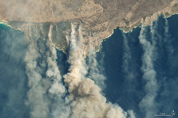
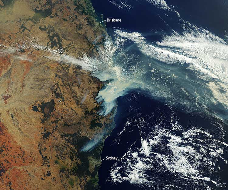
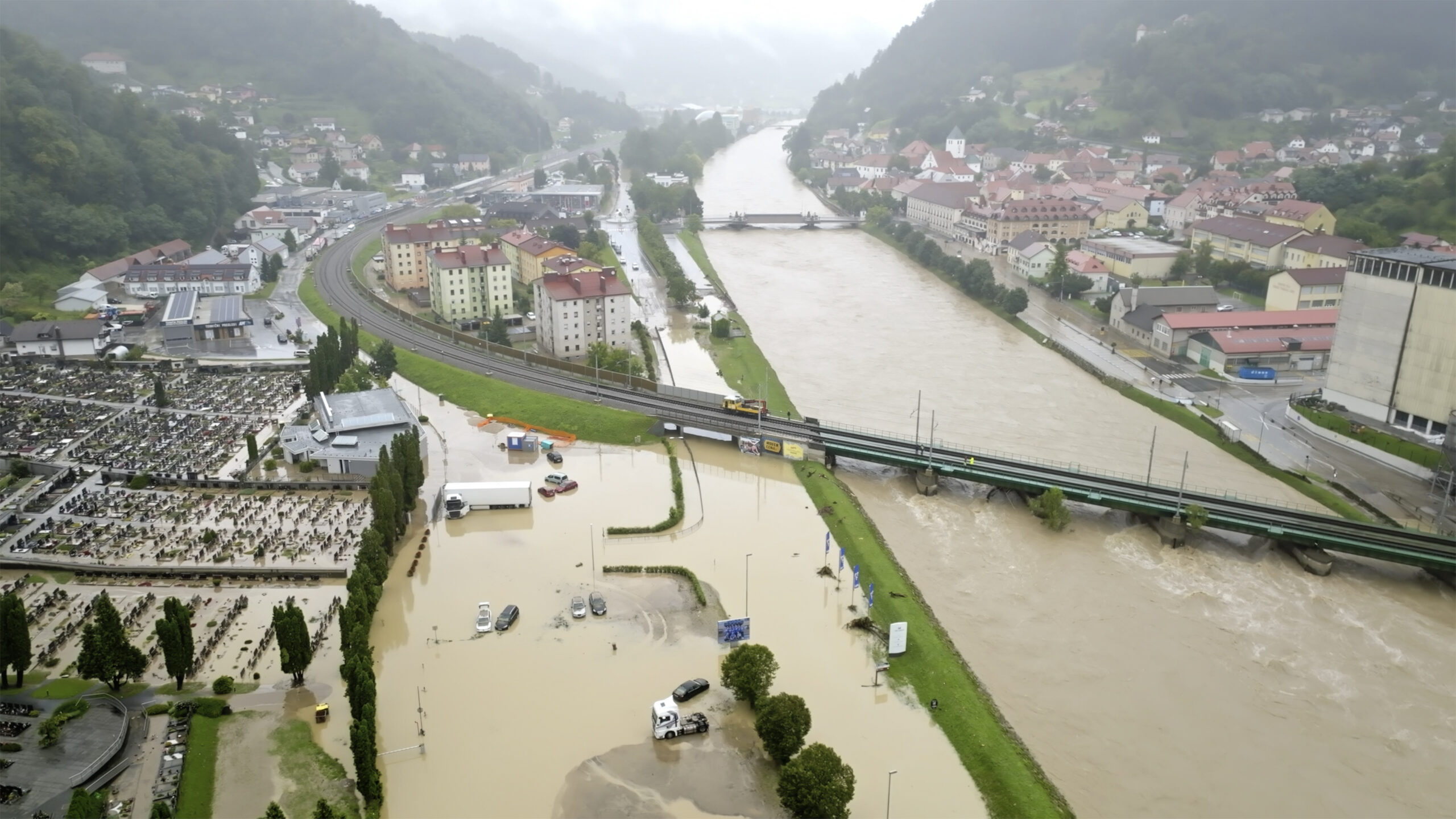
    As Europe faces escalating climate-related disasters and rising economic losses related to them, the need for more effective risk management and greater resilience against natural catastrophes is paramount — not least through the deployment of innovative solutions.

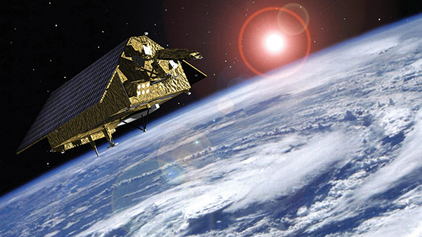
    The white paper is the result of a joint pilot project between EIOPA and EUSPA — highlights the benefits of using open-access Earth observation data from Copernicus to improve the tracking and management of natural hazards.

    The project demonstrates that satellite-based EO data offers independent, objective and near real-time geospatial insights that can meaningfully improve risk assessment and risk management practices for insurers, communities and supervisors.

    Earth observation technology — especially the open, traceable data that Copernicus provides — can sharpen risk identification, reinforce scenario design and accelerate loss estimates in the aftermath of shocks. Financial supervisors can leverage the technology to:

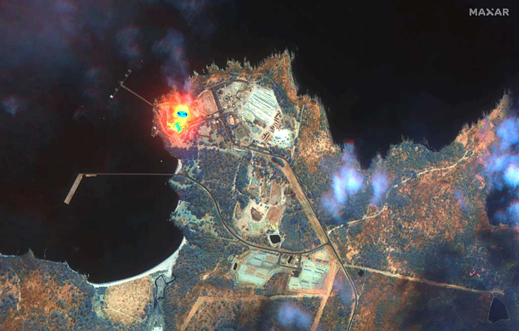
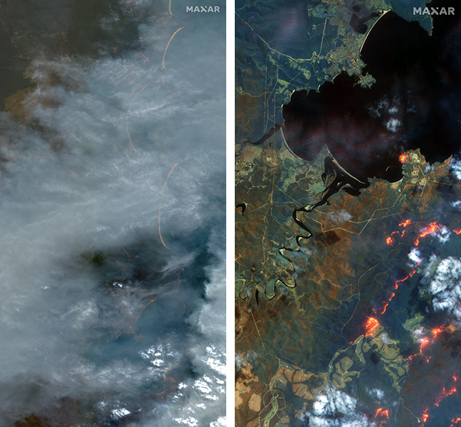
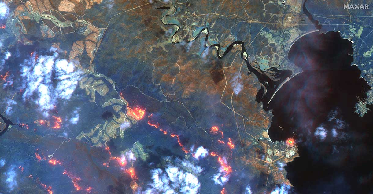
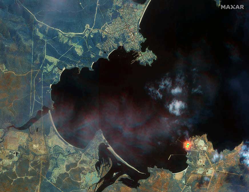
    • rapidly identify affected areas and exposed insurance undertakings: Satellite imagery makes it possible to map disaster-affected areas (for example, the extent and trajectory of floods) as events unfold. This granular geospatial data can be matched with Solvency II regulatory reporting to estimate the potential impact of natural catastrophe events on individual insurers (micro-prudential perspective);
    • estimate overall loss-magnitudes early on by scaling up the micro-level analysis to the sector as a whole (macro-level perspective); and
    • improve benchmarking, model validation and scenario and stress test design by providing objective, data-driven reference points against which model outputs and reported or calculated losses can be compared.

    The collaboration between EIOPA and EUSPA showcases the value of innovation in addressing the challenges posed by climate-related disasters: when used effectively, Earth observation data can contribute to a more resilient and sustainable insurance sector — one that better protects European citizens and businesses from the damaging effects of a warming climate.

  • EUSPA grants Thales Alenia Space framework contract to build European GNSS Demonstrator

    EUSPA grants Thales Alenia Space framework contract to build European GNSS Demonstrator

    EUSPA has signed a Framework Contract with Thales Alenia Space to build the European GNSS Service Demonstrator (ESD), a centralized modular platform advancing EU Space services like EGNOSGalileoCopernicus, and GOVSATCOM/IRIS2.

    This EGNSS Service Demonstrator is a key innovation accelerator for EUSPA, paving the way for large-scale end-to-end testing future Galileo and EGNOS augmentation services through both geostationary satellite and internet-based dissemination.

    The system will serve as the backbone of pre-operational EGNSS service validation, anticipating future positioning, navigation and timing (PNT) user needs across critical markets, support standardization activities, and sustain EUSPA’s commitment to service excellence.

    Building on Thales Alenia Space’s track record in PNT satellite-based services, the EGNSS Service Demonstrator project inherently anchors Thales Alenia Space at the forefront of the new generation of GNSS-based applications and services for millions of European and global users.

    Capabilities

    The ESD will comprise modular and flexible ground and support segments to handle a diverse number of reference stations and data. It will be able to compute corrections, messages or data that will be disseminated in real-time via different means such as GEO SiS and the internet.

    It centralizes EGNSS demonstrations, incorporating future services like high accuracy (HAS), authentication (OSNMA, SAS), maritime/rail DFMC safety, space weather and emergency warning via scalable infrastructure.

    Strategic role

    The ESD will facilitate the seamless rollout of new/improved services without disrupting operations of current EGNSS services, emulating signals for realistic testing to support future prototyping and standarization of receivers (such as for rail safety or automotive high-accuracy units), and app development. It will refine user needs across sectors while engaging users and developers.

    Key use cases

    The main use cases that the ESD will cover are:

    • Early Open Service signals, such as pre-operational EGNOS DFMC SBAS or Galileo HAS integrity, to accelerate user readiness.
    • Service consolidation for evolutions like enhanced HAS via E-GSC interface, OS-NMA/SAS testing, and sector-specific apps (maritime, rail).
    • Standardization support for receivers like MUGG, EDG2E and Fundamental Elements projects; SBAS promotions and demos.

    With the European GNSS Service Demonstrator, EUSPA strengthens Europe’s ability to test, evolve and deploy future EU Space services, supporting innovation, standardization and market uptake while ensuring service continuity and resilience.

  • GMV assesses Turkiye earthquake impact

    GMV assesses Turkiye earthquake impact

    Image: GMV
    Image: GMV

    GMV is using high-resolution optical imagery as a part of emergency management efforts, to map the population and infrastructure of several cities in Turkiye after the 7.8 magnitude earthquake. The imagery of the aftermath is thanks to Europe’s Copernicus program, which keeps satellites and Earth observation services operational to support management and decision-making in different areas, particularly in the field of emergency management.

    The satellite images show the challenge faced by rescue teams and reveal the massive amounts of destruction caused in cities across Turkiye and northern Syria. (Image: GMV)
    The satellite images show the challenge faced by rescue teams and reveal the massive amounts of destruction caused in cities across Turkiye and northern Syria. (Image: GMV)

    GMV is one of the suppliers of Copernicus program infrastructure. GMV monitors the database architecture and ensures its integrity, analyzes the data required by the service chains, and identifies the most suitable technologies to keep the entire program operational.

    GMV is working with the EU Civil Protection Mechanism’s Emergency Response Coordination Center to keep them updated on the ongoing emergency situation.

    For more on the emergency satellite mapping, visit the Copernicus website.

  • Copernicus Sentinel-3 and Sentinel-6 GNSS orbital products available

    Copernicus Sentinel-3 and Sentinel-6 GNSS orbital products available

    Artist's depiction of the Copernicus Sentinel-6 satellite, launched in November 2020. (Image: ESA)
    Artist’s depiction of the Copernicus Sentinel-6 satellite, launched in November 2020. (Image: ESA)

    The Copernicus Precise Orbit Determination (CPOD) Service, in charge of computing precise orbits for the Copernicus Sentinel-1, -2, -3 and -6 missions,  routinely publishes GNSS and quaternions data and precise orbital products of these missions on the POD Data Hub of the Copernicus Open Access Hub.

    The following products are published:

    1. Sentinel-1, 2, 3 A&B GNSS RINEX observation files (AUX_GNSSRD)
    2. Sentinel-1, 2, 3 A&B Quaternions files (AUX_PROQUA)
    3. Sentinel-1 A&B CPOD Predicted Orbits (AUX_PREORB)
    4. Sentinel-1 A&B CPOD Restituted Orbits (AUX_RESORB)
    5. Sentinel-1 A&B CPOD Precise Orbits (AUX_POEORB)
    6. Sentinel-3 A&B CPOD Restituted Orbits (SR___ROE_AX)
    7. Sentinel-3 A&B CPOD Medium Orbit (AUX_RESORB)
    8. Sentinel-3 A&B CPOD Precise Orbits (AUX_POEORB)
    9. Sentinel-3 A&B CPOD Precise Platform data (AUX_PRCPTF)

    The following new products from Sentinel-3 and Sentinel-6 are now available as well. The Sentinel-6A GNSS RINEX observations include GPS and Galileo data — the first publicly available Galileo data obtained from an orbiting receiver.

    1. Sentinel-3A&B CNES Medium Orbit Ephemeris (SR___MDO_AX)
    2. Sentinel-3A&B CNES Precise Orbit Ephemeris (SR___POE_AX)
    3. Sentinel-6A CNES Medium Orbit Ephemeris (AX____MOED_AX)
    4. Sentinel-6A CNES Precise Orbit Ephemeris (AX____POE__AX)
    5. Sentinel-6A CPOD Restituted Orbit Ephemeris (AX____ROE__AX)
    6. Sentinel-6A GNSS RINEX observation files (AUX_GNSSRD)
    7. Sentinel-6A Quaternions files (AUX_PROQUA)

    The GNSS RINEX (AUX_GNSSRD) and Quaternions files (AUX_PROQUA), together with the final orbital products (AUX_POEORB, AUX_PRCPTF, SR___POE_AX, and AX____POE__AX) are available at the beginning of each mission.

    The other orbital products (AUX_RESORB, SR___ROE_AX, SR___MDO_AX, AX____MOED_AX, and AX____ROE__AX) are available for at least one month, until the final products are available.

    The typical accuracy of the orbital products can be found in the Regular Service Reviews carried out by the CPOD Service quarterly.

    Details about these products can be found in the POD Product Handbook.

    Auxiliary data needed for precise orbit determination, such as maneuvering information, can be found in the Sentinel online:

    Please send questions to mailto:[email protected].

  • EUSPA’s 2nd Horizon Call seeks projects for GNSS, Earth observation

    EUSPA’s 2nd Horizon Call seeks projects for GNSS, Earth observation

    EUSPA logoEurope’s 2nd Horizon Europe call has been launched for European GNSS, Galileo and Earth observation projects, offering total funding of €48.1 million.

    The Horizon program is managed by the European Union Agency for the Space Programme (EUSPA). It funds research and innovation by small and mid-size enterprises, academia, public actors and others that will stimulate development of space applications and solutions using EUSPA data and services.

    The 2nd call aims to to strengthen downstream capabilities and modernize the EU public sector by offering cutting-edge solutions based on Galileo, Copernicus, EGNOS and GOVSATCOM.

    Funding is being offered for projects that make use of Galileo and EGNOS in smart mobility applications. Other projects fuse Copernicus data with artificial intelligence to boost the European economy and help modernize the public sector. For the first time, the call seeks to deliver satellite communication use cases based on the forthcoming GOVSATCOM system.

    Below is a breakdown of the funds’ distribution per thematic area.

    Visit the EU’s funding & tender opportunities portal for detailed information about the EUSPA call and the topics available. The deadline for applications is March 2, 2023.

  • Massive global map provided free from MapTiler

    Massive global map provided free from MapTiler

    MapTiler has created a single image of the entire world detailed enough to find a specific house. If printed, the map would cover nearly 16 soccer fields.

    To create the world image, satellite imagery was processed to remove clouds and balance shades and tones, and then carefully stitched together to create a seamless map layer with beautiful colors. The input data is recent, from 2020 and 2021, and rendered as one tiled file with zoom levels 0-13 for use in web applications.

    Crafted by a small Swiss/Czech team, it is a viable, up-to-date alternative to Google maps for software developers, without privacy issues. It is available including seamlessly merged, super-high resolution aerial images for selected countries. The imagery provides more detail when users zoom beyond the satellite data.

    The map’s cloud-free satellite imagery is useful for real-estate websites, mobile apps, globes, games, virtual worlds, in airplane infotainment systems, and for TV news and weather. In addition, scientists and artists can download it for their own innovations and creations.

    In all, 180 terabytes of imagery have been crunched to fit on a 512-gigabyte USB stick.

    MapTiler has a history of collaborating with the European Space Agency (ESA) and its Copernicus Earth observation project, and has won two Copernicus Masters Awards. Working in ESA’s Business Incubation Center also boosted the company’s ability to adapt satellite imagery into useful data.

    Learn more on MapTiler’s blog.

    Image: MapTiler
    Image: MapTiler

  • ESA and NASA launch open-source biomass platform

    ESA and NASA launch open-source biomass platform

    The European Space Agency (ESA) and National Aeronautics and Space Administration (NASA) have publicly released a globally harmonized assessment of aboveground biomass — information vital for managing global climate change.

    The Multi-mission Algorithm and Analysis Platform (MAAP) provides seamless access to aboveground biomass information from both NASA and ESA Earth observation data. The open-science tool is now fully operational and accessible online.

    The beta of the dashboard is now available.

    Circumboreal forest biomass density mapped at high spatial resolution (30 m) with NASA’s ICESat-2, the joint NASA/USGS Landsat-8, and ESA Copernicus Digital Elevation Model (DEM) data. This provisional product is representative of 2020 conditions and is an open-source science product created on the NASA-ESA MAAP platform that will be validated in the coming months. (Image: NASA/ESA)
    Circumboreal forest biomass density mapped at high spatial resolution (30 m) with NASA’s ICESat-2, the joint NASA/USGS Landsat-8 and ESA Copernicus Digital Elevation Model (DEM) data. This provisional product is representative of 2020 conditions and is an open-source science product created on the NASA-ESA MAAP platform that will be validated in the coming months. (Image: NASA/ESA)

    MAAP is the culmination of a two-year NASA and ESA effort and reflects the cooperation between the two agencies under the NASA and ESA Joint Program and Planning Group (JPPG) Joint Working Group (WG) on Ground Segment and Operations.

    The MAAP platform enables international scientists and researchers to collaboratively develop algorithms and code as well as analyze and visualize large datasets acquired from sources including satellite instruments, the International Space Station, and airborne and ground campaigns. The large data and high-performance computing required for MAAP, along with a shared code repository and catalog, are stored and managed in the cloud. MAAP capabilities are supported and shared between NASA and ESA.

    “Biomass is the first ESA mission with open-source algorithms,” said Clement Albinet, ESA’s Biomass data quality manager. “Thanks to that, the community will be able to access all the source code, the test data and all the documentation, and will be able to contribute in a collaborative way to the improvement of the biomass products. MAAP will allow scientists to easily work with large datasets at a global scale and to finally focus on science.”

    The initial application of MAAP focuses on aboveground biomass to help determine the size and carbon content of Earth’s forests. These data are vital for informing our understanding and forecasting of climate change, including regular updates to the Intergovernmental Panel on Climate Change (IPCC).

    While biomass is the first application of MAAP, it can be adapted for collaborative exploration across the breadth of science data and scientific disciplines available through NASA, ESA and similar research agencies.

    MAAP includes data from missions such as NASA’s Global Ecosystem Dynamics Investigation (GEDI) and the joint NASA/ESA AfriSAR campaign, and will eventually support data from upcoming NASA and ESA missions such as the joint NASA/Indian Space Research Organization SAR (NISAR) and ESA’s Biomass mission.

    Several projects are producing continental to global biomass maps for 2020, including ESA’s Climate Change Initiative Biomass and JPSs global map, both at 100 m, as well as NASA’s GEDI 1-km map. GEDI, the Global Ecosystem Dynamics Investigation, is a spaceborne laser instrument that measures the structure of Earth’s forests in high resolution and three dimensions.

    The world’s Earth observation biomass community is undertaking an exercise on MAAP aimed at resolving discrepancies between those products and producing harmonized estimates of biomass and uncertainty at a policy-relevant, jurisdictional-level scale.

  • Europes’s GSA becomes EUSPA for stronger space role

    Europes’s GSA becomes EUSPA for stronger space role

    EUSPA logoA new space agency launched in Europe today, taking the place of the European GNSS Agency (GSA) and adding responsibilities to encourage Europe’s space enterprises.

    The European Union Agency for the Space Program (EUSPA) marks the start of a new era for European Union space, according to an agency statement. EUSPA will build on the legacy of the GSA, which was established to promote use of Galileo and EGNOS, with additional responsibilities to create even more opportunities from space for European Union citizens and its economy.

    An April 27 space regulation established EUSPA. Under the new space regulation, EUSPA’s mandate includes promoting Galileo and EGNOS, but with increased responsibilities, including their service provision and operational security. The agency also will coordinate the user-related aspects of government satellite communication in close collaboration with Member States and other entities.

    Including Copernicus

    Rodrigo da Costa, executive director of the European GNSS Agency. (Photo: GSA)
    Rodrigo da Costa, executive director, EUSPA (Photo: EUSPA)

    EUSPA is also responsible for the development of downstream markets and fostering of innovation based on Galileo, EGNOS, and now also commercial uses of Copernicus (Europe’s Earth observation satellite program), leveraging funding mechanisms such as Fundamental Elements and Horizon Europe.

    EUSPA is also responsible for security accreditation of all the components of the EU Space Program. The European Commission may also decide to entrust the agency with other tasks.

    “More and more, our economies, our society and our safety depend on space,” said EUSPA Executive Director Rodrigo da Costa, former director of GSA. “Europe has incredible opportunities ahead that cannot be missed. By creating EUSPA, the European Union will further increase the return on investment made by EU citizens in the EU Space Program by strengthening its contribution to the priorities of the union. We will achieve this primarily by leveraging synergies between the various program components — particularly navigation, Earth observation and secure communications — to drive innovation across a broad range of sectors.”

    In particular, bringing management of downstream and combined applications based on Galileo, EGNOS and Copernicus under the umbrella of one agency will make it possible to leverage synergies, according to the agency statement.  “On their own, these technologies can play a key role supporting a digital and green transformation, but leveraging their synergetic and combined use will facilitate the generation of innovative solutions that bring a higher societal impact,” the statement read.

    Focus on security

    “The teams of committed professionals we have in place at our sites in Europe — from the EGNOS center in Toulouse to the European GNSS Service Centre in Spain and the Galileo Reference Centre in the Netherlands — will continue to ensure the high quality, robustness and reliability of EUSPA’s service provision,” reads the statement. “This will be backed up Galileo security monitoring centers in France and in Spain, and the industrial teams managed by EUSPA in the Galileo control centers in Germany and Italy, along with facilities around the world.”

    In addition, the Security Accreditation Board will continue to initiate and monitor implementation of security requirements to ensure a robust and uniform level of security for the entire EU Space Program.

    “The new agency has a core role in the security accreditation of all the components of the EU Space Program,” said Bruno Vermeire, chair of EUSPA’s Security Accreditation Board.

    Looking to the future

    While EUSPA’s mission has expanded, its core aim remains the same – to link EU investment in space to the needs of users in the European Union and around the world.

    “The agency remains committed to its traditional users and will continue to deliver the high level of GNSS services that users have come to rely on,” the agency stated. Copernicus and satellite communications will also benefit from the former GSA’s user-oriented focus and “the experience it has gained in developing markets for Galileo and EGNOS.”

    Fucino, Italy, hosts a Galileo Control Centre. (Image: Telespazio/ESA)
    Fucino, Italy, hosts a Galileo Control Centre. (Image: Telespazio/ESA)

  • GSA releases 3rd GNSS User Technology Report

    GSA releases 3rd GNSS User Technology Report

    Report cover GSA
    The full GNSS User Technology Report 2020 is available for download. (Cover: GSA)

    News from the European GNSS Agency

    The European GNSS Agency (GSA) has released its latest GNSS User Technology Report, providing a comprehensive analysis of GNSS trends and developments.

    With four GNSS available and more than 100 satellites in operation broadcasting multiple frequencies, the GNSS industry is shifting towards the wide adoption of multifrequency receivers across market segments to meet the diverging user needs of emerging applications.

    The report includes contributions from leading GNSS receiver, chipset manufacturers and service providers, and serves as a valuable tool to support planning and decision-making with regards to developing, purchasing and using GNSS technology.

    Published biennially since 2016, the User Technology Report has become a point of reference for the GNSS industry, research and policy-makers.

    Rapid Evolution

    ‘’The GNSS industry is evolving at a rapid pace and is shaped by the dynamics of emerging applications and user needs as well as the upgrade of existing and new GNSS and Satellite Based Augmentation Systems (SBAS),” said Rodrigo da Costa, GSA executive director. “The industry has understood the potential of Galileo’s unique features.”

    The third edition of the report begins with a chapter devoted to technology trends common to all segments: receiver design, position processing and signal processing. It also discusses protection measures against GNSS jamming and spoofing, such as authentication, including what 5G and other technologies and sensors can do, in combination with GNSS.

    With multi-constellation now being the norm, the industry is moving towards the wide adoption of multi-frequency receivers even for usually power- and cost-constrained consumer solutions. The Galileo E5 is becoming the preferred frequency with about 20% of all receiver models in the market already using it.

    The report is built around four macro segments defined on the basis of commonalities from a technology point of view:

    • high volume
    • safety- and liability-critical
    • high-accuracy
    • timing devices and solutions (a new-entry in this edition)

    Each chapter starts with the macrosegment characteristics and receiver capabilities, depicts the industry landscape and typical receiver form factor, it then delves into the key current and future drivers and trends, and finishes with the added value of the EGNSS, Galileo and EGNOS, for the macrosegment at stake.

    Space Data for Europe

    This year editor’s special “Space Data for Europe” sheds light on the role that Copernicus and Galileo play within the European Space Programme in the data management and use, now and in the future. It also provides a vision of major transformations underway within our society and our economy and the benefits expected from this digital transformation, paving the way towards the European Data Strategy and Green Deal.

    “Today, Galileo and EGNOS already provide increased capabilities which are being used across a broad range of applications, and are already igniting the next generation of location-based applications. In the future, new services — the Galileo High Accuracy Service (HAS), Galileo Open Service Navigation Message Authentication (OS-NMA) and Commercial Augmentation Service (CAS) — will raise the accuracy and reliability bar even higher, and dramatically enhance positioning, navigation and timing solutions for businesses and citizens.

    By bringing insight and understanding into the evolutions of GNSS technology, we are creating opportunities for innovation,” concluded da Costa.

    The full GNSS User Technology Report 2020 is available for download.

  • GSA and CLGE accepting submissions for Geomatics on the Move 2020 competition

    GSA and CLGE accepting submissions for Geomatics on the Move 2020 competition

    Logo: Geomatics on the Move competition

    The European GNSS Agency (GSA), in collaboration with the Council of European Geodetic Surveyors (CLGE), has launched the Geomatics on the Move 2020 competition. The event aims to foster the use of European Union (EU) satellite programs Galileo, EGNOS and Copernicus among students, young professionals, entrepreneurs and small and mid-sized businesses to create innovative geomatics applications and solutions across all over Europe.

    Building and expanding on the CLGE Student Contest, which has been held for the past nine years, the new Geomatics on the Move Prize Contest targets applications that integrate the use of additional technologies such as artificial intelligence, machine learning, augmented and virtual reality, as well as supplementary remote sensing data sources like drones, GSA said. Solutions animated through mobile phone applications or other easy-to-use platforms are also accepted.

    “This is the ninth year of partnership between the Council of European Geodetic Surveyors and the GSA; over the years we have seen some exciting and innovative solutions emerge that leverage the EU Space Programme to deliver practical solutions for the mapping and surveying community,” said GSA Acting Executive Director Pascal Claudel. “This year, as we recover from this global setback, I look forward to seeing even more novel ideas — from all over the European Union — able to respond to current and future challenges.”

    The competition will be organized in two stages. The first phase is an open call for ideas, during which applicants submit posters describing their ideas. The deadline for these submissions is Oct. 16.

    The proposals then will be evaluated by the GSA and CLGE, and a maximum of 10 projects will be chosen to present their pitch during the finals. The selected applicants will refine their poster and prepare their pitch, for which technical support and training will be made available.

    The official award of the Geomatics on the Move prize contest will take place virtually, during the European Space Week, taking place Dec. 7-11. During this event, finalists will present their solutions to the evaluation board, and winners will be announced on the official contest site.

    With an overall prize of €30 000, a set of 10 prizes will be offered in two categories. The first of these categories targets EU space-based traditional geomatics solutions and the second targets integrated geomatics solutions. he first category is looking for solutions in which the main innovation is based on the use of EGNSS, employing traditional equipment such as surveying or GIS grade GNSS receivers for applications such as cadastral, marine and mining surveying or GIS mapping. The integrated geomatics category targets integrated surveying solutions that use Galileo or EGNOS and leverage cutting-edge tools and technologies such as drones, mobile mapping, laser scanners or augmented/,mixed reality, both within geomatics applications or beyond.

  • Analysis of satellite imagery shows reduced NO2 in China, Italy

    Analysis of satellite imagery shows reduced NO2 in China, Italy

    Screenshot: ESA video
    Screenshot: ESA video

    Descartes Labs, a geospatial data analytics company, is using satellite imagery analysis to examine how the coronavirus reduced nitrogen dioxide (NO2) emissions in China.

    NO2 is produced by vehicles, power plants and heavy industries such as cement manufacturing, which were shut down during the coronavirus epidemic.

    Descartes Labs shared its visualization in a Facebook post. The visualization maps a time series of NO2 levels across Eastern China, Japan and the Korean Peninsula using data from the European Space Agency (ESA)  Sentinel-5P satellite.

    Plots of NO2 emissions from 2019 compared to 2020 show declines of nearly 60%. Read more on Descartes Lab’s blog.

    Copernicus data shared

    In a video provided by ESA, a drop in concentrations in late January is visible in China, coinciding with the nationwide quarantine; from the beginning of March, the nitrogen dioxide levels have begun to increase.

    Italy reduction

    Copernicus data also reveals the decline of air pollution, specifically nitrogen dioxide emissions, over Italy. This reduction is particularly visible in northern Italy, coinciding with its nationwide lockdown to prevent the spread of the coronavirus.

    “Satellites offer a unique vantage point to monitor the health of our planet,” said Josef Aschbacher, ESA’s director of Earth Observation Programmes. “Sentinel-5P is one of seven Copernicus satellites in orbit today. It currently provides the most accurate measurements of nitrogen dioxide and other trace gases from space.

    “As nitrogen dioxide is primarily produced by traffic and factories, it is a first-level indicator of industrial activity worldwide,” Aschbacher said. “What is clearly visible is a significant reduction of nitrogen dioxide levels over China, caused by reduced activity due to COVID-19 restrictions, but also the Chinese New Year in January. The Copernicus programme is a perfect example of how space serves all European citizens by combining the political strength of the EU with the technical excellence of ESA.”

    “We can certainly attribute a part of the nitrogen dioxide concentration reduction to the impact of the coronavirus,” said Claus Zehner, ESA’s Copernicus Sentinel-5P mission manager. “We currently see around a 40% reduction over Chinese cities, however these are just rough estimates, as weather also has an impact on emissions. We are conducting a detailed scientific analysis which will soon provide more insights and quantified results in the following weeks and months.”

    The Copernicus Sentinel-5 Precursor mission, also known as Sentinel-5P, is dedicated to monitoring air pollution by measuring a multitude of trace gases as well as aerosols — all of which affect the air we breathe.

  • Visualizing the Australian bushfires through satellites and maps

    Visualizing the Australian bushfires through satellites and maps

    The months-long wildfires raging in Australia have killed at least 25 people. Millions — possibly 1 billion — animals have died. More than 2,000 houses have been destroyed. Around 150 fires are still burning in New South Wales and Queensland, with hot and dry conditions accompanied by strong winds fueling to the fires’ spread.

    With this conflagration rocking the continent down under, satellite imagery has become important to understanding the scope of the disaster. Here are some of the recent captures.

    As seen from the ISS

    “Talking to my crew mates, we realized that none of us had ever seen fires at such terrifying scale,” European Space Agency astronaut Luca Parmitano tweeted on Monday, sharing photos taken from the International Space Station.

    The astronaut posted images showing what he described as “an immense ash cloud” captured at the time the ISS was flying toward sunset.

    Artist’s visualization misinterpreted

    Another social media image, shared widely, was interpreted as a map showing the live extent of fire spread, with large sections of the populous eastern coastline molten red. Because of widespread misinterpretation, the original poster then explained that the image was a 3D visualization and not a photograph of Australia, and showed some areas where fires have been extinguished.


    View this post on Instagram


    * Didn’t realise this would go viral ? PLEASE READ BELOW* Regarding False Information. This has occurred NOT because of this post, or my information being inaccurate. It has been Zucc’d because other people have shared this image with the caption “This is a NASA photograph”. This image has been flagged as a result. Update – this is now being corrected, finally. Should be clear in a day or so… This is a 3D visualisation of the hotspots in Australia. NOT A PHOTO. Think of this as a graph. Also note this was created as an art piece This is made from data from NASA’s FIRMS (Satellite data regarding fires) between 05/12/19 – 05/01/20. These are all the areas which have been affected by bushfires. https://firms.modaps.eosdis.nasa.gov/map/#z:5;c:137.4,-27.9;t:adv-points;d:2019-12-05..2020-01-05;l:dark_gray,firms_viirs,firms_modis_a,firms_modis_t Scale is a little exaggerated due to the render’s glow, but generally true to the info from the NASA website. Also note that NOT all the areas are still burning, and this is a compilation. This image is copyrighted by Anthony Hearsey. Please contact for usage. DONATE HERE – https://linktr.ee/lukebakhuizen?fbclid=IwAR1hxUc97BXMPIxjiJqcVW7uG8wlgkPLfyO2wVFLVRDSw5X6cXAGeBuikeM _ #bushfires #render #visualisation #data #3d #australia #climatechange #disaster #fire #infographic #cinema4d #graphic #nasa

    A post shared by Anthony Hearsey (@anthony_hearsey) on


    NASA and USGS Landsat images

    NASA and the U.S. Geological Survey’s Landsat 8 satellite imagery from Jan. 9 shows Kangaroo Island, home to nature reserves. The images were taken using the Operational Land Imager (OLI) on Landsat 8. Using natural-color observations, the images show burned land and thick smoke covering the island, of which at least 156,000 hectares have burned.

    Photo: NASA/USGS
    Photo: NASA/USGS

    The U.S. National Oceanic and Atmospheric Administration (NOAA) satellites are also capturing images, including the resulting plumes of smoke.

    Worldview-3 captures Australia’s wildfires

    Maxar collected satellite imagery Jan. 12 of the wildfires in New South Wales (NSW). The imagery shown below focuses on the area near the town of Eden, and demonstrates the value of the shortwave infrared (SWIR) sensor.

    SWR satellite imagery of the town of Eden shows the wildfires through the smoke. (Satellite images ©2020 Maxar Technologies)
    SWR satellite imagery of the town of Eden shows the wildfires through the smoke. (Satellite images ©2020 Maxar Technologies)

    In an image taken with Maxar’s normal RGB color imagery, the smoky air prevents a clear view of the fires and the hot spots. With Maxar’s WorldView-3 satellite, however, the team is able to penetrate through the smoke using its SWIR sensor for a detailed look at the fire lines and burned vegetation.

    With SWIR imagery, burning areas are apparent and show up in a glowing orange-red. Healthy vegetation shows up in shades of blue, and burned vegetation appears in shades of brown.

    Satellite Photo: :ESA
    Satellite Photo: :ESA

    Copernicus Sentinel-3 imagery

    Europe’s Copernicus Sentinel-3 mission has captured the multiple bushfires burning across Australia’s east coast.

    In the above image, captured on Nov. 12, 2019, at 23:15 UTC (Nov. 13, 09:15 local time), the fires burning near the coast are visible. Plumes of smoke can be seen drifting east over the Tasman Sea. Hazardous air quality owing to the smoke haze has reached the cities of Sydney and Brisbane.

    Flame retardant was dropped in some of Sydney’s suburbs as bushfires approached the city center, and many residents were evacuated. Firefighters continue to keep the blazes under control.

    The Copernicus Emergency Management Service – Mapping was activated to help respond to the fires. The service uses satellite observations to help civil protection authorities and, in cases of disaster, the international humanitarian community, respond to emergencies.

    Quantifying and monitoring fires is fundamental for the ongoing study of climate, as they have a significant impact on global atmospheric emissions. Data from the Copernicus Sentinel-3 World Fire Atlas shows that there were almost five times as many wildfires in August 2019 compared to August 2018.

    Additional images from Worldview-3

    Fireline south of Eden. (Satellite image ©2020 Maxar Technologies)
    Fireline south of Eden. (Satellite image ©2020 Maxar Technologies)

    Fires new Eden. ( Satellite image ©2020 Maxar Technologies)
    Fires new Eden. (Satellite image ©2020 Maxar Technologies)

    Closeup of fires at Honeysuckle Point south of Eden. (9atellite image ©2020 Maxar Technologies)
    Closeup of fires at Honeysuckle Point south of Eden. (9atellite image ©2020 Maxar Technologies)