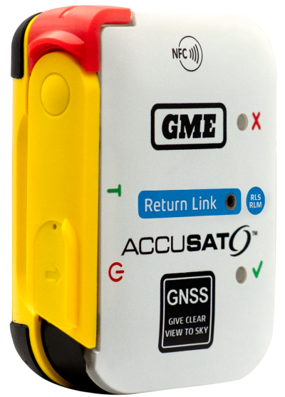
Austtralian company GME is offering its first emergency beacon with Return Link Service (RLS). RLS confirms the distress signal has reached a rescue coordination centre (RCC), providing critical reassurance in an emergency.
The MT620GR personal locator beacon (PLB), with integrated RLS and a mobile app, is a compact safety companion for outdoor and marine adventure enthusiasts.
Enhanced with GNSS for precise global positioning and a 121.5 MHz homing signal, it ensures efficient SAR operations. It is approved for worldwide Cospas-Sarsat operation.
The companion mobile app monitors the beacon’s operational status. With a seven-year battery life and a six-year warranty, it offers dependable performance and peace of mind, according to GME.
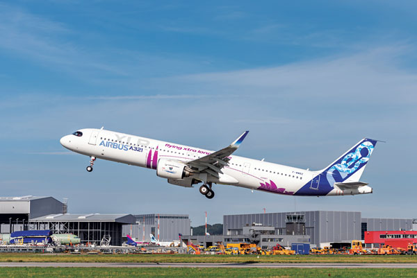
Airbus will install Orolia’s Ultima-DT emergency locator transmitter on its aircraft. (Photo: Airbus)
This fall, Orolia’s Ultima-DT was certified as an emergency locator transmitter with distress tracking (ELT-DT) by Cospas-Sarsat, an international humanitarian search-and-rescue system. Cospas-Sarsat uses space-based technology to detect and locate model 406 emergency beacons carried by ships, aircraft or individuals venturing into remote areas — often inaccessible by GNSS signals. The system consists of a network of satellites, ground stations, mission control centers and rescue coordination centers that work together when a 406 beacon is activated.
I spoke about the certification with Christian Belleux, director, Aviation & Defense Beacons for Orolia.
Matteo Luccio (ML): Has Orolia produced aviation safety products in the past?
Christian Belleux (CB): Orolia has been supplying emergency locator transmitters for aviation since 1995 on a very large number of platforms to OEMs and airlines for use on commercial aircraft — Airbus, Boeing, Embraer and Bombardier aircraft. Orolia is also participating in industry groups creating standards (Eurocae, RTCA, ARINC) or contributing to the progress of the Cospas-Sarsat search-and-rescue satellite system as a member of the Expert Working Group.
ML: What are the key challenges in making an aviation ELT?
CB: With new requirements for lithium batteries and new regulations introducing distress tracking, recent times have been rich in innovation. We were granted the first ETSO certification ever for an ELT-DT and the same product, the Ultima-DT, was also the first ELT to be certified for its lithium battery.
ML: What did Cospas-Sarsat certification of the ELT-DT entail?
CB: The ELT-DT is a new type of beacon with a new communication protocol. The labs performing the certification tests must be approved by Cospas-Sarsat before we can apply. Then the Cospas-Sarsat organization and infrastructure must be updated to receive and consider the new ELT-DT protocol. The Cospas-Sarsat certification of our ELT-DT means that it complies with the performance requirements described in Cospas-Sarsat standards and can communicate with the infrastructure.
ML: What is new about an ELT-DT?
CB: The principle of an ELT-DT is to activate in flight before a crash, as opposed to a legacy ELT that is activated by the shock of a crash. This means that the aircraft and the ELT-DT can analyze the health of the aircraft and its parameters, and activate if a catastrophic event is about to occur. Once activated, the ELT-DT transmits a high-rate distress signal that makes it possible to track the aircraft until it crashes. The ELT-DT contains its own GNSS receiver that is independent the aircraft’s navigation system.
ML: Did you cooperate closely with one or more avionics manufacturers to develop your device?
CB: Orolia was in very close contact with Airbus, which designed the avionics components.
ML: Do you already have contracts with airlines or aircraft manufacturers besides Airbus for the Ultima-DT?
CB: We have several contacts with aircraft manufacturers and airlines interested in the Ultima-DT.
ML: When will the first batch of the ELT-DT / Ultima-DT be operational?
CB: We started flight tests months ago at Airbus and delivered production units. Airbus soon will announce its first delivery of an aircraft equipped with the Ultima-DT.
M3 Systems Belgium’s Haps-Augmented Search-And-Rescue Demonstrations System (HASARDS) project is looking to improve positioning of the global collaborative Copas-Sarsat search-and-rescue system by using its high-altitude platform system (HAPS).
The project is designing features for the system, such as carrying out geolocation with HAPS imagery and establishing communication between individuals in distress and emergency services.
While conducting HASARD, researchers were able to document system enhancements, execute a piloted flight-test campaign to create a realistic distressed aircraft carrying a second-generation beacon and future HAPS, and develop and operate a second-generation beacon signal simulator and HAPS system simulator.
Researchers found that using HAPS independent of Cospas-Sarsat adds value to search-and-rescue operations, providing location details via data fusion and georeferenced imagery while relaying communication between SAR teams and people in distress.
News from the European Space Agency (ESA). Europe’s first generation Galileo constellation is already the world’s most precise satellite navigation system — delivering meter-scale positioning to more than 3.5 billion users worldwide. The Galileo Second Generation will enable even better performance and an expanded range of services.
Essential elements of the G2 system are being evaluated in ESA laboratories, including key algorithms to synchronize satellite timing and determine orbits, as well as test versions of a GNSS receiver and emergency beacon.
Two independent families of satellites, totaling 12 G2 satellites, are being procured by Thales Alenia Space in Italy and Airbus Defence & Space in Germany. With their first launches due in the middle of this decade, G2 satellites will be much larger than existing Galileo satellites, and they represent a major technical step forward.
Backwards-compatible with the current constellation, the G2 satellites will incorporate numerous technology upgrades, developed through EU and ESA research and development programs. They will employ electric propulsion for the first time and host an enhanced navigation antenna. Their fully digital payloads are being designed to be easily reconfigured in orbit, enabling them to actively respond to the evolving needs of users with novel signals and services.
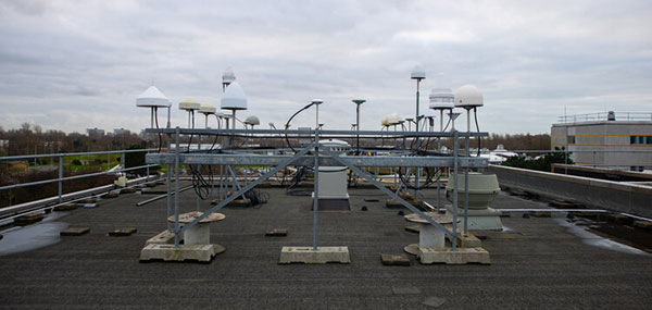
The GNSS antenna farm on the ESTEC roof for live signal reception. (Photo: ESA)
Algorithms at the heart of G2
At the heart of satellite navigation is the ability of the satellites to determine where they are in space and the precise time down to a few billionths of a second as they transmit their navigation signals. The greater the precision of these factors, the greater the accuracy of the positioning for users, because Galileo receivers take the time between the signals being transmitted and received and turn it into a measurement of distance. Signals from four or more satellites are used to pinpoint the receiver’s location.
The Advanced Orbit Determination and Time Synchronisation (ODTS) Algorithms Test Platform evaluates the advanced software that will perform these calculations for G2. Developed by Thales Alenia Space through an EU Horizon 2020 project coordinated by ESA, the platform is now installed and running in ESA’s Navigation Laboratory. The laboratory is based at ESA’s technical heart, the ESTEC establishment in the Netherlands, where it is helping simulate how the G2 satellites will operate in practice.
“This platform represents a dynamic, highly-performing environment for algorithm experimentation in both real-time and post-processing modes, using either real or simulated data,” said Francisco González, the project’s technical officer. “It contains the algorithmic core of Navigation for Earth Orbit Determination and Identification Segment, NEODIS, which is the suite of algorithms developed by Thales Alenia Space for precise orbit determination of the satellite constellation. These algorithms allow the real-time estimation of orbits and clocks, as well as the generation of Galileo navigation messages, with an estimated accuracy in the tens of centimeters.”
“Important evolutions aimed at improving the estimation of clocks and orbits are being incorporated,” said Gustavo Lopez-Risueno, head of ESA’s Galileo G2 System Engineering Unit. These improvements include:
integration of composite clock algorithms for a stable and robust reference timescale
the dynamic modeling of satellite and station clocks based on their known behavior
the processing of auxiliary measurements such as laser range measurements, in which lasers are reflected off of satellites to measure their orbital position, delivering a ranging accuracy down to under a centimeter —significantly better than the half-meter or so available from radio ranging
intersatellite links.
The first G2 receiver prototype “breadboard” is now running in ESTEC’s Navigation Lab. (Photo: ESA)
First G2 receiver up and running
Another outcome of ESA-led H2020 research is also up and running in the lab: the first G2 receiver prototype “breadboard,” developed by GMV.
“Its development has been key to supporting the fine-tuning and assessment of some signal design options we are considering,” said Jose A. Garcia-Molina, who leads the G2 signal-in-space design at ESA. “Representative mass-market receiver processing architectures and techniques have been considered to assess the final benefits a user would receive.”
“This first G2 receiver breadboard allows us to better understand the performance G2 can achieve in different user conditions, such as the urban environments in which many Galileo users are based today,” said Miguel Manteiga Bautista, who leads ESA’s G2 Programme.
Meanwhile, two parallel activities have been started for development of the G2 test user receiver. The receiver will be taken outside the lab for various test activities ahead of the first G2 launches, and then again for in-orbit testing and validation.
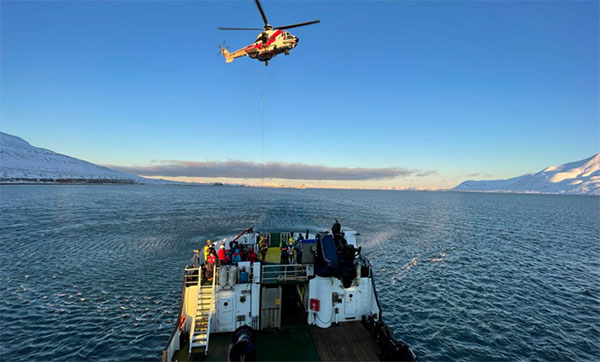
Arctic Mass Rescue Operation in 2021 tested the rescue of 200 cruise-ship passengers using Galileo SAR. (Photo: EUSPA)
Search-and-rescue system also being updated
Nearby, in ESTEC’s Telecommunications Lab, is the G2 search and rescue test beacon simulator, now operational following site acceptance testing.
Like their first-generation predecessors, the G2 satellites will pick up emergency signals from beacons on Earth and relay them to a ground station, which will forward them to local emergency services. This contributes to emergency response saving more than 2,000 lives annually.
Emergency position-indicating radio beacon (EPIRB). (Photo: ESA)
The new simulator to model the performance of these emergency beacons was developed over three years by Thales Alenia Space, under ESA leadership through a G2G System Engineering Technical Assistance Activity.
“Equipped with state-of-the-art signal generation and processing capabilities, coupled with a 200 W amplifier, this new simulator offers several enhanced functionalities over first-generation simulators, including the transmission of the new G2 beacons developed by the Cospas-SARSAT organization and the simulation of complex operational scenarios of up to 15 parallel distress beacons,” said Eric Bouton, ESA’s Galileo search and rescue engineer.
“Its development is really a crucial step to gaining a better understanding of the in-orbit behavior of Galileo’s First and Second Generation search-and-rescue payloads with the new waveforms of the G2 beacons and with the growing beacon population and associated alert traffic,” Bouton said. “It will be used for an initial test campaign already in preparation, and in the future to support the commissioning of all new Galileo search-and-rescue systems.”
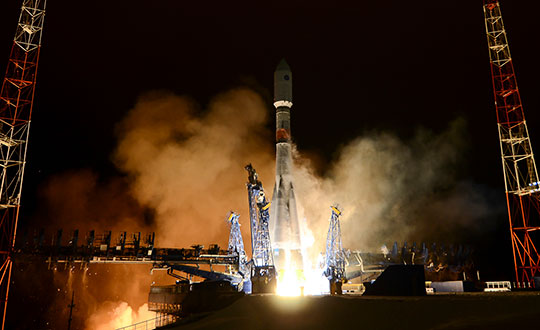
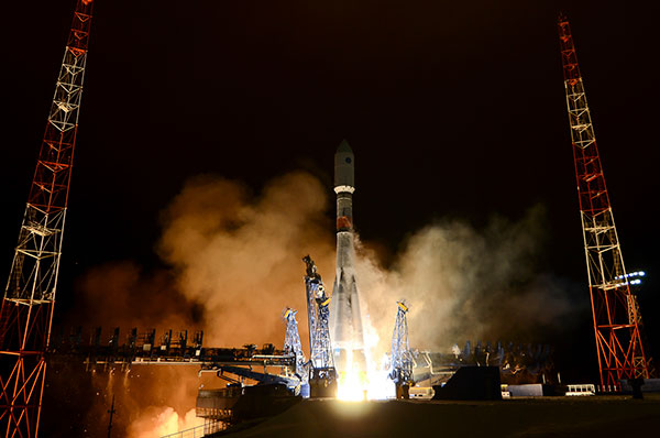
Russia launched a new-generation Glonass-K satellite, number 15, into orbit Oct. 25. Unlike its Glonass-M predecessors, Glonass-K satellites carry two types of navigation signals — frequency-separated and code-separated. The satellites emit additional code-division L2 navigation signals.
In addition to their main functions, Glonass-K satellites will transmit information from the Cospas-Sarsat international search-and-rescue system. Additional Glonass-K satellites are in production at ISS Reshetnev, all with a domestic electronic component base.
Russia’s Aerospace Forces (VKS) Space Forces launched the satellite aboard a Soyuz-2 rocket from the Plesetsk cosmodrome in the Arkhangelsk region. The launch of the carrier rocket and the maneuvering of the spacecraft into the orbit took place under normal operating conditions, according to Roscosmos.
Two minutes after the launch, the ground-based automated control complex of the Titov Main Testing Space Center acquired the Soyuz-2. On schedule, the Glonass-K satellite was injected into the target orbit by the Fregat upper stage and taken over by the ground-based facilities of the VKS Space Forces.
Photo: Roscosmos
A stable telemetric connection has been established and maintained with spacecraft. The onboard systems of the Glonass-K spacecraft are operating normally.
GLONASS consists of 28 spacecraft, with 24 active, two in reserve, and one Glonass-K undergoing flight tests. Another spacecraft is temporarily out for maintenance.
Glonass-M satellites form the basis of the system’s orbital grouping. Replacing the orbital constellation with Glonass-K spacecraft will ensure the stable operation of the Russian navigation system and increase the accuracy of its navigation determinations up to tens of centimeters.
According to Roscosmos, Glonass-K spacecraft are constructed in an unpressurized design, have a guaranteed period of active existence in orbit increased to 10 years, reduced energy consumption, and significantly lower weight.
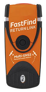
The first Galileo Return Link Service Personal Location Beacon (PLB) developed under the H2020-funded Helios project will be released in December across 19 European countries.
In close collaboration with the European GNSS Agency and within framework of the H2020 HELIOS project, Orolia has been working to equip search-and-rescue beacons with the breakthrough Galileo Return Link Service.
Declared operational in January, the Galileo Return Link Service is a unique feature of Galileo, allowing people in distress to receive an automatic acknowledgement that their signal has been received and their location is known.
How It Works
The FastFind ReturnLink PLB transmits the user’s unique ID and GNSS location via the global network of Cospas-Sarsat search-and-rescue satellites. When a person in distress activates the emergency beacon, the Galileo satellites capture the signal and transmit it to a set of ground-segment facilities — the Galileo Return Link Service Provider (RLSP) based in Toulouse, France.
Once the location of the person in distress is determined, an automatic message is sent through the Galileo satellites, confirming to the user that their position has been detected and the information has been routed to the relevant government authorities. With the FastFind ReturnLink PLB, the person in distress — on land or at sea — will see a blue light blinking on their beacon 10-15 minutes after confirmation that the distress signal and location has been detected.
”At the GSA, our objective is to ensure that EU Space investments and our work on Galileo services are bringing added value to citizens,” said Rodrigo da Costa, GSA executive director. “With the first search-and-rescue beacon worldwide deployed thanks to the H2020 project Helios, we can proudly state that our actions made a difference for innovation but also for the citizens. The ones who need to use this Personal Location Beacon will be reassured by the Return Link Service.”
Cospas-Sarsat rescue beacon activated. Its signals are picked up by satellites in orbit, including Galileo. (Photo: GSA)
Galileo a SAR Game Changer
Galileo’s immediate impact on search and rescue (SAR) has been the addition of 26 new satellites, allowing for greater global coverage and faster detection of the 406-MHz distress frequency. Coupled with Galileo’s robust signal, SAR beacons deliver greater positioning accuracy.
Galileo’s development is part of the European Union’s preparations for upgrading the international distress beacon locating organisation Cospas-Sarsat’s Search and Rescue (SAR) Ecosystem under the MEOSAR program, which requires new Earth-based antenna and a network of 72 GNSS satellites, combining GPS, the EU Galileo and the Russian Glonass systems. The Return Link Service is a unique feature provided by Galileo within its contribution to Cospas-Sarsat.
Survival Booster
By sending a confirmation to the user that the distress signal from the beacon has been localised by the Cospas-Sarsat system and the information relayed to the relevant Search and Rescue l authorities, the Return Link Service provides confidence and reassurance to the people in distress that help is on the way.
“The Search and Rescue community has long known the survival impact of dealing with a distress situation on your own, either as a solo adventurer or as a group that feels isolated due to the lack of communication with the outside world,” said Chris Loizou, vice president of Maritime at Orolia. “The Return Link reassurance signal will reduce the chances of rash decisions taken by those who feel they have nothing to lose, such as leaving the site of an accident or attempting to swim to safety. The psychological impact of knowing that help is on the way cannot be underestimated, and this PLB will provide invaluable peace of mind for those in distress.”
The Galileo Return Link Service increases survival rates by giving an important psychological boost to people in distress. It is estimated by Cospas-Sarsat that the international SAR system, with the contribution of the Galileo Search and Rescue service, saves more than 2,000 lives a year.
Countries Included
The beacons will be sold in the following countries.
Croatia
Cyprus
Denmark
Faroe Islands (DK)
France
Germany
Greece
Greenland (DK)
Iceland
Ireland
Israel
Italy
Latvia
Liechtenstein
Norway
Sweden
Switzerland
United Kingdom
Eventually, the RLS-enabled beacons will be available in most countries in the world.
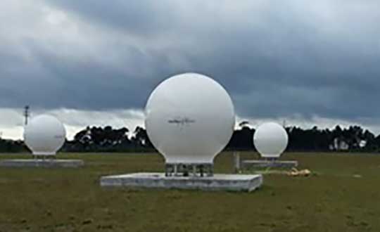
Orolia has successfully installed the first operational Cospas-Sarsat second-generation technology on search-and-rescue ground stations for the National Oceanographic and Atmospheric Administration (NOAA) in Florida and Hawaii.
The ground stations have been upgraded with second-generation beacon (SGB) signal-processing capabilities to more accurately and quickly locate the source of distress signals.
The NOAA Florida and Hawaii ground stations are the only operationally ready Medium Earth Orbit Search and Rescue (MEOSAR) ground stations in the world to receive the SGB signal specification capability.
The Cospas-Sarsat global search-and-rescue system developed specifications for the second-generation 406-MHz search-and-rescue beacon, which uses a modern, spread-spectrum signal to achieve more accurate and robust performance.
“The work performed by Orolia was exceptional, as the process of upgrading an operational system to a higher set of requirements, years after its initial design, involves minimizing downtime while validating the new requirements and revalidating the previous requirements,” said Mickey Fitzmaurice, NOAA SARSAT Systems Engineer. “The successful result makes it obvious that the engineering and operations team at Orolia put a great deal of time and effort into planning the upgrade, as the execution was seamless.”
“This series of world firsts demonstrates Orolia’s broad technical leadership in the global search and rescue ecosystem,” said Orolia Director of SARSAT Operations, Steve Ludwig. “We continually innovate to enhance the usefulness of these technologies, from generating encrypted beacon alert signals to including alert authentication through the use of Galileo Return Link Service.”
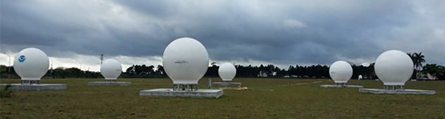
Cospas-Sarsat ground stations are called Local User Terminals (LUTs). These satellite receiving units are the ground stations that receive emergency beacon distress alerts. (Photo: NOAA)
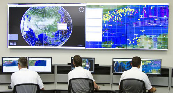
Orolia’s LEOSAR-GEOSAR-MEOSAR (LGM) Mission Control Center (MCC) solutions are now commissioned as Nodal MCCs in Spain and Australia, enabling global distribution of critical search-and-rescue information through the Cospas-Sarsat system.
With the successful commissioning of their Nodal MCCs, Spain and Australia will now be able to share critical information with the U.S. and France, providing worldwide coverage for global search and rescue.
In addition, since they will be authorized to commission other MCCs in their regions, they will also significantly advance the Cospas-Sarsat MEOSAR program.
Orolia’s McMurdo PRISMA MCC features satellite search-and-rescue technology with full LGM capability. It is the commercial solution of choice for search-and-rescue authorities in Norway, the UK and many other countries.
“We’re proud to support the world’s most critical search and rescue operations,” said Steve Ludwig, Orolia’s director of SARSAT Operations. “With Orolia onboard, you can rely on proven solutions in critical environments where failure is not an option. Our PRISMA Mission Control Center systems are the only successfully deployed, Cospas-Sarsat commissioned commercial solutions available, meeting the highest standard for search-and-rescue support.”
The Orolia PRISMA Mission Control Center. (Photo: Orolia)
Orolia has been developing global search-and-rescue programs for nearly 30 years, reaching a major milestone with the Medium-altitude Earth Orbit Search and Rescue (MEOSAR) system in 2011, and completing all global MEOSAR system installations since.
To date, 75 percent of the Earth’s surface is monitored by Orolia’s MEOSAR systems.
Through its McMurdo brand, Orolia has equipped these systems with the latest search-and-rescue technology to increase response times and save more lives worldwide.