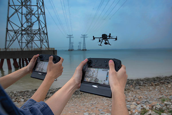
DJI now offers dual UAV controllers. Dual operator mode allows a pilot to focus solely on safe operation of the drone, while another operator can focus on payload operations — creating a 3D scan of a location, hoisting or releasing items, or operating a lidar scanner or air-quality sampler.
The DJI Inspire 2 and M600 have dedicated forward-facing video feeds so pilots can see where they are flying, regardless of what the payload camera or other sensors are doing.
Dual controls can ensure safe operation remains the top priority of even a complex and challenging drone flight.
Professor Tom Scott, from the School of Physics at the University of Bristol, U.K., led a group of researchers from NCNR to conduct surveys on multiple sites of interest, including the Buriakivka village, a settlement abandoned following contamination from the power plant accident, and the “Red Forest,” a natural woodland area located the closest to the reactor.
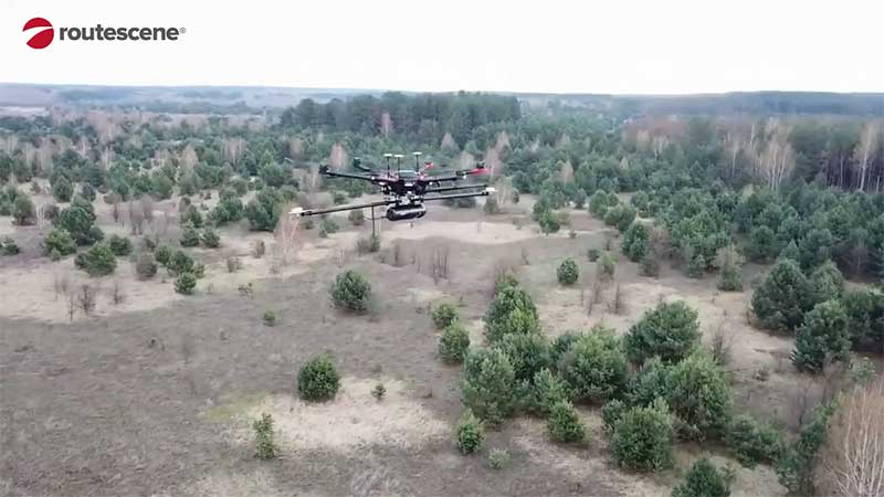
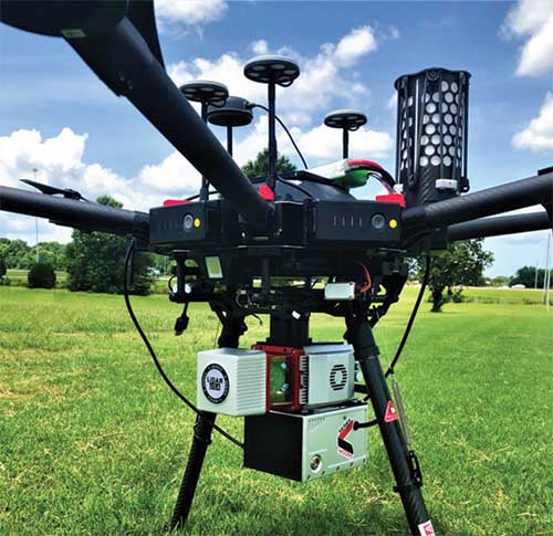
Working closely with local Ukrainian authorities, the team operated unmanned aerial vehicles (UAVs) — Routescene’s LidarPods flown on DJI M600 hexacopter drones — to perform a series of radiation mapping surveys over the course of 10 days.
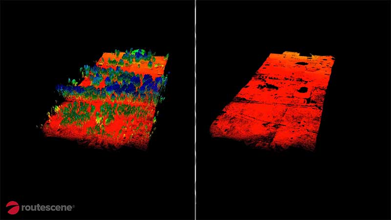
According to Routescene, the point cloud data collected was processing using its LidarViewer Pro software to generate a detailed digital terrain model. It was then overlaid with the results from a gamma spectrometer survey, undertaken to measure radiation intensity, to locate the exact sites of the radiation hotspots.
“The algorithm converts the aerial radiation intensity recorded by a UAV survey into a ground intensity map,” said Kieran Wood, senior research associate at the University of Bristol. “This process is heavily affected by the distance between the airborne radiation sensor and the ground/buildings. Hence, high accuracy lidar-based models were essential.”
Photo: Routescene
Results
While the general widespread radiation contamination in the Red Forest was already known, the results revealed that the radioactivity was unevenly disturbed. Although radiation intensity had reduced in some areas, other areas remain highly contaminated confirming continued danger to anyone accessing those areas, Routescene reported.
In addition, the researchers detected one unexpected hotspot in the ruins of a facility that was used to separate contaminated waste during clean-up efforts immediately after the accident.
This expedition was the first in a series of surveys NCNR will conduct in Ukraine over the next year. The new maps will help officials prevent risks to visitors to the area and the full results will be published soon, Routescene said.
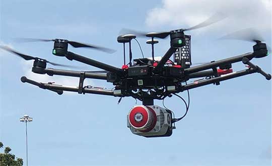
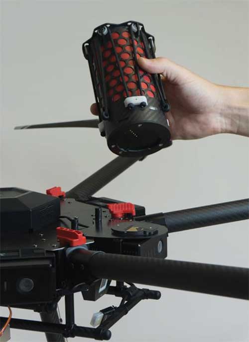
Lidar USA is now offering the option of the Drone Rescue Systems parachute system with all of its DJI M600 UAVs.
As UAVs become increasingly common for mapping applications, the likelihood of a crash increases. The number-one concern for any pilot should be the safety of all people in the vicinity. Equipment safety is number two.
Any mapping-equipped drone will have enough weight to potentially harm a person even if falling from a low altitude flight. The Drone Rescue System greatly mitigates this danger and gives pilots the added assurance that, should the system fail, they have gone the extra mile to prevent harm to any bystanders.
Effective as low as 10 meters with a descent of 3 meters per second, the equipment will land without a hard impact yet quickly enough to keep from being dragged far away.
Photo: Lidar USA
Weighing in at 430 grams in a repackable canister 160 x 75 millimeters in size, the DRS-M600 is designed to auto-release using a patented, airplane-friendly ejection mechanism within milliseconds of detecting a system failure. The size and weight are a major bonus when combined with the airplane-friendly feature, especially for field workers, according to the company.
“We performed our own tests of the Drone Rescue system to ensure the system really worked as advertised,” said Daniel Fagerman, CTO of Lidar USA. “We weren’t disappointed. While it’s an expensive test if it fails, the good news is it that the system worked as well as could be expected. The M600 incurred very little damage that was easily repaired. We feel confident this will be more than just an accessory for our clients but rather a necessity.”
Lidar USA is offering the parachute option to any M600 owners. Watch a video of one of the company’s test flights.