Tag: drone management

  • AirData expands global access to drone fleet platform with 8 new languages

    AirData expands global access to drone fleet platform with 8 new languages

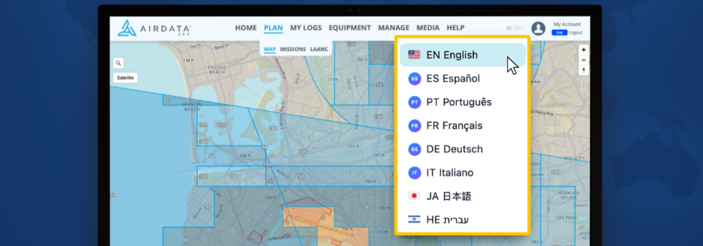
    The full platform experience is now available in English, Spanish, Portuguese, French, German, Italian, Japanese and Hebrew.

    AirData, a drone fleet data management platform used by organizations worldwide, today announced that its platform is now available in eight languages across both the web application and mobile apps. Supported languages include English, Spanish, Portuguese, French, German, Italian, Japanese and Hebrew.

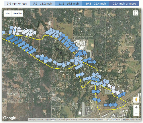
    AirData is used by a wide range of commercial, public safety and government drone programs, helping operators manage daily operations, reporting and compliance across distributed teams. The addition of platform translation reflects efforts to improve accessibility and usability to meet demand from international customers.

    AirData automatically displays the platform interface in a supported language, with no manual configuration, plugins or external translation tools required. The default language is determined by the preferred language settings of the user’s device or browser.

    The translated interface supports navigation and workflows across daily drone fleet operations and is available across the AirData web application and mobile apps. AirData plans to continue expanding localized support over time, including additional languages, region-specific regulations, compliance requirements, and airspace considerations.

    An AirData wind map aids in drone fleet planning. (Image: AirData)
    An AirData wind map aids in drone fleet planning. (Image: AirData)
  • Skycatch launches UAV mining software for the DJI M300

    Skycatch launches UAV mining software for the DJI M300

    Photo: Skycatch
    Photo: Skycatch

    Skycatch is offering new data-capture capabilities for the DJI Matrice 300 through its proprietary Flight1x software — a key component of the company’s High Precision Package.

    The High Precision Package provides mining operations with cloud or edge-based data processing that enables viewing terrain in 4D, automated RTK/PPK industrial drone management, and fast edge processing with data visibility in minutes.

    Built on technology adopted by companies Komatsu Mining and AngloAmerican, Flight1x outperforms traditional off-the-shelf data mapping tools by including purpose-built flight automation software for the M300, leveraging DJI’s L1 and P1 sensors.

    The solution delivers data and network security via Skycatch servers in the United States, coupled with advanced automation features like a 3D first-mission planner, mining-focused workflows and deep integration into Skycatch’s data analytics platform Datahub.

    The Flight1x software will work with the M300 to help mining engineers quickly extract data. Features include:

    • fully automated capture, extraction and processing of high-precision 3D point clouds
    • highly specialized mission-planning automation to extract data from complex terrains such as high walls
    • complete industrial data capture and processing for repeatable and automated spot inspection
    • consistent data-retrieval analysis of thousands of terrain spots in a single location by an automated industrial drone
    • fully automated aerial robot technology built on Skycatch’s automation platform, eliminating the need for manual pilots and reducing risk of human error.