Tag: drone swarm

  • Helix Geospace wins UK grant for GNSS antennas for drone swarms

    Helix Geospace wins UK grant for GNSS antennas for drone swarms

    Photo: Windracers
    Photo: Windracers

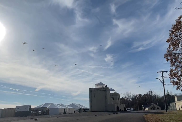
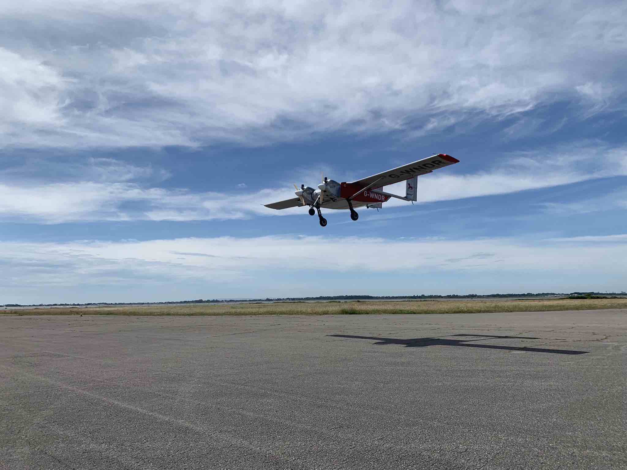
    Helix Geospace will participate in the “Future flights challenge phase 3” project by Innovate UK involving drone swarms. The project aims to demonstrate how large unmanned systems can be used to solve environmental-protection concerns in GNSS-denied environments, functioning in swarms and utilizing a combination of digital twinning, computer vision and real-world flight testing.

    Other project participants include Windracers, Distributed Avionics, University of Bristol and University of Sheffield.

    The goal of the project is to prove that a single remote operator and local safety pilot can handle many unmanned devices and maintain continuous communication in GNSS-denied environments.

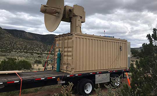
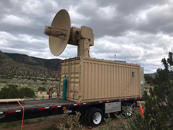
    Commercially available antennas are susceptible to jamming and spoofing. DielectriX antennas from Helix Geospace are built into a sophisticated array system that can detect all jamming and spoofing events, pinpoint their precise source, and then eliminate their impact, maintaining the accuracy and resilience of GNSS positioning, navigation and timing in GNSS-denied environments.

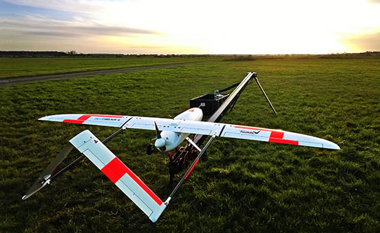
    Collaboration with NERC British Antarctic Survey and Lancashire fire and rescue will provide proof of exploitation and public engagement for the project. The Windracers aircraft will be equipped with British Antarctic Survey scientific research equipment and flown in the Antarctica region to gather novel research data, previously not achieved before at this scale.

    The collaboration with Lancashire fire and rescue will help develop a solution for early fire detection and mitigation. The Windracers aircraft will be retrofitted with sensors and fire mitigation technology providing an airborne system that will patrol high-risk areas.

  • Raytheon swarm enables one operator to guide 100+ drones

    Raytheon swarm enables one operator to guide 100+ drones

    Raytheon BBN-led team recently supported DARPA's fifth OFFSET program field exercise. (Photo: Raytheon)
    Raytheon BBN-led team recently supported DARPA’s fifth OFFSET program field exercise. (Photo: Raytheon)

    Raytheon Intelligence & Space, a Raytheon Technologies business, recently supported the fifth OFFensive Swarm-Enabled Tactics (OFFSET) DARPA program field exercise.

    Using integrated swarm technology developed by a Raytheon BBN-led team, a single operator successfully controlled a swarm — composed of 130 physical drone platforms and 30 simulated drone platforms — both indoors and outdoors in an urban setting. Raytheon BBN provides advanced technology research and development with a focus on national security priorities.

    During the exercise, the team used a combination of commercial off-the-shelf and custom-built hardware and software to deliver swarm autonomy. This enabled a single or small group of operators to direct and manage the activities of a large swarm of autonomous air and ground vehicles with minimal training.

    “Controlling a drone swarm changes the way an operator or group of operators think about the drones,” said Shane Clark, Raytheon BBN OFFSET principal investigator. “Takeaways from this exercise help inform us of the inflection points between utility and manageability.”

    Inexpensive Hardware

    A key element of the program is the use of inexpensive hardware. Without the powerful computing and sensing capabilities available in larger more expensive platforms, Raytheon BBN needed to create a broad library of simple tactic building blocks used to create plans to accomplish mission objectives.

    Raytheon BBN also designed and configured a scalable, modular and decentralized approach to manage a variety of current and future platforms and missions. Whenever possible, the drones collaborate actively to decide how to accomplish a specific mission most efficiently.

    “Our software is smart enough to assign drones with the right capabilities to the appropriate set of tasks,” Clark said. “For example, if the task is to surveil a building, multiple drones will be dispatched, with each surveilling portions of the building. The software considers each platform’s sensor capabilities, and tasks drones with downward-facing cameras to surveil the roof.”

    Once the drones are deployed, their collaboration allows them to understand what parts of a building have been explored and where the gaps are. They then autonomously select how to fill in those gaps.

    Virtual Reality Interface

    To tackle the complexities of human swarm interfaces, the Raytheon BBN team created a virtual reality interface in addition to traditional camera views. It takes feeds from all the swarm assets to create an interactive virtual view of the environment.

    “You can look behind the building to access a view of drone locations, for example, and use the virtual reality environment to test and see if your mission is viable,” Clark said. “We also developed a speech interface with the operationally deployed Tactical Assault Kit, or TAK, integration capability that enables the operator to act quickly while maintaining situational awareness over many systems simultaneously.”

    The Raytheon BBN-led team includes Smart Information Flow Technologies, or SIFT, and Oregon State University. The team is contracted by DARPA to demonstrate its swarm capabilities during Army Expeditionary Warrior Experiment 2022 taking place in February to March, and hosted by the Army Maneuver Battle Lab.

  • Seen & Heard: Sky show, seal solution

    Seen & Heard: Sky show, seal solution

    “Seen & Heard” is a monthly feature of GPS World magazine, traveling the world to capture interesting and unusual news stories involving the GNSS/PNT industry.


    The 10-minute-long drone show included a flying dove with a wingspan of 600 meters, visible from three kilometers away. (Photo: u-blox)
    The 10-minute-long drone show included a flying dove with a wingspan of 600 meters, visible from three kilometers away. (Photo: u-blox)

    A swarm of bird

    A massive swarm of drones created a 10-minute show over Saint Petersburg, Russia, on Sept. 3. The 2,198 miniature UAVs danced for 10 minutes, forming images such as a dove with a wingspan of 600 meters, visible from three kilometers away. Geoscan built and programmed the drones, which use u-blox positioning modules.


    Photo: Danielrao/iStock/Getty Images Plus/Getty Images
    Photo: Danielrao/iStock/Getty Images Plus/Getty Images

    Not bogged down

    Mobile GIS Services (MGISS) is helping the Yorkshire Wildlife Trust (YWT) deploy rugged handhelds to capture highly accurate survey measurements with cloud-based data storage and GIS software. Trust projects include restoring the largest, continuous blanket bog system in England. Blanket bog has been damaged by excessive burning, overgrazing, man-made drainage and extreme weather events. The YWT is using Spectra SP20 handheld GNSS receivers.


    Photo: Genni Brookshire/Ceto Marine Research
    Photo: Genni Brookshire/Ceto Marine Research

    Drones to the rescue

    Seals and sea turtles face threats from humans, such as fishing nets. Marine biologist Genni Brookshire, Ceto Marine Research, and David Thirtyacre, Embry-Riddle Aeronautical University, are researching how drones can improve animal rescue, with help from Skyward, a Verizon Company. Her team is using drones to find and help distressed marine animals. “Using a drone before we respond to an animal to determine the animal’s condition — if it’s entangled, its body condition, if it’s sick — allows us to bring the proper equipment,” Brookshire said. “Using a drone allows us to reduce the stress on the animal, and increase our efficiency in responding to their unique situation.”


    Photo: dzphotovideo/E+/Getty Images
    Photo: dzphotovideo/E+/Getty Images

    Flight mysteries tracked

    GNSS tech in a smart altimeter is guiding paragliders, skydivers, wingsuit pilots and other free-flying athletes. Dekunu Technologies’ One SmartAlti body-worn altimeter offers altitude and position information similar to what pilots obtain in their cockpits, increasing safety throughout freefall. Along with a multi-constellation u-blox chip, the device includes Bluetooth, Wi-Fi and USB. A cloud service incorporates 3D visualizations of the user’s jump data.

  • Power of THOR ready to down enemy drones

    Power of THOR ready to down enemy drones

    The Air Force Research Laboratory (AFRL) has developed a counter-swarm high-power weapon to deter enemy drones — THOR.

    THOR stands for Tactical High-power Operational Responder, a counter-swarm electromagnetic weapon for airbase defense. Although AFRL’s THOR is not a hammer-wielding god associated with thunder and lightning, the system provides non-kinetic defeat of multiple targets. It operates from ground power and uses energy to disable drones.

    The THOR drone deterrent designed by the Air Force Research Laboratory. (Photo: AFRL)
    The THOR drone deterrent designed by the Air Force Research Laboratory. (Photo: AFRL)

    “THOR is essentially a high-powered electromagnetic source that we put together to specifically defeat drones,” said Stephen Langdon, chief of the High-Powered Microwave Technologies Branch of AFRL’s Directed Energy Directorate.

    AFRL is located at  Kirtland Air Force Base, New Mexico. A demonstration system has been built and tested on military test ranges near the base, where it has successfully engaged multiple targets. Further testing against a larger set of drone types in swarming configurations is being planned.

    THOR stores in a 20-foot transport container, which can be transported in a C-130 aircraft. The system can be set up within three hours and has a user interface that requires little training.

    The technology, which cost roughly $15 million to develop, uses high-power electromagnetics to counter electronic effect. When a target is identified, the silent weapon discharges with nearly instantaneous impact.

    With much of the necessary basic research previously completed at AFRL, THOR was rapidly developed and tested in 18 months.

    Although there are other drone defensive systems available, including guns, nets and laser systems, THOR will most likely to extend the engagement range to effect and decrease the engagement time over the other deterrent devices.

    Langdon said the THOR team hopes to transfer the technology to a System Program Office soon in order to get it into the hands of U.S. warfighters as soon as possible.

    AFRL exhibited THOR at the 2019 Air Force Association Air, Space and Cyber Conference at the Gaylord National Resort and Convention Center, located just across the Potomac River from Washington, D.C. and Virginia, Sept. 16-18.

  • Blue Bear successfully demonstrates BVLOS drone swarm

    Blue Bear successfully demonstrates BVLOS drone swarm

    Launch of the RedKite drone. (Photo: Blue Bear Systems)
    Launch of the RedKite drone. RedKite is a long-endurance sub-20-kg UAS designed to carry payloads of up to 5 kg. (Photo: Blue Bear Systems)

    Blue Bear Systems Research Ltd. has successfully demonstrated a fully autonomous suite of multiple drone swarm assets under beyond-visual-line-of-sight (BVLOS) conditions.

    The technology enables complex drone operations where multiple assets are able to carry out simultaneous tasks controlled by a single user to create a swarm effect.

    The five fixed-wing drones clocked up to 15 hours of flying time, over four days, in challenging weather conditions. The swarm comprised a combination of Blue Bear’s Redkite and Cobra fixed-wing systems, which flew multiple simultaneous sorties from a test range in the northwest of England.

    The drones were equipped with the latest automatic dependent surveillance-broadcast (ADS-B) technology, and the airspace was managed by Blue Bear’s airspace deconfliction software. All of the assets were controlled by a single operator from Blue Bear’s mission command control system in Bedfordshire, England.

    “This is an exciting development for us, proving our ability to operate multiple drones, simultaneously, using the latest Blue Bear technology to deliver a swarm effect under BVLOS conditions,” said Ian Williams-Wynn, managing director of Blue Bear Systems.