Tag: EAB

  • EAB Q&A: What is the most promising innovation in satellite navigation?

    EAB Q&A: What is the most promising innovation in satellite navigation?

    Photo: Orolia
    John Fischer

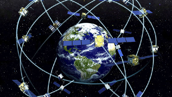
    What is the most promising innovation in satellite navigation being introduced by BDS, Galileo, QZSS, or NavIC?

    Two things are having an immediate impact: authentication methods, such as Galileo’s Open Service-Navigation Message Authentication (OS-NMA), and the proliferation of correction services for high accuracy. Navigation message authentication offers a practical, easy-to-implement defense against several (though not all) types of spoofing attacks. QZSS and NavIC offer this too. And though paid correction services have been available for some time, Galileo’s High Accuracy Service (HAS) will bring it into the mainstream. Sometimes innovation is just applying simple techniques in a useful, efficient manner.”

    — John Fischer
    Safran Navigation & Timing 


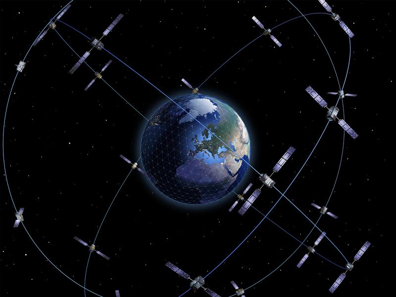
    For critical infrastructure, how good a remedy are multi-constellation receivers to GNSS vulnerability?

    “Multi-constellation receivers do not do much to combat jamming and spoofing; they only detect failures in a constellation itself through comparison. Since they all are open standards, a good spoofer can fake all the systems simultaneously. Multi-frequency receivers are a bit more resistant to jamming, since one must jam multiple bands, but since all the bands are relatively close, the barrier is not high. To be truly resilient, you need diverse, redundant PNT sensors — IMUs, CRPAs, strong signals of opportunity, lidars, etc. — in addition to GNSS receivers.

    — John Fischer
    Safran Navigation & Timing 

  • EAB Q&A: What accuracy level should public services end and private ones begin?

    EAB Q&A: What accuracy level should public services end and private ones begin?

    “Regarding augmentation services such as Galileo HAS, at what accuracy level should public services end and private ones begin?”


    F. Michael Swiek
    Michael Swiek

    This reminds me of the questions that arose many years ago over whether the U.S. Coast Guard differential correction service (DGPS) would unfairly compete with commercially provided augmentations. I don’t know whether there is a single rigid number that fairly separates publicly provided augmentations from commercially provided ones, or if such a number could be set for all time. It would probably need to be flexible, and evolve over time as needs change and technological improvements come to pass. In the end, the public-provided service should be at a reasonable minimum level to address an identifiable broad public need — such as safety of life requirements — but not so fine as to undercut finer levels of accuracy for which there is a market of users willing to pay for such services from the private sector. This could ensure a responsible service provision for the public good, as well as a healthy competitive environment for commercial technological development.

    — Michael Swiek
    GPS Alliance

  • EAB Q&A: Is the GNSS community  failing to exploit the potential of CSAC?

    EAB Q&A: Is the GNSS community failing to exploit the potential of CSAC?

    “Is the GNSS community failing to exploit the potential of chip-scale atomic clocks (CSAC)?”


    Photo: Orolia
    John Fischer

    “Yes! And there are several CSAC suppliers, each with varying accuracies, power consumptions, and price points. These atomic clocks are no longer exotic scientific instruments but rather commercialized, proven devices that can be mounted on a circuit card at a reasonable cost. They offer extended holdover time in the absence of GNSS and help with spoofing detection by verifying the incoming signal. They provide exact frequency recovery on power-up (re-trace) for power saving modes. Defense, telecom, financial transactions, and autonomous navigation for cars and drones are all applications that can be made more resilient by these clocks.”

    — John Fischer
    Safran Navigation & Timing


    Jean-Marie Sleewaegen
    Jean-Marie Sleewaegen

    “Atomic clocks, including CSAC, are frequently used in GNSS timing applications, for example to keep accurate time during GNSS outages or to assist in identifying spoofing attacks targeting the time component. On the other hand, the long-term stability of atomic clocks is not particularly relevant in navigation applications where time is not the main output, and the additional cost, power consumption and size of CSAC are not justified.”

    — Jean-Marie Sleewaegen
    Septentrio


    Headshot: Ismael Colomina
    Ismael Colomina

    “Indeed. After the DARPA-NIST initiative and subsequent commercialization, affordable, accurate and stable chip-scale oscillators can be easily integrated into circuit boards providing additional measurements to PNT systems to improve positional vertical accuracy, as well as reliability and integrity. For example, in high-end mobile mapping systems operating in complex urban scenarios, their use helps detect GNSS outliers at a relatively negligible additional cost.”

    — Ismael Colomina
    GeoNumerics

  • EAB Q&A: Should countries build their own GNSS constellations?

    EAB Q&A: Should countries build their own GNSS constellations?

    “When Galileo was just an idea, its EU proponents used the argument of “political, economic, social and technological sovereignty.” Should countries such as Brazil build their own GNSS constellations?”


    Headshot: Ismael Colomina
    Ismael Colomina

    “When, almost 20 years ago, I was in Brazil giving talks about the future of Galileo and promoting its combined use with GPS, I was often asked the logical question as the EU Galileo sovereignty arguments were known. It is not for us Europeans to answer that question for other countries or oppose their plans. However, while being aware of the defense aspects of GNSS, we may ask ourselves whether an international cooperative approach could avoid a somewhat unjustified future proliferation of GNSS constellations.”

    — Ismael Colomina
    GeoNumerics


    Headshot: Jules McNeff
    Jules McNeff

    “GPS enables continuous access, free of fees and political encumbrances. A decision by any nation to bear the cost of creating a separate GNSS should be justified by realistic requirements for security or coverage that cannot be satisfied by GPS. Japan, South Korea and India are models for additional GNSS services driven by regional needs. For any new system, compatibility with other GNSS, as well as life-cycle costs, are the primary factors to consider.”

    — Jules McNeff
    Overlook Systems Technologies


    Headshot: John Fischer
    John Fischer

    “When Galileo was just an idea, the U.S. military’s GPS was the only viable global constellation. GLONASS was a rusting cold-war relic and BeiDou was in an embryonic stage. The U.S. military’s official policy was that any civilian use was not guaranteed and could be interrupted anytime. Therefore, no nation outside of the United States could depend on GPS and maintain its independent interests. However, today, any country could reasonably maintain its sovereignty by ensuring interoperability with all four — betting that at least one of those constellations would always be available to them. They don’t need their own system.”

    — John Fischer
    Orolia


    F. Michael Swiek
    F. Michael Swiek

    Those are always nice-sounding words when trying to justify a monumentally huge expense. However, is there an actual need to justify that expense? Can the expense and burden of perpetual system operation and maintenance, along with technological innovation to keep pace with other systems and user requirements, be guaranteed over the long term? For the users, GPS can be seen as the gift that keeps on giving, whereas to the operators it is the gift that keeps on costing. So, do Brazil, or other nations, have the commercial or social need, technological foundation, economic resources and political will to initiate a new system and sustain it over the long term? Providing a GNSS constellation is not for the faint of heart or those of short-term vision.

    — Michael Swiek
    GPS Alliance

  • EAB Q&A: Could a new PNT constellation replace GNSS?

    EAB Q&A: Could a new PNT constellation replace GNSS?

    “Could a new PNT constellation using LEO satellites fully replace the services provided by the four existing GNSS constellations?”


    Mitch Narins
    Mitch Narins

    “From a pure capabilities standpoint, the answer is “Yes”. LEO constellations can provide the PNT performance metrics that users require. However, should this strategy be followed, it would lack the diverse, complementary solutions needed to ensure the safety, security, and efficiency of critical infrastructure. Many have recognized the need for resilient PNT solutions and identified system-of-systems approaches. Multiple satellite constellations — MEOs and LEOs (despite the number of platforms) — lack this needed resilience. A resilient system-of-systems should include satellites in multiple orbits and complementary ground-based PNT infrastructure, each providing needed performance and overall demonstrating resilience from diverse threats.”

    — Mitch Narins
    Strategic Synergies


    Photo: Orolia
    John Fischer

    “In theory, yes. With a much stronger signal (antijam) that is encrypted (antijam), they counter GNSS’s two main vulnerabilities. However, with a paid service business model, it is difficult to compete with a free service. Moreover, large constellations are needed to overcome GDOP. OneWeb, Starlink, et al. already have launched and will continue to launch large constellations, so they must compete with these high bandwidth communications constellations that can provide accurate PNT as a side service and don’t have a GDOP limitation because of their size. Adoption of a single-purpose PNT system will be difficult.”

    — John Fischer
    Orolia


    Bernard Gruber
    Bernard Gruber

    “Yes, it could. That said, as with any new product or technology, evolution of PNT capabilities will be dependent on competition, value or threats that undermine the current environment. Burgeoning systems such as Xona, Satelles or any number of augmentations utilizing “signal of interest” such as Starlink will rightly contribute to the evolution of enhanced PNT. Current advantages of LEO-based systems such as increased received power, decreased convergence time and numerical diversity are noteworthy, but replacing an investment of $100B+ government backed GNSS systems that adhere to well established policies and published ICDs is another.”

    — Bernie Gruber
    Northrop Grumman


    Headshot: Jules McNeff
    Jules McNeff

    “As my colleagues above note, the answer is yes from a technical perspective. However, in practice, not so much. Even with software-defined receivers, issues of signal reception and processing, interface standards, comm/nav service prioritization, security, integration into complex systems, integrity assurance, etc. make use of such nav services in lieu of purpose-built GNSS services impractical.”

    Jules McNeff
    Overlook Systems Technologies 

  • Editorial Advisory Board Q&A: NATO Galileo and GPS integration

    Editorial Advisory Board Q&A: NATO Galileo and GPS integration

    How do/will/should North Atlantic Treaty Organization (NATO) forces integrate GPS and Galileo for position, navigation and time?

    Ellen Hall
    Ellen Hall


    For improved resiliency, it would be a great move for NATO to integrate Galileo with GPS into their system. The ‘how’ will be difficult. Some of the challenges are that the EU consists of more than a single nation with which to negotiate complex security issues, such as whether NATO will be treated as a ‘third nation entity’ for the use of PRS. The initial Galileo development was difficult for all these reasons and the Europeans managed to sort it all out, so I’m confident that, if the desire is to do this, it can be done successfully.

    — Ellen Hall
    Imminent Federal


    Photo: Orolia
    John Fischer


    In the interest of operational robustness and the criticality of the use case, NATO should integrate GPS and Galileo capability at the earliest. Both GPS’ M-code and Galileo’s PRS are encrypted, providing anti-spoof capability and extra frequency diversity, making jamming of our forces more difficult. Crypto key management for both systems may be an extra burden, but a single receiver capable of operating with either system individually or both simultaneously would be key for interoperability — always a driving factor for NATO. The capability is available, and NATO should take advantage of it.

    — John Fischer
    Orolia

  • Editorial Advisory Board Q&A: How could the U.S. develop GPS high-accuracy analogous to Galileo’s HAS?

    What would be required for the United States to develop and deploy a GPS high-accuracy service analogous to Galileo’s HAS?


    Headshot: Ismael Colomina
    Ismael Colomina

    “Galileo HAS is a particular implementation of a PPP-RTK service. U.S. companies are already providing similar fee-based services that are even more accurate than HAS. Therefore, there is no big technical challenge for the United States to provide a GPS HAS. Actually, the European Union already provides a HAS for GPS. It is more a question of strategy for GPS policy makers: which user segment to service with a HAS-like augmentation? What about other services analogous to Galileo’s OSNMA and the upcoming CAS [commercial authentication service] for resiliency purposes? In short, a HAS-like service would just require including it in the U.S. GNSS evolution roadmap.”

    — Ismael Colomina
    GeoNumerics


    Photo: Orolia
    John Fischer

    “The challenge is probably more political than technical. The U.S. government usually refrains from competing with commercial services. The prevailing attitude in the United States is that the private sector is more efficient than the public sector. Maybe the most practical approach is for the government to provide the authentication mechanism and open access to the data required, then allow the private sector to offer services. There isn’t a pressing need for high-accuracy GPS for transportation — it needs resiliency/reliability. However, precision agriculture needs it, so maybe sponsorship from the Department of Agriculture would be more effective than from the Department of Transportation.”

    — John Fischer
    Orolia


    Mitch Narins
    Mitch Narins

    When I saw this question, my first impression (as a systems engineer) was to ask ‘For whom? For what applications? For which services?’ (Positioning? Navigating? Time/frequency?) Many have concentrated on accuracy, competing in a GNSS Olympics to see who can achieve ‘the best’ position accuracy and precision (repeatability). Finally, (thanks to Logan Scott) integrity is being pushed beyond just SBAS and GBAS, and real civil authentication of signals is being pursued. I can promise nanometers/nanoseconds if I don’t have to prove it’s true. While we finally understand the need for zero trust, we must still address loss of service by establishing real complementary PNT.

    — Mitch Narins
    Strategic Synergies

  • Editorial Advisory Board: The “geodesy crisis” and GNSS satellites

    Editorial Advisory Board: The “geodesy crisis” and GNSS satellites

    What are your thoughts on the “geodesy crisis” and what do you propose to address it?

    Bernard Gruber
    Bernard Gruber

    “Evidence seems to be very clear that we, as a country, need geodesists and that there has been a decline in investments, training, and research in geodesy. While our decline relative to China may be shocking, it should not be surprising. U.S. industry and government relentlessly pursues STEM graduates, or those with relevant experience, but that does not meet current needs. Besides maybe surveying, it is unclear to the public what the geodesy profession is all about, why it is needed, and quite frankly, why it is an exciting career choice.”

    — Bernard Gruber
    Northrop Grumman


    Does crowding of low-Earth-orbit (LEO) space — with new satellites and space debris — pose any problems for the launch or operations of GNSS satellites in medium
    Earth orbit (MEO)?

    Ellen Hall
    Ellen Hall

    “This was a focused topic at SATELLITE 2022, where the discussion centered on the 6,000 tons of space debris circulating in LEO. Even the smallest piece of debris can be lethal to a satellite, so the key is to track and maneuver where possible. Add to that about 5,000 active satellites and plans to launch tens of thousands of additional ones into LEO over the next few years, and you have a serious problem to overcome. While there are treaties and plans for tracking and maneuvering these satellites, the debris is the real challenge.”

    — Ellen Hall 
    Spirent Federal Systems


  • Editorial Advisory Board PNT Q&A: PPP versus RTK

    Editorial Advisory Board PNT Q&A: PPP versus RTK

    Every month, we ask members of our Editorial Advisory Board to weigh in on a topic. For the January 2021 issue, we asked,

    Will precise point positioning (PPP) replace real-time kinematic (RTK)? If so, for which applications and when?

    Headshot: Miguel Amor
    Miguel Amor

    “Recently, Hexagon’s Autonomy & Positioning division demonstrated RTK levels of performance — globally —through PPP technology; we call it RTK From the Sky (see page 29). I believe that PPP adoption rates will grow significantly in the coming years and eventually replace RTK — especially in areas that are not well served by RTK networks or similar services. Adoption rates will depend on which applications can field GNSS receivers capable of the signals and constellations to perform like RTK.”

    Miguel Amor
    Hexagon’s Autonomy & Positioning division


    Headshot: Alison Brown
    Alison Brown

    “For many applications, the improved accuracy provided by PPP (10 cm) is sufficient and RTK solutions are not needed. However, the typical convergence time of PPP is between 20 and 40 minutes, depending on the number of satellites available, satellite geometry, the quality of the correction products, the receiver’s multipath environment, and atmospheric conditions. This slow convergence compared to RTK solutions will limit application for many real-time applications such as mobile solutions.”

    Alison Brown
    NAVSYS Corporation


    Jean-Marie Sleewaegen
    Jean-Marie Sleewaegen

    “PPP-RTK combines near-RTK accuracy and quick initialization times with the broadcast nature of PPP, over internet or L-band. PPP-RTK can be seamlessly integrated into GNSS receivers, bringing convenient sub-decimeter accuracy to applications where configuring RTK is not practical or where there is no internet connection. PPP-RTK is likely to be adopted by emerging mass-market applications such as UAVs, while RTK will probably remain prevalent in applications where it is already well established, such as precision agriculture.”

    Jean-Marie Sleewaegen
    Septentrio


    Photo:
    Bernard Gruber

    “I do not believe that PPP will replace RTK technology solutions anytime soon. Satellite-based GNSS correction services with an emphasis on global provide worldwide access, but achieving the required accuracy, due to convergence, can be slow. Today, myriad users and emerging customers may utilize corrections augmented with RTK transmitter/base stations that hybrid solutions can provide, thus solving both the age-old navigation issue of obscuration and near real-time positioning simultaneously.”

    Bernard Gruber
    Northrop Grumman

  • Editorial Advisory Board PNT Q&A: Simulation challenges

    Editorial Advisory Board PNT Q&A: Simulation challenges

    What’s the biggest challenge in simulating new GNSS signals for manufacturers’ product testing?

    John Fischer
    John Fischer

    “Anyone can follow a spec, but real expertise is required for interpreting nascent ICDs, looking for inconsistencies and pitfalls. The first receivers to market may not always get it right, especially before and during early live-sky signal broadcasts.” — John Fischer, Orolia


    Ellen Hall
    Ellen Hall

    “The challenge is twofold. Manufacturers are constantly implementing new signals, which is extremely difficult and expensive to do without the use of a simulator in a lab. The second problem manufacturers are facing is integrating secure signals across international constellations.” — Ellen Hall, Spirent Federal Systems


    Julian Thomas
    Julian Thomas

    “The industry has been stimulated by growing constellations and the arrival of new signals, resulting in an increasing number of sophisticated receivers hitting the market. Our biggest challenge is ensuring that all simulated signals work on all of these receivers.” — Julian Thomas, Racelogic Ltd.