Tag: Editorial Advisory Board

  • Editorial Advisory Board PNT Q&A: GPS in popular culture

    Editorial Advisory Board PNT Q&A: GPS in popular culture

    Photo: KenWiedemann/iStock/Getty Images Plus/Getty Images
    Photo: KenWiedemann/iStock/Getty Images Plus/Getty Images

    What is your pet peeve about how GPS/GNSS is portrayed or discussed in the media and popular culture?

    Headshot: Terry Moore
    Terry Moore, professor emeritus, University of Nottingham

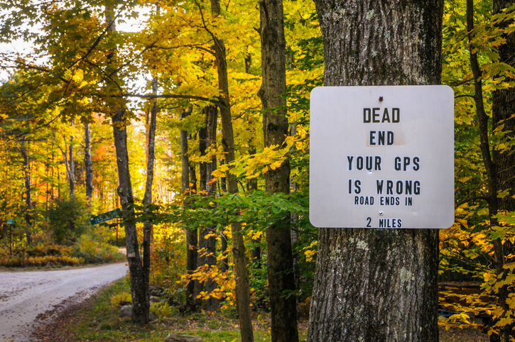
    “What really annoys me is the misinformed assumption that SatNav and GNSS are one and the same. There is now a proliferation of ‘Do Not Follow SatNav’ signs [in the United Kingdom], and so many anecdotal stories about accidents caused by drivers blindly following SatNavs in their vehicles. These are almost always due to the deficiencies of the mapping and the route guidance components of the SatNav systems and not due to any problem with GNSS whatsoever. Nevertheless, it is GNSS that takes the blame.”

    Terry Moore
    University of Nottingham


    Headshot: Julian Thomas
    Julian Thomas
    Managing Director

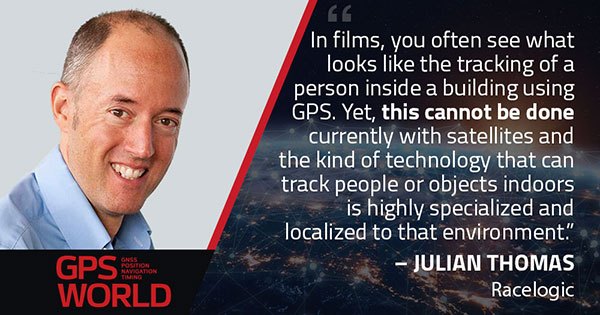
    “In films, you often see what looks like the tracking of a person inside a building using GPS. Yet, this cannot be done currently with satellites and the kind of technology that can track people or objects indoors is highly specialized and localized to that environment.”

    Julian Thomas
    Racelogic Ltd.


    Headshot: Stuart Riley
    Stuart Riley, vice president of GNSS technology, Trimble

    “My pet peeve is the oversimplification of consumer navigation issues. I ran a few searches for ‘GPS fails’ and almost immediately saw images of cars in water and stuck in narrow streets. All too often, this is attributed to a GPS issue or failure. From a consumer perspective, the overall system from maps to satellites is considered GPS. The reality is that GPS (the satellites and control segment) is extremely reliable. Historically, satellite issues have been minimal. The most likely navigation errors are routing errors and old or erroneous maps, coupled with users blindly following the directions, and, to a lesser extent, receiver design issues (e.g., lack of ICD compliance) and harsh conditions (deep urban canyons).”

    Stuart Riley
    Trimble


    Mitch Narins
    Mitch Narins

    “For many, GPS/GNSS remains the miracle cure for all that ails you — for position/surveillance (e.g., ADS-B), for navigation (RNAV and RNP), and for the largest user base, time and frequency. Even while acknowledging the risks, many still treat GPS/GNSS interference as the 500-year flood that will ‘never’ happen in their lifetimes and, if it does, can be excused away as force majeure. It seems that in most of the articles I read it is always a sunny day and GPS/GNSS works perfectly. The need to incorporate resiliency is never emphasized. Nobody would buy a car without a spare tire. Isn’t it time for GPS/GNSS users to recognize the need and insist that an appropriate PNT ‘spare’ be included in the deal?”

    Mitch Narins
    Consultant


    Headshot: F. Michael Swiek
    Headshot: F. Michael Swiek

    “We can chuckle while watching spies, super sleuths, and adventurers receive GPS positions in incredibly challenged environments — even in caves. My main beef is that nowhere is any mention made of who operates GPS. Instead, GPS is treated as an assumed given, embedded in a smart device, constantly and reliably available on demand anywhere and under all conditions. It is about time recognition and credit is given to those who actually make the miracle of GPS happen.”

    Michael Swiek
    GPS Alliance

  • Brad Parkinson offers 5 ways to protect, improve PNT

    Brad Parkinson offers 5 ways to protect, improve PNT

    What should the new administration’s priorities be to make PNT more resilient?

    We asked Brad Parkinson, the “Father of GPS” and a GPS World Editorial Advisory Board member, what the new U.S. administration’s priorities should be to make positioning, navigation and timing (PNT) more resilient. For more answers from board members, see below.

    Brad Parkinson
    Brad Parkinson

    Protect the Spectrum. Reverse FCC authorization for relatively high-powered Ligado transmitters that have been proven to degrade GPS and other GNSS operation for thousands of PNT users. All U.S. government departments and major user groups affected have pleaded with the FCC to reverse this terrible decision. There is little benefit from it to the American public.

    Protect the rapidly evaporating and self-proclaimed Gold Standard of GPS. The GPS satellite designs are showing their age. They need to go to multiple launch (three at a time) and revert to simpler designs without the spot-beams and other weighty add-ons that greatly increase complexity and cost. The Chinese have added to BeiDou (a) inter-satellite precision ranging and wide-band communications, (b) geosynchronous satellites, probably with good spot-beam acquisition aids, and (c) a WAAS-like correction directly on the satellites, which may have accuracies down to real-time kinematic (RTK, perhaps a few centimeters). Also, they claim their basic accuracies to be better than GPS (it might be true!) — I think they already have operational retro-reflectors.

    Allow and encourage export of the basic and quickest fix to jamming and spoofing for high-value PNT users. More than 40 years ago, we demonstrated, in hardware, a high anti-jamming receiver that could fly directly over a 10 kW GPS jammer and not be affected. We know that high-gain, digital beam-steering antennas will create close to immunity, but our manufacturers will not move this way because we cannot sell or use them on the international market.  These devices, combined with inexpensive inertial components and the newer signals, would make PNT virtually immune to current threats of interference — both jamming and spoofing.

    Move the military focus from alternative PNT techniques to seriously upgrading their receivers and useful signals. No current or reasonably anticipated alternative can provide the accuracy (3D), availability or integrity of GPS. The new M-code and L1C signals have been in the queue for about 20 years. (Loran for ground operations probably is very vulnerable to direct attack in a fluid battlefield operation. Loran’s main value is to distribute time and for maritime users.) In those 20 years, we now have cellphone chips costing less than $5 that can listen to about 200 ranging signals and process RTK, as well as use all the corrections available (WAAS, EGNOS, etc.). Such capability cannot be found in military receivers. The Defense Department must improve its acquisition strategy in terms of both speed and competition, and ncorporate existing civil capability into military user equipment.

    Take government actions to rapidly identify, shut down, and prosecute GPS jammers. Some believe this problem is much larger than recognized already. All cellphones should be required to report extraordinary spectrum noise levels or apparent attempts at spoofing. This should be fed to a dynamic national database, perhaps maintained by the Coast Guard. GPS users should have an automated way to find out whether there are substantial threats in their operating area.


    Brad Parkinson is the Edward Wells Professor, Emeritus, Aeronautics and Astronautics (recalled) and co-director of the Stanford Center for Position, Navigation and Time at Stanford University.


    Editorial Advisory Board PNT Q&A

    Here are additional responses to the question from more GPS World Editorial Advisory Board members.

    John Fischer
    John Fischer

    “We hope the new administration continues on the path established with the Executive Order last year for resilient PNT, supporting progress made by DHS and NIST in establishing resilient and cybersecure frameworks. It will be important for them to maintain an open market concept toward future innovative solutions and not mandate a particular PNT approach. Awareness of the criticality for trusted PNT in our mobile connected society is established and we must not lose this.”
    John Fischer
    Orolia


    Jules McNeff
    Jules McNeff

    “Resilient PNT should be a national security priority. Its continuity is vital to both military and economic/social activities of all kinds. Its qualities of spatial awareness and synchronization enable the efficient functioning of the most sophisticated modern technologies in the physical and cyber worlds while also simply getting people and things from point A to point B on schedule. In that context, the elements which comprise resilient PNT should be protected from natural or hostile disruption.”
    Jules McNeff
    Overlook Systems Technologies


    Greg Turetzky
    Greg Turetzky

    “Truly resilient PNT requires combining multiple positioning technologies to maximize resiliency. However, the government’s influence in many of the augmentation technologies (sensors, vision, etc.) is limited. What the administration can do is make GPS itself more resilient by speeding up the launch and acquisition schedule of GPS Block III. The new signals, particularly at L5, are invaluable for improved resiliency to jamming and spoofing as well as providing a significant improvement in accuracy.”
    Greg Turetzky
    Consultant

  • Editorial Advisory Board PNT Q&A: PPP versus RTK

    Editorial Advisory Board PNT Q&A: PPP versus RTK

    Every month, we ask members of our Editorial Advisory Board to weigh in on a topic. For the January 2021 issue, we asked,

    Will precise point positioning (PPP) replace real-time kinematic (RTK)? If so, for which applications and when?

    Headshot: Miguel Amor
    Miguel Amor

    “Recently, Hexagon’s Autonomy & Positioning division demonstrated RTK levels of performance — globally —through PPP technology; we call it RTK From the Sky (see page 29). I believe that PPP adoption rates will grow significantly in the coming years and eventually replace RTK — especially in areas that are not well served by RTK networks or similar services. Adoption rates will depend on which applications can field GNSS receivers capable of the signals and constellations to perform like RTK.”

    Miguel Amor
    Hexagon’s Autonomy & Positioning division


    Headshot: Alison Brown
    Alison Brown

    “For many applications, the improved accuracy provided by PPP (10 cm) is sufficient and RTK solutions are not needed. However, the typical convergence time of PPP is between 20 and 40 minutes, depending on the number of satellites available, satellite geometry, the quality of the correction products, the receiver’s multipath environment, and atmospheric conditions. This slow convergence compared to RTK solutions will limit application for many real-time applications such as mobile solutions.”

    Alison Brown
    NAVSYS Corporation


    Jean-Marie Sleewaegen
    Jean-Marie Sleewaegen

    “PPP-RTK combines near-RTK accuracy and quick initialization times with the broadcast nature of PPP, over internet or L-band. PPP-RTK can be seamlessly integrated into GNSS receivers, bringing convenient sub-decimeter accuracy to applications where configuring RTK is not practical or where there is no internet connection. PPP-RTK is likely to be adopted by emerging mass-market applications such as UAVs, while RTK will probably remain prevalent in applications where it is already well established, such as precision agriculture.”

    Jean-Marie Sleewaegen
    Septentrio


    Photo:
    Bernard Gruber

    “I do not believe that PPP will replace RTK technology solutions anytime soon. Satellite-based GNSS correction services with an emphasis on global provide worldwide access, but achieving the required accuracy, due to convergence, can be slow. Today, myriad users and emerging customers may utilize corrections augmented with RTK transmitter/base stations that hybrid solutions can provide, thus solving both the age-old navigation issue of obscuration and near real-time positioning simultaneously.”

    Bernard Gruber
    Northrop Grumman

  • Editorial Advisory Board PNT Q&A: Advancing bathymetry

    Editorial Advisory Board PNT Q&A: Advancing bathymetry

    Which recent GNSS/INS innovations have been most helpful in advancing bathymetry? Which upcoming ones will be?

    Headshot: Miguel Amor
    Miguel Amor

    “Development of PPP removed reliance on shore-based RTK base stations, allowing operation almost anywhere on the oceans. Continued performance improvement in FOG and MEMS INS, along with bathymetric sensors, provide cost-effective solutions while also providing more accurate seabed maps. The future will see increased PPP accuracy with faster convergence and continued improvement in INS, coupled with increased resolution of bathymetric sensors, leading to more of the oceans mapped using autonomous platforms.”
    Miguel Amor, 
    Hexagon Positioning


    Bernard Gruber
    Bernard Gruber

    “While GNSS has been a clear contributor to Earth mapping, it is an altogether different dilemma to solve ‘submarine topography’ mapping. Given recent developments in the IMU and lidar markets, one can readily utilize these sensors to correct for roll, pitch, and yaw, and produce digital maps, respectively. Combining these sensors with GNSS receivers, mounted on a drone for example, can allow for precise measurements in areas of tidal shifts or dynamic variations of water depth.”
    Bernard Gruber,
    Northrop Grumman

  • GPS World adds Col. Bernard Gruber to Editorial Advisory Board

    GPS World adds Col. Bernard Gruber to Editorial Advisory Board

    Bernard Gruber
    Bernard Gruber

    Bernard Gruber, who previously headed the GPS program for the United States Air Force, has joined the GPS World Editorial Advisory Board.

    Gruber is senior director of Guided Projectiles and Precision Weapons, Innovation Systems, at the Armament Systems Division of Northrop Grumman in Plymouth, Minnesota. In this role, he is responsible for the capture and program execution of multiple U.S. Department of Defense and global programs within five business lanes:

    • Precision Guidance Kits
    • Advanced Weapons
    • Barriers/Area Denial Systems
    • Air Defense/Counter-Unmanned Aircraft Systems (C-UAS)
    • Air-to-Ground Precision Weapons

    Gruber joined Northrop Grumman (then ATK) in September 2013, where he was responsible for winning and managing cost, schedule and technical performance of a significant international co-production program before moving on to deputy for precision weapons and then senior director in 2015.

    Before joining Northrop Grumman, Gruber completed a distinguished 26-year Air Force career and retired as the program director of the Global Positioning System (GPS), Los Angeles Air Force Base. As GPS director,  he was responsible for development, acquisition, fielding and sustainment of all GPS satellites, command and control (ground segment) and military user equipment.

    The $32 billion GPS program, with a $1 billion annual budget and 700 member team, maintained the largest satellite constellation and the largest avionics integration and installation program in the entire DOD.

    Gruber earned his B.S. in mechanical engineering from North Dakota State University and his M.B.A. from Michigan. He is a graduate of Squadron Officer School, Air Command and Staff College, Air War College, Defense Systems Management College and the Joint Forces Staff College; he has commanded at the squadron, group and wing levels.

    Gruber has distinguished himself in a variety of leadership positions within the operations, intelligence, launch, engineering and acquisition disciplines, and had served in key positions at Major Command, Air Staff, Joint Staff, Corporate and Defense Agency levels. He is a National Defense Fellow, life member of the Air Force Association, National Eagle Scout Association, Program Management Institute and sits on the board of directors for AirSpace Minnesota and the Midwest Defense Alliance.

    Northrop Grumman is a global security company providing innovative systems, products and solutions in autonomous systems, cyber, C4ISR, strike and logistics and modernization to customers worldwide.

  • Editorial Advisory Board PNT Q&A: Opportunities with GNSS correction services

    Editorial Advisory Board PNT Q&A: Opportunities with GNSS correction services

    New players are offering GNSS correction services — pushing prices down and offering new business models. What opportunities does this open up?

    Jules McNeff
    Jules McNeff

    “This trend is encouraging, as new entrants bring energy and new ideas, keeping the PNT technology sector fresh. GNSS corrections enhance the value of dynamic mapping coupled with grid-coordinate systems such as the U.S. National Grid in producing user-friendly geolocation values for delivery of people and things and especially enabling efficient, precise, land mobility activities such as spatial awareness for autonomous vehicle movement and command and control of emergency response operations.”
    — Jules McNeff
    Overlook Systems Technologies


    Greg Turetzky
    Greg Turetzky

    “In a 5G world where most devices regardless of size are connected, it make sense that those devices that are mobile are going to need to be located. Correction services are key to providing enhanced accuracy, and new business models are needed to address these new markets that are fundamentally different than traditional high-accuracy markets.”
    — Greg Turetzky
    Consultant


    Jean-Marie Sleewaegen
    Jean-Marie Sleewaegen

    “Traditional correction services rely on bidirectional communication between a user and a local correction provider. They offer centimeter accuracy over small regions. Instead, new services broadcast corrections applicable to larger areas and with flexible accuracy levels, from centimeters to decimeters. They bring benefits not only in pricing, but also in terms of accessibility, scalability and ease of use. They make accuracy transparent to the user, opening up the opportunity of high accuracy to mass-market and industrial applications.”
    — Jean-Marie Sleewaegen
    Septentrio

  • GPS World welcomes new EAB members

    GPS World welcomes new EAB members

    GPS World magazine is excited to announce two additions to our Editorial Advisory Board.

    Mitch Narins
    Mitch Narins

    Mitch Narins is the principal consultant and owner of Strategic Synergies LLC, a technical and management consulting firm that he formed after retiring following over four decades of U.S. government service. He worked at the Federal Communications Commission as an acquisition engineer for the Field Operation Bureau; supported the U.S. Navy and U.S. Marine Corps as branch chief for Data Terminal Systems and Electronic Warfare Systems; and served more than 26 years at the Federal Aviation Administration as a program manager, systems engineer, and finally as the chief systems engineer for navigation.

    At the FAA, he was integrated into all aspects of aviation sector position, navigation and time systems engineering, standards development, and enterprise architecture efforts in support of the National Airspace System and the Next Generation Air Transportation System (NextGen).

    Narins is a recognized position, navigation, and timing (PNT) expert, who has published numerous articles and delivered many papers at conferences and seminars worldwide. He is a Certified Information Systems Security Professional (CISSP), a Fellow of the Royal Institute of Navigation, an active member of the Institute of Navigation (ION), and a member of RTCA, RTCM, and SAE Standards Committees. He is a recipient of ION’s Norman P. Hays Award and the International Loran Association’s President’s Award and Medal of Merit.

    Stuart Riley
    Stuart Riley

    Stuart Riley is vice president of GNSS technology responsible for GNSS signal processing and products for several Trimble business areas. In this role, he is responsible for the core GNSS technology from signal reception through to the measurement engine that is used in all Trimble GNSS precision products. He oversees GNSS product development for Trimble’s GNSS Real-time Networks, Geospatial, Heavy Civil Construction and InTech OEM Divisions.

    Beginning his career at Trimble in 1995, Stuart has worked on GNSS receiver development in various engineering roles, in addition to holding several management roles. He holds several patents filed and pending in the field of GNSS and is often a guest speaker at international conferences.

    His research interests include improving GNSS performance in harsh environments, and taking measurements from additional sensors along with optimizing the GNSS receiver architecture, especially for the newer GNSS signals BeiDou, Galileo, IRNSS, QZSS and next-generation GPS and GLONASS signals.

    Riley has an electronic engineering Ph.D. in the field of GNSS from the University of Leeds in England. After he graduated, he was a research fellow at the university on a European Space Agency-funded project to develop a prototype GNSS receiver for space applications.

  • Industry stalwarts remember change agent Javad Ashjaee

    Industry stalwarts remember change agent Javad Ashjaee

    Dr. Javad Ashjaee, Founder and CEO of Javad GNSS, 1949–2020. (Photo: Javad GNSS)
    Dr. Javad Ashjaee, Founder and CEO of Javad GNSS, 1949–2020. (Photo: Javad GNSS)

    The GNSS community was deeply saddened by the loss of Dr. Javad Ashjaee — Javad, as he liked to be called — on May 30. Following are excerpts of comments by GPS World Editorial Advisory Board members and others, all of whom also expressed their heartfelt sorrow.


    Message from The Ashjaee Family

    “Once in a while an individual comes along with a spirit seemingly superhuman, a resolve and constitution seemingly indestructible. Dr. Javad Ashjaee was one such individual. His talent, intellect, commitment and sheer guts were head and shoulders above the rest, much to the chagrin and frustration of his competitors and naysayers. But those closest to him know that he was also simply, beautifully, erringly human. He brought out in the rest of us the strength and wisdom we could not always see in ourselves. Yes, he was a force of nature, as many describe, but Javad never did anything alone. Throughout the years, he has had a sizable family and team, by blood as well as by love, behind each of his many achievements and contributions to his field. He once told us his name, Javad, means ‘generous.’ And that he was. All that he has given to, and all that he has inspired in, his family, team, and professional industry, forms a legacy that will continue for years to come. We, his family, his team, his protégés and protectors, are here to stay and stronger than ever. If he were here, he would surely wonder how his competition would proceed without that fire only he could ‘light up their asses.’”


    Jules McNeff
    VP of Strategy and Programs
    Overlook Systems Technologies

    “Javad was a brilliant innovator, although he could be a bit infuriating at times. He loved to place ads in GPS World in part to poke fun at the DoD for our Selective Availability policies, for which I was the principal defender at the time. Javad was a unique and talented person of tremendous fortitude and intellectual confidence who was never afraid of controversy. The GNSS community will miss his energy.”

    Mitch Narins
    CISSP/FRIN
    Strategic Synergies

    “When I think of Javad, the words that come to mind are ‘brilliant, dedicated, driven, and committed.’ The last time I saw Javad at an ION GNSS+ conference, he knew he was on the side of an argument opposing many other experts in our GNSS community. That did not bother Javad. He was never one to go along to get along — which was one of the reasons he was able to develop such innovative and capable systems. Our GNSS community has lost a leader, innovator and contributor to the science and engineering behind position, navigation and time.”

    Paul McBurney
    Ph.D., CTO and co-founder
    OneNav

    “Javad was a one-man army who was not afraid to fight. From his days at Trimble, where he developed major advancements in receiver software, and through all of his endeavors, Javad produced an impressive amount of truly innovative solutions. He used the LightSquared crisis as an opportunity to add novel front-end filtering to his products, and cleverly marketed it. His writing was unmistakable, featuring the wordsmithing of both an engineer and a salesman. He was a role model to many aspiring GPS entrepreneurs.”

    Tim Burch
    Director of Surveying
    SPACECO

    “Javad’s contributions to the surveying profession helped turn every practitioner into a geospatial information provider. From his early days at Trimble pioneering the commercial-grade receiver to creating his company at Ashtech and embracing GLONASS with GPS, he continued to expand the capability of the GNSS receiver. Many surveyors today, however, only know his name through his latest company, Javad GNSS, and its unique line of receivers and measuring devices, with their distinct green color. Javad was a big part of the GNSS revolution, so the next time someone starts up his/her receiver to collect survey data, take a moment to thank him. His departure leaves a giant hole in the geospatial world.”

    Michael Swiek
    Managing Director, Executive Branch and International
    GPS Innovation Alliance

    “The ‘Original Cast’ of GPS innovators is dwindling. Javad was a complicated, self-made, innovative, and entertaining man. In the many years we knew each other, we worked on shared visions, many challenges, laughed a lot, and disagreed and argued more than a bit. We always remained friends, honest to each other. Javad was a true GNSS pioneer.”

    Ellen Hall
    President and CEO
    Spirent Federal Systems

    “What a loss for everyone. Such a talented person who truly made his mark on the world.”

    Greg Turetzky
    consultant

    Dr. Ashjaee led the signals team of the “Satellites vs. Signals” after-dinner debate at the GPS World Leadership Dinner held during ION GNSS 2008. (Photo: GPS World)
    Dr. Ashjaee leD the signals team of the “Satellites vs. Signals” after-dinner debate at the GPS World Leadership Dinner held during ION GNSS 2008. (Photo: GPS World)

    “I have very fond memories of Javad from the many years we attended
    ION GNSS+ and other industry conferences. I will always remember a spirited ‘Satellites vs. Signals’ debate we had at a GPS World Leadership Awards Dinner. We were equally passionate about the debate — despite not having chosen the opposite sides to which we were attached. These are the memories of Javad I treasure. He was passionate, informed, innovative and really good at playing the game. His spirit of innovation will be missed, but I am confident it will be carried on by other members of the GNSS community of which he was such an important part.”

    Alison Brown
    President and CEO
    NAVSYS

    “I am so sorry to hear about Javad’s passing. He was an innovator and an originalist. We worked together after he left Trimble and was in the process of starting Ashtech. I particularly remember his championing the cause, with me, against Selective Availability. He ran an ad with the iconic image of the Mona Lisa as part of this cause, with the slogan “Why ruin a work of art?” It is tragic that Javad fell victim to COVID-19. He will be sorely missed.”

  • Editorial Advisory Board PNT Q&A: 3D in construction

    What are the key obstacles to widespread adoption of 3D positioning and guidance in the construction industry?

    Ismael Colomina
    Ismael Colomina, GeoNumerics

    “Construction site monitoring with UAVs requires regulated standard scenarios that allow flying over people and in urban areas without spending weeks obtaining the needed permissions. It also requires the development of critical UAV components, especially the guidance, navigation and control (GNC) systems. Safe UAV navigation — guaranteeing positional accuracy with small probabilities of actual errors larger than the specified ones — is still under development and will involve a multi-sensor navigation system. Current GNSS augmentation systems, such as WAAS and EGNOS, may not be appropriate for flights in the very-low-level (VLL) airspace.”
    Ismael Colomina, GeoNumerics


    Members of the EAB

    Tony Agresta
    Nearmap

    Miguel Amor
    Hexagon Positioning Intelligence

    Thibault Bonnevie
    SBG Systems

    Alison Brown
    NAVSYS Corporation

    Ismael Colomina
    GeoNumerics

    Clem Driscoll
    C.J. Driscoll & Associates

    John Fischer
    Orolia

    Ellen Hall
    Spirent Federal Systems

    Jules McNeff
    Overlook Systems Technologies, Inc.

    Terry Moore
    University of Nottingham

    Bradford W. Parkinson
    Stanford Center for Position, Navigation and Time

    Jean-Marie Sleewaegen
    Septentrio

    Michael Swiek
    GPS Alliance

    Julian Thomas
    Racelogic Ltd.

    Greg Turetzky
    Consultant

  • Editorial Advisory Board Q&A: High-precision surveying and GPS III

    Editorial Advisory Board Q&A: High-precision surveying and GPS III

    What improvements will GPS III bring to high -precision surveying? When? Will these improvements require any changes in equipment and/or processes?

    Photo: Nearmap
    Tony Agresta, Nearmap

    “The biggest impact of GPS III to high precision surveying will be a full constellation of L5 satellites. Triple frequency will bring faster convergence times and better accuracy in more difficult conditions. GPS III will better align with Galileo and BeiDou with L1C which means better availability in restricted sky conditions. Users will want to have equipment capable of supporting these new signals, in antenna and receiver HW as well as the signal processing done on board.”
    Tony Agresta
    Nearmap


    Jean-Marie Sleewaegen
    Jean-Marie Sleewaegen

    “Of all the improvements brought by GPS III, the new L1C signal will probably have the biggest impact on high-precision surveying. Compared to L1 C/A, L1C brings better reception in difficult environments, improved availability thanks to the “pilot” component, enhanced resilience to jamming attacks, and better interoperability with Galileo, BeiDou and QZSS. Many receivers do support L1C already, but the benefits will become more tangible as the GPS III constellation grows.”
    Jean-Marie Sleewaegen
    Septentrio


    Members of the EAB

    Tony Agresta
    Nearmap

    Miguel Amor
    Hexagon Positioning Intelligence

    Thibault Bonnevie
    SBG Systems

    Alison Brown
    NAVSYS Corporation

    Ismael Colomina
    GeoNumerics

    Clem Driscoll
    C.J. Driscoll & Associates

    John Fischer
    Orolia

    Ellen Hall
    Spirent Federal Systems

    Jules McNeff
    Overlook Systems Technologies, Inc.

    Terry Moore
    University of Nottingham

    Bradford W. Parkinson
    Stanford Center for Position, Navigation and Time

    Jean-Marie Sleewaegen
    Septentrio

    Michael Swiek
    GPS Alliance

    Julian Thomas
    Racelogic Ltd.

    Greg Turetzky
    Consultant

  • Editorial Advisory Board PNT Q&A: Policy on jamming

    What is or would be the best policy response from Congress and/or executive branch agencies to the growing threats to GPS from jamming and interference?

    Brad Parkinson
    Brad Parkinson

    “Homeland Security has declared GPS to be an essential system to virtually all of our infrastructure. It is time to install a national system to identify and shut down interference. As part of that, all cell phones should periodically report interference to that national system and allow law enforcement to pinpoint and eliminate offenders.”

    -Bradford W. Parkinson

    Stanford Center for Position, Navigation and Time


    Allison Brown
    Allison Brown

    “On Dec. 5, 2018, the president signed into law the National GPS Timing Resilience and Security Act tasking the Secretary of Transportation with establishing a backup timing system for GPS within two years. To date, only limited technology demonstrations have been performed. Congress needs to fund the Department of Transportation to rapidly acquire and deploy a back-up timing capability, using available commercial solutions, to assure resilience within the Air Traffic Control system and other critical infrastructure to GPS jamming or spoofing.”

    -Alison Brown

    NAVSYS Corporation


    Members of the EAB

    Tony Agresta
    Nearmap

    Miguel Amor
    Hexagon Positioning Intelligence

    Thibault Bonnevie
    SBG Systems

    Alison Brown
    NAVSYS Corporation

    Ismael Colomina
    GeoNumerics

    Clem Driscoll
    C.J. Driscoll & Associates

    John Fischer
    Orolia

    Ellen Hall
    Spirent Federal Systems

    Jules McNeff
    Overlook Systems Technologies, Inc.

    Terry Moore
    University of Nottingham

    Bradford W. Parkinson
    Stanford Center for Position, Navigation and Time

    Jean-Marie Sleewaegen
    Septentrio

    Michael Swiek
    GPS Alliance

    Julian Thomas
    Racelogic Ltd.

    Greg Turetzky
    Consultant

  • Editorial Advisory Board PNT Q&A: Terrestrial PNT

    Which of several proposed terrestrial PNT technologies is best suited to complement and back up GPS?

    Jules McNeff
    Jules McNeff

    “Seeking PNT resiliency for critical functions, a layered, multi-source terrestrial RF backup strategy could include eLoran for continental coverage and Locata, or similar system(s), for high-precision, localized service where needed. However, don’t forget feature-aided navigation using optical, radar, lidar, etc., and positioning/timing from ‘validated’ signals of opportunity in data-rich environments.”
    Jules McNeff
    Overlook Systems Technologies


    Headshot Terry Moore
    Terry Moore

    “No single technology can provide a backup to GNSS to match the ubiquity of satellite-based PNT. However, placing inertial navigation systems at the core of our PNT solution, and focusing on bounding the growth of the positioning errors using whatever other space or terrestrial measurements are available, could provide an alternative paradigm to resilient positioning and navigation.”
    Terry Moore
    University of Nottingham


    Members of the EAB

    Tony Agresta
    Nearmap

    Miguel Amor
    Hexagon Positioning Intelligence

    Thibault Bonnevie
    SBG Systems

    Alison Brown
    NAVSYS Corporation

    Ismael Colomina
    GeoNumerics

    Clem Driscoll
    C.J. Driscoll & Associates

    John Fischer
    Orolia

    Ellen Hall
    Spirent Federal Systems

    Jules McNeff
    Overlook Systems Technologies, Inc.

    Terry Moore
    University of Nottingham

    Bradford W. Parkinson
    Stanford Center for Position, Navigation and Time

    Jean-Marie Sleewaegen
    Septentrio

    Michael Swiek
    GPS Alliance

    Julian Thomas
    Racelogic Ltd.

    Greg Turetzky
    Consultant