Laser Technology’s MapSmart app for Android is a tool for expert field data collection without complicated equipment, the company said.
The software is designed for quick and accurate mapping of anything, including stockpile volumes, with or without GPS coordinates for every data point.
The survey-quality mapping app, using the smart device’s internal GPS or the user’s own external GPS, integrates with LTI TruPulse lasers and enables users to establish an origin and begin capturing field data in minutes.
MapSmart:
offers four mapping methods to accommodate user preferences
provides an intuitive interface with icons and buttons
organizes and classifies data to ease the process of decrypting field measurements in the office
enables real-time addition of height and missing line values to mapped features
delivers advanced image capabilities, including tablet photo association with data points and TruPoint 300 image integration
supports a variety of report formats and wireless data transfer.
The smart features and remote-fire capabilities are especially useful for stockpiles, where users can measure and calculate the volume and tonnage of any material from a safe location.
Asteri Navigation will introduce a new line of rugged, compact and fully integrated GNSS receivers on Nov. 15 at the 2016 Autodesk University in Las Vegas, Nevada.
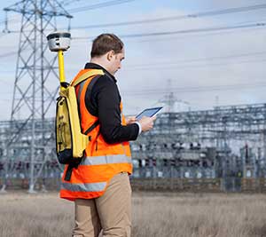
Suitable for geospatial field data collection and inspection applications that require high accuracy positioning, the Asteri X-Series receivers are light enough to be mounted to external sensors or worn on the body or arm.
Asteri Navigation will debut the affordable X-1 and X-2 receivers in booth No. 1783 at Autodesk University, which runs from Nov. 15-17 at The Venetian in Las Vegas. The X-3 is scheduled for release in December.
The compact Asteri receivers were designed with safety and ease of use in mind. Each device weighs just 11.3 ounces with the 12-hour lithium battery. Their 2.8-inch by 5.4-inch size allows them to fit safely in shoulder or arm pouches.
The internal single-frequency antenna enables users to capture accuracies of well under 10 centimeters with RTK/VRS corrections. This integrated design allows users to work in difficult terrain without worrying about equipment and antennas getting snagged or broken.
Engineered to provide centimeter-level accuracy with Real-Time Kinematic (RTK) or Virtual Reference Station (CRS) correction when connected to an external antenna, the Asteri GNSS receivers support a generic NMEA 0183 GNSS data protocol. This makes them compatible with data collection and field mapping applications supporting the same protocol and ideal for users who want to develop their own software applications for inspection and GIS data capture activities.
The new receivers can communicate via Bluetooth or cable with most popular devices used for field data collection, including utility line locators, ground penetrating radar, data loggers, laser rangefinders, smartphones, and tablets.
Asteri expects the X-Series will be used extensively in mapping and survey applications related to asset management, pipeline operation, utility construction, forestry, electric staking, and underground utility location.
For users needing higher accuracy, an external multi-frequency antenna can be added to the provided port on the receiver. In addition, the Asteri X-3 will be compatible with Atlas GNSS satellite-based real-time correction services worldwide.
The three products in the X-Series provide varying levels of accuracy:
X-1 provides sub-meter accuracy out of the box.
X-2 offers accuracy of 1 meter down to 1 centimeter with RTK/VRS.
X-3 will achieve 1 centimeter with RTK/VRS, 30 centimeters with Atlas H30, 4-10 centimeters with Atlas H10.
TerraGo Edge 3.9.5 is now out. The new version offers a number of new, powerful features for iOS, Android and web users, the company announced.
TerraGo Edge is a mobile platform that combines customizable smart forms and workforce management with advanced GPS and GIS features for fast, accurate asset inspections, field surveys, site audits and mobile data collection projects.
“Quality management guides everything we do and the newest version of TerraGo Edge will help us eliminate data entry errors and capture mobile inspection data efficiently and correctly the first time,” said Matthew Colvin, junior team lead, Corrosion Service. “TerraGo’s agile development teams have worked together with us, listened to our ideas and rapidly turned them into valuable features, versus waiting months or years for a new version. For our fast-paced engineering projects, this translates directly into continuous quality improvement, service innovation and successful projects for our customers.”
“We work closely with our customers as part of our agile development process so we can deliver customer-driven innovation with each and every release of TerraGo Edge,” said Dave Basil, vice president of product development at TerraGo. “In this release, we were able to provide measurement tools and quality assurance features that we think are the best in the market. It’s not because we designed them internally, but based on the assessment of our end users, who tested them under real-life working conditions and gave us the feedback and insights you can’t get from sitting at a keyboard, allowing us to design the optimal user experience.”
Esri has launched two new ArcGIS apps for field operating efficiency at the Esri User Conference, being held June 27–July 1 in San Diego. Attendees can see live demonstrations and experiment with Drone2Map for ArcGIS and Survey123 for ArcGIS.
“These two apps are already becoming game changers,” said Esri President Jack Dangermond. “What we’ve done is make it much easier for our users to collect data, including imagery, and then right away start working with that data — mapping, analyzing, sharing—in ArcGIS.”
Drone2Map for ArcGIS provides safe and affordable imagery on demand—a benefit especially useful to people who work in land analysis or infrastructure inspection and those monitoring events such as natural disasters and environmental change. Drone2Map takes still imagery captured by a drone and quickly turns it into high-quality 2D and 3D products in ArcGIS.
The app detects camera and sensor parameters and intelligently applies appropriate defaults. Its rapid-process capability allows teams in the field to be sure they’ve captured everything they need to avoid costly return trips. The imagery products created using Drone2Map can be used for analysis in ArcGIS Online and ArcGIS Pro to support informed decision-making.
Esri Survey123.
Survey123 for ArcGIS is a simple yet powerful form-centric field data gathering solution that makes it possible to create, share, and analyze surveys in three easy steps. With Survey123, paper forms are effectively transformed into digital surveys. Surveys, from simple to sophisticated, are authored and then shared in ArcGIS.
Using the Survey123 mobile app for iOS, Android or Windows, teams in the field capture survey results with their smartphones and tablets, even in disconnected environments. Data captured in the field is immediately available for analysis in ArcGIS to help users make better decisions. Survey123 is a versatile data collection solution already popular with people in public health, education, public works, disaster response, and humanitarian agencies.
Attendees of the Esri User Conference can see live demos and get hands-on experience with both of these new apps along with hundreds of other solutions designed to enable a smarter world.
]The annual event attracts 16,000 geographic information system (GIS) users, managers, and developers. It offers 300 moderated sessions, 450 hours of technical training, access to 300 software vendors, inspirational keynotes, and one-on-one sessions with Esri technical and professional support staff. See more of GPS World’s coverage.
A GPS World webinar on April 14 explores how five organizations made the switch to using their own tablets and smartphones for field data collection (also known as bring your own device, or BYOD).
Lance Fugate of Enmapp based in Calgary inspects pipelines using TerraGo Edge on iPads.
Webinar participants will learn about and benefit from the real-world challenges faced during the five deployments of BYOD GPS field data-collection solutions. These customers and projects span very different industries, working conditions and requirements for GPS field data collection. Each offers a unique perspective based on their requirements and ultimately their approach to using smartphones and tablets for GPS-powered asset inspections, surveys, field service and remote workforce management.
The City of Sebring Water Utility faced challenges with field crew use of CAD diagrams, as well as obtaining RTK accuracy on iPads. Read more about the Sebring project in this article from our March issue.
The State of Louisiana needed to complete more than 4,000 miles of annual levee inspections while syncing field data from tablets to the cloud. Read more about the project.
Kleinfelder engineers needed to shift to real-time GPS on tablets so they could eliminate four hours per day of post-field processing, and bring projects in faster and under budget.
Empire Electric needed a method for customers to approve GPS-tagged work orders in real-time from the job site to avoid delays and lower costs.
Enmapp needed to cut pipeline inspection hardware and labor costs in the face of the oil industry’s low-price and margin-challenged cost environment.
Geneq has introduced a new “all-in-one” GPS, GNSS and RTK Data Collector Series, the SXPro.
The professional-grade series of handheld receivers is accurate, rugged and competitively priced, the company said.
Standard features include an extra-long battery life of more than 10 hours on a charge as well as a large outdoor-viewable touchscreen. The handhelds are rated IP65 for protection against water and dust.
The SXPro handheld is also equipped with a 5-megapixel autofocus camera and Microsoft utilities. The SXPro is sold as a fully loaded package that includes a spare battery, hard carrying case and Field Genius Survey Data Collection software.
The SXPro series is built for mobile survey and GIS users for applications such as water, electric and gas utilities; transportation; mining; agriculture; and forestry.
The SXPro RTK (real-time kinematic) model offers 220 multi-constellation channels for centimeter accuracy with RTK networks. A surveyor-grade external dual-frequency antenna and cables are included.
The SXPro GNSS offers 372 multi-constellation channels for sub-meter accuracy with SBAS corrections.
Trimble debuted its new R2 GNSS receiver at INTERGEO 2015, held this week in Stuttgart, Germany.
The R2 GNSS receiver is a receiver that works with Trimble handheld devices and iOS, Android or Window mobile handhelds, smartphones and tablets using Bluetooth or USB connectivity. When paired with a mobile device, the receiver adds professional-grade GNSS capabilities for better accuracy. The rugged Trimble R2 provides GIS and survey professionals the flexibility to choose the mobile device, workflows and accuracy they need based on applications.
Trimble R2 GNSS Receiver for Mobile Devices
The Trimble R2 GNSS receiver is compact and portable, weighing 2.4 pounds. With one button operation and field swappable battery, the receiver can be pole or vehicle mounted or carried on a backpack. The R2 is a multi-constellation receiver that supports GPS, GLONASS, Galileo, BeiDou and QZSS satellite signals as well as SBAS.
With a variety of standard and optional correction capabilities, the Trimble R2 can achieve sub-meter to centimeter positioning for a broad range of accuracy requirements. The receiver is an option for the Bring Your Own Device (BYOD) strategy.
“Today’s geospatial professionals require flexible solutions which allow for configuration to meet their specific job requirements,” said Ron Bisio, general manager of Trimble’s Surveying and Geospatial Division. “The Trimble R2’s versatility to support GIS and survey workflows as well as BYOD deployment enables geospatial professionals to collect data using the mobile device, workflow and accuracy they choose.”
Workflows – GIS and Survey Field Software
Designed for both GIS field data collection and survey workflows, the Trimble R2 receiver integrates with Trimble TerraFlex mapping and GIS field software and Trimble Access survey field software.
TerraFlex software is a scalable cloud-based solution for geospatial data collection. By pairing the R2 with a smart device or Trimble handheld running TerraFlex, the solution addresses a wide variety of field requirements, including attribute-rich GIS data collection on consumer and professional devices.
Trimble Access software supports the workflows of everyday surveying tasks such as topographic and control surveys and specialized surveying tasks such as roads, monitoring, tunnels and mines. By pairing the receiver with a Trimble handheld running Trimble Access or TerraFlex field software, the Trimble R2 is a versatile solution that supports the full range of geospatial data collection workflows for both GIS and survey applications.
Flexible Accuracy
It us capable of receiving a broad range of corrections from traditional RTK, VRS networks and SBAS to Trimble RTX correction services via cellular/IP connections or satellite (L-band), the Trimble R2 provides high-accuracy data worldwide.
The R2 GNSS receiver can leverage the entire portfolio of subscription-based Trimble RTX correction services to accommodate a wide range of applications and accuracy requirements. This includes CenterPoint RTX (less than 4 centimeters), RangePoint RTX (less than 50 centimeters), and ViewPoint RTX (less than 1 meter) correction services.
Trimble debuted its new R2 GNSS receiver at Intergeo 2015, held this week in Stuttgart, Germany.
The R2 GNSS receiver is a receiver that works with Trimble handheld devices and iOS, Android or Window mobile handhelds, smartphones and tablets using Bluetooth or USB connectivity. When paired with a mobile device, the receiver adds professional-grade GNSS capabilities for better accuracy. The rugged Trimble R2 provides GIS and survey professionals the flexibility to choose the mobile device, workflows and accuracy they need based on applications.
Trimble R2 GNSS Receiver for Mobile Devices
The Trimble R2 GNSS receiver is compact and portable, weighing 2.4 pounds. With one-button operation and a field swappable battery, the receiver can be pole or vehicle mounted or carried on a backpack. The R2 is a multi-constellation receiver that supports GPS, GLONASS, Galileo, BeiDou and QZSS satellite signals, as well as SBAS.
With a variety of standard and optional correction capabilities, the Trimble R2 can achieve sub-meter to centimeter positioning for a broad range of accuracy requirements. The receiver is an option for the Bring Your Own Device (BYOD) strategy.
“Today’s geospatial professionals require flexible solutions which allow for configuration to meet their specific job requirements,” said Ron Bisio, general manager of Trimble’s Surveying and Geospatial Division. “The Trimble R2’s versatility to support GIS and survey workflows as well as BYOD deployment enables geospatial professionals to collect data using the mobile device, workflow and accuracy they choose.”
Workflows – GIS and Survey Field Software
Designed for both GIS field data collection and survey workflows, the Trimble R2 receiver integrates with Trimble TerraFlex mapping and GIS field software and Trimble Access survey field software.
TerraFlex software is a scalable cloud-based solution for geospatial data collection. By pairing the R2 with a smart device or Trimble handheld running TerraFlex, the solution addresses a wide variety of field requirements, including attribute-rich GIS data collection on consumer and professional devices.
Trimble Access software supports the workflows of everyday surveying tasks such as topographic and control surveys and specialized surveying tasks such as roads, monitoring, tunnels and mines. By pairing the receiver with a Trimble handheld running Trimble Access or TerraFlex field software, the Trimble R2 is a versatile solution that supports the full range of geospatial data collection workflows for both GIS and survey applications.
Flexible Accuracy
The receiver is capable of receiving a broad range of corrections from traditional RTK, VRS networks and SBAS to Trimble RTX correction services via cellular/IP connections or satellite (L-band), the Trimble R2 provides high-accuracy data worldwide.
The R2 GNSS receiver can leverage the entire portfolio of subscription-based Trimble RTX correction services to accommodate a wide range of applications and accuracy requirements. This includes CenterPoint RTX (less than 4 centimeters), RangePoint RTX (less than 50 centimeters), and ViewPoint RTX (less than 1 meter) correction services.
The newest version of MicroSurvey FieldGenius delivers expanded toolsets and enhanced capabilities for fast, accurate and complete field data collection, according to maker MicroSurvey Software. FieldGenius 8 was developed through close market collaboration and feedback from users, and provides tight control over crucial aspects of field data collection through expanded toolsets and an enhanced user experience, the company said.
Benefits of the new release include:
Easy GNSS Local Transformation. A redesigned interface provides a streamlined workflow along with the ability to export/import localization files and use Helmert transformation.
Enhanced DXF Support. Blocks, extrusion vectors, circles, and other entities are now supported in DXF file format for faster and easier drawing import.
Advanced Point Averaging. The routine allows users to take multiple GNSS and/or TPS temporary measurements of a point and calculate an averaged position for increased accuracy and reliability.
All-New Electronic Bubble. Integrated inertial sensors are now supported, which enables tilt compensated surveying on selected receivers and improves efficiency at difficult job sites.
Native Unicode Support. Unicode character encoding has been implemented throughout the program. International users can now use their own language for data entry inside FieldGenius.
Simplified GIS Mapping. GIS attributes can now be easily added to figures. In addition, users can quickly access default/previous values for both points and figures to make mapping tasks even easier.
FieldGenius 8 also includes improvements to road alignments, an onboard basic measurement mode, dynamic screen rotation, and expanded ASCII export options. Additionally, supported coordinate systems, geoids, instruments, and data collectors has been expanded, making it easier to integrate into existing survey operations.
The CT4 and other rugged handhelds by Cedar Tree Technologies will now be available through Juniper Systems.
Juniper Systems is merging its subsidiary company, Cedar Tree Technologies, into Juniper Systems. The move will allow customers to purchase Cedar’s Android-operated rugged handhelds directly from Juniper Systems.
Juniper Systems launched Cedar Tree Technologies as a rugged handheld company in August 2014.
“With a reputation for top-of-the-line, ultra-rugged handheld computers, Juniper Systems aimed to expand its products to meet the needs of customers who may not need the outstanding level of ruggedness or support that Juniper handhelds provide. And that’s how Cedar Tree Technologies began. Cedar handhelds lie somewhere between consumer devices and Juniper Systems’ ultra-rugged handhelds, providing a mesh of both ruggedness and affordability,” said a statement from the company.
Cedar handhelds run on the Android operating system, offering access to thousands of business-ready apps and Google services via the Google Play Store. This provides users with an off-the-shelf product, eliminating the need to download third-party data collection software. Juniper Systems has published a blog post that outlines the differences between Cedar and Juniper handhelds.
The Cedar product line that Juniper Systems will now be carrying includes three new handheld devices:
CT7 Rugged Tablet. Featuring a large, 7-inch display, the CT7 tablet is IP67 waterproof and dustproof, and is priced at $899 USD.
CT4 Rugged Handheld. The CT4 handheld is a more compact device than the CT7. Featuring a 4.3-inch display and an IP68 waterproof and dustproof rating, it is priced at $489.
CMP1 Miniphone. The CMP1 Miniphone is rated IP65 (dustproof and resistant to water), and is ideal for swapping out a regular smartphone for outdoor excursions, for kids, or for use as an emergency phone. The CMP1 sells for $124.
For years, when I was the GIS manager for the Atlanta Regional Commission (ARC), I’d get an annual visit from the Layton Graphics sales rep trying to sell me something. Layton Graphics was an Atlanta blueprint company. I never needed blueprint services so I politely listened and sent the sales rep on his way. In 2005 that changed when the sale rep demonstrated his company’s eye-opener GeoPDF, a significant leap in GIS-enabled map publishing. With the invention of the GeoPDF, the company was reformed as TerraGo, and the rest, shall we say, is history.
Screenshot of Edge on an iPhone showing data capture points in red and current location in blue.
Until GeoPDFs, we published our GIS data as Shapefiles on CDs and relied on users to display the data correctly using their own GIS software. Since many new GIS users had no cartographic training the resultant maps frequently looked terrible or, even worse, completely misrepresented the data. As the publishers of the raw data, we frequently got blamed for some very crappy-looking maps- including those created by our own ARC transportation and land-use planners. GeoPDFs changed that since the cartography remained intact. Not until Esri’s Map Publisher, now ArcGIS Publisher, and subsequent cartographic tools was cartography preserved as the originator intended.
A GeoPDF was a single Adobe document that bundled GIS data, imagery and resultant maps into one compact file with no lost data files, no improperly displayed data and no incorrect data pointers. The Acrobat file was, in effect, an interactive GIS map display that permitted a user to pan, zoom, turn layers on and off, view, import social media and navigate 3D models and many other functions in one single compact file. GeoPDFs proved so valuable that they became the Army’s and other federal agencies’ geospatial publication method of choice.
The Next Geospatial Leap
Recently, TerraGo made another geospatial technology leap, doing for geospatial data collection what the company did for geospatial data display. TerraGo streamlined and sped up geospatial data collection with its new product, TerraGo Edge. TerraGo Edge is a cloud-based application that works on PCs, tablets and even smartphones. A user downloads the app and can then build a data-collection environment that is completely tailored to the needs of an organization. Field personnel can then rapidly collect enterprise data using a PC, tablet or smartphone with very little training and no additional software. The application permits the collection of tabular data, photographs, video clips and more that are georeferenced using the mobile device’s built-in GPS to locate each data point. All data is saved in the cloud and instantly shareable with designated users.
Now the even better news: If the network connection is lost or weak, the field collection can continue in the disconnected environment. The collected data is stored locally, then automatically synced when the connection is restored. The simplicity of the system and disconnected use may help make the Army’s Future Combat Systems vision, in which each soldier is a data user and data collector, a cost-effective reality.
Field Test
Bryan Burns of TerraGo collects data with his iPhone and Bluetooth-connected Bad Elf GPS.
I had to see the system in actual operation, so I paid a visit to the TerraGo Atlanta offices last week. Scott Lee and Bryan Burns of TerraGo gave me a full demo. I previously loaded the TerraGo trial app on my iPhone, which you can also do by going to your app store and downloading the free trial application. The software is fairly intuitive, and I was able to shoot a georeferenced picture and record some notes on my own. Bryan and Scott demonstrated the more advanced Edge features, especially the creation of custom collection forms that greatly speed data collection by field users.
Form creation is an important aspect of Edge, because it not only speeds data collection, it also reduces the chance of errors. As most of you know, sloppy data capture can really corrupt a database. Poor spelling, missed keystrokes, etc., can make database searches difficult and even result in missed records. Developers have found that entry errors can be minimized and collection speed enhanced with several simple data collection tools and techniques that are part of TerraGo Edge. Some of these include the use of pull-down menus for frequently used terms, numeric/alphanumeric entry key restrictions, checkboxes, the use of “radio buttons” for multiple choices, and others. As a result, field users can collect data as quickly as they can walk from one location to another with minimal data entry errors or corruption.
How Much Does It Cost?
$360 per year, with up to three devices. If you want TerraGo to host your operation, storing and backing up your data, that’s another $360 per year. The only additional cost, assuming you already have a smartphone, is additional GPS hardware to achieve better accuracy than the native 5 meters of a smartphone. The additional hardware cost depends on your accuracy needs. A Bad Elf plug-in device gives you 2-meter accuracy for $300 and 1-meter accuracy for $600. Better is a sub-meter accuracy iSX Blue II for $2,000, and even an RTK centimeter system, the EOS Arrow 200, for $6,000. This graph shows the hardware comparisons.
Keep in mind that the GPS units permit data collection even if disconnected, and all available GPS metadata is captured with each fix, so additional post-processing could be done at a later date if needed. The system also comes with a ton of GeoPDF maps, vector data such as OpenStreetMap, WMS feeds and imagery to serve as a backdrop for your data collection. As you would expect, the data you collect can be saved and exported in popular formats such as Esri Shapefiles, KML and GeoPackage, the new OGC handheld standard being supported by AGC and NGA.
How Good Is It?
This image shows the water fountain in front of the TerraGo offices. The green dots show the data points I captured with the Bad Elf Bluetooth GPS.
We then went outside for a short data-collection test using the Bad Elf Bluetooth GPS. It was easy to pair the Bad Elf to my iPhone, and I was able to collect data as fast as I could walk from one location to another. Since this was a short test in the open, I couldn’t judge how quick data collection would be in less than ideal conditions such as building canyons or tree canopy cover. I’d certainly want to spend a day collecting under different conditions to get an accurate feel for the speed, accuracy and reliability of each hardware option in a production environment.
Go to the TerraGo website for a much deeper dive. Edge looks like it will give the competition a real run for the money, not to mention the very significant smartphone accuracy improvements being tested in the labs. So, in short, you can have in your hand a networked GPS datalogger with up to cm accuracy that can operate in a disconnected environment. It seems like smartphones are slowly replacing our stand-alone devices — watches, media players, digital/video cameras, car navigation, compass, level, PC and flashlight. I can even use my iPhone as a magnetometer. Now, even high-end GPS dataloggers are in the smartphone crosshairs.
A good way to see TerraGo Edge in action will be the GPS World webinar at 1300 EDT May 28. Registration is free.
P.S. With Mother’s Day and Memorial Day coming up soon, I’d like to call your attention to my column last year. We frequently read about the bravery and hardships of our military, but the families at home not so much. The mother in the column was so selfless I can’t forget her. You won’t either.
Editor’s Note: Learn more about how the TerraGo Edge replaces single-use GPS handheld devices and enables mobile workers and field crews to easily collect and share field data. Attend GPS World’s May webinar, Say Goodbye Proprietary GPS Devices, Hello TerraGo Edge.
TerraGo, a geospatial collaboration and enterprise mobility software company, is offering a new version of its OpenGeoPDF software, now available with TerraGo Publisher for ArcGIS, TerraGo Composer and TerraGo Toolbar. The latest release gives end users powerful new spatial database features, including the ability to search and update feature attributes, with an interactive OpenGeoPDF map accessible to any end user without requiring them to purchase any software.
“TerraGo’s OpenGeoPDF lets people turn static maps into interactive GIS-lite applications by letting ArcMap users share a free portable client application,” said Kevin Coles, manager of Enterprise GIS at Lumos Networks. “With OpenGeoPDF, end users can do more than view maps and imagery. They can interact with maps in ways previously only available with GIS software including the ability to control layers, measure distances, query, update and extract feature data in a universal format.”
OpenGeoPDF produces a measurable return on investment by enabling organizations to leverage their GIS investment to create free GIS-Lite solutions for non-GIS users. One of the many benefits of the OpenGeoPDF approach is that GeoPDF maps with embedded feature attributes can be accessed, searched, updated and extracted as an OGC (Open Geospatial Consortium) GeoPackage.
“The incredible value of geospatial data and an organization’s investment in GIS should result in more than a paper map or flat image in a PowerPoint,” said TerraGo Chief Technology Officer George Demmy. “OpenGeoPDF offers limitless, new possibilities for geospatial data interchange and creates much richer analytical applications for end users.”
To start a trial of TerraGo Publisher for ArcGIS, download here.
To start a trial of TerraGo Toolbar for Adobe Reader, download here.