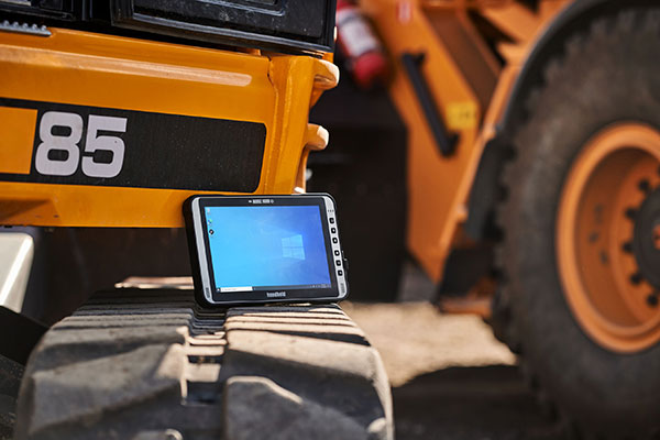
The Algiz 10XR’s screen features a glove/rain mode. (Photo: Handheld)
Handheld Group, a manufacturer of rugged mobile computers, has released the Algiz 10XR, a rugged 10-inch Windows tablet that combines durability with a GNSS receiver, 5G and future-proof features.
The Algiz 10XR was developed for field work or other challenging environments in markets such as logistics, mining, public transport, public safety, waste management or geographic information systems (GIS). It also has also been designed with customization in mind.
The tablet has a dedicated multiband GNSS u-blox NEO-M8U receiver for accurate positioning. The NEO-M8U module offers u-blox’s untethered dead-reckoning technology, which provides continuous navigation even under weak GNSS conditions.
Other key features
future-proof 5G communication for live video streams and bandwidth-heavy tasks such as mapping
Intel Elkhart Lake x6000 platform for reliable performance
Windows 10 Enterprise LTSC (64 bit)
high-resolution, sunlight-readable 10-inch touchscreen with super-hardened glass and rain-and-glove mode
future-proof 5G capabilities, 4G/LTE high-speed data, Wi-Fi, Bluetooth
IP65 and MIL-STD ruggedness
full-day, hot-swappable battery
optional, integrated barcode scanner and near-field communications.
The tablet is supported by a broad set of accessories for field professionals: carry cases, vehicle cradles, pole mounts, extended batteries, and a vehicle dock with antenna pass-through for both GPS and Wi-Fi.
“The Algiz 10XR will bring some great performance gains for our partners and customers who rely on Windows tablets in the field,” says Johan Hed, Handheld chief product officer. “We’ve worked with this segment for decades now and are confident that we’ve developed a device with not only great specs, but a complete accessory package to help our customers with their fieldwork.”
Bad Elf has introduced a base/rover feature built upon its Bad Elf Flex GNSS receiver. The new base/rover feature brings affordable centimeter-level accuracy to surveyors and geospatial professionals working anywhere in the world.
The solution consists of two Flex GNSS receivers and two UHF radios, allowing customers to perform high-accuracy field data collection in areas where traditional real-time kinematic (RTK) corrections or cellular coverage is not available. Existing Flex customers can upgrade by adding Flex radio kits.
Bad Elf designed the base/rover feature with emphasis on accuracy, affordability and versatility. The Bad Elf Flex enables reliable data collection either as a standalone receiver or paired with apps on iOS or Android phones and tablets. A checklist-based workflow ensures consistent results and eliminates many common issues associated with setup and deployment of a base/rover solution.
Photo: Bad Elf
“The Bad Elf app walks the user through these steps and more, and it doesn’t let the project proceed until each checklist is complete,” said Larry Fox, vice president of Marketing and Business Development at Bad Elf. “The automated checklists simplify every process, so that geospatial professionals and surveyors of every experience level get reliable results.”
The base feature requires only one Flex Extreme and a radio kit. Customers may choose to use either Standard or Extreme Flex with a radio kit for rovers. Using Flex Standard and one daily token provides access to the rover feature.
Bad Elf’s flexible hardware-as-a-service model provides a mechanism for customers to further reduce the capital cost of a complete base/rover system. In addition, customers can deploy multiple rovers in either configuration for larger projects.
“For about one-third of the purchase price of competing products available today, our base/rover feature makes survey-grade one-centimeter accuracy a reality worldwide,” said Fox. “And our pay-as-you-go Flex Token model dramatically reduces operating expenses by allowing users to activate — and pay for — just the service levels needed on a given day.”
Complete base/rover kits are available immediately, along with à la carte options for existing Flex customers. The Flex base/rover solution is compliant with FCC operating standards in the United States. Bad Elf provides customers with complete instructions for acquiring a radio operator license and call-sign designation.
A positioning service energizes large pipeline surveying projects, saves time, and becomes a field crew favorite
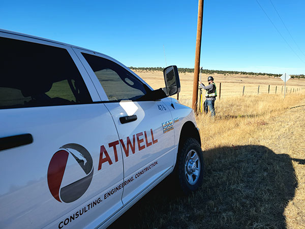
For projects spanning large areas, a large engineering and construction firm discovered that a precise point positioning (PPP) service — Trimble’s CenterPoint RTX — could solve the challenge of receiving high-precision GNSS in remote areas.
Atwell Group LLC is a national consulting, engineering and construction services firm with 33 offices throughout the country and more than 1,000 team members. The company delivers a broad range of strategic and creative solutions to clients in three core markets: oil and gas, power and energy, and real estate and land development.
Atwell provides comprehensive turnkey services, including land and right-of-way support, engineering, land surveying, environmental compliance and permitting, and project and program management.
Photo: Trimble
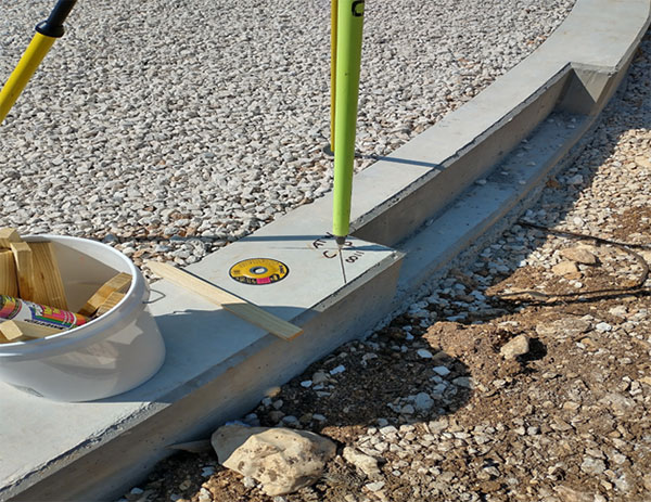
Pipeline construction
Atwell’s introduction to PPP and Trimble’s CenterPoint RTX took place during two large-scale linear pipeline projects within remote areas. Atwell has substantial experience with projects of this scale, but the remoteness of some of the projects’ sections was proving to be a challenge. While they could expect to rely on base or network correction methods for most projects, Atwell needed to seek other correction alternatives — and up their efficiency for the long-corridor projects.
With the CenterPoint RTX service at hand, Atwell performed construction staking and as-built surveys for a 50-mile pipeline. The project spanned a five-month period, with an hour or more of time saved each day using the service.
Crews noticed an additional benefit: rapid response time. On any given day, there could be project managers, right-of-way agents, or inspectors on site, asking for additional survey data.
“Inspectors and others started to notice how fast our crews could jump from one place to another and get the shots they requested, without having to do any base setups,” said Jason Jung, project manager with Atwell.
“The speed at which our crews can get up and running with RTX is awesome.” — Jason Jung, 3D laser scanning projects manager, Atwell
Because of the range limits of base radios, the crews might have to do multiple setups of a conventional real-time kinematic (RTK) base each day. RTX removed this hindrance, saving the crews time by not having to use temporary RTK bases, which entails driving to base reference points, setup and teardown, and downtime from malfunctioning equipment and battery issues.
“RTX completely freed us from the time and hassle of base setups,” Jung said. “You turn it on, and it’s ready to go before you’ve had time to take a sip of coffee. And once our crews got used to it and gained confidence in the results, they have really loved this solution.”
Photo: Trimble
Scanning a pipeline
Atwell recently used CenterPoint RTX on a 135-mile large-diameter pipeline project that included 19 facilities along the route. Atwell provided as-built services related to the facilities using a Trimble X7 scanner.
The data captured was used to generate spatially correct site models that included the material traceability necessary to comply with Pipeline and Hazardous Materials Safety Administration (PHMSA) regulations. Crews used RTX to georeference point clouds from the scanner to provide the accuracy needed to comply with industry regulations. Each site was referenced with permanent monuments or scribes that tied into the master control system.
Crews also used the RTX service to establish hard checkpoints to meet Atwell’s strenuous quality-control requirements for ground targets, such as those used in UAS control work. To do the daily “in and out” check shots, they used the free BenchMap app to locate nearby survey control marks from the National Geodetic Survey database. Most checks were sub-0.08’.
The time saved in not having to change base positions, as well as setup and breakdown, were significant time savers along this lengthy project. The precisely registered scans helped speed up PHMSA required inspections and audits, and construction change management field operations.
A crew favorite
Atwell’s crews use Trimble R10 receivers and Trimble Access running on TSC7 controllers, but Jung noted that they have recently upgraded to some R12i GNSS receivers, “and they are already earning their keep.” He expects to realize even more benefits from RTX coupled with the advanced multi-constellation capabilities of the Trimble ProPoint RTK engine in the R12i.
RTX has not only become a crew favorite, it is fast becoming a go-to solution for many Atwell projects.
SPH Engineering has launched a new product to make bathymetric surveys of inland and coastal water.
The system — an unmanned aerial vehicle (UAV) integrated with an echo sounder — is time- and cost-efficient. It is suitable for mapping, measuring and inspecting tasks as well as environmental monitoring.
The system allows field workers to collect data with high accuracy quickly. It is easily transported, quickly deployed and twice as cost-efficient as traditional methods.
The UAV/echo sounder system can be operated in hard to reach locations, and unsafe or hazardous environments. Locations not reachable by foot or that are dangerous for a human (steep coasts, mining pits, contaminated waters, terrain obstacles, etc.) as well as waters of ponds, lakes, and canals can be reached by the drone.
“Since autumn 2018 we have been getting bathymetry-related requests,” said Lexey Dobrovolskiy, CTO of SPH Engineering. “Analyzing about 150 inquiries, we have come to the conclusion that a drone-based solution could open a new business opportunity for drone service companies to do bathymetry surveys of coastal and inland water, especially those for industrial needs.
“Compared with a standard approach using a boat or an unmanned surface vehicle, a drone could save a lot for its user,” Dobrovolskiy said. “An echo sounder itself could be integrated into a client’s drone with no need to purchase additional equipment. Moreover, it is small and easy to transport and operate. At the same time, such research method guarantees data accuracy and employee safety.”
Sokkia has introduced a pair of software solutions for its total stations, robotics and GNSS rover systems — GeoPro Field and GeoPro Office.
Sokkia GeoPro Field software.
GeoPro Field provides a graphical user interface designed to collect field measurements for land surveying and construction activities.
“End-users needing a field tool to collect and import measurement data into design and drafting software will find GeoPro Field to be a fast and accurate method that will increase productivity with CAD functionality in the field,” said Ray Kerwin, director of global surveying products. “A key to GeoPro Field is its compatibility with various software workflows — point files are easily exported to third-party software.”
Sokkia GeoPro Office software.
Sokkia GeoPro Office is the office-processing complement to the field software — designed to clean, process, and analyze field data into its easiest-to-use form. “Users will immediately see the benefit in time saved, when compared to a variety of traditional manual methods,” Kerwin said.
The office software can also be expanded with an optional 3D and road design module, for further versatility to design roads with the processed field measurements.
“The Sokkia GeoPro Field and Office have user-friendly graphical interfaces, with simple in-field functions and office workflows. The user can get to work quickly due to the intuitive interface and simplicity of operation without the need for advanced training,” Kerwin said.
Handheld Group, a manufacturer of rugged mobile computers and tablets, has launched the Algiz 8X ultra-rugged tablet computer. The Algiz 8X is built for field workers who require a powerful, portable computer for mobile tasks.
The Algiz 8X offers GPS and GLONASS positioning via u-blox, along with an 8-inch projective capacitive touchscreen that is ultra-bright and built for outdoor use. Enabling glove mode or rain mode allows for operation in changing weather. The chemically strengthened glass survives an impact test in which a 64-gram steel ball is dropped on the screen 10 times from a height of 1.2 meters. The Algiz 8X also comes with an optional active capacitive stylus.
“The new Algiz 8X is the most compact and ergonomic Windows tablet we have ever developed,” said Johan Hed, director of product management.”We’ve pushed the limits of modern field technology with this product, fulfilling customers’ needs for powerful computing, mobility, outstanding screen performance and battery life. We made no compromises.”
Built-in features
The Algiz 8X rugged Windows tablet by Handheld Group. Photo: Handheld Group
The Algiz 8X comes standard with Windows 10 Enterprise LTSB to meet the needs of enterprise customers who value long-term stability. Other features include:
u-blox GPS and GLONASS
WLAN a/b/g/n/ac
BT 4.2 LE
A rear-facing 8 MP camera with autofocus and LED flash
4G/LTE
Expansion options
The Algiz 8X offers LAN port, COM port or barcode scanner options. It also features a “backpack” system that allows users to add custom features and electronics.
Ruggedness
The Algiz 8X is rigorously tested for use in tough outdoor and industrial environments. It’s IP65-rated for dust and water ingression and meets stringent MIL-STD-810G military standards for:
Operating temperature: -20°C to 60°C (-4°F to 140°F) — Method 501.5, Procedure II
Storage temperature: -40°C to 70°C (-40°F to 158°F) — Method 501.5/502.5, Procedure I
Drops: 26 drops from 1.22 meters (4 feet) — Method 516.6, Procedure IV
Vibration: Method 514.6, Procedures I & II
Humidity: 0-95% (non-condensing) — Method 507.5
Altitude: 4,572 meters (15,000 feet) — Method 500.5, Procedure I
Orders can be placed immediately. Units will be in stock in March 2017.
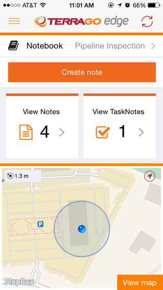
TerraGo and Eos Positioning Systems have entered a collaboration to combine the TerraGo Edge mobile GPS data-collection platform with the Eos Arrow line of sub-meter and centimeter accuracy receivers. The combination delivers a modern, cloud-based, real-time data collection capability, according to a TerraGo press release.
While the working environments and the projects are very different, customers in for water utilities, energy, survey and engineering are using TerraGo Edge and Eos Arrow receivers to replace traditional GPS handhelds for cost-savings and improved productivity.
Enmapp, a pipeline inspection company based in Canada, was able to cut hardware costs by 85 percent while capturing sub-meter data in real-time, eliminating all the costs of post-processing handheld data.
Summit Engineering, a Colorado-based engineering and land surveying firm, was able to reduce hardware costs by over 50 percent and improve productivity by more than 30 percent while surveying power lines in Minnesota for one of the country’s largest energy companies. Similar performance improvements and cost reductions are reported by joint customers in water utilities, forestry, engineering, agriculture and environmental operations, TerraGo said.
“When we talk about Eos Arrow, we’re not simply pairing their receivers via Bluetooth, there are millions of apps that do that without any meaningful integration,” said Dave Basil, VP of products and services at TerraGo. “We interoperate with their receivers at the software level to ensure our customers get the full real-time GPS data set so they can monitor, alert and capture data that meets the highest accuracy and quality standards. For customers, it’s as simple as Bluetooth pairing, but we’ve done the work to turn their phone or tablet into a survey-grade receiver.”
“TerraGo and Eos Positioning are strategic technology partners,” said Jean-Yves Lauture, chief technology officer of Eos Positioning Systems. “This means that our collaboration goes beyond simple marketing and includes sharing core technology for the benefit of our customers. For example, we have been able to share Eos software components, which TerraGo has built into the Edge app. This integration provides the full fidelity monitor and lossless capture of NMEA data from the Eos receivers, including the Arrow 200.”
TerraGo Edge version 3.7, now available, includes new intelligent, responsive forms, as well as GPS and GIS enhancements designed to dramatically improve the speed, quality and efficiency of asset inspections, land surveys and any location-based data-collection project.
TerraGo Edge smart forms can accelerate the data-collection process by automating and accelerating user entries while eliminating unnecessary or redundant steps. Smart forms can be customized to meet the workflow requirements of customers in any industry.
New features in version 3.7 include:
Advanced Form Creation with New Smart Forms
Form groups – new form element to organize multiple related fields
Conditional fields – additional fields appear based on user entry of other fields
Barcode and QR code support – instantly scans codes to eliminate manual entry
Calculated fields – calculated result field based on other form field values
Multiple form attachments – ability to attach two or more forms to a single Note
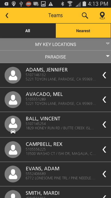
Trimble has announced the addition of a Supervisor app to its FieldMaster suite of mobile applications. The latest addition to the suite is designed to enable managers to stay efficient and effective on the go by empowering them to do more work in the field and manage their day-to-day operations remotely. With the FieldMaster Supervisor app, managers can leave the office and still have visibility into their fleet and mobile workers from their smartphone or tablet.
“Mobility is an increasingly valuable tool for field service organizations,” said John Cameron, general manager of Trimble’s Field Service Management (FSM) Division. “It allows a traditional office role to move into the field and still access up-to-date information about the performance of the field operation. The result is a more effective operation where managers in the field have the information they need at their fingertips.”
“I’m often meeting with customers or surveying a job so it’s important for me to know my technicians’ location,” said Dave Rowan, manager of Del-Mar Doors in Delaware. “I use FieldMaster Supervisor whenever I’m on the road. I can open the app and see where my team is, where they’ve been and how long they’ve been at each location. Having quick access to this information has improved my efficiency and productivity. FieldMaster Supervisor is an excellent tool.”
FieldMaster Supervisor is available with Trimble Fleet Management and Trimble Work Management solutions. Features include:
Viewing all locations of your entire team on a map
Seeing each team member’s job progress, including tasks at riskF
Finding the nearest worker to another team member or customer
Navigating to key locations using turn-by-turn directions
Inspecting job performance and documenting status in the field
Receiving important vehicle and driver performance alerts in real-time
FieldMaster mobile applications are a core component of FSM’s integrated suite of field service management solutions that includes Fleet Management, Work Management and Driver Safety. FieldMaster also includes a Technician app, which is an advanced collaboration tool for mobile technicians that allow them to receive, access and update job information in real-time for improved effectiveness on the job.
CartoPac International Inc. has announced a major new release of the CartoPac Mobile Platform. CartoPac 5.0 extends the mobile platform with support for Windows 8 and introduces the CartoPac Workflow Manager, which provides a structured process to manage the use of geospatial data across the enterprise.
CartoPac will demonstrate the applications and technologies of Version 5.0 in the free CartoPac Mobility Webinar Series beginning on September 30.
The CartoPac Platform is a configurable suite of field and office tools designed to maximize the productivity of crews as they digitally map, inventory and inspect critical assets using GPS-enabled mobile devices. Seamlessly integrating with the Esri ArcGIS Server, CartoPac is used extensively by oil and gas companies, pipeline operators, electric utilities, state/local governments and environmental engineering firms to populate the enterprise GIS and asset-management systems with captured infrastructure information.
The new CartoPac Workflow Manager (CWM) in CartoPac 5.0 provides organizations with a structured workflow to view, edit, validate and approve asset data as it moves from the field back into the enterprise. CWM ensures that individuals responsible for data are notified as it comes into the organization so they can incorporate the data into systems related to work-order fulfillment, risk analysis, integrity modeling and other asset management processes.
CartoPac developed CWM for the management of heavily regulated assets in the field, such as gas pipelines and electric distribution infrastructure. A module within the CartoPac Server, the CWM extension creates an audit trail of all the edits and modifications made to the data sets that represent the monitoring and maintenance of real world assets in the field.
“CartoPac Workflow Manager fills the gap between data collection and enterprise asset management systems to enable organizations to maximize the value of their data,” said CartoPac CIO Scott Crouch. “CWM enables organizations to show regulators they have a structured process for tracking and responding to the conditions of their critical assets and has proven to be key component for assisting companies with their regulatory compliance and integrity management programs.”
Further expanding the capabilities of the CartoPac mobile components, version 5.0 has been optimized for the Windows 8 operating system running on standard GPS-enabled laptop computers and tablet devices. This migration means that crews can use CartoPac to collect and manage asset data in the field on the same hardware devices they will use back in the office to run their daily business applications.
“The attractive cost, integration with GPS and expanded performance of Windows 8 tablets and laptops will enable organizations to put more personnel into the field, ensuring that vital infrastructure is mapped, inventoried and properly managed,” said Crouch “Laptop/tablet-equipped maintenance personnel in the field will now be able to run CartoPac solutions on the hardware they already use for tracking repairs and closing work orders.”
To demonstrate the advantages of enterprise asset management, CartoPac has launched the CartoPac Mobility Webinar Series, which will feature applications by electric and gas utilities and highlight new mobile technologies. The first webinar, “Applying New Mobile Technologies to Electric Utility Inspections,” will be presented with EDM International Inc., a Colorado electric utility services company.
The free “Applying New Mobile Technologies to Electric Utility Inspections” webinar will be held on September 30, 2014, at 4:00 pm Eastern Time. To register, click here.