The Galileo High Accuracy Service (HAS) was tested under real farming conditions to assess its performance and suitability for precision agriculture
The European GNSS Service Centre (GSC) of the European Union Agency for the Space Programme (EUSPA) partnered with Hemisphere GNSS and Case New Holland to test the suitability of the Galileo HAS service for precision agriculture.
The tests were performed at the New Holland campus in Peñarrubias del Pirón, Segovia, Spain.
The working width used for the test was 2.55 m, while the test area covered approximately 20,000 m² with a perimeter of about 740 meters. During the three-hour test, the teams collected GNSS data to analyze the pass-to-pass and absolute accuracy metrics. Pass-to-pass accuracy is the relative precision of a guidance system to maintain a consistent distance between adjacent, parallel machine passes within a short timeframe (usually 15 minutes). It is crucial for reducing gaps and overlaps during planting, spraying, and harvesting.
Test campaign
The test campaign aimed at proving that the tractor consistently maintained the specified path accuracy during consecutive passes. This would show that HAS can optimize agricultural operations by reducing costs associated with overlaps (reworking the same area), leading to savings such as reduced fuel consumption, minimal input waste, and improved crop yield.
For the test setup, in addition to the onboard guidance system, an independent antenna was mounted on the tractor cab. This antenna was connected to two positioning solutions: one based on the Galileo HAS and another based on an RTK solution.
An RTK base station deployed for the occasion provided the rover with precise RTK corrections and enabled generating a “reference path” against which to compare the tested Galileo HAS, in this case based on corrections obtained directly from the signal in space (SIS) via the Galileo E6 band.
The driving was performed in automatic mode, with manual intervention required only for turning at the end of each pass. The autosteering system of the tractor would then automatically reconnect with the following path, as calculated at start-up.
Test results
The test began with the GNSS receiver in Cold Start mode, requiring it to obtain ephemerides and process satellite data before achieving precise positioning. The convergence time was calculated and is shown as the red area in the image below. The green area shows when the tractor started along the predefined paths and hence when the data was used for the pass-to-pass accuracy calculation.
Converge time and data set during the test. (Credit: EUSPA)
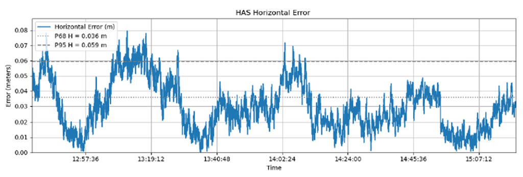
The data analysis showed that the Galileo HAS system consistently maintained horizontal errors of 3-6 cm.
With a 95% horizontal error of 5.9 cm and its maximum value below 8 cm, the error remains well below the 20 cm HAS accuracy target.
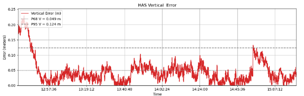
As regards the vertical axis, the 95% vertical error was 12.4 cm, with its maximum value below 25 cm, (remaining well below the 40 cm HAS accuracy target).
Galileo HAS signal vertical error. (Credit: EUSPA)
The horizontal error of the HAS service relative to the RTK reference baseline is shown in the following figure.
Galileo HAS signal horizontal error. (Credit: EUSPA)
Regarding the pass-to-pass accuracy, the analysis shows an overall pass-to-pass accuracy of 1.18 cm, demonstrating highly stable performance throughout the test period.
Year-to-Year accuracy was not part of this testing campaign but will be analysed in the next testing campaign.
Galileo HAS potential confirmed
The Galileo HAS service is an open, standardized correction service distributed directly via Galileo E6 or the internet (with global coverage) and the test campaign results confirm its potential to generate savings to farmers in terms of fuel consumption, fertilizers, seeds and other inputs, by reducing overlap in field operations.
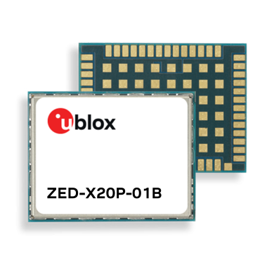
ZED-X20P-01B adds Galileo High Accuracy Service (HAS), Moving Base, and stronger resilience against jamming and spoofing, enabling scalable high-precision positioning for global OEM deployments.
U-blox has launched and availability of its new all-band GNSS module variant, the ZED-X20P-01B.
Building on the proven capabilities of the ZED-X20P platform, the new module expands access to high-precision positioning by bringing global precise point positioning (PPP) to a broader range of use cases. With support for Galileo High Accuracy Service (HAS) the ZED-X20P-01B enables OEMs to launch products with reliable, decimeter-level positioning across markets worldwide, without tying product availability to local correction infrastructure.
The ZED-X20P-01B extends u-blox expertise in GNSS by addressing a growing market need: making high-precision positioning more practical to deploy at global scale. By integrating enhanced PPP capabilities, including Galileo HAS functionality, and improving resilience against jamming and spoofing (verified at Jammertest 2025), the module gives developers a dependable positioning that can serve both as a primary global solution and as a fallback where local RTK correction services are limited, unavailable, or impractical. This flexible approach opens new opportunities for global OEMs to design and ship products with reliable decimeter-level accuracy out of the box across regions, applications, and operating conditions.
The ZED-X20P-01B. (Credit: U-blox)
Built for global OEM deployment
The ZED-X20P-01B is especially valuable for products shipped across regions with inconsistent access to RTK networks, SBAS coverage, or reliable communications. This gives manufacturers a more flexible path to delivering high-precision positioning worldwide, while also opening new opportunities in remote, rural, and infrastructure-limited environments.
Representative applications include:
UAVs without reliance on continuous connectivity for mapping and navigation:
Marine applications such as dredging, near-shore navigation, and seabed mapping without complex RTK setup
Precision agriculture, construction and mining in remote locations, including geofencing and equipment tracking
Environmental and utility mapping in infrastructure-limited regions
Robotics and autonomous platforms requiring reliable relative positioning through Moving Base functionality.
Enhanced performance and robustness
The ZED-X20P-01B builds on the core strengths of the ZED-X20P while introducing key enhancements:
Native support for Galileo HAS for globally accessible PPP corrections
Moving Base functionality for applications requiring precise relative positioning
Improved jamming and spoofing detection and mitigation for mission-critical applications
Continued compatibility with u-blox PointPerfect services for scalable correction options.
Together, these enhancements help OEMs deliver reliable high-precision positioning across wider geographies and more demanding RF environments, while keeping system design streamlined. Most importantly, they make decimeter-level accuracy out of the box a practical option for products deployed globally.
Ease of integration and scalability
Maintaining the established ZED form factor, the ZED-X20P-01B offers a seamless upgrade path for existing customers. With its compact design it reduces the need for additional hardware or complex host-side computation.
This helps developers accelerate time to market and scale from pilot projects to global commercial rollouts without redesigning their systems for each target region. For OEMs building products for international shipment, the ZED-X20P-01B offers a practical way to standardize around one high-precision platform while expanding coverage, improving resilience, and simplifying deployment.
“ZED-X20P-01B reflects our commitment to making high-precision positioning more scalable, resilient, and easier to deploy globally,” said Andreas Thiel, CEO of u-blox, said. “With Galileo HAS support, Moving Base, stronger protection against jamming and spoofing, and a seamless path for existing ZED-X20P customers, we are enabling OEMs to bring reliable decimeter-level positioning to more products, in more markets, with fewer deployment constraints.”
Experience ZED-X20P-01B live
U-blox will showcase the ZED-X20P-01B at XPONENTIAL 2026 in Detroit, where visitors can experience the module live at booth 23023.
Availability
Samples and evaluation kits for the ZED-X20P-01B will be available in June.
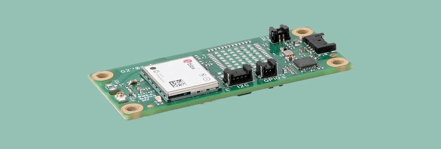
Syslogic has introduced a GNSS expansion board for its rugged embedded computers.
Based on u-blox GNSS technology, the board provides centimeter-level positioning, opening up new applications across industries such as autonomous field management, operation of construction machinery in remote areas, or navigation of automated guided vehicles and autonomous mobile robots.
All-band, multi-frequency reception and HAS-ready
Syslogic’s all-band GNSS board is powered by the u-blox X20 receiver, supporting all major GNSS constellations and frequencies, including L1, L2, L5, L6 and L-band. This enables the use of the upcoming Galileo High Accuracy Service (HAS).
HAS supplements standard Galileo Open Service positioning with correction data transmitted directly over the E6/L6 band. The result is centimeter-level positioning via GNSS signals — without the need for traditional RTK base stations, costly reference networks, or 5G connectivity. HAS is free and globally available.
The u-blox X20-based GNSS board also supports simultaneous multi-frequency reception. With additional frequencies compared to previous models, typical GNSS errors — such as multipath effects and signal blockage — are significantly reduced, particularly in urban environments. This is crucial for applications that demand highly precise and reliable positioning, including surveying, autonomous vehicles, agricultural machinery and industrial automation.
The GNSS board is designed for worldwide use. The integrated u-blox receiver supports modern correction techniques such as RTK, PPP-RTK and PPP. For the first time, it has been fully optimized for PointPerfect Global, u-blox’s proprietary high-precision GNSS correction service, delivering centimeter-level positioning anywhere in the world. This is particularly useful in remote areas without cellular coverage. PointPerfect Global uses advanced PPP-AR technology (precise point positioning with ambiguity resolution), providing corrections via the Internet or L-band satellite transmission. The service achieves convergence times of less than 2 minutes and positioning accuracy within 10 centimeters.
The new expansion board is compatible with Syslogic embedded computers, including both Nvidia Jetson-based and x86-based devices. It is available with either one or two receivers, enabling RTK and heading functions without additional hardware. Vehicles and machines can be positioned with centimeter-level accuracy.
Several Syslogic customers are already using the GNSS functionality in pilot projects, including precision farming and construction machinery monitoring.
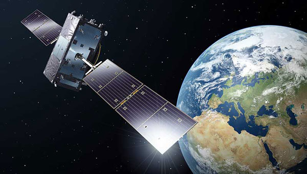
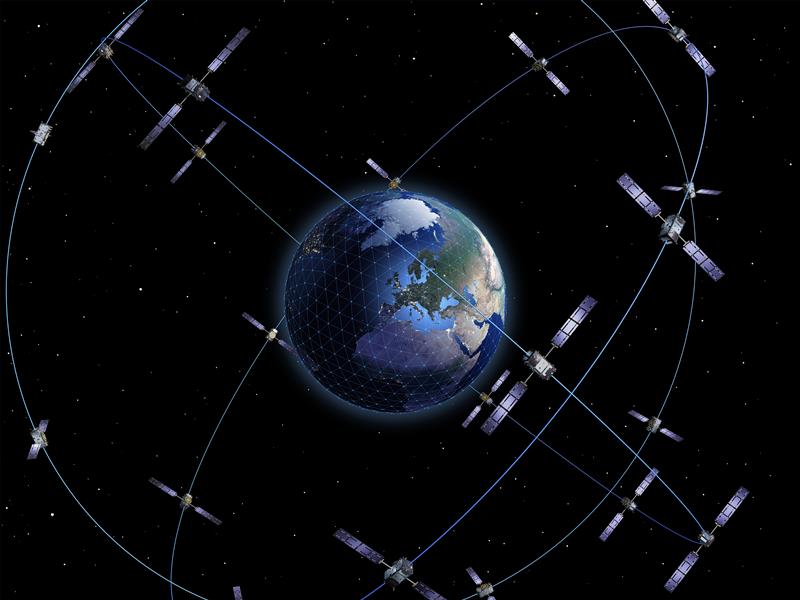
Developed by the European Union, Galileo is an independent, global, satellite-based navigation system that provides a range of services. Among its most significant advancements is the Galileo High Accuracy Service (HAS), which aims to offer free, high-precision positioning to users worldwide. This article explores Galileo HAS, covering its history, architecture, implementation phases, performance, limitations, and future prospects.
What is the Galileo High Accuracy Service?
Galileo HASis a precision augmentation service leveraging precise point positioning (PPP) to provide corrections to GNSS signals, aiming at a positioning accuracy of less than 20 cm horizontally and 40 cm vertically. Unlike the traditional real-time kinematic (RTK) method, which depends on local reference stations, HASdelivers corrections globally via Galileo satellites using the E6-B signal, as well as over the Internet. The service provides corrections for measurements on multiple frequencies across both Galileo and GPS constellations, enhancing real-time positioning performance.
The concept of a high-accuracy service for Galileo was driven by growing demand for decimeter-level accuracy in applications such as precision agriculture and autonomous vehicles. Initially envisioned as a paid service under the Galileo Commercial Service, feasibility studies in 2014 confirmed its potential. In 2018, the European Commission decided to offer HASfree of charge.
In the Galileo HASspecifications, two Service Levels are defined. Service Level 1 with global availability and the enhanced Service Level 2 for the European Coverage Area. The Galileo HASroadmap consists of three phases: Phase 0 (testing and experimentation), Phase 1 (Initial Service), and Phase 2 (Full Service). After extensive internal testing, Phase 1 was officially launched in January 2023, marking a significant milestone in Galileo’s evolution as a leading GNSS provider. Phase 2 is currently in development and expected to launch in the near future.
Technical Components
Galileo HASis designed with several key components that enable its high-precision capabilities. One of the most critical aspects involves orbit and clock corrections. These corrections compensate for inaccuracies in satellite orbital positions and clock errors, which are major sources of positioning errors in standard GNSS. Another essential element of HAS is the provision of signal bias corrections to enable precise carrier phase ambiguity resolution, which in turn greatly improves positioning accuracy. In the current Initial Service (Phase 1), Service Level 1provides only code bias corrections, along with orbit and clock corrections. In Phase 2, Service Level 1 will be upgraded to include both code and phase bias corrections, while Service Level 2will further add atmospheric (ionospheric and tropospheric) corrections for the European Coverage Area.
Capable GNSS receivers decode the high-accuracy corrections broadcast on the E6-B channel for Galileo (E1, E5a, E5b, E5, AltBOC, E6) and GPS (L1, L2, L5) signals and apply them via algorithms to enhance positioning solutions. This refines raw measurements to reduce errors, providing decimeter-level accuracy for use in fields rangiranging from ecological surveys to city infrastructure management and routine mapping tasks.
In addition to satellite broadcasts, the corrections are also made available over the Internet via the NTRIP protocol, providing an alternative access method for users with network connectivity. Notably, receiving HAS corrections via NTRIP eliminates the need for a receiver with E6-B capability, but the receiver still needs to implement the PPP algorithm to process the corrections.
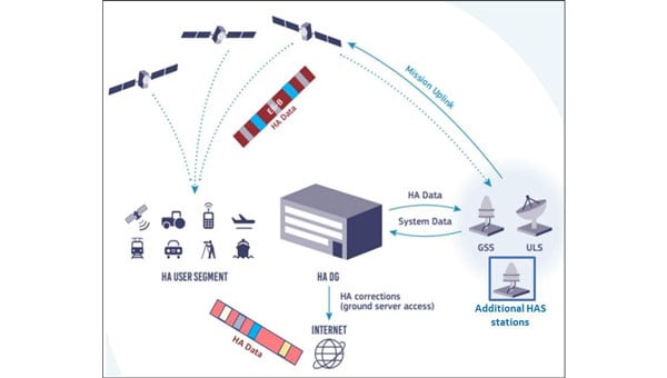
Architecture
The Galileo HASrelies on the robust infrastructure already established within the Galileo system. At the foundation of this network are the Galileo Sensor Stations (GSS), a global network of 15 monitoring stations (according to the latest updates). These stations play a vital role by continuously collecting GNSS measurements, which serve as the raw data needed to generate precise corrections. The collected data are then processed by the High Accuracy Data Generator (HADG). This system analyzes the GSSinput and produces high-precision corrections for both Galileo and GPS signals. Once the corrections are prepared, they are transferred to Uplink Stations (ULS), which transmit the correction data to the Galileo satellites for distribution via Signal-in-Space, or to an NTRIP caster for distribution over the Internet. In the case of Signal-in-Space distribution, the Galileo satellites themselves serve as the delivery mechanism to users worldwide, broadcasting the corrections globally via the E6-B signal.
The HAS is being rolled out in three phases, ensuring progressive development and refinement:
Phase 0 (2020–2022): Internal Testing
Focused on validating the feasibility of broadcasting HAS corrections via the E6-B signal.
Tests involved internal and external stakeholders, with feedback used to refine the service.
Phase 1 (January 2023–Present): Initial Service
Declared operational on January 24, 2023, Phase 1 provides Service Level 1 with global coverage, though with reduced performance compared with the enhanced Service Level 1 expected in Full Service (Phase 2).
Current corrections include orbits, clocks, and code biases.
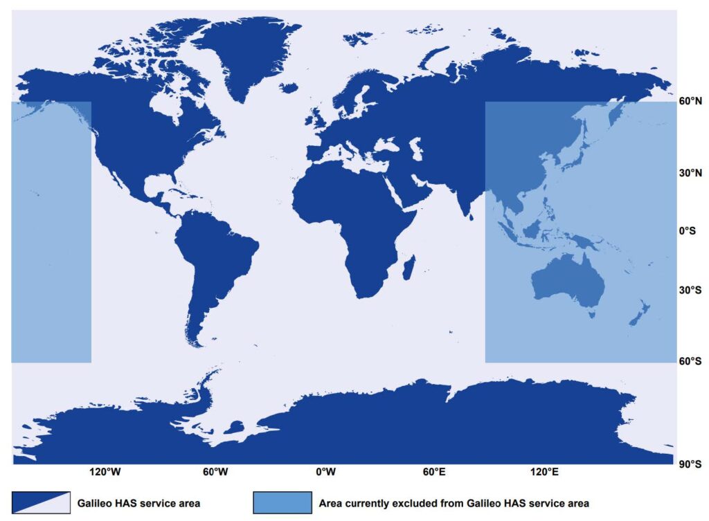
The service area excludes certain regions (e.g., parts of the Pacific and Australia) because of infrastructure limitations.
Convergence time is specified as <300 seconds (Service Level 1) or <100 second (Service Level 2), with horizontal accuracy <20 cm and vertical accuracy <40 cm under optimal conditions. Currently, accuracy <20 cm may be achieved with a convergence time up to 60 minutes, owing to the lack of phase bias and atmospheric corrections.
Phase 2 (Future): Full Operational Capability
Will provide full Service Level 1 performance globally with horizontal accuracy <20 cm and vertical accuracy <40 cm, adding phase bias corrections for faster convergence <300 seconds.
Will introduce Service Level 2 for regional coverage in Europe with horizontal accuracy <20 cm and vertical accuracy <40 cm, adding phase bias and atmospheric corrections for faster convergence (<100 seconds).
Will include data authentication and enhanced infrastructure for improved reliability and coverage.
Challenges and Limitations
The current capabilities of Galileo HASare constrained by several limitations, which are expected to diminish as the system evolves. Global coverage is not yet fully established, with parts of the Pacific region and Australia remaining outside the service area. While users can receive HAScorrections anywhere in the world, the official performance specifications apply only within the service boundaries. However, even within the service area, achieving the specified accuracy presently requires long convergence times, limiting applicability in scenarios that demand rapid solutions. Convergence time is expected to decrease significantly in Phase 2, when phase bias and atmospheric corrections are introduced.
As of 2025, relatively few commercial receivers support HAScorrections via E6-B, with availability concentrated in professional and industrial receivers. The lack of integration into mass-market devices limits broader adoption, reflecting both the technology’s ongoing development and the additional hardware complexity required to receive HAScorrections.
Finally, while decimeter-level corrections are sufficient for a wide range of applications, many professional domains, such as surveying, demand cm-level accuracy. Even at Full Service, HASwill not provide this level of precision, meaning that certain fields will continue to rely on RTK. However, considering that most RTK vendors require a paid subscription or charge per hour, HAScan still provide great value to surveyors and other professionals through its use in preliminary work or applications where cm-level accuracy is not critical, offering decent accuracy free of charge.
The Galileo constellation was recently reinforced with satellites 31 and 32, which became operational in January 2025, while the ground segment underwent major upgrades in 2024. Despite these improvements, Phase 1 (Initial Service)remains the only operational HAS capability. As of September 2025, Phase 2remains in active development. In January 2025, it was announced that the European Union Agency for the Space Programme (EUSPA) awarded GMV a 45-month, €12 million contract to develop an enhanced HADGthat will support enhanced Service Level 1 globally and Service Level 2 for Europe. The contract’s duration provides an indication of the anticipated timeline for completion.
An inquiry regarding the timeline for Galileo HASService Level 2 (Phase 2) was submitted to the European GNSS Service Centre (GSC) Helpdesk. Their reply stated that the schedule is not available at this time and will be announced through GSC channels once released.
Wider adoption is anticipated as more GNSS receivers capable of receiving and decoding the E6-B signal to process HAScorrections become available, enabling sectors such as autonomous transportation, fleet management, and smart agriculture to capitalize on improved performance. Adoption is also expected to accelerate when Galileo HAS reaches Full Operational Capability with the launch of Phase 2, which will reduce convergence times and broaden the system’s applicability.
Ultimately, Galileo HASis positioned to become a cornerstone of high-accuracy GNSS, democratizing access to professional-grade precision.
Buoys located via GNSS and electromagnetic signals enable divers to navigate underwater in a way that is gentle on the animals. A head-up display in the mask shows the appropriate routes.
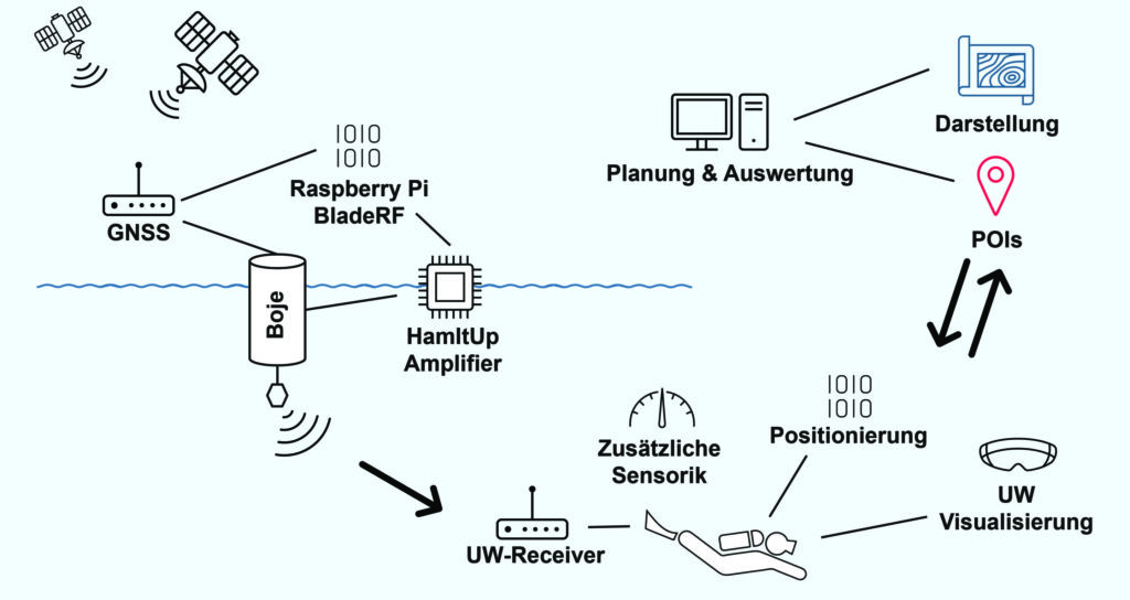
A team led by Philipp Berglez from the Institute of Geodesy at Graz University of Technology, Styria, Austria, has developed a navigation system for divers that uses GNSS-supported buoys. The buoys emit electromagnetic signals to enable animal-friendly, precise positioning underwater.
Using a heads-up display in their mask, divers can find their way to their desired destinations, back to the dive boat, or around restricted areas. The divers also can always be found in an emergency.
Wave propagation the biggest challenge
The navigation system’s operating principle combines the precision of satellite navigation with the transmission of electromagnetic signals underwater. The buoys are placed in the operational area and determine their position via GNSS, more specifically via the Galileo High Accuracy Service (HAS).
A signal generator in the buoys sends electromagnetic signals to the divers, who carry a receiver the size of a cookie. Since several buoys communicate simultaneously with the divers’ receivers, the various distance information can be used to determine their position and depth using trilateration.
TU Graz and partners have developed a GNSS navigation system for divers. (Credit: TU Graz, Institute of Geodesy)
Ocean environment. “The biggest challenge for us was calculating the propagation of the electromagnetic signals underwater to obtain the appropriate distance values,” Berglez said. “The properties of the water — such as salinity, temperature, depth or conductivity — have a major influence here. Due to these diverse and variable influencing factors, modeling the propagation properties underwater was particularly challenging.”
The research team succeeded in transmitting signals horizontally over 150 meters, but the scientists still see considerable potential for optimization when it comes to penetrating greater depths of up to 100 meters.
Applications. The underwater navigation system is useful for divers in several applications. In the tourism sector, it is ideal for sport and recreational diving, where dive sites equipped with position buoys help visitors find underwater sights. They can see the route there on the mask’s head-up display. The company Oxygen Scientific has already developed a head-up display mounted on the mask.
The system is also useful in the fields of aquatic ecology, underwater archaeology and underwater debris documentation.
Wildlife Friendly. It was important to the project team that the system, unlike sonar, would not impact wildlife. Test measurements were conducted with golden rainbow trout, which are normally very sensitive to external influences.
During measurements with different transmission power levels, the fish showed no abnormal behavior, and they continued to behave normally even after the measurements were completed. The golden trout were equally unaffected one week, one month and four months after the measurements, ruling out any delayed negative effects with a very high degree of probability.
In addition to TU Graz, project partners included pentamap GmbH, 1st-Relief GmbH, Oxygen Scientific GmbH, Disaster Competence Network Austria , and the Austrian Center for Research Diving.
On June 28-29, the European Union Agency for the Space Programme (EUSPA) will host Galileo High Accuracy Service (HAS) Days for users, industry stakeholders, application developers and international experts to learn more about HAS. This event provides an opportunity for all attendees to discuss and share expectations of Galileo HAS, its challenges, and benefits.
Over two days, participants will learn more about the status of Galileo HAS, including current performance, evolution plans and key user applications. There will also be dedicated user sessions, including live demonstrations allowing participants to experiment the Galileo HAS capabilities.
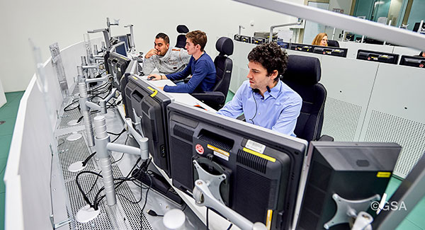
In addition, participants will visit the European GNSS Service Centre (GSC), the single interface between the Galileo system and the users. The GSC is a center of expertise, knowledge sharing, custom performance assessment, information dissemination and support to the provision of value-added services enabled by the Galileo services.
The GSC hosts the high accuracy data generator, which computes the HAS orbit and clock corrections as well as the signal biases that are broadcast through the Galileo constellation and over the internet.
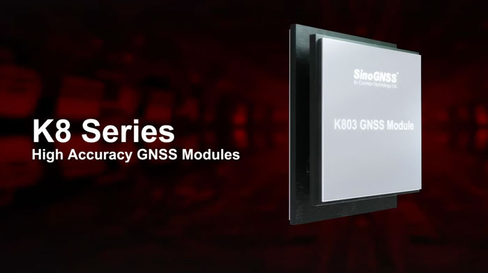
ComNav Technology’s K8 series GNSS modules can use the Galileo High Accuracy Service (HAS) precise-point positioning (PPP). The PVT algorithm upgrade to the K8 series module supports Galileo HAS with an accuracy of 20 cm horizontally and 40 cm vertically.
Galileo HAS provides free access to information necessary to estimate accurate positioning using a PPP algorithm in real-time through the Galileo signal E6-B and an internet connection. Galileo HAS Initial Service was declared on January 24, enabling users within the service area to achieve improved positioning performance.
The improved performance capabilities provide a higher level of accuracy for industries such as UAV, autonomous driving, intelligent transportation, agriculture and GIS collection.
Eos Positioning Systems has released its Arrow Gold+ GNSS receiver, which supports the Galileo high-accuracy service (HAS). Arrow Gold+ enables users to achieve better than 20 cm accuracy with 95% confidence using Galileo HAS.
The Arrow Gold+ is one of the first high-accuracy GNSS receivers that supports Galileo HAS and is designed specifically for the geographic information systems market. Additional signal support for Arrow Gold+ includes: the concurrent use of the BeiDou B3 and GPS L5 signals as well as GLONASS, BeiDou, QZSS and IRNSS signals.
Galileo HAS is a differential correction service from the European Space Agency and European Union Agency for the Space Programme. The service became available on January 24, and it is the first global differential correction service to provide sub-meter accuracy to compatible GNSS receivers anywhere in the world.
For more information on the Arrow Gold+ click here.
What would be required for the United States to develop and deploy a GPS high-accuracy service analogous to Galileo’s HAS?
Ismael Colomina
“Galileo HAS is a particular implementation of a PPP-RTK service. U.S. companies are already providing similar fee-based services that are even more accurate than HAS. Therefore, there is no big technical challenge for the United States to provide a GPS HAS. Actually, the European Union already provides a HAS for GPS. It is more a question of strategy for GPS policy makers: which user segment to service with a HAS-like augmentation? What about other services analogous to Galileo’s OSNMA and the upcoming CAS [commercial authentication service] for resiliency purposes? In short, a HAS-like service would just require including it in the U.S. GNSS evolution roadmap.”
— Ismael Colomina GeoNumerics
John Fischer
“The challenge is probably more political than technical. The U.S. government usually refrains from competing with commercial services. The prevailing attitude in the United States is that the private sector is more efficient than the public sector. Maybe the most practical approach is for the government to provide the authentication mechanism and open access to the data required, then allow the private sector to offer services. There isn’t a pressing need for high-accuracy GPS for transportation — it needs resiliency/reliability. However, precision agriculture needs it, so maybe sponsorship from the Department of Agriculture would be more effective than from the Department of Transportation.”
— John Fischer Orolia
Mitch Narins
“When I saw this question, my first impression (as a systems engineer) was to ask ‘For whom? For what applications? For which services?’ (Positioning? Navigating? Time/frequency?) Many have concentrated on accuracy, competing in a GNSS Olympics to see who can achieve ‘the best’ position accuracy and precision (repeatability). Finally, (thanks to Logan Scott) integrity is being pushed beyond just SBAS and GBAS, and real civil authentication of signals is being pursued. I can promise nanometers/nanoseconds if I don’t have to prove it’s true. While we finally understand the need for zero trust, we must still address loss of service by establishing real complementary PNT.”
The high-accuracy service (HAS) offered by Galileo is now available and provides sub-meter accuracy over most of the globe. It will help enable emerging technologies such as UAVs and autonomous vehicles, which require stringent levels of accuracy for better navigation, safety and efficient traffic management.
Other industries expected to benefit include transportation, agriculture, geodesy and entertainment.
Thierry Breton, European commissioner for Internal Market, announced that the service was now live during the annual European Space Conference in Brussels, Belgium, on Jan. 24.
The European Union Agency for the Space Programme (EUSPA) developed Galileo HAS along with the European Commission and the European Space Agency (ESA). The new service will become a pillar of government programs such as EU sectorial policies and national policies by EU Member States.
“This new service has been made possible thanks to the outstanding cooperation and team commitment of all involved partners,” said Rodrigo da Costa, EUSPA executive director.
“Galileo is not standing still,” said Javier Benedicto, ESA director of navigation. “This new High Accuracy Service offers a new dimension of precision to everyone who needs it, while the Open Service Navigation Message Authentication — already available — allows users to authenticate Galileo signals as they make use of it, to minimize any risk of spoofing. An upgraded integrity message of the signal rolled out last year reduces the time to first fix while enhancing the overall robustness of Galileo.”
Galileo HAS delivers horizontal accuracy down to 20 cm and vertical accuracy of 40 cm in nominal use conditions, according to ESA. The service is transmitted directly via the Galileo signal in space (E6-B) and through the internet.
With HAS, Galileo becomes the first constellation worldwide able to provide a high-accuracy service globally and directly through the signal in space.
The service is freely accessible to all users with a receiver capable of processing the HAS corrections broadcast in the E6-B signal and via the internet. The precise corrections provided by Galileo HAS will allow users to reduce the error associated with the orbit and clocks provided through the Galileo Open Service broadcast navigation messages and the GPS Standard Positioning Service navigation data.
“With the Galileo HAS we are ready to unleash the full potential of new technologies such as drones and bring autonomous driving closer to reality,’’ da Costa said. “At EUSPA, our role is to link space to user needs. With the launch of this new service, we met a clear market demand for accurate, robust, and reliable navigation.”
Galileo High Accuracy Service one step closer to initial launch
The EU Agency for the Space Programme (EUSPA) has published the first Galileo High Accuracy Service Signal in Space Interface Control Document (HAS SIS ICD). The document can be downloaded here.
The HAS SIS ICD was published by EUSPA together with the European Commission and the European Space Agency (ESA).
By providing free-of-charge, high-accuracy precise point positioning (PPP) corrections through both the Galileo signal (E6-B) and via the internet, the HAS will offer users improved positioning performance with an accuracy of less than two decimeters.
“Galileo will be the first GNSS constellation capable of providing a high-accuracy service directly through the signal in space,” explained Guerric Pont, Galileo Services, EUSPA program manager. “This is unique in that, typically, high-accuracy services are based on accurate satellite and atmospheric data provided from a third party, but not directly from the GNSS.”
According to Pont, high-accuracy services are experiencing a massive boost in interest, thanks in large part to new capabilities of GNSS receivers and the rapid emergence of new applications that require accurate location data.
“Currently, high accuracy is primarily used in such professional applications as surveying, precision agriculture and civil engineering, among others,” he said. “However, new and emerging applications, including autonomous driving, unmanned vehicles, robotics and a range of location-based services, will all welcome high accuracy.”
Pont also notes that, when used in synergy with Copernicus, the Galileo HAS will open up market possibilities and help design new services.
An ongoing process
In 2021, EUSPA, in coordination with the European Commission and ESA, published an Information Note on the Galileo HAS. The note provided an overview of the service’s main characteristics, along with information on such key features as service levels, targeted performance and markets, and a roadmap for implementation.
This was followed by a call for Expression of Interest for High Accuracy Service Testing, which invited external stakeholders to participate in a testing campaign of the Galileo HAS Signal in Space broadcasting. The goal of the campaign was to collect relevant feedback, not only on the HAS SIS ICD structure and implementation at the receiver level, but also on service-related aspects and specifications.
“The Galileo program has been performing a long set of HAS testing activities since 2019, which cumulated in the first-ever HAS signal broadcast in May 2021,” said Javier de Blas, EUSPA Commercial and HAS manager. “Based on the feedback gained during the joint efforts conducted by EUSPA, the European Commission and ESA, with the key support of European aerospace industry during the testing phase, we are now able to publish the first Galileo High Accuracy Service Signal in Space Interface Control Document.”
Following the publication of this HAS SIS ICD, the Galileo Program will continue deployment and service validation of HAS over the next months, in view of an operational declaration of HAS initial service, or HAS Phase 1, by the end of 2022. This will enable development of products in parallel to the gradual entry into full operational service in the next few years.
Galileo Control Centre in Oberpfaffenhofen, Germany. (Photo: ESA)
Spirent Communications plc has launched a commercially available simulation test solution for the Galileo High Accuracy Service (HAS), via a beta interface implementation based on HAS ICD version 1.2. During the development of the solution, Spirent collaborated with GMV, a leader in cutting-edge GNSS high-accuracy technologies.
Galileo HAS will provide free-of-charge high-accuracy Precise Point Positioning corrections through the Galileo E6-B signal, with accuracy under two decimeters, offering real-time improved user positioning performance. Developers need to be able to test their devices against this new service to ensure they can optimally capture the emerging capability when it becomes available. By integrating HAS simulation and capabilities, Spirent’s latest simulation solution enables customers to utilize and incorporate Galileo HAS as early as possible.
In February 2021, the European Union Agency for the Space Programme (EUSPA) awarded GMV with the contract for the implementation of the Galileo High Accuracy Data Generator (HADG), which will be the facility in charge of generating the high-accuracy corrections data to enable the provision of HAS. Spirent’s collaboration with GMV will prove a key element in the early adoption of the service.
“The high accuracy, feature richness and flexibility of Spirent’s simulator platforms provides an ideal foundation for the testing of innovative new Galileo services such as our recent Galileo HAS capability,” said David Calle, section head of advanced GNSS services at GMV’s aerospace sector.
“The high level of expertise and in-depth understanding of Galileo HAS within GMV provided important guidance as we implemented HAS on our simulation platform,” said Jan Ackermann, Spirent’s director of product line management. “This enabled us to again be the first in the industry to offer a commercial solution to simulate and test these important new capabilities.”