Max Weber famously described how bureaucratic inertia often leads formal organizations, such as government agencies, to devise new justifications for themselves after they have outlived their original purpose. That is certainly not the case for the U.S. Space Force, which is in its infancy and is responsible for key missions, including operating the Global Positioning System that it took over from the United States Air Force about two years ago.
However, bureaucratic inertia can also refer to the tendency of organizations to continue to pursue projects or approaches that may no longer be the best match for their goals, missions, or budgets. A recent, congressionally-mandated report by the United States Government Accountability Office (GAO) — Report to Congressional Committees, GPS MODERNIZATION: Space Force Should Reassess Requirements for Satellites and Handheld Devices, issued in June — questions the Space Force’s approach to modernizing GPS with a more jam-resistant, military-specific signal known as M-code.
In 2005, the Air Force launched the first GPS satellite capable of broadcasting the M-code signal, which is at the core of a multi-billion-dollar modernization and sustainment effort. Yet, 18 years later, widespread adoption of the technology is still hampered by delays in upgrading GPS ground and user equipment. Approximately 700 types of weapon systems — including ground vehicles, ships and aircraft — will ultimately require M-code-capable user equipment.
Providing M-code requires the cooperation of GPS’ ground, space and user equipment segments. Regarding the first one, the report states: “In 2022, Space Force further delayed delivery of the ground control segment due to development challenges. This delay pushes delivery until December 2023 at a minimum. Space Force officials have not finalized a new schedule and acknowledged that remaining risks could lead to additional delays.”
Regarding the space segment, it states: “Space Force met its approved requirement for 24 M-code-capable satellites on orbit but determined that it needs at least three more to meet certain user requirements for accuracy. Building and maintaining this larger constellation presents a challenge. GAO’s analysis indicates it is not likely that 27 satellites will be available on a consistent basis over the next decade.”
Finally, regarding the user segment, it notes that development of the Military GPS User Equipment (MGUE) Increment 1 has progressed “to the point where the military departments are ready to commence activities in support of testing and fielding it on the lead weapon systems.” However, it cautions that “[d]elays and unexpected challenges could affect the fielding of capability for some systems.”
GAO’s report recommends that the United States Department of Defense (DOD) assess the number of GPS satellites necessary to meet operational needs, and either develop a sound business case for the M-code-capable Increment 2 handheld, or not initiate the effort. The DOD concurred with both recommendations.
“Who Runs GPS?”, the special feature in our February 2023 issue, which detailed the structure of this vast enterprise, listed an executive committee, a coordination office, an oversight council, two Space Force commands, and, as partners, several federal departments and agencies. Has this complex structure become too diffuse to make tough decisions?
In early August, the U.S. Government Accountability Office (GAO) released its third report in 15 months about GPS and other positioning, navigation and timing (PNT) issues within the Department of Defense (DOD). Each report raised raised concerns about the way in which PNT programs were being managed and led within the department.
Observations included that DOD continues to rely heavily on GPS despite known vulnerabilities. Also, that alternate PNT efforts are not well coordinated and receive little support.
“Opportunities” for DOD to improve its alternate PNT efforts, according to the report, include:
Improving coordination across the services
Clarifying authorities and responsibilities for prioritizing needs
Focusing on resiliency versus GPS as the cornerstone of department PNT efforts
Clarifying PNT requirements rather than just defaulting to GPS as “the need”
The report pointed out that M-code has been in development for 20+ years, and that GPS satellites have been capable of transmitting M-code signals since 2005. Also, while there are still program risks, the Next Generation Ground Control Segment, known as OCX, is forecast to be ready to support M-code use by 2023.
OCX has experienced severe cost overruns and is more than five years behind its original schedule. GAO issued a report on OCX delays in May 2019.
M-code won’t really be a capability in DOD, though, until user equipment is widely fielded. That will take several more years, according to GAO.
One of the remaining challenges to M-code implementation, GAO said, was that the department did not collect and validate all the data it needed for leadership planning and prioritization.
A summary on the first page of the report contains what could be seen as harsh criticism of how PNT efforts are led within DOD:
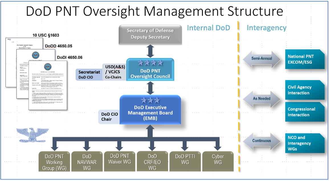
“DOD’s overall PNT portfolio is managed by the PNT Oversight Council, a statutorily established senior-level body. However, the Council has largely prioritized modernizing the existing GPS system over alternative PNT efforts during recent meetings and has no strategic objectives or metrics to measure progress on the alternative efforts.”
Image: DOD
Too Much Leadership?
Some believe the real problem with DOD PNT is not a lack of leadership, but rather too much.
“If everyone is in charge, no one is,” commented one retired senior military officer familiar with the issue.
“Congress has been concerned about DOD’s lack of attention to GPS and PNT alternatives for years,” the individual said. “In 2015 Congress mandated creation of the Oversight Council to help ensure PNT got the right amount of leadership attention.” This may have not had the desired effect, though.
“The council is comprised of three undersecretaries, the vice chairman [of the Joint Chiefs of Staff], four combatant commanders, the NSA [National Security Agency] director, DOD’s CIO [chief information officer], and host of other very senior folks. All of whom have way too many other duties. It’s no wonder the department has a hard time getting things done!”
The department’s CIO is the Defense Secretary’s Principal Staff Assistant for PNT. As such, the CIO is tasked with coordinating department-wide efforts. The task is made particularly difficult by the many and diverse players across the department, all of whom have their own authorities, interests and projects.
Proposed systems and capabilities are examined and developed by a variety of DOD organizations. These include laboratories belonging to the five services and the Defense Advanced Research Projects Agency (DARPA).
Programs of Record, which usually lead to acquisition of large systems, are led and managed within the individual services.
A Better Way?
Aside from recommending improved coordination of PNT efforts across the department, GAO has never addressed the way DOD manages its PNT enterprise.
“That is not something we normally get into unless specifically tasked,” said one of the reports’ authors. “We assume departments know best how to lead and manage their efforts.”
Others are not so reticent. They believe the current management structure is incapable of managing the development, acquisition and fielding of the DOD PNT Enterprise with any urgency or efficiency.
“GAO’s focus on the Oversight Council is misplaced,” one retired official asserted. “The missing piece is not oversight, it’s day-to-day DOD-wide management.”
“They need a multi-service program of record for resilient PNT,” the official said. “This would be separate from the GPS program, which would keep its own projects going and feed into the resilient effort. The new resilient PNT program should be managed by a Joint Program Office, which could consolidate integration and acquisition of resilient PNT applications. The office would be the steward for the critical technologies that underpin the modular, open-system integration strategy, including the digital reference architecture, input and output standards, software fusion engines, and needed modeling and simulation tools to ensure NAVWAR compliance.”
Such a construct could provide needed focus and coordination to DOD efforts, address many long-standing congressional concerns, and, by coordinating efforts within DOD and with industry, accelerate progress.
Dana A. Goward is President of the Resilient Navigation and Timing Foundation. He serves on the President’s National Space-based Positioning, Navigation, and Timing Advisory Board.
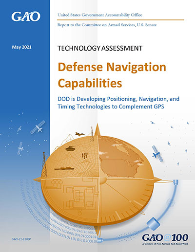
A May report by the Government Accountability Office (GAO) explores Department of Defense (DOD) strategy for positioning, navigation and timing (PNT) technology to complement GPS. The 51-page report takes a comprehensive view of alternative PNT policy and leadership across the department.
While GPS will remain the core of DOD’s PNT solution, it will use other PNT technology to complement GPS or as an alternative for when GPS is degraded or unavailable. DOD is exploring both improved sensors to provide relative PNT information, and external sources to provide absolute positioning and navigation.
DOD also is working to create common standards and interfaces to help integrate and field new PNT technologies faster and at lower cost. DOD also is developing its PNT modeling and simulation capabilities to evaluate the performance of new PNT technologies.
Challenges for DOD
Officials from across DOD and experts told GAO that alternative PNT solutions are not prioritized within DOD. For example, there is no central program office responsible for developing the variety of alternative PNT technologies across DOD.
DOD’s continued reliance on GPS, despite known GPS vulnerabilities to disruption, presents a challenge for obtaining sufficient support to develop viable alternatives. Defense officials and experts also said challenges in establishing clear PNT performance requirements hinder technology development.
In response, GAO developed six policy options that may help address challenges with developing and integrating alternative PNT technologies. The policy options identify possible actions by policymakers, who may include Congress, federal agencies and industry groups.
Increase collaboration. Consider mechanisms to coordinate across DOD to clarify responsibilities and authorities in prioritizing the need for alternative PNT technologies.
Focus on resiliency. Consider selecting the most resilient technologies as the cornerstone of the PNT suite for military missions, rather than defaulting to GPS.
Clarify requirements. Consider opportunities to clarify what level of PNT performance actually is needed for missions, rather than defaulting to requirements that match GPS performance.
Coordinate with industry. Consider ensuring DOD and industry coordinate so that industry is prepared to meet DOD’s needs, and DOD can leverage industry advances.
Institutionalize open architecture. Consider making the open architecture initiative more permanent, including providing funding.
Analyze vulnerabilities. Consider having DOD conduct ongoing analysis of vulnerabilities of different PNT systems.
The GAO reviewed technical studies, agency documents, and other key reports; interviewed government officials and researchers about alternative PNT technologies; and convened a three-day meeting of experts from government, non-governmental organizations, academia and industry.
It said policymakers “could consider selecting the most resilient technologies as the cornerstone of the PNT suite for military missions, rather than defaulting to GPS.”
The 51-page report takes a comprehensive view of alternative PNT policy and leadership across the department. Its findings are an interesting and informative look at issues and efforts.
Increasing demands
The report comes at a time when U.S. forces have been seeing increasing interference with their own and allied GPS-enabled systems. The Organization for Security and Cooperation in Europe has regularly reported that its surveillance drones in the Ukraine have been jammed. Chinese press recently bragged that jamming caused U.S. Navy ships in the South China Sea to switch from using GPS to the Chinese BeiDou system. Additionally, U.S. military commanders have regularly described the Middle East as the most contested electronic warfare area on the planet, in large part because of regular interference with GPS signals.
The GAO study also comes on the heels of a provision in the National Defense Authorization Act (NDAA) for this year which directs DOD to provide non-GPS PNT to combatant commanders by 2023. The act says this timeline is consistent with responding to Joint Urgent Operational Needs, a formal method for commanders to communicate with department leadership. According to some sources, this suggests that the Pentagon has been receiving such requirements from field commanders, but has not responded to them in what Congress considers a timely manner.
Alternative PNT “not a priority,” resisted
Despite chronic GPS signal interference across the globe, outside experts and officials across the DOD told the GAO study team that developing alternative sources of PNT was not a priority for DOD. One example cited was the lack of a central program office.
One expert said, “PNT — It’s everyone’s need, but nobody’s business.” Another expert said, “Everyone wants to use [PNT], no one wants to pay or care for [PNT].” One DOD official characterized alternative PNT as an afterthought. DOD’s PNT Roadmap states that PNT capabilities, despite being mission critical, are not normally considered a key requirement, but rather may be treated as “a second-tier requirement.”
Worse, the report indicated that some forces within the department resist alternative PNT efforts.
According to one DOD official cited anonymously in the report “bureaucratic and political obstacles [represent] the biggest challenges for alternative PNT” and “anything that threatens GPS, such as alternative PNT technologies, faces pushback.”
The report cited another DOD official as agreeing that “there is an impression that the GPS program has a lot of political clout within DOD, and that those trying to develop alternative PNT technologies may face political challenges.”
Realistic requirements
Many missions do not need the accuracy provided by GPS, according to the report. Nevertheless. DOD programs often default to GPS performance standards when developing requirements. Many alternative technologies, while more resilient, are unable to achieve the same accuracy as GPS and therefore fail to meet the over-stated requirements.
Open architecture
Both DOD and GAO see development of modular open system architecture (MOSA) as key to PNT success in the future. This will allow addition of new PNT sources to a platform without the need for a major retrofit. With MOSA, all that would be needed is a new sensor module for the desired PNT source.
The GAO report endorsed this approach and encouraged DOD to institutionalize it with dedicated funding.
Working with industry
Decades of civil GPS use have benefited DOD in many ways. Broad academic and commercial research has resulted in a host of applications and improvements in the size, weight, and power requirements of equipment, as well as lowered costs. These benefits would almost certainly not have been realized at the current scale if the market for GPS equipment and apps had been restricted to military users.
The 2021 NDAA directs the department to “…enable civilian and commercial adoption…” of the GPS alternative technologies it develops for field commanders. The GAO report suggests DOD also work to leverage industry advances in technologies.
Scope and recommendations
GAO’s tasking for this effort did not include examining efforts to make GPS signals and equipment more resilient to disruption, nor use of non-U.S. satellite navigation systems. Neither were non-defense uses of PNT, nor improvements in such things as tactics, techniques, and procedures considered.
The study focused solely on department efforts to complement GPS services.
Six recommendations for policymakers are included in the report:
Increase Collaboration — Consider mechanisms to coordinate across DOD to clarify responsibilities and authorities in prioritizing the need for alternative PNT technologies.
Focus on Resiliency — Consider selecting the most resilient technologies as the cornerstone of the PNT suite for military missions, rather than defaulting to GPS.
Clarify Requirements — Consider opportunities to clarify what level of PNT performance is actually needed for missions, rather than defaulting to requirements that match GPS performance.
Coordinate with Industry — Consider ensuring that DOD and commercial industry coordinate so that industry is prepared to meet DOD’s needs, and DOD can leverage industry advances.
Institutionalize Open Architecture — Consider making the open architecture initiative more permanent, including providing funding.
Analyze Vulnerabilities — Consider having DOD conduct ongoing analysis of vulnerabilities of different PNT systems.
The May 2021 GAO report “Defense Navigation Capabilities: DOD is Developing Positioning, Navigation, and Timing Technologies to Complement GPS” is available here.
Raytheon plans to deliver the final phase of the GPS Ground Control System (OCX) upgrade to the United States Air Force by June 2021, despite past delays to the program.
A report by the General Accountability Office (GAO), issued in May, said the Air Force has yet to develop full cost estimates for the new ground system, as well as the user equipment needed to access the expanded capabilities of GPS III.
In the report, the GAO recommended that the Department of Defense (D0D) conduct an independent schedule assessment of the full program schedule at the end of 2019. DOD did not agree with the recommendation.
“OCX delivery, acceptance, and the ready to transition to operations decision will likely be delayed, potentially exceeding the April 2023 threshold date for completing the program,” the GAO report said.
However, Raytheon said Oct. 1 that it had completed software and hardware development and has started testing and integrating the system, keeping it on track to meet its contractual deadline.
In an Oct. 1 Denver Post article, David Wajsgras, president of Raytheon’s Intelligence, Information and Services business, said Raytheon has changed its process for the OCX upgrade by adopting less-traditional tech startup development processes.
The new process —now in action at Raytheon’s Aurora, Colorado, campus — emphasizes collaboration across teams and has a less linear structure.
“I’d call it almost a 180 from the way we had developed software in the past, from the traditional way for the Department of Defense,” Wajsgras told the Post.
“A few years ago the GPS OCX program was considered the No.1 problem program in the entire Department of Defense,” Wajsgras acknowledged. “Our team truly stepped up to the challenge of what needed to be done in order to get one of the most important programs for U.S. government back on track.”
DOD’s Defense Digital Service helped the company apply an “agile” approach to “DevOps” (development and operations) that stresses collaboration across teams as well as flexibility.
The new process includes “dojos,” centers for focused, quick training, and “hives,” open workspaces without cubicle walls.
Elsewhere in this (January) issue you’ll find the hard facts — basic, but hard — concerning the inaugural launch of the long-awaited GPS III constellation. On pages 10 and 12, with some seasoned leavening between, on page 11.
This column instead waxes briefly on the phenomenon of time, and humankind’s struggle to dominate it, to subject the fourth dimension to its own will.
For GPS III has been, yes, long awaited, long debated, long victim to multiple delays of many colors and causes, scrutable and inscrutable, of technological challenges and institutional barriers, and of that base determinant, money. The Government Accounting Office has issued its fair and due share of reports pointing alarmed fingers at constellation gaps and fulfillment shortfalls and the trials of OCX, the ground control system without which GPS III satellites may some day, soon or not-soon, be capable of broadcasting powerful new signals from space, yet not able to do so because of lagging accomplishment on Earth.
It’s often said that GPS is a victim of its own success, that older satellites living beyond their forecast lifetimes have allowed the Air Force to economize by not replenishing when unnecessary. There’s wisdom in this, of course.
Were my friend Don Jewell still with us, he would be justifiably proud of the Air Force for launching this new golden era of the gold standard in positioning — yet he would have seethed for years over the continued pushes to the right.
This reminds me a good deal of the drama and occasional comedy in the rise of Galileo, observed from afar. Next month I’ll give a talk at the European Space Agency, provisionally titled “An Outside History of Galileo,” the bemused viewpoint of one who only heard and interpreted the news, but did not participate in its forming.
For such complex endeavors do not happen easily or speedily or exactly as planned by mere mortals. Nor should they. Despite much gnashing of teeth, no one — in the civil sphere at least — has suffered unduly from the longish delays in either satnav system’s modernization. Perhaps a few lives could have been saved in the military, or greater strategic advantage gained, with the new capabilities that III will offer warfighters, had same been available on schedule, say, four to six years ago. But even this is mere conjecture.
There is a rhythm and a flow to life, and we are part of it. You can hurry neither sundown nor sunrise. Things happen in their own due course.
When full GPS III capabilities arrive — I don’t believe 2023 — then it will still be in good time. In its own best time, actually, to be here.
The Government Accountability Office (GAO) recommends the U.S. Department of Defense (DOD) assign responsibility to an organization to collect test data, lessons learned and design solutions in its effort to meet GPS modernization goals.
According to the GAO, “The Secretary of Defense should ensure that the Under Secretary of Defense for Acquisition, Technology and Logistics, as part of M-code receiver card acquisition planning, assign an organization with responsibility for systematically collecting integration test data, lessons learned, and design solutions and making them available to all programs expected to integrate M-code receiver cards.”
DOD concurred with the recommendation.
The GAO presented its findings in a 53-page report issued Dec. 12, “Global Positioning System: Better Planning and Coordination Needed to Improve Prospects for Fielding Modernized Capability.”
According to the GAO, “DOD has made some progress on initial testing of the receiver cards needed to utilize the M-code signal. However, additional development is necessary to make M-code work with over 700 weapon systems that require it.
“DOD has begun initial planning for some weapon systems, but more remains to be done to understand the cost and schedule needed to transition to M-code receivers.
“The preliminary estimate for integrating and testing a fraction of the weapon systems that need the receiver cards is over $2.5 billion through fiscal year 2021 with only 28 fully and 72 partially funded (see below figure). The cost will increase by billions when as yet unfunded weapon systems are included.”
Status of weapon systems that have determined the cost needed to transition to M-code receivers through Fiscal Year 2021, as of February 2017.
In its summary, the GAO wrote “DOD faces risks as it simultaneously develops satellites, a ground system to operate them, and receiver cards that allow use of GPS signals. It will need to install receiver cards on hundreds of systems and, without better coordination, risks paying repeatedly to solve similar problems across the systems.”
The report also assesses the extent to which DOD faces acquisition challenges in sustaining the GPS constellation and developing a new ground control system. The GAO analyzed GPS quarterly acquisition reports and data, acquisition strategies, software and test plans, and other documents, and interviewed DOD and contractor officials.
About three-quarters of eighth grade students — the only grade for which trend data are available — were not “proficient” in geography in 2014, according to a new analysis by the U.S. Government Accountability Office (GAO) of nationally representative data from the Department of Education.
Specifically, these students had not demonstrated solid competence in the subject, and the proficiency levels of eighth-grade students have shown no improvement since 1994 (see figure).
Geography is generally taught as part of social studies, but data show that more than half of eighth-grade teachers reported spending a small portion (10 percent or less) of their social studies instruction time on geography. Further, according to a study by an academic organization, a majority of states do not require geography courses in middle school or high school.
A key challenge to providing geography education is the increased focus on other subjects, according to officials in selected states and K-12 teachers GAO interviewed. These officials and teachers said spending time and resources on geography education is difficult due to national and state focus on the tested subjects of reading, math, and science. GAO’s interviews and review of relevant reports identified a range of other challenges, as well, including:
misconceptions about what geography education entails;
lack of teacher preparation and professional development in geography;
poor quality of geography instructional materials; and
limited use of geographic technology in the classroom.
The Department of Education’s role with respect to geography education primarily involves assessing student performance in the subject, and providing data and the results of its analyses to the public. The Department of Education periodically assesses student achievement in geography, and other areas, but not with the same regularity as other subjects it is required by law to assess. Beyond assessments, department officials said that absent funding specifically for geography-focused programs, the agency is hindered in its ability to support geography education.
GAO conducted the study because geography — the study of places and the relationship between people and their environment — is present across many facets of modern life, from tracking lost cell phones to monitoring disease outbreaks such as Ebola. The growing use of geographic information and location-based technology across multiple sectors of the American economy has prompted questions about whether K-12 students’ skills and exposure to geography are adequate for current and future workforce needs.
Senate Report 113-71 included a provision for GAO to report on the status of geography education and challenges elementary and secondary schools face in providing geography education with limited resources.
In this report, GAO examined
the extent that eighth grade students are proficient in geography;
the challenges selected school officials and teachers face in providing geography education; and
the role of the Department of Education with respect to geography education.
GAO reviewed relevant federal laws; analyzed nationally representative Department of Education data on student proficiency and instruction time in geography; interviewed education officials in four states selected, in part, for varying K-12 geography requirements; reviewed key studies and research reports, including a 50-state 2013 survey of geography requirements; and interviewed agency officials and researchers. The GAO also leveraged a professional association to identify and interview 10 K-12 teachers.
Galileo satellites 9 and 10 are functioning perfectly, and the initial series of flight operations is continuing as part of the critical launch and early orbit phase, according to a European Space Agency Rocket Science blog by Daniel Scuka, senior editor for Spacecraft Operations at ESOC, ESA’s European Space Operations Centre, Darmstadt, Germany.
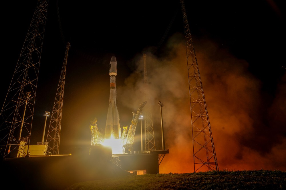
Galileo 9 and 10 lifted off together on Sept. 11 from Europe’s Spaceport in French Guiana atop a Soyuz launcher, bringing the total number of Galileo satellites in orbit to 10.
“The pair are being stepped through an intense series of check-outs, confirmations, mode changes, configurations and health verifications by the joint ESA/CNES mission team working around the clock at ESOC, Darmstadt, Germany,” according to the blog. “The team are now focusing on conducting a series of thruster burns designed to start the drift of the two satellites toward their target orbital positions.”
“Following the burns performed during the LEOP (launch and early orbit phase), the satellites will continue naturally drifting, ending up in their final desired operational orbits at about 23,222 km after another set of thruster burns, planned to achieve fine positioning in orbit, around the end of October,” said Liviu Stefanov, co-flight director from ESA.
With the excellent performance of the spacecraft and the ground teams, the LEOP is expected to wrap up soon.
All the Soyuz stages performed as planned during the September 11 launch, relieving anxieties tied to a faulty Soyuz launch in September of last year. The Fregat upper stage released the satellites into their target orbit close to 23,500 km altitude, around 3 hours and 48 minutes after liftoff.
“The deployment of Europe’s Galileo system is rapidly gathering pace,” said Jan Woerner, director general of the European Space Agency (ESA). “By steadily boosting the number of satellites in space, together with new stations on the ground across the world, Galileo will soon have a global reach. The day of Galileo’s full operational capability is approaching. It will be a great day for Europe.”
Two more Galileo satellites are scheduled for launch by end of this year. These satellites have completed testing at ESA’s ESTEC technical centre in Noordwijk, the Netherlands, with the next two satellites also undergoing their own test campaigns.
More Galileo satellites are being manufactured by OHB in Bremen, Germany, with navigation payloads coming from Surrey Satellite Technology Ltd in the UK, in turn utilizing elements sourced from all across Europe.
“Production of the satellites has attained a regular rhythm,” said Didier Faivre, ESA’s Director of Galileo and Navigation-related Activities. “At the same time, all Galileo testing performed up to now — including that of the ground segment — has been returning extremely positive results.
“And while the continuing deployment of Galileo remains our priority, along with exploitation of EGNOS — Europe’s already operational satellite navigation augmentation system — ESA is also looking farther ahead.
“With the European Commission, we are doing the technical work to ensure Galileo goes on forever — locking in continuity of Europe’s navigation services into the long term, to meet performance on a par with the other global satellite navigation systems.”
Next year Galileo deployment will be boosted by operation of a specially customized Ariane 5 launcher that can double, from two to four, the number of satellites that can be inserted into orbit with a single launch.
European SBAS Advances, Improves
After extensive ground and space testing, the SES-5 GEO satellite has entered into the European Geostationary Navigation Overlay Service (EGNOS) operational platform, broadcasting EGNOS Signal-In-Space (SIS). Replacing Inmarsat-4F2, SES-5 will ensure reliable EGNOS services until 2026, and will enable a range of performance improvements. In particular, EGNOS will offer even greater stability during periods of high ionospheric activity.
“SES-5 is the first step of the complete renewal of the EGNOS Space Segment, securing the EGNOS services for the next decade and the future transition to the dual-frequency multi-constellation services,” said Carlo des Dorides, European GNSS Agency executive director. “It will be completed by the introduction of the ASTRA-5B signals and the procurement of a new EGNOS payload which are both planned for 2016.”
SES-5, carrying EGNOS L1 and L5 band payloads, was launched in July 2012. The integration of a second EGNOS SBAS L1/L5 band payload on SES ASTRA-5B GEO satellite is currently ongoing. The introduction of the second SES GEO satellite for EGNOS is planned at the end of 2016.
GAO Report Spotlghts OCX Delays, Cost Increases
According to a report released by the U.S Government Accountability Office (GAO) on Sept. 9, titled “Actions Needed to Address Ground System Development Problems and User Equipment Production Readiness,” the Air Force has experienced significant difficulties developing the GPS next-generation operational control system (OCX). According to the report, completion of OCX will require $1.1 billion and four years more than planned to deliver OCX. The report Highlights section states, “The Air Force began OCX development in 2010,” and “accelerated OCX development in 2012 to meet optimistic GPS III satellite launch timeframes even as OCX development problems and costs grew, and then paused development in 2013 to address problems and resolve what it believed were root causes.
“However . . . OCX cost and schedule growth have persisted due in part to a high defect rate, which may result from systemic issues. Further, unrealistic cost and schedule estimates limit OSD visibility into and oversight over OCX progress. “ The full report may be read online.
During the course of development the Air Force made changes, updating the specifications for connections to other government systems and in the M-code signal requirements. Officials for Raytheon, the prime OCX contractor, estimated that, as a result of various modifications “nearly two-thirds of the requirements baseline as of [preliminary design review] had changed by mid-2012.” Subsequent software updates and modifications contributed to a high defect rate in the OCX software. “
If you have requirements change at the same time you’re developing the software, it’s more likely that you could have a higher amount of defects that you have to change after the fact,” said Matthew Gilligan, Raytheon’s vice president for navigation and environmental solutions.
Tim Tebow, GPS, space acquisition, 60 Minutes and the GAO.
One of these things is not like the others. When you first learn this Sesame Street song as a child, where it may be presented as a series of cartoonish pictures, the odd item is usually fairly obvious. Years later, when you encounter this deceptively simple statement on a physics test at Stanford University — where the choices are beguilingly similar formulas or algorithms — the correct answer may be a bit more difficult to determine, and may actually require serious thought.
It seems the U.S. government (USG) acquisition cadre seems to have a similar problem when it comes to recognizing the critical importance of small businesses. The USG has a federally documented mandate and stringent policies (unfortunately, often ignored) in place to support small businesses in the United States. Supposedly, a quota system is in place where, in a perfect world, 23 percent of all eligible contracts should be won and performed by small businesses — the word eligible being the fly in the ointment.
Small Business
For government contractor purposes, what exactly is a small business? This is not an easy question to quantify or answer simply but let’s try. NAICS (North American Industry Classification System) codes specify, among other requirements, the maximum number of employees in a business qualified to compete for contracts of a certain dollar amount — that is one way to designate not only a small company, but their small business qualifications as well. Some companies are not only small in size, but have special qualifications that allow them to compete in a special category for certain contracts; such as being owned by a woman, a Native American, an Eskimo, a handicapped person (any of the five senses), or by the economic success or lack thereof, where the business is geographically located, or the population it serves and employs.
As you can readily see, this small business definition can become unwieldy in a hurry. For our purposes, let’s describe a small business as a company of 500 employees or less that may meet any or all of the aforementioned qualifications, but most importantly meets the operational requirement of having a certain field of expertise for which it is known and at which it excels in. In short, the small company is the domain expert in a certain field of endeavor and typically is sought after by government (municipal, state and federal) and commercial entities alike for their expertise.
Such companies are also sought out by large government contractor competitors known as prime companies that may range in size from several thousand to hundreds of thousands of employees. These companies have historically been likened to a battleship that takes forever to change course. The large primes are the Warren Buffets of government contracting, as they typically have tons of resources and stores of cash, but they historically lack the flexibility, expertise and low cost structure (read low overhead) of the small companies. Therefore, the smaller companies are frequently sought out as critical team members on large government contracts at all levels. Plus, since there is supposedly, in writing anyway, a small business quota system in place, if you can place a small company on any government contract, so much the better. To the prime and the U.S. government, it may be just statistics, but to the small company, it is often a matter of success or failure for the company.
It is a fact of life in government contracting that many times the small companies’ domain expertise is why the prime, who put a winning team together, wins the big contract in the first place. You would think this would ensure success for the small company. However, “build a better mouse trap” and “build it and they will come” are nice clichés, but often get lost in the real profit-and-loss world of government contracting.
In my experience, problems typically come about because both the government and the prime contractors lose sight of why the small, domain expert company is on the team in the first place. Great small companies are so good at what they do, they typically under promise and over deliver and begin to make both the government oversight institutions and the prime look bad. By bad, I mean less efficient, not as capable, and burdened with a plethora of rules and regulations and monstrous overhead rates that rarely apply to small companies.
Don’t think that I have a problem with prime contractors. I worked for two of the largest for many years and they were and are great companies. None of the satellites we have in orbit today would be there without prime contractors. So prime contractors are a great asset to this country and to the space programs, but even large primes occasionally lose their way or fail to deliver.
Acquisition Analogy
Bear with me as I present a simple football analogy some serious thought as it pertains to GPS contracting.
Tim Tebow was/is arguably one of the most famous and sought after American college football quarterbacks of all time. He was the first college sophomore to win the coveted Heisman Trophy, the First round NFL draft pick in 2010, and the winner of two NCAA National Football Championships.
At the conclusion of his phenomenal college career, Tim Tebow held the Southeastern Conference’s all-time records in college football for both career passing efficiency and total rushing touchdowns, appearing second and tenth (respectively) in the NCAA record book in these categories.
Playing his rookie season for the Denver Broncos, Tim started the last three games and became the team’s full-time starting quarterback beginning in the sixth game of 2011. The Denver Broncos were a dismal 1–4 before Tim became the starting quarterback, but began winning with him on the field, playing just as he did in college, often scrambling and running with the football and coming from behind late in the fourth quarter to win. Under his tutelage and leadership, Denver won their first AFC West title and first playoff game since 2005, defeating the Pittsburgh Steelers in overtime.
Tebow the Pro
What happened next? This is where is gets interesting and pertinent to government space acquisitions.
What happened is Tebow changed. He was made to conform to what is viewed as proper professional football behavior. Professional football pundits criticized Tim Tebow for everything from his scrambling and running plays to his obviously devout displays of Christian faith. Statements were made such as “He will get hurt scrambling and running the ball so much, then Denver will not have him as a starting quarterback.” “These college plays he keeps running just don’t work in the NFL.” “Tim needs to wake up and realize he is not in college anymore.”
Amazingly, despite all the critiques, the Tim Tebow college-based solution was working. College plays and Christianity were the formula that worked for Tim in college and was obviously, despite his critics, working well in the NFL, at least for the Denver Broncos. For all the other NFL teams, not so much. Then it all started to come apart, because what the other NFL teams were really admitting to was what psychologists call social phobia or the fear of being embarrassed. In other words, what the other NFL teams were really saying was:
“Come on Denver, we can’t have a college quarterback, using old college plays, defeating the NFL’s finest teams. It makes us all look bad. People pay big money to see NFL teams win on Sunday and Thursday. So get this flea flickering wunderkind under control and come back into the fold. You and your college quarterback are embarrassing the league with your success!”
The Denver Broncos and subsequently other teams in the NFL bowed to pressure and forced Tim Tebow to drastically change the way he played football. The winning formula was shelved, and T2 was made to conform. When that happened, he became the league’s top-losing quarterback. His once accurate passes started to miss their mark because he was told to stay safely in the pocket and not scramble or run with the ball, even though historically his most accurate passes were thrown while on the run. Since he no longer scrambled or ran, he not only lost accuracy but historically the yards he gained running with the football were gone as well. So he rapidly became just what the league declared he should be, not a winning collegiate quarterback in the NFL, but a nominal losing NFL quarterback. At least he was not doing anything outside the norm for the NFL. He was no longer embarrassing the league by winning, but by finally playing by the rules and losing.
Now let’s take the Tim Tebow saga and apply it specifically to federal government GPS acquisitions, or simply to space acquisition practices in general.
Random Scenario
Let’s take a random and totally make-believe scenario and say the federal government requires a new command and control system (C2) for a large global satellite constellation. For purposes of this imaginary scenario, I need to remind you of an old adage, that unfortunately is not imaginary, in the national security space business concerning space C2 systems. It goes like this: The space hardware is 95 percent complete when a team member remarks, ‘Wow! this satellite system is going to be the best in the world at what it does! I can’t wait to see the whole system up and running.” Another team member ponders that statement and replies, “A system, what system? All we have is space hardware. How are we going to launch it, control it (TT&C) and send and receive operational data? Oh yeah, we need a space C2 system. We better get right on that!” You may laugh, but this exact scenario has been played out more times than anyone cares to admit. But, of course, this is all just make believe! Right?
RFI/RFQ
Now imagine for a moment that you find yourself in this situation. As a member of the U.S. government acquisition team, at an SPO or (Special, Space, Strategic, Scientific — take your pick) Program Office, you quickly put an RFI (Request for Information) or an RFQ (Request for Quote) together just to see which companies have the requisite expertise and how much they, the companies, estimate it will cost to complete the C2 system for your constellation. The only problem being that in the RFI or RFQ, which is typically just a few pages, you only delineate the actual basic requirements and you only give the responding companies 30 days to determine how they will go about controlling a constellation you have been building for the last five years. Imagine that! The important part of the scenario is that the RFI/RFQ is actually on the street.
You can be assured most of the five big space primes are going to reply. After all, they have teams of highly qualified proposal writers that do nothing but respond to these requests. While the response process is often a thing of beauty, it is also frequently highly inefficient and misleading. Remember an RFI/RFQ format is almost inconsequential, as it is just the response the government is looking for at this point: Does your company or team of companies have the qualifications to do the work? How long will it take? How much will it cost?
This is far from the end of the story or process. Typically several small companies also respond to Space C2 RFIs and RFQs, primarily because the request concerns their area of expertise, not from a process point of view but from a domain expertise point of view, which may require radically different approaches.
Small technological companies in the space control business are usually flexible and agile, no-nonsense, lean and mean, replete with subject matter experts that specialize in C2 for satellite systems, both commercial and for the USG. They may well be the best in the world at what they do. Alas, they initially and naively think that is all that is required. They may even be under contract to the federal government doing exactly the type of work the RFI/RFQ specifies is needed, but they are frequently overlooked because they are, you guessed it, a small company. However, being small and sometimes naïve, they answer the RFIs and RFQs with enthusiasm, expectations and hope that the system will work and they will be recognized for their expertise, low cost, low overhead and even their outstanding past and present performance. Then, to quote Gilda Radner, “Oh, Never mind!”
Finally, the other shoe drops, as eventually the actual thousand-plus page RFP (Request For Proposal) is released. The RFP has critical detailed data for program success but unfortunately also contains frequently superfluous documentation and tedious requirements lists known as CDRLS (Contract Data Requirements Lists) that commonly reference hundreds of compliance documents so obscure that the USG provides the documents in a special digital online library, because no entity other than the USG would ever bother to keep such sleep-inducing documentation on hand. In this case, 90 percent of the CDRLs do not involve actual C2 of a space constellation, or whatever expertise is required to accomplish the mission, but rather they invariably pertain to some obscure government regulation concerning report formats and interfacing with the government oversight companies and committees.
Too Small To Succeed
Unfortunately we have all heard of companies and institutions that are supposedly too big to fail but what about too small to succeed? In one real-world example, and the USG actually put this in writing, the small expert company that was utilizing its expert system software to actively launch and control spacecraft flawlessly for seven years and is still actively controlling critical space payloads today was told in a competition debrief that they did not fully qualify for the new C2 RFP. Not because of any lack of expertise or past or current performance issues, but because they were too small — not that they could not and were not actually successfully accomplishing the same mission currently (they were the incumbent), but that they did not have the requisite number of personnel to interface with the government on a daily basis during the C2 contracts development phase. This 200+ person small expert company was told they would need to hire another 80 administrative staff just to keep up with the government paperwork and oversight the new C2 program would generate. None of these ‘required’ positions were engineers or subject-matter experts, just paper pushers that generate tons of paper and of charge at a high hourly rate that would add approximately $5M to the contract bid price. True story; sad but true.
So the small company, fully qualified to accomplish the task in record time and for a pittance, a fact nervously recognized by some in the government and by the primes, is not awarded the contract because their hourly rates are half those of the big primes, they can do the work in two years versus six, which for some reason is considered a high-risk proposal, and they do not have the additional 80 staff members sitting around waiting to respond to every government inquiry. Just like Tim Tewbow they were embarrassing the USG and worrying the big primes.
All is not lost. The small company is approached by Prime-A, a large company that is competing for the C2 contract even though they had never launched or controlled a satellite of this type before and are not known for their expertise in the space C2 area. Seeing the handwriting on the wall, the small company agrees to join Prime-A’s team on the six-year $900M effort that the small company was prepared to accomplish for $200M in only 24 months. Twelve months later, the contract is awarded to Prime-A. During the government debrief, one of the primary reasons for the “win” for Prime-A is because they teamed with the right small company — you guessed it, the one with all the domain expertise that was currently doing the work. Smart move by Prime-A.
Ok, so all’s well that ends well, right? Unfortunately, Prime-A now makes a bad move and announces just days after winning the new C2 contract that, having reconsidered their position, now that they have won, they will not be utilizing the tried-and-true operationally proven system from our small expert company, that actually helped them win the contract. No, Prime-A has decided to develop their own brand-new C2 system, become a competitor to the small expert company (a teammate), and allow the government to pay for it all. Of course, the end product, if it is ever successfully developed, will be a totally unproven and proprietary system and will take twice as long, cost five times as much and be far less capable, without any flexibility. But competition is king!
Time Passes
Five years into our imaginary scenario and the C2 program is years behind schedule. The only deliverables the USG has in its possession are those accomplished by the small company partner with the C2 domain expertise, along with invoices from Prime-A that add a 20 percent handling fee or surcharge to all the small company’s accomplishments and that now make the original $900M program a $1.8B program that will only accomplish 50 percent of the original RFP’s stated objectives. The program has moved so far to the right that full completion of all program phases will now take 10-12 years at a cost surpassing $4.2B, during which time all the space hardware will be placed in storage for an additional cost of $1M per space vehicle per year, because the space hardware cannot be launched and fully utilized without the C2 system that makes them incredibly valuable global assets instead of space junk on orbit. More space debris if you will.
Of course, if the small expert company had been awarded the contract or their product had been utilized by Prime-A at the outset, to do the job it currently does so well, valuable space assets would be ready for launch today and ready to benefit mankind worldwide. BTW the USG would also have $1.4B more in its coffers.
But, alas, that is not how our imaginary scenario plays out. In this scenario the small space company experiences the Tim Tebow process and government indoctrination. Their expertise is discounted because they are playing with the “big boys” now, and they are required to hire 80 additional administrative personnel just to compete. They are required to submit all work product through Prime-A that adds an extra 20-50 percent just to process the paperwork and keep the marching army of support staff employed.
As a consequence of the teaming agreement, the small expert company can no longer talk directly to USG representatives who are now suddenly very interested in the original $200M, 24-month proposal. As a member of Prime-As team, the small expert company cannot undertake any independent actions. It is under the thumb of the prime, and the USG will never have the opportunity to take the road less traveled that leads to success and a winning season with a small company. They have been Tebowed!
Rare
Fortunately, the imaginary scenario you just read rarely happens. The USG acquisition teams are very good at what they do, and they rarely allow the scenario described to take place. However, rarely is not “never,” and unfortunately similar scenarios do occasionally take place. Sometimes the USG just makes bad decisions. They fail to realize the true potential and the true domain expertise provided by small expert companies.
Budget
In this budget seques-castration era USG acquisition personnel and decision makers need to look beyond procedures, precedence and tradition. They need to think outside the proverbial box and consider all their options. A satellite C2 system does not require a huge prime company and a marching army of a thousand or more personnel. Constellation C2 can and has historically been accomplished by companies just like the 200+ commercial company in our scenario. Additionally once the USG realizes the prime has failed they need to stop throwing “good money after bad” and restructure the contract, reassign tasks or simply re-compete the contract. As I have said in these pages many times there is not a single satellite constellation in orbit today that requires a $1.6B and certainly not a $4.2B C2 system. And we should not have to wait for 10-12 years for it to come to fruition.
That is outrageous, I hear you say, and you would be correct. But, of course, this is just an imaginary scenario! Surely that never really happened, did it?
To quote Winston Churchill, as I have numerous times, “Gentlemen, we have run out of money; now we have to think.”
60 Minutes and GAO
Recently the investigative news program 60 Minutes has become keenly interested in space and so far it has been a great experience for AFSPC (Air Force Space Command), the United States Air Force (USAF) and the USG. Space and the technology it enables are force multipliers and our freedoms in this great country of ours depend more and more on the space domain and billions of people around the globe depend on GPS for positioning, navigation and timing. GPS is without a doubt the most successful and important constellation in orbit today; bar none. It is a good news story and one of which we can all be proud. Let’s hope it continues to be a good experience.
However, when the GAO, or Government Accountability Office, comes calling the story or experience is not always so positive. The word is out that the GAO has been snooping around AFSPC and several prime space contractors and small space companies as well. As the investigative arm of Congress, government programs rarely fare well or, should I say, sometimes bid “farewell” once the GAO is on the scent. I challenge you to find a single government program manager that can say he is just waiting with fond hopes for Congress to tell him how to run his program.
Bottom Line
This could be an outstanding and pivotal year for NFL football, for Tim Tebow and for USG space acquisition programs, if we all learn the hard lessons from the Tim Tebow experience. Don’t mess with success, and bigger and more sophisticated is not always better.
So, which word in the title is not like the others? Only time will tell.
Until next time, happy navigating, and remember: GPS is brought to you free of charge, courtesy of the U.S. Air Force.
Raytheon Company reached several milestones recently in its development of the GPS Next -Generation Operational Control System (GPS OCX). Lockheed Martin’s GPS III Non-flight Satellite Testbed (GNST) — a full-sized, functional satellite prototype currently residing at Cape Canaveral Air Force Station — successfully established remote connectivity and communicated with OCX during pre-flight tests.
GNST proved that it could connect with and receive commands from Raytheon’s Launch and Check Out System (LCS), a part of OCX that supports the satellite and mitigates risks prior to launch. The GNST received commands from Lockheed Martin’s Launch and Checkout Capability (LCC) node in Newtown, Pennsylvania via the OCX servers at Raytheon’s facility in Aurora, Colorado; the system then returned satellite telemetry to the control station. The tests mirror launch and early orbit testing planned for all flight vehicles.
“While we have connected OCX with ground-based simulators before, these tests were the first time that OCX and a GPS III satellite have actually communicated,” said Keoki Jackson, vice president for Lockheed Martin’s Navigation Systems mission area.
Ahead of Schedule. Raytheon received Interim Authorization to Test (IATT) security certification from the U.S. Air Force for OCX LCS four months ahead of schedule. The company received a one-year certification with no liens, meaning the government does not require any changes.
“Typically, IATT certification is given for six-month increments,” said Matthew Gilligan, Raytheon’s GPS OCX program manager and a vice president in Raytheon’s Intelligence, Information, and Services business. “The LCS one-year accreditation speaks to the quality of the information assurance design and threat protection.” The IATT not only includes the LCS, but also Lockheed Martin’s GPS III satellite support systems, Exercise and Rehearsal Training Tool, and Upload Generation Tool.
OCX is being developed in two blocks. There are seven iterations in Block 1 and one in Block 2. LCS is the fifth Iteration of Block 1; it successfully completed Critical Design Review in June 2013.
Early Orbit Exercises. Lockheed Martin and Raytheon also completed the third of five planned launch and early orbit exercises to demonstrate launch readiness of GPS III and OCX.
Exercise 3 demonstrated space-ground communications; first acquisition and transfer orbit sequences; orbit-raising maneuver planning and execution; and basic anomaly detection and resolution capabilities. In addition, the industry and Air Force GPS Directorate teams jointly executed mission planning activities, such as orbit determination and the generation of upload command files.
Two additional readiness exercises and six 24/7 launch rehearsals are planned before launch of the first GPS III satellite. The first flight GPS III space vehicle (SV-01) is expected to be available for launch in 2014, and launched by the U.S. Air Force in 2015.
Exelis Encryptors. Exelis delivered the first three of a planned 14 ground-based encryptors to Raytheon Company for OCX. Designed to automatically code and decode GPS signals, encryptors facilitate the exchange of user information by securely transmitting navigation payload data between the OCX ground station and the orbiting constellation of satellites.
Delivery followed successful thermal, electromagnetic interference and security verification testing. Exelis provides critical elements of software in the navigation processing subsystem that will enable controllers to better understand the exact position of GPS satellites. This helps ensure accurate navigation information is securely broadcast to users. In addition to encryptors, Exelis is building high-precision receivers for use in GPS ground monitoring stations and satellite signal simulators for testing purposes.
Exelis is also on contract with Lockheed Martin to provide the payloads for the GPS III satellites.
Europe Tests Galileo Public Regulated Service
European Union member states began their independent testing of the Public Regulated Service (PRS) broadcast by the four Galileo navigation satellites in orbit. Transmitted on two frequency bands with enhanced protection, PRS offers a highly accurate positioning and timing service, with access strictly restricted to authorized users, such as government defense, security, and emergency services.
PRS access was initially considered for Galileo’s Full Operational Capability phase, but it has been enabled in 2013 in response to the strong interest of member states in this service. To allow early access to PRS during the current phase, the European Commission and ESA began the joint project PRS Participants To IOV (PPTI) in July 2012.
ESA ensured the availability of several tools developed under ESA contracts, including test receivers and other qualification equipment. ESA’s PRS Laboratory, based at the Agency’s ESTEC technical centre in Noordwijk, the Netherlands, provided training, demonstrations and sample data.
“Belgium, France, Italy, and the UK have now performed independent PRS acquisition and positioning tests. In parallel, ESA, through collaboration with Dutch and Italian authorities, is conducting PRS fixed and mobile validation in several locations in the Netherlands and Italy,” said Miguel Manteiga Bautista, head of ESA’s Galileo Security Office.
The PRS tests have demonstrated a current autonomous positioning accuracy of less than 10 meters when in the correct geometrical configuration. This is an impressive result considering the small number of Galileo satellites in orbit and the limited ground infrastructure so far deployed.
Italy has developed its own PRS receiver, and tests have confirmed the feasibility of independent PRS receiver development and verification based on specifications provided by ESA.
“The PPTI project is still ongoing to test more advanced functionalities this coming autumn and to run the first aeronautical PRS tests in collaboration with the Dutch authorities. Other member states have also expressed their willingness to join the IOV PRS experimentation campaigns soon,“ concluded Miguel Manteiga.
The project is a first step to ensure use of the PRS as soon as it becomes operational. It will be complemented by PRS pilot projects, focused on PRS applications, which are currently under definition in a common effort between European agencies.
The United States has submitted a request to be able to use Galileo’s PRS. Other non-EU countries have also expressed a desire to be associated with the program.
System Briefs
Way to Go GAO, Part II. The Air Force should come up with better cost estimates and options for new GPS satellites, according to a September 9 report from the U.S. Government Accountability Office (GAO). The GAO was responding to an Air Force study on lower-cost space solutions for GPS.
“More information on key cost drivers and cost estimates, and broader input from stakeholders would help guide future investment decisions,” the GAO concluded. Specifically, the key cost drivers include dual-launch capability, navigation satellites (smaller GPS-type satellites yet to be developed), and a nuclear detection capability.”
New Birds by Fall. Galileo satellite-builder OHB AG said it should know by late September whether tests of the first Full Operational Capability (FOC) Galileo satellites are proceeding well enough to permit their delivery later this year. The first FOC satellite began testing at ESA’s European Space Research and Technology Centre in May, and the second arrived August 9.
The OHB satellites either “bear a strong resemblance” or “are identical” to the four in-orbit validation spacecraft now in medium-Earth orbit, depending on the source. However, the on-board power of the OHB spacecraft exceeds that of the validation satellites built by a different manufacturer. According to one source, Galileo managers made the modification in part to enable Galileo’s encrypted Public Regulated Service signal to overcome a signal frequency overlap issue with China’s BeiDou constellation.
Global Positioning System experts from Air Force Space Command and the Space and Missile Systems Center will hold a media roundtable teleconference tomorrow, September 24, at 2:30 p.m. Mountain Time (4:30 p.m. Eastern Time) to discuss the recent GAO report titled “Global Positioning System: Challenges in Sustaining and Upgrading Capabilities Persist.” Colonel David Buckman, AFSPC command lead for positioning, navigation and timing, and Colonel Bernard Gruber, commander of the Global Positioning System Wing at Los Angeles Air Force Base, will participate in the teleconference.
Air Force Space Command, which has responsibility for sustaining and maintaining the Global Positioning System, feels that the GAO report is overly pessimistic and doesn’t adequately acknowledge what AFSPC has done to address constellation sustainment, according to a press release issued from the Air Force, Peterson Air Force Base, Colorado. “The Air Force has created the largest, most accurate constellation, with the greatest capability, in the history of GPS, with 31 operational satellites currently on orbit,” stated the press release. “This is well above the 24 minimum satellites needed for a full constellation and to meet constellation performance standards. Since 1995, GPS has never failed to exceed performance standards.”
The release continued, “AFSPC is working to mitigate the challenges identified by the GAO through a number of activities, including: applying a ‘back-to-basics’ approach to acquisition, continuing to identify additional ways to maximize the life of our operational satellites, implementing robust mission assurance processes, and transforming our launch enterprise.”
The first GPS IIF satellite completed on-orbit testing and checkout and was set operational on August 26 as planned, the Air Force said, The GPS IIF program is ready for full rate production and continues to build confidence in its production line. Through the institution of robust mission assurance processes, AFSPC is confident in the future of the GPS IIF program.
The follow-on program, GPS IIIA, recently completed critical design review, two months ahead of schedule, the Air Force said. “AFSPC is optimistic that its ‘back-to-basics’ approach, including stable requirements, mature technologies, and more government oversight, will ensure a successful program, providing the GPS IIIA and its ground segment, OCX, within a timeframe that maintains a robust GPS constellation and supports GPS users.”