Tag: Geneq

  • Geneq introduces SXblue Premier GNSS receiver

    Geneq introduces SXblue Premier GNSS receiver

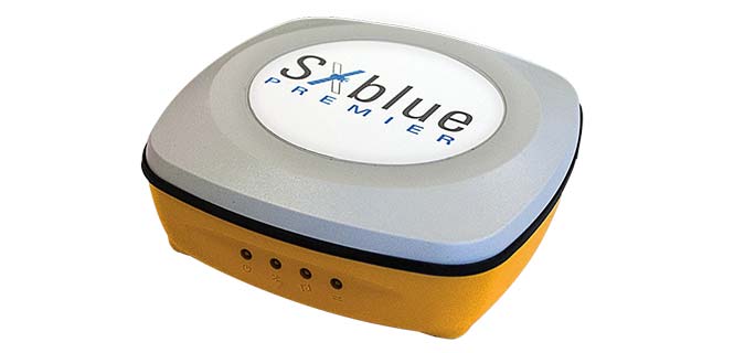
    Geneq has launched the SXblue Premier GNSS receiver, which is available in a submetric version (GNSS) or centimetric version (real-time kinematic, RTK).

    The new SXblue Premier GNSS receiver is equipped with the Pacific Crest Maxwell 6 Trimble technology with BD910 (GNSS version) and BD930 (RTK version) OEM boards, delivering 220 channels to acquire and track GNSS signals from all constellations in view. It makes effective use of GPS, GLONASS, Galileo, BeiDou, QZSS and SBAS signals for outstanding highly precise positioning.

    The SXblue Premier is small and light weight, and rugged for field work. It is equipped with dual mode for Bluetooth V2.1 and Bluetooth V4.0, ensuring the unit’s wireless communication with any Android or Windows terminal. With its two models, the user will have large efficiency and flexibility on the field either with SBAS corrections or RTK reference networks.

    In addition, SXblue Premier can be configured for Wi-Fi hotspots, allowing users to connect and access a web management platform. It also can be used as a data link, providing a quick connection to the internet to receive corrections from reference station (CORS) networks so that it can process RTK measurements.

    With its internal memory using an 8-GB solid state disk, SXblue Premier provides enough storage space for field data collection or raw data recording for a high data sampling rate.

    Multiple compatible software programs — including FieldGenius, Carlson, Collector for ArcGIS — will meet the users’ diverse need, making SXblue Premier more powerful and flexible.

  • SXblue introduces Platinum survey-grade GNSS receiver

    SXblue introduces Platinum survey-grade GNSS receiver

    Geneq has introduced the SXblue Platinum, the latest model in the SXblue series. This high-accuracy GNSS receiver is compatible with iOS, Windows and Android Bluetooth, and provides real-time professional-grade positioning information.

    Powered by 394 channels, the SXblue Platinum uses all constellations (GPS, GLONASS, Galileo, BeiDou and QZSS) with triple frequency, and provides the ability to use global or local coverage for corrections (SBAS, L-band and RTK).

    With the scalable SXblue Platinum Basic, users can activate any frequency or constellation at anytime following initial purchase. The receiver is also field-upgradable, which means that these options can be remotely activated when convenient.

    The Platinum was developed on the success of the proven SXblue receivers that were designed to optimize SBAS performances under tree canopy and in rugged terrain. In addition to location performances when working in a restricted environment, the SXblue Platinum is introducing an L-band signal correction via the Atlas service. This worldwide satellite-based correction system can deliver up to sub-decimeter accuracy. Thanks to its new Tracer technology, the receiver can sustain its level of accuracy when the Atlas signal is interrupted. The Atlas service can also stream data over the internet (NTRIP) while ensuring the best available vertical and horizontal accuracy.

    Another innovative feature integrated on the Platinum model is the aRTK technology. This feature will allow RTK corrections to be received via the Atlas service, when RTK corrections have not been received for a period of time. For an Atlas-subscribed user device, a high accuracy will still be available at the subscribed service level until RTK is restored.

    The new receiver is the same compact, lightweight, palm-sized unit as the SXblue series, which is completely dustproof and ruggedized. The internal, rechargeable, field-replaceable Li-Ion battery has on-board LEDs for easy access to battery life information.

    The SXblue Platinum is targeted at GPS/GIS mapping and survey professionals in industries such as forestry, utilities, agriculture, environmental and other natural resource industries in addition to local, state and federal government users.

    With a wide variety of compatible software and mobile devices, the support team can help users choose the perfect solution for their applications. A free iOS application for NTRIP/DIP configuration, named iSXblue RTN, is available from the App Store.

  • New survey, mapping products

    Deformation monitoring

    Monitor, manage and evaluate monitoring data, optionally trigger alarms

    delta_ms_axii_topcon-WThe Delta Solutions deformation monitoring system uses several software and hardware components — Delta Link, Delta Log, Delta Watch, Delta Sat and the Topcon MS AXII total station — to provide accurate and reliable monitoring measurements and associated reporting for asset protection. Delta Watch delivers accurate and reliable data in a variety of reporting formats to fit a project’s needs. Data from the total station, GNSS receivers, leveling devices and sensors can be processed and analyzed individually or as a network-adjusted solution. Delta Watch’s optional Delta Sat GNSS processing module allows for stand-alone GNSS monitoring or combined GNSS and total-station network adjustments. Delta Link provides hardware support communication for autonomous operation in the field, managing each power source to maximize system availability, while Delta Log provides an intuitive interface to manage observations, target types and measurement scheduling.

    Topcon Positioning, topconpositioning.com

    Rugged handheld

    GPS data collector for utilities, mining, forestry, agriculture

    SXPad-1000P-WThe SXPad 1000P is an affordable, rugged handheld GPS data collector specifically designed for mobile GIS users in applications such as water, electric and gas utilities, transportation, mining, agriculture and forestry. The high-performance 1000-MHz device is designed to give professionals the power needed to work with maps and large data sets in the field. It has an IP67 waterproof seal and can survive 5-foot (1.5-meter) drops to concrete. Its 3.7-inch color touchscreen (full VGA) is sharp and is sunlight readable. Standard features include a battery life of more than 10 hours on a charge, 8-GB internal storage, and slots for MicroSD cards and SIM cards as well as Windows Mobile 6.5. The SXPad 1000P also offers a 3.5G cellular modem, Wi-Fi, Bluetooth, video capture and a 5-megapixel camera. It is optimized for GPS/GIS field data collection using its 1-to-3-meter accuracy internal GPS receiver or one of Geneq’s high-performance SXBlue GPS receivers for sub-meter and centimeter-level accuracy.

    Geneq, www.geneq.com

    Software analytics

    Glean and share insight from big data, internet of things

    esri-arcgis-10-5-tEsri ArcGIS 10.5 offers next-generation analytics technology by helping organizations glean insight from enterprise data, big data and the Internet of Things (IoT) and share that insight in intuitive ways. It includes improved capabilities for handling large-scale analytics and big data; a drag-and-drop interface that streamlines the creation of spatial analysis through maps, charts and graphs; and collaboration features to connect and analyze information across the enterprise. The new release is powered by Esri ArcGIS Enterprise, a significant evolution of the technology formerly known as ArcGIS for Server. ArcGIS Enterprise has been updated with improved power to process and analyze large, disparate datasets.

    Esri, esri.com

    Laser scanner

    Entry-level device for construction, public safety

    Faro-M70-laserscanner-WThe Faro FocusM 70 is an entry-level laser scanner for construction building information modeling (BIM) and public safety forensics. Features include an IP54 rating for use in high particulate and wet weather, high-dynamic-range imaging, an acquisition speed of almost 500,000 points per second and extended temperature range. Data captured can be used with various third-party software packages. The Faro FocusM 70 is specifically designed for both indoor and outdoor applications that require scanning up to 70 meters and at an accuracy of +/– 3 millimeters.

    Faro, www.faro.com

  • Geneq introduces rugged SXPad 800H GPS data collector

    Geneq introduces rugged SXPad 800H GPS data collector

    Geneq Inc. has released the SXPad 800H, which the company describes as a feature-packed, rugged handheld GPS data collector at an affordable price.

    SXPad_800H_main-WThe SXPad 800H is specifically designed for mobile GIS users in applications ranging from water, electric and gas utilities, transportation, mining, agriculture and forestry.

    The high-performance 800-MHz device is designed to give users all the power needed to work with maps and large data sets in the field. It is designed for rugged outdoor use, the company says, with a waterproof seal (IP65) and ability to survive a 5-foot (1.5-meter) drop to concrete. Its 3.7-inch color touchscreen (full VGA) is sharp and is sunlight readable.

    Standard features include an extra-long battery life of more than 12 hours on a charge, slots for MicroSD cards and SIM cards, and the Windows Mobile 6.5 operating system.

    The SXPad 800H offers features typically seen in more costly mobile devices, the company says, including GSM/GPRS cellular modem, Wi-Fi, Bluetooth, a 5-megapixel camera, and an internal GPS receiver with external GPS antenna port.

    The SXPad 800H is optimized for GPS/GIS field data collection using its 1 to 3 meter accuracy internal GPS receiver or one of Geneq’s high-performance SXBlue GPS receivers for sub-meter and centimeter-level accuracy.

  • Geneq’s iSXBlue receivers fully compatible with Collector 10.4

    Geneq’s iSXBlue receivers are now fully compatible with Esri’s Collector for ArcGIS 10.4. for iOS, according to Geneq.

    The high sub-metric accuracy which characterizes the iSXBlue receivers is thus available in real time for field workers and Collector users.

    Users of the high-recision receivers can take advantage of new features of data collection with the Collector software, particularly:

    • Detailed information about the location and its related accuracy
    • An easy way of setting a minimal precision value during data collection
    • A new simple interface for Bluetooth connection setting with the iSXBlue receiver
    • New correction profile setting to define datum transformations
    • Capture GNSS metadata (accuracy, correction type, DOP,…) and attach it to features you collect
    • Improved notifications for receiver changes or configuration issues

    Users that need centimeter accuracy can use Geneq’s iSXBlue RTN software, available at the Apple App Store. iSXBlue RTN allows users to receive and use RTK corrections via an Internet Protocol (IP) connection (NTRIP or DIP) along with iSXBlue receivers.

  • Geneq announces new iSXBlue RTN RTK app for iOS

    Geneq announces new iSXBlue RTN RTK app for iOS

    iSXBlue-RTN-iPad-Pro-Mockup-Satellites-WGeneq has introduced a new NTRIP client app for iOS that works with iSXBlue receivers.

    iSXBlue RTN is used alongside other geospatial information systems (GIS) and surveying apps to obtain real-time centimeter accuracy on an iPhone or iPad.

    Key features include real-time kinematic (RTK) alarm configurations with NTRIP and DIP modes. The easy-to-use app allows users to update their receiver with the latest firmware, the company said.

    Other features include real-time map location with accuracy and satellite skyplot for GPS, GLONASS and SBAS. The app supports all current and future constellations such as BeiDou and Galileo, the company said.iSXBlue and SXBlue GPS Receiver users include GIS and surveying professionals in industries such as agriculture, environmental, government, mining, natural resources, surveying and utilities.

    isxblue_page_accueil
    iSXBlue for iOS
  • Geneq GNSS and RTK data collector heads to the field

    Geneq has introduced a new “all-in-one” GPS, GNSS and RTK Data Collector Series, the SXPro.

    The professional-grade series of handheld receivers is accurate, rugged and competitively priced, the company said.

    Standard features include an extra-long battery life of more than 10 hours on a charge as well as a large outdoor-viewable touchscreen. The handhelds are rated IP65 for protection against water and dust.

    The SXPro handheld is also equipped with a 5-megapixel autofocus camera and Microsoft utilities. The SXPro is sold as a fully loaded package that includes a spare battery, hard carrying case and Field Genius Survey Data Collection software.

    The SXPro series is built for mobile survey and GIS users for applications such as water, electric and gas utilities; transportation; mining; agriculture; and forestry.

    The SXPro RTK (real-time kinematic) model offers 220 multi-constellation channels for centimeter accuracy with RTK networks. A surveyor-grade external dual-frequency antenna and cables are included.

    The SXPro GNSS offers 372 multi-constellation channels for sub-meter accuracy with SBAS corrections.

  • Geneq Talks Pre-Launch of SXBlue III GNSS RTK Receiver at InterGeo


    Richard Desrochers discusses Geneq, Inc.’s pre-launch of its SXBlue III GNSS RTK Receiver while at the 2014 InterGeo Conference and Trade Fair held October 7-9 in Berlin.

    See more InterGeo videos at GPS World’s YouTube Channel.

  • Geneq Introduces Palm-Sized GPS/GLONASS Receiver that Uses OmniSTAR’s 10-cm Service

    Geneq Inc. has introduced the SXBlue III-L GNSS, a palm-sized L1/L2/GLONASS GNSS receiver that is designed to use OmniSTAR’s G2 or HP service to attain realtime 10-cm accuracy in all regions of the world, including North/South America, Australia, Asia, Africa, Europe, and the Middle East. The SXBlue III-L GNSS connects wirelessly to smartphones, handhelds, tablet or notebook computer that are bluetooth-compliant. Optionally, the SXBlue III-L GNSS receiver is fully RTK capable (1cm real-time accuracy) when using an RTK network or other RTK reference station.

    Photo: Geneq
    Photo: Geneq


    According to the announcement,  the SXBlue III-L GNSS is designed to use OmniSTAR’s G2 service, which supports GPS and GLONASS satellites, to provide 10cm accuracy in real-time in most parts of the world. The ability to track both GPS (31 satellites) and GLONASS (24 satellites) significantly increases the number of satellites in view, making the SXBlue III-L GNSS more productive in areas where trees, terrain or buildings block satellite visibility. It also outputs raw observation data that can be used for post-processing using free, online processing software services such as OPUS.

    “We’ve set a new standard for world-wide, real-time high-precision mapping using OmniSTAR’s G2 service,” said product engineer Jean-Yves Lauture. “The affordable price and flexibility of the SXBlue III-L GNSS makes worldwide, dual frequency, dual constellation 10cm real-time accuracy available to a wide number of users.”

    In addition to the OmniSTAR service, the SXBlue III-L GNSS also supports RTK GNSS. “If you want 1cm real-time accuracy, the RTK option lets the user connect to an RTK Network or a single RTK base station using standard RTCM and common industry formats,” said Lauture. “And, in that case, the RTK network or RTK reference station doesn’t need to support GLONASS for the SXBlue III-L GNSS to fully utilize the benefits of GLONASS.”

    The company reports the SXBlue III-L GNSS measures 14.cm (5.57”) x 8.0cm (3.15”) x 5.6cm (2.22”) and weighs slightly over a pound (1.14lbs, 517g) including battery. The SXBlue III-L GNSS is the smallest and lightest GNSS L1/L2 OmniSTAR receiver being produced in the world today.

    The SXBlue III-L GNSS is compact and rugged for optimal field use, requiring no backpack or external batteries. It was designed to meet the IP-67 rating, and can survive accidental immersion in water. The SXBlue III-L GNSS comes with a small, hermetically-sealed antenna that receives GPS, GLONASS, SBAS and OmniSTAR signals.

    The SXBlue III-L GNSS is targeted at high-precision users in industries such as surveying, GIS, utilities, construction, agriculture, engineering and other natural resource industries in addition to local, state and federal government users.

  • Geneq at the ESRI International Users Conference

    GPS World magazine interviews at the ESRI show, talking with Marcel Belanger of Geneq.

  • Geneq Introduces Palm-Sized GPS/GLONASS RTK Receiver for Real-Time Centimeter Accuracy

    Geneq Inc. has launched the SXBlue III GNSS, a palm-sized GNSS RTK receiver that uses both GPS and GLONASS for real-time centimeter accuracy. Via Bluetooth, it brings centimeter accuracy to any smartphone, handheld, tablet, or notebook computer that is Bluetooth-compliant.

    sxblue3gnss_hand

    According to the announcement, the SXBlue III GNSS uses new, patented technology that allows it to generate corrections for both GPS and GLONASS satellite data even if the user’s reference station (or RTK network) only supports GPS. This opens up productivity benefits of GLONASS to all high-precision users around the world, and not just ones who have access to GLONASS-enabled reference stations, Geneq said.

    “With its competitive price and creative implementation of GLONASS, the SXBlue III GNSS will open new doors for users who want to improve their productivity with GLONASS but don’t have control over their reference station infrastructure,” said Jean-Yves Lauture, product engineer. “With the SXBlue III GNSS, the user doesn’t need to be concerned with their RTK reference station at all. It could be a 20 year-old GPS-only reference station and the SXBlue III GNSS will still create corrections for the GLONASS data and allow you the benefit of GPS/GLONASS RTK productivity in the field.”

    By implementing GLONASS, the SXBlue III GNSS immediately increases your RTK productivity with its ability to track 55 satellites (31 GPS, 24 GLONASS). With 12 to 19 satellites in view at all times, the SXBlue III GNSS provides superior performance when working in tough environments such as in and around tree canopy, buildings, and rugged terrain.

    The company reports the next-generation SXBlue III GNSS is a small, palm-sized unit that uses a 2.7-inch diameter GNSS antenna. The unit is  waterproof (submersible), dustproof, and ruggedized, with an IP-67 rating. Its Class-1 long-range Bluetooth 2.0 has a typical range of 250 meters. The internal, rechargeable, field replaceable Li-Ion battery has on-board LEDs to let the user know how much battery life is left. The operating temperature range of the SXBlue III GNSS is -40°C (-40°F) to 85°C (185°F).

    In addition to the built-in long-range Bluetooth transceiver, the SXBlue III GNSS also has a standard DB-9 RS-232 port and a USB Type B port whose outputs are fully programmable up to 10-Hz standard with a 20-Hz option.

    The SXBlue III GNSS is targeted at high-precision users in industries such as surveying, GIS, utilities, construction, agriculture, engineering, and other natural resource industries in addition to local, state, and federal government users.

  • Geneq Bluetooth GNSS Receiver Uses both GPS and GLONASS with SBAS

    Geneq Inc. has announced the SXBlue II GNSS, a GNSS receiver that uses both GPS and GLONASS with SBAS (WAAS/EGNOS/MSAS/GAGAN) to attain 30-cm/1-foot (RMS) accuracy in real-time using free SBAS corrections. It connects wirelessly to any smartphone, handheld, tablet computer, or notebook computer that is Bluetooth-compliant.

    For years, the SXBlue GPS product line has lead the market in squeezing the most out of SBAS for high-precision mapping and surveying users. New technology used in the SXBlue II GNSS allows it to utilize both GPS and GLONASS with SBAS, enabling it to track and use nearly twice as many satellites compared to typical SBAS receiver technology.

    “More satellites means more accurate positioning in tougher environments, such as under tree canopy and near buildings,” said Jean-Yves Lauture, product engineer. “GLONASS has proven itself valuable for RTK, and now we are bringing GLONASS to SBAS, with impressive accuracy and tracking results.”

    The SXBlue II GNSS builds on the success of the proven SXBlue II GPS that was designed to optimize SBAS performance under tree canopy and in rugged terrain. With the ability to track 55 satellites (31 operational GPS, 24 operational GLONASS), the SXBlue II GNSS uses between 12 and 19 satellites in view at any time, providing superior performance when working under and around tree canopy, buildings, and rugged terrain, Geneq said.

    The next-generation SXBlue II GNSS is the same, small, palm-sized unit as the SXBlue II GPS and uses a small 2.7-inch diameter GNSS antenna. The unit is completely waterproof (submersible), dustproof, and ruggedized, with an IP-67 rating. Its Class 1 long-range Bluetooth 2.0 has a typical range of 250 meters. The internal, rechargeable, field replaceable Li-Ion battery has on-board LEDs let the user know how much battery life is left. The operating temperature range of the SXBlue II GNSS is -40°C (-40°F) to 85°C (185°F).

    In addition to the built-in long-range Bluetooth transceiver, the SXBlue II GNSS has a standard DE-9 RS-232 port and a USB Type B port with outputs fully programmable up to 10-Hz standard, with a 20-Hz option. Other optional features are L1 RTK for <2-cm real-time accuracy and base station RTCM output.

    There is no need for post-processing or other sources of differential corrections as the SXBlue II GNSS uses WAAS (North America), EGNOS (Europe), MSAS (Japan), and GAGAN (India) satellite corrections. Users receive real-time, 30-cm/1-foot positioning all day long, Geneq said.

    The SXBlue II GNSS is targeted at GPS/GIS mapping professionals in industries such as forestry, utility, agriculture, and other natural resource industries in addition to local, state, and federal government users.

    Geneq will be showing the SXBlue II GNSS at the Esri International User Conference July 24-26 in San Diego, California, booth #1203.