Surveying is both an ancient profession and one of today’s most technologically advanced. Surveyors are among the first on the site of a new construction project, staking out its corners and boundaries, and mapping elevation contours, as well as among the last, surveying the project “as built.” This is particularly important for features that will no longer be visible once the project is complete, such as underground utilities.
While many surveyors work in quiet, uncrowded environments — such as surveying the boundaries of farm fields — those who work on large construction projects operate among the hustle and bustle of bricklayers, carpenters, electricians, plumbers and other tradespeople, as well as cranes, backhoes and other heavy machines. This chaotic environment means that in addition to accuracy and efficiency, surveyors also are concerned with safety.
In the following cover story, a Minnesota-based construction company describes a new system it developed for surveying and mapping underground utilities. Also, professional surveyor Gavin Schrock discusses the benefits of a flexible approach to GNSS rover accuracy and of adding scanning capabilities to robotic total stations.
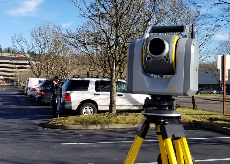
A unique workflow enabled by scanning robotic total stations is the simultaneous operation, with the same data controller and software, of a GNSS rover while scanning and imaging are being performed. Pictured: a Trimble SX12 and R12i GNSS. (Image: Gavin Schrock)
Scanning capabilities, in one form or another, have been added to models of robotic total station (RTS) since 2007 — for instance, on the Trimble VX. Such capabilities were limited to a pattern of individual shots, as the RTS would “nod.” While not designed to compete with traditional scanners, even such painfully slow “pseudo-scanning” capabilities demonstrate the value of new options for capturing detailed features.
It was not long before nearly all RTS offered limited (nodding scanning) capabilities, though at rates as slow as 15 shots per second. By 2013, the release of the Leica MS50 took the nodding scan to the next level, with a rate of up to 1,000 points per second, and then up to 30,000 in the subsequent MS60 model (which now also supports a tilting prism pole).
The end of 2016 saw the release of Trimble’s SX10 (and SX12 more recently). This routed the laser through a pair of rotating prisms to capture a swath of points as it nodded. In 2019, Topcon took the approach of adding a piggy-backed compact conventional scanner to the top of an RTS: the GTL-1000 and GTL-1200 models.
All these implementations were built upon high-quality RTS. Foremost, they can be operated as an RTS, with all the same integrated surveying capabilities as instruments with which surveyors were familiar, and in the same field software.
This includes all the integrated GNSS workflows: resections, combining optical and GNSS captured points in the same survey, and adding a rover to the prism pole for track-on-GNSS methods. One huge advantage of scanning total stations is instant deliverables already fully registered, as adopters of these new systems quickly realized.
Some initial users seemed skeptical of the relatively slow scan rates of these various models: 12 to 30 minutes for full-dome scans, and then a photo capture pass. Others, though, discovered that the time did not necessarily need to go to waste.
First, it is not necessary to do a full-dome scan and image pass every time; it is sufficient to pre-select specific areas to scan and image.
The real kicker is that while the RTS is scanning, it is possible to fire up the GNSS rover and capture points that the RTS cannot see, such as behind curbs, cars and vegetation. This is true especially now, with the advent of no-compensation tilt capabilities on nearly every new GNSS rover system.
This can be done in the same project, using the same software and field controller. This struck this writer as one of the coolest lateral features of scanning total stations when he first tried out an SX10 in 2017.
Considering the benefits scanning total stations deliver (especially with the integrated GNSS bonus), what has the reception been like among surveyors and other segments of the architecture, engineering and construction (AEC) community?
“As an industry, we’re getting better at tying solutions and workflow elements together, and not seeing them, or treating them, as individual functions or pieces of hardware,” said Derek Shanks, director of Geospatial Optical Product Management for Trimble. “We bring the system aspect, a case of using the best tool, using the strengths of each tool to their fullest.”
Accoring to multiple manufacturers, sales numbers indicate that the adoption of scanning total stations for AEC applications — and not just surveying — has exceeded expectations.
An interview with Rachel Wong, product manager, surveying and engineering division at CHC Navigation about recent GNSS receiver innovations.
Wong
What was the most significant technical innovation in your GNSS receivers in the past five years?
CHC Navigation is a technology enabler for geospatial professionals in more than 120 countries. End users of geospatial data increasingly come from diverse backgrounds. This forces us to invest heavily in simplifying data-acquisition processes by focusing on the user friendliness and positioning reliability of our GNSS receivers.
The latest technological developments in GNSS real-time kinematic (RTK) rovers are based on the maturity and improvement of satellite navigation systems, as well as on the integration of IMU sensors in the receivers — the latter being certainly the most important innovation.
In addition, the latest generation of our GNSS rovers, such as the CHCNAV i83, is based on the sophisticated iStar algorithm, which significantly improves the efficiency of tracking GNSS satellite signals for unmatched performance in GPS, GLONASS, BeiDou, Galileo and QZSS constellations, using all available frequencies including BeiDou 3. This goes hand-in-hand with the integration of the IMU as it helps to ensure increased GNSS positioning accuracy through optimized satellite geometry.
What has it enabled users to do that they could not do before?
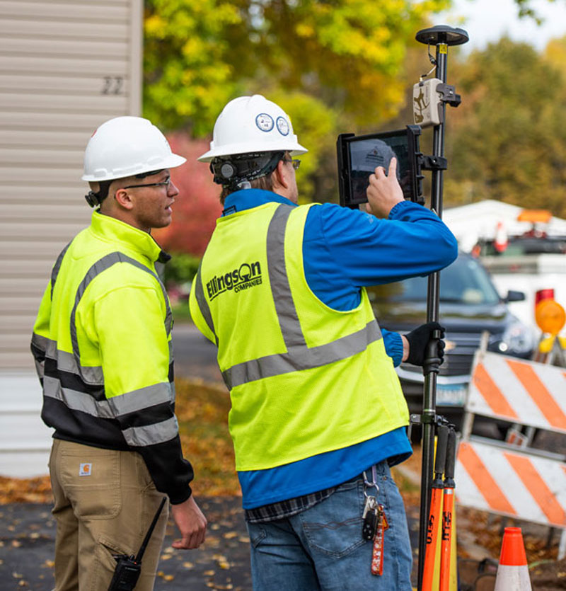
A utility worker uses the tilt-pole-compensation feature to measure a manhole. (Photo: CHC Navigation)
The integration of GNSS+IMU modules allows surveyors to survey points without the need to level the range pole, accelerating the adoption of GNSS technologies for early adopters by simplifying work processes. For example, our i83 GNSS is powered by a 1,408-channel multiband GNSS receiver, the latest iStar technology and a high-end, calibration-free IMU sensor for faster, more reliable GNSS field surveys.
The i83 GNSS’ integrated IMU automatically compensates for pole tilt, increasing surveying, engineering and mapping efficiency by 30% over conventional RTK GNSS surveying methods. In less than 5 seconds, the 200-Hz inertial module is initialized to ensure survey-grade accuracy over a pole-tilt range of up to 30 degrees that meets the real-world operational needs of our users.
What is a good example of this?
Surveyors can extend their working boundaries near trees, walls and buildings without the need for a total station or offset measuring tools. This can be illustrated in sewer and drainage applications, such as measuring the bottom of manholes for water, utilities or sewers, which was barely feasible in terms of GNSS measurement before the advent of hybrid GNSS + IMU positioning.
Operators only need to concentrate on their tasks and no longer need to level their pole vertically. They are now able to perform many measurements without compromising accuracy and reliability. Productivity is greatly increased, RTK usability is greatly improved, and potential human error is reduced, whether you are an engineer, foreman or surveyor, and whether you are an experienced or new user.
ComNav Technology has announced major upgrades to its T300 and T300 Plus GNSS receivers for the global market, including an upgrade to its GNSS K8 platform on both receivers and a tilt-sensor replacement for the inertial measurement unit (IMU) on the T300 Plus.
The upgraded T300 and T300 Plus provide reception of more GNSS channels and increased reliability, the company said.
More channels. The powerful full-constellation tracking ability on the K8 platform enables reception of all current and future GNSS signals, including GPS, BeiDou, GLONASS, Galileo, QZSS, NavIC and SBAS. Signal support and tracking for QZSS L1/L2/L5, Navic L5, Galileo E6 and Altboc as well as GLONASS L3 are also available. After the upgrade, T300 and T300 Plus each receive 965 GNSS channels, and offer robust GNSS tracking performance.
Improved reliability. The advanced GNSS real-time kinematic (RTK) technology on the K8 platform provides continuous centimeter-level positioning within a short period of time. To alleviate the influence on authentic satellite signals, the K8 platform enhances interference detection and mitigation. The interference, for example, between buildings or in the dense jungle, will not affect the positioning results.
With the upgrades, users can expand the reach of their GNSS rovers and obtain reliable positioning results even in complex environments.
Low power consumption. In static mode, power consumption is reduced to 1.92 W, extending working time to 16 hours and providing a smooth workflow without an external power supply.
T300 Plus tilt compensation. Combined with the inertial measurement unit (IMU), the T300 Plus can support tilt compensation up to 60° and keeps the accuracy within 2.5 centimeters, which significantly improves the fieldwork with increased efficiency, convenience and reliability without magnetometer and accelerometer calibration.
The upgraded T300 and T300 Plus GNSS receivers are available now.
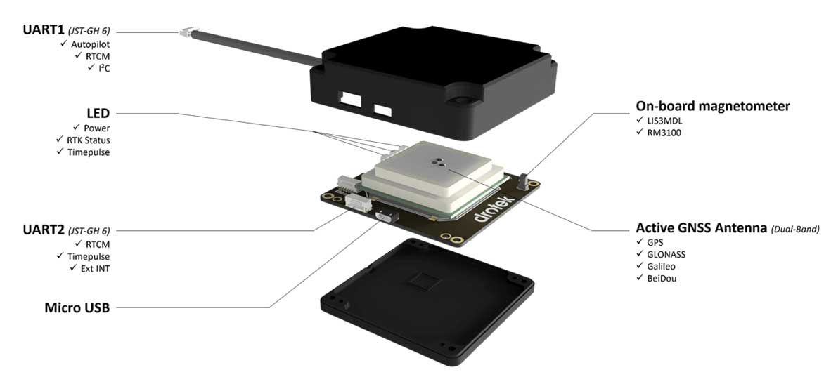
Drotek Electronics is now offering the F9P Sirius RTK GNSS Rover, which is designed to be mounted on a moving vehicle. The u-blox ZED-F9P module inside provides 1-cm position accuracy, a convergence time under 10 seconds and a navigation update rate up to 20 Hz.
The new Sirius RTK GNSS Rover F9P has a built-in active antenna patch. It receives GPS, Galileo, Beidou and GLONASS signals, providing additional accuracy. The F9 Sirius Rover is designed to fit most setup designs as well as integrate easily into a vehicle. Its six-pin JST-GH connector makes it plug-and-play with the Pixhawk Pro 3 autopilot.