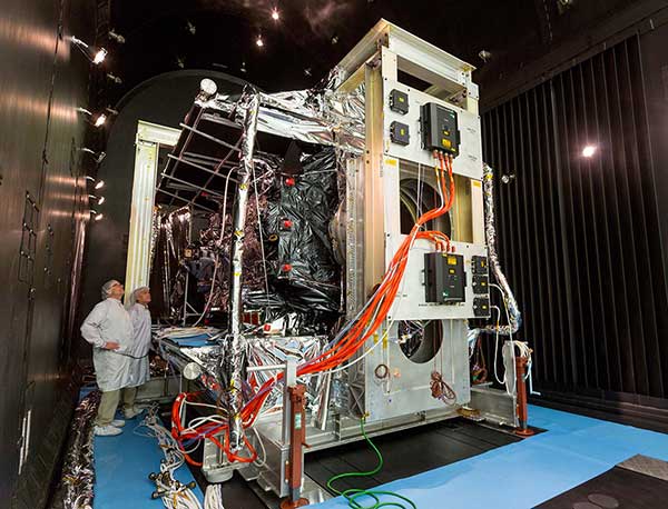
Thermal Vacuum testing verifies that a satellite can operate in space’s extreme environment. (Photo: Lockheed Martin)
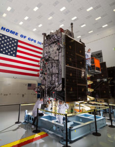
With GPS III SV01 and SV02 now on orbit, GPS III satellites continue to roll off the production line at Lockheed Martin’s GPS III Processing Facility near Denver.
Johnathon Caldwell, Lockheed Martin Space’s vice president for navigation systems, provided GPS World with an update to the entire GPS III family.
SV01. The first GPS III satellite is in a holding state pending readiness by 2SOPS [the Second Space Operations Squadron] to take the vehicle onto the system for operational checkout, a transfer expected to take place later this year, Caldwell explained. The satellite completed on-orbit testing in July.
“We’re in the process of getting the 2SOPS crews trained up to operate a GPS III vehicle,” Caldwell said. “By the end of this year, they will be able to take [SV01] into the constellation and start flying it as a live, set-healthy vehicle.”
SV02. Launched Aug. 22, SV02 is following in the footsteps of its older sibling, with a quiet checkout and no major findings. Like SV01, once it completes testing, it will stay in temporary holding until 2SOPS is ready to bring it into the constellation.
SV03. On May 27, the Air Force declared SV03 available for launch. It is now in final preparations for shipment, with an expected launch date in January 2020 aboard a Falcon 9 rocket.
SV04. The Air force declared SV04 available for launch; it is now in storage awaiting a launch date.
SV05. The fifth satellite is wrapping up environmental tests. Lockheed Martin anticipates that it will be available for launch early next year.
SV06. The satellite has been moved into the thermal vacuum testing chamber and begun a rigorous testing campaign before it meets the harsh environment of space.
SV07, SV08 and SV09 are on the assembly line.
GPS IIIF Satellites. In 2018, the Air Force selected Lockheed Martin to build up to 22 GPS IIIFs, adding new features and resiliency to the original GPS III satellite design. The company has been on the path to meet the critical design review for the GPS IIIF spacecraft, which is due to take place next spring.
Plus an update on GPS III satellites in production
Editor Alan Cameron talked with Johnathon Caldwell, Lockheed Martin’s vice president of navigation systems.
Tell us about the on-orbit performance of the GPS III SV01, launched in December.
On Jan. 8 we began broadcasting navigation data across all signal chains, and the satellite has been in checkout mode since then. According to all the reports I get from various independent agencies, the vehicle has been performing outstanding, and the payload performance has been exceeding expectations.
We’ve been evaluating in depth how the payload performs, including independent agencies assessing the signal quality. Later this fall we’ll transition satellite ground control from the OCX Block 0 ground control system installed at Lockheed Martin’s Waterton Launch & Check Out facility over to the GPS Operational Control Segment (OCS) the 2SOPS is using now, and we’ll really see the performance improving from where it is today.
“We’re certainly at the top end of what
we thought we might be able to achieve
in terms of signal accuracy.”
The satellite is doing what everybody had hoped. There’s always great anticipation when a new system goes up. It’s actually been a very smooth on-orbit test campaign. We’re wrapping up on the early side; we’ll be ready to transition into the OCS this fall.
This past December we completed a major Architecture Evolution Plan (AEP) 7.5 OCS upgrade. This included both hardware and software upgrades to the legacy control system, and the Contingency Operations (COps) upgrade is coming later this fall. This is the software upgrade that will let OCS fly this first GPS III satellite and let the Air Force take advantage of great new capabilities. We will deliver the upgrade in May; it will get packaged up and delivered into the OCS in the fall. SV01 will then move from Lockheed Martin’s Waterton launch and checkout facility control to Air Force 2SOPS control and join the constellation on the OCS.
A GPS satellite doesn’t do its mission by itself. It takes an entire system to run. You’re always monitoring signal quality and tweaking things to get the optimal performance. Today, we’re flying SV01 by itself. The OCS and the 2SOPS crew will start flying it like they do the others, giving it the daily update and looking at the signal quality and maximizing the performance.
We’re certainly at the top end of what we thought we might be able to achieve in terms of signal accuracy.
And GPS III SV02 has shipped to the Cape.
We’ve wrapped up functional testing; it’s in great shape. We’re now in a quiet period prior to final review leading up to fueling decisions in May for a planned July launch.
Using the Delta IVb rocket for SV02 offers a good opportunity to demonstrate the wide range of launch vehicles that GPS III is capable of. The satellite has great compatibility across platforms, a flexibility that’s a benefit for the Air Force.
The factory was also getting pretty full so it was great to ship out SV02. When it gets to the end of the line and ready to go, you want to get it out and have it doing the mission it’s designed to do.
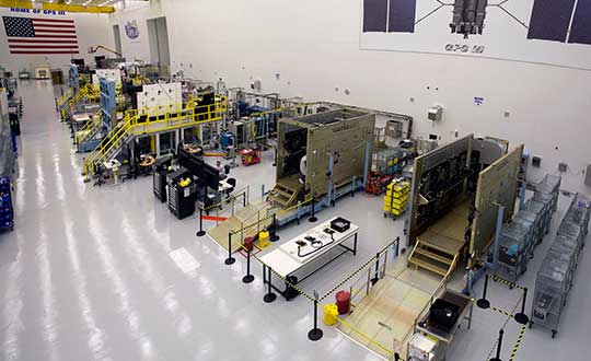
GPS III production line. (Photo: Lockheed Martin)
How about the production status of SVs 03 through 10 on the factory line?
SV03 has gone through complete environmental tests and is ready for delivery to the Air Force later this spring. SV04 is in final environmental test and will deliver later this year. SV05 is in thermal vacuum (TVAC) testing now, and doing an outstanding job. TVAC is the hardest test we go through, and it’s as if it’s flying in the environment of space. It’s the stress test. SV06 is put together, and now in its initial functional testing.
There aren’t many production lines of this size of large satellites. It’s very impressive. As you look down the line, our high bay is modeled after the best of production lines. Hardware and avionics and power systems are coming in as piece parts, getting built in. As you go down the bay, the vehicles are getting more and more complete. Now on the front end of the line we’ve got SV07 and SV08 starting. SV09 will begin later this summer, and not long after we hope to open up space for the 10th vehicle.
Last words: Progress so far on GPS IIIF?
We’re now in the full design campaign for the follow-on satellites that will lead to critical design review, the capstone of the process. The CDR will wrap up in February 2020.
Harris Corporation has received a $243 million contract from Lockheed Martin to provide fully digital navigation signals for the first two GPS III Follow-On (GPS IIIF) satellites — to deliver stronger signals, with greater operational flexibility.
Harris’ GPS IIIF fully-digital Mission Data Unit (MDU), the heart of the satellite’s navigation payload which generates the GPS signals, will provide more powerful signals, assure flawless clock operations for GPS users, and add flexibility to adapt to advances in GPS technology, as well as future changes in mission needs.
It will provide improved capabilities over Harris’ 70-percent-digital MDU used for GPS III Space Vehicles 01-10 (GPS III SV01-10).
The new MDU also offers the Air Force a smooth transition to its GPS OCX ground control segment. Harris will seamlessly port its digital signal design, minimizing both integration risks and associated costs.
In September 2018, the U.S. Air Force selected Lockheed Martin, with Harris as its navigation signal partner, to build up to 22 GPS IIIF satellites, with a total estimated contract value up to $7.2 billion.
The Air Force expects the first GPS IIIF satellite, SV11, to be available for launch in 2026.
Launched aboard GPS III SV01 in December 2018, Harris’ first GPS III navigation payload began broadcasting navigation signals on January 8. While testing of the first-of-its-kind satellite continues, the payload has performed beyond expectations.
Harris has provided navigation technology for every U.S. GPS satellite ever launched, enabling the reliable GPS signal that millions of people — including U.S. soldiers — and billions of dollars in commerce depend on every day.
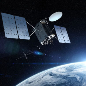
When managed by a new ground control system, GPS III satellites will offer triple the accuracy and eight times the anti-jamming capabilities of the satellites currently comprising the U.S. Air Force’s GPS constellation. Users military and civilian will reap ample benefits.
Everything changed for space-based positioning, navigation and timing around the world on Dec. 23, 2018. Or maybe it didn’t. The innovations heralded by the launch of the first GPS III satellite will take years more to occur. We tabulate here the advances that Generation Three will bring over GPS-to-date, and review the timeline for their actual arrival.
While these new capabilities exist — in concept — in space, they can’t be leveraged on the ground (or in the air, or at sea) until a sufficient number of additional GPS III satellites have joined the constellation, and until a new ground control system comes online. This will occur — perhaps — in 2023. At that time the satellites’ talents will be unleashed.
“As more GPS III satellites join the constellation, it will bring better service at a lower cost to a technology that is now fully woven into the fabric of any modern civilization,” stated Lt. Gen. John Thompson, commander of the U.S. Air Force’s Space and Missile Systems Center and the Air Force’s program executive officer for space.
The many GPS III upgrades should make the service more reliable and accurate for civilians, more secure against those who want to jam military users, and more cyber-secure for everyone.
TALKIN’ ‘BOUT OUR GENERATION
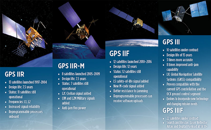
GPS constellations have grown through six major iterations since 1978. The sixth, GPS IIF, rose during the years 2010 to 2016. Those 12 satellites are all designed to last 12 years. Some of their notable features include the ability to receive software uploads, better jamming resistance and increased accuracy.
GPS III, the seventh generation, will launch nine more satellites to join SV01 already in space. GPS III SV02 is scheduled to launch in July of this year, SV03 in late 2019, and SV04 in 2020. The final III payload should rise in 2023. From that point on, the follow-on era of GPS IIIF takes over.
How Long, How Long? “Projections for how long the current constellation will [continue to] be fully capable have increased by nearly two years to June 2021, affording some buffer to offset any additional satellite delays,” reported the Government Accounting Office at the end of 2017. This provided some schedule buffer for launching the first GPS III satellite, but it did not reduce the desire to launch as soon as the booster rocket became available.
The new birds will introduce new capabilities to meet higher demands of both military and civilian users: once filled out, the GPS III constellation will bring three times better accuracy and up to eight times improved anti-jamming capabilities. Spacecraft life requirement will extend to 15 years, 25 percent longer than the latest GPS satellites and twice the original design life of the oldest satellites on orbit today.
The new L1C civil signal broadcast by GPS III is an interoperable signal with other international global navigation satellite systems, like Galileo, improving connectivity for civilian users.
GPS III will eventually actualize full M-code capability — carried aboard the IIR-Ms and IIFs but not yet completely implemented — in support of warfighter operations. GPS III M-code capability exceeds that of GPS IIR-M and GPS IIF.
GPS III will complete the deployment of the L2C civil signal and the L5 safety-of-life signal capabilities that began with \GPS IIR-M and GPS IIF satellites.
Finally, GPS III will enact improved integrity: the ability of the satellite to detect and issue alerts on its own reduced accuracy, should that phenomenon ever occur.
Military Signal Power Up. Encrypted M-code signals will be up to eight times more powerful than currently. This makes them more reliable. but also enables the sats to overcome efforts to jam their signals.
Other signals also offer increased signal power at the Earth’s surface. L1 and L2: −158.5 dBW for aC/A code signal and −161.5 dBW for the P(Y) code signal. L5 will be −154 dBW.
Family Features. The most recent generations of the GPS constellation. IIR, IIR-M and III were produced by Lockheed Martin, while IIF was built by Boeing. One GPS IIA satellite is still in operation, at 25 years young (design life was 7.5 years). All satellites carry Harris Corporation payloads. (Graphic sourced from: Lockheed Martin and Boeing Co.)
L SIGNALS
L2C, the second open GPS signal, after L1 C/A, has been available from every new GPS satellite since the first IIR-M launch in 2005. L5, the third open GPS signal, became available with the first IIF launch in 2010. Now L1C, the fourth open GPS signal, joins the band, broadcasting from every new GPS satellite, starting with the recent GPS III launch (see First Light).
The first GPS III satellite is in checkout and testing that could last up to 18 months before it enters service. “After its Dec. 23 launch, GPS III SV01 successfully completed its orbit raising and deployment of all of its antennas and solar arrays. On Jan. 8, the satellite’s navigation payload began broadcasting navigation signals,” said Johnathon Caldwell, Lockheed Martin vice president for navigation systems. “On-orbit testing continues, but the navigation payload’s capabilities have exceeded expectations and the satellite is operating completely healthy.”
Testing, Testing. Using the Air Force’s Back-to-Basics program, which involved early prototyping and simulations, Lockheed Martin developed GPS III with an approach that involved rigorous quality-build certificates, component testing and system-level testing. The comprehensive requirements verification and validation process ensured more than 30,000 requirements were achieved. The system functional qualification includes the performance verification in multiple environmental tests, including the acoustic, thermal vacuum (TVAC) and electromagnetic spectrum.
“We consider thermal vacuum the gold standard for testing any satellite before it goes into operations,” Col. Steve Whitney, director, GPS Directorate, wrote in GPS World in December. “It really is putting the craft through the paces. When it goes through the testing, the satellite is on. It is working. It is exposing it to the heat and the cold and the zero pressure while the satellite is functional. The entire thermal vac testing from start to end is about 70 days. Test like you fly. From the time it launches and deployment sequence, we test it like it is real. Minus the shaking, the satellite thinks it is getting launched. Meanwhile, our people are looking at the data and its health. TVAC is a huge milestone for a satellite to go through and come out no issues.”
To date, more than 90 percent of parts and materials for all 10 GPS III satellites have been received from more than 250 aerospace companies in 29 states.
BRAIN OF THE BUNCH
THE FIRST GPS III satellite was fully assembled and entered into SV single-line flow when Lockheed Martin technicians integrated its system module, propulsion core and antenna deck. (Photo: Lockheed Martin)
Harris Corporation is a subcontractor to Lockheed Martin for development and production of GPS III Mission Data Units (MDUs) and transmitters for the GPS space section. Six have been delivered.
The Harris MDU, together with the Atomic Frequency Standards and the L-band transmitter equipment, make up the Navigation Payload Element. The MDU performs the primary mission of the GPS satellite: generation of the navigation signals and data on a continuous basis. The MDU controls the generation of the precise timing signals used for navigation signals while distributing the timing signals to other satellite components.
This MDU is 70 percent digital. The next to come, aboard GPS IIIF satellites, will be fully digital.
When asked about the advantages of an all-digital payload, Harris Corporation’s Jason Hendrix, PNT program director, told GPS World in April 2018, “The advantages and the 30 percent difference are the timekeeping system portion. We’re moving from manual, analog timing to digital to deliver to the Air Force more flexibility. It’s a nice option to have to be able to reprogram in orbit and maybe enhance capabilities desired in the future.”
LIVING BETTER, LIVING LONGER
Greater mission longevity is one of the key improvements GPS III delivers over those currently in service. Space Vehicles 1–10 have a planned mission life of 15 years, 25 percent longer than their predecessors. That begs the question, “How long should a satellite live in space, with technology innovation occurring almost annually?”
Advanced payload technology provides a partial answer. Lockheed Martin and Harris point to new payload capabilities with built-in flexibility to adapt satellites in orbit to technology advances, as well as changes in missions. According to Harris, the fully digital navigation payload will provide the ability to change and upgrade the satellites incrementally over mission life.
In late 2017, Lockheed announced a partnership with NEC Corporation to introduce artificial intelligence for computer learning in orbit. The company touted significant advances in processors and a move toward next-generation antennas, arrays and transmitters to drive more satellite flexibility, capability and resilience.
FROM THE GROUND UP
GPS IIIF’s M-Code can be broadcast from a high-gain directional antenna in a concentrated, high-powered spot beam, in addition to a wide-angle, full-Earth antenna. (Artist rendering: Lockheed Martin)
GPS III’s military upgrades require new ground control stations, a replacement effort called OCX that has suffered repeated delays and cost increases, due to the complexity of the programming and requirements modifications. The new jamming-resistant military signal will not be available until the new, highly complex ground control system is available, and that is not expected until 2022 or 2023. Delay and cost considerations were driven in part by full implementation of all Department of Defense 8500.2 “Defense in Depth” information assurance standards without waivers, giving it the highest level of cybersecurity protections of any DoD space system.
Deliverables for GPS OCX are divided into three blocks. Block 0 delivery took place in fall 2017, enabling it to support the December launch. Block 1 delivery will take place in 2021, providing full operational capability to control both legacy and modernized satellites and signals. Block 2, delivered concurrently with Block 1, adds operational control of L1C and modernized M-code.
In 2018, wrote Col. Whitney of the GPS Directorate, “We have actively utilized the [Block 0] system in a variety of exercises, training events, compatibility tests and launch readiness events. We also completed a comprehensive security review of the system to demonstrate our readiness to start operations. The system is ready to go. We continue to work the development of the OCX Block 1 system and are wrapping up the initial coding of the system early in 2019, leading into our integration and test campaign.”
Given delays in OCX, “the Directorate is actively working two major upgrades to bridge the gap,” Whitney continued. “The first is GPS III Contingency Operations (COps) modification which will allow the 2nd Space Operations Squadron (2SOPS) to command and control the GPS III family of vehicles in a mission state matching today’s legacy signals for all users world-wide. The second modification is M-code early use (MCUE), which enables 2 SOPS to operationalize the Modernized GPS military (M-code) navigation signals for the warfighter.”
Before December’s launch, OCX underwent rigorous cybersecurity vulnerability assessments that tested the system’s ability to defend against both internal and external cyber threats. GPS OCX prevented the broadcast of corrupt navigation and timing data in all tests, bolstering the program’s readiness for GPS III.
“We’ve built a layered defense and implemented all information assurance requirements for the program into this system,” said Dave Wajsgras, president of Raytheon Intelligence, Information and Services. “The cyber threat will always change, so we’ve built OCX to evolve and to make sure it’s always operating at this level of protection.”
The new Harris navigation payload offers a smooth transition to use of OCX. The payload for the first 10 GPS III satellites has been verified for OCX compatibility so the same OCX commands will seamlessly port to the Harris fully digital design, minimizing integration risks and associated costs.
According the the GAO, “Full M-code capability —which includes both the ability to broadcast a signal via satellites and a ground system and user equipment to receive the signal — will take at least a decade once the services are able to deploy military GPS user equipment (MGUE) receivers in sufficient numbers.” The April 2019 issue of GPS World will review M-code implementation across U.S. DoD platforms.
THE FUTURE’S NOT OVER YET
In spring 2018, Lockheed Martin submitted a proposal for the GPS III Follow On (GPS IIIF) program, which will add enhanced capabilities to the satellites. New hardware — a high-gain directional antenna — aims signals in a spot beam at a limited area, but blasts the signal at high power for strategic use by the military.
Inter-Satellite Links. Block IIIF satellites will carry laser retro-reflectors to enable orbit tracking independently of the satellites’ radio signals, which in turn will allow satellite clock errors to be disentangled from ephemeris errors. A standard feature of GLONASS, this is included in the Galileo positioning system, and was flown as an experiment on two older GPS satellites, 35 and 36.
In September 2018, the Air Force selected Lockheed Martin to build up to 22 additional satellites under the GPS IIIF program.
As a risk reduction effort for the U.S. Air Force’s GPS III Follow On (GPS IIIF) satellite program, Frequency Electronics Inc. has received a contract from Lockheed Martin Space, valued at $5.9 million, for the qualification of FEI’s Digital Rubidium Atomic Frequency Standard (DRAFS).
The contract’s intent is to qualify FEI’s DRAFS for potential use on the new GPS IIIF satellites, securing the industrial base for high-accuracy GPS atomic clocks.
To help the Air Force modernize its GPS satellite constellation with new technology and capabilities, Lockheed Martin Space designed and built the most powerful GPS satellite, GPS III. With 10 satellites under contract, in 2018, the Air Force selected Lockheed Martin to build up to 22 additional GPS IIIF satellites, adding new features and resiliency to the flexible satellite design. The Air Force began launching GPS III satellites in December 2018. Today, more than 4 billion users rely on GPS.
“We are extremely pleased to be awarded this contract and the opportunity to play a significant role in the GPS IIIF program,” Stanton Sloane, FEI’s CEO commented. “This award is the culmination of 50+ years of research and development of advanced quartz and atomic clocks based on FEI’s proprietary technologies. We are also pleased to continue our long-standing relationship with Lockheed Martin Space on critical national security programs.”
Martin Bloch, FEI’s Executive Chairman added, “I congratulate the FEI team on the development of this digital Rubidium clock for GPS IIIF program. FEI will continue the development of advanced clock technologies for future generations of Satellites and Terrestrial applications.”
Frequency Electronics designs, develops and manufactures high-precision timing, frequency control and synchronization products for space and terrestrial applications. Its products are used in satellite payloads and in other commercial, government and military systems including C4ISR and EW markets, missiles, UAVs, aircraft, GPS, secure radios, energy exploration and wireline and wireless communication networks.
Its subsidiaries and affiliates include FEI-Zyfer, which provides GPS and secure timing (“SAASM”) capabilities for critical military and commercial applications; and FEI-Elcom Tech, which provides subsystems for the Electronic Warfare markets and added resources for RF microwave products.
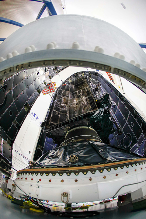
GPS III SV01 is now encapsulated and will be placed on the SpaceX rocket for Dec. 18 launch. (Photo: Lockheed Martin)
The U.S. Air Force’s first Lockheed Martin-built GPS III satellite is now encapsulated for its planned Dec. 18 launch from Cape Canaveral Air Force Station, Florida, on a SpaceX Falcon 9 rocket.
GPS III Space Vehicle 01 (GPS III SV01) underwent pre-launch processing, fueling and encapsulation at Astrotech Space Operations in Titusville, Florida. During encapsulation, GPS III SV01 was sealed in its launch fairing — an aerodynamic, nose-cone shell that protects the satellite during launch.
In the coming days, the fairing-enclosed satellite will be mounted to the rocket as launch preparations continue.
GPS III SV01 is the first of an entirely new design of GPS satellite that will help the Air Force modernize today’s GPS constellation with new technology and advanced capabilities.
GPS III has three times better accuracy and up to eight times improved anti-jamming capabilities. Spacecraft life will extend to 15 years, 25 percent longer than any of the GPS satellites on-orbit today. GPS III’s new L1C civil signal also will make it the first GPS satellite broadcasting a compatible signal with other international global navigation satellite systems, like Galileo, improving connectivity for civilian users.
“The world is dependent on GPS. More than four billion military, commercial and civilian users connect with signals generated by GPS satellites every day,” said Johnathon Caldwell, Lockheed Martin’s vice president for Navigation Systems. “The launch of GPS III SV01 will be the first step in modernizing the Air Force’s GPS constellation with the most powerful and resilient GPS satellites ever designed and built.”
Lockheed Martin developed GPS III and manufactured GPS III SV01 at its advanced $128-million GPS III Processing Facility near Denver. In September 2017, the Air Force declared the satellite “Available for Launch” (AFL) and had the company place it into storage.
In 2017, the Air Force “called up” the satellite for launch and Lockheed Martin delivered it to Florida on Aug. 20. The Air Force nicknamed the satellite “Vespucci” after Italian explorer Amerigo Vespucci.
GPS III SV01 is the first of 10 GPS III satellites originally ordered by the Air Force. GPS III SV03-08 are now in various stages of assembly and test. In August, the Air Force declared the second GPS III “AFL” and, in November, called GPS III SV02 up for 2019 launch.
In September, the Air Force selected Lockheed Martin for the GPS III Follow On (GPS IIIF) program, an estimated $7.2 billion opportunity to build up to 22 additional GPS IIIF satellites with additional capabilities.
GPS IIIF builds off Lockheed Martin’s existing modular GPS III, which was designed to evolve with new technology and changing mission needs. On Sept. 26, the Air Force awarded Lockheed Martin a $1.4 billion contract for support to start up the program and to contract the 11th and 12th GPS III satellite.
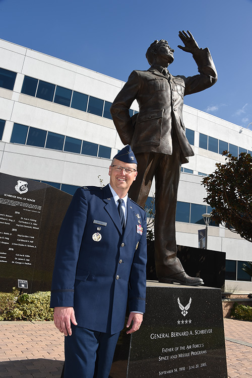
Col. Steve Whitney stands beside a statue of General Schriever at Los Angeles Air Force Base, home of the GPS Directorate. (Photo: U.S. Air Force/Joseph Juarez, Sr.)
By Col. Steven Whitney Director, Global Positioning Systems Directorate
Navigating across the world’s roads with GPS is easy. Navigating through the shifting construction zones, detours, and forks of the GPS Enterprise is not always so straightforward.
For that reason, the GPS Directorate has placed more emphasis on illustrating, both figuratively and literally, the roadmaps leading to the integration of the GPS Enterprise.
Before linking everything together, let’s start with an update on each major program effort. This way you can zoom out to see the path ahead; hopefully minimizing any “route recalculating” along the way.
Program Updates
The journey to build the new GPS III satellites has been full of twists and turns but we are now close to our destination – in this case the GPS orbit of 12,550 miles above the Earth.
We not only have 10 GPS III Space Vehicles simultaneously in production at Lockheed Martin’s manufacturing facility in Waterton, Colorado, but are also going full swing on preparations to launch our first vehicle in December 2018 on a SpaceX Falcon 9 rocket – more on this later. The GPS III satellites provide signals designed to improve the user’s ability to navigate.
In addition to the increased power and greater accuracy, GPS III adds a civil new signal, L1C, designed for compatibility with the international Global Navigation Satellite Systems (GNSS) community.
GPS IIIF. In September 2018, the Air Force awarded the GPS III Follow-on contract to Lockheed Martin. This $7.2B contract for 22 satellites was the result of a competitive process for a production effort. Based on the GPS III technical baseline, the GPS IIIF family of satellites embraces modernization and capability improvements in multiple areas.
First, a Regional Military Protection capability will provide increased anti-jam capabilities. Furthermore, a new Search-and-Rescue (SAR/GPS) payload will provide improved timeliness of global search-and-rescue operations. Additionally, a Laser Retro-reflector Array (LRA) payload will enable precise ranging measurements and the program will implement a Unified S-Band capability to address consolidation of telemetry, tracking, and commanding frequencies.
Finally, the program will host a redesigned Nuclear Detonation (NUDET) Detection System (NDS) solution that has a lower overall size and weight. We look forward to the continued partnership with Lockheed Martin and will be looking collaboratively at opportunities to add additional capabilities incrementally over the life of the 22 GPS IIIF satellite production line.
OCX, the Next Generation Operational Control Segment. Last year Raytheon delivered the initial system, known as OCX Block 0, to support the launch and on-orbit check-out of the GPS III satellites. This past year, we have actively utilized the system in a variety of exercises, training events, compatibility tests, and launch readiness events.
We also completed a comprehensive security review of the system to demonstrate our readiness to start operations. The system is ready to go. We continue to work the development of the OCX Block 1 system and are wrapping up the initial coding of the system early in 2019, leading into our integration and test campaign.
The journey over the past few years has been challenging, but we have emerged stronger, armed with better metrics, and a culture of integrated development (often called DevOps) which puts us on a path to success. There will be challenges and risks in the path ahead but rather than mountains to climb, I see these more as standard blocking and tackling of a software intensive program.
Col. Whitney next to an artist’s depiction of a GPS III satellite in orbit. (Photo: U.S. Air Force/Van Ha)
Legacy Ground Sustainment. Running in parallel to these modernization efforts is the all-important work to sustain our existing GPS infrastructure of our current Operational Control System (OCS). These sustainment efforts ensure GPS continues to be the gold standard in positioning, navigation, and timing but also are a crucial “on-ramp” to facilitate a smooth merge onto the modernized GPS capabilities.
Since 2014, the GPS program office has incrementally implemented several upgrades that not only maintain our satellite constellation delivery of GPS signal-in-space accuracy of 50 cm, but also significantly increases the cybersecurity posture of the legacy OCS.
These upgrades culminated with a deployment of the latest modification in October 2018, which finished a worldwide modernization of our entire control system hardware and software. This latest upgrade, known as Version 7.5, virtualized the network, implemented two-factor authentication, and improved encryption for mission data.
Legacy Ground Improvements. Given the delays in OCX, the Directorate is actively working two major upgrades to OCS to bridge the gap. The first is GPS III Contingency Operations (COps) modification which will allow the 2nd Space Operations Squadron (2SOPS) to command and control the GPS III family of vehicles in a mission state matching today’s legacy signals for all users world-wide. The second modification is M-Code Early Use, which enables 2SOPS to operationalize the Modernized GPS military signals (M-Code) navigation signals for the warfighter.
User Equipment. As I write this article, soldiers, sailors, marines and airmen are testing and integrating mature, next-generation GPS receiver cards providing more accurate and reliable position, navigation, and timing (PNT) solutions. In 2019, the first increment of Military GPS User Equipment (MGUE) is on track to complete card-level testing to inform Service procurement strategies.
This exciting work is the culmination of nearly two decades of modernization efforts throughout the GPS Enterprise. In the near term, we are utilizing M-Code capable lead platforms — USAF B-2 Bomber, USMC Joint Light Tactical Vehicle, USN Arleigh-Burke Class Guided Missile Destroyer, and Army Stryker combat vehicle — to prove out those capabilities.
The second increment of MGUE focuses on requirements for precision guided munitions, a joint common modular handheld unit, as well as circuit cards and components for low size, weight and power needs. With MGUE, the DoD and services are poised to have enduring PNT solutions the warfighter can leverage for years to come.
Integration Roadmaps
The delivery of individual programs is the stepping stone in the capability deliveries to the warfighter and our civilian users. However, it is our ability to unite a diverse collection of programs and stakeholders, across the GPS Enterprise, which defines our success as the GPS Green Monsters. We have done this by linking cross-program enterprise teams so the sum of the whole is greater than its parts.
Enterprise Road to Launch (ERTL). The goal is pulling together a series of firsts (new satellite, new ground system, and new launch provider), which has not been done before in the modern GPS Era, to deliver the spacecraft safely on-orbit and under control. Our journey to this historic launch has taken time and effort, and we are enthusiastically awaiting the final steps.
The first GPS III spacecraft is safely at Cape Canaveral and ready to go. The control system has been tested and run through its paces. The integrated launch team has conducted its exercises and reviews. All signs point to launch in December 2018.
The launch itself is a significant milestone, and marks a beginning of the orbital phase of GPS III. The Road to Launch team is prepared to execute the launch, the check-out and the day-to-day on-orbit housekeeping until the ground updates are complete to transfer the new GPS III satellite into the active constellation later in 2019.
Enterprise Road to Mission (ERM). The goal is bringing the GPS III satellites into the active constellation providing mission similar to today’s capabilities. A key enabler of the ERM IPT’s success is their development of the first-ever Enterprise “Integration Playbook”, which is the tangible, documented output of a significant dedicated planning effort.
The Playbook captures how all the pieces and efforts from each stakeholder community tie together to achieve Operational Acceptance of the first GPS III satellite, the USNDS payload, and the COps modification to OCS. The “Playbook” describes in clear and concise terms how these deliveries integrate across the GPS Enterprise, as well as how tasks and milestones from various stakeholders converge to achieve clear end states.
Enterprise Road to M-Code Mission, or ERM-M-Code. Shifting now to our military users, the purpose of the ERM-M-Code team is to lead the early delivery of a more robust, resilient, jamming/tampering-resistant PNT signal capability to warfighters.
The rollout of the operational M-code capability depends on the success of the M-Code Early Use modification to OCS, installation of new M-code signal monitoring equipment at sites around the globe, modification of mission planning software, Military GPS User Equipment Increment 1 development, service lead platform integration efforts, and operationalization of space receivers.
Our ultimate objective is to improve the ability of the Combined Space Operations Center (CSpOC) to respond to urgent PNT needs of the combatant commanders, as they engage more sophisticated adversaries. We remain closely aligned with our peers at USSTRATCOM, AFSPC and user communities.
Conclusion
It is an exciting time to be a GPS Green Monster! These roadmaps are by no means easy to create and execute. It is thanks to the remarkable people of your GPS Directorate that these multifaceted challenges are unraveled, aligned, and resolved. The team has worked incredibly hard this past year to position our systems for major, integrated deliveries over the next couple of years.
It has been the highlight of my career to serve with these men and women and I can’t wait to see where we — and the GPS Enterprise — go next.
The U.S. Air Force has awarded Lockheed Martin a $7.2 billion contract to build 22 more GPS III satellites.
Like the first batch of 10 GPS III satellites, the GPS III Follow-On (GPS IIIF) satellites “will provide greater accuracy, and improved anti-jamming capabilities, making them more resilient,” said Air Force Secretary Heather Wilson in a statement.
The satellites will be built at the company’s Waterton campus in the Denver suburb of Littleton.
Under a previous contract, Lockheed is in the process of building 10 GPS III satellites, the first of which is slated to launch in December. The first GPS IIIF satellite could be ready for launch in 2026.
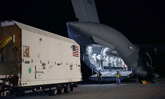
GPS III SV01 on Aug. 20 boards a U.S. Air Force C-17 for its flight to Cape Canaveral, Florida. (Photo: Lockheed Martin)
“We’re grateful for the U.S. Air Force’s continued confidence in Lockheed Martin on the GPS III/IIIF program,” said Johnathon Caldwell, Lockheed Martin’s program manager for Navigation Systems. “We’ve worked hard to develop and produce GPS III to help the Air Force modernize the GPS constellation with new, more powerful, and more resilient, technology.
“This new contract for GPS IIIF will bring GPS to a whole new level. It takes full advantage of our flexible satellite design to incorporate additional new technology like a 100% digital navigation payload, Regional Military Protection and new search-and-rescue payloads into the constellation. We are proud to be bringing these new capabilities to our warfighters and the world.”
Both Boeing and Northrop Grumman declined to bid on the contract, leaving Lockheed Martin the lone provider.
Lockheed Martin has submitted a competitive and fully compliant proposal for the U.S. Air Force’s GPS III Follow On (GPS IIIF) program, which will add enhanced capabilities to the most advanced GPS satellites ever designed. The GPS IIIF program intends to produce up to 22 next-generation satellites.
The U.S. Air Force’s first 10 GPS III satellites, now in full production at Lockheed Martin, are already the most powerful GPS satellites ever designed. GPS III will have three times better accuracy and up to eight times improved anti-jamming capabilities. Spacecraft life will extend to 15 years, 25 percent longer than the newest GPS satellites on-orbit today. GPS III’s new L1C civil signal also will make it the first GPS satellite to be interoperable with other international global navigation satellite systems, like Galileo.
Lockheed Martin’s proposal for the GPS IIIF program adds further power, resiliency and capabilities to GPS III.
The biggest feature of GPS IIIF will be a regional military protection capability, which will increase anti-jam support in theater to ensure U.S. and allied forces cannot be denied access to GPS in hostile environments.
Lockheed Martin’s GPS IIIF will feature a fully-digital navigation payload. The payload on the first 10 GPS III satellites is already 70 percent digital.
Each GPS IIIF satellite will include a laser retro-reflector array, which allows the positioning of on-orbit satellites to be refined with ground-based, laser precision. The precise positioning of each satellite ultimately enhances the positioning signals they generate.
Additionally, the U.S. government will provide each GPS IIIF with a new search-and-rescue payload. These hosted payloads, spread around the globe on GPS IIIF satellites, will make it easier for first responders to detect and respond to emergency signals.
“When we developed our design for the first 10 GPS III, we used a flexible, modular architecture that would allow for the insertion of modern technologies and new Air Force requirements in a low-risk manner,” said Johnathon Caldwell, program manager for Lockheed Martin’s navigation systems mission area. “In addition, our GPS IIIF solution is based off a design already proven compatible with both the Air Force’s next generation Operational Control System (OCX) and the existing GPS constellation.”
The first 10 GPS III satellites are in full production at Lockheed Martin’s GPS III Processing Facility, a $128 million cleanroom factory designed in a virtual reality environment to drive efficiency and reduce costs in satellite production.
GPS III SV02 completed rigorous Thermal Vacuum (TVAC) testing in December 2017, is in final environmental testing, and is expected to be declared AFL in summer 2018. GPS III SV03 was fully integrated in fall 2017 and recently began TVAC, and SV04 was recently integrated in anticipation of environmental testing later this summer. GPS III SV05 has now received its navigation payload and is in final vehicle build up. Not far behind, GPS III SV06 has begun its initial build with GPS III SV07 also planned to begin production this spring.
To date, more than 90 percent of parts and materials for all 10 satellites have been received, from more than 250 aerospace companies from 29 states, to help ensure GPS III maintains the gold standard in position, navigation and timing.
Col. Steve Whitney stands beside a statue of General Schriever at Los Angeles Air Force Base, home of the GPS Directorate. (Photo: U.S. Air Force/Joseph Juarez, Sr.)
By Col. Steven Whitney Director, Global Positioning Systems Directorate
The most discussed theme in the U.S. Air Force space community over the last year has been “resiliency.” But what does that actually mean, and how can the Air Force increase resiliency in space?
The GPS Directorate took these questions to heart and thought long and hard about resiliency in our Positioning, Navigation, and Timing (PNT) service. I am pleased to report that we have made significant progress in the past year in our quest to bring a new generation of PNT technology to reality.
More importantly, our investments in space, ground, and user equipment developments are bringing real, tangible benefits towards providing a more resilient PNT service worldwide. We stand on the cusp of delivering modernized civil and military GPS signals which provide critical pieces to the puzzle.
Farther into the future, the Air Force is already exploring new, emerging technologies and capabilities to even further advance the robustness of the GPS enterprise, with the vision that GPS will always remain the “Gold Standard” for the worldwide PNT community.
Resiliency Begins with Signals
Modernized GPS signals will be the first piece of the puzzle for an overall resilient PNT solution. The community has long anticipated the beginning of the multi-GNSS era.
The GPS Directorate has embraced this future with a new L1C signal, designed cooperatively from the ground up to be interoperable with international satellite navigation systems. The signal design will greatly improve GPS reception in cities and other challenging environments.
Another important GPS signal was introduced with our GPS IIF satellites. The L5 signal is designed specifically to meet the demanding requirements for safety-of-life transportation and other high-performance applications.
This signal is broadcast in a radio-frequency band reserved exclusively for aviation safety services to ensure it has optimal spectrum protection. Together, these two new additions greater improve PNT resilience for civil users around the globe.
“The need to improve cyber security and protection quite honestly cannot wait until delivery of the Next-Generation Operational Control System (OCX). To that end, the Directorate has focused on high payoff updates for the existing operational system.”
Other measures already improve resiliency by leveraging existing signals. For example, the L2C signal, when combined with L1 C/A in a dual-frequency receiver, will enable ionospheric error correction and improve positioning and timing accuracy.
For the military, the directorate has been focused on bring Military Code (M-code) into operations. The M-code signal features advanced anti-jam, anti-spoof, and encryption features that will ensure resilient and dependable PNT solutions for the United States and its allies.
The rollout of an operational M-code capability involves all segments of the GPS enterprise, and while it has been a long time in coming, the GPS Directorate made big strides this year (see “2017 in Review”). I will touch on the progress we are making in each of our development programs.
Resiliency in Space
The GPS space segment is the next step towards a more resilient PNT architecture. Our constellation remains robust and healthy, albeit aging, with 31 operational satellites providing worldwide coverage at the time of this article. The GPS III satellites will bring additional robustness with increased power and accuracy over previous generations of satellites.
We made big strides towards launching the first GPS III satellite in 2018, and just as importantly, production is in full swing on the rest of the ten satellites. I am incredibly proud of the entire government and contractor team that is meticulously acquiring, assembling, and testing these complex machines.
GPS IIIF. Farther into the future, the directorate is preparing for the GPS III follow-on program. The Air Force will be adding important new resiliency capabilities, with added signal flexibility via a reprogrammable, digital payload and increased anti-jam support to theater with a Regional Military Protection capability. Over the coming years as the follow-on GPS III satellites join the constellation, they will revolutionize GNSS with the full complement of operational L1C, L2C, L5 and M-code signals.
Resiliency in Control Segment
As important as the satellites are, the control segment is just as integral to the overall resiliency of the GPS enterprise. The need to improve cyber security and protection quite honestly cannot wait until delivery of the Next-Generation Operational Control System (OCX).
To that end, the directorate has focused on high payoff updates for the existing operational system.
For example, we acquired and deployed software-based GPS monitor station receivers, known as Monitor Station Technology Improvement and Capability (MSTIC) receivers, to replace the aging fleet of existing monitor-station receivers.
The functionality and expandability of the MSTIC receiver design will facilitate adding further capabilities such as M-code signal monitoring, and even civil L1C, L2C, and L5 signal monitoring.
The GPS Directorate also deployed a new cybersecurity monitoring suite to enhance cyber defenses. This new suite is in operation today at the GPS Master Control Station (MCS).
Beyond just improving our cyber protection, the Air Force has also stepped out on several OCX off-ramps to support the launch and operation of the GPS III satellites and mitigate risk of further OCX delays.
The Contingency Operations (COps) program modifies the existing Operational Control System (OCS) to allow the first GPS III satellites to join the operational constellation. The Air Force also initiated a companion program, M-code Early Use (MCEU) to further update OCS to provide limited M-code operations.
Together, these two programs provide critical interim steps towards fielding a more resilient constellation.
The OCX program provides the ultimate cyber protection and assurance needed for the GPS enterprise. After emerging from program recertification this year, the program has focused heavily on improved software system engineering and embracing software industry best practices, such as adopting DevOps and greater software automation.
The program has even leveraged Amazon Web Services’ Gov’t Cloud capability to provide more responsive development and test environments. While the program has a long ways to go, the government and prime contractor, Raytheon, are committed to delivery to ensure a robust and secure ground infrastructure.
User Equipment: Final Piece
The final piece of the resiliency puzzle for military customers is our user equipment segment. The directorate has made big strides in delivering the first set of modernized receiver cards for the Military GPS User Equipment (MGUE) Increment 1 program.
These advanced cards will enable platforms across the U.S. Department of Defense to leverage the new M-code signal, providing a tremendous boost in both anti-jam and anti-spoof capability.
They will also provide the latest in cryptography to ensure secure, robust protection for the United States and its allies.
Down the road, the Department of Defense is evaluating additional capabilities and platforms for the MGUE Increment 2 program.
Currently envisioned to address precision guided munitions, space receivers, and a modernized handheld unit, the Increment 2 program will be laying out an acquisition plan in this coming year to further adoption of M-code signals throughout the military.
A consideration for the future of user equipment will be exploring processing multi-GNSS signals. While no decisions have been made, multi-GNSS could offer opportunities for even additional resiliency.
Final Thoughts
This is an exciting time for the GPS enterprise.
We stand on the cusp of a new generation of capabilities that will usher in a huge increase in PNT resiliency and robustness. I am astounded at the quality of work that is presented at the many GNSS and PNT conferences around the world, and it is both exciting and humbling to see the community continuing to innovate ways to increase accuracy, integrity, availability, continuity, and performance.
Likewise, I am honored to lead the men and women of the GPS Directorate as we strive to deliver on our commitments and find new, innovative ways to provide robust and resilient PNT to the world.
This dedicated team is poised and ready to lead us into the future, and we look forward to working with the entire community to continue delivering the GPS “Gold Standard” in space-based PNT.