Tag: GPS signal

  • DHS Report on Denver Jamming – More questions than answers

    DHS Report on Denver Jamming – More questions than answers

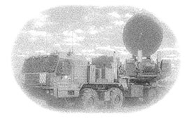
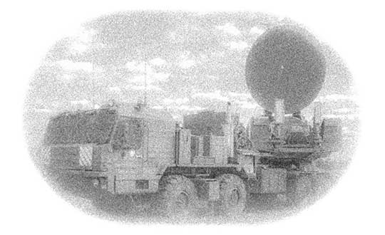
    The Cybersecurity and Infrastructure Security Agency (CISA) at the Department of Homeland Security (DHS) recently released a three page “CISA Insights” document titled “Global Positioning System (GPS) Interference.” The January 2022 GPS jamming incident in Denver is discussed on the first page as an example of bad things that can happen and why GPS users should take precautions against interference.

    Issued eleven months after the event, the report provides little new information, and leaves several important questions unanswered.

    Photo:
    Image: YayaErnst//iStock/Getty Images Plus/Getty Images

    Delay in locating and ending interference

    One of the most important questions is why it took so long to locate and end interference from a strong signal impacting such a large area.

    The Federal Aviation Administration (FAA) was the first agency to become aware of the issue and the report credits the Enforcement Bureau of the Federal Communications Commission (FCC) with finding and terminating the spurious transmission.

    Despite an “established national coordination process,” the interference was unabated for 33 hours.

    While the report does not give details of the delay, likely reasons include the large number of agencies involved, diffuse authorities and responsibilities, the lack of a national interference detection system or a GPS/PNT “command center,” and several decades of funding and staffing reductions for FCC’s Enforcement Bureau.

    How and why it happened

    One of the primary reasons for doing an analysis of an accident like this is to prevent similar events in the future. Yet the CISA report provides no helpful information in this regard. It does not identify the source, nor the chain of events leading to the presumably accidental interference.

    Those who might take steps to ensure that their operations don’t accidentally interfere with GPS signals learn nothing from the document.

    A similar GPS jamming event occurred in October 2022 in the Dallas area. That one lasted 44 hours and the source was never identified. One wonders if this could have been prevented if the CISA report had been issued earlier and included more information.

    Why the general public was not warned

    The FAA issued a Notice to Airmen as soon as it became aware of the problem. The CISA report says surface (road and highway), rail, and telecommunications users were also impacted. Undoubtedly other types of users were also affected. Yet despite the outage lasting almost a day and a half, no public warning was issued to inform and protect non-aviation interests.

    At a minimum, such a warning could have saved companies a lot of trouble and effort. A trouble report during the event from one public safety system operator provides an example of the unnecessary effort expended because a company did not know about the on-going disruption:

    “Approximately 1530 on 21 DEC 22 two of our base transceiver systems began to lose sync. The GPS receivers, control cabling, and surge protectors were replaced with no change to loss of sync. There are no other BTS affected other than three sites in Aurora, Colorado … also problems with the local public safety P25 simulcast systems which have lost GPS lock in this area. Spok provides critical encrypted health care communications at these facilities.”

    Warning the public could also help prevent more serious consequences, like the loss of life and property.

    Troubling assertion

    In this case, no losses of life or property have been connected to the disruption.

    Yet the CISA report makes a more affirmative statement that “No accidents or injuries occurred because of the GPS interference incident.”

    While we all certainly hope that was the case, and it may well be true, the CISA statement is troublingly certain.

    A fairer and more accurate statement would be that “…none occurred, that we know of…” This would acknowledge that GPS is a safety of life system in many applications, and the seriousness of interference events.

    Striving to do better

    After its discussion of the Denver incident the report says improving GPS interference detection and mitigation is a CISA priority. And they are leading an interagency review to improve things.

    This will be an uphill battle.

    One challenge is DHS and other departments and agencies have limited authorities. The FCC is legally responsible for ensuring transmitters don’t trespass into unauthorized frequencies. However, its resources are limited and, as an independent agency not part of the administration, its participation in cross-governmental efforts is entirely voluntary.

    Another is the lack of a clear, authoritative leader and champion for positioning, navigation, and timing (PNT) issues within the federal government.

    Executive branch policy scatters PNT-related tasks thinly across the administration. These are to be coordinated by a senior level executive committee tasked to make recommendations “…to the President, through the Assistant to the President for National Security Affairs, or the Executive Secretary of the National Space Council…”

    It is not hard to imagine that the details of PNT policy are rarely, if ever, brought to the attention of the President. This can lead to a stalemate between much more junior White House officials and greatly inhibit action.

    Let’s hope the CISA report, limited as it is, highlights for leadership the many challenges faced by folks across government who care about GPS reception and national PNT issues. And that, as they collaborate on good solutions, they get the policy and budget support they deserve.

  • Orolia selected for NIST workshop on PNT profile development

    Orolia selected for NIST workshop on PNT profile development

    Photo: Orolia
    John Fischer. (Photo: Orolia)

    John Fischer, vice president of advanced R&D at Orolia, will join three industry leaders as a panelist in a National Institute of Standards and Technology (NIST) workshop about the federal government’s PNT Executive Order. Fischer is a member of GPS World’s Editorial Advisory Board.

    Other workshop panelists include Michael Calabro, chief engineer at Booz Allen Hamilton; Michael J. Lewis, senior staff security strategist at Chevron; and Gerardo Trevino, technical leader in cyber security at the Electric Power Research Institute. The workshop will take place Sept. 15-16.

    The PNT Executive Order requires the development of positioning, navigation and timing (PNT) profiles to ensure that the nation’s critical infrastructure is resilient to disruptions or denial of service attacks on GPS signals and PNT data, Orolia said.

    NIST, the organization hosting the workshop, is working to provide a ybersecurity framework-based profile to promote the responsible use of PNT services and help critical infrastructure owners make risk-informed decisions to protect their systems.

    NIST is also seeking feedback on the Cybersecurity Profile for the Responsible User of Positioning, Navigation, and Timing (PNT) Services Draft Annotated Outline, which can be viewed here.

    Register for the workshop here. Registration closes Sept. 11.

  • Apple applies for license to install GPS testing equipment at Apple Park

    Apple applies for license to install GPS testing equipment at Apple Park

    Logo: Apple

    Apple has applied for a license from the Federal Communications Commission (FCC) to install GPS testing equipment within Apple Park.

    For the purposes of licensing, GPS transmitters are included in radio broadcasting legislation, and enforced jointly by the FCC and the U.S. National Telecommunications and Information Administration, which is part of the Department of Commerce.

    In its application, Apple named two objectives. The first objective is the “illumination of the part of the the facility, located at 1 Apple Parkway, Cupertino, California, with a GPS signal to allow for the testing and experimentation indoors for continued exploration of utilizing GPS technologies within their devices to provide innovation applications and continue to provide safe products.” Its second objective is the “further design, development and enhancement of existing GPS applications to provide greater efficiency and more effective means of utilizing GPS derived information.”

    According to Apple Insider, this would mean Apple would install a GPS transmitter or repeater within Apple Park in order to better control and test its own GPS devices. Apple plans to use a GPS repeater called Metro GNSS, Apple Insider added.

    The application has not yet been granted, but Apple previously applied three times for licenses to conduct tests regarding cellular and consumer radios, with each application being approved, reported Apple Insider.

  • Israel accuses Russia of spoofing in its airspace

    Israel accuses Russia of spoofing in its airspace

    Above: Krasukha jammer mounted on a heavy-duty truck, part of the radio electronic warfare unit (EW) of the Western Military District. Photo: Ministry of Defense of the Russian Federation
    Photo: Ministry of Defense of the Russian Federation

    Israeli security officials publicly accused Russia of disrupting and spoofing GPS signal reception in Israeli airspace throughout the month of June. The electronic warfare at which Russia is known to be adept was reportedly traced to the Khmeimim Air Base in Syria, where Russia maintains and actively flies a large number of warplanes on behalf of the Syrian government. The base is approximately about 350 kilometers (217 miles) north of Ben Gurion, so if the accusation is true, fairly powerful equipment is behind the attack.

    Both Israeli and other-nationality airline pilots have reported interruptions in GPS reception during take-off and landing at Tel Aviv’s Ben Gurion International Airport. The Israeli Airline Pilots Association labeled the interruptions a spoofing attack, causing airplane receivers to report false positions.

    The International Federation of Air Line Pilots’ Associations issued a Notice to Airmen: “GPS signal loss affects RNAV arrivals and departures and may create numerous alerts for systems that rely on internal position accuracy. Flight Crews should be aware of the potential risk, avoid distractions, and plan for alternative procedures as necessary.”

    Pilots have since for the most part relied on Instrument Landing System, a precision runway approach aid based on two radio beams which together with both vertical and horizontal guidance during an approach to land at Ben Gurion International Airport.

    The Israeli Airports Authority stated that the GPS attacks affected only airborne crews and not terrestrial navigation systems, and that they occur only during daytime.

    The Russian ambassador to Israel has denied the accusations.

    In April, a U.S. research institute, the Center for Advanced Defense Studies, documented more than 10,000 separate incidents of GPS disruption on Russian soil, in northern Scandinavia and in the Middle East between February 2016 and November 2018. It said Russia was “pioneering” the technique to “protect and promote its strategic interests.” GPS World summarized the report here, stating that “The Russian Federation is growing and actively nurturing a comparative advantage in the targeted use and development of GNSS spoofing capabilities to achieve tactical and strategic objectives at home and abroad.”

    Tie-in with Iran Tensions. Meanwhile the Helsinki Times reported that researchers at the Finnish Geodetic Institute noticed unusual power variations in the GPS signal on June 20 and 21: “an increase of up to 10dBHz in the carrier-to-noise ratio readings comparing with the usual daily values.” Normally the variations are between -0.5 and 0.5 dBHz.

    The same findings were communicated to the research community by Peter Steigenberger, senior scientist at the German Aerospace Center, DLR:

    “Based on carrier-to-noise density ratio observations (C/N0) of IGS receivers, we observed global flex power operations on June 20 and 21, 2019. Flex power started subsequently for all healthy Block IIR-M and IIF satellites on June 20 between 15:18 and 17:49 UTC. C/N0 of the P(Y)-code tracking increased by roughly 10 dB for all healthy Block IIR-M and IIF satellites whereas C/N0 of the C/A-code decreased by about 2-3 dB for the healthy IIR-M satellites only. The changes in power levels are similar to flex power mode III discussed in “Steigenberger P, Thölert S, Montenbruck O. (2019) Flex power on GPS Block IIR-M and IIF, GPS Solutions, doi:10.1007/s10291-018-0797-8″. All satellites returned to normal power levels on June 21 between 6:00 and 10:00 UTC.”

    On June 20, a US military drone was downed down by Iranian missiles. On June 21 President Trump tweeted that he had called off a dawn attack on Iran that day.

    Whether the spoofing affecting Israeli airspace has any connection to building tensions 1,500 kilometers to the east is unknown.

  • U.S. Army to equip light armored vehicles with new GPS anti-jam units

    U.S. Army to equip light armored vehicles with new GPS anti-jam units

    The U.S. Army will send prototype anti-jamming systems to its 2nd Cavalry Regiment, stationed in Europe, in September to aid forces under GPS jamming or spoofing conditions. The first generation of Mounted Assured PNT Systems (MAPS) and anti-jam antennas are nearly ready for integration aboard armored Stryker vehicles, and the Army is already evaluating proposals for an upgraded version incorporating an inertial navigation system (INS) for further resilience.

    The shipment comes in response to widespread Russian jamming of GPS signals from the sub-Arctic to the Middle East, and in tacit, likely tardy acknowledgment of Russian superiority in electronic warfare.

    An Interim Armored Vehicle "Stryker" and AH-64 Apache helicopters with Battle Group Poland move to secure an area during a lethality demonstration as part of Saber Strike 18 in June 2018. (Photo: U.S. Army/Spc. Hubert D. Delany III, 22nd Mobile Public Affairs Detachment)
    An Interim Armored Vehicle “Stryker” and AH-64 Apache helicopters with Battle Group Poland move to secure an area during a lethality demonstration as part of Saber Strike 18 in June 2018. (Photo: U.S. Army/Spc. Hubert D. Delany III, 22nd Mobile Public Affairs Detachment)

    Col. Nickolas Kioutas, Army project manager for positioning, navigation and timing (PNT), announced the move at the annual C4ISRnet conference in Arlington, Virginia. C4ISR stands for Command, Control, Communications, Computer, Intelligence, Surveillance, and Reconnaissance, or more broadly, electronic and other systems, procedures and techniques used to collect and disseminate information.

    Three vendors are providing prototypes for the IMU-equipped second-generation MAPS, or MAPS-2, with testing to begin in September. A MAPS-3 capability, drawing on lessons learned in 1 and 2, may get underway soon. GPS Source, now a subsidiary of General Dynamics Mission Systems, made MAPS-1 and is now competing for MAPS-2.

    The initiative reflects a new approach by the Army of “doing much smaller, iterative programs,” according to Col Kioutas. Traditionally, U.S. armed forces have taken years (and sometimes more years) to develop large, complex weaponry and supporting systems, and then even longer to deploy them. By the time they arrive in the operational theater, they are obsolete.

    Rapid deployment of smaller, quickly designed and manufactured batches creates the opportunity for rapid feedback on what works and what doesn’t, with equally rapid return to the design board and re-manufacture. In other words, “shoot, aim, ready.”

    Kioutas and crew are also flouting another U.S. military tenet, that in which previously “[we] asked for exactly what we wanted and industry built exactly to that. We don’t know exactly what we want. Tell us how we should do this the best, and then we’ll test that.” The PNT program has left requirements broad and open to change, knowing how quickly technology develops — and is shown to be vulnerable.

    The Stryker is an eight-wheeled armored fighting vehicle, basically a lightly armored tank or heavily-armored troop carrier that is more road-friendly, that is, faster, than a tank.  It has several variants of armament, armor and troop-carrying capacity. It saw extensive use in the Iraq counter-insurgency campaign.

  • Record-breaking satellite advances NASA’s exploration of high-altitude GPS

    Record-breaking satellite advances NASA’s exploration of high-altitude GPS

    GPS signals extend farther than expected, meaning future space missions can reliably use GPS at extreme altitudes.

    By Danny Baird
    ​NASA’s Goddard Space Flight Center, Greenbelt, Maryland

    The four Magnetospheric Multiscale (MMS) spacecraft recently broke the world record for navigating with GPS signals farther from Earth than ever before. MMS’ success indicates that NASA spacecraft may soon be able to navigate via GPS as far away as the Moon, which will prove important to the Gateway, a planned space station in lunar orbit.

    After navigation maneuvers conducted this February, MMS now reaches over 116,300 miles from Earth at the highest point of its orbit, or about halfway to the Moon. At this altitude, MMS continued to receive strong enough GPS signals to determine its position, shattering previous records it set first in October 2016 and again in February 2017.

    This demonstrates that GPS signals extend farther than expected and that future missions can reliably use GPS at extreme altitudes.

    “At the first apogee after the maneuvers, MMS1 had 12 GPS fixes, each requiring signals from four GPS satellites,” said Trevor Williams, the MMS flight dynamics lead at NASA’s Goddard Space Flight Center in Greenbelt, Maryland. “When we began the mission, we had no idea high-altitude GPS would be such a robust capability.”

    MMS’ orbit shift allows it to continue its mission to better understand the complex magnetic processes around Earth. MMS studies a fundamental process that occurs throughout the universe, called magnetic reconnection, in which magnetic fields collide and explosively release particles in all directions. Near Earth, reconnection is a key driver of space weather, the dynamic system of energy, particles and magnetic fields around Earth which can adversely impact communications networks, electrical grids and GPS navigation. Magnetic reconnection was long predicted by physicists, but not directly observed until the MMS mission.

    To study Earth’s magnetosphere, the region of space dominated by the planet’s magnetic field, MMS spacecraft maintain a highly elliptical orbit around Earth. A highly elliptical orbit resembles a long oval around the globe with an extreme high point, or apogee, and low point, or perigee.

    MMS’ tight formation and highly elliptical orbit require extremely accurate navigation data from GPS satellites, which are operated by the U.S. Air Force. The main GPS antenna signals enable navigation down on Earth, but precise high-altitude navigation requires both these as well as signals from the antenna’s side lobes. Side lobe signals radiate out to the side of the direction an antenna is pointing and extend past Earth.

    A simplified antenna radiation pattern with different lobes of radiation extending from the antenna. (Image: NASA)
    A simplified antenna radiation pattern with different lobes of radiation extending from the antenna. (Image: NASA)

    Communications engineers usually consider these side lobes wasted energy. However, the signals can be used by satellites at high altitudes on the opposite side of the globe as the GPS satellite. (Such high-altitude missions fly above GPS satellites’ orbit.) Previously, most engineers considered the upper limits of the GPS navigation in space to be an altitude of about 22,000 miles, or the altitude of satellites in geosynchronous orbit — until MMS.

    Additionally, the navigation maneuvers allowed the spacecraft to gather data not available to scientists during normal operations.

    “MMS usually flies in a close, tetrahedral formation [that looks like a pyramid],” said Thomas Moore, the project scientist for MMS at Goddard. “During the orbit-raising maneuvers, the spacecraft became a [straight line or] ‘string of pearls,’ which gave us unique data about the magnetosphere that may further our understanding of magnetic reconnection.”

    MMS’ tight configuration and record-breaking GPS fixes would not be possible without the mission’s Navigator GPS receiver, an instrument developed at Goddard. It can detect faint GPS signals while withstanding the harsh radiation environment within the magnetosphere. NASA has made this revolutionary technology available for licensing through the Technology Transfer program, ensuring that commercial enterprise can also benefit from this innovation.

    A diagram showing how GPS antenna signals can serve spacecraft at high altitudes. (Image: NASA)
    A diagram showing how GPS antenna signals can serve spacecraft at high altitudes.
    (Image: NASA)

    In fact, NASA simulations show GNSS signals could even be used for reliable navigation in lunar orbit, just as a car uses GPS on an interstate highway. Engineers are considering using GNSS signals in the navigation architecture for the Gateway, an outpost in orbit around the Moon that will enable sustained lunar surface exploration.

    “We’re working with the international community to document GNSS performance for space users, including side lobe signals,” said Joel Parker, a Goddard navigation engineer representing NASA internationally in GNSS policy. “A better understanding of GNSS capabilities will allow high-altitude missions to take advantage of the robust navigation signals they provide.”

    Illustration of the four MMS spacecraft in orbit in Earth's magnetic field. (Image: NASA).
    Illustration of the four MMS spacecraft in orbit in Earth’s magnetic field. (Image: NASA).

    Thanks to MMS and NASA’s navigation engineers, the sky is no longer the limit.

    NASA’s Science Mission Directorate provides strategic oversight to MMS. Goddard’s Explorers and Heliophysics Projects Division manages the mission. The four MMS spacecraft launched on March 13, 2015, from NASA’s Kennedy Space Center in Cape Canaveral, Florida, on board an Atlas V launch vehicle.

    NASA’s Space Communications and Navigation (SCaN) program office oversees the agency’s work in navigation policy related to GNSS. NASA, consulting the United Nations International Committee on GNSS (ICG), collaborates with other U.S. agencies and the six international GNSS providers to define GNSS requirements and develop additional capabilities. The team of SCaN navigation specialists charged with aiding the ICG are based out of the Exploration and Space Communications projects division at Goddard.


  • How perfect is GPS? You be the judge

    How perfect is GPS? You be the judge

    In the July and August issues of the magazine, the “Out in Front” editorials held forth on the perfection or lack thereof in the GPS signal and service.

    Now it’s your turn!

    Give us your opinion at gpsworld.com/17augustpoll and we’ll publish the results in the September issue. And you’ll gain entry to a random drawing for a $50 gift card.

    The question is: How close to perfect is GPS performance?

    And your choices are:

    • Absolutely perfect. 100 percent.
    • Nearly perfect. The space segment functions flawlessly. The only problems are with jamming and user equipment.
    • Almost nearly perfect. There have been a few hiccups in space, then there’s jamming, and user equipment weaknesses.
    • Not nearly close enough to perfect — but pretty good.  The (admittedly rare) operator miscue, jamming, spoofing, and other exploitable user equipment weaknesses.
    • Fair, but a long way to go.  All the above cited problems, plus lack of signal reception under canopy, urban canyons, indoors.
    • Not a passing grade.  But it’s the best I have, so I grit my teeth and use it.
    • Pretty poor if you ask me. It just does not meet my requirements.
    • Other (please specify)
    For background and two different views on the controversy engendered by a U.S. Air Force public release on this subject, see:
  • First GPS signal received 40 years ago this month

    First GPS signal received 40 years ago this month

    Working well after midnight on July 19, 1977, a Rockwell Collins engineer named David Van Dusseldorp sat on the rooftop of a company building in Cedar Rapids, Iowa, adjusting an antenna every five minutes to receive a signal from the world’s first Global Positioning System (GPS) satellite, known as NTS-2.

    Within a small window of time, the satellite was turned on and the message was successfully received and decoded by the team working the GPS receiver below.

    The receiver station used by Rockwell Collins in 1977 was about six feet tall and had two seats, becoming a part of history for receiving and decoding the world’s first GPS signal. (Photo: Rockwell Collins)

    Since then, the technology has grown to be the standard of navigation around the world and touches nearly every part of our daily lives. To commemorate the 40-year anniversary, Rockwell Collins invited retirees involved in the project to share their firsthand stories at an event held in Cedar Rapids today.

    “We had leaders and team members working together and I knew we could meet the challenge put before us,” said Van Dusseldorp. “The future of GPS was uncertain at the time, but I really felt like we had just accomplished something important.”

    Soon after successfully receiving the signal, the U.S. Air Force awarded Rockwell Collins the NAVSTAR GPS user equipment contract. This was the first of many wins that would position the company as a market leader in GPS products for aerospace and defense.

    Since that time, Rockwell Collins has continued to pioneer advancements in GPS such as being the first to complete a transatlantic flight using GPS navigation in 1983. In 1994, a secure, military-grade Precision Lightweight GPS Receiver (PLGR) was first fielded that provided warfighters a tactical navigational advantage on the battlefield.

    In 2014, Rockwell Collins achieved another milestone in navigation technology by successfully developing a prototype to track a satellite in the Galileo navigation system being created by the European Union to provide global coverage for its nations.

    The Rockwell Collins GPS-4000S.

    A modern version of the GPS receiver used in 1977 is the Rockwell Collins GPS-4000S, which has the ability to process the transmissions of up to 10 GPS satellites and two Space-Based Augmentation Systems (SBAS) geostationary satellites simultaneously. Compared to the first GPS receiver station that was six feet tall, the GPS-4000S receiver is only 7.87 inches tall.

    Size and power of receivers have evolved for different applications, like the Micro GPS Receiver Application Module (MicroGRAM). The receiver is only one inch tall, can use data from up to 12 GPS satellites and consumes the least power of any receiver in its class. Other advancements in receivers include anti-jamming and anti-spoofing technologies crucial to security and efficiency when used within critical military and aircraft operations.

    Since that historic day 40 years ago, Rockwell Collins has introduced more than 50 GPS products including GPS anti-jam and precision landing systems, and has delivered more than one million GPS receivers for commercial avionics and government applications, helping shape how the world navigates both on the ground and in the air.