Tag: GPS World magazine

  • GPS World: 20 Years Young, 1990-2010

    1990cv  1994cv  1998cv
    Covers from 1990, 1994, and 1998.

    Two Decades of GNSS Products

    Question: How has your product and services mix changed, with the evolution of GNSS technology and users, since 1990 (or since your company was founded, or entered the GNSS market)?

    Hemisphere GPS replies:

    Like GPS World, Hemisphere GPS is proud to be celebrating our 20th anniversary in 2010. Over the past 20 years, our products have evolved, and continue to evolve, from a focus on providing positioning hardware to providing complete machine-control solutions as well as related services and applications. The evolution of GNSS technology has allowed us to create a more sophisticated and more accurate product line. We have been fortunate over this period to expand our market share in a variety of new industries. As GNSS technology matures, we are expanding our sales globally by servicing existing markets and finding new markets for our products.

    Spirent Federal replies:

    Spirent’s first simulator contracts were for GPS L1/L2 systems. During the 1990s, most customers were interested in these two GPS frequencies, often including classified P(Y) code simulation capability. GPS modernization is a major change that continues to shape the industry today. Spirent was first to launch GPS L2C, GPS L5, and M-code test systems into the market and developed SAASM-capable simulation systems for Precise Positioning Service (PPS) receiver testing. Growing concerns about RF interference and anti-jamming have led to Spirent GPS/inertial test interfaces and the development of CRPA test systems for comprehensive wavefront testing.

    To enable testing of consumer GPS, Spirent developed a range of GPS L1 C/A code simulators which went on to sell widely to a whole new group of customers. Spirent delivered GPS plus GLONASS simulation during the 1990s. Today, with a nearly full GLONASS constellation and confidence building in Galileo again, many companies are looking to improve performance through multi-GNSS-capable receivers.

    Rakon replies:

    Rakon started supplying the GPS market back in 1990 with 1 ppm TCXOs that were about 11.7 2 18.3 mm in size. At the time they were the smallest on the market, hand assembled, and orders were for 100,000 units per year. These larger discrete products sold between US$30- $50 per unit. In 2002 Rakon introduced the first 0.5 ppm TCXO in a 5 2 3.2 mm surface-mount package, and since then the market for PND and mobile phones has really taken off. Today the market is 100s of millions of units a year — and this is still growing fast. The products are down to 2 2 1.6 mm in size, five times the performance and a fraction of the cost they were back in 1990 (now under US$1 each).

    At Rakon we’ve realized that GPS needs more than just headline frequency stability and have built an entire bespoke manufacturing process that targets the parameters that GPS is sensitive to. The mobile phone environment GPS needs to operate in today is extremely challenging. Rakon has been developing new designs in high-stability TCXO technology, to continue to develop cost-reducing solutions with unmatched performance.


    Special Section Sponsors

    Sponsors of this special section commemorating the 20th anniversary of GPS World publication also include CAST Navigation and ITT. The magazine thanks all advertisers over the years for their support in relaying the latest technical, system, and business news to the marketplace. GPS World reaches 133,152 core buyers across the GPS World brand: print magazine, e-mail newsletters, website, webinars, and social media.


    2002cv  2004cv  2008cv
    Covers from 2002, 2004, and 2008.

    Two Decades of Innovation

    Question: What is the most significant innovation your company has made over the last 20 years, and how does it relate to a development in GNSS technology or market?

    Rakon replies:

    Rakon was the first to develop the smallest 1 ppm TCXO in 1990 and led the way again in 2002 with the first 0.5 ppm TCXO. Rakon convinced the GPS chipset companies on the advantages of this level of stability while still remaining cost competitive. Today 0.5 ppm is now industry standard.

    Spirent Federal replies:

    Spirent has always been engaged in research and development to meet the growing user demand and provide new solutions for the latest requirements. The last five years alone have seen many significant innovations. In 2006, Spirent was awarded a contract to support the in orbit validation phase of the Galileo project. Test signals were needed to exercise the receivers for the Galileo Ground Sensor Stations and the initial “Test User Segment” receivers. Spirent developed Galileo simulators that could accurately simulate GPS with Galileo in a wide range of conditions, including error states.

    In 2007, Spirent Federal won a contract to supply SDS M-code simulation systems to Rockwell Collins in support of its MUE contract with the GPS Wing. In 2008, for NASA’s Orion project, Honeywell selected a Spirent GPS/inertial simulator to emulate inertial sensor output while concurrently simulating GPS RF signals. Additionally, Spirent brought the first GPS/GLONASS/Galileo/QZSS simulator to the market and developed a CRPA test system recently selected by Rockwell Collins for comprehensive wavefront testing.

    Hemisphere GPS replies:

    In 2000, we launched the Outback S guidance system for agriculture. Outback S provided farmers visual guidance through a light-bar style system. At the time, GPS guidance in agriculture was in the infancy stage and due to its high cost was only accessible to a small number of users. Outback S brought GPS-based guidance to the agriculture market at a new price point and with a simple, intuitive user experience that appealed to the mainstream farmer. By the end of 2001, Outback was the number-one selling GPS guidance system for agriculture. We have since expanded on this innovation to include affordable auto-steering and continue to take pride in being “The leader in performance and value.” Today, we continue this value for performance legacy with our newest product, Outback eDriveX, which provides the highest accuracy steering available in the market at very compelling value.

    Two Decades of Eager Users

    Question: How have your customers/users developed or adapted over the last 20 years, as GNSS technology has developed? Or, have you changed what customers/users you sell to?

    Spirent Federal replies:

    Traditional users of GPS have developed to take advantage of new opportunities offered by improved and new signals, evolving technology, and research findings. The focus has shifted from getting receivers to navigate, to improving performance, systems integration, and user experience. Resilience has been a key focus for many users, who want to have not only high availability but also position information that they can trust.

    In 1990 there were very few users of GNSS. Today GNSS is close to “the fifth utility,” with near ubiquitous deployment in vehicles in some countries and also increasingly in mobile phones. GNSS is used in many ways, including in innovative and unforeseen applications. Just one example is the possible use of GNSS to determine driving dynamics so that insurance premiums for more careful drivers can be set lowest!

    Rakon replies:

    Initially Rakon’s customers were involved mainly in marine, military, surveying, and agriculture. GNSS is increasingly becoming part of our modern-day infrastructure and services. Positioning capability is constantly being designed into an extending range of mass marketed consumer applications. Today we have many PND customers and those making products with GPS capability such as in mobile and smartphones and telecommunications. Customers have disappeared and many have changed significantly as the market has evolved; however, a core group has been with us since they started.

    Hemisphere GPS replies:

    In the past, the majority of our customers and users were very technically sophisticated. They were often educated in the field and demanded products solely based on position accuracy. Over time, our users have come to demand much more from our products and GNSS technology in general. Advancements in technology have also created a new category of customer who may be less technically sophisticated with the technology but who are looking for simplified solutions to complex problems. This has led us to focus our product development on more complete solutions that meet specific applications.

    About This Magazine

    Question: In your view, how has GPS World changed to reflect developments in the marketplace, the technology, customers’ needs, and your marketing needs?

    Spirent Federal replies:

    GPS World has been a valued companion for those involved in GNSS technology development. Many in the industry are deeply involved in a particular aspect of GNSS technology and find the broad, accessible perspective offered by GPS World very valuable. Many will remember reading about new signal performance first in GPS World — the first GIOVE Galileo signals from space and new Compass signals, for example. Key themes have also included vulnerability of the GNSS signals, from the Volpe Report through to analysis of the recent SVN-49 issues.

    Hemisphere GPS replies:

    GPS World has done a fantastic job in highlighting the evolution from GNSS technology to the myriad of both consumer and industrial applications the technology now enables. The publications are timely and consistently produce a credible resource for industry professionals. From a marketing perspective, GPS World’s expansion into online media has broadened its scope and circulation.

    Rakon replies:

    Originally the publication focused on the U.S. Global Positioning System. With the advent of others such as Galileo, GLONASS, and Compass, the publication has evolved to cover all GNSS systems.

  • Mobile World Congress 2010: Planet of the Apps

    Mobile World Congress 2010: Planet of the Apps

    APP PLANET featured 100 exhibitors and a lounge for old-fashioned social networking.
    APP PLANET featured 100 exhibitors and a lounge for old-fashioned social networking.

    By Moni Malek

    It’s that time of year, around Valentine’s Day, when most of the who’s who in the mobile phone industry meet at the Mobile World Congress. I have been attending this event for nearly 15 years, and have seen the location change from Cannes to Barcelona, and the name change from GSM World Congress to 3GSM World Congress to Mobile World Congress.

    At the same time, the number of mobile phone users shot up from the millions to the billions. A new feature this year was the App Planet hall. The attendance of 47,000 was only marginally down from the 49,000 visitors in 2009, making it still a very busy a event, with no sign of the recession compared to other shows I’ve seen. It’s still the best place to meet companies in the mobile space — I met 25 in three days, as well as running into ex-colleagues and contacts who, like me, have been attending for years.

    Smartphone Entry. The trend of the last year or so has been the burst entry of smartphones. First started by Apple iPhone for consumers and to some extent Blackberry for professionals (the so-called fruit phones), operating systems (OS) have evolved to include Android from Google, Palm Pre’s webOS, Nokia and Intel merging their top-end smartphone operating systems, and Symbian going open source. Microsoft has people excited with Windows Phone 7, with the first handsets running on it scheduled to hit the markets around the holiday season.

    Most of the smartphones are GPS-enabled, and as these phones increase the market penetration of GPS, GPS use will increase, leading to more use of location-based applications.

    Deep Pockets. For those of you who think GPS personal navigation device market pricing is tough, the mobile phone market is cut throat. Volumes are out of this world, and in lots of countries around the globe, the volumes are more than the population! These volumes require deep pockets to keep up the investment to make money on decreasing margins.

    There has been a trend toward  consolidation in the GPS chip industry. Less than a year or two ago in Barcelona booths represented eRide (acquired by Furuno), Global Locate (acquired by Broadcom), GloNav (acquired by NXP, then wound up in ST Ericsson), Nemerix (which seems to have disappeared, though it’s rumored some assets went to another chip company), and finally SiRF (now part of CSR-SiRF). CSR-SiRF’s booth was more like a fortress, but at least I got to talk to the SiRF founder.

    It will be interesting to see what a Bluetooth-GPS company with a lot of cash in the bank plans as a next move. As for survivors, u-blox still had a booth (they weren’t acquired; they did an Initial Public Offering), and CellGuide had a small section of the Israel booth.

    App Planet. Since I first attended this show, global mobile-phone technology has gone from GSM voice to GPRS data to 3G voice/data to HSPA. Now comes LTE (Long Term Evolution), which is really a packet data network that can use VoIP.  Together, 3G and smartphones give us an environment which lets apps become a new business model worth billions. The Apps Planet hall showcased a lot of these models. The hall didn’t exist last year, but this year had 100 exhibitors. It easy to predict this number will grow.

    There are so many applications, they will need to differentiate to stand out from the crowd and gain mass. I think location-based apps need to get better, and I see that happening at the show. deCarta allows searches for places based on real walking distances or near the route you are traveling. Aloqa has clients for every smartphone with channels that you can choose for your interest. Mireo impressed me with not only natural text guidance (“turn left after the Apple store”) but its super-fast routing in less that 2 seconds, as opposed to 30-seconds-plus on other devices. It features algorithms with pre-stored routes to major junctions, so only the rest is routed. In any case, the net effect is you are routed before you have to think which way to drive or walk. I always say mobile phone users have short attention spans and expect instant gratification, and fast routing certainly helps.

    Finally, an Audi A5 Cabriolet displayed a solution for the European Commission’s eCall emergency call initiative, a car which automatically sends your position after an accident to a Public Safety Answering Point. eCall should be implemented in Europe by 2014, but Qualcomm is looking to put the system into the Audi A8 this year.
    Moni Malek is CEO of ML-C MobileLocation-Company GmbH, a new company integrating location and communication in a system platform.

    Motorola’s Christian Kurzke discusses Android with developers.
    Motorola’s Christian Kurzke discusses Android with developers.
  • Out in Front: GPS World, 20 Years Young

    GPSW_20th_LogoThis magazine, the very one you hold in your hand or peruse digitally, hereby celebrates its 20th birthday. Hooray!

    Since its inception in 1989 and first appearance in the public eye in 1990, GPS World has provided — and continues to provide — technical and business information on global navigation satellite systems (GNSS) to engineers, product designers, manufacturers, researchers, system developers, executives, and high-level managers around the world who incorporate global positioning, navigation, and timing (PNT) technologies into their corporate strategies, operations, and product offerings to maximize profit and performance.

    Many things have changed since our birth: changes in the world, changes in GPS itself and now in GNSS, and changes in this magazine.

    The book has repositioned itself over the years from its early focus on applications to the present comprehensive yet detailed grasp of design concepts at both the space system and integrated circuit level.

    We can still say, as Glen Gibbons wrote in the inaugural issue, “Perhaps the most remarkable thing about GPS today is the enthusiasm that we find

    everywhere among people involved with the field. We want to share that enthusiasm with our readers. GPS — our world and welcome to it.”

    Double-Decade Insights

    Langley_new-mug_REV_lmRichard Langley: in the fall of 1989, GPS World’s founding editor, Glen Gibbons, approached Dave Wells, Alfred Kleusberg, and me — faculty members in the then Department of Surveying Engineering at the University of New Brunswick — about editing a “technology/product development column” in a new magazine. Since readers would have marked differences in their knowledge and expertise in the GPS area, “the column should deal with issues that have broad application and interest and are presented in terms that are accessible to as wide a range of readers as possible,” he wrote. The column was to be called simply Innovation.

    We decided that Alfred Kleusberg and I would manage the column, with Dave Wells serving as one of the inaugural members of the magazine’s Editorial Advisory Board. I took over sole responsibility for the column in 1997.

    Many Innovation columns have been tutorials including the one in the very first issue of the magazine. Written by Dave Wells and Alfred Kleusberg and titled “GPS: A Multipurpose System,” it used three different positioning scenarios to explain how GPS could provide positioning accuracies all the way from a Selective Availability-constrained 100 meters down to the sub-centimeter level. It also outlined GPS’s ability to determine platform attitude with multiple antennas and its use for accurate time transfer.

    The Innovation column has run continuously in every issue of the magazine except for August and December, when it gives way to the Almanac GNSS information pages. Next April’s column will be the 200th!

    Ed Aster, Founding Publisher: 20 Years Ago, GPS World almost didn’t happen. The idea of a magazine focussed on an unknown technology shrouded in military guise was turned down by 10 publishers before the idea was thrown at me while developing our international offices in Chester, England. It immediately made sense, as long as you had long eyes. A technology that has changed the world almost as much as the invention of the telephone. Who woulda thought. GPS leads the world and allows all countries to benefit from its quite simple premise, “Where am I?”


    GPS World: That Was Then

    During the last decade of the 20th century, the U.S. Global Positioning System achieved full operational capability. Prior to and after that key 1995 event, the technology saw active use and growth, primarily in the fields of surveying, mapping, and high-precision positioning. The technology most often took the form of a GPS receiver, frequently a stand-alone box, although active research and development into smaller form factors and integration with other technologies began.

    A 1996 Presidential Decision Directive reiterated GPS’ global availability for peaceful use. Russia’s GLONASS became irregularly active.

    Marking the practical — that is, the true — start of the GNSS era, the first integrated GPS+GLONASS RTK surveying system appeared in 1997: the GG-24 from Ashtech. The first GPS IIR (for replenishment) satellite rose that year, proving that satnav was not only here to stay, but to improve.

    Europe’s Galileo became a topic of earnest discussion.

    Double-Decade Insights

    McNeff_Jules_boxJules McNeff: Twenty Years ago, GPS was just a promise. The first Block II satellite was not yet a year old. GPS was known to only a few. It had not contributed to victory on the battlefield; it had not revolutionized earth science nor changed the way businesses and people conduct their daily activities. Now it has done all of that. It has awakened a global awareness of precise and ubiquitous position and time and of their value as essential elements of every human endeavor.

    I look forward to its next 20 years with the same anticipation and excitement I felt then.

    GerardLachapelleGerard Lachapelle: The Launch of the Block II satellites, starting in February 1989 after a hiatus of more than three years, was the most remarkable, exciting news of the time. By January 1990, six satellites had been launched with four more to come throughout 1990, an impressive accelerated schedule that had a major impact on equipment manufacturers, technology, performance, and users. It accelerated investments in research and development, and in long-term planning of major users and suppliers of positioning services.

    GPS would be a reality! The world has never been the same since!


    First Advertisers

    These companies advertised in the inaugural January 1990 issue — and we thank them!

    Three Full Pages

    • Ashtech

    Two Full Pages

    • Trimble

    Full Page

    • McDonnell Douglas
    • Magellan
    • Geodimeter
    • Wild Leitz
    • Interstate Electronics Corp.
    • Ball Aerospace
    • Oscilloquartz
    • Navstar
    • Stanford Telecom
    • Plessey/ITT
    • GE Astro Space
    • Odetics
    • CAST
    • ITT Defense

    Fractional Ads: Holden GPS, Sensor Systems, Racal, Alcatel, FTS/Austron, Allen Osborne Associates, Datum, McIntosh & McIntosh, Intermetrics, Piezo Crystal, Van Martin Systems, Navtech Seminars, GEOSurv.

    Map these companies onto their present names/ownership and enter to win the editor’s Happy Anniversary to Us Prize! Send your answers to [email protected].


    GPS World: This is Now

    During the first decade of the 21st century, the GPS industry entered early maturity and saw action in an ever-increasing number of fields: avionics, transportation, wireless communication, burgeoning consumer devices, and location-based services. Emphasis in product design shifted to the board and chip level, and GPS chips began “disappearing inside the application,” going inside other boxes fo
    r integration with other technologies.

    GLONASS declined, then rose again; Galileo got underway in fits and starts; international regional augmentations began.

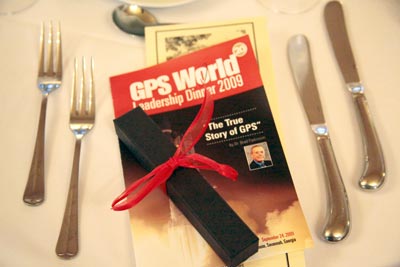
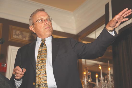
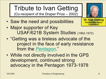
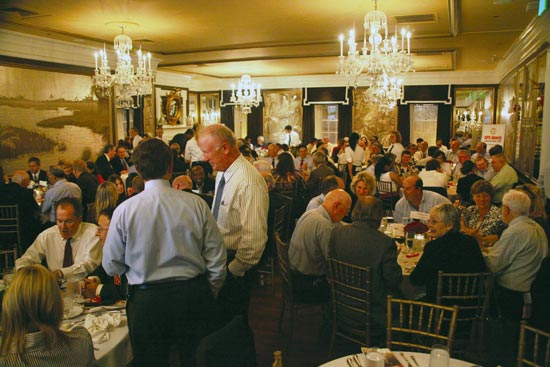
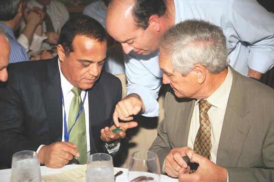
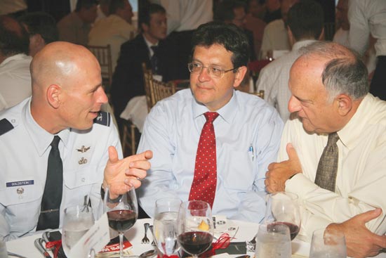
    GPS World held its first Summit for 1001 GNSS VIPs with a top-level panel during the 2002 ION-GNSS conference, and a second Summit in 2004. It became the Leadership Dinner in 2006, with a Great Debate in 2007, a GNSS Election in 2008, and Brad Parkinson’s “True History of the Origins of GPS” in 2009. In each case, proceedings were subsequently shared with all our readers.

    The magazine became more than a magazine, redesigning its website to track developments in ever-diverging industry sectors, and launching e-mail newsletters focused on these specialized interests, followed by discussion forums, webinars, video interviews, job listings, and more.

    Double-Decade Insights

    ashkenazi_vidal_boxVidal Ashkenazi: As a geodesist, I consider GPS as the natural follow-on to satellite triangulation-trilateration and Transit Doppler (in the 1960s), when navigation and timing were added to straight positioning, and geodetic concepts of accuracy and reliability (renamed integrity) were adopted. We still had some difficulties in convincing the navigation community of the need to adopt a precise geodetic coordinate system (like WGS84), instead of just latitudes and longitudes.

    The imposition of Selective Availability led civilian ingenuity to come up with differential GPS, carrier-phase, and RTK. Who could have predicted in the 1990s that countless GPS applications would develop, benefiting business, governments and citizens everywhere?

    StephenC_BOXStephen Colwell: I started GPS World back in 1989. With a $1,200 investment and business plan in hand, I struggled through 43 investor presentations until finally receiving an approval nod for funds to launch the magazine. What I remember most during these times was invariably a potential investor would say “Now explain this to me again — what is GPS, and why does it need a magazine?”


    LONG HAULERS
    These memoirs come from founding members of our Editorial Advisory Board who still serve in that capacity! Jules McNeff is now vice president, strategy and programs, Overlook Systems Technologies; Gérard Lachapelle is professor and CRC/iCORE chair in wireless location, Department of Geomatics Engineering, University of Calgary; Vidal Ashkenazi is CEO, Nottingham Scientific Ltd. Other advisors still on board from that first issue are Paul Cross, Larry Hothem, William Klepczynski, Keith McDonald, and Brad Parkinson.Richard Langley is, as ever, a professor of geodesy and geomatics at the University of New Brunswick; Ed Aster is a vineyard owner and entrepreneur in New Zealand; Stephen Colwell writes a monthly e-mail column on the Consumer OEM sector; Glen Gibbons is a publisher in his own write, familiar to many readers.

    GPS World: Behold the Future

    Alan-CameronIn this nascent decade, the GNSS industry will enter its full maturity as truly an indispensable utility for everyday life, at individual consumer, industrial enterprise, and government organization levels. Multi-technology circuitry, which now integrates positioning with other capabilities on a single chip, will only continue its astonishing march.

    Galileo and GLONASS will achieve their promise, and Compass will join the family, forming together with GPS a veritable system of systems with highly accessible and accurate coverage and availability even in challenging environments. GPS itself will modernize, strengthen, and expand its considerable capabilities.

    As ever, GPS World will be there, up close and personal with the technology and the business, providing eyewitness accounts by researchers, product designers, program managers, and end users.

    The magazine will continue serving its international readers and advertisers, accomplishing its mission through an integrated information system of print, e-mail newsletters, websites, webinars, and videos, all communicating critical intelligence to decision-makers and technical experts.

    GPS World’s media platform, designed for and dedicated to industry’s use, is a searchable, application-specific knowledge base of GPS/GNSS-related technologies that is mapped to the markets and needs of the community’s core purchasing audience.

    Despite its name — and names may change — the magazine has never limited itself to coverage of the U.S. Global Positioning System. We chronicle the development of all GNSS: Galileo, GLONASS, and Compass; of augmentations WAAS, EGNOS, MSAS, NDGPS, QZSS, GAGAN, and GRAS. We track the integration of GNSS with other PNT technologies, such as inertial, laser, Loran, and radio frequency fields such as wireless communications, RFID, Bluetooth, ultra-wideband, and others.

    While busy writing and talking, we are also busy listening. We encourage online comments to articles appearing at env-gpsworld-integration.kinsta.cloud. We’ve started one technical discussion forum, Tech Talk, and plan to have another, on chip and circuitry design, flying within months. We administer a LinkedIn network for GNSS professionals to communicate interests, leads, queries, referrals, and open positions; our Facebook page enables members to create unique user content to build meaningful and resource-full discussion.

    We have unparalleled personal reach in every industry sector. You’ll find one or more of GPS World’s dozen correspondents and business development consultants at every important technical and business conference. Come right up and give us a piece of your mind. Please.

    GNSS — your world. We feel privileged to play a key part in it. — Alan Cameron, Editor-in-Chief


  • The True Story of the Origins of GPS

    Photos from the GPS World Leadership Dinner 2009, September 24

    ION GNSS 2009 Conference, Savannah, Georgia

    dinner-7

    Bradford W. Parkinson, the first GPS Program Office director, chief architect, and advocate for GPS, relates “The True Story of the Origins of the Global Positioning System” and pays tribute to many of the people he worked with during that time.
    Bradford W. Parkinson, the first GPS Program Office director, chief architect, and advocate for GPS, relates “The True Story of the Origins of the Global Positioning System” and pays tribute to many of the people he worked with during that time.
        A slide from Parkinson’s presentation, which drew from previously classified reports as early as 1964–66. A text version of his history lesson will appear in an upcoming GPS World magazine.
    A slide from Parkinson’s presentation, which drew from previously classified reports as early as 1964–66. A text version of his history lesson will appear in an upcoming GPS World magazine.
    Keynote speaker Brad Parkinson with the evening’s hostess, publisher Kristina Panter.
    Keynote speaker Brad Parkinson with the evening’s hostess, publisher Kristina Panter.
    It’s hard to tell which shines brighter, the crystal chandeliers in Savannah’s Olde Pink House ballroom, or the many GNSS luminaries in attendance. Also sponsoring the Leadership Dinner were ITT and Spirent (Silver), and Trimble (Bronze).
    It’s hard to tell which shines brighter, the crystal chandeliers in Savannah’s Olde Pink House ballroom, or the many GNSS luminaries in attendance. Also sponsoring the Leadership Dinner were ITT and Spirent (Silver), and Trimble (Bronze).
    Greg Turetzky of SiRF Technology shows off his newest chip to Javad Ashjaee and Tom Hunter of JAVAD GNSS.
    Greg Turetzky of SiRF Technology shows off his newest chip to Javad Ashjaee and Tom Hunter of JAVAD GNSS.


    Col. David Goldstein, GPS Wing, converses with Art Gower of Lockheed Martin and Len Jacobson, Global Systems and Marketing (both members of GPS World’s Advisory Board).
    Col. David Goldstein, GPS Wing, converses with Art Gower of Lockheed Martin and Len Jacobson, Global Systems and Marketing (both members of GPS World’s Advisory Board).
    Lockheed Martin Space Systems was a Gold Sponsor of the dinner. From left are Todd Bender, Mike Shaw, Nancy Fitzgerald, Dan Hennessey, Bob Wright, Tom Hollenbach, and Daniel Reigh.
    Lockheed Martin Space Systems was a Gold Sponsor of the dinner. From left are Todd Bender, Mike Shaw, Nancy Fitzgerald, Dan Hennessey, Bob Wright, Tom Hollenbach, and Daniel Reigh.


    (from left) Sherman Lo, Stanford; Dennis Akos, U. Colorado/CSR; Mikel Miller, U.S. Air Force, ION president.
    (from left) Sherman Lo, Stanford; Dennis Akos, U. Colorado/CSR; Mikel Miller, U.S. Air Force, ION president.
    (from left) Tomoya Shibata, Copla Corp.; Hiroshi Nishiguchi, Japan GPS Council; John Wilde, DW International.
    (from left) Tomoya Shibata, Copla Corp.; Hiroshi Nishiguchi, Japan GPS Council; John Wilde, DW International.
    (from left) Carl Andren, ION; Donna Reay, Galileo Supervisory Authority; Hermann Ebner, European Commission, Galileo Unit.
    (from left) Carl Andren, ION; Donna Reay, Galileo Supervisory Authority; Hermann Ebner, European Commission, Galileo Unit.
    (from left) Attila Komjathy, JPL; Thomas Pany, iFen GmbH; Chaminda Basnyake, GM; Tom Nagle, GPS Wing.
    (from left) Attila Komjathy, JPL; Thomas Pany, iFen GmbH; Chaminda Basnyake, GM; Tom Nagle, GPS Wing.


  • The Business: Location-Driven Coupons on iPhone

    >> LOCATION-BASED SERVICES

    Location-Driven Coupons on iPhone

    By Gwen Cameron

    Yowza!!, an application designed for the latest GPS-enabled iPhone 3G and 3GS models and iPod Touch, brings relevant coupon offers to customers based on their location.

    “Any time you insert a concept such as location into a marketing program, you end up with a far more compelling value proposition,” states Mike Wehrs, president of the Mobile Marketing Association.

    Sales and discount offers via Yowza!! can be updated in real-time and targeted by region or store location. “The phone will deliver a list of stores within one mile that have offers on Yowza!!,” said August Trometer, co-founder of the recent startup. Users show the barcode and digital mobile coupon on their handset at checkout to redeem the discount on their purchase.Bus-2

    “We work directly with merchants; they provide us with their latitude and longitude, we get the GPS coordinates, do a database search with a proprietary algorithm,” said Trometer. “The phone constantly goes back and forth between our app, touching data from our database. When the person touches their location, it touches a new set of data in the database. The phone will work with them to keep delivering the closest store. There’s a lot of work on the database end of things.”

    One drawback of the app is that it has to be turned on to work — it does not sit in the background, waiting to be activated by incoming offers. “Users have to give the application access to their GPS coordinates,” explained Trometer. “But the power of the device and all the applications it brings make it silly to turn off the location capability.”

    Retailers that have signed with Yowza!! include Sears, McDonald’s, The Container Store, and more. Unlike traditional forms of couponing such as newspaper ads, Yowza!! offers can be updated in real time and targeted by region or store location.

    Trometer expects to announce Yowza!! capability through other GPS-equipped phones: Blackberry Storm, Google’s Android-based phone, and the Palm Pre. “All three makers allow developer access to the GPS and this is very important, it’s crucial, obviously. They also have a high-res screen, which is a requirement for our scannable barcode that the user shows to the merchant.”

    Referring to GPS handsets that lack a high-res screen, he claims “The other phone manufacturers really have an uphill battle right now.”

    Whose GPS? The source of the GPS chip within Apple’s iPhone remains a mystery. “Even people who have done teardowns of the devices, the chips are completely blank,” says Trometer.

    “There are so many possibilities, we’re just scratching the surface right now with what can be done,” Trometer said. “The mind reels with the things that can be done with that.”

    >> SURVEY & CONSTRUCTION

    Hemisphere, Juniper Jointly Offer DGPS Receiver for Demanding Environments

    Juniper Systems and Hemisphere GPS offer the XF101 DGPS receiver for the Archer Field PC, designed to deliver sub-meter DGPS to location-based applications in demanding environments.

    According to the companies, the Hemisphere GPS XF101 DGPS receiver provides: Crescent GPS technology for sub-meter accuracy; COAST technology to maintain accuracy during temporary loss of differential signal; optional external antenna for centimeter-level accuracy; low power consumption; modular connection for rapid field use; real-time or post-processed DGPS data collection; and multipath minimization.

    The XF101 with the Archer is priced at less than $2,500. It fully supports mobile GIS applications such as ESRI ArcPad and OnPoz GNSS Driver.

    >> AVIONICS

    NovAtel Receiver for Next-Gen WAAS

    NovAtel announced receipt of a contract from the U.S. Federal Aviation Administration (FAA) to develop the next generation Wide Area Augmentation System (WAAS) reference receiver, the GIII. Total contract value can go up to $9.7 million.

    NovAtel has worked with the FAA WAAS program since 1995, providing and supporting two previous generations of reference receivers for the WAAS ground network. The technology refresh will add support for new L1C, L2C, and L5 signal capabilities, on a qualified RTCA DO-178B software and DO-254 hardware platform. The WAAS GIII receiver program is scheduled to be completed over the next three years, and will include growth provision for further signal capability such as Galileo. As many as 14 receivers will be produced in the GIII development and qualification program.

    >> FLEET TRACKING

    AT&T, Trimble Fleet Management

    AT&T has broadened its fleet and mobile asset management portfolio with the latest version of Trimble’s GeoManager solution, which helps reduce fuel and maintenance costs by enabling operators to manage their vehicle assets more efficiently.

    Trimble GeoManager enables transportation and field-service fleet operators to track their mobile workers and assets through software and GPS modems running on AT&T’s wireless network. GeoManager integrates GPS, wireless data communications, and a browser interface to help manage mobile workers, the mobile worker’s work, and the mobile worker’s assets.

    AT&T and Trimble have jointly offered fleet-tracking solutions for several years. The GeoManager update features improved map and status, new landmark uploads, WLAN usage, schedule report enhancements, driver logs, and organizational hierarchy modifications.

    >> TIMING

    Timing Vulnerability Concern Grows

    Industrial and enterprise users in telecommunications and utilities privately express concern over revelations from the April Government Accounting Office (GAO) report, “Global Positioning System: Significant Challenges in Sustaining and Upgrading Widely Used Capabilities.” The GPS signal is used for synchronizing almost all global computer networks belonging to the military, utilities, banks, telecomms, television companies, and many more.

    Backup? What Backup? These same companies point to a continued lack of commitment on the part of the U.S. government to stable and reliable backup for GPS. As long ago as 2007, in comments before the Department of Transportation, wireless carrier Sprint Nextel stated: “Sprint Nextel Corporation respectfully requests that the U.S. government continue to operate and invest in the LORAN-C and eLORAN systems. Should the DOT and DHS decide to decommission the LORAN-C system, Sprint Nextel recommends that the agencies delay doing so until the eLORAN system is fully operational. Sprint Nextel and other communications providers use the frequency signals of the Global Positioning System, LORAN, and atomic clocks for multiple levels of redundancy and diversity in their networks. Therefore, Sprint Nextel urges the DOT and DHS to carefully weigh decisions which might impact LORAN’s availability to the nation’s voice and data communications networks.

    “The loss of a primary reference source (PRS) can negatively impact a telecommunications network, and those impacts can vary from minor short-term noise impairments to long-term network-wide outages. Both traditional wireline services and newer wireless services require a precise frequency reference for basic service delivery . . . . The continental U.S. portion of the Sprint Nextel network requires a PRS at thousands of switch sites, interconnection sites
    , and cell tower sites to ensure reliable service delivery.”

    Deadlock on Capitol Hill. Competing resolutions to either discontinue or adequately fund LORAN and eLORAN continue fencing in Congressional subcommittees in both chambers. Nothing has changed since Sprint commented two years ago — aside from a potential rise in the susceptibility of GPS to jamming, unintentional interference, and decreased availability.

    GAO REPORT, FIGURE 5. Probability of maintaining constellation of at least 18, 21, and 24 GPS satellites based on reliability data as of March 2009 and a two-year GPS III launch delay.
    GAO REPORT, FIGURE 5. Probability of maintaining constellation of at least 18, 21, and 24 GPS satellites based on reliability data as of March 2009 and a two-year GPS III launch delay.

    >> TIMING

    Telecom Clock from EndRun

    EndRun Technologies announced a Telecom Clock Option for its Meridian Precision GPS Timebase, which provides accurate and stable GPS-synchronized outputs for military communications, aerospace, broadcast, engineering and calibration laboratories, telecommunications, and more.

    The option was designed as a plug-and-play module that can supply any combination of E1, T1, J1 and/or composite clock outputs. An alarm output is also available and single-satellite mode (SSM) is supported. The Telecom Clock Option can be installed in EndRun’s GPS or CDMA-based Meridian and Tycho product lines.