Designed for BIM, indoor surveying and reality capture
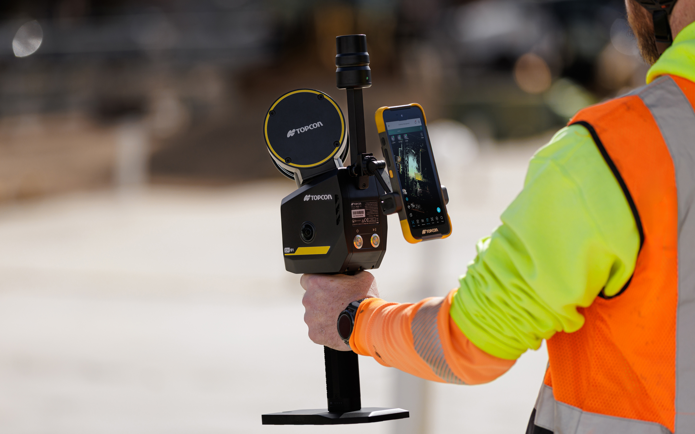
CHC Navigation announced the RS7, a new handheld SLAM (simultaneous localization and mapping) scanning solution, unveiled at the 2026 CHCNAV Connect Partner Conference.
Built for BIM documentation, indoor surveying, renovation planning and complex spatial analysis, the CHCNAV RS7 is designed to help professionals capture high density 3D data efficiently and convert it into practical deliverables through CHCNAV’s software and cloud ecosystem.
“Customers no longer evaluate hardware in isolation. They expect an end-to-end solution that shortens the path from 3D data capture to deliverables,” said Byron Yuan, senior vice president of CHCNAV. “CHCNAV RS7 combines high performance mobile scanning with an integrated workflow to support efficient operation in complex indoor environments.”
High-density capture with multi-sensor fusion
CHCNAV RS7 integrates a next generation lidar scanner capable of measuring up to 1.15 million points per second. Its wide field of view (360° x 189°) supports comprehensive coverage of floors, walls and ceilings, helping reduce the need for repeated passes and complex capture maneuvers in tight or cluttered spaces.
RS7 also includes a high-precision inertial measurement unit with bias stability better than 0.5°/h. By combining lidar and inertial data, the system is designed to maintain stable motion estimation and consistent point-cloud quality in environments that challenge many mobile workflows, including long corridors, repetitive structures, and feature limited interiors.
Integrated field-to-office workflow with cloud processing
RS7 is supported by CHCNAV software ecosystem that covers scan setup, data review, and post processing. With integration to CHCNAV CoCloud, teams can adopt a “Cloud + Terminal” workflow for centralized management of projects and data. Field datasets can be uploaded for automated processing to generate common deliverables such as registered point clouds and mesh models.
By automating key processing steps, the workflow can reduce turnaround time and lower the technical threshold required to convert raw capture into outputs suitable for design review, documentation, and downstream CAD or BIM tasks.
High-fidelity visualization with 3D gaussian splatting outputs
Beyond geometric data, CHCNAV RS7 is designed to support realistic visualization for communication and review. It features dual 12-megapixel cameras optimized for low light capture. Using the CHCNAV HPGS 2.0 engine, the workflow supports 3D gaussian splatting (3DGS) outputs that deliver photorealistic scene rendering while retaining spatial context. These outputs can help stakeholders understand conditions on site, support progress tracking, and improve collaboration across surveying, engineering, and construction teams.