Tag: health

  • GPS World coverage of COVID-19

    GPS World coverage of COVID-19

    GPS World is offering the latest news and updates concerning the coronavirus (COVID-19) pandemic as it affects the GNSS/PNT industry. Read a message from GPS World here.

    Features

    COVID-19 impact revealed through the lens of GPS (12/1/20)
    GNSS helps fight coronavirus while companies adapt (11/3/20)
    COVER STORY: Indoor location could mitigate COVID-19 (6/25/20)
    Skyports joins Thales in COVID-19 drone-delivery trial (6/25/20)
    Taking to the field during the coronavirus pandemic (6/25/20)
    TopXGun Robotics uses drones to fight COVID-19 from above (6/25/20)
    Using location data in the fight against COVID-19 (6/25/20)
    Survey Scene Insights: Surveying and COVID-19: A lesson in essential services (5/6/20)
    COVER STORY: GNSS industry adapts during COVID-19 pandemic (4/13/20)
    Seen & Heard: Drones and robots fight coronavirus (3/5/20)
    Coronavirus, organ transport top medical drone uses (2/19/20)

    NEWS

    GNSS-RO measurements improved with COVID-19 pandemic (9/24/20)
    Drone payloads to become vital in supplying medicines, test results in COVID-19 pandemic (7/30/20)
    GMV leads development of ESA COVID-19 Space Hunting Platform (7/20/20)
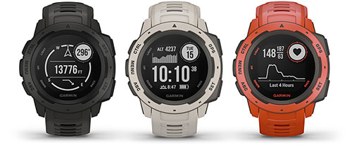
    Garmin offers insights on active lifestyles during COVID-19 (5/1/20)
    How is COVID-19 affecting you? Take part in our survey (4/22/20)
    US small business loans a challenge due to COVID-19 (4/20/20)
    Plans to reopen after COVID-19 vary widely (4/20/20)
    Airbus to produce 3D-printed visors in fight against COVID-19 (4/17/20)
    Galileo Masters 2020 open for submissions (4/16/20)
    Martek Marine launches COVID-19 tests for crew changes (4/15/20)
    Robotic Research innovates to help fight COVID-19 (4/15/20)
    New Topcon Talks aimed at professionals at home during COVID-19 (4/9/20)
    Coronavirus delays GPS III SV03 launch until June (4/8/20)
    Schriever stays operational despite COVID-19 (4/3/20)
    PCTEL terminates share repurchase program (4/2/20)
    U.S. Space Force accepts control of GPS III SV02 amidst global pandemic (4/1/20)
    Testing suspended on Galileo Batch 3 satellites (3/30/20)
    GPS tracking shows critical truck deliveries continue despite COVID-19 (3/26/20)
    China adds to BeiDou as satnav service helps fight coronavirus (3/10/20)

    Mapping & geospatial

    GIS tool provides updates on open businesses amid COVID-19 (4/22/20)
    NSGIC issues joint statement on value of GIS during COVID-19 pandemic (4/17/20)
    How to prepare and organize a fleet during the COVID-19 pandemic (4/13/20)
    Dashboard graphs those working from home during COVID-19 (4/10/20)
    Georgia county provides grocery store app for residents (4/8/20)
    Esri releases resources for businesses during COVID-19 (4/3/20)
    Esri to provide mapping resources to WHO Member States (4/1/20)
    Analysis of satellite imagery shows reduced NO2 in China, Italy (3/23/20)
    Esri supports John Hopkins COVID-19 Design Challenge (3/27/20)
    Genasys releases COVID-19 interactive map layer service (3/19/20)
    Esri ArcGIS map tracks global coronavirus cases (3/13/20)

    Mobile apps & location intelligence

    Esri offers COVID-19 resources for nonprofits (5/8/20)
    Galileo positioning aids with COVID-19 tracking apps (4/29/20)
    Vesedia proposes COVID-19 contact tracing platform (4/27/20)
    Traxens offers smart-container tracking to manage COVID-19 supplies (4/21/20)
    Radius Telematics sees spike in vehicle theft during coronavirus crisis (4/15/20)
    GPS tracking need not sit out COVID-19 because of privacy laws (4/8/20)
    Esri to provide US school data during COVID-19 pandemic (4/8/20)
    InnerSpace location platform supports public safety, COVID-19 response (4/1/20)
    Sewio helps fight COVID-19 with ‘smart quarantining’ (4/1/20)
    European GNSS Agency provides list of COVID-19 apps (3/30/20)
    19 countries track mobile location to fight COVID-19 (3/26/20)
    Coronavirus and location: Is there a line? (3/23/20)
    WHO Health Alert brings COVID-19 facts to billions via WhatsApp (3/21/20)
    COVID-19: Israel’s citizens now tracked by their smartphones (3/19/20)
    Oxford University explores feasibility of coronavirus tracing mobile app (3/18/20)

    UAVs

    How drones are helping with COVID-19, first response applications (10/21/20)
    Drone payloads to become vital in supplying medicines, test results in COVID-19 pandemic (7/30/20)
    Benefits of commercial drones and upcoming major trends (7/30/20)
    Long-endurance drones prove their value against COVID-19 (5/6/20)
    Parrot helps design MakAir respirators for COVID-19 support (4/28/20)
    NCDOT initiative use drones for COVID-19 relief efforts (4/24/20)
    Draganfly conducts pandemic drone tests in US (4/21/20)
    AUVSI report: Demand growing for expanded drone operations (4/21/20)
    UAVOS completes tests for drone delivery of humanitarian relief (4/17/20)
    Kazakhstan uses drones to patrol capital during COVID-19 lockdown (4/9/20)
    Drone Delivery Canada asks for COVID-19 use cases (3/30/20)
    DJI joins with firefighting provider Rosenbauer on digital emergency response (3/30/20)
    ARPAS-UK coordinates COVID-19 drone capability task force (3/30/20)
    Pandemic drones to monitor, detect those with COVID-19 (3/26/20)
    China fights coronavirus with delivery drones (3/6/20)
    Xag creates fund for drones disinfection program to fight coronavirus (2/11/20)

    Show Updates

    Postponed 2021 IGS Workshop now to take place in 2022 (1/5/21)
    ION changes date for 2021 Joint Navigation Conference (12/17/20)
    GEO Business 2021 moved to the fall (12/17/20)
    NAVCEN hosts 60th CGSIC meeting virtually before ION GNSS+ 2020 (8/13/20)
    AUVSI Xponential 2020 goes virtual (7/24/20)
    ION cancels 2020 Joint Navigation Conference (7/20/20)
    Intergeo 2020 to take place virtually only (7/8/20)
    5th annual FAA UAS Symposium goes virtual because of COVID-19 (5/13/20)
    AUVSI Xponential postponed until October because of COVID-19 (5/5/20)
    Trimble Dimensions 2020 canceled because of COVID-19 (5/1/20)
    An overview of GPS/GNSS shows canceled or postponed because of COVID-19 (4/23/20)
    Esri User Conference goes virtual because of COVID-19 (4/22/20)
    3 more conferences postponed due to COVID-19 (4/20/20)
    ION 2020 Joint Navigation Conference rescheduled over COVID-19 concerns (4/9/20)
    36th Space Symposium rescheduled due to COVID-19 (4/9/20)
    GEO Business 2020 rescheduled amid coronavirus concerns (3/18/20)
    IEEE/ION PLANS Conference canceled due to COVID-19 concerns (3/13/20)
    AUVSI Xponential show postponed until August (3/13/20)
    Munich Satellite Navigation Summit canceled due to coronavirus (3/10/20)
    Mobile World Congress 2020 canceled due to coronavirus concerns (2/12/20)


    Featured image: NicoElNino/iStock / Getty Images Plus/Getty Images

  • Esri ArcGIS map tracks global coronavirus cases

    Esri ArcGIS map tracks global coronavirus cases

    The Center for Systems Science and Engineering at Johns Hopkins University is tracking the coronavirus, COVID-19, via an Esri ArcGIS map.

    The map is updated in almost real time, and it includes a zoomable map identifying confirmed cases of the virus throughout the world. It also includes numerical data on how many cases have been confirmed in each country, as well as deaths and recoveries.

    “In response to this ongoing public health emergency, we developed an interactive web-based dashboard hosted by the Center for Systems Science and Engineering at Johns Hopkins University, to visualize and track reported cases in real-time,” John Hopkins stated on its website. “The dashboard, first shared publicly on Jan. 22, illustrates the location and number of confirmed COVID-19 cases, deaths and recoveries for all affected countries. It was developed to provide researchers, public health authorities and the general public with a user-friendly tool to track the outbreak as it unfolds.”

    Check out the map, titled “Coronavirus COVID-19 Global Cases by the Center for Systems Science and Engineering at Johns Hopkins University,” here.

  • Coronavirus: How mapping can stop a pandemic

    Coronavirus: How mapping can stop a pandemic

    Birth of an epidemic

    Image: William Tewelow. Map data © Google
    Image: William Tewelow. Map data © Google

    Men wearing white bio-suits entered the market from the main entrance. A panic ensued at the sight, and a commotion quickly spread through the crowd.

    Shop keepers, sensing the worst, hurriedly gathered their belongings. People rushed towards the exits. More armed soldiers in white bio-suits pressed in, sealing off escape. Screams and weeping filled the market with the din of anxiety and fear. The Huanan Seafood Market was under lock down. The order was not to hurt anyone, but no one was to leave. The quarantine had begun.

    Empty semi-trucks lined the main road. The trucks entered the parking lot one by one, and masked soldiers guided people into the backs of the empty trucks. Once filled, the trucks drove away until the market was empty. The people were transported to “isolation centers” several hundred kilometers outside the city.

    Image: Duncan A Smith, CASA UCL. Data from Global Human Settlement Layer, https://ghsl.jrc.ec.europa.eu/index.php
    Image: Duncan A Smith, CASA UCL. Data from Global Human Settlement Layer, https://ghsl.jrc.ec.europa.eu/index.php

    In Wuhan, the situation had deteriorated rapidly. A month earlier videos went viral about a mysterious flu with pneumonia-like symptoms. Most of the information was coming from citizen journalists. People speculated the Huanan Seafood Market was the source of the illness, but no official statements had been made.

    Anxiety spread. People began fleeing Wuhan ahead of the Chinese New Year, which is the world’s largest annual human migration. Making matters worse, Wuhan is a major transportation hub in Central China, servicing 400,000 commuters per day through the Hankou Railway Station, a short, 15-minute walk to the Huanan Seafood Market.

    Alerting the world

    On Dec. 31, 2019, China notified the World Health Organization (WHO) of the infection. The cause was a new strain of coronavirus along the same viral spectrum as the severe acute respiratory syndrome (SARS) and the Middle East respiratory syndrome (MERS). The next morning, on Wednesday, Jan. 1, 2020, the WHO declared the novel coronavirus 2019 (COVID-19) a public health emergency. It was also that morning that the seafood market was shutdown.

    Above: One of the first and only videos coming out of China that covers the outbreak. Copyright: DW News, posted 23-JAN-2020

    Twenty-three days after China notified the WHO, the city of Wuhan and the entire province of Hubei were quarantined and cut off from the rest of the world — an area comprising 57 million people, unprecedented in the history of public health.

    Still, even with such extraordinary measures, it was already too late. The people moved faster than the system could adjust. Five million people, almost half the residents of Wuhan, had already evacuated. Many traveled to other parts of China to stay with family while others left China altogether, some finding themselves in countries they were banned from entering.

    Containment and quarantine

    China is now dealing with a containment issue at some level in every one of its provinces. In total, 174 million people in China are under some level of travel restriction. By comparison, that is equal to more than half the population of the United States.

    China immediately began leaning on its massive surveillance network and facial recognition technologies to control the outbreak. Using these technologies, Chinese authorities could narrow the search for those most likely to carry the virus. The situation transitioned from a medical emergency to a national security emergency on Tuesday, Feb. 11, when China fired its two highest ranking medical officials in Hubei province, replacing them with a senior Chinese government party official.

    Additionally, China continues working with the three cellular phone carriers in the country to gain access to users’ location data. This information will enable China to conduct geospatial analysis at an individual scale to identify those who have come into contact with infected areas. This practice is very controversial, placing privacy and human rights in conflict with public health security.

    Roots of GIS in epidemiology

    Epidemiology is the study of people, place and disease, perfectly suited for geospatial technologies. Not surprisingly then, the true origins of geographic information systems (GIS) are founded in epidemiology, harkening back to John Snow’s Cholera map in 1854. The location of infected people clearly pointed to the Broad Street water pump as the cause. That changed the scientific understanding of the time from believing cholera was transmitted in the air to realizing it was a waterborne disease.

    John Snow's 1854 map of the London Broad Street Cholera outbreak. (Image: public domain)
    John Snow’s 1854 map of the London Broad Street Cholera outbreak. (Image: public domain)

    Similarly, the scientific consensus of COVID-19 has also changed since it first emerged. When the outbreak began, it was believed to be zoonotic, meaning the virus originated from animals and transmitted to humans. It was then believed the virus could only be transmitted directly from person to person. Now, it is known to be carried through the air or by touching infected surfaces.

    Each of these modes changes the transmission rate of the disease. This is known as the reproduction number, written as R0 and referred to as the R-naught number. The larger the R-naught, the more infectious the disease. COVID-19 is estimated to have an R-naught between 1.4 and 6.6, which is similar to its cousin the SARS virus; however, SARS only infected 8,096 people and this virus is already more than 10 times that amount.

    In terms of GIS, the higher the R0, the greater the geographic area potentially infected. Narrowing the area to concentrate resources more efficiently requires improved modeling and collecting more data, both of which increase the time required before effective measures can be taken. This creates a dilemma between acting swiftly and acting accurately. This explains some of the images coming out of China showing people forcibly removed from their homes and placed in quarantine.

    Image: John Hopkins CSSE, https://systems.jhu.edu/research/public-health/ncov/
    Image: John Hopkins CSSE, https://systems.jhu.edu/research/public-health/ncov/

    Controlling the spread of the virus also requires knowing the source of each outbreak. The originating source, called the reservoir, once discovered can be cordoned off. Afterwards, through a process called “contact tracing,” all potentially infected people are tracked down and monitored or quarantined if necessary.

    Probability models based on geospatial analysis use factors such as age, sex, pre-existing health conditions and distance from the reservoir overlaid with data such as population density to create an intensity map showing the areas most favorable to the spread of infection. People in the defined areas can be isolated and monitored, preempting further spread.

    Maps: Centers for Disease Control and Prevention
    Click to enlarge. (Maps: Centers for Disease Control and Prevention)

    In the United States, the Health Insurance Portability and Accountability Act (HIPPA) requires data be aggregated at the zip code or county level, which is useful in defining regional trends, such as the CDC maps above of heart disease (red) and the areas of least physical activity (teal). Comparing the two visualizes the premise that exercise and good health go together. However, at this scale the information is not useful in fighting a dynamic and evolving situation like an infectious outbreak.

    Ultimately, the goal is real-time feedback at a high-scale resolution. Smartphones and other mobile devices offer unique opportunities to combat epidemics. South Korea is using location information to help contain the outbreak. People use a special number to text where they have traveled. This is to assist in contact tracing if necessary.

    Mobile devices can also report location data along with vital signs to monitor overall health and instantly identify individuals who may be a risk. The mobile device can also alert individuals if they are nearing an infected area and show the infected zones on their phones.

    COVID-19 reporting via GIS

    Systems can be established to report live events like Waze does for reporting traffic hazards, which have proven to report accidents faster than 911 calls. Also, the use of social media live feeds can help identify evolving situations and monitor existing ones.

    Perhaps the government, working with mobile application mapping companies, should create a layer specifically for the epidemic that provides critical information, such as healthcare centers, some of which might be established specifically for the care of the disease outbreak.

    Also, included in that public health layer would be high-risk areas, prohibited entry locations, areas under quarantine, and more, in order to provide an integrated interface to communicate with the general public. This is similar to how the departments of transportation, public works, and emergency response units provide information to the public to reroute traffic around congestion, accidents or closed-off areas.

    Image: Coronavirus story map by Maria Laturnas, University of Potomac
    Image: Coronavirus story map by Maria Laturnas, University of Potomac

    A former U.S. Navy healthcare executive, Ben Boccuzzi, Ph.D., shared his thoughts on the matter with me. “The actual mortality rate of COVID-19 (in the U.S.) is hard to determine until mass testing can be done,” Boccuzzi said. “As of now, the true denominator (all people that would test positive for the virus) we only know of symptomatically and those that died from the disease. So, with these small numbers, the real mortality rate is not fully known. When testing begins on a grander scale, and more people are known to have the virus and do well, the actual rate of mortality will become much smaller.”

    It is now more than two full months since the WHO declared a public health emergency. The number of known cases worldwide stands at 105,941 with 3,569 deaths affecting 100 countries.

    If you’d like to track the virus, the John Hopkins GIS webmap interface updates in real time as new information becomes available.

    Story Maps

    Working with the University of Potomac, several students contributed story maps for this article. You can see their full projects at the links below:

    Image: Coronavirus story map by Gangesh Khadka, University of Potomac
    Image: Coronavirus story map by Gangesh Khadka, University of Potomac

    If you have read this far, thank you. I would like to leave you with the most important information in this article.

    When I began covering this story it was early January, the virus was just beginning to make the news. Fear was in the air. I began to worry. As I immersed myself deeper into the topic, I became even more concerned; so much so, I bought two months of supplies preparing for a long-term self-quarantine situation.

    If you’ve been watching the news, you may be nearing the same state of mind I found myself in. If so, I’ve got good news for you.

    Paradoxically, people are attracted to fear. Fear is a potent biochemical rush. The horror movie industry rakes in $11.7 billion per year. Most media’s primary business is not information. It is using information to increase its readers and viewers, and fear captures people and holds their attention. The media is a profit-driven business. Facts tell. Fear sells.

    The following is what is reported by the WHO based on 55,924 laboratory-confirmed cases since the coronavirus began. The study was published on Feb. 28. At that time, there were 86,992 confirmed cases of COVID-19 and 2,979 deaths, equating to a mortality rate of 3.4%, but those numbers were mostly in China, specifically Hubei province. Outside of China, the number of cases were only 7,166 with 109 deaths having a fatality rate of 1.5%.

    Image: Coronavirus story map by Zaid Alshaboul & Kush Shah, University of Potomac
    Image: Coronavirus story map by Zaid Alshaboul & Kush Shah, University of Potomac

    These numbers do not reflect the whole story. If you are below age 50 and in good health, recovery is 99.1%, so there is almost no reason to be concerned. For those older than age 50 the mortality rate is 1.3%, and over age 60 it increases to 3.6%. For those over age 70 it doubles to 8.0%. The most vulnerable populations are those over age 80 with a mortality rate of 14.8%.

    Additionally, those with pre-existing conditions, such as cardiovascular disease, diabetes, or respiratory disease are also at high risk. If you fall into either of those categories, take great care with your hygiene and personal protection. However, if you are below 60 and in moderately good health, there is less than a 1.3% reason to be concerned and more than 98.7% reason not to be concerned.

    Unless something significant changes, the virus is a reason for caution, but should not be a cause for panic. The fearmongering has gotten out of control. We may or may not get COVID-19, but for those of us who do, most of us will only experience muscle aches, fever and a dry cough, about the same as catching a bad cold.

    Ironically, be grateful in times like these. They give us reasons to take pause, love our family, appreciate what we have, realize life is worth living, and get our house in order. The truth is not the story we are being sold.

    Image: wildpixel/iStock / Getty Images Plus/Getty Images
    Image: wildpixel/iStock/Getty Images Plus/Getty Images
  • Garmin’s latest watch features GPS, GLONASS and Galileo

    Garmin’s latest watch features GPS, GLONASS and Galileo

    Garmin is now offering a GPS, GLONASS and Galileo watch called Instinct. Instinct is a strong and durable watch with GNSS support, plus built-in 3-axis compass, barometric altimeter and wrist-based heart rate sensor.

    The watch includes a built-in sports apps, smart connectivity and wellness data.

    Photo: Garmin
    Photo: Garmin

    “We are thrilled to add Instinct to our adventure watch lineup, an approachable smartwatch that is rugged and reliable,” said Dan Bartel, Garmin vice president of global consumer sales. “Instinct is perfect for those who spend their time outdoors and demand a device built tough to stand up in the elements.”

    The Instinct is built to endure challenging environments, constructed to military standards (MIL-STD-810G) for thermal, shock and water resistance (rated to 100 meters) with a fiber reinforced polymer case. The chemically strengthened and scratch-resistant display is readable in direct sunlight, and the fully vented silicone bands include two independent, removable keeper loops to ensure a secure fit.

    The multi-GNSS feature helps users track their location in challenging environments. The Garmin Explore app helps plan the trip in advance, and the TracBack feature can navigate the same route back to the starting point.

    The built-in heart-rate sensor helps monitor heart rate, steps taken, distance traveled, calories burned and more.


  • Esri Launches Climate and Human Health App Challenge

    Esri has unveiled a Human Health and Climate Change App Challenge, calling on the worldwide GIS community to create apps that help communities visualize, understand and combat the health impacts of climate change. Esri will award three winners more than $15,000 in cash prizes or the equivalent in software. The deadline to enter is August 14.

    The app challenge is part of Esri’s comprehensive effort in support of the White House Climate Data Initiative under President Obama’s Climate Action Plan. “Esri is committed to helping communities work smarter and more efficiently to become more livable and, as a result, more resilient to climate change,” said Esri president Jack Dangermond.

    Participants are encouraged to create apps using Esri’s ArcGIS platform that provide decision-making support for health professionals and empower the public to take action. Apps should help private and public organizations combine open data to gain new insights into the impacts of climate change on health.

    “Understanding the geography of climate change is critical to mitigating its health effects and creating a vibrant and sustainable future,” said Este Geraghty, Esri chief medical officer.

    The app challenge is open to everyone — including developers, start-ups, governments, academics and nongovernmental organizations. Participants are encouraged to use the growing pool of open data and Esri apps, maps, services and APIs to develop their app.

    Judges will select the top three apps to be highlighted at the Esri Health and Human Services GIS Conference in September. In addition to awarding prizes, Esri will feature the winning apps on its collaborative resource portal.

  • Mobile World Congress Sees Rise in Indoor Location Companies

    Kevin Dennehy
    Kevin Dennehy

    This year’s Mobile World Congress in Barcelona was the biggest ever, with 95,000 attendees and thousands of booths, conferences and people with sore feet walking a cavernous exhibition hall. While the Geneva Auto Show ran close to the same dates, connected vehicle companies and technology were prominently featured. What was interesting, however, was the rise of indoor positioning companies and mobile advertising agencies with interest in location.

    BARCELONA — Joining the 95,000 or so Mobile World Congress attendees were about three dozen companies who are offering indoor location and location advertising services. These companies have exhibited at previous conferences, but not in the numbers this year.

    At the huge Fira convention center where MWC was held March 2-5, Los Altos, Calif.-based Pole Star installed more than 600 beacons for indoor location. Visitors were able to be guided to booths and other areas through an interactive map. “Business was good in 2014, we sold 10,000 beacons. We are making money,” said Christian Carle, Pole Star CEO.

    One analyst said that the big change at MWC wasn’t the number of indoor positioning companies and demos, but the maturity and breadth of the technology. “Intel announced indoor positioning capabilities in their Wi-Fi chip, and had a demo that was very impressive. Many smaller companies that in past years were showing raw technology were showing polished solutions this year, such as Quuppa, MTI and Sensewhere, said Bruce Krulwich, Grizzly Analytics president, who has authored a report identifying 150 indoor positioning companies. “I definitely see a shake-out coming up, but it won’t be one technology prevailing over another. Different technologies meet different needs in the industry, and different technologies fit different sites. There are technologies that deliver universal indoor positioning, without any infrastructure or preparation, such as Wi-Fi multilateration and sensor fusion.”

    Krulwich said that there is a shake-out that’s already started because there are too many companies working on similar technologies. “Start-ups in the area that don’t have differentiating innovation, don’t have integration into retail or other back-end systems, and don’t have market penetration, are already finding themselves in a challenge. But companies with clear innovations and commercial deployments will do fine,” he said.

    United Kingdom-based Sensewhere is using crowdsourcing in its indoor positioning software. The software uses radios to scan for Wi-Fi and Bluetooth to allow an IP location to reference the sources and form a location database.

    “It’s what we call the universal indoor positioning versus venue specific indoor positioning, which can work anywhere — we just need a crowd of people. Our target partners are handset manufacturers, network operators, social media, social network providers, and also chipset guys as well,” said Rob Palfreyman, Sensewhere CEO. “So, there are obviously a lot of companies like Google looking at venues; there is Micello and TomTom looking at add-ins in the indoor location, which is great news, but it just needs to have a technology that can drive the blue dot on their map, and we feel that Sensewhere is the right place to provide that blue dot because of the crowdsourcing global nature of our approach.”

    One company, which has developed a popular mobile game, is using its network to attract advertisers for its location-based ad platform. “We already have the infrastructure in place because of our mobile game. With our platform, we can allow advertisers to launch campaigns using our beacon signals and geofencing,” said Pedro Jahara, CEO of Brazil-based RevMob.

    New location technology like the ability to track SIM cards was rolled out at MWC. W-Locate, which is partnering with Morpho in Thailand, is tracking SIM cards with its XimLoc product, which the company said is more accurate indoors than other technology.

    Even such companies as Geotab, which is a strong player in the fleet market, are leveraging MWC to continue a foothold in the European market. The company displayed its IOX-CAN system that can send data from a mobile device to the MyGeotab system, which can be viewed an analyzed by fleet managers, said Maria Sotra, Geotab marketing manager.

    Geotab also partnered with Telefonica in November 2014 to focus efforts in Spain, Germany and the United Kingdom, Sotra said.

    At MWC, location-based advertising market is gaining traction as advertisers are seeing the benefit of locating and attracting customers. New York-based xAd said it has doubled its revenue for the second year. “We have billions of mobile ads processed and billions of ad impressions. The company is profitable,” said Dipanshu Sharma, xAd founder and CEO.

    He said the company has expanded into France and Germany and added China to its global ad network.

    Another company that is using location technology as a differentiator is Airpush, which had another big presence at MWC. The company’s Abstract Banners was a big draw to attendees. Location, particularly geofenced areas, have created a call to action for consumers, which is attractive to advertisers, said Cameron Peeples, Airpush vice president of marketing.

    Connected Car Still Big Opportunity at MWC

    Although the Geneva Auto Show was starting as the MWC was ending, there were still several big announcements by connected car companies in Barcelona. Even the well-publicized Samsung S6 and S6 Edge and HTC One M9 handset rollouts included Mirrorlink, the connected vehicle standard from the Connected Car Consortium.

    In another big announcement, Audi and AT&T said that all 2016 model vehicles equipped with Audi connect will come with the carrier’s 4G LTE or 3G coverage. This increase in services is big because the auto giant just rolled out 4G AT&T service in Audi A3s last year.

    AT&T selected Airbiquity to provide end-user registration and device management connected vehicle services for select customer programs. “Airbiquity will deliver these services to AT&T using our Choreo cloud-based connected vehicle services delivery platform and project management, engineering, and operations teams,” said David Jumpa, Airbiquity chief revenue officer. “This is a ‘white label’ agreement whereby AT&T will integrate Airbiquity’s service delivery capability into AT&T’s connected vehicle customer solutions.”

    Another location company is making huge inroads in connected vehicle markets with its Glympse for Autos product. Glympse will be installed in select Volkswagen and Peugeot models through MirrorLink, said Bryan Trussel, company co-founder and CEO.

    The app allows users to share location from their vehicle by setting the recipient and timer, and hitting send. The company has a similar app for Gogo inflight aviation networks to allow a person on the ground to know where an airplane is for picking up passengers.

    In other connected car news, Accenture is providing Fiat Chrysler Automobiles the capability of in-car, Internet-based services. Starting with the new Fiat 500X, Uconnect Live services, which was co-developed by Accenture, will power an infotainment system that offers music and news services, social network access, the ability to monitor driving style and a range of diagnostic services.

    Accenture also partnered with Visa for an IoT-based connected car commerce test. At MWC, the company tested a scenario where drivers could order food from the car using cellular, Bluetooth and beacon connectivity. Accenture deployed a similar system with BMW’s ConnectedDrive, which allows customers to choose services in real time for a vehicle.

    Health Market Even Has Location Potential

    Niche location applications are growing as Internet of Things, or IoT, markets start to grow. One company taking advantage of the mobile market is Annapolis, Md.-based TCS, which featured its VirtuMedix platform in its MWC booth.

    The platform is tailored to emergency physicians as part of the growing market for video telemedicine products and mobile health, said Jay Whitehurst, TCS commercial software group president. “It’s already saving lives,” he said of the platform, which combines encryption, navigation, mapping and messaging.

    While the product, now being rolled out in a North Carolina emergency medicine group, provides patients with an alternative to urgent care centers and emergency rooms, it also can be used for longer term cases such as assisted living and rehab centers, the company said.

    Whitehurst said TCS has made several company acquisitions that have played a part in new product rollouts, which include the company’s Trusted Location. The application allows financial firms, online gaming companies and others to identify and prevent credit-card fraud. The application identifies and validates a device’s location worldwide.

    In other Mobile World Congress news:

    • Spirent said its simulators have the capability to evaluate Wi-Fi Offload and Wi-Fi performance of mobile devices on its test framework. The new product allows companies to test multiple devices on a single unit to cover Wi-Fi/LTE mobility and interoperability. The testing is important in light of wireless carriers’ strategy to extend VoLTE in areas where cell coverage is limited, said Saul Einbinder, Spirent vice president, venture development.
    • Google Waze said its Google Mobile Service (GMS) will be available as a preinstall option on mobile devices. OEMs and carriers can preinstall the app on their handsets so consumers can use the service immediately, the company said.
    • Trimble’s ALK said its ALK Maps and route visualization software is now available in Europe. ALK Maps, launched in the United States in 2012, allows users to overlay routing, geocoding points, weather and other features, the company said.
  • Group on Earth Observations Convenes 11th Plenary

    Under the theme “Taking the Pulse of the Planet,” 275 members of the GEO community from more than 45 countries will chart the next steps in creating and implementing a Global Earth Observation System of Systems (GEOSS) during the Group on Earth Observations (GEO) Eleventh Plenary Session. The session will be held November 12-14 in Geneva, Switzerland.

    A highlight of the conference will be announcement of the winners of the GEO Appathon, a global app development competition built on the 80-million-plus resources available through GEOSS. The Appathon attracted 250 competitors from 50 countries, and will generate easy-to-use decision tools for mobile devices and computers.

    GEO’s mandate is to harness the power of Earth observations from sources across the globe to provide more and better information to leaders in government, industry, and civil society confronting fundamental decisions affecting people and societies worldwide. One key GEO initiative that will be highlighted during the meeting is developing a comprehensive system to monitor the availability and quality of fresh water, in partnership with the World Health Organization, the UN Environmental Programme and other UN agencies as part of the UN Sustainable Development agenda.

    GEO is leading the creation of an Africa-wide technological and human infrastructure so decision makers have the capacity to access and use Earth observations in making key decisions. To strengthen agricultural activity and reduce market volatility, GEO is coordinating the assessment of growing conditions of the world’s major crops through a combination of regional expertise, ground observations and analysis of meteorological and satellite data.

    GEO is a voluntary partnership of governments and organizations that envisions “a future wherein decisions and actions for the benefit of humankind are informed by coordinated, comprehensive and sustained Earth observations and information.” Members include 94 nations and the European Commission and 77 participating organizations comprised of international bodies with a mandate in Earth observations.

    GEO’s agenda spans nine Societal Benefit Areas, including agriculture, biodiversity, climate, disasters, ecosystems, energy, health, water and weather.

  • New Broadcom Chip Provides Always-On Location and Sensing for Mobile Applications

    Broadcom Corporation today announced the industry’s first low-power GNSS and sensor hub combo chip to deliver new always-on location applications for a full range of mobile devices.

    The Broadcom BCM4773 minimizes battery drain and adds a new layer of intelligence to location technology on mobile devices by integrating the GNSS chip and sensor hub into a single combo chip. Broadcom’s architecture enables information from Wi-Fi, Bluetooth Low Energy (BLE), GPS and micro electro-mechanical systems (MEMS) to be calculated on a single system-on-chip (SoC) instead of the application processor (AP). This design drives more than 80 percent power savings by offloading from the AP and lowers cost by reducing board area by 34 percent.

    “Broadcom today extends its leadership by announcing the industry’s first combo chip that brings GNSS and sensor hub technology together to revolutionize mobile apps in areas such as health, fitness and lifelogging,” said Mohamed Awad, Broadcom director, Wireless Connectivity. “We are proud to make all mobile platforms even smarter by enabling them to dynamically predict and react to consumers’ needs.”

    Additionally, Broadcom brings more intelligence to context awareness by integrating GNSS and providing a direct connection to the Wi-Fi combo chip. This allows a mobile device to know where a user is and what the user is doing to further personalize the experience. For example, a BCM4773-based smartphone can use information from Wi-Fi, BLE, GPS and MEMS to recognize when a runner is outdoors versus inside on a treadmill and dynamically manage these technologies to save battery life and optimize the user experience, all without involving the main AP.

    Key Features:

    • Optimized for hardware offload of sensor fusion, on-chip positioning, geofencing and location batching
    • More than 80 percent power savings compared to standard GNSS receivers
    • 34 percent board area reduction by integrating GNSS receiver and sensor hub
    • Standalone microcontroller offloads fusing of sensor data from the AP to maximize power savings
    • Concurrent support for five different satellite systems, including GPS, GLONASS, SBAS, QZSS and BeiDou
    • Ultra-low power on-chip positioning for background and foreground location using GNSS
    • On-chip Wi-Fi positioning using a direct connect communication protocol to the Wi-Fi SoC
    • Batching support for all devices connected to the Location Hub, including Wi-Fi, MEMS and GNSS

     The Broadcom BCM4773 is currently in production.