Tag: Hexagon Geospatial

  • HxGN LIVE Global: New mining solutions, award winners announced

    HxGN LIVE Global: New mining solutions, award winners announced

    HxGN LIVE Global 2022, taking place this week in Las Vegas, is a cross-industry conference showcasing the latest technologies and innovations from Hexagon.

    The first two days brought numerous announcements and demonstrations. Here are a few highlights.

    Hexagon unveils mining smart platform

    The new Power of One platform is a holistic, life-of-mine smart solution connecting sensors, software, infield apps and cloudware. Available and ready to implement, the technology connects the mine to the boardroom via a single onboard ecosystem. Harnessing data from multiple sensors in a simple and consolidated software architecture, the platform helps mines to become situationally aware, self-learning and autonomously connected in the field and in the cloud.

    For the customer, the platform offers an effortless experience with a seamless UI/UX and consistent functionality. Reduced cost of ownership, reduced deployment and training time, reduced supply chain complexity and increased operator adoption are just some of the platform’s many benefits.

    “The Power of One platform is a landmark enabler for next-generation autonomy,” said Nick Hare, Hexagon’s Mining Division president. “It offers mines a uniquely intelligent approach based on open architecture to autonomously connect key mining ecosystems, such as exploration, planning, drill and blast, material movement and mine monitoring. “It’s the scalable, platform-agnostic answer to challenges previously addressed by point solutions and multiple vendors.”

    HxGN LIVE Global visitors can learn more about the Power of One platform during this week’s Intelligent Mining Summit.


    Ola Rollén, President and CEO of Hexagon., delivers the keynote address at HxGN LIVE 2022. (Photo: Hexagon)
    Ola Rollén, president and CEO of Hexagon, delivers the keynote address at HxGN LIVE 2022. (Photo: Hexagon)

    Hexagon and Fujitsu announce strategic partnership

    Hexagon’s Safety, Infrastructure & Geospatial division and Fujitsu Limited will partner to accelerate the development and promotion of use cases to solve societal challenges and contribute to the realization of the “Trusted Society” — a sustainable, resilient place where people can live together in peace and prosperity.

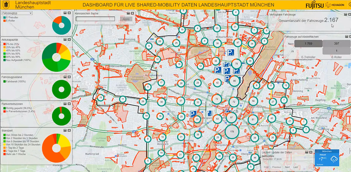
    Hexagon and Fujitsu will work together to provide joint use cases leveraging digital-twin technologies and solutions from both companies, including sensors, data processing, data analysis and advanced data visualization in the cloud and high-performance computing infrastructure. The partners will deploy these technologies to develop joint solutions that deliver richer information and deeper insight to customers in government, the public sector, transportation and utilities to help reduce emissions, increase safety, optimize operations and more.

    “Our goal at Fujitsu is to realize our vision for a ‘Trusted Society’,” said Yoshinami Takahashi, EVP and vice head of Global Solution Business Group, Fujitsu. “Partnering with Hexagon will allow us to extend our reach and provide even greater value to cities and regions around the world.”

    “Cities are playing a leading role in solving global challenges, from addressing climate change to eliminating traffic fatalities,” said Steven Cost, president, Hexagon’s Safety, Infrastructure & Geospatial division. “Our partnership with Fujitsu can help cities put data to work to solve these pressing problems and meet sustainability and safety goals.”

    The new global partnership builds from the companies’ work to solve urban sustainability challenges in Europe, including efforts to better manage and understand the impacts of shared mobility services in Germany, including a project with the City of Munich.

    The Hexagon mascot peruses a map during HxGN LIVE 2022. (Photo: Hexagon)
    Hex-E, the Hexagon mascot, peruses a map during HxGN LIVE 2022. (Photo: Hexagon)

    HxGN EAM asset management software leads in Green Quadrant

    HxGN EAM from Hexagon’s Asset Lifecycle Intelligence division was named a leader in the enterprise asset management (EAM) market in the Green Quadrant: Enterprise Asset Management Software 2022 report from Verdantix.

    Verdantix is an independent research and advisory firm with expertise in digital strategies.

    HxGN EAM received the highest weighted score for the technical capabilities of the platform. The report assessed 14 EAM software vendors across their product functionality, user interface and market momentum.

    Verdantix estimates that global spending on EAM will reach $5.4 billion in 2026, compared to $3.6 billion in 2021, and states that acquisitions and funding are reshaping the EAM market. This comes just after Hexagon’s $2.8 billion acquisition of Infor’s EAM software business to form HxGN EAM in 2021.

    “HxGN EAM’s growth ambitions align with the market outlook and Hexagon’s vision to be the world leader in digital realities and autonomous solutions,” said Kevin Price, vice president, Enterprise Asset Management Portfolio Segment, Hexagon’s Asset Lifecycle Intelligence division. “Asset visibility is the first step in proactive maintenance and the prevention of the breakdown of critical functions, and we’re proud that HxGN EAM’s wide availability of services matches the growing needs of our customers. It’s an honor to be classified as a leader in the EAM market.”

    The Hexagon mascot gets excited about his reflection at HxGN LIVE 2022. (Photo: Hexagon)
    Hex-E gets excited about his reflection at HxGN LIVE 2022. (Photo: Hexagon)

    Hexagon Elite Awards recognize customers

    Hexagon’s Asset Lifecycle Intelligence (formerly PPM) division  announced the recipients of the 2022 Hexagon Elite Awards, which honor Asset Lifecycle Intelligence division customers who are champions of progress and innovation using Hexagon solutions.

    “As we expand our portfolio and capabilities through acquisitions, our customers’ designs and animations using Hexagon solutions for this competition continue to amaze,” said David Cryer, Senior Vice President & Chief Marketing Officer, Hexagon’s Asset Lifecycle Intelligence division. “It’s an honor to recognize this year’s winners and we want to thank all of our customers who submitted entries.”

    This year’s awards were presented in six categories:

    • Best in Design recognizes the most innovative and well-executed uses of Intergraph Smart 3D, Intergraph Smart Review and/or CADWorx: Fandy Maulana, Reformer Petrochemical Plant, PT Rekayasa Industri (Rekind).
    • Best in Automation rewards the most innovative automation ideas for Intergraph Smart 3D, Intergraph Smart P&ID, Intergraph Smart Electrical and/or Intergraph Smart Instrumentation: Petrobras – Surface Systems Engineering.
    • Best in Analysis recognizes innovative applications of CAESAR II, PV Elite and/or GT STRUDL that helped successfully complete a project and meet design and engineering goals: Chengwen Wang, Wuhuan Engineering Co. Ltd.
    • Best in Operations highlights customers who are true champions of progress and continue to move their company and industry forward in digital transformation in the Operations and Maintenance segments: Sudharshan Nambiar, Engineering Data Management – Systems, Petronas.
    • Best in Project Performance recognizes customers who use Asset Lifecycle Intelligence division and EcoSys solutions to successfully complete a project or improve project performance: Yann Guyot, Cost Control & Risk Management, Technip Energies.
    • Best in Procurement, Fabrication & Construction Management honors the most innovative and well-executed uses of the Asset Lifecycle Intelligence division’s PF&C solutions to successfully complete a project or move the company and industry forward in digital transformation: Jingwei Zhang and Zhifang Li, Zhengzhou Coal Mining Machinery Shuyun Intelligence Technology Co. Ltd.

    Submissions for the 2023 Hexagon Elite Awards competition will be accepted starting Nov. 1.


    Photo: Hexagon
    Photo: Hexagon

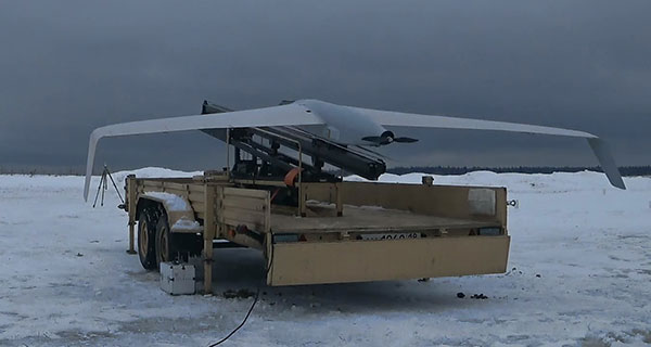
    Hexagon and Mineral Resources partner on automated road-train solution

    Hexagon’s Autonomy & Positioning and Mining divisions announced the development of an automated road-train solution with mining services company Mineral Resources Limited (MRL). To be deployed on MRL’s haulage fleet, the solution integrates drive-by-wire technology with an autonomous management system to orchestrate vehicle movement in road-train haulage.

    The automated road-train solution focuses on safety, productivity and sustainability for MRL operations and will be phased in over the next two years. Both companies are confident that progressive automation will profoundly change the safety and economics of mining where macroeconomic challenges, including commodity prices and labor shortages, impact the feasibility of projects.

    The automated road-train solution improves the safety of long-range haulage, provides cost-efficiencies and reduces emissions to assist companies in lowering their carbon footprint. Beyond mining, this innovative solution will also benefit bulk haulage in many other off-road primary industries.

    “Autonomous vehicles are revolutionizing the way we work today and into the future, and Hexagon is very proud to be part of this revolution,” said Ola Rollén, president and CEO of Hexagon. “Our agreement with MRL further solidifies Hexagon’s commitment to autonomous mobility and fulfilling our customer’s safety and productivity requirements.”

  • Launchpad: GNSS antennas and PC boards

    Launchpad: GNSS antennas and PC boards

    A roundup of recent products in the GNSS and inertial positioning industry from the June 2021 issue of GPS World magazine.


    OEM

    Grandmaster Clock

    Multi-constellation receiver

    Photo: Microchip
    Photo: Microchip

    The upgraded TimeProvider 4100 2.2 is now more redundant and resilient. It provides secure, precise timing and synchronization for critical infrastructure such as 5G wireless networks, smart grids, data centers, cable and transportation services. The 4100 2.2 introduces a software-redundancy architecture for flexible deployment, and supports a new GNSS multi-band, multi-constellation receiver to protect against time delay from space weather, solar events and other disruptions. The 4100 2.2 offers options for software and hardware support.

    Microchip Technology, microchip.com

    External Antennas

    GNSS-ready multi-port models

    Photo: Maxtena
    Photo: Maxtena

    The NETZ 5-in-1 multiple-input and multiple-output (MIMO) solution combines two LTE antennas and two Wi-Fi antennas with a GNSS antenna for high data throughput and streaming, video, industrial and internet of things (IoT) applications. It offers a low-profile design with integrated SubMiniature version A (SMA) connectors and is designed with rugged PC+ABS plastic black housing for demanding environmental challenges.

    Maxtena, maxtena.com

    Mini-PCLe Adapter

    For industrial applications

    Photo: Gateworks
    Photo: Gateworks

    The GW16143 is a high-precision GNSS/GPS Mini-PCLe adapter card that provides precise positioning to applications using Gateworks single-board computers. Based on the U-blox ZED-F9P, the GW16143’s multi-band real-time kinematic (RTK) technology enhances convergence times and performance. The module receives GPS, GLONASS, Galileo and BeiDou; supports L1 and L2/L5 bands; and provides GNSS positioning accuracy
    of <2 cm.

    Gateworks, gateworks.com

    Inertial unit

    Tactical grade for higher order integrated applications

    The IMU-NAV-100. (Photo: Inertial Labs)
    The IMU-NAV-100. (Photo: Inertial Labs)

    The IMU-NAV-100 is a fully integrated inertial solution that measures linear accelerations, angular rates, and pitch and roll with high accuracy utilizing three-axis high-grade micro-electro-mechanical systems (MEMS) accelerometers and three-axis tactical-grade MEMS gyroscopes. It features continuous built-in test, configurable communications protocols, electromagnetic interference protection, and flexible input power requirements that allow it to be easily integrated in a variety of higher order systems. The IMU-NAV-100-S offers high performance stabilization for line-of-sight systems, motion-control sensors, and platform orientation and stabilization systems. The IMU-NAV-100-A is for GPS-aided INS, AHRS and motion reference units.

    Inertial Labs, inertiallabs.com

    Mass Market Board

    Single-board computer with up to three receivers

    SimpleRTK2B-SBC. (Photo: ArduSimple)
    SimpleRTK2B-SBC. (Photo: ArduSimple)

    The SimpleRTK2B single-board computer is built around up to three u-blox ZED-F9P high-precision GNSS receivers to simplify development of centimeter-level positioning solutions supporting real-time kinematics (RTK). It was developed to make RTK technology as close to plug-and-play as possible, and make the technology accessible to broader audiences. In addition to working as a stand-alone solution, customers can program their own applications with the company’s microPython API. The SimpleRTK2B-SBC delivers mechanical integration with centimeter position on three axes (heading, pitch, roll), outputting on NMEA, RTCM, RS232 and CANBus interfaces via Ethernet, Bluetooth, Wi-Fi and 2G/3G/4G communication.

    Ardusimple, ardusimple.com


    SURVEYING & MAPPING

    Utility locator

    Software with GNSS receiver enables mapping

    Photo: ProStar
    Photo: ProStar

    PointMan software is now integrated into the Vivax Metrotech vLoc3 with a GNSS real-time kinematic (RTK) receiver to create a utility-locate device. Using the RTK-Pro internal cellular module with 4G LTE capabilities, the operator can connect to the NTRIP RTK caster that provides RTCM 3 corrections. With the integration of PointMan with the vLoc3 RTK-Pro, critical buried infrastructure can be captured, recorded and displayed at survey-grade without additional external equipment or post-processing. The integration provides centimeter accuracy of the precise location of buried utilities in real time. Data collected includes the type of utility, the depth of cover and the utility’s precise location.

    ProStar Holdings, prostarcorp.com

    GIS platform

    Geospatial and location intelligence for smart cities

    Screenshot: Hexagon Geospatial
    Screenshot: Hexagon Geospatial

    M.App Enterprise 2021 is a significant update to the platform for creating geospatial and location intelligence applications. The latest release features new browser-based 3D capabilities and enhanced visual effects, plus the ability to create and configure custom applications more easily. It allows users to access LuciadRIA’s 3D features with support for panoramic imagery, shading, ambient occlusion and other visualization effects to build browser-based solutions. It also features a new browser app configurator that makes it easier to create spatio-temporal dashboards, or Smart M.Apps. Feature Analyzer now allows users to add and manage multiple datasets on the fly and set up workflows.

    Hexagon Geospatial, hexagongeospatial.com


    TRANSPORTATION

    Nearshore receiver

    Measures positioning, heading, attitude, velocity and heave

    Photo: Hexagon | NovAtel
    Photo: Hexagon | NovAtel

    The MarinePak7 marine-certified GNSS receiver is designed for nearshore applications. The multi-constellation, multi-frequency receiver was engineered to receive the Oceanix Correction Service from NovAtel, providing horizontal accuracy up to 3 cm (95%) in a marine environment. With SPAN GNSS+INS technology capabilities, the MarinePak7 couples GNSS and inertial measurement units (IMUs) for 3D positioning.

    Hexagon | NovAtel, NovAtel.com

    Expansion Card

    For lane-level positioning

    Photo: Antzertech
    Photo: Antzertech

    The ANNA-F9 high-precision GNSS Mini-PCIe card can achieve centimeter-level accuracy. It integrates the U-blox ZED-F9 receiver platform, providing multi-band GNSS (GPS, GLONASS, BeiDou, Galileo, QZSS and SBAS) and RTK positioning, and can be integrated with embedded systems. It provides high-accuracy positioning for applications including lane-level navigation and railway transportation. The ANNA-F9 series supports RTCM formatted corrections and centimeter-level positioning from local base stations or virtual reference stations in a network RTK setup.

    Antzertech, antzer-tech.com

    Marine Antennas

    Two added to VeroStar line

    Photo: Tallysman
    Photo: Tallysman

    Marine vessels often host both Iridium (1616–1626.5 MHz) and Inmarsat (uplink: 1626.5–1660.5 MHz) satellite communication antennas that transmit and receive signals. The VSP6037L-MAR and VSP6337L-MAR VeroStar marine antennas strongly attenuate interference from both signal sources, providing 75 dB to 85 dB of attenuation over Iridium and 85 dB to 95 dB over Inmarsat uplink, enabling clean GNSS signal reception and precise positioning. The VSP6037L-MAR supports the full GNSS spectrum; the VSP6337L-MAR supports GPS/QZSS-L1/L2/L5, GLONASS-G1/G2/G3, Galileo-E1/E5a/E5b, BeiDou-B1/B2/B2a, and NavIC-L5 signals. Both antennas support L-band correction signals. Every VeroStar antenna features a robust pre-filter and a high-IP3 LNA architecture, minimizing desensing from high-level out-of-band signals, including 700 MHz LTE, while still providing a noise figure of 1.8 dB. They meet IEC 60945 and IEC 61108 marine certifications for challenging marine environments.

    Tallysman Wireless, tallysman.com

    Cargo Service

    For tracking high-value assets

    The managed internet of things (IoT) Acculink Cargo can track the location and condition of high-value and sensitive assets, providing real-time visibility, product-level tracking and exception-based monitoring as goods move through their supply chains. Tracking can be used to avoid delays, minimize dwell time, prevent theft and remediate environmental conditions that can cause asset damage.

    Sierra Wireless, sierrawireless.com

    Tracking Antenna

    Rugged external mount

    Photo: Laird Connectivity
    Photo: Laird Connectivity

    The GNS1559MPF or Mini GNSS is a rugged, high-performance and cost-effective solution for most GNSS or asset-tracking applications. The small form factor makes it easy to install on or in vehicles or buildings. It is IP67 rated to withstand impact as well as water and dust intrusion in demanding environments and operating conditions. The antenna can be configured with different cable types in varying lengths and with various connector types. Uses include public safety, in-building, fleet management, asset tracking, vehicle and personnel tracking.

    Laird Connectivity, lairdconnect.com


    UAV

    Long-Flight UAS

    Unmanned system for long-distance flights

    Photo: Zala Aero Group
    Photo: Zala Aero Group

    The Zala 421-16E5G long-flight UAS is a domestic unmanned aerial system with a hybrid power plant. The non-aerodrome-based system is capable of providing aerial monitoring covering distances of more than 150 kilometers and staying in the air for more than 12 hours. Its power plant charges a buffer battery for an hour, allowing the UAV to fly long distances. It is equipped with two thermal imagers and a 60x video camera. Alternatively, it can carry a payload of up to 10 kg.

    Zala Aero Group, zala-aero.com/en/

    Inertial navigation system

    Ready for drone surveys

    Photo: OxTS
    Photo: OxTS

    The xNAV650 inertial navigation system (INS) provides surveyors with absolute position, timing and inertial measurements (heading and pitch/roll) that they can integrate into their projects. When combined with data from other devices (such as lidar sensors and cameras), the INS measurements can greatly enhance the surveying process. The xNAV650 has the latest micro-electro-mechanical (MEMS) inertial measurement unit (IMU) technology and survey-grade GNSS receivers. At 77 x 63 x 24 mm and 130 grams, it is suitable for a wide range of UAV data-collection applications: surveys of bridges, buildings, forests and rail; coastal monitoring; map creation; and pipeline exploration. Data collected can be fused with data from almost any lidar sensor. OxTS NAVsuite software is included with all OxTS INS. Other optional software is available, including precision time protocol and GX/IX tight-coupling technology.

    Oxford Technical Solutions, oxts.com

    Lidar System

    With GNSS receiver and IMU

    Photo: CHCNAV
    Photo: CHCNAV

    The AlphaAir 450 (AA450) lidar system is a lightweight, compact all-in-one sensor. Featuring an inertial measurement unit (IMU), GNSS receiver and 3D scanner and camera, the AlphaAir 450 is suitable for power-line inspections, topographic mapping, emergency response, agricultural work and forestry surveys. The unit can be rapidly deployed in the field to collect geospatial data. It achieves absolute accuracy of 5 cm (vertical) and 10 cm (horizontal) for small survey areas. Adjustment algorithms applied in CHCNAV CoPre software further improve precision and accuracy. The AA450 weighs 1 kilogram for easy mounting on a UAV. It is IP64 rated against dust and water spray and operates at –20° C to +50° C.

    CHC Navigation, chcnav.com

    Imaging systems

    Survey-grade with lidar

    Photo: Geocue
    Photo: Geocue

    The True View 635/640 3DIS is GeoCue’s second-generation lidar/camera-fusion platform designed to generate high-accuracy 3D colorized lidar point clouds using the Riegl miniVUX-3UAV. All 3DIS platforms include GeoCue’s data-processing software suite True View EVO, which integrates with the Applanix POSPac. With its 120° fused field of view, the True View 635/640 provides 3D mapping with excellent vegetation penetration and wire detection in a payload package of 3.2–3.6 kg. True View EVO supports the direct creation of ground classified point clouds, surface models, contours, digital elevation models, volumetric analysis, wire extraction and similar products, without the need for additional third-party software.

    GeoCue Group, geocue.com

  • Hexagon selected by Munich for shared mobility solution

    Hexagon selected by Munich for shared mobility solution

    Partnership with Fujitsu will help city track bicycles, e-scooters and ridesharing companies 

    The mobility department of Munich, Germany, has selected Hexagon Geospatial to implement a smart monitoring system to better manage and understand the impacts of shared mobility services in the city. 

    Hexagon will partner with Fujitsu to provide Munich a software-as-a-service (SaaS) solution for tracking, visualizing and analyzing internet of things (IoT) data from a variety of mobility providers. The solution will monitor shared vehicles, such as e-scooters, bikes and cars, and will be the first of its kind in Germany.

    The solution will also feature a dynamic digital twin of the city, allowing users to fuse the real and digital worlds and receive constant updates. Along with Hexagon’s M.App Enterprise software, Fujitsu will provide the necessary infrastructure for the project, which is designed to evolve constantly according to officials’ needs.

    Hexagon was selected from among 14 competitors based on the technical completeness and capabilities of its offering and established expertise in the transportation domain. With this smart monitoring system in place, the city can continually monitor and guide future mobility concepts based on data.

    “Shared mobility is a big issue around the world, and the city of Munich is on the leading edge of leveraging technology to manage these services,” said Maximillian Weber, senior vice president, EMEA, Hexagon’s Safety & Infrastructure and Geospatial divisions. “We are excited to deliver a system that will help officials better identify and understand transportation patterns with the goal of improving future city mobility.” 

    Tracking eScooters in Munich with Hexagon's M.App Enterprise. (Image: Hexagon Geospatial)
    Tracking eScooters in Munich with Hexagon’s M.App Enterprise. (Image: Hexagon Geospatial)
  • Hexagon releases machine-learning GIS tool for smart cities

    Hexagon releases machine-learning GIS tool for smart cities

    Hexagon’s Geospatial division has launched M.App Enterprise 2021, a significant update to its platform for creating geospatial and location intelligence applications. The latest release features new browser-based 3D capabilities and enhanced visual effects, plus the ability to create and configure custom applications more easily.

    M.App Enterprise 2021 adds complete and seamless integration with Hexagon’s LuciadRIA. Now, users can access LuciadRIA’s 3D features, including support for panoramic imagery, shading, ambient occlusion and other visualization effects, to build browser-based solutions with no development necessary.

    The latest version also features a new browser app configurator that makes it even easier to create spatio-temporal dashboards, known as Smart M.Apps. Additionally, Feature Analyzer has been expanded to allow users to add and manage multiple datasets on the fly and set up workflows. These enhancements enable more dynamic configurations, allowing field workers to be alerted quickly when action is required.

    The city of Klagenfurt, Austria — a long-time Hexagon customer — has already begun using M.App Enterprise 2021 to create a city app platform that features a detailed 3D urban landscape of the entire city.

    “This opens up endless possibilities for applications to automate several manual processes within different departments of the city,” said Günter Koren, head of the department of surveying and GIS at the city of Klagenfurt. “We believe M. App Enterprise will be an essential step in our journey to become a smarter, safer city for our 100,000 citizens.”

    The latest release contains other new features and improvements, including an overhauled style editor, a new default dark theme, options for customized theming and full support for SAP HANA databases.

    “M.App Enterprise 2021 helps organizations achieve smart monitoring of their cities, infrastructure and services by seamlessly incorporating location intelligence into enterprise systems and workflows,” said Georg Hammerer, chief technology officer of Hexagon’s Geospatial division. “With augmented visuals and dynamic configurations, this new version of M.App Enterprise can help customers easily set up powerful applications, allowing them to be more productive and efficient.”

    Screenshot: Hexagon Geospatial
    Screenshot: Hexagon Geospatial
  • Hexagon partners with Navantia for Spanish Navy combat system

    Hexagon partners with Navantia for Spanish Navy combat system

    Navantia has selected Luciad — Hexagon’s platform for building advanced location intelligence and real-time situational awareness applications — to equip the combat system of five future F-110 frigates for the Spanish Navy.

    The agreement will also cover corresponding tests, validations and simulation environments, according to Hexagon’s Geospatial division.

    Navantia and the Spanish Ministry of Defense signed a contract for the construction of the F-110 frigates in April 2019.

    Starting in 2016, Hexagon’s Luciad was subjected to the strictest technical benchmarks by Navantia and the Spanish Navy, along with other comparable geospatial technologies on the market. Luciad surpassed the competition to secure the partnership.

    Since then, Navantia has developed initial versions of the combat system, which integrates sensors, nautical cartography, AIS tracks and more.

    “We are proud to support Navantia and the Spanish Navy,” said Jose Luis Peinado, vice president of Hexagon’s Geospatial division. “This partnership represents another step of our expansion in the defense market and is recognition of Hexagon as a leader in geospatial software for mission-critical environments, where robustness and high performance are key.”

    As part of the new partnership, Navantia will join a growing list of systems integrators and defense ministries, including NATO, that have chosen Luciad as the engine for command and control, air defense, border surveillance, combat systems, intelligence and more.

    Luciad enables intuitive and interactive map-centric views for aviation, smart cities and defense. It can connect to any database and more than 200 data formats, including real-time data with domain-specific standards. Users can guarantee the highest accuracy, as well as visualize situations in 2D and 3D with rich and flexible styling options.


    Feature image: Screenshot: Navantia

  • Hexagon Geospatial updates platform for location intelligence

    Hexagon Geospatial updates platform for location intelligence

    Luciad 2020.1 provides capabilities with panoramic imagery. (Screenshot: Hexagon Geospatial)
    Luciad 2020.1 provides capabilities with panoramic imagery. (Screenshot: Hexagon Geospatial)

    Luciad 2020.1 features dynamic panoramic imagery capabilities and immersive 3D imagery

    Hexagon’s Geospatial division has launched Luciad 2020.1, a significant update to its platform for building advanced location intelligence and real-time, situational awareness applications.

    Luciad 2020.1 delivers immersive 3D experiences with 360-degree panoramic imagery support that can be combined with other 3D data layers for geospatial applications. The latest release also features additional styling for 3D meshes and 3D data integration capabilities.

    Visualization and Analysis

    Hexagon’s Luciad portfolio allows developers to create powerful, high-performance applications that leverage data from any source for visualization and analysis in 2D and 3D. Combining static, dynamic and real-time data, including moving tracks, Luciad-powered applications support defense, aviation, infrastructure and other critical sectors.

    For the 2020.1 release of LuciadRIA, which is used for building browser-based solutions, Hexagon has added 360-degree panoramic imagery capabilities that can be combined with other 3D data layers to provide complete imagery coverage and detailed information about a location. Panoramic imagery puts users in control of what they want to look at within an image. The panoramic 3D experience is powered by a new streaming imagery data service in LuciadFusion, Hexagon’s OGC-compliant server solution.

    “With the addition of panoramic imagery capabilities and other 3D data enhancements, Luciad 2020.1 puts local governments, transportation departments, utility companies and others in control of what they can observe and analyze within a particular scene,” said Mladen Stojic, president of Hexagon’s Geospatial division. “With these capabilities, organizations can remotely monitor their assets and infrastructure, significantly reduce manual inspection processes and fully leverage location intelligence across the enterprise.”

    More New Features

    The release contains other new features and improvements requested by customers, including:

    • military grid coordinate transformations
    • non-georeferenced WebGL-based views
    • improved imagery sampling
    • additional format support and upgrades.

    For defense customers, the Luciad 2020.1 release consolidates its military symbology support across all Luciad platforms and programming languages.

  • Hexagon acquires Thermopylae for 5D visualization

    Hexagon AB has signed an agreement to acquire Thermopylae Sciences and Technology, a software provider primarily focused on the U.S. government and defense market that specializes in geospatial applications, mobile frameworks and cloud computing for enhanced location intelligence.

    Thermopylae has developed advanced visualization solutions to support tactical edge mapping in support of mission critical operations. Built upon the Google technology stack, its defense and intelligence solutions are targeted at addressing the challenges involved in working with critical problem sets in secure or classified government environments.

    In addition, its portfolio is applicable to a host of markets in the private sector, including real estate, finance, insurance, retail and media, with customers ranging from startups to Fortune 50 companies.

    “Thermopylae’s software and domain expertise nicely augment our ability to deliver the visual location intelligence necessary for enabling autonomous connected ecosystems,” said Hexagon President and CEO Ola Rollén. “Ultimately, the addition of Thermopylae will enrich the 5D experience delivered through our Hexagon Smart M.App and Luciad portfolios — both of which enable smart digital realities with 3D, 4D (real-time sensor feed integration) and 5D (dynamic analytics) capabilities. Not only does the acquisition provide an avenue for international market adoption of Thermopylae’s technologies but also an additional avenue for Hexagon to accelerate adoption of our 5D visualization capabilities in U.S. government agencies.”

    Headquartered in Arlington, Virginia, Thermopylae will operate as a part of Hexagon’s Geospatial division, which is reported under the Geospatial Enterprise Solutions segment. Sales in 2017 amounted to $20 million.

    Completion of the transaction (closing) is subject to customary regulatory approvals, including a voluntary filing to the Committee on Foreign Investment in the United States (CFIUS).

  • Hexagon presents GEOINT solutions at defense conference

    Hexagon’s Geospatial division, which offers high-performance geospatial solutions, showcased its defense solutions at DGI 2019, which took place Jan. 28-30 in London.

    DGI is Europe’s largest annual gathering dedicated to high-level discussions addressing the major challenges of the defense and government geospatial intelligence (GEOINT) community.

    The theme for this year’s conference is “Source, Analyze, Automate, Share,” and will provide senior defense leaders with opportunities to learn about new developments and innovations in geospatial data gathering and analysis.

    Whether for planning military operations, analyzing intelligence or determining responses to a natural disaster, Hexagon’s Geospatial division’s innovations shorten the time between data acquisition and real-time information delivery, driving mission success through actionable decision-making.

    Located at stand 8, Hexagon’s exhibition at DGI includes solutions from the Power Portfolio, M.App Portfolio and Luciad Portfolio, which improve data integration, access and delivery across the GEOINT enterprise. The following are some of the innovations that will be on display:

    • Machine Learning Processes Massive Amounts of Data: Understanding the situation on the ground starts with geospatial intelligence. Attendees will learn how ERDAS IMAGINE’s machine learning algorithms can be trained to process massive amounts of data, taking the load off analysts and freeing them up to do the work that humans do best.
    • M.App X: Rapidly Exploit Imagery: This cloud-based exploitation for defense and intelligence enables System Integrators to provide tools for the exploitation of imagery and the creation of intelligence and reports for their defense customers.
    • Command and Control: Providing true situational awareness in action, Luciad offers 2D and 3D integration of all data into one visualization tool, including full support for symbols and tactical graphics of the latest military symbology standards.

    “With the traditional battlefield expanding beyond land, sea, and air to the electronic, cyber, and social media arenas, today’s global defense and intelligence agencies operate in high-stakes environments where mission success comes down to accessing, analyzing, and sharing real-time visualization data,” said Mladen Stojic, Hexagon’s Geospatial Division president. “We look forward to showcasing our cutting-edge data analytics and visualization solutions that enable success in today’s multi-domain frontier at DGI 2019.”

    Hexagon Geospatial’s Director, Defense Sector, Tony Wheeler will also give a presentation on “A Tiered Approach to Analysis — Enabling the COP User,” on Tuesday, Jan. 29, from 2 to 2:20 p.m. The session will explore how technology can enable military staff to better exploit information — creating a new tier of analytical capability to augment that of dedicated intelligence organizations.

  • Hexagon Geospatial releases Luciad Portfolio update

    Logo: HexagonHexagon’s Geospatial Division has released V2018.1 of the Luciad Portfolio. According to the company, V2018.1 focuses on further expanding 3D capabilities and includes additional data formats and standards for users in military and maritime domains.

    To accomodate organizations’ expanding geospatial data, LuciadFusion added a RESTful API to automate the entire process of data crawling.

    As a part of the update, LuciadFusion and LuciadLightspeed, the server and desktop solutions, have added support for the E57 point cloud format and automate point cloud data optimization through the Tiling Engine API. LuciadLightspeed now includes inland electronic navigational charts and updated support for military symbology with the U.S. Department of Defense Joint Military Symbology Standard and the NATO Joint Military Symbology Standard APP-6D icons.

    In addition, LuciadRIA now allows users to draw a multitude of complex lines and military tactical graphics in 2D and 3D in the browser.

    “The additional 3D capabilities of Luciad V2018.1 support our vision for a smart digital reality, empowering users to unlock the power of advanced geospatial analytics and visualizations,” said Mladen Stojic, president of Hexagon’s Geospatial Division.

  • Hexagon’s M.App Enterprise update includes mobile workflow

    Hexagon’s Geospatial division released a new version of M.App Enterprise for 2018, M.App Enterprise 16.5. This privately hosted solution allows organizations to deploy Hexagon Smart M.Apps that dynamically address their location-based business problems, the company said.

    M.App Enterprise is the ideal platform to monitor assets, evaluate changes and take action, with the new release now including a native mobile client. The mobile workflow enables managers to assign tasks to field workers when it’s necessary to act. With the new mobile application, the platform is available from anywhere, including areas without internet access.

    The new M.App Enterprise Studio comes with the Spatial Workshop user interface to manage spatial recipes. Its geoprocessing capabilities make it possible to make calculations with any type of geospatial data.

    Updates to the Feature Analyzer component, such as thematic cluster markers, tooltips for boundary data and the option to share your views according to user type, make it easier to interactively derive insights from a variety of data, the company said.

    The new product localization feature ensures that users are no longer lost in translation. New languages can be added to any local M.App Enterprise instance within minutes.

    “M.App Enterprise provides a unified geospatial enterprise platform enabling customers and partners to create vertical solutions for their markets and industry segments,” said Georg Hammerer, chief technology officer of Hexagon’s Geospatial Division. “M.App Enterprise perfectly fits into the movement to the cloud and the trend towards self-service BI.”

  • Hexagon Geospatial launches HxGN Smart Census

    Hexagon’s Geospatial division has launched its total population and housing census management and workflow solution, HxGN Smart Census.

    HxGN Smart Census makes each phase of the census process smarter and more manageable, the company said. HxGN Smart Census pricing is agile, taking into account a nation’s surface area, population, and Human Poverty Index to ensure that all countries can participate in the digitalizing of their census processes.

    Image: Hexagon
    Image: Hexagon

    HxGN Smart Census integrates traditional GIS functionality with a powerful workflow and workforce management tool to provide a total solution for census strategies: from pre-enumeration mapping, to digital enumeration, to post-enumeration dynamic mapping. It can be used on its own or integrated with a nation’s or organization’s existing GIS infrastructure.

    The solution was developed in consultation with South African GIS experts GeoSpace International, and has already been procured by South Africa and Botswana.

    “With HxGN Smart Census, the census gets completed much faster, and the mobile application has made things much simpler for the field workers who are conducting the interviews,” said Shonisani Maranda, senior GIS officer at Statistics South Africa. “It also significantly increased the data quality, which allows us to achieve the UN sustainable development goals more easily.”

    “Census data informs policy development, the running of public services, and the allocation of resources within a country. It is vital that all nations are able to utilize the right technology to ensure an accurate and effective census,” said Mladen Stojic, president of Hexagon’s Geospatial division. “HxGN Smart Census is capable of democratizing the collection of accurate demographic data, and transforming this information into insights to make informed decisions to shape Smart Change.”

  • USGIF, Hexagon Geospatial grant software to 14 colleges

    The United States Geospatial Intelligence Foundation (USGIF) has partnered with Hexagon Geospatial, a USGIF organizational member, to offer software licenses to 14 colleges and universities under USGIF’s Collegiate Accreditation Program.

    Hexagon Geospatial will provide students and faculty at each of USGIF’s 14 accredited programs with three-year licenses for its desktop and cloud-based Smart M.App software.

    The software is designed to benefit and assist students, professors, and scientists in building geospatial cloud applications.

    Smart M.apps are interactive map applications that combine content, analytics, workflow, and presentation to solve a specific business problem.

    “As a company with roots in universities across the world, Hexagon Geospatial has always valued students and academia as an investment in the future,” said Jason Sims, Hexagon Geospatial’s chief channel and marketing officer. “This is why we are so happy to announce our partnership with USGIF, providing access to our software and platforms. We look forward to seeing the way instructors, researchers, and students influence how location information will be used to innovate and shape smart change.”

    USGIF’s Collegiate Accreditation Program prepares students with the necessary knowledge and skills upon entering the professional geospatial intelligence (GEOINT) workforce. USGIF-accredited GEOINT programs include Fayetteville State University, George Mason University, James Madison University, Universidade Nova de Lisboa, Northeastern University, Pennsylvania State University, the University of Texas at Dallas, the University of Utah, the U.S. Air Force Academy, the University of Missouri, the University of Redlands, the University of South Carolina, the University of Southern California, and the U.S. Military Academy.

    “We’re excited about this partnership to collaboratively issue license grants to faculty and students teaching at and attending USGIF accredited institutions,” said USGIF Director of Academic Programs Dr. Camelia Kantor. “USGIF’s accredited programs have a track record consistent with excellence in preparing students for work in the GEOINT profession. Such partnerships bring academia and industry together to ensure the preservation of standards, to encourage innovation, and to enable faculty and students to teach, learn, and conduct research using software from industry.”