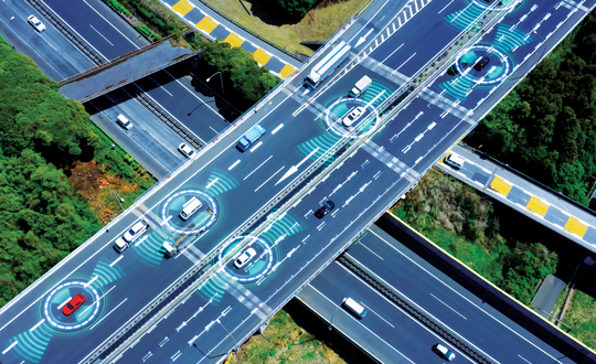
Genesys has developed India’s first large-scale high-definition maps engineered specifically for vehicles enabled with advanced driver assistance systems (ADAS).
Covering more than 1 lakh km of India’s national highways, expressways and strategic corridors, this initiative marks one of India’s most ambitious road intelligence programs and establishes a new benchmark for automotive-grade precision.
India’s highways account for a disproportionately high share of road fatalities, driven by fast-moving traffic, inconsistent lane discipline, and limited real-time awareness for drivers and vehicles. HD maps narrow this gap by adding the centimeter-level context that traditional maps cannot provide — lane geometry, curves, slopes, signage, barriers and localization cues that help ADAS systems anticipate danger instead of merely reacting to it. This is a big leap forward from current sensor-based ADAS systems, Genesys said.
The HD maps include ADAS-critical features such as lane geometry, road markings, barriers, signage, medians, elevation and curvature profiles, and localization objects like poles and gantries — all processed to achieve centimeter-grade precision.
CORS network plays a key role
To achieve the centimeter-level accuracy required for ADAS Level 2 functionality, Genesys relies on the Survey of India’s Continuously Operating Reference Stations (CORS) network. Real-time GNSS correction signals along major corridors dramatically strengthen field operations, allowing survey teams to capture lane-level and asset-level detail that meets global automotive standards.
This work builds on the existing memorandum of understanding between Genesys and Survey of India, enabling collaboration on digital twin projects, national mapping programs, and high-accuracy geospatial missions.
These datasets are owned by Genesys and can be licensed across industries, creating opportunities in commercial fleet navigation, logistics optimization, mobility platforms, safety analytics and automotive R&D.
First commercial deployment to be installed on a major turnpike used by tens of millions of vehicles every year
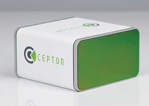
An electronic tolling system that uses high-performance lidar sensors from Cepton and a vehicle identification solution from Red Fox ID is expected to be deployed on a major highway turnpike crossing multiple states in the United States.
The turnpike project is expected to provide fast, accurate, real-time tolling to enable smooth traffic flows. Specifics of the project — including states involved and the timeframe of installation — were not disclosed.
Photo: Cepton
Based on an extended collaboration with leading lidar solution provider Cepton, Red Fox ID — a designer and developer of vehicle identification and classification solutions — has developed a multi-lane, free-flow tolling system called Quantum, which is able to accurately detect, track and classify vehicles of any size or type at highway speeds.
Quantum uses Cepton’s Micro Motion Technology (MMT)-based Sora-P60 or Sora-P90 lidar sensors for high-resolution vehicle profiling, to enable integrators and road operators to achieve highly accurate customer billing in real time, with free flow, barrier-free tolling.
For tolls to be charged correctly based on vehicle class, traditional tolling systems often use tollbooths for manual processing or depend on vehicle speed-reduction infrastructure to allow for time to capture vehicle information. That can cause congestion, increased emissions and frustration among customers.
Advanced systems that aim to enable faster tolling are often subject to significant errors, such as missed vehicles or wrong vehicle classification, because of limitations of the sensors being used, such as cameras and weight-based ground sensors. Vehicle-classification errors can have significant operating cost consequences for tolling operators, while leakage leads to lower revenues. With tollways processing tens of millions of vehicles a year, the cumulative impact of inaccuracies and errors creates significant administrative costs, losses and customer dissatisfaction.
Red Fox ID’s Quantum solution adds an extra layer of accuracy to the tolling system by integrating Cepton’s lidar technology. A gantry-mounted system using Quantum is able to accurately detect and track vehicles even as they switch lanes. Quantum captures and extracts high-quality information, such as vehicle velocity, size and class. All of that information is used as input to a separate billing system to compute and apply the appropriate tolling charge.
Quantum can also direct camera-based systems on the gantry to capture a vehicle’s front and rear plates in the event that a transponder cannot be detected. Through these innovations, Quantum has demonstrated a vehicle-detection accuracy in all traffic conditions of 99.96%, an axle-classification accuracy in all traffic conditions of 99.9% and a vehicle-length accuracy of +/-5%. The system uses Cepton’s Sora-P sensor family which has been tested and proven during extended trials, including in various weather and light conditions.
The recently released Sora-P90 lidar features a 380-Hz frame rate to deliver 1140 line scans per second, providing high-fidelity profiling of vehicles passing at highway speeds. Powered by Cepton’s patented, rotation-free, frictionless and mirrorless MMT, the Sora-P90 is rugged, reliable and scalable, making it suited for automated tolling applications.With a 90° horizontal field of view, the lidar can be set up using one gantry instead of two separate sensors and gantries, making overall deployment more cost effective.
Red Fox ID has been working with Cepton on multiple trials and proof of concept projects across the globe since 2019. This has allowed both partners to expand the application of advanced lidar intelligence for high-accuracy tolling on highways and roadways in a growing list of countries, across North America, Europe, the Middle Eas, Africa and Asia.
“Our industry’s drive for overhead tolling solutions has failed to materialize in the mainstream due, primarily, to a lack of sensors capable of achieving the high levels of accuracy required for a modern tolling product,” said Steve Bird, CEO of Red Fox ID. “The technical innovations enabled by Cepton offer us new design options. Improvements in the resolution of the data, the ability to deal with the full range of weather-related conditions, and the development of a sensor with an in-service lifespan suitable for tolling make it possible, for the first time, for us to develop an accurate, overhead free flow system. Our partnership with Cepton will be a game-changer in revolutionizing the tolling market.”
“It is very clear that lidar’s uses extend far beyond just serving as the ‘eyes’ of autonomous vehicles,” said Jun Pei, CEO of Cepton. “Our lidar technology has a huge part to play in making our transport infrastructure smarter, safer, greener and more efficient, as we can see here following Quantum’s highly successful real-world testing. The key to success for toll operators and providers is minimal error and maximum yield, and we are excited to be partnering with Red Fox ID to help our mutual customers achieve this goal with our market-leading lidar technology. We look forward to working with them to expand our partnership worldwide.”
Tampa, Florida, took a big step toward its goal of becoming a smart city on Nov. 13, when the Tampa Hillsborough Expressway Authority (THEA) hosted its first public demonstration of connected car technology.
THEA plans to equip 1,600 privately owned automobiles with connected vehicle technology by mid-2018 as part of the Tampa Connected Vehicle Pilot.
In the project, volunteers’ automobiles will be equipped to communicate with downtown traffic and pedestrian signals to enhance safety, improve traffic flow and reduce emissions of greenhouse gases. Ten buses and 10 streetcars will also be equipped.
Tampa is one of three sites deploying the technology as part of the U.S. Department of Transportation’s Connected Vehicle Pilot Deployment Program. The other two sites are New York City and the Interstate 80 corridor in the state of Wyoming. Tampa’s project is the only one that involves local residents driving their own cars.
THEA is now recruiting volunteer drivers and pedestrians for the Tampa Connected Vehicle Pilot. Participating drivers commuting on the equipped expressway will receive a warning when traffic backs up, or when approaching a curve at an unsafe speed. Drivers who near pedestrians in certain crosswalks also will receive alerts.
Pedestrians will be able to participate in the pilot by installing an app on their smartphones that will enable them to request a “walk” signal at certain intersections, and issue audible alerts if a bus or streetcar is moving nearby.