Tag: hurricanes

  • Seen & Heard: Self-driving cars get smarter, Antarctic Peninsula turns green and more

    Seen & Heard: Self-driving cars get smarter, Antarctic Peninsula turns green and more

    “Seen & Heard” is a monthly feature of GPS World magazine, traveling the world to capture interesting and unusual news stories involving the GNSS/PNT industry.


    Smarter self-driving cars

    Photo: hoi dongsu / iStock / Getty Images Plus / Getty Images
    Photo: hoi dongsu / iStock / Getty Images Plus / Getty Images

    Researchers at Drexel University have developed a testing method to enhance the robustness of autonomous driving systems. Their approach uses dynamic visual patterns to evaluate object detection capabilities in self-driving cars, focusing on critical objects such as traffic signs. A “Screen Image Transformation Network” (SIT-Net) simulates real-world image capture scenarios affected by environmental factors. By identifying weaknesses in autonomous vehicle perception systems, the researchers aim to improve safety and reliability in future self-driving technologies.

    Robo-dog gets an upgrade

    Photo: Boston Dynamics / Leica Geosystem
    Photo: Boston Dynamics / Leica Geosystem

    The Leica BLK ARC autonomous laser scanning module has become the first certified reality capture device capable of being fitted to Boston Dynamics’ robotic dog, Spot. The BLK ARC, when mounted on Spot, is designed for fully autonomous and repeatable scan missions. Users can plan scan paths remotely using existing drawings or BIM models, allowing the robot to navigate and capture data with minimal human intervention. Spot features a 360° vertical and 270° horizontal field of view, with a scan range of up to 25m.

    USGS aids recovery after Hurricane Helene

    Photo: Logan Combs, USGS
    Photo: Logan Combs, USGS

    The U.S. Geological Survey (USGS) is actively aiding recovery efforts following Hurricane Helene by collecting flood data, repairing damaged stream gages and analyzing new flood records. The agency has deployed its landslide event team to assess and document landslide impacts, conduct aerial surveys and map affected areas. By collaborating with local, state and federal agencies, the USGS is providing critical data and expertise to support disaster response and recovery efforts.

    Antarctic Peninsula turns green

    Photo: Tom Roland
    Photo: Tom Roland

    Satellite imagery revealed that the Antarctic Peninsula is experiencing a dramatic increase in vegetation, with plant coverage expanding from less than 1 km² in 1986 to nearly 12 km² by 2021. This trend has accelerated significantly, coinciding with extreme heat events and record glacier melting linked to climate change. The study, conducted by researchers from the Universities of Exeter and Hertfordshire and the British Antarctic Survey, indicates that warmer temperatures and increased precipitation create favorable conditions for mosses, which dominate the newly vegetated areas.

  • Drones key to Hurricane Ian response

    Drones key to Hurricane Ian response

    A photo taken in the aftermath of Hurricane Ian shows the massive destruction on Fort Myers Beach. (Photo: felixmizioznikov/iStock/Getty Images Plus/Getty Images)
    A photo taken in the aftermath of Hurricane Ian shows the massive destruction on Fort Myers beach. (Photo: felixmizioznikov/iStock/Getty Images Plus/Getty Images)

    Not to harp on an event that’s already passed out of the headlines and national coverage, but Hurricane Ian — a Category 4 storm that hit Florida in September — was full of destructive winds and caused major damage that could be with us for years before things get fixed. One source also indicated that so far we have lost 157 people, mostly from drowning — nothing will ever fix those losses.

    So harp on I will, especially about the role drones and drone pilots played in rescuing survivors, and determining and mitigating effects of the storm.

    The place that took the hurricane hardest was Fort Myers on the southwest Florida coast. The following video is from a security camera.

    While Hurricane Ian was making a mess of Cuba and crawling over the Caribbean and into the Gulf of Mexico, drones were already flying over areas where the storm could cross from the Gulf onto land — initially forecast around Tampa. But the forecast landfall continued to drift south, over where I live in Venice and 150 miles south of Tampa to Fort Myers.

    Before landfall, drone operators in Fort Myers were gathering video/geolocation information on buildings and streets in the path that the forecast 14-foot storm surge might take. They identified areas of potential damage and places people might need rescue.

    Map plotting the storm's track and intensity using data from the National Hurricane Center and a NASA image. (Image: public domain/FleurDeOdile/Wikipedia)/
    Map plotting the storm’s track and intensity using data from the National Hurricane Center and a NASA image. (Image: public domain/FleurDeOdile/Wikipedia)/

    After the storm hit, first responders began searching more than 400 destroyed houses in Fort Myers, some using the pre-storm drone video to rescue any trapped survivors.

    The need was not only for access in difficult conditions, but also for communications. AT&T reportedly got cell coverage up quickly in a couple of areas, and Verizon flew tethered drones (capable of flying for up to 1,000 hours) to restore phone coverage over a circular radius area of five to seven miles. Verizon also hooked up generators and engaged satellite internet coverage for local use, and took a portable cell-site on a barge out to Sanabel Island, which had been cut off from the mainland. T-Mobile put generators at cell-sites that lost power and deployed satellite and ground-based portable cell coverage.

    Photo: Verizon
    Verizon tethered drones provided cellular service for first responders. (Photo: Verizon)

    Powerful Drone

    Loss of power was another issue. Florida Power and Light (FPL) flew its recently acquired fixed-wing FPLAir One drone to assess damage to its power distribution infrastructure, which supplies about 12 million people on Florida’s west coast.

    FPL drone used in power loss assessment (Photo: FPL)
    FPL drone used in power loss assessment. (Photo: FPL)

    Using the drone in damage assessment efforts enabled FPL to get suitable crews to the right places early in the recovery effort.

    FPLAir One is a group 4/5 large UAV. It appears to be a Navmar Applied Sciences Corporation (NASC)/Sonex Aerospace TEROS unmanned aircraft, which is based on an earlier Sonex-powered glider design introduced in 2003. Because of this heritage and its rugged airframe, the TEROS is ideally suited for flights in high wind conditions — great for FPL’s long-range pre- and post-storm assessment application using FLIR and video cameras.

    The drone’s extensive prior airframe proving is assisting NASC/Sonex in its quest for certification of TEROS by the Federal Aviation Administration (FAA). FAA certification will ultimately support its integration into the National Airspace System (NAS) and allow operators to move on from the individual FAA approvals required for each operational drone scenario.

    Drones to the Rescue

    The principal application for hundreds of drone flights by several organizations was search and rescue for missing residents, mostly in the flooded area in and around Fort Myers. Drones also helped rescue people in North Port, where floodwater was as high as four feet, collapsing roofs and trapping people in their homes.

    Skydio provided drones for several search-and-rescue programs by police and other agencies, as well as coaching personnel who might lack experience in flying them. More than 500 drone flights were accomplished in the first days after the storm, a large number using autonomous flight capability, greatly assisting rescue efforts to locate trapped people. First responders were also able to determine whether access was possible, or what steps were initially needed to even enable access.

    Insurance companies are also using drone assessment video, determining the level of damage to homes and vehicles, in an effort to put assistance where it was most needed early on. Using artificial intelligence to align food-stamp users with badly damaged homes identified on satellite images in Lee, Collier and Charlotte counties, GiveDirectly offered immediate $700-assistance to many survivors. If all these offers were accepted, the cost could be as much as $2.4 million in no-strings-attached immediate aid for those worst hit.

    In the aftermath of the largest, most damaging hurricane to hit the United States since 1935, volunteers, first responders, drone pilots, aid agencies, and power, communication and insurance companies all made use of drones. These agencies and companies are still helping many thousands of people to survive and start the long task of picking up the pieces of their lives.

  • GNOMES-3 GNSS radio-occultation satellite launched

    GNOMES-3 GNSS radio-occultation satellite launched

    Artist's illustration of a GNOMES satellite. (Image: Blue Canyon)
    Artist’s illustration of a GNOMES satellite. (Image: Blue Canyon)

    A new GNSS radio-occultation (RO) satellite is now in orbit. The GNOMES-3 — GNSS Navigation and Occultation Measurement Satellite — flew aboard the SpaceX Falcon 9 Transporter-4 rideshare mission on April 1 and was launched into a 646-km circular sun-synchronous orbit. The payload was powered on and operating nominally within four days of launch.

    The GNOMES-3 was manufactured for PlanetiQ by Blue Canyon Technologies LLC, a wholly owned subsidiary of Raytheon Technologies. Using refracted GNSS signals, PlanetiQ can determine the density and moisture content of the atmosphere to improve weather predictions, helping improve NOAA weather models.

    The GNOMES-3 joins GNOME-2 on orbit and is expected to achieve highly accurate GNSS-RO measurements using the fourth-generation Pyxis-RO sensor. PlanetiQ plans to launch more Pyxis-RO atmospheric and ionospheric sounding spacecraft in 2023. In all, PlanetiQ plans for a fleet of 20 GNOMES by 2024.

    The GNOMES-2, launched in June 2021 on SpaceX’s Transporter-2 mission, produces more than 3,200 soundings of the Earth’s atmosphere and 5,000 ionosphere soundings per day with a large-aperture RO antenna that tracks all four GNSS constellations: GPS, Galileo, GLONASS and BeiDou.

    The soundings have sufficient signal-to-noise ratio to indicate the location of the planetary boundary layer, as well as detect super refraction at the boundary layer and near the Earth’s surface. The higher quality GNSS-RO soundings, along with the associated lower troposphere assimilation tools, will be used to produce more accurate weather forecasting and hurricane tracking, and aid in energy, transportation and agriculture industries as well as serve as a climate record with its SI-traceable data.

  • Applanix joins with NOAA on hurricane assessment imagery

    Applanix joins with NOAA on hurricane assessment imagery

    Hurricane Ida assessment imagery and data are now available. Ida was a Category 4 Atlantic hurricane from Aug. 26 to Sep. 4. (Screenshot: NOAA)
    Hurricane Ida assessment imagery and data are now available. Ida was a Category 4 Atlantic hurricane from Aug. 26 to Sep. 4. (Screenshot: NOAA)

    Applanix, a Trimble Company, and the National Oceanic and Atmospheric Administration (NOAA) have collaborated to provide critical information to first responders in the wake of Hurricanes Henri and Ida.

    Applanix’s high-accuracy direct georeferencing (DG) technology enabled NOAA to quickly collect aerial mapping imagery to

    1. provide valuable disaster remediation information to first responders
    2. demonstrate the value of mapping technology in preparing for and responding to emergency situations such as hurricanes, tornadoes and other disasters.

    Within hours of Hurricanes Henri and Ida making landfall, NOAA’s National Geodetic Survey collected post-storm imagery using the latest generation Digital Sensor System (DSS). The sixth-generation DSS, designed and manufactured for Applanix by Lead’Air, is the most powerful to date, thanks to several new features introduced within the solution:

    • simultaneous full color and near-infrared image capture using high-performance Phase One iXM 100 MP NIR and 150 MP RGB cameras
    • option to fly the cameras in wide coverage oblique or traditional overhead (straight line down) mode for mapping with uninterrupted measurement
    • embedded Trimble AP60 GNSS + inertial OEM DG solution for mapping without the need for ground control or aerial triangulation
    • Applanix POSPac post-processing software featuring the Trimble post-processed CenterPoint RTX correction service (PP-RTX) for centimeter-level mapping without GNSS reference stations
    • in-air development of raw imagery to JPEG-ready files for creating map products immediately upon landing
    • Lead’Air’s X-Track flight management, which enables the system to be flown outside of planned flight lines to follow roads, rivers and coastlines.

    Applanix’s DG technology suite provides direct GNSS inertial georeferencing, meaning that all pixels in the aerial images taken by NOAA are mapped at their exact location on the ground.

    “We have worked with Applanix for nearly 20 years,” said Michael L. Aslaksen Jr., chief of the remote-sensing division, NOAA’s National Geodetic Survey. “The level of sophistication they bring to aerial imagery and mapping keeps our team at the forefront of the industry. Their customer support team is always open to new ideas, new innovations and doing whatever it takes to get the job done.”

    First responders have access to this imagery and mapping within 24 hours via the cloud (as does anyone at storms.ngs.noaa.gov) and can map detailed response plans based on highly accurate data highlighting where the greatest need lies.

    Access to this turnkey emergency response imagery is available to any federal agency, municipality, insurance company or other entity that depends on highly accurate information to plan for and recover from disasters.

  • Raytheon, NOAA win award for unmanned hurricane tracker

    Raytheon, NOAA win award for unmanned hurricane tracker

    Raytheon Company and the National Oceanic and Atmospheric Administration received Aviation Week magazine’s Laureate Award for using the Raytheon Coyote unmanned aerial vehicle (UAV) to provide near-real-time, potentially life-saving data during hurricanes.

    Joseph Cione, hurricane researcher at NOAA’s Atlantic Oceanographic and Meteorological Laboratory and principal investigator of NOAA’s Coyote project, holds the UAV in front of NOAA’s P-3 aircraft at MacDill Air Force Base in Tampa, Florida. (Photo: National Oceanic and Atmospheric Administration) (PRNewsfoto/Raytheon Company)

    Developed for the military, Coyote is a small, expendable UAV that’s air- or ground-launched into environments too dangerous for manned aircraft. The system can fly for more than an hour and up to 50 miles from its host aircraft.


    Learn more about the Coyote in this February 2016 GPS World article.


    “Weather forecasters are able to better understand storm behavior and improve hurricane models based on the real-time information provided by our Coyotes,” said Thomas Bussing, Raytheon vice president of Advanced Missile Systems. “Coyote UAVs are collecting and delivering robust storm data that could ultimately save lives.”

    In 2017, NOAA researchers deployed six Coyote UAVs to track and model Hurricane Maria. Launched from a NOAA WP-3D Orion hurricane hunter aircraft, the Coyotes flew directly into the storm, giving researchers an unprecedented view of Maria.

    Traditional weather instruments are dropped from planes and capture only a snapshot of storm behavior, but Coyote’s winged design allowed it to linger and return to key areas of a hurricane to gather more data and transmit it near-real-time to researchers.

    “We think unmanned technologies that explore dangerous and difficult to observe regions of the storm may improve our physical understanding, provide enhanced situational awareness and might ultimately improve the accuracy of hurricane intensity forecasts in the future,” said Joseph Cione, a hurricane researcher at NOAA’s Atlantic Oceanographic and Meteorological Laboratory and principal investigator of NOAA’s Coyote project. “The Coyotes we deployed in Hurricane Maria collected critical, continuous observations in the lower part of the hurricane, an area impossible to reach with manned aircraft.”

    The Coyote UAV was first deployed in 2014, when NOAA launched four of the systems into Hurricane Edouard, a Category 3 storm. Scientists on board the aircraft collected meteorological data in both the eye of the storm and the surrounding eye wall.

  • Satellite imagery aids rescue efforts for Hurricanes Harvey, Irma and Maria

    MODIS Image of Hurricane Harvey. This natural color image of Hurricane Harvey was acquired by the Moderate Resolution Imaging Spectroradiometer on NASA's Terra satellite as the hurricane reached the Gulf Coast of Texas at 12:25 p.m. local time on Aug. 25, 2017. (Image: USGS)
    MODIS Image of Hurricane Harvey. This natural color image of Hurricane Harvey was acquired by the Moderate Resolution Imaging Spectroradiometer on NASA’s Terra satellite as the hurricane reached the Gulf Coast of Texas at 12:25 p.m. local time on Aug. 25, 2017. (Image: USGS)

    Free and rapid imagery was provided through the USGS Hazard Data Distribution System.

    The calls for assistance started days before Hurricane Harvey came barreling across America’s doorstep this summer. First responders and government officials needed answers to prepare and protect communities.

    How strong is this storm going to be? What kind of damage occurred on its path through the Caribbean? How might it impact southeast Texas once it makes landfall?

    Remotely sensed imagery was provided — at no cost and almost daily — through the U.S. Geological Survey’s (USGS) Hazard Data Distribution System (HDDS) for analysis on the extent, severity and evolution of hurricanes Harvey, Irma and Maria.

    “USGS staff worked around the clock to keep HDDS populated with satellite and aerial imagery,” said Brenda Jones, who is the disaster response coordinator for the USGS Earth Resources Observation and Science Center (EROS).

    15,000 images were downloaded from HDDS following the three storms. Requests came from 48 government agencies, including the U.S. Senate, Foreign Agricultural Service, Department of Homeland Security and the Centers for Disease Control and Prevention.

    For example, Harvey dropped as much as 52 inches of rain in Houston. The Federal Emergency Management Agency used data from HDDS to identify roads and other infrastructure that were under water in an effort to better direct rescue efforts.

    “Quick, easy and centralized access to high-quality imagery made it possible to create maps that were useful to disaster management authorities,” Jones said. “We haven’t had a hurricane season like this for a very long time, and the HDDS system proved invaluable to rescue efforts.”

    In addition to hurricanes, HDDS is useful for numerous hazard situations. For example, following the recent earthquake near Mexico City, imagery provided through HDDS allowed first responders to see collapsed buildings, blocked roads and damaged infrastructure.

    During fire season, HDDS makes it possible for first responders to have wide-scale pictures of situations.

    HDDS acquires imagery and data from several sources, including the International Charter for Space and Major Disasters, of which the USGS is a member. Once the hurricane season began, USGS EROS staff began pulling data acquired by space and aerial systems and loading them into HDDS.

    GEOS-13 Image of Hurricane Maria and Tropical Storm Jose. Image of Hurricane Maria and Tropical Storm Jose acquired by the Geostationary Operational Environmental Satellite 13 at 1:15 p.m. local time on Sept. 19, 2017. The satellite is operated by NOAA while NASA helps develop and launch the GOES series of satellites. (Image: USGS)
    GEOS-13 Image of Hurricane Maria and Tropical Storm Jose. Image of Hurricane Maria and Tropical Storm Jose acquired by the Geostationary Operational Environmental Satellite 13 at 1:15 p.m. local time on Sept. 19, 2017. The satellite is operated by NOAA while NASA helps develop and launch the GOES series of satellites. (Image: USGS)
  • Track Hurricane Joaquin with Maps, Social Media

    Hurricane-Joaquin-Esri-O

    Esri is providing a continuously updated hurricane map that shows the projected paths, storm surge, weather warnings and precipitation of Hurricane Joaquin. In addition, the real-time effects of the storm can be seen via social media posts. The website, Hurricanes & Cyclones, is part of the Esri Disaster Response Program.

    The National Oceanic and Atmospheric Administration is offering updates through its National Hurricane Center.

    Hurricane Joaquin strengthened into a Category 4 storm on Thursday as it moved through the eastern Bahamas, and could grow more intense as it nears the U.S. East Coast.

  • CoreLogic Introduces Proprietary Wind Verification Technology

    CoreLogic has introduced wind verification technology that will improve the accuracy and timing of insurance claims related to severe wind damage. The new technology combines proprietary three-dimensional storm models, storm-tracking models and artificial intelligence models with radar data, on-the-ground observations and actual damage reports to analyze wind conditions.

    The scientific and observation-based Wind Speed Maps and Wind Verification Reports from CoreLogic provide updated wind activity analysis at the property level every hour, drawing from data going back as early as 2006. CoreLogic Wind Speed Maps and Wind Verification Reports provide granular wind speed magnitudes that allow insurance professionals to verify if and when severe winds were detected at or near a specific location in order to make more precise damage assessments and, in some cases, avoid an on-site inspection.

    Previously, insurers relied on airport-based and private weather observation station measurements, which can lead to significant ambiguity, as these observations represent a single stationary location and are not representative of activity at the property level. Instant report delivery, as well as custom workflow integration, enhances the ability of insurers to reduce time for claims decisions and processing, CoreLogic said.

    To help adjusters verify what the loss was during a particular policy period and corroborate policyholders’ claims, the Wind Verification Reports provide data on every severe windstorm event dating back to January 2006, including hurricanes, thunderstorms, straight-line winds, Chinooks, Santa Ana winds, coastal lows and “derechos,” which are widespread, long-lived straight-line wind storms. The reports include estimated maximum wind speed magnitudes within one, three and ten miles of a location enabling accurate assessment of when and where severe winds likely impacted properties.

    More timely and accurate wind data, together with the new technology, will help mitigate against fraudulent claims which have traditionally been prevalent with wind-related storms given the broad geographic assessments of wind activity that were previously relied upon.

    “Insurance carriers and adjusters are responsible for making difficult decisions, and it helps to have an objective source to guide the decision-making process, whether it’s for evaluating entire books of business or processing individual wind-related claims,” said Lindene Patton, global head of hazard product development for CoreLogic. “This unique technology provides an element of quality assurance that simply hasn’t been available to the industry before now. Wind verification through scientific observation is going to mean more efficient and effective claims, which will reduce time, mitigate fraud and improve bottom-line results for claims adjusters.”

    Wind and hail claims are one of the largest categories of property damage expenses each year. In fact, $30 out of every $100 collected for a homeowner’s insurance premium goes toward wind and hail claim payments, with the majority of claims involving roof damage. From 2007 to 2011, the average claim was $7,177, according to the Insurance Information Institute.

    “Wind is one of nature’s most difficult hazards to measure, and for the past century, the industry has depended on unreliable sources,” Patton said. “Wind speeds and direction reported from an airport weather vane can be 20-100 miles away from where a specific wind event occurred and do not represent actual conditions and storm impact at the property level. Wind speeds can vary dramatically over very short distances because of variance in topography and land use, so it’s important to evaluative activity at the granular level.”

  • CoreLogic Identifies 6.5M U.S. Homes at Risk of Hurricane Storm Damage

    CoreLogic — a global property information, analytics and data-enabled services provider — has released its 2014 storm surge analysis featuring estimates on both the number and reconstruction value of single-family homes exposed to hurricane-driven storm surge risk within the United States.

    According to the findings, more than 6.5 million homes along the U.S. Atlantic and Gulf coasts are at risk of storm surge inundation, representing nearly $1.5 trillion in total potential reconstruction costs. More than $986 billion of that risk is concentrated within 15 major metro areas. This exposure could constitute significant risk for homeowners and financial services companies, as many at-risk homes lack protection from insurance coverage. 

    The analysis examined homes along the coastlines of 19 states and the District of Columbia in the Gulf and Atlantic regions, extending as far west as Texas and as far north as Maine. Florida ranks number one for the highest number of homes at risk of storm surge damage, with nearly 2.5 million homes at various risk levels and $490 billion in total potential exposure to damage.  At the local level, the New York metropolitan area, which encompasses northern New Jersey and Long Island as well, contains not only the highest number of homes at risk for potential storm surge damage (687,412), but also the highest total reconstruction value of homes exposed, at more than $251 billion.

    To enhance accuracy, the 2014 CoreLogic storm surge analysis has been expanded from prior years’ reports to encompass additional categories of single-family residential structures including mobile homes, duplexes, manufactured homes and cabins, among other non-traditional home types. The addition of these categories, along with new construction, contributed to a higher number of total homes identified within potential surge areas. The values represent estimates of reconstruction costs, taking into account labor and materials, and are based on 100-percent or total destruction of the residential structure. Depending on the amount of surge water from a given storm, there may be less than 100 percent damage to the residence, which would result in a lower realized reconstruction cost.

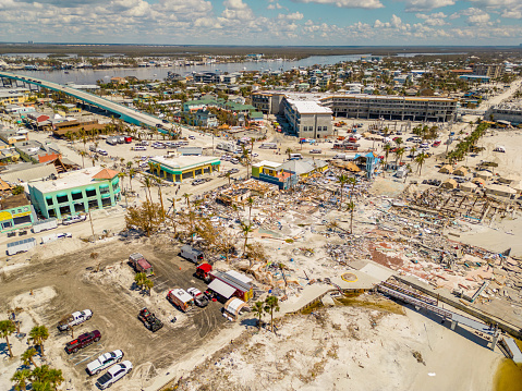
    While scientific predictions are pointing to lower-than-normal storm activity for 2014, the risk of significant damage to homes is a constant threat. “Though the 2013 hurricane season will be remembered for the fact that no storms made landfall along the U.S. coast, this reprieve from hurricane-related damage should not lead to complacency in preparing for future storms and the potential life-threatening conditions they can bring,” said Dr. Thomas Jeffery, senior hazard scientist for CoreLogic Spatial Solutions. “This year’s season is projected to be slightly below normal in hurricane activity, but the early arrival of Hurricane Arthur on July 3 is an important reminder that even a low-category hurricane or strong tropical storm can create powerful riptides, modest flooding and cause significant destruction of property.”

    The 2014 analysis shows that total exposure varies significantly from state to state given differences in population, trends in residential development, geographic risk factors, length of coastline and other distinguishing factors. Florida and Texas, for example, are within the top five states for number of properties at risk primarily because of their extensive coastlines. Louisiana and New Jersey, on the other hand, have a smaller coastal area overall, yet are included in the top five list as a result of relatively low elevation that allows storm surge inundation to extend farther inland and affect more homes. 

    The concepts in this analysis also complement Federal Emergency Management Agency (FEMA) flood zone information to provide a snapshot of potential damage exposure at the property level, as many properties located outside designated FEMA flood zones are still at risk for storm surge damage. The standard FEMA flood zones are designed to identify areas at risk for both freshwater flooding as well as storm surge based on the likelihood of either a 100-year or a 500-year flood event. They do not differentiate risk based on storm severity, and as a result, do not effectively define the total extent of the risk possible along coastal areas.

    To illustrate varying degrees of flood risk exposure, Table 6 compares homes that are not located within FEMA 100-year floodplains against the number of homes located in surge inundation zones, as well as those located in both surge and FEMA Special Flood Hazard Areas (SFHA). Homeowners who live outside the FEMA flood zones typically do not carry flood insurance, given that there is no mandate to do so, and therefore may not be aware of the potential risk storm surge poses to their properties.

    Among select major metro areas, Virginia Beach-Norfolk-Newport News, VA-NC, has the highest percentage of homes (86 percent) at risk of storm surge, but not designated in a FEMA flood zone. Philadelphia-Camden-Wilmington, PA-NJ-DE-MD and Jacksonville, Florida, also top the list at 85 percent and 76 percent, respectively. Even in New York-Newark-Jersey City, NY-NJ-PA, 68 percent of homeowners at risk of flood or surge inundation would not be required to carry flood insurance because they are not located within a designated FEMA 100-year floodplain.

    Additional findings in the CoreLogic storm surge analysis include:

    • The five states with the highest total number of properties at risk include: Florida (2,488,277), Louisiana (738,165), New York (466,919), New Jersey (445,928) and Texas (434,421).
    • The five states (including the District of Columbia) with the lowest total number of properties at risk include: the District of Columbia (3,895), New Hampshire (10,853), Maine (23,439), Rhode Island (26,558) and Delaware (48,534).
    • The five states with the highest value of reconstruction costs for homes at risk include: Florida ($490,403,653,377), New York ($182,474,294,695), Louisiana ($161,062,467,382) New Jersey ($134,194,963,314) and Virginia ($92,001,482,217).
    • The five states with the lowest value of reconstruction costs for homes at risk include: District of Columbia ($394,437,173), New Hampshire ($2,649,086,294), Maine ($6,629,856,369), Rhode Island ($7,389,384,876) and Alabama ($10,333,310,460).     
    • The reconstruction value of the homes exposed to storm surge damage in the Gulf is much less than the reconstruction value of homes in the Atlantic region, as indicated in Table 2. The total reconstruction cost value of homes along the Atlantic coast is nearly $951 billion, which is approximately double the value of at-risk properties in the Gulf region at just over $545 billion. 

    CoreLogic releases storm surge data to enhance understanding of the risk that hurricane-driven storm surge poses to homes, institutions and economies that are prone to tropical storms. Fully understanding the number of homes and financial impact of sustaining storm surge damage is critically important for financial institutions, corporate entities and local governments to make better informed risk management decisions. Storm surge data is highly useful for insurance providers and financial services companies, as it enhances the understanding of potential exposure to water damage for homes, including those that do not fall within the designated FEMA flood zones. Recent regulatory guidelines are compelling financial services companies subject to federal stress testing to understand under-insured or uninsured risks like storm surge flooding, since exposed properties have a significant risk for default following an event. More granular insight into storm surge impact is necessary for preparation and mitigation efforts that can help reduce the amount of damage and loss, and also improve safety and disaster response. 

  • Enhanced Sea-level Prediction System to Improve Coastal Flooding Plans

    National Geodetic Survey logoAs the Gulf Coast begins another hurricane season, researchers with the Conrad Blucher Institute for Surveying and Science (CBI) at Texas A&M University-Corpus Christi will be improving the data collection system to allow for more accurate planning and predictions for flooding and sea-level rise.

    CBI has been awarded $1.35 million to enhance the National Spatial Reference System that helps model and predict sea level rise.

    Forecasters are predicting a hurricane season with one or two major hurricanes, but flooding can still pose significant threat, especially to the vital infrastructure along the Gulf coast, which includes 10 of the 14 largest ports. The long-term stability of this region’s infrastructure is in question due to the impact of sea level rise and associated increases in risks of flooding. Growing Gulf coastal populations, up 32 percent from 1990 to 2008, compound the risks. Preparing for sea level rise, flooding and other impacts requires accurate data about what’s occurring at the water’s edge. Collection methods for this type of geospatial data will be enhanced through this project.

    The funding, from the National Geodetic Survey, a project of the National Oceanic and Atmospheric Administration, provides the foundation for modeling along the northern Gulf of Mexico through the National Spatial Reference System.

    The project focuses on an area that is most exposed to inundation from tropical storm surge and has a high risk of flooding and long-term effects of climate change and subsidence.

    “We are excited to be part of this project to provide the latest geospatial data with information from tide gauges, sea level observations, land elevation reference points, and 3D positioning,” said Gary Jeffress, director of CBI. “This system will help local and regional leaders plan for improved resilience to the impacts of sea level rise and flooding and develop long-term strategies to address impacts along the northern Gulf of Mexico.”

    The project will extend and improve monitoring stations from Texas to the Florida Keys to provide additional measurements, including more accurate data regarding elevations, 3D positioning, subsidence rates and sea level observations, that will establish ongoing monitoring of the relative sea-level change along the northern Gulf of Mexico in the coming decades.

    Jeffress, Ruizhi Chen and James Rizzo, with CBI and Texas Spatial Reference Center, will lead the project for A&M-Corpus Christi. Researchers from University of Southern Mississippi, Louisiana State University and Florida Atlantic University are also partners in the project.