Tag: ICD

  • EUSPA releases updated OSNMA documents

    EUSPA releases updated OSNMA documents

    EUSPA logoThe European Union Agency for the Space Programme (EUSPA) along with the European Commission, have published guidelines that specify the baseline applicable to the Galileo Open Service Navigation Message Authentication (OSNMA) receiver service provision phase. The new documents include the OSNMA Signal-in-Space (SIS) Interface Control Document (ICD), and OSNMA Receiver Guidelines.

    The OSNMA SIS ICD specifies, among other things, the interface between the Galileo Space Segment and the Galileo User Segment. This document is an addition to the Galileo Open Service (OS) SIS ICD.

    The OSNMA Receiver Guidelines provide generic instructions for the user segment implementation of the OSNMA functionality and complement the OSNMA SIS ICD. Additionally, the guidelines explain user capabilities and steps to implement to verify the authenticity of the Galileo navigation message.

    Both documents will be used for the upcoming OSNMA Service Provision Phase that will begin after the OSNMA Service Declaration. They have been developed as an evolution of the Galileo OSNMA User ICD for test phase (v1.0) and the Galileo OSNMA Receiver Guidelines for test phase (v1.1). Copies of the documents can be found here.

  • EUSPA to hold GNSS Signal Simulator Manufacturers Forum in December

    EUSPA to hold GNSS Signal Simulator Manufacturers Forum in December

    To bridge the gap between chipset and receiver manufacturers and GNSS simulator manufacturers, EUSPA, together with the European Commission and the Joint Research Centre (JRC), is organizing a GNSS Signal Simulator Manufacturers Forum on December 13.

    The online forum will aim to help signal simulator manufacturers keep their products up to date by presenting the latest service interface control documents (ICDs), including those for the Galileo Open Service Navigation Message Authentication, the Galileo High Accuracy Service and for the I/NAV improvements. The forum will also serve as a channel for addressing GNSS signal simulator manufacturers’ needs, questions, and concerns.

    Manufacturers use ICDs to access information provided from a GNSS satellite’s Signal in Space (SiS) or from such terrestrial means as the internet. However, before a manufacturer can turn this information into a new product or service, they must first test it – which is where GNSS simulators come into play.

    Signal simulators play a critical role within the GNSS product pipeline. Chipset and receiver manufacturers have rapidly evolving needs. In order to keep up, GNSS signal simulators must be regularly updated. To do this, however, simulator manufacturers must know what those needs are.

    “Whether it be a personal navigation system or smart watch, before a device or application that relies on GNSS signals hits the market manufacturers need to ensure it works,” says Fiammetta Diani, Head of Market, Downstream and Innovation at EUSPA. “GNSS simulators allow manufacturers to test the accuracy of their receivers by simulating such real-world factors as vehicle and satellite motion, signal characteristics and atmospheric effects.”

    In addition to being a source of market intelligence, EUSPA offers the downstream market a range of funding opportunities, including the Fundamental Elements scheme. Part of EUSPA’s market uptake strategy, Fundamental Elements is an EU R&D funding mechanism supporting the development of EGNSS-enabled chipsets, receivers and antennas.

    Interested parties can register for the GNSS Signal Simulator Manufacturers Forum by emailing [email protected]. The deadline for registration is December 8.

  • US Space Force issues ICD revisions for GPS

    US Space Force issues ICD revisions for GPS

    CGSIC logo

    The U.S. Space Force Space and Missile Systems Center (SMC) has issued official, signed Interface Specification (IS) and Interface Control Document (ICD) revisions for GPS. The documents listed are available through the U.S. Coast Guard’s GPS Technical References and at GPS.gov.

    • IS-GPS-200M Navstar GPS Space Segment/Navigation User Interfaces
    • IS-GPS-800H Navstar GPS Space Segment/User Segment L1C Interface
    • IS-GPS-705H Navstar GPS Space Segment/User Segment L5 Interface
    • ICD-GPS-240D Navstar GPS Control Segment to User Support Community Interface

    Past versions of these documents are archived at GPS Technical References and at  GPS.gov Old Versions. Interface Revision Notices (IRN) incorporated into the new documents also can be found on these websites.

    The Space Force is soliciting public comments on the following Proposed Change Notices (PCNs).

    RFC-00467: 2021 Proposed Changes to the Public Documents

    While these PCNs use the August 2020 versions of the ICDs as baseline documents, any approved changes will be incorporated by the next document revisions. Comments are due Aug.24.

    SMC has also announced the date of the next Public Interface Control Working Group meeting. Full details will be provided in an upcoming Federal Register Notice, but advance notice can be found here.

  • Directions 2021: GLONASS on the verge of a new decade

    Directions 2021: GLONASS on the verge of a new decade

    By Yury Urlichich, first deputy director general of Roscosmos State Space Corporation
    Sergey Karutin, designer general of GLONASS
    Nikolay Testoedov, director general, Information Satellite Systems JSC
    Sergey Koblov, director general, Central Research Institute of Machine Building JSC


    The year 2020 heralds the end of another 10-year stage of development of the Russian GLObal NAvigation Satellite System (GLONASS). Reconstruction of our orbital constellation, started in 2006, is bearing its fruit. Today, it is hard to imagine one’s daily life without the continuous artificial radio-navigation field provided to users globally by the GLONASS orbital constellation since 2011.

    GLONASS signals are employed to perform a wide range of tasks, such as

    • Saving lives in road accidents
    • Air, ground and naval traffic monitoring and control
    • Network synchronization of mobile cellular communications
    • Monitoring and enabling the energy grid, road travel, agricultural equipment operation, and more.

    Our orbital constellation is built upon a base of second-generation spacecraft (SC) — Glonass-M SC — that was developed in 2003 and has demonstrated outstanding operational capacity: 14 SC are already operating well beyond their expected lifetimes, and four SC celebrate their 13th birthday in orbit this year. Activities focused on improving GLONASS accuracy have not stopped for a single day.

    If we go back to 2014, the SC-based ranging offset (which specialists refer as equivalent ranging deviation) was 1.4 m. We managed to achieve 0.9 m offset on Jan. 30, 2020, and during the same week the offset did not exceed 1.15 m. Furthermore, the penultimate series-produced Glonass-M SC (Cosmos-2545), which was launched on March 30, demonstrated basic service ranging accuracy of 0.38 m on a daily interval and 0.63 m accuracy on the “best week” interval.

    Glonass-K No. 15 was launched into orbit on Oct. 25. (Photo: Roscosmos)
    Glonass-K No. 15 was launched into orbit on Oct. 25. (Photo: Roscosmos)

    It was Glonass-M SC development that enabled users around the world to gain access to the first dual-frequency navigation service, which is necessary for decreasing the effects of the ionosphere on navigation accuracy.

    The third generation of GLONASS SC — Glonass-K  — was successfully launched from the Plesetsk launch site on Oct. 25. This SC will provide users with a broader range of capabilities — and a more accurate and informative signal in the L3 frequency band. Further gradual rejuvenation of the GLONASS constellation will ensure the ever-improving quality of our navigation services.

    Two Glonass-K2 SC are planned for the launch campaign in 2021, and all the experience accumulated during the development of third-generation GLONASS SC (Glonass-K) will be implemented in the fourth-generation SС. Glonass -K2 is a unique SC: It will provide users with five navigation signals, its accuracy will be within 0.3–0.5 m, and its assured expected lifetime will be at least 10 years.

    High-Orbit Space Complex

    GLONASS developers remain focused on user requirements. Recent surveys show a growing demand for high-quality navigation services in difficult conditions where the SC is visible at more than 25° above the horizon. To satisfy these needs with the implementation of new CDMA signals, development of the GLONASS High-Orbit Space Complex (HOSC) will begin in 2021. Its first SC will be launched in 2025, and complete deployment of the constellation including six SC in three or six planes will be finished by the end of 2027.

    As a result, the accuracy and availability of navigation in difficult conditions will improve in the Eastern Hemisphere. But the major anticipated outcome of the HOSC implementation is assured two-fold coverage of the Northeastern segment of the globe with high-accuracy differential navigation data by GLONASS and other GNSS.

    HOSC implementation will ensure 25% navigation accuracy improvement over the Eastern hemisphere. Glonass-K SC will be used as a base platform for HASC deployment due to its excellent record.

    Ground Control at the Titov Main Test Space Center established a stable telemetry connection with the new satellite shortly after launch. (Photo: Roscosmos)
    Ground Control at the Titov Main Test Space Center established a stable telemetry connection with the new satellite shortly after launch. (Photo: Roscosmos)

    User Interface Harmony

    One of the most important tasks for the year 2020 is harmonization of the GLONASS user interface. As we already mentioned, the signal propagation environment has a strong effect on navigation accuracy; therefore, new issues of GLONASS Interface Control Documents (ICD) are being prepared for publication.

    We anticipate that GLONASS end-user accuracy improvement will be achieved through introducing additional information into reserve bits of navigation frames, including relevant parameters of an ionospheric model.

    The ICD will contain operating methods with parameters of the ionospheric model and definite recommendations designed for compensation of ionospheric delays by both single-frequency and dual-frequency receivers, as well as generalized methods for compensating for tropospheric delays.

    Changes in the ICD concerning FDMA and CDMA signals will ensure backward compatibility and uninterrupted operation for the existing range of user navigation equipment.

  • 2019 GPS Public Interface Control meeting set for Sept. 25

    2019 GPS Public Interface Control meeting set for Sept. 25

    CGSIC logo

    On Sept. 25, the GPS Directorate will host the 2019 Public Interface Control Working Group and Open Forum to update the public on GPS public document revisions.

    The meeting will collect issues and comments for analysis and possible integration into future GPS public document revisions.

    The 2019 Public Interface Control Working Group and Open Forum are open to the general public. It can be attended in person or by dial-in connection.

    Documents Affected

    • IS-GPS-200: Navigation User Interfaces
    • IS-GPS-705: User Segment L5 Interfaces
    • IS-GPS-800: User Segment L1C Interface
    • ICD-GPS-870: NAVSTAR GPS Control Segment to User Support Community Interface

    Meeting Address: SAIC, 100 N Sepulveda Blvd., El Segundo, CA 90245, The Great Room

    Meeting Dial-in Number: 310-653-2663 Meeting ID: 20190925 Password: 123456.

    Documents and proposed changes and the official meeting notice are posted on GPS.gov.

  • CGSIC updates Interface Control Documents, plans next meeting

    CGSIC updates Interface Control Documents, plans next meeting

    The GPS Directorate has released updates to the below Interface Control Documents (ICD). ICDs are the formal means of establishing, defining, and controlling interfaces and for documenting detailed interface design definitions for the GPS program.

    Updated Documents

    • IS-GPS-200: Navstar GPS Space Segment/Navigation User Interfaces
    • IS-GPS-705: Navstar GPS Space Segment/User Segment L5 Interface
    • IS-GPS-800: Navstar GPS Space Segment/User Segment L1C Interface
    • ICD-GPS-240: Navstar GPS Control Segment to User Support Community Interface
    • ICD-GPS-870: Navstar Next Generation GPS Control Segment (OCX) to User Support Community Interface

    Download or view the updated ICDs at GPS.gov or NAVCEN.

    59th CGSIC Meeting Set for September

    The U.S. Department of Transportation (DOT) and the Coast Guard Navigation Center (NAVCEN) have announced plans for the 59th meeting of the Civil GPS Service Interface Committee (CGSIC).

    The meeting will take place Sept. 16-17 at the Hyatt Regency Miami in Miami, Florida, in conjunction with the Institute of Navigation’s ION GNSS+ 2019 conference.

    CGSIC meetings are free and open to the public. Subcommittees of the CGSIC for Timing, International Information, and Survey, Mapping, and Geosciences will hold meetings Sept. 16, and a summary of these meetings will be presented to the CGSIC plenary session Sept. 17.

    The meeting will include important briefings on the status of ongoing GPS programs and a keynote address by Diana Furchtgott-Roth, deputy assistant secretary, Office of the Assistant Secretary for Research and Technology, U.S. Department of Transportation.

    The CGSIC agenda in development can be found in the CGSIC section of GPS.gov.

  • Directions 2017: BeiDou’s road to global service

    Directions 2017: BeiDou’s road to global service

    An effective approach has been taken by the BeiDou Navigation Satellite System (BDS), and significant progress has been witnessed in 2016, from the aspects of launching new satellites, verifying new technologies, promoting applications and industrialization, strengthening international cooperation, and formulating fundamental policies.

    Li Wang
    Li Wang

    Construction Update. In March 2016, a BDS satellite was launched into an inclined geo-synchronous orbit (IGSO); another geosynchronous orbit (GEO) satellite was launched in June. These became the 22nd and 23rd BDS satellites overall and further enhanced service capability. The BDS has been maintaining stable operation, and the performance of BDS Open Services has steadily improved. The availability and continuity surpass 99.9%, which can satisfy the nominal requirements of 95% and 99.5%.

    The deployment of a BDS global constellation has progressed steadily. Five new-generation BDS satellites have been successfully launched so far, to verify advanced signal structure, crosslink, on-board clocks with higher accuracy, and other new technologies. Test results showed that the inter-system technical status is coordinated, the accuracy of orbit prediction was increased by 50%, and accuracy of time maintenance was upgraded by about 60% due to crosslink.

    Meanwhile, the construction of augmentation systems is being accelerated. A nationwide reference station network has been built, and the construction of the basic system has been completed. System performance is under test, including meter and decimeter level for wide-area real-time services, centimeter level for areas within Beijing, and millimeter level for post-processing services.

    As for satellite-based augmentation system (SBAS), BDS is actively participating in the design and international coordination activities for the next generation dual-frequency multiple-constellation (DFMC) SBAS standards. The 30th SBAS Interoperability Working Group (IWG) meeting was successfully held in China.

    The document “Development of BDS and Applications of Multi-Frequency Multi-Constellation Navigation Satellite Systems” was submitted by the Civil Aviation Administration of China (CAAC) during the 39th meeting of International Civil Aviation Organization. This represents Chinese civil aviation authority’s official support of construction of BDSBAS. Development of applications of multi-frequency multi-constellation has been proposed to the international civil aviation community.

    BDS Applications. With the enhancement of BDS service capability, its applications are also making remarkable progress, already producing a BDS industrial chain which comprises the basic products, application terminals, application systems and operational services.

    BDS-based chips have been upgraded in quality and quantity. Great efforts are being made to carry out demonstrations of BDS industrial and regional applications. Mass market applications are flourishing. Chinese industrial production in the field of satellite navigation reached 190 billion renminbi yuan (US$28 billion) in 2015, of which BDS would contribute about 30%. So far, BDS-related products have already been exported to more than 70 countries, and applications and services are available in over 30 countries along the Silk Road Economic Belt and 21st-Century Maritime Silk Road (the Belt and Road) region.

    International Cooperation Activities. BDS continuously carries out bilateral and multilateral exchanges and cooperation, in line with the principle that “BDS is developed by China, and dedicated to the world.”

    To provide better services for global users, BDS carries out exchanges and coordination with the other navigation satellite systems in terms of compatibility and interoperability, monitoring and assessment, frequency resource, augmentation systems and other areas. It also strives to implement applications cooperation with countries in the Asia-Pacific region, members in the Association of South-East Asian Nations (ASEAN) and the League of Arab States (LAS), to bring more benefits to a wider range. On multilateral platforms, BDS continuously contributes to efforts and meetings of the International Committee on Global Navigation Satellite Systems (ICG) and the Committee on the Peaceful Uses of Outer Space (COPUOS). In addition to these international academic activities, China has also been organizing the China Satellite Navigation Conference for seven sessions.

    Fundamental Policies. A whitepaper on BDS released in June 2016 interprets its development concepts and propositions, and is available on the official BDS website. The major content includes: to provide open services for global users free of charge; to continuously improve service performance and enhance the service quality; to promote compatible applications with other navigation satellite systems and to improve users’ benefits; to disseminate BDS information in a timely manner; to protect the radio-navigation satellite frequency spectrum according to law and to firmly reject harmful interference; to enhance BDS applications, industrial development and international application; to actively carry out international cooperation and exchanges, to participate in multilateral activities in the field of international satellite navigation and to promote the ratification of the BDS by international standards.

    The “BeiDou Navigation Satellite System Signal In Space Interface Control Document” (Version 2.1) was published in November.

    As for the standardization process, the “BeiDou Satellite Navigation Standard System” (Version 1.0) has been released, and BDS has been included in the Receiver Independent Exchange Format (RINEX, Version 3.03), approved by the Radio Technical Commission for Maritime Services Special Committee 104 on GNSS Service, RTCM SC-104.

    Follow-up Deployment Plans. In 2017, three to four launches of BeiDou satellites will occur. BDS will provide basic services to the countries along the Belt and Road region by 2018, and possess global service capability by 2020.

    BDS will keep improving its nationwide reference station network and steadily enhance its service performance. The dense reference stations for the nationwide frame network will be constructed by 2018, providing meter and decimeter level real-time location services for users in China, even centimeter level service in some areas.

    BDS will carry out the design, validation and construction of SBAS in accordance with international civil aviation standards. The first GEO satellite of BDSBAS will be launched in around 2018. The satellite-based augmentation services covering China and surrounding regions will be provided from 2020, to provide CAT-I services to civil aviation users.

    China will promote construction of a national comprehensive positioning, navigation and timing (PNT) system based on BDS, and strive to establish such a national PNT system with a united benchmark, no-gap coverage, security and effectiveness by 2030, as well as to upgrade capabilities to provide time and space information.

    Summary. BDS will boost the deployment of a global constellation, continuously enhance performance, fulfill its service commitments, make all efforts to advance satellite navigation applications, promote the development of GNSS, and better serve the world and benefit mankind.

  • New BeiDou Interface Control Document released

    New BeiDou Interface Control Document released

    Logo: Beidou
    Beidou

    Version 2.1 of the BeiDou Navigation Satellite System Signal In Space Interface Control Document for the Open Service Signal has been released.

    The document was issued by the China Satellite Navigation Office. It defines the specification related to open service signals B1I and B2I between the space segment and the user segment of the BeiDou Navigation Satellite System. B2I will be gradually replaced by a better signal with the construction of global system.

  • IRNSS Signal in Space ICD Released

    News courtesy of CANSPACE Listserv.

    IRNSS_ICD_Cover-W
    Photo: CANSPACE Listserv

    The Indian Space Research Organization (ISRO) has released Version 1 of the Indian Regional Navigational Satellite System (IRNSS) Signal in Space Interface Control Document for the Standard Positioning Service.

    The document provides information on the signals and structures of the IRNSS system, including signal modulations, frequency bands, received power levels, the data structures and their interpretations, and user algorithms.

    According to ISRO, the document is being released to the public to facilitate research and development and to aid the commercial use of the IRNSS signals for navigation-based applications.

    Registration is required for ICD download access at a new IRNSS website. At the moment, only the ICD is available at this website.

    The next IRNSS satellite launch is scheduled for the second week of October. The most recent launch was in April, of the second IRNSS satellite, IRNSS-1B.

    IRNSS is an independent regional navigation satellite system being developed by India. It is designed to provide accurate position information service to users in India and the region extending up to 1,500 kilometers from its boundary. IRNSS will provide two types of service: Standard Positioning Service (SPS) and Restricted Service (RS). It is expected to provide a position accuracy of better than 20 meters in the primary service area.

  • Galileo and Compass: A Tale of Also-Runnings

    Beating up the backstretch neck and neck, tied for third in the GNSS race, Galileo and Compass today offer some signals and some satellites to GNSS users — as long as those users are researchers. Galileo has more going for it in the way of signals, while Compass holds an edge in the number of satellites. Without an interface control document (ICD) to guide user/researchers and most importantly manufacturers in the employment of its signals, Compass satellites, however they may increase, are practically useless to anyone outside China. A Compass ICD has been rumored before and is now rumored again. Wait and see before placing your bets.

    The fourth Galileo in-orbit validation (IOV) satellite, Flight Model 4 (FM4), began transmitting signals on December 12, joining its co-launched confrère FM3, which began airing navigation signals on December 1. The FM4 spacecraft uses PRN code E20. As of this writing, FM3 is broadcasting E1, E5, and E6 signals, and FM4 is  broadcasting E1 and E5 signals; we don’t know if and when FM4 E6 signals start(ed) until ESA tells us.

    GPS World authors Oliver Montenbruck (German Space Operations Center) and Richard Langley (University of New Brunswick) have written an early analysis of the signals from FM3; this account will appear in the January issue of the magazine. A few selected excerpts from that article, and one figure:

    “Anyone with commonly available GNSS receivers can presently access the open signals in the E1, E5a, and E5b frequency bands as well as the wide-band E5 AltBOC signal.

    Source: GPS
    Figure 1: Pseudorange errors of IOV-3 tracking at Tanegashima, Japan, using the E1 BOC(1,1) signal (top) and the E5 AltBOC signal (center). The elevation angle over time is shown in the bottom panel.

    “According to an ESA statement, FM3will continue to use binary offset carrier modulation — specifically BOC(1,1) — on the E1 Open Service signals for the time being. In contrast to this, the first pair of IOV satellites has already started to use composite binary offset carrier modulation, which offers better multipath suppression in the received signal.

    “The E5 AltBOC pseudorange measurements in particular exhibit an exceptionally low noise and multipath level of better than 10 centimeters at mid- and high-elevation angles.”

    After discussing and displaying some carrier-phase measurements of the Galileo FM3 E1, E5, and E6 signals, Montenbruck and Langley conclude; “This level of performance highlights the potential benefit of Galileo signals in advanced triple-frequency techniques such as undifferenced ambiguity resolution and ionospheric monitoring.”

    Theoretically, the total of four Galileo IOV satellites now in medium-Earth orbit yield the minimum number needed to perform a 3D navigation fix, although no statement of initial — or even sketchy — operating capability has been issued by the European Space Agency (ESA), nor is one expected.

    Antonio Tajani, vice-president of the European Commission (EC) and head of the EC directorate-general responsible for industry and entrepreneurship, continues to publicly maintain a “political objective [of] the delivery of the first services before the end of 2014,” based on 18 orbiting satellites. In a December speech, he revised the basis for that position slightly to say the civil Open Service (OS) could be declared operational with as few as 12 satellites.

    The system operators had announced three dual-satellite launches in 2013, two dual-satellite launches and one four-satellite launch in 2014, hypothetically producing an operable constellation of 18 satellites by the end of the promised 2014. However, unconfirmed reports from Europe suggest that problems with manufacture of the next set of 14 Galileo satellites mean that no launches at all will take place until Q4 of 2013. Whether this will push out the service delivery date beyond 2014 or not remains open to conjecture.

    Compass

    Another matter open to conjecture and much speculation is whether the world will soon — or ever — see an interface control document (ICD) for China’s Compass system.  More than a year ago, I wrote that “The ICD has been rumored to be available previously to receiver manufacturers within China, creating some disgruntlement among companies outside the country . . .  GPS/Compass chips and receivers are being actively developed by many Chinese manufacturers and research institutes.”  Indeed, conference presentations, leading to a published article in this magazine’s October issue, “What Is Achievable with the Current Compass Constellation,“ confirm that this is so.

    And yet, the rest of the world neither has nor holds a Compass ICD.

    The end-of-year rumor mill has kicked into gear again, though. A GNSS industry representative stationed in Shanghai, China sent this message recently to a U.S. colleague: “Latest unofficial news said that the Compass Interface Control Document (ICD) will be released on 27th this month, and will be available on the internet on 28th.”

    We shall see what we shall see.

  • Compass ICD Rumored Again

    A GNSS industry representative stationed in Shanghai, China sent this message recently to a U.S. colleague: “Latest unofficial news said that the Compass Interface Control Document (ICD) will be released on 27th this month,  and will be available on the internet on 28th.”

    Such rumors have floated before, in late 2010, and again in late 2011.  As the U.S. colleague noted in passing on this light intelligence, “There was a lot of hand-wringing at ICG [Seventh Meeting of the International Committee on Global Navigation Satellite Systems (ICG), organized by the Government of China, Beijing, China, 5 – 9 November 2012] around the Chinese keeping their promise for 2012 release of the ICD.  Maybe they are just going to slip it under the wire.”

    In an October, 2011 newsletter column, the GPS World editor wrote: “The long-awaited signal interface control document (ICD) for China’s growing GNSS will appear this month, according to representatives of the system who spoke in a “Compass: Progress, Status, and Future Outlook” workshop as part of ION GNSS and the CGSIC meetings in Portland in September [2011].

    “The ICD has been rumored to be available previously to receiver manufacturers within China, creating some disgruntlement among companies outside the country. One of the workshop panelists affirmed that GPS/Compass chips and receivers are being actively developed by many Chinese manufacturers and research institutes.”


  • Compass ICD in October; Harmonizing GNSS

    China’s GNSS, Compass or Beidou, intends to publish its signal interface control document (ICD) in October. Representatives of the system made an unprecedented showing at ION GNSS in Portland, and referred frankly to “internal deliberations” that may be at the root of much of the public uncertainty about the system’s planned structure and timeline. Meanwhile, representatives of other navigation satellite systems also delivered updates on their status and plans. Everyone is concerned about LightSquared interference, but everyone continues to move forward.

    This month’s column is a two-parter: a guest appearance by Len Jacobson, editorial advisory board member for GPS World magazine and president of Global Systems and Marketing Inc.  Len writes on the “Harmonizing GNSS” aspect, the briefings by all systems and their efforts to achieve compatibility and interoperability. Then I’ll return with an account of the Compass panel that formed part of the CGSIC meeting immediately preceeding ION.


    len_jacobsonHarmonizing GNSS

    by Len Jacobson

    Representatives of the International Committee on GNSS (ICG) participated in briefings and a panel discussion at the ION-GNSS Conference in Portland on Thursday, Sept. 22, 2011. The ICG is a committee formed under the auspices of the United Nations Office of Outer Space Affairs. The purpose of the panel was to acquaint the audience with the activities of the ICG and to allow the global and regional satellite navigation systems providers to describe their policies and efforts with regard to interoperability and compatibility among the various GNSS and to advise how multi-GNSS services could be harmonized.

    Rick Hamilton from the U.S. Coast Guard Navigation Center organized the panel, and Jeffrey Auerbach, from the same U.S. Department of State (DOS) office as the U.S. ICG representative Dave Turner, moderated it.

    The first speaker was Sharafat Gadimova, from the ICG Executive Secretariat. She described the functions and make-up of the ICG and suggested visiting their web site www.icgsecretariat.org for further information. The next meeting of the ICG is scheduled for December 4–9, 2012 in China.

    David Turner, the deputy director of the Office of Space and Advanced Technology in the DOS, reiterated the President’s 2010 Space Policy and in particular the addition emphasizing international cooperation and more use of foreign systems by the U.S. government to enhance GPS. Turner co-chairs Working Group (WG)-A on compatibility and interoperability. He discussed a Multi-GNSS Monitoring Network using new and existing GNSS monitoring receivers and networks. He stated that the various GNSS geodetic and timing references can be found on the ICG web site.

    Dr. Sergey Revnivykh, deputy director-general, GLONASS Information and Analysis Center, stated his desire that all GNSS be considered equal. In this sense, Russian policy differs from U.S. policy, which considers GPS as the premier GNSS. Dr. Revnivykh discussed the GLONASS System of Differential Correction and Monitoring (SCDM), the Russian version of WAAS. It will augment both GLONASS and GPS. He had to leave after his presentation so was not able to participate in the ensuing panel discussion.

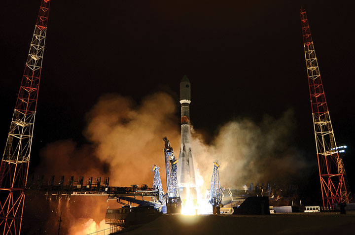
    Independently, we have learned from GLONASS communications that the launch of GLONASS-M No. 42 from Plesetsk is scheduled to take place on October 1 at 20:19 UTC. The launch of GLONASS-M Nos. 43, 44, 45 from Baikonur may occur as early as November 2. The launch of GLONASS-M No. 46 from Plesetsk is now scheduled for November 22. The launch  of the next-generation GLONASS-K1 No. 12 from Plesetsk will likely slip to 2012. Additionally, Luch-5A, a Russian geostationary communications satellite that includes an SBAS payload, will launch together with Amos-5, a Russian-built Israeli communications satellite, on December 10 from Baikonur.

    Next we heard a short briefing by Xavier Maufroid from the Galileo Implementation office of the European Commission in Belgium. He stressed compatibility with all services, and then interoperability. He stated that the European Union (EU) is concerned about LightSquared (LS) because LS transmissions could affect Galileo reception in the United States and also could expand to provide a similar disruption in Europe if they were to expand into that area. And if not LS, then someone else could attempt a similar broadband service over Europe with the same potential to interfere with Galileo. He later added that 7 billion euros are budgeted for Galileo between 2014 and 2021.

    From the Chinese Electronics Technology Group came Dr. Xiancheng Ding, the deputy director-general. He described Beidou (Compass) as having nine satellites with five more to be launched in 2012. This will provide regional service by the end of 2012, including over Australia and New Zealand. Beidou has a communications capability for short messaging, which is needed in rural China.

    Dr. Ding said the Beidou signal interface control document (ICD) would be released soon. Other sources indicate it to be as early as October 2011. He indicated that Beidou is fully funded for phase 2 (regional system) and will probably be funded for phase 3 (global system).

    The final briefer was Dr. Satoshi Kogure from the Japan Space Ageny. He gave a QZSS update similar to one given in other ION GNSS sessions.

    During the panel interchange and answers to questions from the audience, various combinations of signals were discussed as needing to be compatible. That is, to not interfere in same frequency band and to comply with International Telecommunications Union (ITU) regulations. Specific signal pairs mentioned in this context included: GPS L1 and L5 with Galileo; Compass and future GLONASS CDMA; the QZSS LEX with Galileo; and others.

    A WG-A workshop proposed jointly to ICG to study the potential noise impact of too many satellites. By 2020, more than 100 satellites are expected to be transmitting the myriad of GNSS signals, with up to 35 in view at any one place. This could cause mutual interference, which in turn could cause degradation in the levels of service of the various GNSS.

    Dr. Kogure described a Multiple GNSS demo campaign sponsored in part by the Japanese Space Agency consisting of tens of receivers monitoring GNSS signals over Asia and the Western Pacific. For multi-GNSS testing there is better availability in these region as there are initially more GNSS signals in view. This experiment is a prototype of a multi-GNSS monitoring network with 20 QZSS receivers by March of 2012 and 40 by a year later. China will supply Beidou receivers to Japan for the multi-GNSS Monitoring Network in cooperation with the ICG. There will be a workshop on this topic in November in Korea.

    There is still an issue between China and the EU on frequency compatibility for authorized services, but Dr. Xiancheng said a technical solution is known. Negotiations are still ongoing.

    All members of the panel were cognizant of the LS problem and are focused on providing interference detection and mitigation for their GNNS.


    Compass ICD in October

    The long-awaited signal interface control document (ICD) for China’s growing GNSS will appear this month, according to representatives of the system who spoke in a “Compass: Progress, Status, and Future Outlook” workshop as part of ION GNSS and the CGSIC meetings in Portland in September.

    The ICD has been rumored to be available previously to receiver manufacturers within China, creating some disgruntlement among companies outside the country. One of the workshop panelists affirmed that GPS/Compass chips and receivers are being actively developed by many Chinese manufacturers and research institutes.

    The ICD announcement came among many valuable pieces of information presented during the pre-ION workshop, sponsored by the International Association of Chinese Professionals in Global Positioning Systems. The workshop was chaired by Jade Morton, professor of electrical and computer engineering at Miami University, Ohio.

    Dr. Xiancheng Ding of the Beidou Program Office described Compass as a demo system in transition to an operating navigation system. Two more satellites will launch in 2011, making a total of five new space vehicles this year,as part of a total “simple navigational system” of nine satellites that has been built up, and what is termed a “test system” over the Asia-Pacific region, to be complete by the end of the year.

    Five more satellites will rise into orbit in 2012, and the system will graduallly extend its coverage and improve its performance. Compass will start official regional service by the end of 2012, meeting user requirements in the Asia-Pacific region.

    ICD document v1.0 will be published in 2011, and probably in the month of October. It will be available for international download on the Compass website, www.beidou.gov.cn (as yet without an English version), also at www.compass.gov.cn.

    There was some disagreement among panelists as to the final targeted number of satellites in the system: either 30, or 35. Subsequent comments indicated that much of the structure may still be under discussion. The impression given was very much of a dynamic system in formation and growing rapidly.

    In a presentation on “preliminary Results of GPS/Compass Integrated Positioning and Navigation,” Dr. Uanxi Yang of China’s National Administration of GNSS and Applications reported integrated navigation with a Unicore UB 240 Compass/GPS receiver, and also mentioned a Shanghai Huace Compass/GPS receiver. Some systematic errors in Compass positioning were reported, and attributed to the sparse satellite distribution currently.

    Dr. Yang concluded with the exhortation, “Reasonable Wishes for Compass!” emphasizing the desire of the delegation to continue working hard on, but with realistic expectations for, the new system.