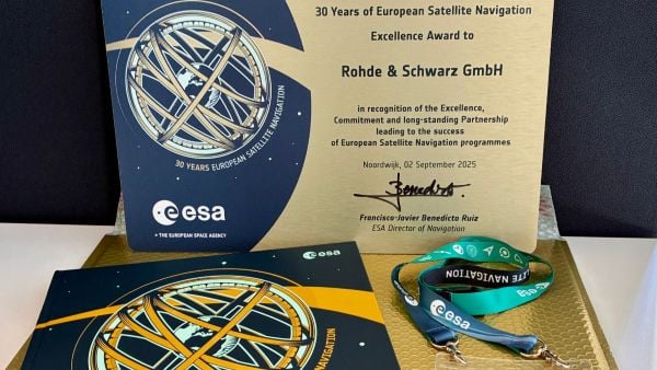
The European Space Agency (ESA) marked 30 years of European satellite navigation with a celebration Sep. 2 at its research and technology center. The event honored key contributors who have shaped the journey of systems like Galileo and EGNOS, which have positioned Europe as a global leader in satellite navigation.
Among the honorees was Rohde & Schwarz, recognized for the excellence, commitment and long-standing partnership leading to the success of European satellite navigation programs over the past three decades.
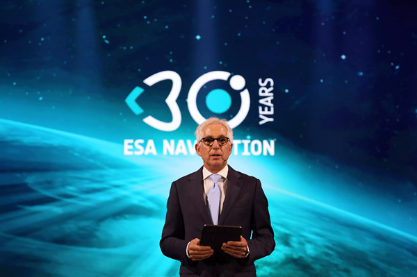
Javier Benedicto kicks off the celebration of 30 years of satellite navigation. (Photo: ESA)
The event brought together institutional and industrial partners, ESA Member State representatives, and leading figures in satellite navigation. The celebration revisited pivotal milestones in Europe’s satellite navigation history and looked ahead to future innovations.
A highlight of the evening was the award ceremony led by ESA Director of Navigation Javier Benedicto, who, alongside past directors, presented accolades to organizations and partners instrumental in this success story.
Rohde & Schwarz’s recognition underscores their role in advancing European satellite navigation technology. Their contributions have been vital in the development and operational success of Galileo and EGNOS, systems that have revolutionized positioning, navigation, and timing services across Europe and beyond.
The event not only celebrated past achievements but also set the stage for the future of European satellite navigation, with discussions around upcoming initiatives and advancements. For Rohde & Schwarz and other honourees, the evening served as both a celebration of past achievements and a call to continue building a connected, resilient, and sustainable future in space.
“Thirty years of satellite navigation is a testament to shared vision, determination to push technology boundaries, and intense, long-term collaboration,” said Rob Short, director of Business Development at Rohde & Schwarz. “We are honoured to have contributed to this remarkable achievement. Congratulations to everyone who made this milestone possible.”
The European Space Agency (ESA), in collaboration with the Joint Research Centre of the European Commission, are hosting this year’s ESA/JRC International Summer School on GNSS with the Swedish Space Agency in July in Kiruna, Sweden. The course will include an overview of satellite navigation from the theoretical basis of GNSS, their signals, and processing by receivers and more.
Elements of this year’s program will include details of low-Earth-orbit positioning, navigation and timing, navigation on the Moon, and Galileo’s Open Service Navigation Message Authentication. Exercises will include receiving signals from Galileo and other GNSS.
Participants will also learn about business aspects, intellectual property rights, and the future of satellite navigation systems, including Galileo second-generation.
Some of the world’s leading satnav and space experts will be giving lectures. Lecturers include Paul Verhoef, former director of navigation for ESA, and Jean-Jacques Dordain, former director general. The course will be opened by Anna Rathsman, Director General of the Swedish National Space Agency; Javier Benedicto, Director of Navigation at the European Space Agency; and Georgios Giannopoulos, head of the Technologies for Space, Security and Connectivity Unit at the Joint Research Centre of the European Commission.
The course is limited to 50 participants on a first-come, first-served basis and is open to graduate students, Ph.D. and postdoctoral researchers, as well as young engineers and academics working within industry or agencies, aged 38 or younger.
The summer school will take place July 17-28 in Kiruna, Sweden. Register before April 14 for a reduced early fee. For more information and to register, click here.
The high-accuracy service (HAS) offered by Galileo is now available and provides sub-meter accuracy over most of the globe. It will help enable emerging technologies such as UAVs and autonomous vehicles, which require stringent levels of accuracy for better navigation, safety and efficient traffic management.
Other industries expected to benefit include transportation, agriculture, geodesy and entertainment.
Thierry Breton, European commissioner for Internal Market, announced that the service was now live during the annual European Space Conference in Brussels, Belgium, on Jan. 24.
The European Union Agency for the Space Programme (EUSPA) developed Galileo HAS along with the European Commission and the European Space Agency (ESA). The new service will become a pillar of government programs such as EU sectorial policies and national policies by EU Member States.
“This new service has been made possible thanks to the outstanding cooperation and team commitment of all involved partners,” said Rodrigo da Costa, EUSPA executive director.
“Galileo is not standing still,” said Javier Benedicto, ESA director of navigation. “This new High Accuracy Service offers a new dimension of precision to everyone who needs it, while the Open Service Navigation Message Authentication — already available — allows users to authenticate Galileo signals as they make use of it, to minimize any risk of spoofing. An upgraded integrity message of the signal rolled out last year reduces the time to first fix while enhancing the overall robustness of Galileo.”
Galileo HAS delivers horizontal accuracy down to 20 cm and vertical accuracy of 40 cm in nominal use conditions, according to ESA. The service is transmitted directly via the Galileo signal in space (E6-B) and through the internet.
With HAS, Galileo becomes the first constellation worldwide able to provide a high-accuracy service globally and directly through the signal in space.
The service is freely accessible to all users with a receiver capable of processing the HAS corrections broadcast in the E6-B signal and via the internet. The precise corrections provided by Galileo HAS will allow users to reduce the error associated with the orbit and clocks provided through the Galileo Open Service broadcast navigation messages and the GPS Standard Positioning Service navigation data.
“With the Galileo HAS we are ready to unleash the full potential of new technologies such as drones and bring autonomous driving closer to reality,’’ da Costa said. “At EUSPA, our role is to link space to user needs. With the launch of this new service, we met a clear market demand for accurate, robust, and reliable navigation.”
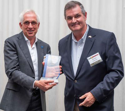
Javier Benedicto, left, with EUSPA’s Rodrigo da Costa. (Image: ESA)
Javier Benedicto will become the director of Navigation for the European Space Agency (ESA) on Feb. 16, 2022, when current director Paul Verhoef retires.
Verhoef has served as director for almost six years, after a 40-year career spanning the European Commission, ESA and private industry.
Benedicto is now head of the Galileo Programme Department within the Directorate of Navigation at ESA. A Spanish national, he spent his early career in academia, working as a microwave engineer at the Polytechnical University of Catalonia in Barcelona and as a telecommunications engineer at MIER Comunicaciones, also in Barcelona, before joining ESA in 1990. He is also a GPS World author, keeping readers apprised on the status of the Galileo program.
He holds a master’s degree in science and telecommunications engineering from the Polytechnic University of Catalonia and has more than 100 publications in technical journals and conferences. He also holds three international ESA patents and has five honors and awards.
Benedicto’s new role was announced Oct. 21, when the ESA Council appointed three new ESA directors. In addition to Benedicto as director of Navigation, Géraldine Naja will lead the new Directorate of Commercialisation, Industry and Procurement. Simonetta Cheli will succeed Josef Aschbacher as Director of Earth Observation Programmes; Aschbacher became ESA Director General in March 2021.
Authors Javier Benedicto (ESA), left, and Rodrigo da Costa (GSA). (Image: ESA)
Throughout 2020, the Galileo Programme under the responsibility of the European Commission, the European GNSS Agency (GSA) and the European Space Agency (ESA), has been delivering continuous and reliable global PNT and Search and Rescue (SAR) services, developed improvements to Galileo First Generation ground and space system infrastructure for increased robustness and new service capabilities, and launched a full modernization program aiming in the future at Galileo Second Generation.
The GNSS User Technology Report 2020 has just been released by GSA, providing a complete overview of the current status and trends of the GNSS worldwide market with focus on user technology and in particular European GNSS (Galileo and EGNOS) applications and services.
In addition to providing a high quality open service based on innovative signals in the E1 and E5 bands, Galileo is also the first GNSS constellation to comprise a SAR capability, including the provision of a return link to users in distress. Galileo also features unique capabilities, such as the provision of Navigation Message Authentication (OS-NMA) and of an encrypted navigation signal on E6, the Commercial Authentication Service (CAS). These functions will offer the first protection against spoofing available to civilian GNSS users.
Finally, Galileo will provide free access to a High Accuracy Service (HAS) through the use of an open data channel used to broadcast high-accuracy augmentation messages.
Performance Meeting Expectations
The Galileo constellation consists today of 22 operational spacecraft (24 satellites are available for the Search and Rescue service). Two additional satellites (GSAT0201/E18 and GSAT0202/E14) are currently under testing with regard to potential operational as auxiliary usage in the near future.
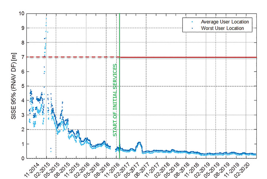
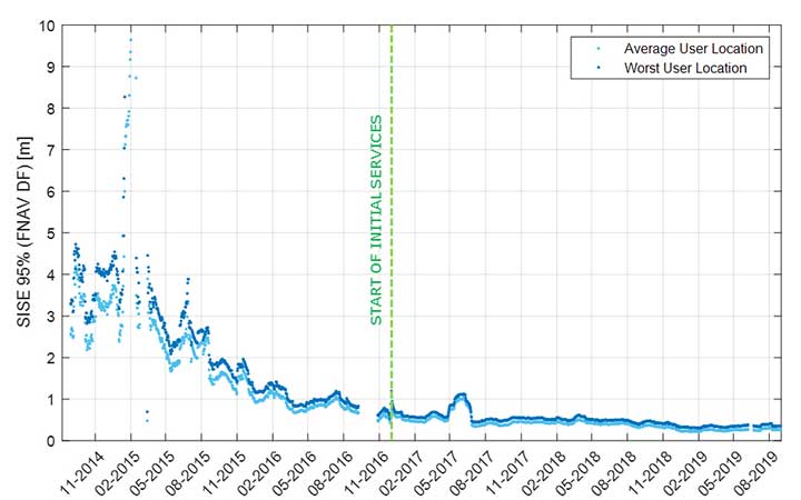
The long-term evolution of performance parameters reveals that the Galileo system is continuously improving. In particular, an excellent quality of the navigation message in terms of ranging accuracy can be observed. Since the Initial Service declaration in 2016, ranging accuracy has steadily improved reaching a level of ~25 cm (95%) by mid of 2020, see Figure 1.
FIGURE 1. F/NAV SISE as observed by user receivers (constellation average, 30 days moving average). (Image: ESA)
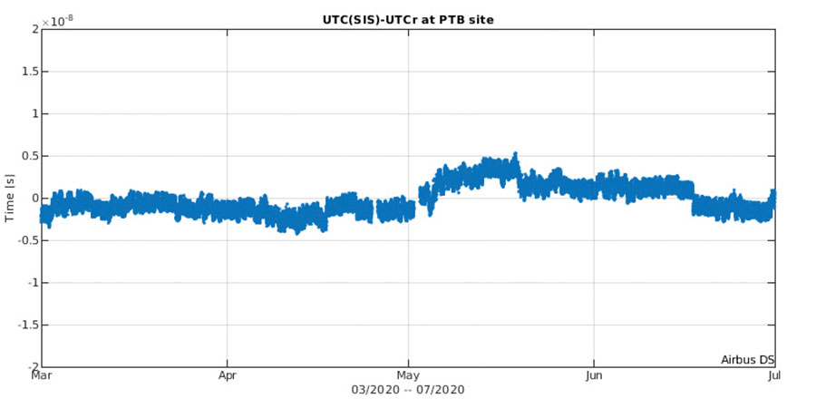
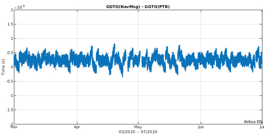
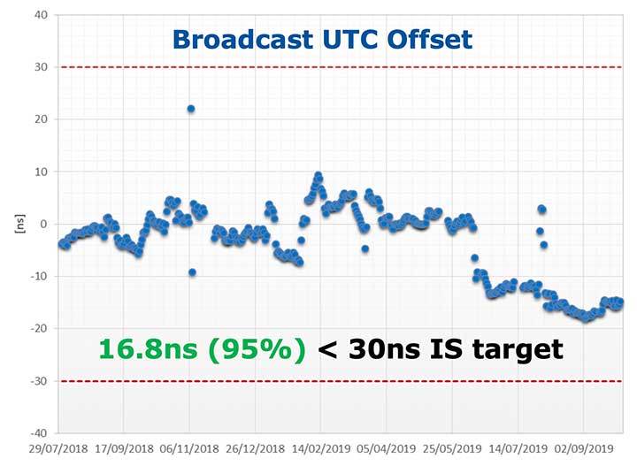
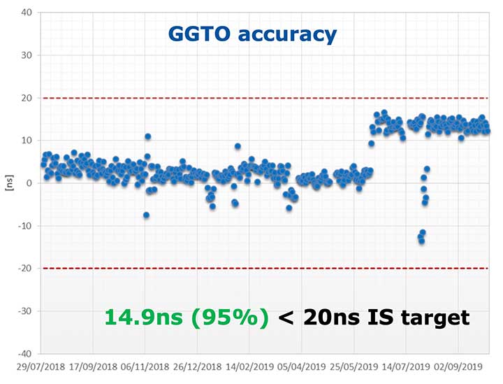
The timing accuracy benefits from the larger number of satellites in service. Figures 2 and 3 present the evolution of the UTC dissemination accuracy and GGTO accuracy performance better than 2.5 nsec and 4.2 nsec (95%) respectively, which are largely within Galileo service commitments.
Figure 2. UTC dissemination accuracy. (Image: ESA)
Figure 3. GGTO accuracy. (Image: ESA)
Probably the most significant discriminator of Galileo versus other GNSS is its capability to broadcast multi-frequency (E1, E6, E5) signal components on all operational satellites. In the high-end and mid-range smartphone chipset market, dual frequency is becoming the norm. All large players have released dual-frequency chipsets, and the first dual-frequency chipsets targeting the budget device market are now becoming available. Dual-frequency receivers offer improved accuracy and robustness, and potential access to high-accuracy techniques. Multi-constellation is now standard for high-volume chipsets and Galileo with its multi-frequency capability is one of the largest GNSS contributors to this emerging dual-frequency PNT market.
Expanding Galileo Services Portfolio
Galileo offers the Galileo Open service (OS) for positioning and timing services, and Europe’s Search and Rescue (SAR) service contribution to COSPAS-SARSAT, equipped with its unique Return Link Message (RLM) declared operational in January 2020. Furthermore, the Galileo system is expanding its infrastructure capabilities such that, once fully operational, it will offer additional high-performance services worldwide.
Public Regulated Service (PRS) is restricted to government-authorized users for sensitive applications that require a high level of service continuity.
Open Service INAV message improvements on Galileo E1-B are under implementation, namely robust symbol level synchronization patterns, additional insertion of clock and ephemeris data with flexible outer encoding and frequent provision of shortened clock and ephemeris for improved robustness in terms of navigation data retrieval in challenging environments, in addition to facilitating a reduced time to first six (TTFF); these improvements ensure backwards compatibility with previously released OS SIS ICDs.
Open Service Navigation Message Authentication (OS-NMA) providing the free authentication of the Galileo Open Service (OS) for geolocation information through the Navigation Message (I/NAV) broadcast on the E1-B signal component.
Commercial Authentication Service (CAS), complementing the OS, providing a ranging authentication function implemented by encrypting the spreading code of the E6C (pilot) channel with a secret key. To ensure backward compatibility, CAS is based on the only civilian signal including cryptographic features (E6). When using both OS-NMA and CAS, users will benefit from data (navigation message) and range authentication, allowing PVT authentication worldwide.
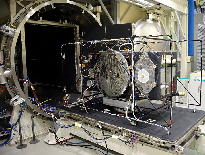
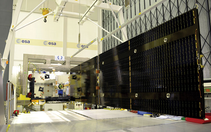
Galileo Batch 3 satellite under test at ESA’s ESTEC facility in the Netherlands. (Photo: ESA)
High Accuracy Service (HAS) complementing the OS by delivering free access high accuracy data and providing better ranging accuracy, enabling users to achieve sub-meter level positioning accuracy.
Support to Safety of Life (SoL) Services through Dual Frequency Multi-Constellation (DFMC) SBAS and supporting the provision of integrity through the concept of Horizontal Advanced Receiver Autonomous Integrity Monitoring (H-ARAIM). In this context, the Galileo Integrity Failure Mode and Effect Analysis (IFMEA) Process is implemented through measurements and review of the system design, including characterization of feared events.
Galileo Batch 3 satellite under test at ESA’s ESTEC facility in the Netherlands. (Photo: ESA)
Infrastructure Modernization
The Galileo System infrastructure is being upgraded and modernized to support the full service portfolio, provide additional robustness and resilience, ensure security and improve operations.
The Galileo Ground Segment is being upgraded implementing ground segment virtualization technologies. This modernized infrastructure will make it possible to easily accommodate technology refresh and will minimize impact to Galileo service operations, under the responsibility of Spaceopal GmbH, during future deployment activities.
Current ground segment upgrades under production by prime contractor Thales Alenia Space in France (in charge of Ground Mission Segment and Security Monitoring) are addressing the deployment of improved robustness of the navigation and precise timing solutions, the full scope of PRS service capabilities, the expansion of the sensor station and up-link ground station networks, and additional security monitoring coverage to protect Galileo ground and space assets.
Ground segment upgrades under production by prime contractor GMV in Spain are addressing the deployment of a new Ground Control Segment providing increased constellation monitoring and control capabilities up to 38 satellites, enhanced operability features, expansion of the TTC network and additional security protection capabilities.
Upgrades of the Galileo Service Facilities are underway as well, notably the evolution of the GNSS Service Center toward the integration of the OS-NMA and HAS capabilities, and the extension of the reference measurement capabilities of the Galileo Reference Centre, by the prime contractor GMV in Spain. The robustness of the SAR service operations, under the prime contractor CNES in France, is also under improvement.
The production of 12 additional Batch 3 Galileo first generation satellites is proceeding, aiming at readiness for launch from mid 2021 onward. Batch 3 satellites are comparable to the 22 FOC satellites launched previously and built by the same prime contractor OHB Systems in Germany. With Batch 3 satellites, Galileo will reach its full constellation capability, including a number of in-orbit spares.
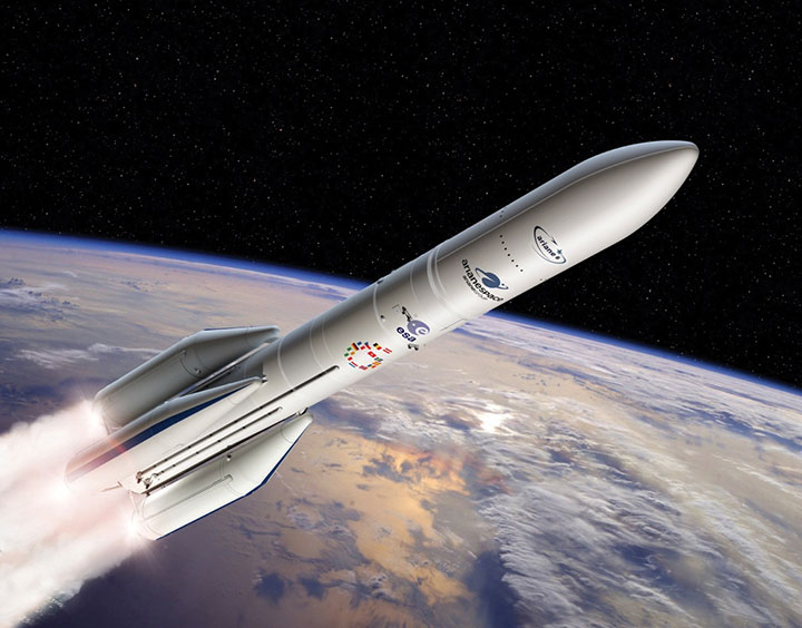
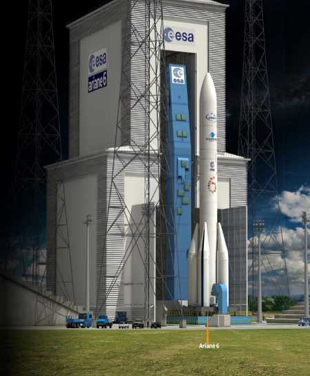
Galileo Batch 3 satellites will be progressively launched with the new Ariane 62 launcher vehicle, the two strap-on solid booster variant of Ariane 6, currently undergoing the final stages of development led by prime contractor ArianeGroup. Meanwhile, France’s space agency CNES is preparing the Ariane 6 launch facilities at Europe’s Spaceport in French Guiana. Ariane 6 is scheduled for its first launch in 2022.
Europe’s new Ariane 6 launch vehicle. (Artist’s concept: ESA)
Toward Galileo Second Generation
The Galileo Programme is fully engaged in the process of developing Galileo 2nd Generation (G2G). Procurement activities for system, satellite and ground segment have been initiated in 2020 with the ambitious goal of starting deployment of the new infrastructure in 2024.
The design of G2G is driven by overarching principles, including backward compatibility, providing an extended portfolio of services and the quality of services, but also the absolute need to meet user demands in a timely and effective manner. The European Commission, in close consultation with EU member states, has converged onto an ambitious set of long term PNT goals for the future European GNSS infrastructures.
G2G Service Portfolio and High-Level Mission Objectives agreed with Programme Stakeholders Service include service evolutions in the areas of signals evolution for increased performance and reduced complexity and power consumption at the user receiver level, time to first-fix, accuracy, authentication and other service attributes, PRS evolutions, advanced timing services, enhanced integration with terrestrial systems (5G/6G), complementarity with external sensors (such as INS, barometer, lidar) and application environments (such as low power devices and internet of things), SAR service evolution, Emergency Warning services, Space Service Volume and Ionosphere Prediction Service.
G2G will build on advanced navigation technology developed over the past 10 years under ESA’s European GNSS Evolution Programme (EGEP) and EU’s Horizon 2020 Programme. This technological leap will allow the early introduction of novel Galileo system features:
Open service capabilities (reduce power consumption and convergence time)
High-accuracy evolution (integrity, availability)
PRS robustness and transmit power
System and SIS in-orbit flexibility, reconfiguration and time-to-market
Inter-satellite links (ranging, mission dissemination, command and control)
SAR second-generation beacons
Reduce operations and maintenance cost
Accelerate time-to-market of new services
Ground technology virtualization and modernization
Acknowledging the changing nature of user requirements, the Galileo second-generation is designed to evolve incrementally and with sufficient flexibility to provide new services or signal features, if and when required, by dynamic reconfiguration of space and ground infrastructure.
By Javier Benedicto
Head, Galileo Programme department,
European Space Agency
Javier Benedicto, left, accept the 2018 GPS World Satellites Leadership Award on behalf of Giuliano Gatti of the European Space Agency, from Phil Froom of Rockwell Collins. (Photo: Melanie Beus)
Since the Galileo initial services declaration in December 2016, the Galileo Program has been providing global PNT and search-and-rescue services for users worldwide. The European GNSS Agency (GSA) just issued its GNSS 2019 Market Report in October, providing a complete overview of the current status and trends of the GNSS worldwide market with focus on European GNSS (Galileo and EGNOS) applications and services.
In parallel with service provision, the Galileo Program is undertaking extensive infrastructure development and deployment activities to reach Full Operational Capability (FOC), incorporating new service capabilities, but above all aiming at increasing the robustness and resilience of the system infrastructure, operations and service provision.
Galileo’s signal-in-space quality has steadily improved over the past few years, reaching in 2019 a best signal-in-space error (SISE) of about 0.25 meters (95%, global average; Figure 1). This has been achieved through a combination of several factors, including the increased number of operational satellites, enhanced versions of the Ground Mission Segment, and higher uplink rate of the navigation message (lower age of data). This performance is well within Galileo’s initial service accuracy commitments, as defined in the public Open Service – Service Definition Document (OS SDD).
Figure 1. Long-term historical SISE plot over a 30-day sliding window, constellation averaged. (Image: ESA)
Figures 2 and 3 (see page 40) show Galileo’s timing performance as broadcast UTC offset and GGTO accuracy. The evaluation was performed with calibrated GPS/Galileo timing receivers operated in UTC(k) laboratory (PTB, INRIM). Again, the initial timing service commitments have been fully met.
Figure 2. Galileo Broadcast UTC offset accuracy performance. (Image: ESA)
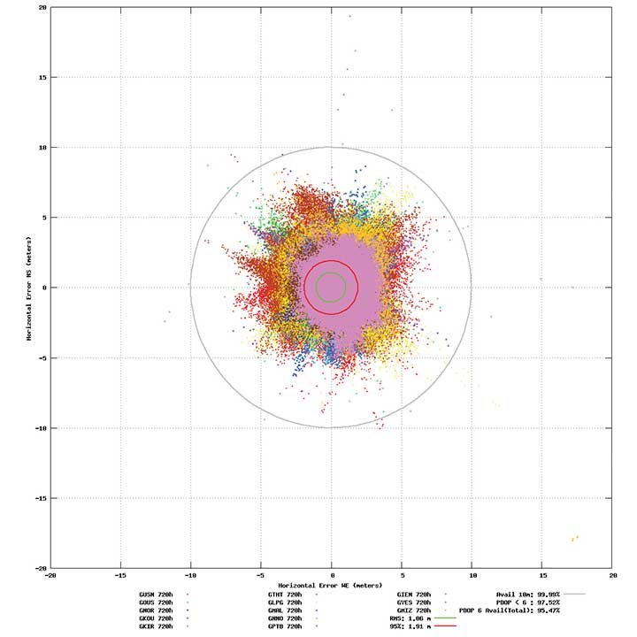
Probably the most significant discriminator of Galileo compared to other GNSS is its capability to broadcast multi-frequency (E1, E6, E5) signal components on all operational satellites. The position performance of a dual-frequency user receiver on-ground is shown in Figure 4. This measurement from June 2019 demonstrates a Galileo position accuracy well below 2 m (95%).
Figure 4. Galileo position accuracy performance, dual-frequency, June 2019. (Image: ESA)
With the aim of further improving the Open Service (OS) performance, three newly introduced I/NAV message improvements on Galileo E1-B are under implementation, namely FEC2 Reed-Solomon Clock and Ephemeris (CED), Reduced CED, and Secondary Synchronization Pattern (SSP). Galileo Open Service (OS) users will benefit from improved robustness in terms of navigation data retrieval in challenging environments, in addition to facilitating a reduced time to first fix. Those I/NAV improvements on Galileo E1-B are backwards compatible with previously released OS SIS ICDs.
In addition, Galileo infrastructure is currently being upgraded to provide means for OS authentication. The protocol proposed uses the E1B External Data Broadcast Service (EDBS) to provide authentication data to the user. The OS Navigation Message Authentication (NMA) is based on an adaptation of the Timed Efficient Stream Loss-tolerant Authentication (TESLA) protocol.
Beyond the OS, the Galileo system has been designed to allow for the dissemination of value-added data, such as high accuracy and authentication, in the E6B signal component. The component has been designed to broadcast the Galileo High Accuracy Service based on the provision of accurate satellite data (clocks, orbits and biases) and atmospheric data (mainly ionospheric corrections) to enable multi-frequency multi-constellation PPP with correction data transmitted through an open format in the Galileo E6B signal.
The introduction in early 2020 of the automatic acknowledgment of the SAR/Galileo Return Link Message (RLM) as part of the Cospas-Sarsat system will enable space assets to be used for search and rescue — persons in distress will get swift acknowledgement that their alert has been detected and located. The Return Link is the means to interact with a SAR beacon, improving the effectiveness of SAR operations. Extensive testing has demonstrated that the median latency for the reception of a return link message on the ground is 14.2 seconds, while 99% of messages are received within 57 seconds, after the request for the RLM transmission is delivered to Galileo (from Cospas-Sarsat to the RLSP). At the same time, the measured rate of reception was 100%, considering line-of-sight availability, thanks to the very robust Galileo navigation data link. This performance has been demonstrated to be uniform across the globe, as shown in Figure 5.
Figure 5. Beacon activation map and RLM delivery latency through the Galileo system. (Image: ESA)
Following the re-profiling of the Galileo Safety-of-Life (SoL) service, Galileo is meant to be exploited through dual-frequency multi-constellation (DFMC) SBAS and will support the provision of integrity through the concept of Horizontal Advanced Receiver Autonomous Integrity Monitoring (H-ARAIM). To allow the exploitation of Galileo for these SoL applications, a thorough analysis of the actual signal-in-space (SiS) performance and of potential feared events critical for SoL users is key. In this context, the Galileo Integrity Failure Mode and Effect Analysis (IFMEA) process is implemented through measurements and review of the system design, including feared-events characterization.
Ground Segment Brings Robustness
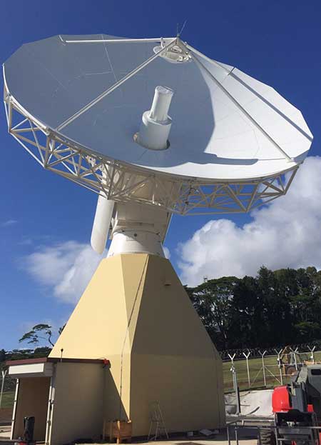
Galileo telemetry and telecommand ground station. (Photo: ESA)
Galileo’s Ground Segment is being upgraded to fully redundant control centers. These include processing and storage, monitoring and control facilities, and security monitoring centers. A worldwide network of Galileo Sensor Stations (GSS) allows monitoring and measuring of satellite signals; uplink stations allow dissemination of the navigation message to users through Galileo satellites; and telemetry, tracking and control (TTC) stations allow monitoring and control of the satellites.
Ground segment upgrades under production by Thales Alenia Space France (in charge of the ground mission segment and security monitoring) and GMV Spain (in charge of the ground control segment) are addressing increased service robustness, through the introduction of a more flexible infrastructure with a significant technology refresh, improved security, service continuity, enhanced service performances, and enhanced operability features.
One important objective of the ongoing upgrades is to implement a modern infrastructure, based on leading virtualization technologies. This modernized infrastructure will make it possible to easily accommodate hardware and software changes without requiring significant redesign or requalification, and will minimize the impact to Galileo service operations — under responsibility of Spaceopal GmbH — during future deployment activities.
Batch 3, Ariane 6 Under Production
Ariane 6 on the launchpad. (Artist’s concept: ESA)
The production of Batch 3 of 12 additional Galileo FOC satellites is proceeding, aiming at readiness for launch by the end of 2020 onward. The satellite design includes a selected number of improvements compared to the 22 FOC satellites launched previously and built by the same satellite manufacturer OHB Systems.
The different stages of assembly, integration and initial test phase in the OHB production plant in Bremen have already started, before shipment to ESA-ESTEC in the Netherlands for the environmental test campaign consisting of thermal vacuum, mechanical tests, interface verification with the launcher and system end-to-end performance tests with the elements of the Galileo ground segment.
Following the phasing out of the Ariane 5 SE launcher, the third batch of Galileo satellites will be progressively launched with the new Ariane 62 launcher vehicle, the two solid-booster variant of Ariane 6 now in the final stages of development.
Evolution to Meet User Needs
The Galileo Second Generation roadmap has achieved maturity in 2019 and is now entering the preliminary design and implementation phase. Based on the EU’s H2020 Galileo Second Generation activities managed by ESA, and the GSA prospective market analysis, the European Commission, in close consultation with EU member states, has agreed on an ambitious set of long-term PNT goals for the future European GNSS infrastructures.
Technology pre-developments, critical engineering activities and synergic design activities between space and ground infrastructure are being conducted. This will translate into the progressive deployment of a complete set of space/ground infrastructure that is tailored to satisfy the diversified user needs in four main dimensions:
Satellite and ground segment infrastructure with capabilities that can dynamically adapt to current and future user needs. Key drivers are flexibility and robustness, ensuring fast time to market to meet user needs.
Full synergy between GNSS and SBAS systems infrastructure, to complement and enhance the service portfolio. This will allow segmentation and complementarity of safety-critical services and extension to all new PNT services available today, including high-accuracy positioning integrity.
Enhanced integration with terrestrial systems — 5G/6G, signals of opportunity (SOOP), terrestrial beacon systems (TBS). ESA and GSA have been actively leading the 5G positioning standardization worldwide in collaboration with public and private institutions inside 3GPP and will soon move toward the start of standardization of 6G terrestrial positioning and GNSS interconnection technologies.
Full complementarity with external sensors (such as INS, barometer and lidar) and application environments (low-power devices and internet of things) so that the Galileo Second Generation Infrastructure enhances and complements the capabilities provided by these external means.
A key pillar for this long-term strategy is the Galileo transition satellites. The competitive procurement procedure for the first batch of transition satellites is coming in 2020. The flexibility and robustness of these satellites will allow the European PNT infrastructure to satisfy all the different user needs in the next decade. This procurement — together with others at system, ground segment and technology level — will enable the start of the in-orbit validation of second-generation capabilities from 2025 onward.
Additional ground and test infrastructure are in early engineering analysis, design and technology development, in order to proceed with additional procurements for experimental and operational usage, starting early in the 2020s.
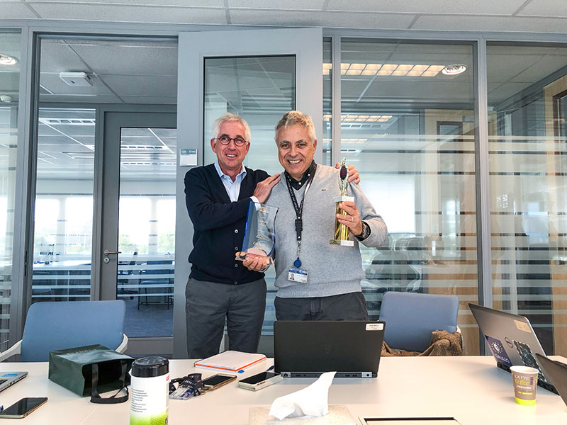
Javier Benedicto (left) and Giuliano Gatti. (Photo: ESA)
Javier Benedicto, head of the Galileo Programme and Navigation-related Activities at the European Space Agency, accepted the 2018 Satellites Leadership Award and delivered these remarks on behalf of Giuliano Gatti at the 2018 GPS World Leadership Awards Ceremony. Gatti, the space segment procurement manager at the European Space Agency, received the award for his contribution to setting up the Galileo constellation from GIOVE-A and -B precursors through all Galileo operational satellites: Soyuz and Ariane 5 launches, a total of 26 Galileo satellites deployed in 7 years.
On behalf of Giuliano Gatti, I express his gratitude for this award.
After a 20-year career in microwave equipment for satellite application, working in Italy, Canada and the Netherlands, Mr. Gatti started working on navigation satellites at end of the 1990s as ESA Galileo Space Segment Manager.
He went through the initial difficulties of the program, namely the uncertainty on financing and the technical lack of maturity of critical units such as atomic clocks. At the time, joining the Galileo team of the European Space Agency was risky and challenging.
In spite of these issues, he was a key player in the developments of the first two Galileo experimental satellites, GIOVE-A and GIOVE-B, and he was in charge of their launches in 2005 and 2008, respectively, on Soyuz rockets from Baikonour, Kazakhstan.
He then followed the development and launch of the 4 IOV satellites, two in 2011 and two in 2012, from the European space port in French Guyana, on a Europeanized version of the Soyuz rockets. The first IOV launch was actually the first launch with this version of the launcher, and interface and schedule coordination issues were challenging tasks for him.
He then was instrumental for the procurement of the following generation of satellites, the 22 FOC satellites. He struggled to make sure that satellites would be produced and launched in line with the program deployment plan. Another challenge in this phase was ensuring that the adaptation of the Ariane-5 ES rocket to the Galileo satellites would converge in time and comply with all technical requirements.
Under his guidance and responsibility, the 22 satellites were put in orbit with 5 Soyuz launches and 3 Ariane-5 launches. Here the most difficult event was the launch that put two Galileo satellites in the wrong orbit, and the subsequent recovery of the satellite mission. In addition, a number of failures affected some of the in-orbit atomic clocks, and hedrove the investigation that led to the discovery of the root causes and their resolution.
Mr. Gatti then initiated the procurement and production of the follow-up recurring satellites, the so-called Batch-3 satellites. These 12 satellites have stringent schedule requirements and their first launch is planned for late 2020 or early 2021.
In parallel, he contributed to the definition of the next generation of satellites, the Transition Satellites: heavier spacecraft with improved performance and high level of re-configurability and flexibility. They will be the first step moving from the existing first generation of satellites to the second generation. In this phase, his experience and competence have played a fundamental role to arrive at the definition of the appropriate procurement requirements.
After 20 years on the development and deployment of Galileo, being in charge of the launches of 28 satellites, from the first GIOVE-A satellite in 2005 to the launch of the last 4 FOC satellites in July 2018, Mr Gatti will retire in mid-2019.
He is delighted and honored that all his efforts and contributions to develop and launch the Galileo constellation have been recognized in this important GNSS event.
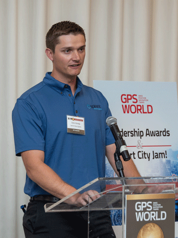
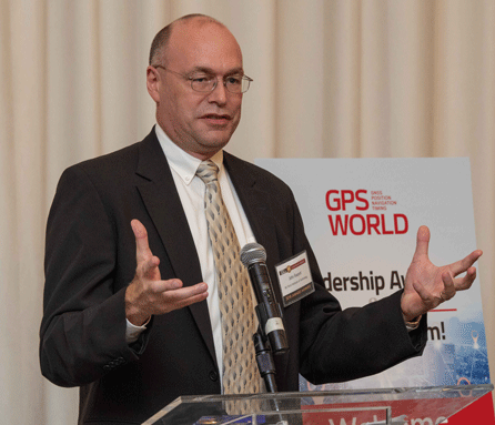
Four innovators in the fields of satellites, signals, services and products accepted Leadership Awards for 2018 from this magazine at the GPS World Leadership Awards Ceremony and Dinner on Sept. 27 in Miami. Their remarks at the podium directed the audience of PNT industry and research community VIPs to key challenges for the future.
Satellites
Javier Benedicto, left, accepts the Satellites Leadership Award on behalf of Giuliano Gatti of the European Space Agency, from Phil Froom of Rockwell Collins. (Photo: Melanie Beus)
Kicking off the ceremony, Phil Froom of Rockwell Collins mentioned that “Rockwell Collins and QinetiQ [have] signed an alliance agreement to produce a new family of high-assurance, multi-constellation GNSS receivers for professional and military use. This new family of receivers is aimed to be complementary to the current encrypted family of Rockwell Collins receivers in service across the globe, but allow the customer to select the level of capability and protection based upon operational, political or even financial needs.”
(Photo: Melanie Beus)
Froom conferred the Satellites Award upon Giuliano Gatti of European Space Agency, for his contribution to setting up the Galileo constellation, as Space Segment Procurement Manager, from GIOVE-A through all current operational satellites, a total of 26 deployed in 7 years.
Accepting the Award on Gatti’s behalf, Javier Benedicto of ESA told the crowd about “two moments in his [Gatti’s] professional life that were very beautiful and very difficult. The beautiful moment was January 12, 2006, when the very first Galileo satellite, GIOVE-A, started transmitting the first Galileo signals. The most difficult moment was on August 27, 2014, when we saw that Soyuz rocket deploy our satellites a few thousand kilometers before the intended orbit. We thought, how are we going to recover? Today, the satellites are working, and they will be injected into the constellation in a few months.”
[The full text of remarks by both award conferrers — Leadership Dinner sponsors Rockwell Collins, Harris and Spirent Federal — and award recipients will appear in the December issue of the magazine. Jointly with their remarks directing all in the PNT community to future challenges will appear the Directions 2019 special section: essays by the chief executive officers operating the GPS, GLONASS, Galileo and BeiDou constellations. Look for it!]
Signals
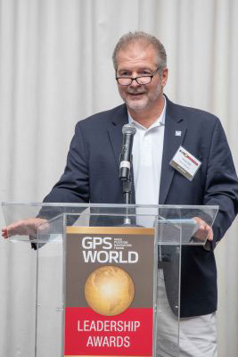
Joe Rolli, Harris Corporation. (Photo: Melanie Beus)
Joe Rolli from Harris opened by saying “I work with an amazing group in Clifton [New Jersey] that comes together, overcomes challenges, builds our [GPS III] payloads, and provides a system that everyone uses every day. I think we’ve gotten to the point where we can honestly say, almost nothing works without GPS.”
“The challenge that I see [for the future] is to overcome the politics: where do you draw the line between doing what’s right for the PNT solution for the common good and addressing your national security and your own agendas in protecting your own country.”
After further comments, he called Logan Scott of LS Consultiing to the podium to receive the 2018 Signals award. Scott has been, in the words of the person who nominated him for the award, “an advocate for improved civil GPS security, and the inventor of a new asymmetric navigation security paradigm for civil GPS signals that avoids the need for secure key storage in civil GPS receivers and thus allows for widespread adoption in applications without physical security capabilities.”
Logan Scott, LS Consulting. (Photo: Melanie Beus)
Scott spoke about the Chips-Message Robust Authentication (Chimera) for GPS Civilian Signals project, in which he was a key participant. “Chimera can offer security benefits far beyond what you see with data message-signing only.”
“Moving forward, the challenge I offer to you all is this: how can we establish the integrity and truthfulness of position and time reports both locally and remotely to other people and mechanized devices? In a world of autonomous vehicles, crowd-sourced databases and geofenced capabilities and information access, and an insecure supply chain, it is not enough to say, ‘Well, I saw it on C/A code.’ ”
Services
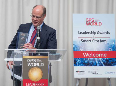
This award, sponsored by Spirent Federal, brought Justin Eldredge to the microphone.
Justin Eldredge, Spirent Federal (Photo: Melanie Beus).
“This year we maintain our position of being first to market with new signals, with the launch of SimMNSA. We’re currently in the final test phase of this new M-code option and it will delivering to several authorized customers by the end of the year. If M-code signals aren’t in the spectrum of testing for you, we offer products that simulate all other GNSS signals, plus a variety of other sensors.”
Eldredge introduced John Raquet, professor at the Air Force Institute of Technology. Raquet was nominated and subsequently voted as winner of the Services award for work he and his team at the Autonomy & Navigation Technology (ANT) Center developed on PNT sensors and systems utilizing almost every available source, including GPS, GNSS, inertial, vision, lidar, magnetic field, pseudolites, radar, terrain mapping, signals of opportunity, star trackers, radio ranging, 3D audio, X-ray pulsars, clocks, and more.
John Raquet, U.S. Air Force Institute of Technology (Photo: Melanie Beus).
“Sometimes I called the ANT the Crazy Idea Factory. We’ve tried lots and lots of things,” said Raquet. “I think I have the best job in the world, because I get to experiment with many, many things, and work with amazing people.”
“This is not the kind of community where you build something once and you’re done, you put it away. This is a growing worldwide enterprise that takes new talent to come in and fill the spots that many of the people in this room have occupied. I’m privileged to see some of the students that we’ve worked with to then go on and fill some of the gaps, really do some amazing things.”
Products
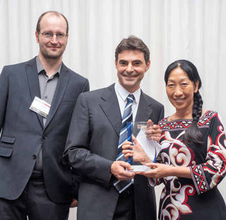
Jade Morton, who herself received a Leadership Award in 2015, introduced the final honor of the evening.
“There’s a community of people kind of like you guys, a few of them are sitting here, who are crazy about the atmosphere. That’s their livelihood. They’re talking about how to use satellite navigation technology to monitor the atmosphere, to provide forecasting and modeling technologies. All of these effects, we [navigation engineers] have done everything we can to filter them out, to make them go away. But this company built a system to analyze the real traits that the atmosphere has imprinted on GNSS signals.”
Jean-Marie Sleewaegen from Septentrio then accepted the Products award, jointly on behalf of his colleagues Tom Willems, Andrew Simsky and Wim de Wilde. The company’s PolaRx5S receiver supports worldwide ionosphere monitoring, providing multi-frequency multi-GNSS measurements with low phase noise, high data rates, and flexible configurations, and enabling many Earth-observing applications ranging from ionospheric scintillation characterization to tectonic movements monitoring.
Wim de Wilde and Jean-Marie Sleewaegen, Septentrio, and Jade Morton, University of Colorado (Photo: Melanie Beus).
Sleewaegen said, “We continue to cherish our close ties with the research community. While most of us dream of getting rid of these error sources and these perturbations, atmospheric research scientists don’t want us to filter them out — they want to focus on them and see them in their full glory! The technology that we developed [to both mitigate and preserve the perturbations] is now at the heart of all of our receivers.”
“With the avalanche of new signals and constellations that we see — in some regions of Asia you can now see more than 60 GNSS satellites — the question is how to absorb, process and use that huge amount of data. All these questions are still not answered and will definitely keep us busy for years to come.”
The GPS World Dinner and Awards Ceremony are held annually at the time of (although separately from and independent of) the ION GNSS+ conference. Nominations for the awards come from a group of 40 industry executives and researchers. A ballot of the nominees is then circulated to a larger group of similar make-up.
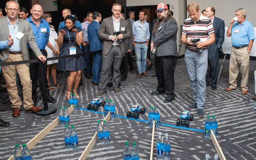
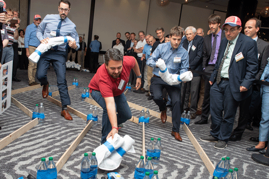
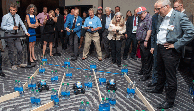
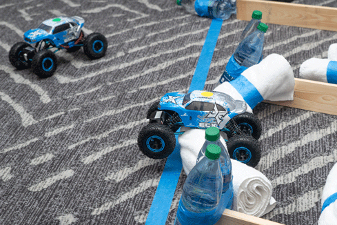
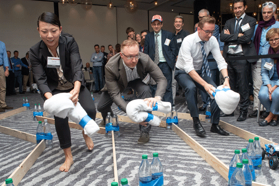
The festive evening concluded, after dinner and dessert, with the Smart City Jam!, a group exercise in navigation and obstruction. Details in the December issue.
At the Smart City starting line (Photo: Melanie Beus).
Smart City jammers in action (Photo: Melanie Beus).
And they’re off! (Photo: Melanie Beus)
Last gasp, struggling to finish in second place (Photo: Melanie Beus).
You wouldn’t think that professional navigation engineers would be so enthusiastic about jamming (Photo: Melanie Beus).
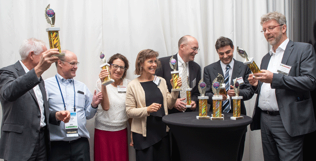
Somehow, the team of Leadership Award winners (LOQUATRIO) ended up winners of the Smart City Jam! as well. Smart drivers (or jammers) (or both). (Photo: Melanie Beus).