Tag: landmines

  • Esri, HALO Trust join to map unexploded bombs in Ukraine

    Esri, HALO Trust join to map unexploded bombs in Ukraine

    A Russian short-range ballistic missile, believed to be an unexploded Iskander missile, was found near Kramatorsk, Ukraine, in this photo released March 9 by Ukrainian authorities. (Photo: National Guard of Ukraine handout via Reuters)
    A Russian short-range ballistic missile, believed to be an unexploded Iskander missile, was found near Kramatorsk, Ukraine, in this photo released March 9 by Ukrainian authorities. (Photo: National Guard of Ukraine handout via Reuters)

    As a geopolitical and devastating humanitarian crisis unfolds in Ukraine, the HALO Trust is partnering with Esri to map unexploded ordnance as part of an immediate humanitarian response.

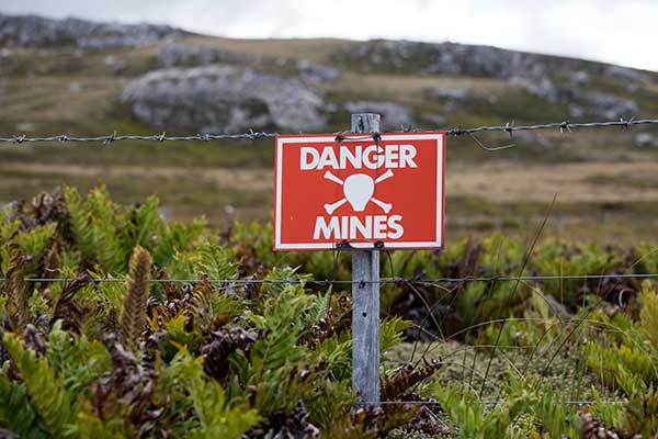
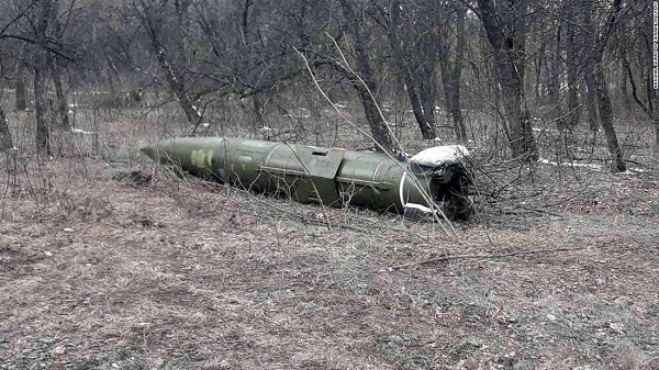
    More than 10 million Ukrainians have been displaced by the war and many are forced to move across a landscape littered with unexploded rockets, bombs and landmines.

    In response, Esri has committed its cutting-edge geographic information system (GIS) software resources, expertise and staffing in support of HALO’s mission in Ukraine.

    The organizations’ collaboration will allow them to map areas contaminated with explosives so HALO can remove the hazards when conditions allow. This will provide safe land to house displaced families and clear routes for humanitarian aid to reach those in desperate need.

    HALO is already using GIS to map the heaviest conflict zones, and the partnership with HALO will support planning for future clearance operations.

    As experts in their field, HALO is the world’s largest humanitarian landmine clearance and weapons disposal organization, clearing more than 13.9 million landmines and unexploded ordinance across 28 countries torn apart by conflict.

    In addition to technical expertise, HALO staff provide safety education for those in contaminated areas to avoid life-changing injuries and death, emergency medical aid, and humanitarian support for displaced persons as they face conflict, and in many cases are forced to flee their homes.

    Esri has collaborated with HALO since 2008 helping to map war-ravaged regions where specific locational awareness of landmines and other hazards is necessary to protect the lives of people in those areas.

  • Draganfly tapped to detect dangerous unexploded landmines

    Draganfly tapped to detect dangerous unexploded landmines

    Photo: Gannet77/E+/Getty Images
    Photo: Gannet77/E+/Getty Images

    Draganfly Inc., a leading North American-based commercial drone company, is partnering with Windfall Geotek to develop drone-based solutions for landmine detection.

    Windfall Geotek is a Quebec-based technology services company and a leader in the use of artificial intelligence (AI) and advanced knowledge-extraction techniques in the mining sector.

    The companies will work to develop an artificial intelligence (AI) driven unmanned aerial systems solution for landmine detection in the defense, humanitarian and other sectors in which the companies have expertise.

    While landmines have been used since World War I, their deployment proliferated from the 1960s onwards. To this day, many unexploded devices are killing and maiming people who step on or trigger the bombs unintentionally.

    About 60 countries and territories are still contaminated with anti-personnel mines, and more than 120,000 people were killed or injured by landmines between 1999-2017, according to research by Landmine Monitor.

    Terms of the agreement include joint research, development and engineering support, drones and equipment o further commercialize an AI driven drone solution for the detection and elimination of landmines, unexploded ordnance and.improvised explosive devices (IEDs).

    In 2018, governments and nonprofits allocated nearly US$700 million in combined international
    and national support for mine action in 2018. The economic impact of landmines is estimated at $100 billion.

    “We have been evaluating drone solutions for nearly a year, and after an exhaustive analysis of the market and providers, it is exciting to select Draganfly as our first drone systems partner for this worthwhile initiative,” said Dinesh Kandanchatha, chairman of Windfall Geotek.

    “Windfall Geotek is the industry leader in AI-based digital exploration for mining. When they approached us on this project, it seemed like a natural fit to partner our engineering and drone capabilities, with their proven software and AI expertise,” sid Cameron Chell, CEO, Draganfly. “The two companies share a mission of saving lives through technology. We expect this partnership to generate new and expanded revenue streams for both companies in the defense sector, public safety and other markets where both companies have expertise.”