Tag: lane-level positioning

  • Asensing demos HD-MapBox for lane-level positioning


    Photo: Asensing
    Photo: Asensing

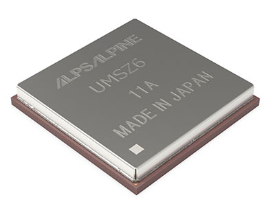
    Guangzhou Asensing Technology Co. Ltd, which specializes in high-precision positioning technology for intelligent transportation, demonstrated HD-MapBox at the Consumer Electronics Show (CES), which took place Jan. 5-8 in Las Vegas.

    HD-MapBox integrates high-precision map data based on high-precision positioning.

    The device can achieve lane-level positioning and 1+ mile (2 km) predictive cruise control (PCC), providing a decision basis for advanced assisted driving to better meet the demanding positioning requirements of autonomous vehicles.

    “As the premise for autonomous driving safety, high-precision positioning is of great importance for integrating positioning technology based on inertial measurement units (IMU), GNSS signals, visual perception systems and high-definition (HD) maps,” said Situ Chunhui, Asensing Technology CTO. “High-precision positioning is becoming the preferred choice due to higher positioning accuracy and improved redundancy as well as an enhanced passing rate under all scenarios.”

    Under any driving scenario, autonomous vehicles must accurately interpret their own lane-level location information to better predict and prevent risks and make safe driving decisions. As a result, positioning is not only part of the autonomous driving process, but also the premise of autonomous driving.

    However, any single positioning technology has its own limitations, especially in certain scenarios such as in tunnels and underground garages where the perception system may be adversely affected by changes in the amount of light and low GPS signal, thereby affecting driving safety.

    Fusing data from a GNSS receiver, IMU, ADAS camera, vehicle dynamics and HD maps, the HD-MapBox can achieve a lateral error of less than 8 inches (0.2 meters) and a longitudinal error of less than 6.5 feet (2 meters) with a 95 percent confidence interval, providing an accurate reference for highway pilot (HWP) and automated valet parking (AVP). Even if both GNSS and lane line detection are not available, the HD-MapBox can still enable vehicles to keep in lane for at least a quarter mile (400 meters).

  • Alps Alpine and Furuno develop GNSS module

    Alps Alpine and Furuno develop GNSS module

    UMSZ6 module allows high-accuracy vehicle positioning to within 50 cm without correction data

    Photo: Alps Alpine
    Photo: Alps Alpine

    Alps Alpine and Furuno Electric Co. Ltd. have jointly developed the UMSZ6 series GNSS module, providing high-accuracy positioning to within 50 centimeters without having to use position correction data.

    On typical 3-meter-wide roads, the module reliably enables vehicle positioning down to the lane level, a requirement of various V2X applications, and makes possible greater sophistication of autonomous driving functions. This is achieved using a multi-frequency GNSS receiver chip based on Furuno’s Extended Carrier Aiding technology.

    The module is compact at 17.8 × 18.0 × 3.11 mm while conforming to automotive-grade specifications. Running costs associated with real-time-kinematic (RTK) base stations, correction data receiving, and correction data use are not needed, maximizing cost performance.

    Under the joint agreement, Furuno developed and supplied an original multi-frequency GNSS receiver chip — eRideOPUS 9 (model ePV9000B) — and algorithm. Alps Alpine is the first company to use the chip, with the UMSZ6 series.

    Alps Alpine plans to carry out evaluations within a real automotive environment to assess performance and interoperability with V2X and other communication modules. Mass production is expected in 2023.

  • Trimble joins VSI Labs in autonomous vehicle research

    Trimble joins VSI Labs in autonomous vehicle research

    Photo: Trimble
    Photo: Trimble

    Trimble to provide reliable in-lane positioning for the year-long research program

    Trimble and VSI Labs have formed an alliance, with Trimble serving as the GNSS precise positioning supplier for VSI’s autonomous research vehicle program. The alliance officially kicked off in March at Destination ACM, a long-distance driving event for VSI’s research vehicle that continues with additional events throughout the year.

    The collaboration provides the opportunity to showcase Trimble RTX technology as the trusted precise-positioning correction source for car manufacturers and their suppliers. Coupled with Trimble’s inertial positioning, Trimble RTX plays a pivotal role in a vehicle’s ability to maintain accurate and reliable lane-discipline during autonomous driving.

    Destination ACM launched from VSI’s Minneapolis headquarters en route to the American Center for Mobility’s (ACM) test center in southeast Michigan where a day of testing and demonstration took place March 26.

    “The integration of Trimble’s precise RTX positioning is a key element of VSI’s technology stack for advanced driver assistance systems (ADAS) and autonomous vehicle (AV) applications,” said Stephen Ruff, general manager of Trimble’s On-Road Autonomy Division. “VSI Labs is a leading researcher of best-in-class technologies critical to autonomous vehicle development.”

    Suitable for on-road driving applications, Trimble RTX corrections operate on a single, global network. Drivers are not subject to the coverage outages that can exist when relying on local positioning systems — requiring line-of-sight to a positioning source or radio/cellular/internet connections.

    When occasional obstructions are present, such as a bridge, tunnel or deep urban or rural canyon, Trimble augments its precise GNSS positioning with inertial technology to maintain continuous positioning and orientation while on the road.

    Trimble’s innovative GNSS positioning is being used on the road today by a number of automotive OEMs and Tier 1 suppliers to improve the functional safety and performance of ADAS for passenger vehicles. Consumers have logged more than 7 million miles using Trimble RTX for lane-level positioning to date.

    “VSI Labs is thrilled to have Trimble’s RTX technology on board,” said Phil Magney, founder and president of VSI. “Trimble’s positioning capabilities allow us to really expand our applied research on the safety and performance of autonomous and ADAS driving solutions.”

    Trimble GNSS positioning technology will be used in the VSI research vehicle during each of the quarterly Destination ACM events, the Drive World Conference in Silicon Valley in August, the VSI 2021 “Drive South,” and other events this year.

    For more about autonomous vehicles, see our June issue.

  • Swift travels across US with Skylark lane-level positioning

    Swift travels across US with Skylark lane-level positioning

    Swift’s first-of-its-kind, cross-continental drive demonstrates the performance of Skylark. (Image: Swift Navigation)
    Swift’s first-of-its-kind, cross-continental drive demonstrates the performance of Skylark. (Image: Swift Navigation)

    Swift’s first-of-its-kind, cross-continental drive demonstrates the performance of Skylark.

    Swift ​​Navigation​, ​​a San Francisco-based tech firm redefining GNSS and precise positioning technology for autonomous vehicles, has completed a cross-country drive test.

    The goal of this first-of-its-kind drive, from San Francisco to New York and back, was to measure the efficacy of Swift’s recently expanded Skylark cloud corrections service and to demonstrate true nationwide lane-level GNSS correction coverage at the accuracy, reliability and availability levels required by Swift customers.

    The drive took the Swift team across 26 states and Washington, D.C., with 6,614.7 miles (10,645.4 km) driven over 116 hours and 14 minutes logged. A Swift vehicle was equipped with 20 different GNSS devices, tested using six unique chipsets that included: Swift’s Piksi Multi, Duro and multiple leading GNSS silicon providers.

    The results of the drive confirmed that Swift’s precise positioning solution — composed of Skylark and the Starling positioning engine — delivers consistent lane-level accuracy at continental level. Skylark delivered 100% availability, with sub-decimeter accuracy, over the entire United States, wherever cellular coverage was available.

    Performance highlights from the drive:

    • +Sub-meter horizontal accuracy (2-sigma) achieved across all environments
    • 100% Skylark availability
    • Highly repeatable results with Starling + Skylark across variety of dual-frequency GNSS chipsets

    “This is the longest continuous GNSS-based precise positioning drive test of its kind and we are proud of the engineering team at Swift for undertaking this ambitious task,” said Anthony Cole, executive vice president of engineering. “The results show that Skylark performs as intended and expected in both open sky and urban environments and demonstrate that Skylark is truly a cross-continental corrections network delivering the high integrity and high availability required by automotive OEMs, last-mile applications, rail, mobile and micro-mobility companies.”

    In addition to full contiguous U.S. (CONUS) coverage, the Skylark corrections service is now available in Europe and is being built out to support autonomous applications across the globe.

    Download a complete write-up of the cross-country drive test at www.swiftnav.com.