In the letter, the Satellite Safety Alliance (SSA) and 93 companies and organizations stated the need for the Ligado Order to be overturned by President Trump and Congressional leadership.
“The proposed network is designed to inappropriately use spectrum reserved for satellite communications, causing significant interference to other services,” the SSA stated. Interference with GPS is a major concern of the group.
The letter urges the president and the chairs and ranking members of the House and Senate armed services and commerce committees to work with the FCC on granting petitions for reconsideration that will help prevent the building of Ligado’s terrestrial wireless network.
“Ligado’s network would threaten a wide range of critical government and commercial services, including military communications, private satellite communication, GPS, agriculture, aviation, weather forecasting, and more,” the SSA stated.
“For over two decades, Ligado and its predecessors have tried and failed to build a
terrestrial network that wouldn’t harm GPS, national security, and other critical interests,” commented the SSA. “The FCC’s Ligado Order has faced unprecedented opposition, including from 14 federal agencies and over 90 organizations representing huge swaths of the economy — from aviation and agriculture to science and manufacturing. Rarely does any issue garner
agreement from such a wide and divergent group of constituencies.”
Congress found through independent analysis that the Ligado Order poses unacceptable risks of interference to GPS, satellite communications, weather forecasting, and other services, the SSA explained. “Countless federal staff hours and resources have gone to reviewing, debating, and litigating this issue. It is past time the FCC put the issue to rest by granting the pending petitions for reconsideration.”
From its humble beginnings in the 1970s to its expanded use in the present day, GPS technology has been vital for nearly every industry from defense and aviation to farming and construction. GPS devices are designed to receive faint GPS signals transmitted from satellites about 12,000 miles away. Acknowledging this reality, regulators have historically maintained for GPS, which relies on such faint radio signals and sensitive equipment, an appropriately quiet spectrum neighborhood—populated by similar users.
With the NASEM report’s confirmation of harmful interference, the deficiencies of the FCC’s April 2020 decision are even more striking
Although these GPS signals and equipment have benefitted from decades of optimization, it is impractical to place highly sensitive GPS receivers designed to capture faint signals from remote transmission facilities immediately next to high-power communications equipment. Unlike those from communications systems, GPS signals are below the thermal noise floor when they are received. As a result, increases in that noise floor often decrease the availability of GPS services, which in turn places at risk high-consequence and safety-of-life services that rely on GPS.
Alex Damato
Why does this matter? In April 2020, the FCC approved a plan to deploy a terrestrial network in spectrum adjacent to the frequency bands used by GPS — operating communications signals that would be around two billion times more powerful than GPS signals at the same location.
This past September, the National Academies of Sciences, Engineering, and Medicine (NASEM) released a report detailing the harmful effects of a terrestrial communications network that would operate in a frequency band close to that of GPS.
Expert concern within 14 federal agencies and departments, a broad coalition in Congress, and the GPS industry resulted in a congressional mandate that NASEM conduct an independent technical review of potential interference to GPS. After a thorough review of the materials, NASEM concluded that the proposed terrestrial network would result in harmful interference to a substantial number of GPS receivers.
In particular, the report noted that high precision GPS devices, which are used in the most economically significant GPS applications, are the most vulnerable receiver class and likely to be affected by interference. The potential for any interference with GPS, especially with devices used by the Department of Defense, poses a threat to national security, the economy, and our daily lives.
With the NASEM report’s confirmation of harmful interference, the deficiencies of the FCC’s April 2020 decision are even more striking: potentially millions of farmers, pilots, construction companies, and first responders may be required to repair or replace GPS equipment at their own cost. Although the FCC assumed that this equipment could be repaired through upgrades or filters, some devices cannot be filtered without significant financial and performance costs, and some devices simply cannot be filtered at all.
GPS is estimated to provide up to $300 billion annually in benefits to the economy. Any disruption in GPS accuracy and usage would have detrimental effects on productivity and economic growth. Moreover, the year before the FCC’s flawed decision, another key report revealed that the loss of GPS service would have an average impact of $1 billion per-day on the nation.
The GPS Innovation Alliance will continue to work with all federal and industry stakeholders to maintain open channels of communication to connect, listen, and learn from all those involved in the discussion. As technological innovation continues, these debates on harmful interference are not going away, and GPSIA is looking forward to engaging further.
The LightSquared/Ligado Networks saga, now in its second decade, continues. On Sept. 9, the Committee to Review FCC Order 20-48 Authorizing Operation of a Terrestrial Radio Network Near the GPS Frequency Bands of the National Academies of Sciences, Engineering and Medicine (NASEM) released its consensus study. Both sides claim the report supports their position.
According to Ligado, the report confirms the FCC’s finding that the company’s operations “can co-exist with GPS.” It cited the report’s conclusion that “the technology to enable compatibility has been in use for over a decade, and most consumer equipment, commercial general navigation, timing, cellular and aviation receivers will not experience harmful interference from Ligado’s operations.”
The NASEM report also confirmed, the company said, the FCC’s finding that “[a] small percentage of very old and poorly designed GPS devices may require upgrading.” Ligado reaffirmed its commitment to “upgrade or replace” federal equipment negatively impacted by its operations and expressed its hope that now the Department of Defense (DOD) and the National Telecommunications and Information Administration “will stop blocking Ligado’s license authority and focus instead on working with Ligado to resolve potential impacts relating to all DOD systems.”
By contrast, the GPS Innovation Alliance applauded the NASEM’s “reaffirmation that Ligado’s terrestrial operations would have a harmful, real-world impact on the millions of federal and commercial users that rely on GPS, satellite communications, and weather forecasting services every single day.” It further stated that the report “demonstrates that Ligado would pose an unacceptable risk to services critical to safety-of-life operations, our national security, and our economy” and urged “government action to address the imminent, but preventable, harm that would result from Ligado’s deployment.”
According to the DOD, the NASEM study “confirms that Ligado’s system will interfere with DOD GPS receivers, which include high-precision GPS receivers.” The study also concludes, DOD says, that the FCC’s proposed mitigation and replacement measures “are impractical, cost prohibitive, and possibly ineffective.”
The NASEM committee pointed out repeatedly in its report that matters are more nuanced than represented by either side and that test results and harmful interference depend on many factors — including the receiver’s signal processing architecture, the amount of SNR loss, the use case, and the relevant failure modes. “The determination of harmful interference is dependent on the particulars,” it said.
The committee also bemoaned “a lack of a quantifiable definition of harmful interference” and “the lack of common receiver assumptions” and called for “more definitive receiver standards.” It also pointed out that “many spectrum conflicts could be avoided if receivers were better designed and implemented.”
The GPS user base is in the billions. Therefore, even if “most” receivers will not be harmed by Ligado’s operations, as the committee reported, tens of millions of devices will be. I highly recommend reading the full report.
“The new LightSquared business plan and the new FCC rules significantly expand the terrestrial transmission increasing the potential for interference to GPS receivers,” the U.S. departments of Defense and Transportation (DOD and DOT) wrote to the Federal Communications Commission in 2011 after the FCC granted the company permission to offer broadband via its satellite and base station networks to a wide variety of mobile broadband partners. The move — heralded by supporters as hastening the advent of 4G services across the country, especially in underserved communities — sent shockwaves across the GNSS/PNT community, which opposed the plan forcefully for the threat it posed to GPS.
Reborn in December 2015 as Ligado Networks, the company obtained the FCC’s unanimous approval in April 2020 for the use of spectrum near the L-bands used by GPS for its 5G network. It is scheduled to launch its first deployment at the end of September.
Nearly all the federal government, including DOD and DOT, as well as most manufacturers of GNSS receivers, are very strongly opposed. On September 9, the National Academies of Science, Engineering and Medicine’s Committee to Review FCC Order 20-48 will release its independent evaluation of the issue, as mandated by the 2021 National Defense Authorization Act.
The study, begun in May 2021, considered three issues:
1. Which of two prevailing proposed approaches for evaluating harmful interference is most effective to mitigate the risk of harm.
2. The potential for harmful interference from Ligado to mobile satellite services — such as Iridium.
3. The feasibility and practicality of the remedies proposed by the FCC.
I am very pleased to announce that Prof. Penina “Penny” Axelrad has joined GPS World’s Editorial Advisory Board.
Penny is a University of Colorado (CU) Distinguished Professor in the Ann and HJ Smead Department of Aerospace Engineering Sciences. She received her B.S. and M.S. degrees in Aeronautical and Astronautical Engineering from MIT and her Ph.D. in Aeronautics and Astronautics from Stanford University. She has been a member of the faculty at CU since 1992, serving as primary advisor for 25 Ph.D. graduates and many M.S. and undergraduate research students.
Penny has been active in research on GPS and PNT technology and applications for aircraft, spacecraft and remote sensing, as well as estimation of satellite orbits and attitude, since 1985, co-authoring more than 60 journal papers and 130 conference papers. She has served as principal investigator or co-investigator on grants and contracts totaling $17 million. She is a Fellow of the Institute of Navigation and the American Institute of Aeronautics and Astronautics, and a member of the National Academy of Engineering. Since 2013 she has served as a member of the National Space-Based Positioning, Navigation and Timing (PNT) Advisory Board.
I overlapped with Penny at MIT in the mid-1980s. Now, nearly 40 years later, I look forward to her contributions to this magazine.
The latest chapter of the decades-long Lightsquared/Ligado saga will be revealed this week
The National Academies of Science, Engineering and Medicine (NASEM) will hold a public online briefing at 11 a.m. ET on Sept. 9 to present the results of its Ligado interference study. The committee’s report will be available at National Academies Press at that same time.
The decision by the Federal Communications Commission (FCC) to grant Ligado Networks permission to operate a terrestrial service in a frequency band adjacent to that used by GPS has been controversial since it was announced in April 2020.
The Executive Branch has formally objected to the decision because of its potential to interfere with various kinds of GPS receivers and requested its reversal. So have numerous industry groups.
The satellite communications company Iridium and some weather organizations also formally objected.
Seven different “Petitions for Reconsideration” were filed with the FCC in May 2020 reflecting a variety of engineering- and process-based objections. None have been acted upon and all are still open issues for the commission.
As a result of the long dispute over the potential for interference, the National Defense Authorization Act for 2021 required the Department of Defense (DOD) to contract with NASEM to examine the issue. The study effort began almost exactly a year ago with the announcement of a proposed study team.
According to the NAESM website:
This study will review Federal Communications Commission order FCC 20-48, which authorized Ligado Networks LLC to operate a low-power terrestrial radio network adjacent to the Global Positioning System (GPS) frequency band. It will consider how best to evaluate harmful interference to civilian and defense users of GPS, the potential for harmful interference to GPS users and DOD activities, and the effectiveness and feasibility of the mitigation measures proposed in the FCC order.
Specific results were intended to include:
which of the two prevailing proposed approaches to evaluating harmful interference concerns — one based on a signal-to-noise interference protection criterion and the other based on a device-by-device measurement of the GPS position error — most effectively mitigates risks of harmful interference with GPS services and DOD operations and activities
the potential for harmful interference from the proposed Ligado network to mobile satellite services — including GPS and other commercial or DOD services, and including the potential to affect DOD operations and activities
the feasibility, practicality and effectiveness of the mitigation measures proposed in the FCC order with respect to DOD devices, operations and activities.
Other relevant issues the study committee found are also expected to be discussed.
The NASEM committee has been meeting regularly since the end of September 2021 and has heard from numerous industry and interest groups on both sides of the issue. Materials presented as well as videos of the public portions of all the meetings are available at the group’s website.
Both a classified and an unclassified version of the report are supposed to be produced. No information has been released about whether the classified report has been completed and provided to the Department of Defense.
Based on previous NASEM reports, some observers predict the results of the study will not strongly support either side of the dispute. “Most of these kind of reports say, ‘On the one hand this, but on the other hand that.’ Usually they are not really conclusive. I expect both sides will find something in it to support their assertions and the dispute will continue as it has to date,” said one stakeholder.
The Canadian Positioning, Navigation and Timing Office (PNTO) is warning stakeholders that Ligado has asked the Canadian government for access to spectrum that neighbors that of GNSS services. The request has long been a major issue in the United States because of the risk of radio frequency interference for GNSS users.
Image: da-kuk/E+/Getty Images
Innovation, Science and Economic Development’s (ISED) Spectrum Management and Telecommunications team announced on Aug. 19 a Notice of Application from Ligado Networks. The application seeks authority for providing terrestrial mobile services in the L-band (1526-1536 MHz in the MSS downlink, and 1627.5-1637.5 MHz and 1646.5-1656.5 MHz in the MSS uplink).
In its application, Ligado Canada is requesting that ISED adopt similar operational requirements and technical rules as those of the U.S. Federal Communications Commission. The rules are spelled out in 2020 FCC order 20-48, “FCC Ligado Amendment to License Modification Applications.” The operational requirements would allow Ligado Canada to provide ancillary terrestrial mobile services over specific portions of its licensed MSS spectrum.
Interested stakeholders can submit comments until Oct. 18 on ISED’s website. Respondents are requested to email their comments in Microsoft Word or Adobe PDF to [email protected].
CANSPACE Listserv is a service of Canadian Space Geodesy Forum and is administered by Dr. Richard Langley.
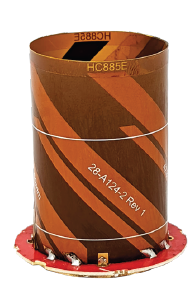
The HC885EXF embedded helical antenna. (Photo: Tallysman)
Tallysman Wireless has added the housed HC885XF and embedded HC885EXF dual-band eXtended Filtering (XF) antennas to its line of helical antennas.
The antennas receive GPS/QZSS L1/L5, GLONASS G1/G3, Galileo E1/ E5a/b, BeiDou B1/B2/B2a and L-band corrections services.
Historically, dual-frequency antennas and receivers commonly supported GPS L1 and L2 and GLONASS G1 and G2. In recent years, GPS, GLONASS, Galileo, BeiDou and NavIC have added GNSS signals in the L5 frequency band (1160-1217 MHz).
As a result, the new dual-frequency GNSS standard has become L1 and L5.
Tallysman’s new HC885XF antenna has been tuned to provide optimal support for the entire L1/G1/E1/B1/L-band correction and L5/G3/E5/B2 bands.
The radio frequency spectrum has become congested worldwide as many new LTE bands have been activated, and their signals or harmonic frequencies can affect GNSS antennas and receivers. In North America, the planned Ligado service, which will broadcast in the frequency range of 1526 to 1536 MHz, can affect GNSS antennas that receive space-based L-band correction service signals (1539-1559 MHz). New LTE signals in Europe [Band 32 (1452-1496 MHz)] and Japan [Bands 11 and 21 (1476-1511 MHz)] have also affected GNSS signals. Tallyman’s XF models mitigate the effects of these new signals.
The Tallysman HC885XF housed helical antenna weighs ~42 g and is enclosed in a robust, military-grade IP67 plastic enclosure. The antenna base has an integrated SMA connector, a water-proofing O-ring, and three screw holes to enable secure attachment.
Tallysman’s embedded HC885EXF helical antenna weighs ~8 g. It is easily mounted with an optional embedded helical mounting ring, which traps the outer edge of the antenna circuit board to the host circuit board or any flat surface. An MCX connector is installed in the base of the antenna.
Tallysman HC885EXF and HC885XF antennas are suitable for a variety of applications, including lightweight unmanned autonomous vehicle navigation (land, sea, and air), land survey devices, automotive positioning, timing and other precise-positioning applications.
Individuals and organizations wishing to comment on the appropriateness of any of the members of that team or on any other aspect of this study have until Sept. 19.
The April 2020 decision by the FCC has generated significant controversy and opposition within the public and Congress. This resulted in, among other things, seven separate petitions for reconsideration being filed, all of which are still pending, and several provisions in the National Defense Authorization Act for 2021. One of those provisions requires the Department of Defense to sponsor a study of the technical assumptions and analyses that went into the FCC’s decision to allow Ligado Networks to operate.
According to the post on the National Academies website, the study will consider:
Which of the two prevailing proposed approaches to evaluating harmful interference concerns — one based on a signal-to-noise interference protection criterion and the other based on a device-by-device measurement of the GPS position error — most effectively mitigates risks of harmful interference with GPS services and DOD operations and activities.
The potential for harmful interference from the proposed Ligado network to mobile satellite services including GPS and other commercial or DOD services including the potential to affect Department of Defense (DOD) operations, and activities.
The feasibility, practicality, and effectiveness of the mitigation measures proposed in the FCC order with respect to DOD devices, operations, and activities.”
This announcement is the first significant public step for the effort which is expected to take approximately 12 to 18 months. Sources say that there will likely be public and classified versions of the report. The classified version is likely to take significantly longer to compile.
Proposed study team members
Chair: J. Michael McQuade
Members:
Jennifer Lacroix Alvarez
Kristine M. Larson
John L. Manferdelli
Preston F. Marshall
Y. Jade Morton
Richard Reaser, Jr.
Jeffrey H. Reed
Nambirajan Seshadri
Stephen J. Stafford
Staff Officer: Jon Eisenberg
Individuals and organizations wishing to comment on these proposed team members may do so through the project web page.
The bipartisan RETAIN GPS and Satellite Communications Act seeks to compensate all GPS and satellite communications users harmed by the April 2020 Ligado Order from the FCC.
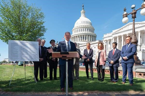
Sen. Inhofe introduces the RETAIN GPS and Satellite Communications Act. (Photo: RNTF)
On June 23, Senator Jim Inhofe (R-OK) held a press event on the lawn of the U.S. Capitol. There he announced his introduction of the “Recognizing and Ensuring Taxpayer Access to Infrastructure Necessary for GPS and Satellite Communications Act” or the “RETAIN GPS and Satellite Communications Act.”
Inhofe is the ranking member of the powerful Senate Armed Services Committee. That committee’s chair, Senator Jack Reed (D-RI), is a co-sponsor, as are Senators Tammy Duckworth (D-IL) and Mike Rounds (R-SD).
The bill has several provisions, all of which are aimed at ensuring anyone using the frequencies the Federal Communications Commission (FCC) allocated Ligado in April 2020 will compensate all GPS and satellite communications users that are harmed.
This would pose a significant increase in financial liability for Ligado. Under the current FCC order, is only responsible for reimbursing the federal government for costs to modify systems and replace equipment.
Many see this provision as manifestly unfair. “The FCC is requiring Ligado to pay damages to federal equipment, so the company should also pay damages to equipment owned by ordinary Americans,” said George Washington University economics professor Diana Furchtgott-Roth.
“With Ligado 5G transmitters overwhelming GPS signals, pipeline maintenance and systems operations would be affected. Plus, private pilots might find that navigation technology does not operate, joggers might find that their health trackers ceased to work, and firefighters might not be able to get to their destinations.”
She estimates the cost of damage to non-federal entities to run into the billions of dollars. Furchtgott-Roth previously served as and Acting Assistant Secretary for Economic Policy at the Department of Treasury and Deputy Assistant Secretary at the Department of Transportation.
The FCC decision was, and remains, controversial. Seven different petitions to reconsider were filed by various organizations and coalitions, including the National Telecommunications Information Agency (NTIA) on behalf of the entire executive branch.
The FCC has yet to respond to any of the petitions, though it has denied requests to stay its order pending resolution of concerns.
Inhofe has long been concerned about the FCC’s action. As then-chair of the Senate Armed Services Committee, he held hearings, issued press releases, and made public statements aimed at Ligado’s financial backers and potential backers. All warn of disastrous consequences should Ligado’s plan for transmissions in the bands adjacent to GPS be put into operation.
Inhofe also ensured several provisions were included in the 2021 National Defense Authorization Act (NDAA) that addressed the FCC’s action. These include:
A requirement for the Department of Defense (DOD) to estimate and report to Congress the cost of damage to department systems as a result of the FCC order.
Prohibiting use of department funds to upgrade or modify military equipment to make it resilient to interference caused by broadcasts in the spectrum allocated (the FCC order requires this to be funded by Ligado).
Prohibiting DOD from contracting with any entity using the frequency bands allocated to Ligado unless the Secretary of Defense certifies the use will not interfere with GPS services.
Requiring the Secretary of Defense to contract with the National Academies of Sciences, Engineering, and Medicine for an independent technical review of the FCC order.
Dana A. Goward is President of the Resilient Navigation and Timing Foundation. The foundation has petitioned the FCC to reconsider its decision regarding Ligado Networks.
In letters sent today to the White House and U.S. Congress, more than 90 organizations representing a broad range of industries urged President Biden and members of Congress to set aside the Ligado Order approved during the previous administration.
The industries urged the president and lawmakers to work with the Federal Communications Commission (FCC) to “stay and ultimately set aside the Ligado Order,” saying that it “poses significant threats to the reliability of GPS for millions of Americans.”
“The risk to American lives and to the American economy are simply too great,” the group wrote in the letters.
“A year ago today, the FCC made the dangerous and misguided decision to allow Ligado Networks to operate a terrestrial network on frequencies adjacent to GPS despite threats to GPS reliability and the concerns of Congress and virtually all federal agencies that rely on GPS to protect our national and economic security,” said Dale Leibach, spokesman for the Keep GPS Working Coalition.
“We are hopeful that under the new administration, something can be done to stop Ligado from proceeding with its plan and we are extremely thankful to the many members of Congress and government officials who have rightly pointed to the very harmful impact this decision will have on countless consumers, farmers, ranchers, pilots, boat owners, surveyors, engineers and construction companies if it is not reversed,” Leibach said.
If there were ever a time to sit back and reflect on things that have happened in the last calendar year, the year 2020 will be the poster child for the next few generations (at least I hope so…). Because of several things that have happened worldwide in the profession of surveying, let us take this opportunity to look back on a year that was filled with new equipment, emerging technology and government interaction that will have a lasting effect on our surveying horizon.
Look at all of these wonderful toys
There was no shortage of introductions to new equipment for surveyors, especially in the GNSS receiver market. While combining GNSS capability with an inertial measurement unit (IMU) is not a new concept, the Big Three of Leica, Topcon and Trimble introduced new or upgraded versions of their latest receivers taking full advantage of the technology. The benefit of having the IMU integrated within the receiver is the ability to “tilt” the instrument yet having the calculated position remain at the tip of the receiver pole.
Photo: Trimble
Leica, however, takes the tilting feature to another level with an integrated camera that allows for close-range photographs to capture additional information through remote sensing software. The data extracted from the photographs can be simple points (and verified in the data collector while in the field) or point clouds that can be integrated into larger projects through the Leica office software.
These new receivers, along with upgraded models from smaller providers, have opened the GNSS market to many more users well beyond surveying. The combination of more capability through advancing satellite constellations, more robust processors, and reduced receiver sizes have continued to drive GNSS positioning growth.
Photo: Hexagon
Manufacturers are using these increased capabilities to promote better coverage to obtain positions under heavier canopies and less likelihood for multi-path errors. While I remain cautious about these claims of increased coverage, I also maintain that with any tool, measurements and positions must have proper and appropriate validation. However, I am impressed that the technology continues to advance with what was once seen as only applicable to the open sky.
Not all the new technology has emerged through the GNSS receiver product lines; several less visible but valuable features have been introduced within the robotic total station lines. The manufacturers continue to push their equipment to react faster, stay locked on targets better, and provide more reliable solutions to data collection and construction layout. Data collectors continue to evolve with larger screens and more software capability, with some rivaling their desktop counterparts.
As cellular networks grow in both size and speed, more direct connections between field and office are being made with faster response time to data transfer. Data collection can take place in the field and be analyzed by an office technician as it happens. Go another step further and add an aerial background image to the collector and/or the office computer; now each team member can confirm that the information being collected is sufficient for the project in real-time.
Another technology that continues to advance is remote sensing, with more devices being introduced and with increased software capabilities. Besides new and upgraded offerings from the surveying-based manufacturers, other device makers are introducing products that offer remote sensing to the masses. The biggest news in this arena was the announcement from Apple that the iPhone 12 Pro and iPad Pro would come equipped with lidar sensing technology along with incredible photographic capabilities.
While there does not seem to be specific apps developed for surveyors at press time, it is safe to say that there will be in short order. It is also a safe bet that having this capability on a mass-produced device will put pressure on the surveying and mapping equipment manufacturers to be cost-competitive on their own proprietary devices or risk losing out on market share.
UAVs continue to be the fastest-growing segment of the surveying industry. More vehicle, sensor and software providers are coming to market to offer the surveyor a variety of choices. DJI continues to lead the way in the multi-rotor category with new products and sensors while other manufacturers are embracing the fixed-wing and vertical take-off and landing (VTOL) platform for greater range.
Just like their automobile brethren, flight time continues to increase with discoveries of new battery compositions and weight considerations. The sensor market is expanding to include more affordable lidar units, as well as new technology in multispectral identification, gas and noxious odor detection, and much more.
Software developers, too, continue to refine and expand the features found in their geospatial offerings with advancing technology and programming. Google Maps is the default navigation app for many smartphone users, but like anything utilizing GNSS in dense urban areas, the users find themselves bouncing all over the map.
2020 did not see any shortage of government action for the surveying and mapping community. As with many topics that come out of the nation’s capital, it should not surprise anyone that several of the items considered by the federal government and its agencies were not without controversy.
The biggest and most controversial item continues to be the advancement of Ligado (formerly known as LightSquared) and the development of new communication technology that has been shown to interfere with the GPS transmission bands. The Federal Communications Commission (FCC), led by Chairman Ajit V. Pai, has been successful in holding off all challenges to the new technology including ones from current legislators and defense staff.
The main argument from the FCC is the value of the system as a provider of 5G communication to a substantial portion of the country. They also make statements that safeguards are being taken to protect the GPS spectrum, yet many studies from outside parties show otherwise. The fight over this spectrum will continue into 2021, and it will be interesting to see if the new administration will see things from a different perspective.
Several items to come out of Washington, D.C., late in the year were the blacklisting of DJI and the announcement of new UAV rules for flying over crowds and at night. With the DJI ruling, it is now illegal for government agencies to use the Chinese-based UAV maker for any activities. Based upon the significant market share of DJI, one can only wait to see how this situation plays out, and if the ban is expanded to private individuals.
The FAA announcement on the new UAV flight rules was surprising but not unexpected. In addition to establishing flight limitations over crowds and at night, it also established a timeframe for requiring most UAVs to transmit a Remote ID during flight for determining who is flying and where they are located. Compliance with these rules will be required by the manufacturer within 18 months and by UAV pilots within 30 months.
The National Geodetic Survey (NGS) has also been busy during 2020 preparing new datums and specifications for upcoming changes to the National Spatial Reference System (NSRS). Among those changes are the deprecation of the U.S. Survey Foot, beta testing of the latest geoid model (GEOID20), and new software tools for transforming positional information between datums. It was also announced that the release of the modernized NSRS scheduled for 2022 was being delayed.
NGS continues to work with each state on the improved state plane coordinate systems and/or low distortion projection systems that will be implemented with the new NSRS rollout. All these efforts have been a monumental task (no pun intended) and kudos go out to NGS for getting everything this far.
Pandemic 2020 (No, this is not a movie or a drill)
As we covered in the May 2020 Survey Scene article, COVID-19 was unlike anything we had been exposed before. Initial reports tried to relate the virus to typical influenza and the H1N1 outbreak in 2009, but the rapid transmission and sheer volume of cases (and deaths) mostly eliminated those comparisons.
From a technical viewpoint, the situation with COVID-19 has no bearing on GNSS operations and positional establishment. An operator of a GNSS receiver, and the business of surveying, is greatly affected by the presence of COVID-19 so it does deserve more than a brief mention in a retrospective look at the past year. This virus upended everything; from data collection and survey-related activities to computations and final drafting, the business of surveying felt the effects.
Once the initial challenges of keeping everyone safe were addressed, it became a year-long marathon of providing surveying services to clients that did not let the pandemic hinder their progress. Field crews were under significant pressure to maintain social distancing at every turn, while office staff dealt with home Wi-Fi and lack of access to normal business conditions such as large-format printing.
Video calls and instant messaging quickly became the norm, yet also became the scourge of dealing with the day-to-day operations of a business. The “normal” work/life balance with families, school, and social activities has disappeared and a more challenging approach has replaced that balance. Fingers are crossed that people will adhere to social distancing protocols and can get vaccinated as soon as possible so we can resume a portion of our previous lifestyles.
However, we do have several positive things to take away from the challenges of the pandemic that will make our lives better going forward. Our reliance on geolocation became quite clear throughout the pandemic. Whether it is using it to help establish contact tracing or as simple as having a delivery service bring necessities straight to your door, almost everyone relies on geolocation for helping guide them through the “new normal.”
We are using our smartphones to track our family members and help keep them out of harm’s way. It would be hard to imagine how much more difficult this situation would have been before cellphone and GNSS integration.
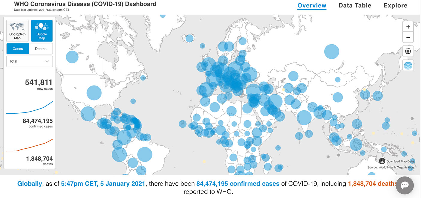
Graphic: World Health Organization (https://www.who.int/emergencies/diseases/novel-coronavirus-2019).
Another leap forward that most people are not aware of is the publicizing of GIS dashboards and incredible analysis of the geolocation of people worldwide. While GIS dashboards have been in existence for many years, it is only now that the public has paid attention to the vast information available to them.
From providing numbers of cases to graphically depicting “hotspots” across the world, these dashboards are full of useful information to help people understand the size of this pandemic, the places where mitigation is working, and where additional restrictions are being put in place to help reduce the spread of COVID-19.
The ability to merge geolocations with physical conditions and situations into a real-time mapping solution can help reduce the spread of the virus. By combining GNSS technology with advanced computing power and data storage, the power of GIS has been brought to the front page of public agencies and news sites.
While we still enjoy watching movies with superheroes, the true heroes during this pandemic are the frontline health workers, first responders and data analysts/programmers who bring us this timely information quickly. A hearty thank you goes out to all of them for their efforts and dedication to the cause.
In memoriam
Photo: GPS World staff
The year 2020 also brought losses to every corner of the world and the surveying community was not spared. There are very few individuals we call pioneers in the surveying industry, so to include Dr. Javad Ashjaee among that group is no small feat. His contributions to the surveying profession helped turn every practitioner into a geospatial information provider.
From his early days at Trimble pioneering the commercial-grade receiver to creating his company at Ashtech and embracing GLONASS with GPS, he continued to expand the capability of the GNSS receiver. Many surveyors today only know his name through his latest company, Javad GNSS, and the unique line of receivers and measuring devices and their distinctive green color.
Cover photo: Ed Koziarski
Dr. Ashjaee was a big part of the GNSS revolution, so next time you starts up their receiver to collect survey data, take a moment to thank him. It was my pleasure to meet and interview him at the 2017 Intergeo trade show in Berlin to talk about his product line. I was also able to test-drive his incredible GNSS products for a feature in GPS World magazine on using smartphones for data collectors.
To say the man will be missed is a big understatement and I wish his family well on continuing his company and tradition of making great leaps in technology.
Ligado application will bring harmful interference to critical technologies
U.S. Representatives Glenn “GT” Thompson (R-PA), Collin Peterson (D-MN) and James Comer (R-KY) sent a letter Nov. 24 to House Leadership and the Appropriations Committee requesting language delaying implementation of the April 2020 Federal Communications Commission (FCC) order granting Ligado’s application to deploy a terrestrial nationwide network to provide 5G services.
In July, the Congressmen expressed serious concerns surrounding the FCC’s decision, questioning the reliability of GPS for millions of Americans, especially the farmers and ranchers who rely on this technology each and every day for precision agriculture.
“Investments in 5G and GPS are critically important to the American economy, especially the agriculture industry,” said Rep. Thompson. “However, the Ligado decision will have negative impacts on GPS and satellite communications, hindering reliability and slowing progress on current and future innovation of this technology. I urge my colleagues in leadership and on the Appropriations Committee to delay this harmful implementation.”
“There is no room for error when discussing safety and reliability of service for GPS signals. Aviation, agriculture, and other vital industries rely on consistent signal quality,” said Rep. Peterson. “Safety and national security issues remain unresolved under the current order, which is why it is vital that we delay Ligado’s 5G deployment.”
“Our farmers are vitally important to providing the food supply for America and the world, and a reliable GPS network is critical to precision agriculture,” said Rep. Comer. “I understand the importance of improving telecommunications operations, especially for advancing rural economies. But critical tools like GPS technology must not be disrupted, as our farmers are essential workers who must have the tools they need to do their jobs. It is our responsibility as policymakers to fight to ensure that federal agency decisions do not negatively impact Americans’ livelihoods. It is my hope that this language to delay implementation of the Ligado order will be addressed in a year-end appropriations package.”
“The FCC’s ill-advised decision on the Ligado matter risks serious negative impacts to the communication of real-time environmental data from satellites that are a primary tool by the American Weather Enterprise in the creation and timely dissemination of accurate weather forecasts and severe weather warnings,” said Jonathan Porter, vice president and general manager, AccuWeather. “Any degradation in these communications will endanger critical economic and societal benefits for weather-sensitive businesses from family farms to large corporations and reduce the ability for people to stay safe during severe weather.”
“GPS is critical to precision agriculture applications that deliver centimeter level accuracy that enables farmers to maximize crop yields while lowering costs and environmental impact,” said Dale Leibach, spokesperson for the Keep GPS Working Coalition. “The FCC’s decision represents a sweeping governmental and regulatory assault on farmers who are already facing unprecedented challenges including severe weather, low commodity prices, and supply chain vulnerability as a result of COVID-19. The order must be stopped, and Congressman Thompson and Chairman Peterson have been relentless champions for farmers in the effort to reverse the FCC’s decision.”
“GPS technology is a key component to precision agriculture, a sustainable practice that benefits both farmers and the environment,” said Dennis Slater, president of the Association of Equipment Manufacturers. “The recent Ligado decision will hinder these hard-working Americans from being able to properly utilize the tractors, combines, harvesters, and other modernized equipment we manufacture. We urge House leadership to include language to delay Ligado implementation. Farmers are already struggling due to the pandemic, natural disasters, and other factors. Let’s not add to their economic pain.”
“Protecting the public interest and our economic security requires defending and protecting critical GPS, satellite communications services, aviation navigation equipment and essential weather apparatus. But Ligado’s reckless venture puts that at risk,” said Jordan Hassin, director, Corporate Communications, Public Relations, and Industry Affairs for Iridium Communications. “As more users of services in the L-band discover the threat Ligado presents to their livelihoods, more of our policymakers are recognizing that they need to demand this threat be addressed either in the NDAA or in an end of year spending package. This is not just a defense issue. We are grateful to the leaders of the Agriculture Committee for adding their voices to the call for a change to the FCC’s misguided and destructive decision.”