HERE Technologies has expanded its partnership with Precisely, a data integrity company, to provide accurate and reliable location intelligence for business use cases across industry sectors.
The partnership builds upon location intelligence capabilities within the Precisely Data Integrity Suite, giving companies deeper analysis, validation, and governance of their location data.
Through the partnership, HERE and Precisely use machine learning (ML) and artificial intelligence (AI) to collect and analyze location data, creating real-time updates that guide important business decisions like property management and analysis, among other business operations. The companies are working together to provide complete and accurate datasets to drive AI-powered intelligence for businesses.
The Precisely Data Integrity Suite delivers the trusted location intelligence that organizations need to power critical business decisions. The suite verifies, standardizes, and geocodes address data with high levels of accuracy and enriches it with robust contextual datasets. This combination of accuracy, consistency, and context helps businesses understand where things happen and why, enabling smarter risk assessment, optimized service delivery, and more targeted customer engagement. With governance and transparency built in, the Data Integrity Suite ensures location data is AI-ready and reliable for even the most regulated industries.
HERE’s Privacy Charter reinforces the company’s commitment to promote responsible privacy and security practices, including data minimization and anonymization. The company has a robust portfolio of certifications in security, privacy and cloud governance, including ISO 27001, SOC 2, TISAX, HITRUST r2, CSA STAR and ISO/IEC 42001, the first international standard specifically designed to guide organizations in managing AI systems responsibly.
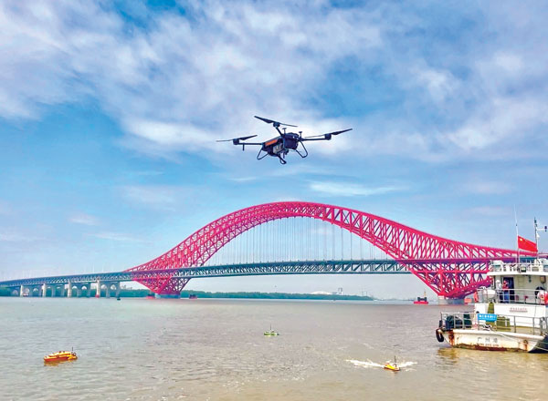
Tactical-grade IMUs enable UAVs to achieve the same locational accuracy as ground-based systems. (Photo: CHC Navigation)
We often hear the anecdote about an early lidar scanner that could take a shot every few seconds, yet it held a value proposition for certain applications. As the capabilities of successive mapping and surveying systems change rapidly, so does the conventional wisdom about which are best for various applications. Transportation corridor mapping — be it for improvements design, as-built surveys, asset management or digital twinning — has always been a balancing act between precision and efficient large-scale data capture.
“I remember 15 years ago, during my university time, the scanner was the size of a dining table,” said Andrei Gorb, segment manager for mobile mapping and unmanned aerial vehicle (UAV) systems, CHCNAV. At the top end of the mapping food chain were terrestrial scanners, targets, bore sighting, and registering point clouds mostly manually. As cumbersome and time-consuming as the legacy tools and methods were, these options still offered efficiency gains compared to conventional surveying with total stations. Then a decade ago, mobile-mapping systems began to change that paradigm. Departments of transportation found that mobile-mapping systems could meet their requirements for many design projects, and certainly for asset inventory and management. Unmanned aircraft systems (UAS) were not quite there yet.
The tech used depended on the application. “First, there was road maintenance, to understand the road condition,” Gorb said. “Previously, UAS did not meet the high requirements: centimeter in absolute and millimeter in relative. We now have mobile-mapping solutions, from us and other suppliers, that can be in the 8-9 mm absolute accuracy range on short road surfaces.” Yet for many transportation applications, the absolute accuracy may not be as important as the relative precision. This is where years of development in UAS has made the difference.
CHCNAV was not alone in recognizing that the gap was closing, and the company planned ahead. “Previously, UAS would fly for under an hour, and were mostly carrying cameras or early lidar, which was not suitable for highways,” Gorb said. “A few years of development, and we see it is practical to meet requirements with UAS flying between 50 and 100 meters — in Europe, many local regulations forbid flying above 120 meters anyhow.” Gorb attributes the advances to lidar sensors that UAS can carry. These sensors have become much better and less expensive. Plus, platforms like vertical-take-off-and-landing (VTOL) systems can stay in the air much longer.
The UAS boom of the past 10 years saw the dominance of consumer-prosumer market UAV platforms becoming quite commoditized, with certain vendors gaining majority market share. CHCNAV, instead, sought to develop enterprise solutions, for both mobile and UAS systems — large-platform rotor, fixed-wing and VTOL platforms. The company offers an amalgam of hardware and software, from Riegl scanner heads on some of their mobile-mapping systems to Honeywell inertial navigation systems (INS) for some of their UAS solutions.
Gorb echoes what we hear from many mapping practitioners, saying ground-control points are not as necessary in the densities required for legacy mobile and UAS mapping. He explained that everything from strip adjustments to processing of GNNS/IMU data has tightened both precision and accuracy. “We have a tactical-grade IMU in both our mobile mapping and UAS solutions, for a high-end trajectory,” Gorb said. “So, it means that we can get the same high-accuracy point cloud for highways from the ground and the air perspectives.”
What is the most promising approach to increasing the location accuracy of smartphones?
Ismael Colomina
“In addition to the use of increasingly available augmentation services, such as Galileo’s free High-Accuracy Service (HAS), I see two development directions that may help, particularly in the context of positioning in urban areas where smartphones are most used. One is the use of 3D city models — in general, 3D geoinformation — to compensate for multipath, non-line-of-sight and occlusion effects. The other is to use signals that are robust against those effects, which today are only available in geodetic-grade receivers.” — Ismael Colomina, GeoNumerics
For the navigation of autonomous vehicles, will GNSS become essential, or will it be relegated to a secondary role by robotic navigation methods?
John Fischer
“The PNT solution cannot be from a single source because autonomous navigation requires high integrity. Therefore, it’s not that GNSS will be relegated to secondary status, it’s that no one method will be primary. An intelligent fusion of diverse sensors —including GNSS — will provide the PNT solution along with an integrity metric that safeguards operation. The various sensors must agree. If they don’t, no trust can be put into the solution and autonomous navigation will cease. The definition of a new integrity metric that quantifies this trust level is needed.” — John Fischer, Orolia
Ellen Hall
“Because GNSS provides high precision and widely available PNT, it will continue to be a critical component in navigation while working with computer vision, inertial measurement units (IMUs) and lidar through sensor fusion. As a secondary component, GNSS serves a vital role for localization and validation.” — Ellen Hall, Spirent Federal Systems
Rx Networks, Inc., a GNSS data services company, announced the availability of TruePoint.io precise location services on Qualcomm’s Snapdragon 8 Gen 1 and Snapdragon 888 5G Mobile Platforms. TruePoint.io integration empowers Android smartphones to achieve enhanced location accuracy down to a meter or less – something previously only seen with high-grade receivers.
With enhanced location accuracy, superior user experience for such use cases as rideshare, micro-mobility, health and fitness and lane-level requirement applications can now be realized. The enablement of reliable meter-level location accuracy on mobile phones will unlock the potential of location-based services and open the door for other innovative and unique use cases. The limitations of a standalone GNSS chipset no longer become the barrier to pursuing the vision of connected ecosystems reliant on location.
TruePoint.io enables scalable, reliable, and affordable ways to leverage high-precision location on smartphones powered by Snapdragon mobile platforms. Rx Networks’ global coverage, including China, gives smartphone OEMs the advantage of a single GNSS corrections vendor that works across all continents.
“Rx Networks provision of GNSS data services for accurately positioning smartphones using Snapdragon mobile platforms will enable meter-level location accuracy almost everywhere smartphones can connect to a terrestrial cellular network,” said Francesco Grilli, Vice President, Product Management at Qualcomm Technologies, Inc. “Meter-level location accuracy is poised to improve smartphone user experiences and spur the creation of exciting and innovative services for businesses and consumers.”
TruePoint.io is scheduled to be available on Snapdragon mobile platforms initially in China in Q4 2022 and globally in H1 2023.
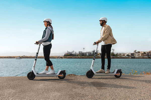
Scooter company Bird and u-blox have jointly developed a new Smart Sidewalk Protection system to help prevent shared scooters from operating on city sidewalks. It uses the u-blox ZED-F9R, a dead-reckoning module that fuses GNSS and sensor data, delivering centimeter-level location information in any condition. This allows the system to monitor whether a Bird e-scooter is being operated unsafely, such as on a sidewalk or speeding. Using Bird data, the companies co-developed a version of the ZED F9R module tailored to meet the needs of the shared micromobility industry.
The dual-band ZED-F9R GNSS receiver supports up to eight times more satellite signal types and four times more constellations (GPS, Galileo, GLONASS and BeiDou) than typical solutions. The module processes real-time vehicle data, including wheel speed, IMU sensor data (including acceleration and heading), and real-time kinematic data that corrects for ionospheric interference. The technology is also optimized for e-scooters by applying dynamic models matching their movements.
To turn this sensor-fusion module into its Smart Sidewalk Protection system, Bird developed a five-step process for creating sidewalk maps with centimeter accuracy. It starts with a geofence outline constructed from satellite imagery or city GIS data. Bird then uses surveying equipment to measure the location of three city landmarks. Only a few measurements are needed for each city. Once the landmarks have been identified, they compare their location to the satellite imagery to determine offsets and rotations and use them to shift and transform each of the original geofence outlines. Finally, they pre-load the updated geofence outlines onto Bird vehicles to eliminate latency. When combined with the hyper-accurate location measurements provided by Bird’s sensor-fusion module, they can detect and respond to sidewalk riding almost instantly, according to Bird.
The micromobility module is being piloted in Milwaukee and San Diego. Madrid will be Bird’s first pilot city in Europe, with plans for a broader roll-out slated in 2022.
By William Roberts, Joshua Critchley-Marrows, Marco Fortunato, Maria Ivanovici, Nottingham scientific Ltd., Karel Callewaert, Thiago Tavares, VVA Brussels, Laurent Arzel and Axelle Pomies, Telespazio France
The FLAMINGO initiative is developing the infrastructure, solutions and services to enable use of accurate, precise GNSS in the mass-market, operating predominantly in an urban environment. Whilst mass-market receivers are yet to achieve accuracies below one meter for standard positioning, the introduction of Android raw GNSS measurements and the Broadcom dual frequency chipset present such an opportunity.
FLAMINGO will enable high-accuracy positioning and navigation information on devices such as smartphones and internet of things (IoT) devices by producing a service delivering accuracies of 50 cm (at 95 percent) and better, employing multi-constellation, PPP and RTK mechanisms, power consumption optimisation techniques.
Whereas the Galileo High Accuracy Service targets 10-cm precision for professional users, FLAMINGO targets 50-cm precision for consumers. With accuracies of a few decimetres, a range of improved and new applications in diverse market sectors are introduced, including, but are not limited to, mapping and GIS, autonomous vehicles, augmented reality environments, location-based gaming and people tracking.
To obtain such high accuracies with mass market devices, FLAMINGO must overcome several challenges which are technical, operational and environmental. This includes the hardware capabilities of most mass-market devices, where components such as antennas and processors are prioritised for other purposes. We demonstrate that, despite these challenges, FLAMINGO has the potential to meet the accuracy required. Tests with the current smartphones that provide access to multi-constellation raw measurements (the dual-frequency Xiaomi Mi 8 and single-frequency Samsung S8 and Huawei P10) demonstrate significant improvements to the PVT solution when processing using both RTK and PPP techniques. Check out more information here.
Growing awareness of the vulnerabilities of GNSS signals — weak, unencrypted and easily jammed or spoofed — have made GNSS less important to steering the driverless vehicle. What’s up with that?
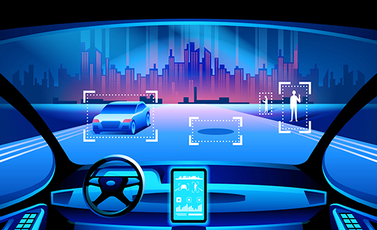
Extensive visual map databases are being created that, when coupled with cameras, radars and lidars on the vehicle and processed by artificial intelligence (AI) algorithms, enable the driverless car to be steered much the way humans drive. Pattern recognition processing in the vehicle allows it to “read” street signs and recognize landmarks, registering its position on the map.
This is the way a person drives in his or her home town, where they always know their orientation and don’t need GNSS. The AI processing “brain,” with access to huge map databases, either through local storage or a network connection, will always be in its familiar home environment: continuously knowing its own position and properly oriented for navigation.
So, will GNSS become unnecessary in the car of the future? Probably not.
First, no one method of navigation is foolproof, and today, GNSS is our primary method of navigating our cars. It is a cost-effective, accurate way of determining position in real time, and with the integration of inertial navigation sensors to handle cases when GNSS is intermittently unavailable, it is improving.
Second, it is not just the car itself that needs to know its location for navigation, but also others outside the car. Ride-sharing apps like Uber and Lyft, car-sharing, usage-based insurance apps, dynamic toll charging, and parking apps all depend on knowing where the car is at all times. GNSS offers sufficient accuracy for all these apps by providing location coordinates. Therefore, a GNSS receiver will most likely remain in the car.
The case for jamming and spoofing
Recall, however, that one of the weaknesses of GNSS is its open, unencrypted format. It is becoming increasingly easier to spoof these signals. Car-sharing, usage-based insurance and dynamic toll charging apps all create a monetary incentive for fraud that can be implemented with a spoofer. For example, a car in a car-sharing network can report a fake position indicating that it is safely parked in a secure area — while in reality, a thief is busy driving it away.
(Image: Orolia)
Let’s assume that all wireless connections to and from the car are secure. This is a reasonable assumption, although recently there have been demonstrations of carjacking via unsecure remote links. Standard SSL encryption, similar to what is used to enter credit card information on the internet, works well here. We have both the awareness and the technology now to prevent such carjackings from ever reoccurring.
However, even if communication links are secure, a GNSS spoofer in the car can fool the GNSS receiver into reporting a fake “safe” position right as it is being stolen. The same is true for insurance or toll apps. And the fraud does not have to be sophisticated. A simple, low-cost jammer can deny proper position just long enough to skirt payment. A secure location method is needed.
Other signals for localization
What would an ideal signal for localizing a driverless car look like?
It needs to be much stronger than GNSS so it is not easily jammed.
It needs to be encrypted so it cannot be spoofed.
It must be ubiquitous, available worldwide.
It must be reliable and robust — with 99.999% availability or better.
It must be practical and priced for the mass-market automotive application.
Though accuracy is always important, the signal used for localization does not have to be as accurate as GNSS is today. Accuracy to 10s of meters is sufficient for all these applications needing fraud protection since it would not be used for steering the car, but rather, only localization. It can also be used in tandem with GNSS to authenticate a reported position when a GNSS signal is available.
Such a signal is available today, worldwide: STL (Satellite Time and Location). Carried on the Iridium satellites, it is a special purpose signal that is more than 30 dB stronger than GNSS and encrypted for anti-spoof protection. Decoding of this signal is available via a subscription model to users.
Here’s how it would work using a car-sharing example. A group of people subscribe to a car-sharing service that provides X number of cars to serve Y number of people, where X is less than Y. The service optimally schedules people when and where a car will be available. The service provider needs to know the whereabouts of the cars at all times to maximize utilization of the fleet, so every car has a GNSS receiver in it.
But to ensure the authenticity of these reports, they also have a secure localization receiver. This receiver is assigned a unique ID that is authorized to decode the encrypted signal. (Eventually, we expect this receiver and GNSS to converge into one device much the way multi-GNSS receivers operate today).
If a position report does not agree with the authentic localization report, the fleet manager can act to recover the car immediately. Insurance providers who cover secure localization-equipped cars would also give preferential rates as an anti-theft device.
(Image: Pavel Vinnik/Shutterstock.com)
Could PRS do it?
The new Public Regulated Service (PRS) from Galileo is encrypted and could provide a similar level of authentication protection, if made available. However, it is still a weak GNSS signal that can easily be jammed. Of course, any signal can be jammed, even one that is a thousand times stronger than GNSS.
However, given the robust nature of a very strong signal, the managing system that is monitoring the cars — the insurance, toll or car-sharing system, for example — can alarm upon the loss of positioning information. Such alarms on a GNSS-only car would be frequent and often erroneous due to simple fades, yielding so many false alarms that it would render the monitoring system useless. But a loss of both the strong localization signal and GNSS would likely be considered suspicious and result in a valid alarm.
GNSS navigation is truly one of the great advances of the modern era, giving us precise time and location for any place in the world. Its two major weaknesses — that it is easy to jam and spoof — can be overcome by augmenting it with other stronger encrypted signals, such as STL, providing robust jam-resistance and positive authentication.