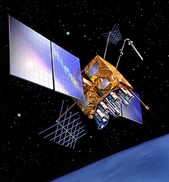
The Military Code (M-Code) Early Use (MCEU) contract will accelerate deployment of command and control of M-code capability to GPS IIR-M and GPS IIF satellites currently on orbit, as well as future GPS III satellites (like GPS III SV02 above). (Photo: Lockheed Martin)
The U.S. Air Force has awarded Lockheed Martin a $45.5 million contract to provide military code (M-code) early use (MCEU) capability to GPS.
MCEU will provide command and control of M-code capability to eight GPS IIR-M and 12 GPS IIF satellites on orbit, as well as future GPS III satellites, which the Air Force expects will begin launching in 2018.
MCEU is envisioned as a way to accelerate M-code’s deployment to support testing and fielding of modernized user equipment in support of the warfighter.
The U.S. Air Force’s MCEU contract directs Lockheed Martin to upgrade the existing Architecture Evolution Plan (AEP) Operational Control System (OCS), allowing it to task, upload and monitor M-code within the GPS constellation. The contract includes new software and hardware development that will be deployed in 2019 to worldwide ground facilities that support the Air Force’s GPS.
The AEP OCS — maintained by Lockheed Martin under the GPS Control Segment (GCS) Sustainment Contract — controls the 12 GPS IIR, 8 IIR-M and 12 IIF satellites in orbit today. The company has successfully implemented several recent projects to modernize and sustain the system for the Air Force.
U.S. Department of Defense units and university researchers gathered at Edwards Air Force Base, in California, to evaluate various aerial platforms in a degraded GPS environment. The week-long test event called Developmental Test Navigation Festival (DT NAVFEST) was the first large-scale program of its kind, according to James Cook, KC-46A project manager with the 418th Flight Test Squadron.
“DT NAVFEST was established to provide a locally more realistic GPS jamming environment in which aircraft platforms and unmanned aerial vehicles could evaluate their performance under a degraded GPS signal,” Cook said. “Other locations around the U.S. provide such environments, but having it locally allowed for direct program input and cost savings to customers by not having to deal with the logistics costs of deploying to those locations.”
Units that tested assets at Edwards included the Emerging Technologies Combined Test Force, the 411th, 416th, 419th and 461st Flight Test Squadrons, Stanford University, the University of Illinois, and the U.S. Army’s Special Operations Command. The GPS jammers and support came from the 746th Test Squadron at Holloman Air Force Base, New Mexico.
“Live GPS jamming data is extremely difficult for academic labs to obtain due to the complexity of working with the Federal Aviation Administration and regional first responders,” said Wei Lee, test safety engineer with the 412th Test Wing. “It is crucial that the Department of Defense support basic research and development that is ongoing in our nation’s top academic institutions. Many of the low-technology readiness-level projects will eventually migrate from academic labs to defense industry and military applications. Allowing the labs to participate on a non-interference basis is a win-win situation.”
The GPS jammers employed had a vertical reach of upwards of 30,000 feet.
The 746th Test Squadron from Holloman Air Force Base, New Mexico, provided an array of GPS jamming equipment and support for DT NAVFEST at Edwards Air Force Base. The jammers provided a degraded GPS environment for testing multiple aerial platforms throughout the week. Testing was done from 1 to 6 a.m. each day to minimize impact on the community and civilian air traffic. (Photo: U.S. Air Force/Cole Johnson)
IRNSS launch unsuccessful
A launch of a new Indian Regional Navigation Satellite System (IRNSS) satellite failed when the protective fairing did not separate. The 1425-kg satellite was expected to expand the existing seven satellites of the NavIC constellation. The launch vehicle PSLV-C39 lifted the satellite on Aug. 31.
The three phases of the launch went smoothly, but the heat shield that was supposed to be separated in the fourth stage could not be detached. IRNSS-1H was planned as a replacement satellite for IRNSS-1A.
The German Ministry of Defense selected Rockwell Collins’ NavHub navigation system to provide GNSS availability to a variety of its military vehicles.
The NavHub system serves as a next-generation GNSS- and Military-code (M-code)-enabled solution for the German Armed Forces.
Customizable for ground and maritime platforms, NavHub provides a variety of vehicle interfaces, meets the standards required by military vehicle operators, and allows users to receive data from multiple secure and open-service GNSS constellations to simultaneously confirm the navigational solution.
Access to multi-constellation GNSS and GPS M-Code will provide a significantly enhanced navigational solution over the current GPS-only solution.
Work under the contract will be performed in Rockwell Collins’ facilities in in Europe.
About the NavHub GNSS navigation system
NavHub (Image:: Rockwell Collins)
Based on Rockwell Collins Selective Availability/Anti-Spoofing Module (SAASM) GPS receivers, NavHub is strategically designed to meetfast-moving and demanding combat environments.
Through the use of dual-installed GNSS receivers, NavHub provides an assured navigational solution, interfaces and GNSS upgrade path to support modern operations platforms.
SAASM security (expansion to M-code), expansion to multi constellation GNSS
Extended platform interfaces, including Ethernet, USB and CAN
Extended performance in a jammed environment (i.e., 41 dB while tracking and 24 dB during initial acquisition)
“NavHub meets the critical mission need for accurate navigation support for fast-moving platforms and challenging environments,” said Claude Alber, vice president and managing director, Europe, Middle East and Africa for Rockwell Collins. “Our military GNSS receivers will provide significantly enhanced navigational capabilities to military vehicles and will mitigate terrain, forest and urban degradation as it will raise the number of satellites used from 28 to well over 100.”
The U.S. Air Force has awarded Lockheed Martin a $45.5 million contract to provide military code (M-code) early use (MCEU) capability to the Global Positioning System (GPS).
Part of the Air Force’s overall modernization plan for the GPS, M-code is an advanced, new signal designed to improve anti-jamming and protection from spoofing — as well as increased secure access — to military GPS signals for U.S. and allied armed forces.
MCEU will provide command and control of M-code capability to eight GPS IIR-M and 12 GPS IIF satellites on orbit, as well as future GPS III satellites, which the Air Force expects will begin launching in 2018.
MCEU is envisioned as a way to accelerate M-code’s deployment to support testing and fielding of modernized user equipment in support of the warfighter.
The Military Code (M-Code) Early Use (MCEU) contract will accelerate deployment of command and control of M-code capability to GPS IIR-M and GPS IIF satellites currently on orbit, as well as future GPS III satellites (like GPS III SV02 above). (Photo: Lockheed Martin)
The U.S. Air Force’s MCEU contract directs Lockheed Martin to upgrade the existing Architecture Evolution Plan (AEP) Operational Control System (OCS), allowing it to task, upload and monitor M-code within the GPS constellation. The contract includes new software and hardware development that will be deployed in 2019 to worldwide ground facilities that support the Air Force’s GPS.
“When people think of GPS, they often think of the satellites that provide the signals, but do not remember the important ground system behind it,” said Mark Stewart, Lockheed Martin’s vice president for Navigation Systems. “We recognize the ‘ground’ is critical for any major space mission constellation and we are proud that we can help the Air Force with this part of their GPS modernization plan.”
The AEP OCS — maintained by Lockheed Martin under the GPS Control Segment (GCS) Sustainment Contract — controls the 12 GPS IIR, 8 IIR-M and 12 IIF satellites in orbit today. The company has successfully implemented several recent projects to modernize and sustain the system for the Air Force.
In June, Lockheed Martin deployed the first of its state-of-the-art GPS Monitor Station Technology Improvement Capability (MSTIC) receivers at Cape Canaveral Air Force Station. The software-defined MSTIC system replaces 30-year-old hardware, positioning the Air Force to take advantage of commercial off-the-shelf technology enhancements in processing power, reliability and cybersecurity in the future. Six Air Force AEP OCS monitoring stations around the world will receive the MSTIC upgrade by the end of 2017.
In February 2016, the Air Force awarded Lockheed Martin the GPS III Contingency Operations (COps) contract to upgrade the AEP OCS with new capabilities so it could support the more powerful, next-generation GPS Block III satellites. The COps program passed a successful Critical Design Review milestone with the Air Force in December 2016.
Also in 2016, under the GCS contract, Lockheed Martin completed the commercial off-the-shelf upgrade No. 2 (CUP2) project — part of a multi-year plan to modernize the AEP OCS’ technology and enhance the system’s ability to protect data and infrastructure from internal and external cyber threats, as well as improve its overall sustainability and operability. CUP2 is now fully operational and managing the current GPS constellation.
Spirent Federal Systems, a provider of GPS and GNSS simulators, has begun developing MNSA-capable GNSS simulators for the Modernized Navstar Security Algorithm.
Spirent Federal is developing software that will support M-code using MNSA. M-code is an updated GPS military signal that is being rolled out as part of the modernization of the current GPS constellation.
GPS modernization began in 2000 when the GPS Selective Availability feature was set to zero. Since that time, the U.S. Air Force has been working on newer generation satellites that will transmit new civilian and military signals.
Until now, AES and SDS have been the only methods authorized to be used within a GNSS simulator to produce M-code.
Spirent Federal Systems has been a provider of AES M-code and SDS M-code capable simulators for many years, but as the long awaited MNSA M-code signals become available, Spirent Federal Systems will be making this option available to authorized users on the GSS9000 series simulator.
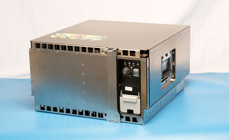
Harris Corporation delivered the first of 34 modernized receivers to support the GPS Next-Generation Operational Control System (OCX). They will receive the signals sent by the current GPS satellite constellation plus the new signals sent by the next generation GPS III — 13 military and civilian signals in all.
The receiver was shipped to the prime contractor, Raytheon Company, in Aurora, Colorado, after it passed a critical electromagnetic interference test, the first of many stringent qualification requirements. Though the receivers will be placed throughout the world, this first production unit will be installed in Aurora as OCX software development and integration continues.
OCX will replace the existing ground control system that receives signals from the 31 operational GPS satellites already orbiting Earth. Only OCX will be able to receive and decrypt all GPS III military and civil signals, however.
In addition to receivers, Harris has delivered 14 ground encryptors that will help protect the GPS signal. Harris also is providing critical software elements, which provide the fundamental navigation data to the GPS satellites and enable U.S. Air Force operators to better know and monitor the exact position and timing of the GPS constellation.
Risk Reduction Testing Completed for GPS OCX
Image: Raytheon
Raytheon reached a milestone in development of the GPS Next Generation Operational Control System (OCX), completing a series of Risk Reduction functional checkouts of OCX Block 1 capabilities, with a focus on OCX software.
This activity integrated iteration 1.5 of the OCX Block 1 Master Control Station with the GPS System Simulator and ran operational scenarios, representing the first end-to-end integration of available Block 1 capabilities.
The testing included GPS constellation management and sustainment, demonstrating OCX’s abilities for precision navigation and timing capabilities in a fully cyber-hardened environment.
The test also included running Kalman filters and generating GPS satellite navigation uploads. Future development will add to and expand capability to include both the civil and military modernized signals.
OCX’s development is delivered in “blocks,” with Block 0 comprising the Launch and Checkout System to take GPS III satellites into early orbit. Block 1 is built on Block 0 and delivers the full OCX capability, which allows the Air Force to transition from its current GPS ground controls to the modernized and secure GPS OCX master control station.
GPS OCX is being developed by Raytheon under contract to the U.S. Air Force Space and Missile Systems Center.
M-Code User Equipment Certified
L-3 Communications announced that its next-generation military code (M-code) GPS user equipment has successfully completed the final step in a government security certification process. L-3’s M-code GPS features advanced user equipment technology, increasing soldiers’ ability to resist enemy jamming and spoofing and performing significantly better in contested environments. The development and certification of this technology was performed under the Air Force Military GPS User Equipment (MGUE) program led by the GPS Directorate.
Certification review was performed by an independent government review team, with a focus on the security design of the L-3 GPS User Equipment. The goal of these new security standards is to further protect the integrity of the navigation and timing solutions and provide required safeguards for critical information inside GPS User Equipment.
Work on this project will be done by L-3 Interstate Electronics Corporation (L-3 IEC), which is part of the Precision Engagement and Training sector within L-3’s Electronic Systems business segment.
The first eight GPS III satellites are under contract and in production at Lockheed Martin’s GPS III Processing Facility outside of Denver.
GPS III Satellites 9 and 10 Procured, Launches Targeted for 2022
The U.S. Air Force Space and Missile Systems Center awarded a contract option to Lockheed Martin Space Systems Company to procure two additional GPS III satellites, space vehicles nine and 10 of the next generation. The contract option procures long lead and production hardware.
“The GPS III SV 9 and 10 satellites are expected to be ready for launch in 2022, thus sustaining the GPS constellation and the global utility the world has come to expect,” said Lt. Gen. Samuel Greaves, the Space and Missile Systems Center’s commander.
The Lockheed Martin team is finishing up final testing and integration activities on the first GPS III satellite, GPS III SV01, and is preparing to deliver it to the Air Force later this year. The second satellite, GPS III SV02, is poised to have its major functional systems fully integrated into one space vehicle prior to starting its own environmental testing. GPS III SV03 also is beginning to take form in the company’s production clean room as its major subcomponents are being assembled. All eight of the first set of GPS III satellites are in various stages of production at Lockheed Martin’s GPS III Processing Facility outside of Denver.
The government expects to compete future purchases of GPS III satellites, beginning with GPS III SV 11. This competition will maintain the current technical baseline of GPS III and will add additional hosted payloads to increase system accuracy, search-and-rescue capability, and universal S-band compatibility.
European GNSS Service Centre Opens
The European GNSS Agency (GSA) is gearing up to assume its operational role for Galileo in early 2017. This summer, the GSA formally accepted the Loyola de Palacio facility in Madrid, Spain, that houses the European GNSS Service Centre (GSC). This is a significant milestone in the development of the programme and its service provision as Galileo’s “door to the GNSS world.”
GSA already oversees the operation and service provision for the European Geostationary Navigation Overlay Service (EGNOS), along with managing the security accreditation and general security provision for both programmes.
The GSC offers 1,100 square metres of space and employs over 40 people. Since 2013, the core team at GSC has been providing limited services and working as a precursor to GSC v1. Its key work includes supporting the lead up to Galileo Initial Services provision, along with operating the GSC Helpdesk, disseminating orbital products to the search-and-rescue community, supporting GNSS-related research and industrial activity, and monitoring user satisfaction.
Once operational, GSC v1 will be connected to the Galileo core system, enabling the long-anticipated Commercial Service. This service is expected to enter operations by mid-2017.
L-3 Communications has announced that its next-generation military code (M-code) GPS user equipment has successfully completed the final step in a government security certification process.
L-3’s M-code GPS features advanced user equipment technology, increasing soldiers’ ability to resist enemy jamming and spoofing and performing significantly better in contested environments. The development and certification of this technology was performed under the Air Force Military GPS User Equipment (MGUE) program led by the GPS Directorate within the Space and Missile Systems Center (SMC) at Los Angeles Air Force Base.
The certification review was performed by an independent government review team, with a focus on the security design of the L-3 GPS user equipment. The goal of these new security standards is to further protect the integrity of the navigation and timing solutions and provide required safeguards for critical information inside GPS user equipment. Work on this project will be done by L-3 Interstate Electronics Corporation (L-3 IEC), which is part of the Precision Engagement & Training sector within L-3’s Electronic Systems business segment.
“We are pleased to be the first DoD contractor to complete security certification for our new M-code GPS user equipment,” said Michael T. Strianese, L-3’s chairman and chief executive officer. “L-3 is ahead of the technology curve, and we are delivering critical innovations that have significant applications inside DoD markets and on several U.S. Army initiatives. Timely delivery of these advancements to the warfighter is essential as they respond to current and emerging threats on the battlefield.”
Based in Anaheim, California, L-3 IEC is provider of positioning, navigation and timing products and solutions and long-term supplier of critical navigation, test instrumentation and missile tracking systems for the U.S. Navy’s Fleet Ballistic Missile (FBM) weapon systems, including the Trident submarine.
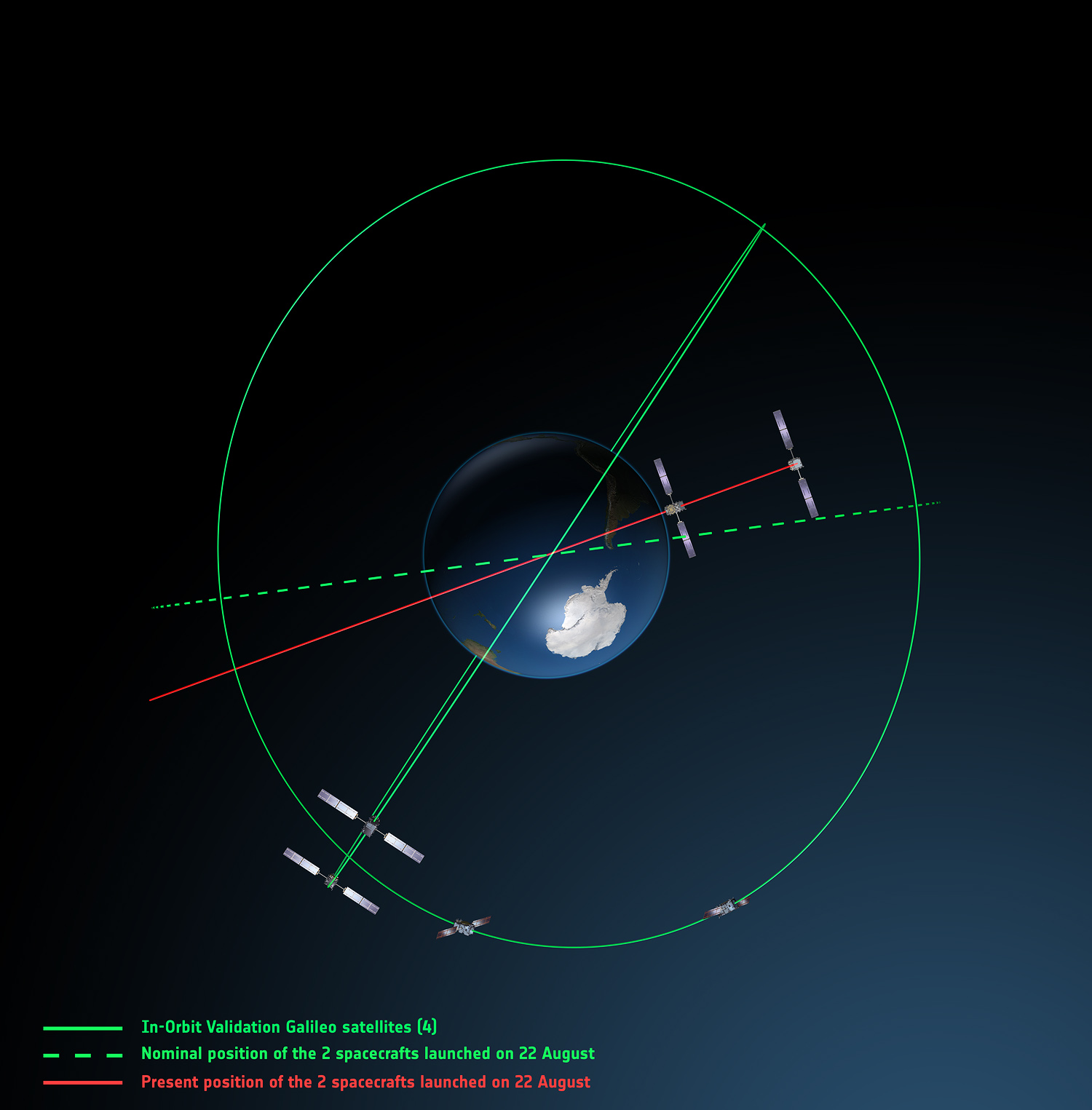
Europe’s fifth and sixth Galileo satellites, salvaged from their faulty 2014 Soyuz launch, will begin broadcasting working navigation signals for test purposes, for the benefit of receiver manufacturers, service providers and scientific researchers. The European Commission will decide later whether the two satellites will become part of the operational Galileo constellation.
The European Space Agency performed a complex series of in-orbit maneuvers to raise and circularize the two after they arrived in space too low and too elliptical for full Galileo use. Their initial orbits dipped the satellites too close to Earth to keep their antennas properly locked on the planet.
“Once their orbits were modified, their navigation payloads could be turned on and in-orbit testing could take place,” explained Marco Falcone, head of the Galileo System Office. “The good news was their performance was excellent.
“The navigation signals will include a signal health status reading that ‘signal component currently in test’ and its navigation data validity status will be ‘working without guarantee.’ In this way, these signals will not disturb the performance of any receivers using the Galileo signals coming from the other satellites. On the user community side, some application providers are interested in harnessing as many available satellites as possible for precision applications.”
Testing will take place in two phases: initially their navigation signal will be updated via the Galileo ground segment every 14 hours or so. Later this year, the ground segment will be reconfigured to send updates more often, enhancing navigation precision, although they will remain outside the official constellation until decided otherwise.
The two satellites are also midway through an ambitious space experiment to test Einstein’s General Theory of Relativity more precisely than ever before, by measuring how their onboard time varies in accordance with their altitude and therefore gravity, known as their gravitational redshift.
New Activation. Galileo GSAT-0210 (PRN E01), one of two launched May 24, began dual-frequency broadcast on Aug. 17, transmitting E1 and E5a signals.
GPS III launch RFP
Competitive bids invited
The U.S. Air Force released a Request for Proposal (RFP) in August for GPS III-3 launch services, scheduled to begin in 2019. The contract will be a standalone for a single GPS III launch.The United Launch Alliance (ULA) and Space Exploration Technologies (SpaceX) are expected to compete for the contract. In April, SpaceX was chosen to launch the GPS III-2 satellite in May 2018. ULA chose not to compete.
The RFP seeks an Evolved Expendable Launch Vehicle (EELV) Launch Service. The Air Force’s acquisition strategy seeks a balance between mission success/operational needs and lowering launch costs, reintroducing competition for national security space missions.
This is the second competitive launch service solicitation under the current procurement strategy. Previously, ULA was the only certified launch provider. In 2013, ULA was awarded a sole-source contract for launch services as part of an Air Force Block Buy of 36 rocket cores. In May 2015, SpaceX was certified for EELV launches, yielding two qualified launch service providers.
M-code, OCX updates
The Air Force awarded a $52.6 million contract to Raytheon for modernization of the Miniature Airborne GPS receiver 2000 (MAGR-2K): test and delivery of an M-code automatic dependent surveillance and broadcast-capable system. Congress has mandated the military buy only M-code GPS equipment by 2018. Last year, Rockwell Collins received a $36.6 million contract for such equipment.
OCX. Raytheon is implementing changes to its GPS Next-Generation Operational Control System (OCX). “Momentum is very good” towards a December 2020 deadline for software delivery, said the program manager. A Pentagon review in July followed breach of a critical cost-growth cap. The complexity of cyber security requirements contributed to delays to date. The company expects to deliver Block 0 software in 2017, in conjunction with plans to launch GPS III satellites. However, the capability will not be turned on until 2018, when an OCX Block 0 launch-and-checkout capability for GPS III launches is to begin.
Northrop Grumman Corporation has been awarded an order to support embedded GPS/inertial navigation system (INS) pre-Phase 1 modernization efforts.
The Military GPS User Equipment (MGUE) program is developing M-code-capable GPS receivers, which are mandated by Congress after fiscal year 2017 and will help to ensure the secure transmission of accurate military signals.
Under the cost-plus-fixed-fee order valued at $4.8 million from the Joint Service Systems Management Office, Northrop Grumman will evaluate new GPS receivers’ modes of performance, including M-code and Selective Availability Anti-spoofing Module (SAASM).
Additionally, the company will perform trade studies, assess the state of development of MGUE for upcoming applications, and contribute to architecture development for next-generation GPS/inertial navigation systems.
“We are honored to help shape the next generation of navigation systems that will modernize the GPS infrastructure and keep our warfighters safer,” said Bob Mehltretter, vice president, navigation and positioning systems business unit, Northrop Grumman Mission Systems. “We are committed to using our navigation systems expertise to develop a solution that offers dependable and accurate positioning, navigation and timing information.”
The updated GPS/inertial navigation system will also comply with the Federal Aviation Administration’s NextGen air traffic control requirements that aircraft flying at higher altitudes be equipped with Automatic Dependence Surveillance-Broadcast (ADS-B) Out by January 2020.
ADS-B Out transmits information about an aircraft’s altitude, speed and location to ground stations and to other equipped aircraft in the vicinity.
The modernized system is expected to be available for platform integration starting in 2018.
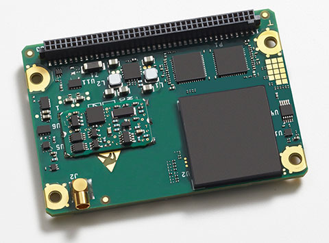
The Rockwell Collins GB-GRAM-M (pictured here) is the product of one of the MUE card development contracts, awarded by the U.S. Air Force Space and Missile Systems Center. The program is developing the next generation of GPS user equipment to include a new military signal and enhanced security architecture
GPS Source and Rockwell Collins have successfully demonstrated the ability of the Military-Code Ground-Based GPS Receiver Application Module (GB-GRAM-M) receiver card to fit within the Defense Advanced GPS Receiver (DAGR) Distributed Device (D3).
GPS Source and Rockwell Collins are the first to provide this capability for the M-code signal, which is one of the key elements in the modernization of military GPS capabilities.
The initial fit checks confirm that the Rockwell Collins GB-GRAM-M Type II receiver fits within the volume of the D3 and is able to acquire, track and navigate using C/A, Y and M-code while enclosed in the unit. Initial testing also validated backwards compatibility of the IS-GPS-153 serial port interface of the GB-GRAM-M receiver.
“These outstanding initial results confirm our confidence that the MGUE integration with the D3, when authorized to proceed, will be achieved in short order and with a very high probability of success,” said GPS Source CEO Robert Horton.
Mike Jones, vice president and general manager of Communication and Navigation Products for Rockwell Collins, added, “This demonstration paves the way for the D3 to incorporate the next-generation GPS capability that our GB-GRAM-M provides.”
GPS Source’s D3 supports new or retrofit programs integrating radio or communications equipment. It removes the burden of multiple SAASM GPS receivers or antennas. As a Selective Availability Anti-Spoofing Module GPS router, it is designed to meet the U.S. Army’s DAGR Distributed Device (D3) performance requirements, mounted into an existing DAGR vehicle mount, utilizing standard DAGR accessories.
The Rockwell Collins GB-GRAM-M is the product of one of the MUE card development contracts, awarded by the U.S. Air Force Space and Missile Systems Center. The program is developing the next generation of GPS user equipment to include a new military signal and enhanced security architecture.
Are you using a legacy-model PNT (position, navigation and timing) receiver or a smart PNT receiver, and why does it matter? Don’t have a clue? Read on! Hint — L2C and CNAV (civilian navigation message format) are the major reason it matters. Yes, it’s all because of L2C, the controversial GPS civilian signal that seems to always be in the news and just keeps getting better the more we learn about it.
A couple of weeks ago, Alan Cameron, our esteemed editor in chief — penned a follow-on editorial comprised of excerpts from techies, subject-matter experts and editors, including yours truly, exchanging opinions about the flexibility, sustainability and capability of the GPS L2C signal and all that signal enables.
I won’t bother to go into the details or history of the L2C signal here, as I did that in excruciating detail 30 months ago. However, let’s consider L2C 30 months on and determine if the landscape has changed.
What is L2C?
According to the official U.S. government PNT website, “L2C is the second civilian GPS signal, designed specifically to meet commercial needs.” As it turns out, the military needs L2C as much as the civilian world, but that is a story for another time. When combined with L1 C/A (coarse acquisition signal) in a dual-frequency GNSS receiver, L2C enables ionospheric corrections, a technique that boosts accuracy. Civilians with dual-frequency GPS receivers typically enjoy the same or better accuracy as the military.
For professional and high-precision users with existing dual-frequency receivers, L2C delivers faster signal acquisition, enhanced reliability and greater operating range. L2C broadcasts at a higher effective power than the legacy L1 C/A signal, making it more jam and interference resistant, plus it’s easier to receive signals under trees and indoors. The U.S. Commerce Department estimates L2C will generate about $6 billion in economic productivity benefits through the year 2030. Considering there are more than four billion GPS users around the world today, the DOC economic benefits number seems rather low.
L2C Status
The first GPS IIR-M (R= Replenishment, M= Modernized with M-code and L2C) satellite featuring L2C launched on Sept. 26, 2005, and is still operational today. Every GPS satellite fielded since then (18 SVs, including SVN 49) has included an L2C transmitter. This equates to 16 operational L2C satellites on orbit and transmitting, with GPS IIF-10 being number 17 when it is fully commissioned. With 17 SVs (GPS satellite vehicles) on orbit, the L2C system is officially near Initial Operating Capability (IOC). With the requisite ground system upgrades, which are in the works, this means that on any given day most users will have at least one or more L2C signals in view. You can be sure manufacturers will be quick to take advantage of the geometry.
LMCO GPS IIRM Satellite Vehicle On Orbit. (Artist’s rendering courtesy of Lockheed Martin)
Legal Caveats
“In April 2014, the U.S. Air Force began broadcasting civil navigation (CNAV) messages on the L2C and L5C signals. Prior to that time, L2C and L5C provided a default message or Message Type Zero, containing no data. Adding additional CNAV message types required upgrades to the GPS control segment. On Dec. 31, 2014, the Air Force began transmitting CNAV uploads on a daily basis. L2C should continue to be considered pre-operational and should be employed at the user’s own risk.”
Now the lawyers are happy.
So What?
What does this mean for the average user? You might be surprised at the answer. Depending on how technical you are and exactly how you use GPS, it could mean that all your “legacy” GPS receivers are about to become obsolete. Or, depending on the company that builds your receivers and the amount of foresight they built in, it could just mean a few firmware upgrades and new applications.
Regardless, with the full implementation of L2C GPS signals and navigation messages, GPS will never be the same again. This is not to say your legacy receiver will not work just as efficiently as it does today, and in fact you will probably be able to use it quite effectively for years. But it will not be able to take full advantage of all the capabilities L2C enables without an upgrade, if indeed it is upgradeable.
Legacy versus Smart
No matter how much or how little you paid for your GPS/GNSS/PNT receiver, it is essentially — except for a few notable exceptions — a legacy receiver. For example Trimble is ahead of the game as they began producing L2C capable receivers as early as 2003 and are just waiting for the additional L2C messages to be defined. Again, those receivers that are not L2C-ready or capable are what I will classify as a legacy receiver, simply because of all the future capabilities that are missing. Your current PNT receiver may have the potential to be a smart receiver — it may have the technical capability to process far more than it does today. But, unfortunately, essentially almost every receiver, again with a few exceptions, on the market today falls into the “legacy ” category.
Is My Legacy Device Considered Obsolete?
Now that I have your attention and have probably riled more than a few GPS device manufacturers, please allow me to explain. In the past, your GNSS/PNT device (for brevity’s sake, I will default to PNT for the rest of the column) has basically performed a simple function. It displayed your position, and perhaps maps and other ancillary data (targets or destinations) after it received, decoded, verified and applied timing signals and a very small number of navigation messages.
It accomplished this feat typically from a cold start in under 120 seconds. Maybe much less. Recently, I was privileged to view a demonstration of a receiver from a major manufacturer that performed a warm restart in less-than-ideal conditions and displayed a useful position in 1/20th of a second. As amazing as that may be, it is still today classified as a legacy receiver. It accomplished its task; it supplied a useful position both in human and machine language that could be utilized by both. In the past, this was the task your receiver accomplished routinely. With the full implementation of L2C, all that changes and changes drastically. I call it a revolution for PNT, but alas I am frequently given to hyperbole. However, give me a moment and see if you don’t agree.
I was attracted to a Wall Street Journal headline recently by a company that I know well, since they have an abundance of well-known and multi-talented former military leaders. That company, Accenture, puts it this way: “Change is good. Transformation is even better.” That is exactly where I believe we stand today with L2C. It is a game changer.
For example, just this week in the WSJ, which I read cover to cover six days a week, I saw stories about Audi vehicles driving autonomously from coast to coast, over 3,000 miles without driver intervention. Contrary to many manufacturers, Audi is quick to credit GPS with a large portion of the proprietary Audi (VW) technology and the capability it enables. There was a story about commercial vehicles, over-the-road diesel trucks that may have even more capabilities than the Audi. Again, with GPS as the prime contributor. The same WSJ story mentioned that, “Some of the features being added to trucks are similar to those in cars, but generally the move to autonomy in commercial and industrial vehicles is far ahead of the autonomous systems offered on most passenger vehicles. Already, mining vehicles and military forklifts are operated without drivers.”
Amazingly, these capabilities depend greatly on GPS, but exist without the full implementation of the revolution that L2C, CNAV and multiple nav messages will bring.
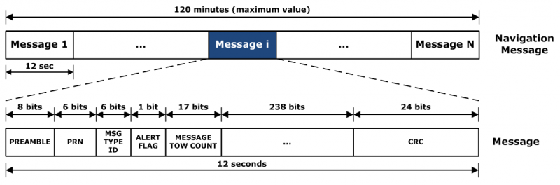
L2C CNAV Message Structure.
L2C Ready
I have over the past year seen advertisements for PNT devices that proclaim they are L2C ready. I beg to differ, but only because my definition of L2C ready probably varies greatly from that of the devices’ marketing department. Beyond its signal structure, L2C has a new messaging capability.
As stated earlier, the L2C signal is heads and shoulders above most other GNSS signals in strength, code structure and security. L2C delivers faster signal acquisition, enhanced reliability, and greater operating range. L2C broadcasts at a higher effective power than the legacy L1 C/A signal, making it interference and jam resistant and easier to receive under trees and indoors. These attributes make it a great signal and when you consider the carrier-phase and RTK (real time kinematic) capabilities, which really are real-time today. It is a very appealing signal indeed.
For precision and timing users, the carrier phase of the L2C signal, non-coded carrier, is 1,000 times more stable than the fully coded L2C signal. The L2C carrier-phase stability will remain unchanged until the semi-codeless transition date of Dec. 31, 2024, per the FRP or Federal Radio Navigation Plan of 2014. Then officially all bets are off, but who knows? That date could be extended.
However, the real and future strength of the L2C signal structure is hiding in one or more (accurately 255 more, for a total of 256) messages that can be utilized in a myriad of ways and applications. These are messages, nav-messages if you will, that your new or updated PNT device will be able to utilize for who knows how many functions. Just use your imagination. Here are some ideas I have for using the additional L2C messaging capability.
Send 250+ other navigation messages, to be defined.
Send continuous atmospheric corrections (such as ionospheric) for each two degrees of longitude around the globe or in one degree increments if you consider land mass applications only.
John Deere and Trimble as the leading commercial and civil providers of navigation data could appropriate a small fragment of the messages for their global navigation and timing corrections to their agricultural and precision users/customers around the globe.
Companies or governments could send nominal navigation or even text-based navigation-related messages to users anywhere an L2C signal can be received.
Companies could shut down and render useless receivers from users that have not paid their bills or were abusing the system.
Companies could send small firmware updates or notices of larger updates directly to users. Data could include active hyperlinks.
Precision, scientific and premium users might have the capability to receive constant correction updates that make their PNT receiver a centimeter or potentially a millimeter level device.
Receivers with communications — four billion plus smartphones and other devices with PNT capabilities and built-in communications — could become sensors capable of being sampled at will. These devices have the potential to be considered remote monitoring stations both for PNT and communications purposes. They could report both communications and PNT jamming or interference. They could also help track intentional jammers.
If you think about it hard enough, you will see that this modest list of capabilities with the proper security either make spoofing an impossibility or without proper security a malicious nightmare.
I hope by now you catch my drift and have come up with some ideas of your own concerning how the additional 250+ L2C messages could be utilized. We’re unsure how many messages will actually be available or how the messages will be used. The government will, out of operational necessity, require a small number, so right now your guess is as good as mine.
Keep in mind that L5C and M-code will have the same capabilities on differing frequencies, and different governing bodies will decide how the signals and 750-plus multiple-messaging capabilities are allocated and utilized. That is all hopefully in the near future. How that process unfolds, technically and operationally, will have a great deal to do with how successful and ubiquitous L2C becomes. The process alone will undoubtedly spawn thousands of articles; however, right now we are primarily discussing the necessity for smart receivers to fully utilize the additional L2C messages. For along with all the potential capabilities comes a processing and communications tail that does not exist today, except in a few instances that we can’t go into in this venue.
Relative
This is probably a good time to further qualify what I mean by legacy versus smart receivers. Were the appellation “legacy” not already in our vernacular concerning today’s highly functioning devices, it would not be one I would have chosen. However, it is and we are stuck with it. Consider that there are static high-end (read premium quality) single GNSS receivers that “see” more than 50-60 separate GNSS satellite vehicles and processes more than 150 GNSS signals. This does not take into consideration all the augmented and companion signals some of these devices are capable of processing. Many of these devices are very difficult to jam and literally cannot be spoofed, and still today they are legacy receivers in relationship to L2C capabilities.
However, I am told such high-end receivers are absolutely L2C ready, which may mean the additional L2C messages are ready to be processed and applied, received or rejected, whenever they are properly and officially defined. This brings us to the future definition or next generation smart L2C receiver.
Smart L2C PNT Receiver
For the first time a smart PNT L2C capable receiver will have the ability to:
Select between GPS only, GPS + GLONASS, or full GNSS mode with ancillary corrections such as WAAS and EGNOS, and work with, process or reject messages, making a decision about some or all the signals it has in view. While there are receivers that accomplish some of these functions today, they do not typically have the option of accepting or rejecting a GPS navigation message if it is properly formatted and verified. L2C smart receivers will — indeed must — at a minimum possess and correctly utilize that capability.
Alert users concerning new navigation message(s) and determine automatically or with user input whether the navigation message should be applied immediately, in the near future, put on hold or totally rejected.
Alert users to the effect that applying new or multiple navigation messages will have on the current PNT display and possibly the current mission or operation. For example, if you are a precision user, think millimeters for level of accuracy, utilizing PNT to measure tectonic plate movement — you are very interested in relative displacement over time and you may have no desire to apply a multiple nanosecond correction that could move your current measured position several inches or feet. If you are a geocacher, you do not want the coordinates of your latest buried treasure to dynamically change.
Determine if the latest valid navigation message(s) apply to your geographic area or, for mobile receivers, your destination, and what effect incorporating the messages will have on your displayed position or ETA.
Display a text-based navigation message if it is addressed to your device.
Require password(s) for certain actions — be they sensitive, proprietary, classified or of a “cannot undo” nature. Passwords could also be required in the message format before it could be unlocked and applied.
Determine and alert users if multiple navigation or device-control messages conflict with organizational or user-defined parameters.
Alert users to malicious messages or spoofing attempts.
Alert users to GNSS assets that are no longer available or go offline, such as during the two total GLONASS constellation shutdowns when GLONASS signals were not available for several hours. In the case of Apple iPhones, the GLONASS constellation-wide shutdown meant these devices went from multiple GNSS devices to “GPS plus PNT augmentation (WAAS) and other onboard sensors” devices. This is something many users may not care about, but is definitely worth a user-defined parameter for a warning message.
The ability to permanently reject a certain type of message by type, source, timeframe, etc.
By now, I hope you see the trend. You can probably think of many more possibilities for future GNSS or PNT receivers and the necessity for them to be loaded with computing and communications capabilities, especially where L2C is concerned — indeed, where all the CNAV signals and messages are concerned.
Bottom Line
The bottom line is L2C is a potentially revolutionary signal for GPS/PNT; it opens incredible opportunities for entrepreneurs, manufacturers and users at a minimum. We now all have some hard and important questions to consider before we purchase our next-generation PNT device or upgrade our legacy device.
Until next time, happy navigating, and I hope to see everyone at ION GNSS+ in September in Tampa, Fla. Remember, GPS is brought to you courtesy of the United States Air Force.
L-3 Communications has been awarded an $8.5 million modification to the Military GPS User Equipment (MGUE) contract to accelerate the MGUE program. The goal is to speed delivery of upgraded, more powerful GPS receivers to warfighters.
L-3 Communications has been providing hardware for the Air Force in related contracts since 2012 for the GPS user equipment program, reports Defense Systems. The next phase of L-3’s project includes procurement of pre-prototype receiver card deliveries as well as test support activities. The receiver card deliveries will greatly increase the fielding of Military Code (M-code) capable GPS receivers to soldiers.
MGUE is a joint service program to develop a modernized set of military GPS receivers delivering improved capabilities to allow for accurate and reliable positioning, navigation, and timing service where current receiver performance might be compromised or unavailable.
Work will be performed in L-3 Communications’ Anaheim, California, location, with an expected completion date of Sept. 30, 2016. Fiscal 2015 research, development, test and evaluation funds in the amount of $1,814,560 are being obligated at the time of award.
The Space and Missile Systems Center, Los Angeles Air Force Base, California, is the contracting activity.
With apologies to the Bard of Avon, as I paraphrase his prose, 2C or not 2C — that is the question for millions of GPS users and has been for several years. Indeed, over the past seven years hardly a week has gone by without an email or inquiry about the status of the GPS L2C signal.
The name “L2C” refers to the radio frequency used by the signal (1227 MHz, or L2) and the fact that it is for civilian use, but of course it will also be used by the military. There are also two military signals on the L2 frequency. In the past couple of months inquiries concerning L2C have become an almost everyday occurrence. Plus I have it on good authority that it was a topic of conversation at recent a PNT EXCOM or Executive Committee Meeting.
However, when I started making inquiries I was met with an interesting dichotomy. One group of users actually laughed and accused me of having a Don Quixote complex and tilting at windmills, since this debate has been continuing for over seven years, while other more sanguine user groups are seriously interested in the future of L2C. Here is what I discovered.
What is L2C?
According to the official U.S. government website concerning GPS, “L2C is the second civilian GPS signal, designed specifically to meet commercial needs. When combined with L1 C/A [ed. coarse acquisition] in a dual-frequency receiver, L2C enables ionospheric correction, a technique that boosts accuracy. Civilians with dual-frequency GPS receivers enjoy the same or better accuracy as the military. For professional users with existing dual-frequency operations, L2C delivers faster signal acquisition, enhanced reliability, and greater operating range. L2C broadcasts at a higher effective power than the legacy L1 C/A signal, making it easier to receive under trees and even indoors. The Commerce Department estimates L2C could generate $5.8 billion in economic productivity benefits through the year 2030. The first GPS IIR(M) satellite featuring L2C launched in 2005. Every GPS satellite fielded since then has included an L2C transmitter.”
Problems
So while this would appear to be a “no brainer” as it were, especially the $5.8 billion in economic benefits, it appears the Global Positioning System is actually at a crossroads and the decision makers are apparently on the horns of a dilemma. For some groups of users, the laudable global PNT (position, navigation and timing) gold standard is looking a bit tarnished of late but has an opportunity to shine once again. The question and future perception of GPS by many global users simply revolves around implementing full navigation messages on signals that are already in place, namely L2 and L5 with CNAV and M-code with MNAV. So, what’s the issue, you say? The signals are there, and in the case of L2C and M-code, have been for seven years — simply upload a full navigation message and be done with all the ambiguity that has become unwelcome baggage for these modern day signals. Au contraire, mon ami, if it were only that simple.
Now grant you this, should be a simple decision, but remember this is the U.S. government we are talking about — apropos failed budgets, endless continuing resolutions, health care fiascos, and the fiscal cliff — important but in the end actually simple decisions all. Unfortunately, history reflects when the U.S. government is involved, nothing is ever easy and timely decisions are hard to come by. So as not to confuse anyone, especially the players, let’s take this process one step at a time and see what all the fuss is about, shall we?
Problem Statement: The L2C and M-code signal capability has been on orbit for more than seven years, since 2005. In 2009, the 2SOPS began uploading and broadcasting a Message Type Zero on L2C, which, while not a navigation message, does put data on the channel. What users are now asking for is the full navigation message on L2C or CNAV, which is a modern-day navigation message and will have significant advantages for all users. Plus, the signal would be available to potentially more than 3 billion users versus the small subset today that utilizes the L2C carrier phase for RTK (real-time kinematic) operations. Indeed, when compared to the L1 C/A (coarse acquisition) signal, L2C has 2.7 dB greater data recovery (with a navigation message) and 0.7 dB greater carrier tracking.
The bottom line is that, with the addition of a valid and updated CNAV message on L2C, all users, the military included, would immediately have ten more potential navigation signals available, and that number would grow with each new GPS launch. Obviously, the same is true for military users with M-code and for all users with an L5 capability. However, the upgrade process needs to start somewhere, and L2C is the obvious choice since there are essentially no M-code receivers available today and there are approximately between 450,000-500,000 L2C capable receivers already in the hands of users.
Assets
Hardware – Simply put, there are currently 10 satellites (SVs) capable of broadcasting a full navigation message or CNAV message on the L2 signal and MNAV message on the M-code signal, also on L2 and three L5 CNAV capable SVs:
7 – IIRM SVs (does not include SVN-49 which, while capable, is currently in residual and/or test status).
3 – IIF SVs (same capabilities as the IIRMs and also capable of broadcasting an L5 signal with CNAV).
While the lack of L2C monitor stations has historically been used as a reason for not broadcasting the new CNAV navigation messages, today there are literally more than one hundred L2C- and L5-capable monitoring stations, which includes the NASA JPL (Jet Propulsion Laboratory) monitoring stations. Logs from several independent monitoring stations show that at any given time there are from one to three L2C SVs visible for the majority of global users, including our warfighters, who in the mountains of Afghanistan need all the signal availability we can provide.
Plus, of the estimated 450,000-500,000 fully capable L2C receivers, several thousand of those are in the hands of our warfighters. Trimble started building in the L2C and L5 CNAV capability as far back as 2003, a full two years before the first L2C launch, for users that wanted the option. However, that option has never been fully tested with live on-air CNAV coded transmissions and they need to be. More on testing later.
From a global user perspective, Japan has essentially leapfrogged the U.S., since the L2C and L5 signals with full CNAV messages are already being broadcast on the Japanese QZSS navigation satellite QZSS-1.
Software was initially thought to be an issue, but according to my sources, the current MNAV or M-code full navigation message is remarkably similar, as to be almost identical to the CNAV messages for L2C and L5, and MNAV has already been shown to work well on the ten GPS SVs capable of broadcasting the M-code signal. Granted, it is not fully integrated into the current OCS or operational control system known as AEP or Architecture Evolution Plan, but then not many future capabilities are, so this is really not an issue since manual processes abound in the current OCS. The L2C, L5 and M-code full navigation messages are supposedly still part of the plan for OCX or the future operational control system for GPS, which should be up and working sometime in early 2017. This would be twelve years after the L2C and M-code signal capability was first placed on orbit.
Timelines
Given those timelines, some would say, hey that’s only four years from now, maybe five if you count testing, and the full navigation message might actually be turned on. But, alas, rumors abound that there is a government agency apparently objecting to the immediate activation of L2C and L5. This agency, and it is not hard to ferret out exactly which one, wants extensive testing to ensure there will be no complications with the WAAS or Wide Area Augmentation System broadcasts, and as an alternative plan it proposes waiting until all the L5 satellites are on orbit before activating navigation messages on L2C or L5. Let’s do the math – that’s 24 L5 SVs, before the L2C and L5 PNT signals are activated with full navigation messages. At one launch per year, the current GPS launch rate, and it matters not whether it is a IIF or a III, and with three L5 SVs already on orbit, that effectively means we will see all 24 L5 SVs on orbit sometime in 2034, if indeed the II-F SVs are truly the first 30-year GPS SVs. If not, then it could be as late as 2037. However, given the average life span of GPS SVs today, it is more than likely that by 2037 every single L2C, L5 and M-code capable satellite on orbit today will have been disposed of without ever having broadcast any of the new signals for which they were designed. Now, how’s that for a lachrymose plan?
Fortunately, this alternate long-term “plan’ has not a prayer of passing, dare I utter the words, the dreaded Washington Post test. Never having purposely written anything for the Washington Post, even though several of my articles have been quoted and misquoted there, it is still a force to be reckoned with in our nation’s capital, simply because the Washington Post continually asks the question, “Is this a wise use of taxpayer’s money?” The answer for the alternative GPS L2C and L5 plan is obvious.
Personnel and monetary issues are always mentioned in the context of new GPS capabilities; however, I have no doubts that the absolutely superb blue suit operators, tacticians and support contractors at 2SOPS are more than capable of performing the simple actions of uploading the new navigation messages on their own.
Sure, times are tough but the blue suit operators and their on-site support staff, at the 2SOPS, have proven themselves time and again to simply be the best in the business. They have brought GPS SVs back from the dead, they (with Braxton Technologies Software) maintain residual satellites that everyone thought for years was an impossible task, and they have saved SVs for important missions that everyone else thought should have been abandoned. We don’t give the fine men and women at Schriever AFB, the 50th Space Wing and the 2SOPS (2nd Space Operations Squadron) enough credit, and I am not about to sell them short. I am convinced the signals in question can be uploaded with full navigation messages, tested and made operational, even if only on a test basis, within six months without expensive outside help.
Full-Scale Testing
This brings us back to the full testing proposal, which actually makes a lot of sense. We (all users) need immediate full scale and extensive operational evaluations that confirm “we have it right” with the CNAV and MNAV data messages. We should encourage manufacturers to participate in this testing process to ensure their GPS devices meet specifications and are not flawed because of a misinterpretation of an interface specification. The GPS equipment manufacturers would be the first to embrace this approach. The manufacturers and users need open-air full-scale testing with valid CNAV messages being broadcast by numerous satellites to ensure they have coded the L2C, L5 and M-code receivers properly.
Immediate testing is the key here, because otherwise under one proposed plan we will only find out if there is a problem with full end-to-end testing of the L2C CNAV signal and user equipment 13 years after manufacturers began fielding the supposed and promised capability. Under the wait for L5 FOC (full operational capability) plan, we won’t find out if the implementation of specifications are correct for another 20-plus years. Personally, I find this to be unacceptable. We need to begin the immediate six-month test plan now.
The aviation community has the mantra, “Test it as you fly it.” We should not do any less. A full six-month evaluation is absolutely appropriate and should be undertaken now. We cannot afford to repeat the 5.5C debacle. [ed. click to read more about 5.5C].
Users, of course, are the prime concern. If you or your organization, including the military, can benefit from 23 more navigation signals today (and three additional signals each year from now until 2034), one of them being the strongest GPS signal to ever be broadcast (L5 with CNAV), and you want/need those signals active now, then please let us know. You may email me at [email protected].
Stand up and Be Heard
Although some of my comments have been a bit tongue-in-cheek, this is indeed your chance to be heard and to make a difference. Let there be no mistake: there is no other PNT system in existence today, planned or unplanned, on the drawing boards or on PowerPoint slides that approaches the capability, availability, reliability, longevity, accuracy and integrity of the Global Positioning System. The folks at Air Force Space Command have been and continue to be admirable stewards. We just need to let them go about their business without undue restrictions.
Dare to Compare
If you want to know exactly how the GPS compares to other PNT systems, consider that the Russian GLONASS (Globalnaya Navigatsionnaya Sputnikovaya Sistema), which came into existence in 1979 only one year after the first GPS launch, has only been Fully Mission Capable (FOC) as a global PNT system for about two years, and that dubious status is literally day-to-day as it teeters on that magic number of 24 available SVs broadcasting multiple PNT signals simultaneously. Contrast that to the GPS, which currently has 32 active SVs with several additional SVs in residual status. Three GPS SVs are nearing, have attained or will soon attain 20 years on orbit. One of our SVs has been on orbit for more than 22 years. GLONASS has serious problems merely attaining an average SV life of less than five years on orbit. Even the vaunted Chinese are experiencing serious technical, longevity and integrity issues with their multiple PNT constellations. It is just not as easy as it sounds. So yes, GPS is the global PNT gold standard, and its stewards must always strive to improve and lead the way. The GPS must continue to grow and innovate or risk being left behind. This is your chance to contribute to that leadership role. Let your opinion be heard.
Until next time Happy New Year, happy navigating, and keep those card, letters and emails coming.