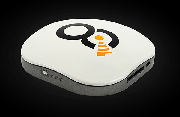
OQ’s dual-mode satellite-cellular IoT terminal can collect data from more than 1,000 sensors, has built-in GPS, and supports 5G NB-IoT, GSM, LTE-M and bi-directional satellite links. (Photo: OQ Technology)
5G satellite operator OQ Technology has successfully completed the in-orbit commissioning (IOC) of its Tiger-2 nanosatellite, and is ready to begin customer demonstrations. The company will start commercial services for “latency-tolerant” low-power devices in 2022.
OQ Technology started the IOC phase on Aug. 15, conducting operations to verify the performance of the satellite’s payload, which worked flawlessly on both uplink and downlink.
OQ also tested and calibrated its terminals in different fixed and mobile environments in the desert and for indoor usage. During tests, OQ was able to send the terminal’s location, as determined by its internal GPS receiver, to the satellite from inside a fast-moving car without having a direct line of sight to the sky.
When buried in desert sand, the terminal still sent signals to the satellite, making it suitable for many agricultural applications.
Over the next few years, OQ Technology is planning to launch a constellation of 72 satellites, providing 5G internet of things (IoT) and machine-to-machine communication. Its “cell-tower inside the satellite” technology is designed to provide real-time global connectivity with reliable low latency communication.
While GPS technology originally started as a product of the space race, it has transformed in recent decades to be used in a variety of different industries. Its positioning and navigation capabilities make many everyday tasks easier to achieve. One industry that has continuously benefitted from this technology is agriculture.
The world’s population is expected to reach nearly 10 billion people by 2050, effectively increasing global food demand by 50%, according to the United Nations. To meet these demands, global agricultural productivity will need to increase by 1.75% a year.
Currently, productivity is only growing at an average rate of 1.63%, according to the Global Harvest Initiative. Precision agriculture and advanced technologies, such as automation, computer vision, artificial intelligence (AI) and machine learning are already on the farm helping farmers meet this demand, and GPS technology plays an especially significant and transformative role in making this happen.
Game-Changer
The development of automated driving and self-driving tractors has changed the game for farming by allowing technology to drive the machines with great accuracy, while farmers focus on other value-added tasks.
Over time, that technology further developed in conjunction with other technology on the farm, such as GPS. Having a reliable way to keep equipment from running over crops is incredibly important to farmers.
The GPS technology we use at John Deere is accurate within centimeters and complements the computer vision and sensors within the tractors with precise positioning in the field. This allows the farmer to drive faster without running over and damaging the crop. It also means farmers no longer cover the same ground twice.
Other technology has also been installed on farming machines to provide added value, especially when paired with GPS. When used alongside sensors, GPS offers the potential to enable real-time data collection. Sensors throughout the field let farmers know things such as where each seed was planted or environmental conditions while spraying nutrients on their crops.
Historical data from the farmer and garnered through the technology are turned into maps that, when combined with real-time information from the sensors, enable farmers to have even more accurate and precise information about what is happening next in the field, to ultimately optimize operations. This is critical as almost every job that gets done on the farm has to be completed in short time windows.
Spatial intelligence provides a more vivid representation of what is happening in the field at all times so the farmer can make real-time decisions and plan for the future.
Tasks such as tilling, planting, spraying and harvesting are easier when farmers have a more precise way to track their position. GPS technology, working in conjunction with computer vision cameras and sensors, allows crops to be distributed more evenly across a field and enables seeds to be planted at exactly the correct spacing and position to maximize yield.
All of these tasks boost productivity and sustainability on the farm by providing farmers with the data to make informed, sustainable decisions.
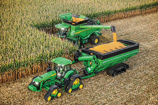
Photo: John Deere
Machines Talking to Each Other
Technology on farms has evolved to the point where machines can wirelessly communicate to each other in the field. This concept, known as machine-to-machine (M2M) communication, is also linked closely to GPS technology. Enabling machines to know where in the field another machine is and what work it has done in real time means the machines work as a team to get the job done in the most efficient way possible with no overlap. Coordination among machines helps farmers avoid redundant effort and the overuse of valuable inputs, which allows for more efficient use of resources and unlocks the potential of automation.
As the agriculture community continues to work to meet the rising demands for food, fuel and fiber, GPS technology will play a key role to help farmers make more food more efficiently, sustainably and with greater consistency in results. This not only benefits the farmer’s business, but it impacts every single person in the world.
Al Savage is the StarFire Network manager at John Deere.
The global LoRaWAN market is projected to reach US$5557.2 million, growing at a very high compound annual growth rate (CAGR) of 47.2% during 2019 to 2027, according to market research firm InForGrowth.
LoRaWAN is mainly designed for wide range and low-power communications in smart city applications that benefit from wireless battery-operated devices and secure bi-directional communication, mobility and localization services.
InForGrowth’s LoRaWAN market report provides a detailed analysis of global market size, regional and country-level market size, segmentation market growth, market share, the competitive landscape, sales analysis, impact of domestic and global market players, value-chain optimization, trade regulations, recent developments, opportunities analysis, strategic market growth analysis, product launches, area marketplace expanding and technological innovations.
Top driving factors
The report discusses these driving factors in the LoRaWAN market.
Growing adoption of smart devices (IoT) in smart cities and smart home projects.
The growing adoption of machine-to-machine communication devices due to low cost and less power consumption.
Due to the use of IoT in various applications such as smart metering, smart lighting, and livestock monitoring, organizations face challenges regarding the selection of an appropriate connectivity option for specific business use cases.
LoRaWAN mainly the private or virtual networks, and connect different endpoints that use different applications (IoT, M2M, smart cities, sensor networks, and industrial automation) in a single data environment. This fuels the demand for LPWANs that offer requisite connectivity, provide long-range access, and extended battery life for connected devices and sensors.
Market segmentation
The global LoRaWAN market has been segmented on the basis of deployment, hardware, application and end-user.
The application of LoRaWAN is based on industry verticals segmented into
asset tracking
smart metering
smart parking
smart waste management
smart building
others.
Top-end users — those receiving benefits through the LoRaWAN market — can be segmented into
agriculture
utilities
consumer electronics
healthcare
manufacturing
others.
Region Analysis
The market is classified into North America, Europe, Asia Pacific, Middle East, Africa and Latin America.
Europe dominated the market in 2018 and is anticipated to dominate the market in the coming years as well. This is mainly attributed to the rapid adoption of smart agriculture in the region. Large-scale macro-farms are being replaced by family-owned micro-farms across Europe.
Key players involved in the LoRaWAN market included in this study are Murata Manufacturing Co., Ltd., Link Labs, Microchip Technology Inc., Laird Connectivity, Semtech Corporation, SK Telecom Co. Ltd., Orange S.A. Senet Inc., Comcast Corporation and others.
Iridium Communications Inc. has introduced its Satellite Time and Location (STL) service, an alternative or complement to traditional indoor and outdoor location-based technologies, and declared it ready for use. STL’s position, navigation and timing (PNT) technology is deployed through Iridium’s 66 cross-linked, low-earth orbit satellite constellation.
Through Iridium satellites and in GNSS receivers, STL technology can work to verify GPS, GLONASS, Galileo and other navigation services, and also can serve as an alternative for those services when GPS signals are degraded or unavailable. STL also can provide an alternative source of time when testing GPS signals.
Iridium is working with Satelles, a division of iKare Corporation, as its primary technology partner. Satelles enables Iridium’s paging channels to reach small, low-cost receivers in nearly any environment, the company says in a news release.
“We think STL can help solve an important and growing problem for governments and businesses, and serve as a platform for continued innovation,” says Matt Desch, chief executive officer at Iridium. “With STL, we are introducing a global capability that is already in space, technologically ready for use and is independent of any particular location technology. The team at Satelles has been able to leverage the unique capabilities that our network offers to create a solution that can ultimately be integrated into almost any kind of platform, including other Iridium machine-to-machine devices, heavy machinery, automobiles and even the power grid, to name a few. Once implemented, STL could revolutionize the way the world’s largest, global companies and governments operate and manage cyber security.”
In a chipset about the size of a postage stamp, the technology can be embedded into many devices. STL’s signal strength may make spoofing GPS systems more difficult, the company says. STL transmits its signals through Iridium’s satellite constellation to deliver a unique code to each position on the ground that can be independently authenticated, which allows operation or access only if the user is in the location expected.
“Commercial users are now able to use STL to deliver trustworthy timing solutions for critical infrastructure, such as LTE networks, transactional data centers and the power grid,” says Greg Gutt, president and chief technology officer of Satelles. “Military and government users can also acquire these commercial off-the-shelf solutions for the Department of Defense and other government applications. In addition to enhancing the security and resiliency of GPS, STL technology can be embedded into servers anywhere in the world to geo-fence data and applications, providing trusted time and location data as an independent factor for end-point authentication.”
The STL solution has been successfully demonstrated across multiple sectors, including military, academia and commercial applications. The technology is available today and will be supported by Iridium NEXT, the Iridium’s next-generation global satellite constellation, which is scheduled for completion by late 2017, the company says.