Tag: MAGNET

  • Topcon partnership with CyArk bolsters cultural site archiving efforts

    Topcon partnership with CyArk bolsters cultural site archiving efforts

    Screenshot: CyArk
    Screenshot: CyArk

    Topcon Positioning Group is partnering with CyArk, a non-profit organization committed to the conservation of cultural heritage sites around the globe.

    Using 3D digital documentation technology, CyArk works to ensure that culturally significant sites can be thoroughly and accurately documented for the benefit of current and future generations. Many of the technologies needed for doing so come from the geospatial world, making the Topcon partnership a welcome one, according to John Ristevski, CEO of CyArk.

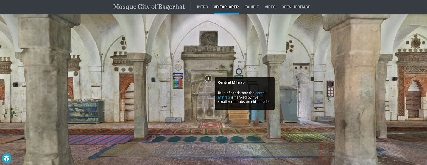
    “We have supported the documentation of over 200 sites around the world from the Mosque City of Bagerhat in Bangladesh to the iconic statues on Easter Island, but the need for high precision documentation continues to grow and there are many exciting projects yet to come,” he said. “High-precision measurement and documentation of these culturally significant sites is critical for decision making, so we are thrilled to be partnering with Topcon, an industry leader in that area and more.”

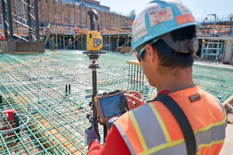
    The commitment from Topcon includes GNSS receivers, robotic total stations, field controllers, MAGNET software and a subscription to Topnet Live, the company’s real-time GNSS reference network. According to Ulrich Hermanski, executive vice president of Geopositioning for Topcon Positioning Group, having worked alongside CyArk in the past, it was a pleasure to continue to support the organization in this way.

    ”Our relationship with CyArk dates back to 2015 when we helped them digitally document the Sogi Power Plant, one of Japan’s national industrial historic sites,” Hermanski said. “We quickly recognized and admired the crucial role they are playing in ensuring cultural landmarks of all types are preserved in a digital format. Our expertise — providing precision measurement solutions — blends perfectly with their needs, now and as they move forward.

    “One of the first projects on which they plan to use the new solutions is mapping the redwood grove in Big Basin Redwood State Park, in California, an area that suffered severe damage in the recent wildfires,” Hermanski said. “We are pleased to help with this important effort.”

    CyArk’s mission, to record, archive and share the world’s most significant cultural heritage sites, stems from a desire to not only save these places digitally but provide critical information to aid in the physical conservation and restoration of the sites today.

    “In recent years alone, we’ve seen instances in which culturally-invaluable sites were damaged or lost to arson, terrorism or the effects of climate change,” said Ristevski. “To know that the accurate digital documentation efforts can play a role in rebuilding or reconstruction is a humbling opportunity. We are grateful to have Topcon partnering with us in our efforts.”

  • Topcon Positioning Group launches point creation software

    Topcon Positioning Group launches point creation software

    Photo: Topcon Positioning Group
    Photo: Topcon Positioning Group

    Topcon Positioning Group has released Topcon Point Manager, a point creation software that’s available as a plug-in for Autodesk AutoCAD and Autodesk Revit users in the U.S. and Canada.

    According to Topcon, the solution is designed to automate point creation and easily import and export layout files to and from a robotic total station. It’ll also simplify the BIM-to-field process with a faster, more seamless point creation experience from within the design platform, reducing the time and cost of layout, Topcon added.

    “Unlike standalone point creation software, which requires the user to leave their particular design environment, users of these two widely used Autodesk technologies will be able to access the solution as a plug-in component to their design package,” said Ray Kerwin, director of Topcon global product planning. “Users will benefit from the ability to automatically create multiple points on BIM objects and 2D/3D drawings from within the Autodesk environments. Just as importantly, however, they will see an increase in their quality assurance and control efforts through easily generated point and deviation reports; a likely reduction in on-site personnel (key during these challenging times), and, with the simplified processes, avoid costly construction errors and rework — the goal of most any operation working in today’s highly competitive construction environment.”

    Photo: Topcon Positioning Group
    Photo: Topcon Positioning Group

    In addition, Topcon MAGNET users can wirelessly send points to the field for layout and completed layout files can be sent back to the office to update the model to match as-built conditions.

    “With the cloud-connected MAGNET workflow, BIM personnel or CAD teams can immediately share information to and from the field crew using a layout device. Doing so can prove invaluable, as any conflicts in point data can be quickly identified, keeping production levels up and eliminating costly rework,” Kerwin added.

    Topcon Positioning Group designs, manufactures and distributes precision precision measurement and workflow solutions for the global construction, geospatial and agriculture markets.

  • Topcon upgrades MAGNET Collage Web with new deliverable options

    Topcon Positioning Group has upgraded its MAGNET Collage Web, a web-based service enabling the sharing and collaboration of UAV and scanning data sets.

    MAGNET Collage Web version 1.3 is designed to allow operators to work with more types of data with greater flexibility, including the ability to import BIM models, as well as CAD and GIS data, the company said.

    MAGNET Collage Web and MAGNET Collage desktop software meet the demands of a diverse user-group. The latest update is designed to address an increasing need from the vertical building construction market segment to work in a single-software environment with BIM, scanning, and UAV datasets.

    “Now operators can view and publish BIM models, along with other data types, directly through the web browser to be sharable with more versatility,” said Alok Srivastava, director of product management. “MAGNET Collage Web can be used to overlay as-built laser scans and design data to visualize proposed changes and detect construction issues. The software supports OBJ, FBX and 3DS formats.”

    The upgrade to MAGNET Collage Web also includes new direct publishing functionality for CAD and GIS data files through the browser.

    “Operators can now overlay 3D point clouds and reality models with CAD and GIS design data, including support for DXF, SHP, KML, GML and GeoJSON formats,” said Srivastava.

    The upgrade to MAGNET Collage Web also introduces advanced sharing controls including the ability to fully customize layer visibility, appearance, window layout, feature selection, and camera position.

    “The updated customization controls allow operators to share and present their projects exactly the way they mean to with a multitude of viewing options, allowing specific features to be highlighted as necessary,” said Srivastava.

    Additionally, MAGNET Collage Web can now be accessed through the Topcon “Blue Bar” that allows direct access to the service from any Topcon website. The universal account and application management toolbar is embedded at the top of Topcon web pages.

  • Topcon, Bentley Systems integrate Magnet 4.0 and ProjectWise

    Topcon_Bentley_screen-W

    Topcon Positioning Group and Bentley Systems have announced a new level of direct communication between Bentley’s design applications and Topcon mobile work force products with the upcoming Magnet 4.0 release.

    With the direct communication from Magnet Enterprise to Bentley’s ProjectWise, users of Topcon’s family of Magnet and 3D-MC software solutions can, while working in the field, access or receive i-models created by Bentley’s OpenRoads design modeling technology.

    Furthermore, the survey data and as-built conditions captured by Topcon’s field devices can be brought back into Bentley’s design applications using the same Magnet to ProjectWise direct connection.

    Topcon_Bentley_man-at-desk-W“The direct connection to Bentley’s ProjectWise in Magnet Enterprise allows project managers to distribute i-models directly to their Topcon field devices,” said Jason Hallett, Topcon vice president of global product management. “With this drag and drop functionality, i-models from ProjectWise easily move from the Magnet Enterprise Data Manager to your mobile work force.”

    The integration will allow for direct import and export of i-models in Magnet Field and Magnet Office products.

    “With the simplified workflow from ProjectWise to machines with a Sitelink3D connection from Magnet Office or Enterprise, updated models can be quickly sent to a machine, reducing the chance of rework and ensuring the most current data can be sent to project teams,” Hallett said.

    With the upcoming release, users will be able to deliver any Magnet project files as i-models into ProjectWise for the purpose of capturing “as constructed” conditions of infrastructure projects.

    Dustin Parkman, Bentley vice president of product development, said, “We are excited to offer the industry-first ability to ‘round trip’ i-models. Soon operators will be able to send i-models directly to their mobile work force, who can consume the models, update them directly on the job site, and then send the updated i-models from the field back to ProjectWise with selected data (points, point lists, layers library) directly to an i-model.

    “The integration between ProjectWise and Magnet Enterprise has opened up endless new possibilities for construction-driven engineering workflows using OpenRoads and Magnet Office,” Parkman said.

    Magnet 4.0 is expected to be available in late June with additional upgrades and functionality for users.

  • Topcon MAGNET Field GIS Software Offers Cloud Capability

    Topcon Positioning Group has released the MAGNET Field GIS software kit designed for efficient data collection, navigation and maintenance tasks.

    “MAGNET Field GIS is field data collection software with extremely useful data sharing capabilities,” said Jason Hooten, national sales manager, GIS products. “Utilizing the cloud, MAGNET Field GIS can send and receive data via a company’s MAGNET Enterprise account, allowing professionals in the field greater productivity and less time wasted driving to and from an office to deliver collected data.

    “MAGNET Field GIS is powerful and intuitive — built to easily recognize and adapt to a user’s surroundings,” said Hooten. “Whether in an urban area within a GNSS network or in a rural setting with a DGPS connection, MAGNET Field GIS provides a modern data collection solution.”

    The software package also includes features such as Microsoft Bing Maps for real-time background imaging, popular GIS file-format compatibility and a customizable interface.

  • Topcon Announces Expanded Features, Connectivity Options with Magnet v2.0

    Topcon Positioning Group announces a multitude of new features and enhanced functionality to the entire Magnet suite of connected workflow software. The Magnet suite includes solutions for the field personnel, the office designers and managing supervisors.

    The release of Magnet v2.0, a Topcon enterprise solution for the geomatics industry, provides more than 30 substantial additions or upgrades to the Enterprise, Field and Office packages. Enterprise is a cloud service designed for the supervising manager that connects the Field and Office products and provides a collaborative web-based interface to company data. Cloud-based collaboration and real-time data exchange makes Magnet a productivity enhancing solution for virtually any operation.

    Magnet v2.0 is now available.
    Magnet v2.0 is now available.

    “Magnet is the industry leader in cloud computing and real-time data exchange,” said Jason Hallett, Topcon vice president for software product management. “Now with v2.0, the total product suite has been elevated to a new level. Not only does Magnet allow for real-time collaboration between the project manager, job foreman, job site crews, office personnel, engineers and consultants, it also introduces myriad new features that will increase productivity in every aspect of every job.”

    Key new developments are expanded functionality for BIM and GIS applications.  Magnet v2.0 now has customized packages designed for building layout and high accuracy GIS application.

    A unique new feature is Hybrid Positioning technology, available in the Magnet Field solution package. It provides the option to simultaneously connect to GNSS signals and robotic measurements on a single rover pole. “This is a powerful feature that is easily managed in Magnet,” Hallett said.

    “Topcon continues to bring efficiencies in productivity by providing the ability to maintain simultaneous connections to a robot and a GPS rover when using the Hybrid Positioning module.”

    Other key features available to enhance data workflow and automation include:

    • AutoCAD 360 cloud surfing: Allows user to visualize, edit and share field projects with non-Magnet users.
    • AutoCAD Civil 3D support: Single-click ability to convert 3D line work generated in Magnet to DWG and launch seamlessly in AutoCAD Civil 3D for review or continued design, and vice versa.
    • Real-time sessions: An office user can log in and connect to any active project, select a field crew and view the field activity and data in real timeMagnet Field-enabled rovers to work from a single cellular-enabled RTK base.
    • Asset manager: Ability to show all active field assets (crews and equipment) in Map View with satellite image background.
    • Third-party file format support: Enlarged library of supported file formats of all major positioning equipment providers, and third-party vendors to Magnet.

    “With Magnet a company can manage its positioning data and field information to ensure maximum efficiency in all facets of each project. The exciting new BIM and GIS features makes it the most productive workflow solution for almost every precise positioning and mapping professional,” Hallett said.

    Magnet v2.0 is available for use with Topcon and Sokkia instruments and is available through subscription service so the user has continuous access to the latest features. Magnet Field and Office products can also be purchased for stand-alone use.