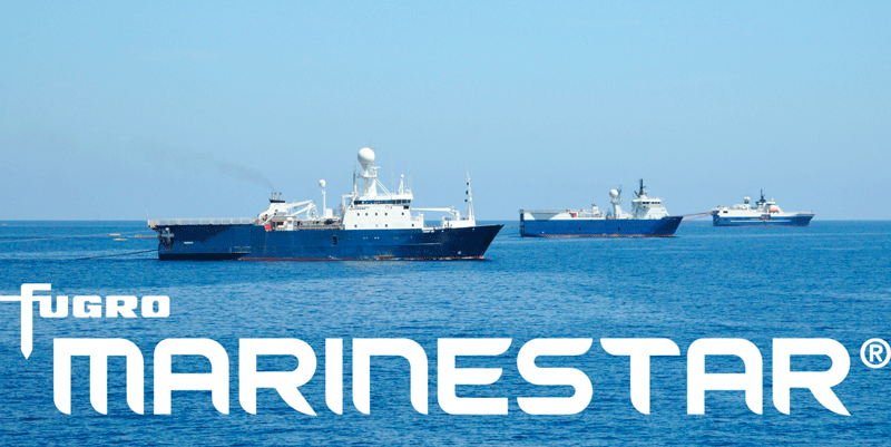
The latest versions of Ekinox, Apogee, and Navsight from SBG Systems are now fully compatible with the Fugro Marinestar G4+ precise point positioning (PPP) solution.
Fugro Marinestar G4+ is a solution that uses satellite-based augmentation to deliver centimetric positioning accuracy without depending on a local base station. This product is suitable for maritime operations where precise positioning is important.
With this compatibility, users can now use Marinestar correction with SBG products both via L-Band or NTRIP distribution.
The combination of high-performance correction with inertial measurements from SBG Systems enables users to achieve accuracy in attitude and position for maritime applications. This is suitable for applications such as marine construction, dredging, hydrography and more.
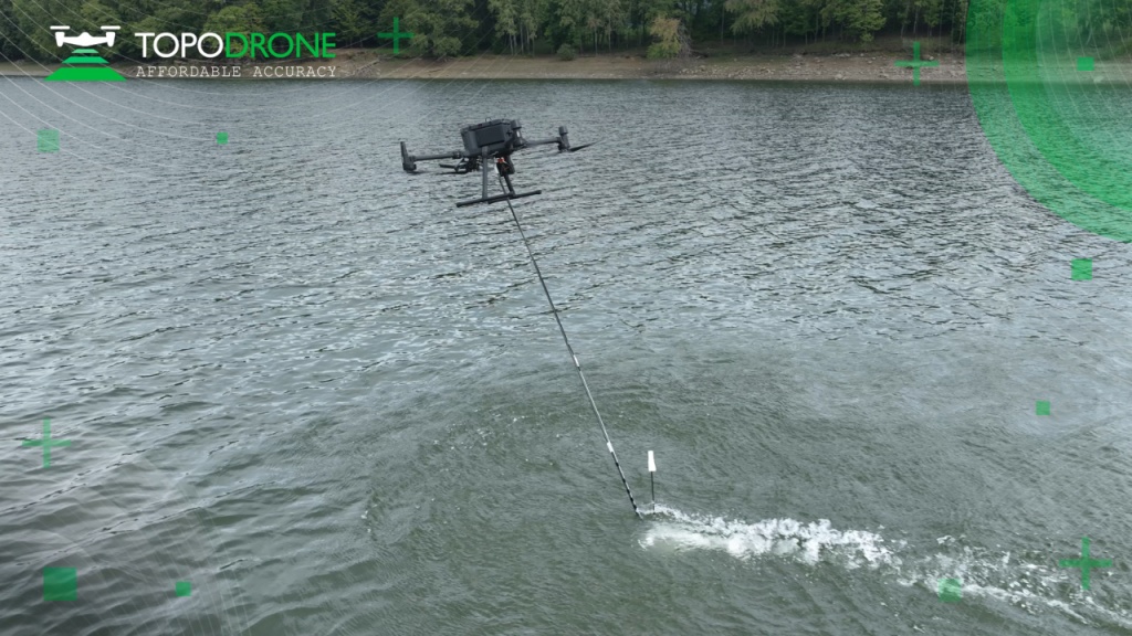
TOPODRONE, a Swiss-based designer and manufacturer of high-precision lidar equipment for installation on drones, vehicles and backpacks, launched AQUAMAPPER, a UAV-based solution for bathymetric surveying and marine construction.
AQUAMAPPER contributes to a complete set of photogrammetry, lidar and bathymetry surveying solutions from TOPODRONE. The product, compatible with the DJI Matrice 300 RTK, provides a combination of high-speed efficiency (up to 14 km/h) and accuracy mounted on a UAV. The application areas include an open sea bathymetric survey up to 100m depth, quantity survey and calculation of sediments and periodic maintenance survey of storage pools.
Photo: TOPODRONE
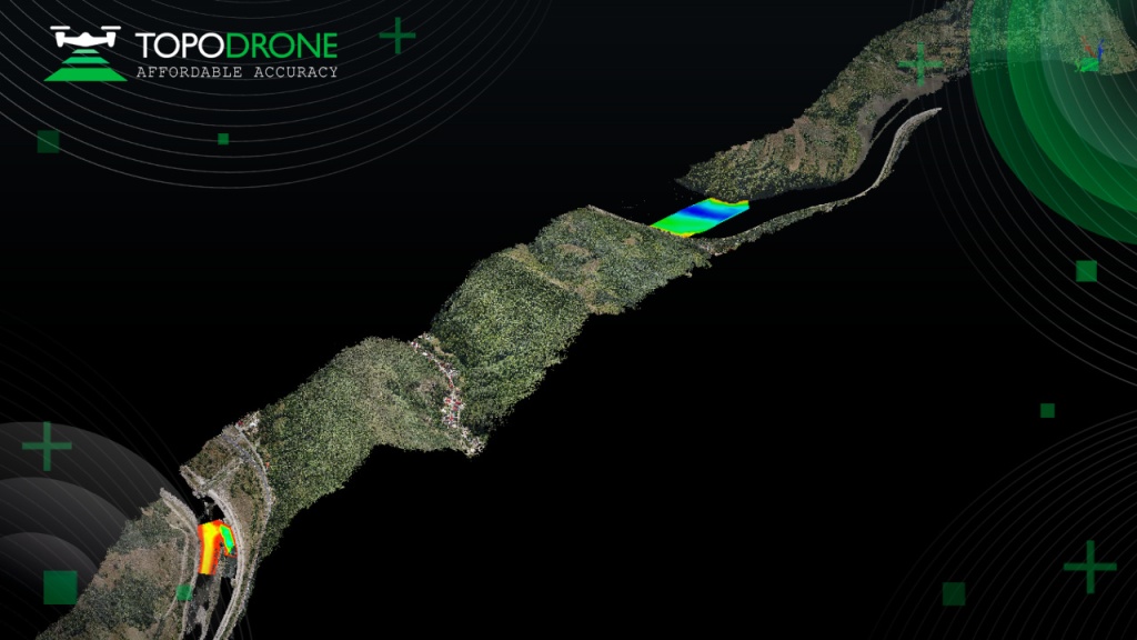
The new data-collecting device has been successfully used alongside TOPODRONE’s LiDAR ULTRA equipment for airborne surveying at a highway construction project in one of the toughest terrains in Romania, EU, including 7 tunnels, 24 bridges and 18 viaducts. The project was performed by the Romanian company GRAPHEIN TOPO SA to deliver a full digital twin of a studied area.
Photo: TOPODRONE
The TOPODRONE LiDAR ULTRA on board a DJI M300 drone was used to capture laser scanning data from an altitude of 100 m to 120 m over rugged terrain forest area to cover a corridor 32 km long and 400 meters wide in 14 flights while AQUAMAPPER connected to the same DJI M300 drone performed a bathymetric survey over six river crossings.
“The key advantage of the new bathymetric equipment from TOPODRONE is the ability to capture a riverbed with centimeter-level accuracy with high speed in fully automatic mode and without using any boat,” said Andrei Sueran of GRAPHIEN TOPO SA. “The combination of an echosounder, GNSS and inertial measurement system helps to get accurate results after data post-processing.”
Offshore construction company Sulmara Subsea has exclusively used Hexagon | VERIPOS solutions since inception to achieve precise, redundant and reliable vessel positioning for a variety of marine construction projects. Projects involving the precise positioning of offshore vessels and subsea assets and vehicles such as ROVs and trenchers are vital to success — even slight errors or loss of connection in surface navigation can lead to problems and down time that can cost millions.
“Sulmara has set out to be an industry leader in innovation and technology from the start. Key to the success of any project is the ability to achieve accurate and reliable global positioning,” said Cory Goodyear, Sulmara’s Americas business unit director. “The support from Veripos to provide not only a cost-effective but reliable service is vital to our operations.
“2020 has seen an unprecedented decline in the oil and gas market, and a growing demand for renewable energy,” Goodyear said. “This has created an even larger demand for lower costs and increased reliability in our services. As a new-start survey company with a goal of establishing itself as a serious competitor, positioning services supported by Veripos was the obvious choice.”
Veripos offers customers several marine receiver options for hydrographic/offshore surveying, dredging, offshore construction, seismic exploration and dynamic positioning. The LD8 ruggedized compact dual-antenna, multi-constellation receiver is best for short-term projects or where space is limited. The larger LD900 can receive Veripos services through a multi-channel L-band demodulator. The multi-constellation receiver is configurable to allow GNSS heading and inertial positioning. It has an intuitive color display for configuration and monitoring. A kit allows the receiver to be installed within vessel equipment racks.