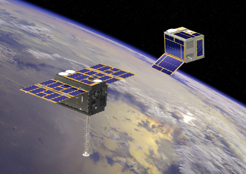
Low-Earth-orbit signals add increased signal strength, geometry diversity and robustness to GNSS.
U-blox, a global leader in positioning and short-range communication technologies for automotive, industrial and consumer markets, is exploring how the introduction of low-Earth-orbit (LEO) signals can complement and integrate with existing GNSS to support mass-market positioning solutions.
The announcement comes following the launch of the European Space Agency’s (ESA) first Celeste LEO-PNT demonstration satellites (IOD-1 and IOD-2) on 28 March 2026, marking a key milestone in bringing LEO-based signals into the operational positioning environment and ESA’s first step toward extending satellite navigation into low Earth orbit.
As the positioning ecosystem evolves, LEO-based signals are emerging as a complementary layer to established GNSS. Designed to augment systems such as Galileo, LEO satellites introduce a new building block characterized by lower orbital altitude, increased signal strength, and rapidly changing satellite geometry. GNSS remains the foundation of global positioning, delivering proven coverage and consistency at scale.
This evolution is not only about additional signals, but about how positioning systems behave over time. The dynamic geometry of LEO satellites introduces new system characteristics that influence convergence speed, robustness, and performance in challenging signal conditions.
Under its Navigation Innovation and Support Program (NAVISP) Element 2 (EL2) project, co-funded by ESA, u-blox is conducting a technical assessment of the role of LEO signals in multi-layer positioning architectures. This work forms part of a broader effort to bring LEO-PNT capabilities to mass-market GNSS receivers, combining emerging LEO signals with established GNSS systems.
This includes early integration work on u-blox’s X20 GNSS platform, exploring how different signal types and frequency bands can be optimally incorporated into u-blox’s positioning systems. The scope of work includes:
Observation and characterization of emerging LEO signal transmissions
Analysis of interactions between LEO signals and GNSS measurements
Evaluation of the impact of dynamic satellite geometry on positioning performance
Exploring different system-level approaches for integrating LEO signals into future platforms
“U-blox is committed to advancing positioning technologies through focused research and collaboration,” said Jani Käppi, head of technology positioning at u-blox. “Our work within the ESA NAVISP framework allows us to better understand how emerging signal sources can complement GNSS and contribute to robust and reliable positioning performance.”
U-blox expects to contribute to the development of the new LEO satellite ecosystem with significant innovation in the positioning solution, collaborating with key partners like ESA.
The Celeste initiative
The Celeste mission is ESA’s initiative for LEO-PNT (Low Earth Orbit Positioning Navigation and Timing) and is in its in-orbit demonstration phase. This first phase features a demonstration constellation of 11 satellites that will fly in low Earth orbit to test innovative signals across various frequency bands. Its goal is to advance satellite navigation concepts for resilient positioning and timing services.
The Celeste in-orbit demonstration phase was approved at ESA’s Council at Ministerial Level of 2022. The fleet is being developed through two parallel contracts respectively led by GMV in Spain with OHB in Germany as core partner, and by Thales Alenia France as prime and Thales Alenia Italy as space segment responsible and involving over 50 entities from more than 14 countries.
Celeste was further supported in ESA’s Council at Ministerial Level of 2025 (CM25), towards the implementation of the next phase: the LEO-PNT In-Orbit Preparatory phase.
Celeste also contributes to one of the three core pillars of ESA’s new European Resilience from Space (ERS) initiative, endorsed at CM25. ERS addresses critical security and resilience needs for Member States while laying the groundwork for future European strategic space capabilities.
Abstracts for the ION GNSS+ 2023 show, “GNSS + Other Sensors in Today’s Marketplace,” are due March 3.
ION GNSS+ will take place Sept. 11-15 at the Hyatt Regency Denver at Colorado Convention Center in Denver.
ION GNSS+ 2023 is the world’s largest international technical meeting and showcase of GNSS technology, products and services. The show aims to bring together leaders in GNSS and related positioning, navigation and timing to present advances, introduce new technologies, update current policy, demonstrate products and exchange ideas.
The two tracks covered during the show will be commercial and policy tracks and research tracks.
The commercial and policy tracks will include navigation for mass market, autonomous and safety critical applications and future trends in navigation. The research track will cover multisensor and autonomous navigation, algorithms and methods and advanced GNSS technologies.
Interested parties may submit their abstracts on the ION GNSS+ 2023 website.
Onocoy has launched a project to provide a dense network of community-powered GNSS reference stations. Based on Web 3.0 and an innovative incentive program, onocoy’s project strives to ensure outstanding positioning data quality suitable for mass market applications such as drones, micro-mobility, robotic lawnmowers or autonomous vehicles.
In the past, ultra-precise GNSS navigation with real-time kinematics (RTK) was only available to high-end markets because of prohibitive costs. With increasing demand for higher accuracies and advances in receiver technology, along with the availability of new GNSS signals, RTK receiver prices have dropped, yet high correction service costs and insufficient business models for mass markets have limited large-scale application of RTK.
Onocoy’s project aims to provide scalable correction services by leveraging Web 3.0 methods and distributed ledger technology. Such technology will facilitate a decentralized approach to the number of GNSS reference stations, 20 times the density as exist now. Ultra-dense distribution of GNSS reference stations will allow global access to instant centimeter-level positioning.
“Utilizing Web 3.0 methods with distributed ledgers and smart contracts, onocoy is poised to create the world’s densest distribution of GNSS reference stations that will enable RTK positioning anywhere,” said Daniel Ammann, initiator of the onocoy project. “By applying an open governance system, the interests of all stakeholders are taken into account in a transparent manner, ensuring that the project effectively addresses the needs of the stakeholders.”
The project will enable users to have the highest quality in GNSS data thanks to rigorous data validation and an innovative incentive scheme for data miners, where high-quality data is rewarded. Costs will be kept at a minimum with cutting-edge technology implementation and the wide user base. As a result, users will have the freedom to shape their solution to fit their market’s needs.
U-blox is partnering with ArduSimple, a Spanish company seeking to facilitate the adoption of centimeter-level GNSS technology for mass-market applications.
The companies partnered to develop the SimpleRTK2B single-board computer (SBC). The device, which is built around up to three u-blox ZED-F9P high-precision GNSS receivers, simplifies the development of centimeter-level positioning solutions supporting real-time kinematics (RTK), making the technology accessible to broader audiences.
The SimpleRTK2B-SBC was developed to make RTK technology as close to plug-and-play as possible. In addition to working as a stand-alone solution, customers can program their own applications with the company’s microPython API.
The SimpleRTK2B-SBC delivers mechanical integration with centimeter position on three axes (heading, pitch and roll), outputting on NMEA, RTCM, RS232 and CANBus interfaces via Ethernet, Bluetooth, Wi-Fi and 2G/3G/4G communication. It offers configurable input/output and an inertial measurement unit.
Septentrio is starting high-volume production of mosaic-X5, its next-generation multi-constellation and multi-band receiver module.
Featuring the company’s latest GNSS technology, mosaic-X5 brings centimeter-level positioning to technologies such as robotics, automation, smart wearables and telematics among others. Its small form factor and low-power design makes high-performance positioning accessible to volume applications, the company said.
“For smooth, uninterrupted operation in the field mosaic-X5 is the logical choice for an industrial-grade GNSS positioning module,” said Francois Freulon, head of Product Management at Septentrio. “In an industrial setting the cost of equipment downtime can quickly get out of hand. We designed mosaic to be robust in difficult environments, ensuring continuous operation as well as quick set-up times for our customers.”
Septentrio’s mosaic-X5 was conceived to be the first GNSS receiver module on the market without performance compromises. Featuring complete multi-frequency multi-constellation technology mosaic receives every existing and future signal from all GNSS constellations including the American GPS, European Galileo, Russian GLONASS, Chinese BeiDou, Japanese QZSS, Indian NavIC and L-Band satellites. Such signal diversity allows maximum positioning availability even in difficult environments such as near tall structures or under foliage.
The compact GNSS module features Septentrio’s proprietary Advanced Interference Mitigation (AIM+) technology, which shields the receiver from jamming and malicious spoofing. This allows machinery and robotics equipped with GNSS to keep on working, instead of being grounded by RF interference. mosaic-X5 also includes the unique RAIM+ integrity engine essential for safety-critical applications such as autonomous systems.
For those who want to try out the mosaic-X5, evaluation kits can now be ordered directly at shop.septentrio.com.
Sapcorda Services GmbH has released its SAPA (Safe And Precise Augmentation) Premium GNSS positioning service.
The SAPA service enables mass-market GNSS devices to operate with increased accuracy and reliability across Europe and the continental United States. The service’s technology unlocks advanced performance with instantaneous sub-decimeter position accuracy for devices used in all market applications.
SAPA is delivered using the open industry-recognized SPARTN format, which allows efficiently delivery of the correction data via internet and satellite broadcast. “When using our service, users across Europe and the United States can experience homogeneous, gap-free, advanced positioning performance with any GNSS hardware designed for high precision positioning,” CTO Rodrigo Leandro said.
The SAPA service is tailored for mass-market applications including innovative mobility solutions, IoT applications, and traditional markets such as maritime.
SAPA was designed from ground up to support safety-critical applications such as autonomous driving.
SPARTN (Safe Position Augmentation for Real-Time Navigation) is a high-accuracy, open- and free-to-use GNSS format tailored for broadcast distribution in mass-market applications.
Sapcorda Services GmbH is a GNSS service provider focusing on the emerging high-precision GNSS mass markets. The company has designed its technology and service offering to serve high volume automotive, industrial and consumer markets.
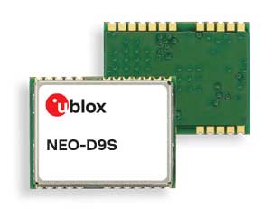
U-blox said its new NEO-D9S GNSS correction data receiver module provides an affordable approach to bringing centimeter-level accuracy to GNSS receivers.
The NEO-D9S receives from correction service providers broadcast on the L-band (1525-1559 MHz). A host processor can then decrypt this correction data and provide it to a high-precision GNSS receiver, combining corrections directly with readings from the satellite constellations to enable much more accurate position readings than those offered by GNSS signals alone.
Use of the NEO-D9S will also increase the availability of high-precision GNSS positioning data in areas with limited connectivity and reduce the amount of cellular data consumed by positioning receivers.
Customers are expected to include carmakers, both Tier 1 and OEMs, industrial system integrators that offer position-correction services, and any other applications that rely on very accurate positioning at low cost.
The NEO-D9S module is a correction-only receiver, based on the latest u-blox ninth-generation (D9) platform. This means that it will integrate easily with the u-blox F9 RTK GNSS receivers from u-blox, or can be used as part of a modular product roadmap. The module also integrates a TCXO and SAW filter to ensure good RF sensitivity and resilience to interference from adjacent channels.
The module includes the algorithms necessary to decode satellite data broadcasts. It is configured to work initially with whichever correction service has been set as default, but can be configured for any L-band data broadcast. It stores its configuration settings in non-volatile memory.
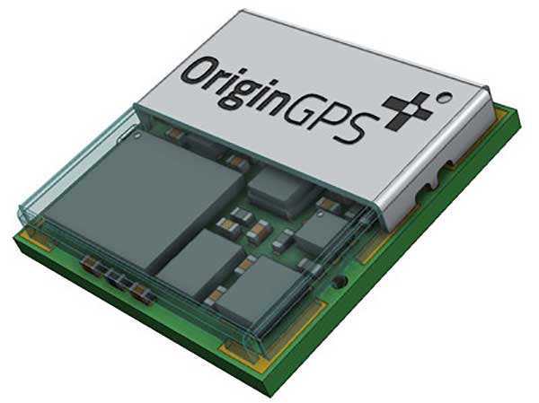
OriginGPS has collaborated with Broadcom to create a new miniature module with L1 + L5 support provided by the BCM47758 chip, enabling ultra-accurate GNSS positioning. The module was developed for solutions requiring super-precision GNSS and a dual-frequency combination.
Photo: OriginGPS
The ORG4600-B01 is OriginGPS’ first dual-frequency GNSS module. The module enables customers to build solutions with sub-1-meter accuracy without implementing external components.
Measuring 10 x 10 mm, the ORG4600-B01 module supports L1 + L5 GNSS reception with one RF port, enabling the use of a low-cost, dual-band antenna delivering sub-1-meter accuracy performance in real-world operating conditions.
Alternate Build. An alternate build option allows for separate L1/L5 RF outputs when dual antennas are required. The ORG4600-B01 is suitable for solutions requiring ultra-accurate positioning, such as telematics, the Internet of Things (IoT) and auto OBD applications.
“This year has seen several satellites launched into orbit every month, most of them fitted with L5/E5 capabilities, and the Chinese and European Union governments plan to have their satellite constellations fully operational by 2020.” said Haim Goldberger, CEO of OriginGPS.
Developing the ORG4600-B01 module with the BCM47758 GNSS receiver chip by Broadcom Inc. was the fastest and surest way to add a high-quality dual-frequency module to our portfolio and meet our customers’ increasing requirements for ultra-accurate GNSS modules,” Goldberger said.
“Size is a crucial parameter in GNSS dual-frequency solutions,” said Prasan Pai, product marketing director for the Wireless Communications and Connectivity Division at Broadcom. “The collaboration with OriginGPS has created the industry’s smallest dual-frequency module with ‘no compromise’ quality. For our customers seeking an ultra-accurate GNSS solution in a compact form factor, the ORG4600-B01 fits the bill. The collaboration enables Broadcom to reach new markets, such as precision agriculture, security, children tracking and fleet management.”
“OriginGPS is interested in additional partnerships to enable bringing advanced solutions to market quickly,” said Haim Goldberger, CEO of OriginGPS.
OriginGPS is presenting its products with real-life demonstrations at MWC 2019, Los Angeles, Oct 22-24, Booth S2938.
China’s super-thin rubidium atomic clock, which is just 17 millimeters thick, has been put into mass production, according to Xinhua News Agency.
The clock, developed in 2018 by a research institute under the China Aerospace Science and Industry Corp. Ltd, (CASIC) is the key to the positioning and timing accuracy of BeiDou navigation satellites.
In 2015, Chinese scientists developed a rubidium clock that is tiny enough to fit in the palm of your hand but was almost 40 millimeters thick. The new clock, with a length of 76 millimeters and width of 76 millimeters, is only 17 millimeters thick.
Compared with the previous generation, the new clock is smaller in size but performs better. It adopts a plug-in design, making it easy to insert and remove on circuit board. With stronger resistance to high temperatures, it can work at 70 degrees Celsius (158 degrees Fahrenheit).
In addition, it has a taming function, enabling the clock to be automatically recognized and tamed by the pulse per second (PPS) signal provided by navigation satellite systems, improving the accuracy of local frequency.
The clock can be used in fields such as aviation, aerospace and telecommunications. According to its developers, the ultra-accurate clock will have a broader market prospect in the future.
Atomic clocks are the most accurate time and frequency standards. They use vibrations of atoms to measure time. Due to its small size, low cost and high reliability, rubidium clock is the most widely produced atomic clock.
A large number of self-developed rubidium and hydrogen atomic clocks have been carried by satellites that provide accurate positioning for China’s BeiDou Navigation Satellite System.
The atomic clocks are the workhorses that send synchronized signals so sat-nav receivers can triangulate their position on Earth.
China began to construct the BDS in the 1990s. The system started serving China with its BDS-1 satellites in 2000 and started serving the Asia-Pacific region with its BDS-2 satellites in 2012. China will complete the BDS global network by 2020.
Guest column by Peter Fairhurst, Director, Product Line Management, Product Center Positioning, u-blox
Peter Fairhurst, Director, Product Line Management, Product Center Positioning, u-blox. (Photo: u-blox)
A new generation of GNSS hardware and pioneering new correction data services are enabling cheaper, more compact and truly scalable high-precision GNSS solutions, ready for the mass market.
High-precision GNSS as employed by specialized markets for more than a decade isn’t aren’t suitable for mass-market autonomous vehicles or other mainstream use cases. As well as being big, heavy and expensive, traditional high-precision GNSS systems don’t scale, which is a critical shortcoming when you consider this capability may very soon need to be built into every car that gets built.
To overcome these challenges, we’re seeing two complementary things coming to market: a new generation of GNSS hardware, and pioneering new correction data services. These two key facets combine to enable cheaper, more compact and truly scalable high-precision GNSS solutions, ready for the mass market.
A new generation of GNSS correction service forgoes the two-way link between customer device and the correction data service that is a hallmark of traditional high-precision GNSS corrections. Instead of sending each device its own, location-specific GNSS correction data, the new-generation services create a real-time model of relevant errors across their entire territory. They broadcast this over satellite and/or the Internet for customer devices to pick up.
Transmitting modeled GNSS error data to receivers across an entire region – as opposed to maintaining a two-way link with each and every device – opens the door to large-scale, mass market applications of high-precision GNSS
The shortcomings of traditional high-precision positioning
Correction data has long been key to high-precision GNSS services. In traditional applications, the customer’s positioning device detects its approximate location and sends this information to its correction service provider. This provider uses a network of base stations to monitor GNSS errors, comparing the readings calculated from the satellite signals to the stations’ known, fixed positions. It uses these insights to send the customer’s device tailored correction data, based on its location.
The technology has successfully been used to provide centimeter-level accuracy in surveying, agriculture and machine control, but annual subscriptions of sometimes more than $1000 per device mean it’s remained confined to specialized markets.
Moreover, traditional correction data services typically only operate in one country, or even one state. While this may not be an issue in some applications (such as localized agriculture), there are other use cases where limited range is a major problem. Imagine, for example, that you regularly need to travel across a state or national boundary in your (semi-) autonomous vehicle, or carry out remote UAV-based surveying in another country: maintaining your high-precision positioning capability is likely to mean roaming contracts and other extra costs.
The other issue with these traditional services is scalability. They use two-way cellular communication to pass data back and forth between the customer device and the correction data provider. And while this works when device density is relatively low, if this number grew to thousands or even millions of end-user pieces of kit trying to access the correction data service, current cellular infrastructure would struggle to deliver the required reliability. Particularly in safety-critical applications, where losing access to the correction data service could put lives at risk, this is unacceptable.
Image: u-blox
Recent developments in high-precision positioning
The new generation of GNSS correction services, creating and broadcasting a real-time model of relevant errors across their entire territory, over satellite and/or the internet for customer devices to pick up, opens the door to large-scale, mass-market applications of high-precision GNSS. Technology using State Space Representation (SSR) is one flavor of these new-generation GNSS correction data services.
Japan has led the way in GNSS error-broadcasting, using the L6 signal of its QZSS satellite network as a proving ground for mainstream use of the approach. Although it’s currently only available within Japan, the Centimeter Level Augmentation Service (CLAS) is generating a lot of interest across the automotive, agricultural and machine-control industries. Mitsubishi Electric, for example, used the CLAS service to field-test its autonomous driving system.
In China, Qianxun Spatial Intelligence Inc. is pioneering a different technique. Instead of broadcasting the data, Qianxun SI is leveraging its special access to the Chinese GNSS reference base stations to push the boundaries of what’s possible using the traditional technique. It provides tailored correction data services to customers including individuals, system integrators and original equipment manufacturers (OEMs). While it’s been a success in China, the approach is less appealing to OEMs who ship worldwide, because it requires their clients to arrange their own, local GNSS correction data.
Another important advance has been the rise of multi-band GNSS receivers, which enhance standalone positioning accuracy, thereby delivering a better customer experience in a variety of use cases. However, even multi-band receivers can’t achieve the centimeter-level accuracy that mobile robotics and autonomous vehicles need: these devices will always need to be complemented by some form of correction service.
Continent-wide GNSS correction data
Particularly in Europe, where there’s a lot of cross-border travel and economic activity, the simplicity of continent-wide GNSS correction services would offer enormous value. Sapcorda, for example, a recently launched joint venture between Bosch, Geo++, Mitsubishi Electric and u-blox, is creating a next-generation GNSS correction data service with coverage on a global scale (Europe, North America, etc), building on the lessons learned in Japan.
Sapcorda will broadcast right across the continent, using cellular networks as well as over satellite links. Customers won’t be tied to a specific GNSS manufacturer. Data will be distributed in an open format, so that device-makers can create exactly the solutions their customers want.
Having access to GNSS correction services continent-wide has the potential to transform high-precision positioning into a mainstream offering, supporting various IoT applications, as well as drones and (semi-) autonomous vehicles.
Addressing the remaining challenges
High-precision GNSS correction services that target the mass market are still relatively new, with different suppliers pursuing different business models. Trimble’s service, for example, doesn’t use an open correction-data format, and is only compatible with devices using its own GNSS receivers. The benefit of this is that it can deliver a seamless, fully integrated solution, with complete interoperability across the Trimble product range (provided the region in question has good coverage). OEMs with customers is geographically broader markets will need to weigh this up against the benefits of global coverage provided by a range of correction-data suppliers offering open-format data.
As we touched on earlier, in safety-critical applications where location-accuracy is essential, any correction data service must be up to the task. This includes ensuring data broadcasts aren’t crowded out when cellular networks become saturated. To this end, u-blox has been working with the 3GPP body to create appropriate standards that can ensure the service meets the required service level agreements.
Lastly, although there’s now country-wide coverage in both China and Japan, Sapcorda is now attempting to provide continent-wide high-precision services. If it’s a success, it could overcome the challenges of national boundaries and country-based cellular providers. It’s as yet unclear how existing correction-data-service suppliers will respond.
Customer satisfaction is paramount
For high-precision GNSS services to achieve mainstream success, they not only need to offer wide coverage and be truly open, but must facilitate innovation and ensure they can broaden the appeal of this capability beyond being a niche specialism. Like in any industry, customer satisfaction is essential if the technology is to achieve this.
Complexity that arises as a result of state boundaries, national borders, conflicting regulations or subscriptions, must be shielded from the end user and dealt with upstream. This is already happening in some areas, where device-makers are partnering with correction data service providers, enabling them to bundle the service cost into the device cost that the end user pays.
A revolution in positioning
As well as helping to realize some of the automated navigation solutions currently under development, new-generation high-precision GNSS services are driving a seismic shift across the whole industry.
The rise of innovative, high-precision GNSS technology, combined with business models that promise to make high-precision a mass market reality, mean the coming years will be tremendously exciting. By disrupting the existing market, the new technology will mean lots of new opportunities for those ready to grasp them.
Peter Fairhurst joined the Product Strategy team in the Product Center Positioning at u-blox AG in 2015. He is responsible for the development of industrial markets, with a specific focus on unmanned systems and mapping solutions. Prior to u-blox, he was part of the Product Management group at Leica Geosystems AG, where his focus was on high-precision GNSS surveying technology.
Fairhurst holds a bachelor degree in Mathematics & Computer Sciences and doctorate degree in satellite geodesy from Newcastle University and an MBA diploma from the University of Strathclyde.
By Paolo Crosta, Paolo Zoccarato, Rafael Lucas and Gerarda De Pasquale, European Space Agency
Test set-up. (Image: Authors)
Most mass-market manufacturers have already developed a dual-frequency chip or will soon do so. What is still not completely clear is the main benefit of adding the second frequency. Is it beneficial just for correcting ionospheric error?
Will it provide an improvement of the ranging error thanks to the wideband nature of the signal broadcast on the second frequency and their multipath rejection capabilities? Is it improving the measurement quality by means of a higher transmitting power?
Could it be exploited as a source of data for the provision of accurate orbit and clock corrections? What is the best PVT algorithm to apply to a multi-constellation dual-frequency mass-market chip?
To answer these questions, an evaluation kit of the Broadcom chip BCM4775 has been tested — the first dual-frequency mass-market chip commercially available.
Results show:
the code noise (multipath) is often the main source of error, hiding the benefits of more accurate clocks and orbital data.
wide-band signals are very beneficial for multipath rejection. Position fix based on E5a-L5-only measurements even with fewer satellites can outperform L1-E1-only in tests performed this September (impact of the new Galileo satellites).
after deactivation of the duty-cycle tracking on Android phones, the carrier phase measurements are improved and we do not experience any longer filter resets in the position Kalman filter.
Mobile brand Xiaomi has launched a dual-frequency GNSS smartphone.
Fitted with a Broadcom BCM47755 chip, the Xiaomi Mi 8 provides up to decimeter-level accuracy for location-based services and vehicle navigation, the company said.
The Mi 8 smartphone represents a breakthrough in GNSS technology as the first commercial deployment of Broadcom’s dual-frequency BCM47755 chip designed for the mass market and introduced in September 2017.
Until now, mobile location-based applications have been powered by single-frequency GNSS receivers whose location accuracy is limited to a few meters. However, in recent years GNSS systems have been launching satellites broadcasting signals on new frequencies to open up new possibilities. Specifically, Galileo has the majority of satellites with E1/L1 and E5/L5 frequency capabilities.
The E1/L1 + E5/L5 GNSS chip can compute location with an accuracy of up to a few decimeters.
Leveraging Galileo for increased accuracy
According to the company, users of the Xiaomi Mi 8 and future models with dual-frequency GNSS will benefit from better positioning and navigation experience in urban environments. This is due to the unique shape of the E5/L5 frequency, which makes it easier to distinguish real signals from the ones reflected by buildings, reducing the multipath effect, a major source of navigation error in cities and other challenging environments.
The numerous Galileo satellites broadcasting E5 make this improvement available for users all around the world. In addition, the simultaneous use of two frequencies reduces other sources of error, such as those due to the ionosphere, and the frequency diversity is more robust to interference and jamming.
In addition to making existing applications more accurate, the enhanced position precision offered by dual-frequency GNSS will also create opportunities for new applications in areas such as augmented reality, vehicle navigation and mapping.
Commenting on the product launch, European GNSS Agency (GSA) head of market development Gian Gherardo Calini said that the arrival of the first dual-frequency GNSS smartphone to the mass-market represents a breakthrough for users all over the world.
“The enhanced accuracy provided will empower developers to create new applications that meet the growing high-accuracy location requirements of users and also open up applications that previously only ran in dedicated devices intended for professional use,” Calini said.
“Broadcom is glad to gear up Xiaomi’s flagship smartphones with the very latest dual-frequency GNSS technology,” added Alex Chou, vice president of product marketing for the Wireless Communications and Connectivity Division at Broadcom. “Xiaomi Mi 8, the world’s first smartphone with BCM47755, will take smartphone GNSS navigation to a whole new performance level.”
”The importance of GNSS to modern life is undisputed, and is particularly important for smartphones,” said Zhiyuan Zang, Xiaomi’s director of product marketing. “Navigation and LBS-based apps these days require greater positioning accuracy to work effectively, and dual-frequency GNSS is the key to delivering a great user experience when using these apps. Xiaomi is delighted and honored to be the world’s first smartphone manufacturer to support dual-frequency GNSS. We will continue to pursue innovation for everyone to enjoy.”
Access to raw measurements for geolocation
The launch of the first dual-frequency GNSS smartphone, together with the opportunities offered by the availability of GNSS raw measurements in Android, creates exciting opportunities for the geolocation community, the company said.
Access to raw measurements opens the door to algorithms once restricted to more advanced GNSS receivers. This, in turn, allows users to fully benefit from the differentiators offered by Galileo.
Recognizing these opportunities, in 2017 the GSA engaged with academia and industry in the areas of navigation and positioning to innovate around this new feature as part of a GNSS Raw Measurements Task Force.
Then, in January, the GSA published a white paper on the use of GNSS Raw Measurements in Android, providing developers with in-depth information on accessing and using raw measurements to implement advanced GNSS techniques in mass-market devices.
Building on this work, the GSA and the Raw Measurements Taskforce shared their latest updates at a dedicated workshop — “GNSS Raw Measurements: From Research to Commercial Use” — held at the GSA headquarters in Prague on May 30, where Broadcom presented its encouraging test results from the dual-frequency BCM47755.